9 Picturesque Waterfalls near Seattle (2 Hours or Less)
Washington State boasts some of the most diverse landscapes and ecosystems in the United States, making it a place of endless adventure and discovery for outdoor junkies like myself. This state, renowned for its rain, thick forests, and snow-dusted mountains, has no shortage of natural beauty, including waterfalls.
From the alpine forests of Western Washington to the arid stretches of the eastern side of the state, you’ll find waterfalls of all sizes. In fact, there are over 100 waterfalls in Washington, so you’ll never run out of options. And if you’re not up to making a long excursion or committing to an overnight trip, you’re in luck because there are a number of fantastic waterfalls near Seattle.
In less than two hours (and in some cases, much less), you can reach many waterfall hikes near Seattle. Whether you’re seeking a waterfall that is readily accessible for all ages and fitness levels or are hoping for a bit more of a hike, there is plenty of choice for Seattle waterfalls. These waterfalls make for the perfect day trip (or even half day trip) out of the city.
As someone who has spent a significant portion of her childhood and adult life in the Seattle area, I have been within arm’s reach of Washington State’s incredible nature for much of my life. Finding and experiencing the nature of the Pacific Northwest is one of my favorite pastimes and I have been lucky to have extensively explored the hikes and the best waterfalls around Seattle.

Disclaimer: Some of the links in this post, like hotel and vacation rental links, are affiliate links, meaning at no additional cost to you we make a little bit of money if you click through and book. That being said, we would absolutely never recommend something to you that we don’t stand behind 100%.
9 Picturesque Waterfalls near Seattle (Within Two Hours)
Ready to head out in search of waterfalls? Always check for updated information on road and trail conditions before you go.
While waterfalls tend to be at their prime during spring when the water is at full flow, many of the trails are still covered in snow, making them either inaccessible or requiring technical snow gear.
There are a few waterfalls accessible from lower elevation hikes that you can visit anytime. Otherwise, summer and fall are the seasons when the trails are most easily accessible. Check out our list of our favorite waterfalls within a two-hour drive from Seattle and happy exploring!
Note: There are a bunch of amazing waterfalls around Mount Rainier, especially on the south side near Paradise (Myrtle Falls, Christine Falls, Comet Falls, and Narada Falls, to name a few). However, those are all around two and a half hours away from Seattle, so they don’t quite make the list here. If you’re interested in those, head over to our guide to taking a day trip to Mount Rainier!
Twin Falls

- Region: Snoqualmie Pass
- Drive Time / Distance from Seattle: 35 minutes / 35 miles
- Pass Required: Discover Pass
- Hike Distance: 2.6 miles
- Elevation Gain: 500 feet
- Trailhead Location
At just over half an hour drive east of Seattle, Twin Falls are some of the closest waterfalls near Seattle and make for a perfect half-day excursion.
The hike to the best viewpoint of the falls is just over 2.5 miles roundtrip and starts from the Twin Falls parking lot or from the Homestead Valley trailhead.
Twin Falls is a popular one – it also makes the list of our favorite easy hikes in Washington – so come prepared to share the trail and viewpoints with other eager waterfall enthusiasts.
While the hike doesn’t involve significant elevation gain, it does require a number of slippery scrambles and switchbacks to reach the viewpoint. Much of the hike is below a valley, which limits views of the falls until further along.
At first, you can admire spring and summer wildflowers blooming in grassy meadows. Further along the trail, enjoy a number of impressive views, including a fantastic viewpoint from a bridge that you’ll cross over.
After the first hill, you can take a break and admire a view of the Lower Falls at The Benches. Be wary of the winds that tend to slam through this area, however. Depending on the wind conditions, you may want to make this stop a short one and keep hiking to the top.
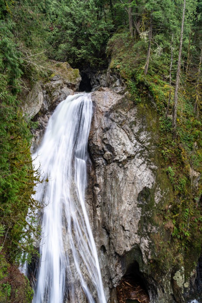
After a few steep descents and ascents, you’ll reach arguably the best views of the Lower Falls. Before you reach the main attraction of Twin Falls—the Upper Falls—you’ll cross a large bridge with pretty spectacular views of the valley and the smaller falls.
Although these falls are known as the “Twin Falls,” there are technically three falls in the collection. Once you’ve hit the bridge, you’ll just have a few stairs and a slope to climb before reaching the best view of the Upper Falls.
Admire the icy white cascades pouring from a forest of evergreens, into a deep pool below. The total height of the falls is 230 feet, and the tallest drop is 135 feet. This popular hike is well worth it for the views and lush vegetation.
More trail information can be found here.
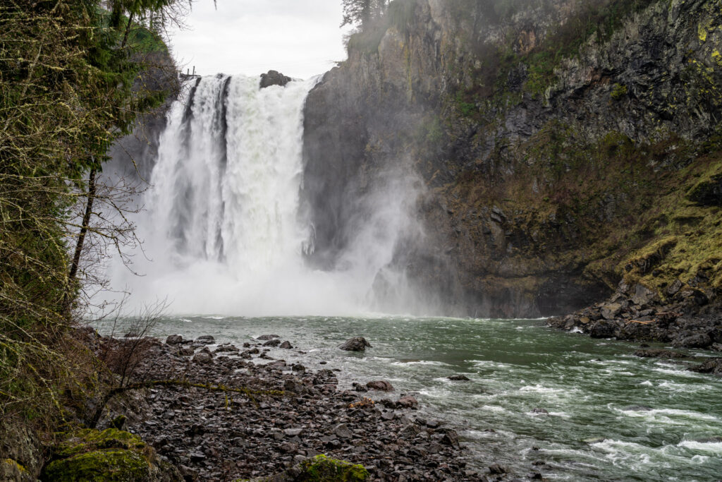
Snoqualmie Falls
- Region: North Bend
- Drive Time / Distance from Seattle: 30 minutes / 30 miles
- Pass Required: None
- Hike Distance: 1.4 miles
- Elevation Gain: 250 feet
- Trailhead Location
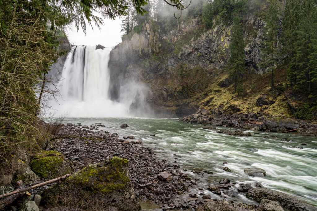
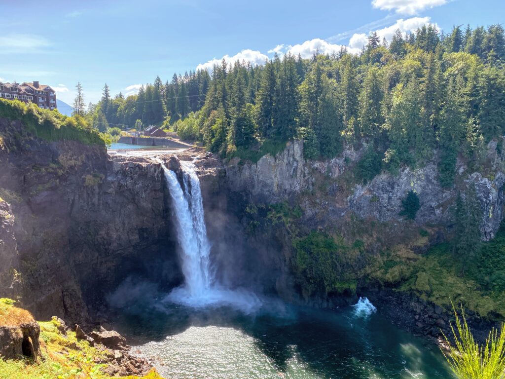
The mighty Snoqualmie Falls are recognized for their powerful waters that cascade 268 feet into the Snoqualmie River below.
Among the most famous and frequented falls in Washington State (and the Pacific Northwest as a whole), Snoqualmie Falls are a result of glaciers that receded thousands of years ago and left a fertile plain near the falls.
Snoqualmie, which comes from the Salish word for “moon,” is a spiritual place to the native tribes of the region, who honor the falls as humanity’s place of origin.
The plains around Snoqualmie River and Falls were once abundant in berries, vegetation, deer, and mountain goats, and were a popular meeting place for trade. Over the last century, the falls have also provided hydroelectric energy to the region.
Whether you’re headed there from the city or are making a stop before heading east across the mountains and over Snoqualmie Pass, Snoqualmie Falls are an easy day trip from Seattle.
After driving east on I-90 from Seattle for just about half an hour, you’ll reach a large establishment for Snoqualmie Falls, including a parking lot that has space for around 50 cars. Note that the upper parking lot is free, while the lower lot costs $7.
Snoqualmie Falls has a number of paths and viewpoints to explore. From the upper falls to the lower falls viewpoint, you’ll find a map and informative signs providing a background to the history, flora and fauna, and native culture around Snoqualmie Falls.
From this direction, the trail starts at a somewhat steep descent enveloped by cedar, fir, and maple trees that lead to a short, flat walking path parallel to the river. Each section offers a unique viewpoint to the waterfalls and the river. Expect to be enveloped by the roaring rush of water and a refreshing spray.
Each season brings a different face to the falls, which are particularly full of life during spring when the snow is melting. Watch massive sheets of water cascading into the river below as fog and mist circles trees in the backdrop.
A downside is that you’ll be sharing the views with many other visitors, regardless of the time of the year. Snoqualmie Falls is among the most popular day trips from Seattle.
Should you wish to extend your visit, make a stop by the Visitor’s Center, restaurant, stylish hotel, and boutique gift shop by the falls. Salish Lodge makes a cozy getaway from the city for a quick weekend or midweek getaway.
More trail information can be found here.
Teneriffe Falls
- Region: Snoqualmie Pass
- Drive Time / Distance from Seattle: 40 minutes / 36 miles
- Pass Required: Discover Pass
- Hike Distance: 5.6 miles
- Elevation Gain: 1,585 feet
- Trailhead Location
Teneriffe Falls—formerly known as Kamikaze Falls—are spectacular waterfalls tucked into a forest in the Snoqualmie region. These falls are a fun half-day excursion that combine a moderate hike with a fantastic waterfall as your reward at the end. By spring, snow should be melted off the trail and the waterfalls are in full flow, making it the perfect time of the year to visit.
To reach the trailhead for Teneriffe Falls, head east on I-90 towards North Bend for just around 40 minutes. The parking lot for Teneriffe is not far from the popular Little Si and Mount Si trailheads and is paved and spacious with room for over 100 cars. Note that there used to be a different parking lot for the trail that is now off-limits.
Also, make sure you pay attention to the opening and closing times for the gate as you enter the parking area, as they vary throughout the year.
For the first mile, you’ll follow the Mount Teneriffe trail, which ascends at a very gentle incline. Once you reach the intersection, follow the sign to the right marking Teneriffe Falls.
The trail is still quite mellow until the last mile of the hike. At this point, you’ll have a lofty ascent and a number of switchbacks ahead of you, weaving in and out of the shady forest. As you approach the falls, you’ll catch glimpses of the rushing stream flowing from the falls.
You’ll also be able to see parts of the old trail. Even though you might be tempted to meander over to the former trail, it’s important to stay on the new path for safety purposes and to prevent erosion.
Just before the end of the trail, you’ll see the lower falls. After you dominate the final switchbacks, you’ll reach the viewpoint for the upper falls. There is a level area between the upper and lower falls that makes for a nice lunch spot if you’re only a few people but be careful of the slippery rocks to reach it.
On that note, the trail has loose rock in some places, so come prepared with sturdy shoes for this hike. Admire these impressive waterfalls cascading down 414 feet in total, plunging from a shady forest and down a mountainside.
More trail information can be found here.
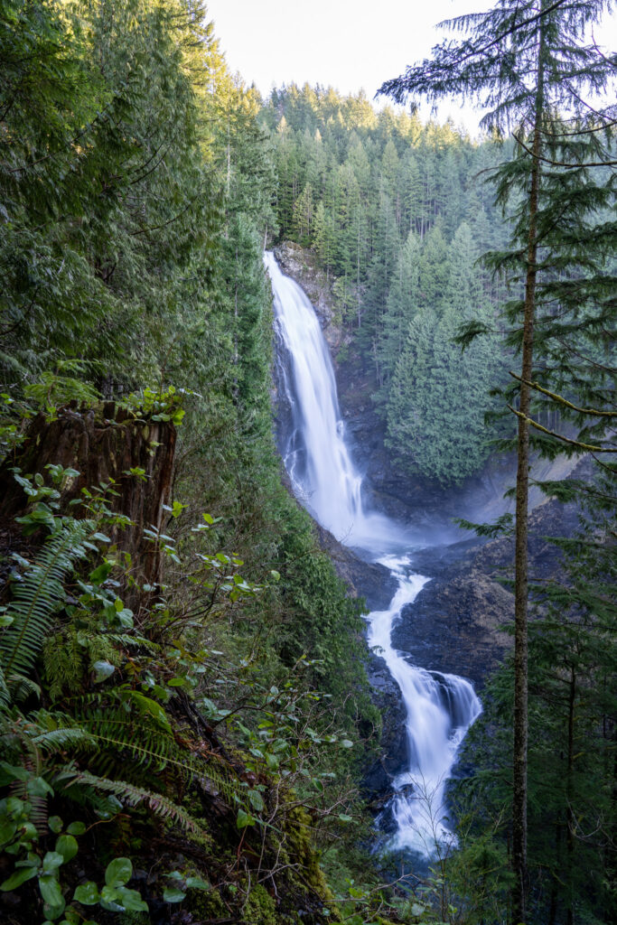
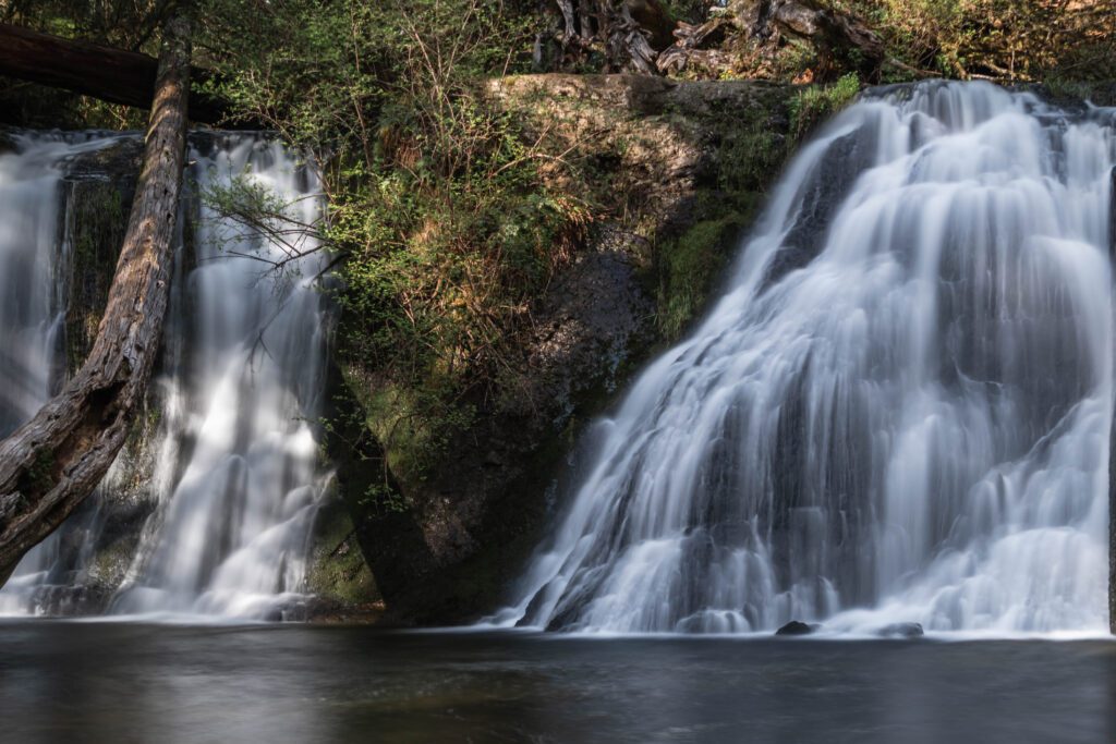
Wallace Falls
- Region: Central Cascades / Stevens Pass (Highway 2)
- Drive Time / Distance from Seattle: 1 hour / 50 miles
- Pass Required: Discover Pass
- Hike Distance: 5.6 miles
- Elevation Gain: 1,300 feet
- Trailhead Location
About an hour trip from Seattle, Wallace Falls, located in Wallace Falls State Park, involves a moderate hike through thick forest with a phenomenal set of falls at the pinnacle.
To reach the state park, drive towards the town of Gold Bar along Highway 2—east of Everett—and park at the Wallace Falls State Park parking lot. The lot is spacious, but you’ll still benefit from arriving early as it is a popular spot, particularly on weekends.
Although Wallace Falls requires a hike in, it is well worth the effort as the journey along the way is almost as spectacular as the cascading falls themselves, traversing through lush greenery.
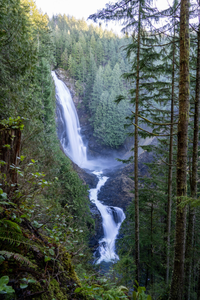
Technically, there are nine falls from three main sections within Wallace State Park and even if you aren’t up for climbing to the highest viewpoints, you can still catch phenomenal views from the lower and middle viewpoints. The Lower Falls are a combined 212 feet, the Middle Falls 260 feet, and the Upper Falls 100 feet.
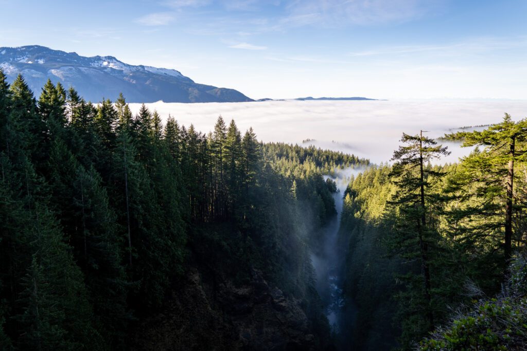
The full route is a 6.5 miles-long loop with 1,300 feet elevation gain. Much of the hike runs parallel to the Wallace River through lush, green foliage. At two miles in, you’ll reach the Lower Falls. The Middle Falls offer even more dazzling views of Wallace Falls and panoramic views of Skykomish River Valley, as well as a distant silhouette of the Olympic Mountains.
You can turn around here if you’re not up for the steep climb. However, if you’re feeling adventurous, keep pushing for a final half mile on steep switchbacks to catch the Upper Falls plunging into Wallace River below.
You’ll get pretty sweaty on the last half-mile of switchbacks, but the challenge is part of the fun and the views at the top are a worthy reward. As you emerge from the dense forest, you’ll be welcomed by massive sheets of white water cascading down through trees and into a river below.
More trail information can be found here.
Cherry Creek Falls
- Region: Central Cascades / Stevens Pass (Highway 2)
- Drive Time / Distance from Seattle: 40 minutes / 30 miles
- Pass Required: None
- Hike Distance: 5.0 miles
- Elevation Gain: 450 feet
- Trailhead Location
In the early 20th century, Cherry Creek Falls were the site of a logging camp. Since then, this area has become a popular place among locals and visitors alike. While these humble falls may not be as dramatic as some of the other waterfalls in Washington State, they make for an inviting swim following a moderate hike through the woods.
The trailhead for Cherry Creek Falls is reachable from the town of Duvall, which will lead you to Mountain View Road and the access point for the trail. There is no designated parking area for Cherry Creek Falls, so you’ll have to park on the shoulder of Mountain View Road.
Pay attention to signs indicating “no parking” along certain areas of the road!
The trail starts behind the gate on the road-turned-trail. The first half mile of the trail starts on private property so stay on the main path and keep noise to a minimum.
About three-quarters of a mile into your hike, you’ll cross a bridge over Margaret Creek and shortly after will reach a few junctions. At the first junction, stay left and at the second junction stay right. You’ll then climb up a short hill and reach a third junction, at which you’ll also stay right and continue downhill.
The hike continues along a muddy trail through the woods, across an overgrown road, and past an abandoned car in the trees. Hop over a few creeks along the way and perhaps use the assistance of walking sticks to ford Hannan Creek.
After crossing the creek, the path branches off to the right. You’ll hear the sound of the falls and know that you’re not far. Continue along a short path until you reach the base of Cherry Creek Falls plunging a fairly short drop from trees into a wide pool below.
More trail information can be found here.
More to Explore in Washington State
- The Best Things to Do in Seattle, Washington
- A Weekend in Seattle: A Seattle Itinerary for First Timers
- Where to Stay in Seattle: A Complete Neighborhood Guide
- The Best Day Trips from Seattle: 10 Great Options
- The Best Weekend Getaways from Seattle
- The 17 Best Hikes Near Seattle (Local’s Guide)
- 16 Incredible Hikes in Washington State
- The Best Easy Hikes in Washington State
- The Best Cozy Cabin Getaways in Washington State
- The 3 Amazing National Parks in Washington State
- The Best Hikes in Mount Rainier National Park
- A Complete Olympic National Park Itinerary
- How to Plan a Perfect North Cascades National Park Itinerary
- 15 Gorgeous Waterfalls in Washington State
- How to Plan an Amazing Washington Road Trip Itinerary
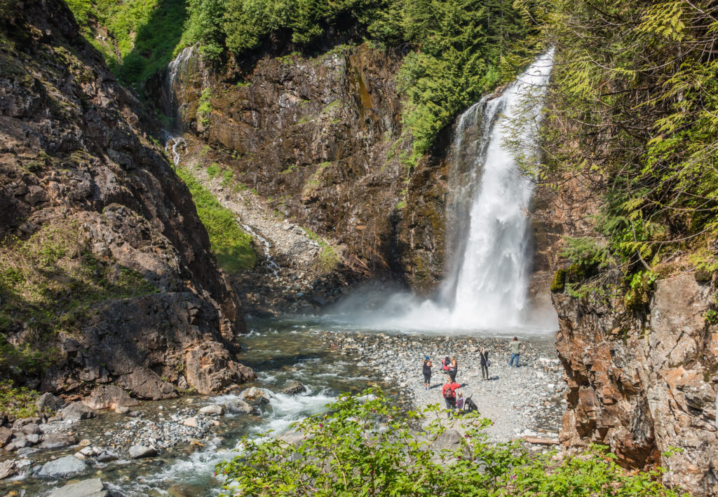
Franklin Falls
- Region: Snoqualmie Pass
- Drive Time / Distance from Seattle: 1 hour / 50 miles
- Pass Required: Northwest Forest Pass
- Hike Distance: 2.0 miles
- Elevation Gain: 400 feet
- Trailhead Location
This quintessential Washington State waterfall hike leads you through dense, shady forest to tumbling falls and a large plunge pool.
Located near Snoqualmie Pass, Franklin Falls are about an hour drive from Seattle. Head east on I-90 and take the Denny Creek exit. The trailhead for Franklin Falls isn’t long after Denny Creek Campground.
There is a parking lot that fits about 30 cars. If this lot is full, head about a half mile further to a larger parking area with room for about 60 cars. Franklin Falls are a popular destination so arrive early for best chances at finding parking. Spot the bulletin board in the parking lot and from there, you’ll find the trailhead to Franklin Falls.
The trail is accessible for most skill levels, gently inclining over one mile. Although there are a few areas where the trail is washed out, the trail is generally in great condition.
Bridges, steps, and walls have been added during recent years in an effort to make the trail safe for young hikers and experienced trekkers alike. The hike is shaded, making it a pleasant excursion even on a rare, hot Washington day.
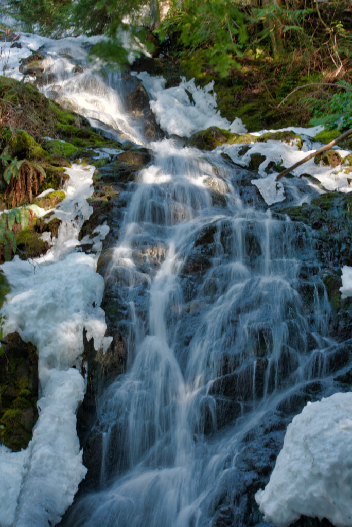
Walk through leafy coniferous trees until you reach the spectacular Franklin Falls, cascading 70 feet down tree-shrouded boulders.
Even though there are three tiers, only the last set of falls can be seen from the trail, which are most vibrant between April and July when the winter snow is melting and feeds into the flow of the falls.
More trail information can be found here.
Whatcom Falls
- Region: Bellingham
- Drive Time / Distance from Seattle: 1.5 hours / 90 miles
- Pass Required: None
- Hike Distance: 4.0 miles
- Elevation Gain: 50 feet
- Trailhead Location
Whatcom Falls include a series of shorter waterfalls inside Whatcom Falls Park, which is easily accessible from the towns of Bellingham and Fairview in northwestern Washington not far from the Canadian border.
The falls are a very popular summer hangout spot and you can expect to find a lot of college students from Western Washington University here. Some visitors choose to jump from the falls into the pool below (but only do so if you’re comfortable with cliff jumping!) You can also choose to simply relax in the pools below the falls.
The park is about an hour and a half drive from Seattle, so completely doable in a day but it also makes for a great weekend excursion. The entrance isn’t far off the Lakeview Drive exit on I-5 and has a spacious parking area.
Inside Whatcom Falls Park, you’ll find a beautiful maze of trails winding through meadows and the forest, overlooking gorges and creeks. To reach Whatcom Falls, follow a one-mile loop that begins at the Silver Beach Road parking area.
However, if you’re up for more of an adventure, you can also spend the better part of the day exploring the mossy wonders in the park and wandering along more of the trails.
More trail information can be found here.
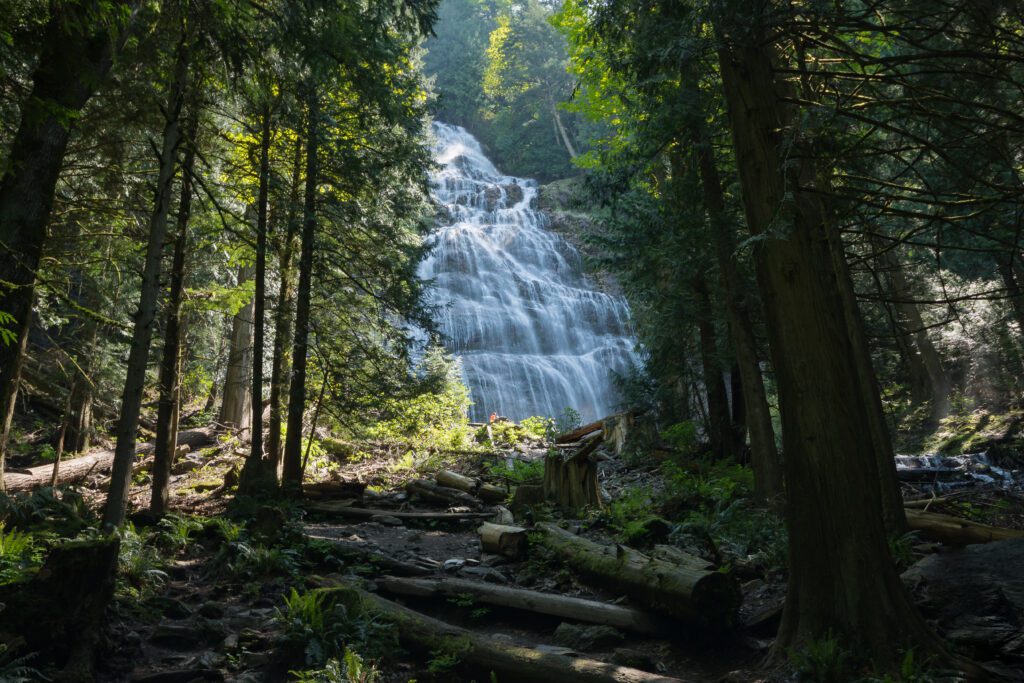
Bridal Veil Falls
- Region: Central Cascades / Stevens Pass (Highway 2)
- Drive Time / Distance from Seattle: 1 hour and 20 minutes / 55 miles
- Pass Required: Northwest Forest Pass
- Hike Distance: 4.0 miles
- Elevation Gain: 1,000 feet
- Trailhead Location
Bridal Veil Falls is definitely no secret and remains a favorite among local hikers. Just under an hour and a half drive from Seattle, you’ll pass through the small town of Gold Bar and reach Mount Index Road.
Follow the signs to Lake Serene Trail and you’ll reach the parking lot for the trailhead, which may seem deceptively large. You’ll have better luck finding space during the week, as hikers flock to this region on the weekends.
These falls require a bit of a hike but it is a rewarding excursion if you’re up for an adventure. These falls are linked to another of my favorite hikes in Washington: Lake Serene. Bridal Veil Falls flow out of Lake Serene, cascading down the rugged wall of Mount Index.
The trail starts off gently, winding through a forest of maples and old growth conifer trees and crossing a few streams. Stop to admire a view over the lower falls before heading up the last half mile of the trail. Climb up the rocky and steep ascent, eventually ending at the spectacular Bridal Veil Falls.
Cascades of water rush down rugged rockfaces enveloped by pristine forest. If you’re an avid hiker and eager to keep exploring, you may choose to continue about another 1.5 miles to Lake Serene, which involves another 1,300 feet of elevation gain.
While Bridal Veil Falls is a phenomenal sight on its own, Lake Serene is a splendid spot to kick back and enjoy a lunch among some of the finest Pacific Northwest scenery.
More trail information can be found here.
Coal Creek Falls
- Region: Bellevue / Issaquah (Cougar Mountain)
- Drive Time / Distance from Seattle: 25 minutes / 16 miles
- Pass Required: None
- Hike Distance: 2.5 miles
- Elevation Gain: 416 feet
- Trailhead Location
Coal Creek Falls is an easy day hike for any level of hiker looking for a family-friendly excursion just outside of the city.
The trail for Coal Creek is situated in Cougar Mountain Regional Wildlife Park, less than 20 miles from Seattle. While very accessible from the city, it is important to note that the 28-foot falls of Coal Creek are at their most abundant during rainy, winter months.
By mid-June they’re often completely dried up for the summer season and won’t be flowing until whenever the rainy season resumes that fall or winter.
To reach the trailhead, drive east on I-90 from Seattle and get off at West Lake Sammamish. The trailhead is located in a sharp bend in the road and clearly marked with a noticeable blue King County sign. Here, you’ll find a large parking lot that tends to fill up quickly.
This area is filled with an extensive network of trails, so a map may be helpful to ensure you’re on the right path. As you set off on your hike, keep your eyes peeled for remnants of mines that were prevalent in Cougar Mountain between the mid-19th and mid-20th centuries.
Some of these signs include cave holes, which can be quite deep and dangerous off trail so make sure to stay on the path to avoid these as well as the stinging nettle on the edge of the path.
As you follow your way through a tangle of maple and cedar trees and fields of wildflowers, you’ll come across a number of junctions.
Follow the Cave Hole Trail. After the third trail junction, veer to the right and begin along the Coal Creek Falls Trail, which will become noticeably narrower. You’ll start to hear the rush of the falls as the trail descends and will soon be greeted by these short but sweet falls pouring down mossy rock faces.
More trail information can be found here.
MORE TO EXPLORE IN THE PACIFIC NORTHWEST
If you’re planning a trip to the Pacific Northwest, we’ve got you covered with all sorts of super detailed travel guides to our favorite places in Washington and Oregon.
- Seattle: Find the perfect place to stay in Seattle, use our itinerary and complete Seattle city guide to plan your weekend in Seattle (we also have a guide to one day in Seattle for shorter trips), find a new hike near Seattle to tackle, and plan your next day trip or weekend getaway.
- Portland: Get a local’s take on what to do in Portland and where to stay in Portland, plan your weekend itinerary (we also have a guide to one day in Portland for shorter trips), find the best hikes in and around Portland, and discover the best day trip and weekend getaway destinations.
- Road Trips: Explore the best of the Pacific Northwest on a 14 day Pacific Northwest road trip. Plan an amazing Washington road trip or Oregon road trip with our detailed guides, including a couple of itineraries that you can copy/paste.
- The Oregon Coast: Explore the best of the Oregon Coast on a 7 day Oregon Coast road trip. Discover the best hikes on the Oregon Coast, and figure out what to do in Cannon Beach and Astoria.
- Hiking in Oregon: Get a local’s take on the best hikes in Oregon, the most spectacular Oregon waterfalls, and dive deeper into each region with our guides to the best hikes at Mt. Hood, in the Columbia River Gorge, and more.
- Hiking in Washington: Add to your Washington hiking bucket list with our guide to the best hikes in Washington. Then dive into our regional hiking guides to discover the best hikes near Seattle, hiking at Mount Rainier, in Olympic National Park, in the North Cascades, and at Mount Baker.
- Mount Rainier National Park: Plan the perfect trip to Mount Rainier with our guides to the best things to do, the best hikes, and how to plan a perfect day trip to Rainier.
- Olympic National Park: Explore the best that Olympic National Park has to offer – the best hikes, a complete itinerary, and exactly where to stay in Olympic National Park.
- North Cascades National Park: The least visited of the National Parks in Washington, learn how to plan a perfect itinerary, and figure out the best hikes to add to your list.
- Crater Lake National Park: Discover the best that Oregon’s only national park (isn’t that crazy?) has to offer with our guide to planning your Crater Lake itinerary, and our guide to the best hikes in Crater Lake. Plus, a guide to planning an amazing Seattle to Crater Lake road trip.