The 7 Best Hikes in Snoqualmie Pass: Complete Hiking Guide
If you’ve spent time in Seattle, you may have noticed that every other Subaru – our unofficial state mascot – features a bumper sticker with John Muir’s famous quote, “the mountains are calling, and I must go”. It’s no wonder though, because just an hour east of the city in places like Snoqualmie Pass, hikes in the alpine wilderness breathe life into visitors seeking the type of refreshment only mountains can provide. And holy smokes, there are so many to choose from!
With trails catering to a variety of fitness levels, you will be rewarded with a spectacular view no matter which one you take. The hard part is deciding what you’d like to see. A roaring waterfall? Turquoise glacial lakes? A granite peak so perfectly placed it feels like you’re looking at the entire state of Washington? Lakeshore campsites nestled in a rocky bowl? An interconnected lake system? You can’t go wrong!
And bonus, the trailheads for these destinations – some of which make our list of the best hikes in Washington State – are concentrated in a 15-minute stretch of I-90.
Interested in hiking in Washington State? Here are some other Washington hiking guides to help you find your next amazing hike.
- 16 Incredible Hikes in Washington State
- 18 Great Easy Hikes in Washington, Perfect for Beginners
- 20 Great Hikes Near Seattle: A Complete Seattle Hiking Guide
- 9 Jaw-Dropping Hikes in North Cascades National Park
- 11 Stunning Hikes in Mt. Rainier National Park
- The Best Hikes in Olympic National Park
- 7 Amazing Snoqualmie Pass Hikes
- 9 Unforgettable Hikes at Mount Baker
Disclaimer: Some of the links below are affiliate links, which means that if you click on one and purchase something, we make a small portion of the sale at no additional cost to you. It goes without saying that we would never recommend something we wouldn’t use or do ourselves.
When to Go Hiking in Snoqualmie Pass
The best time to hike Snoqualmie Pass is July through October (with exception for winter snowshoeing – see Franklin Falls and Olallie Lake). Washingtonians thank the rain for making this the evergreen state, but it’s notoriously unpredictable until after July 5th – so pack waterproof layers or start hiking in the second week of July. After this time, the weather is consistently sunny and trails will be mostly if not totally free of snow.
That said, summer is also the busiest time and if you don’t arrive early for literally every hike (9am is not early) you will be met with a full parking lot and plenty of trail companions.
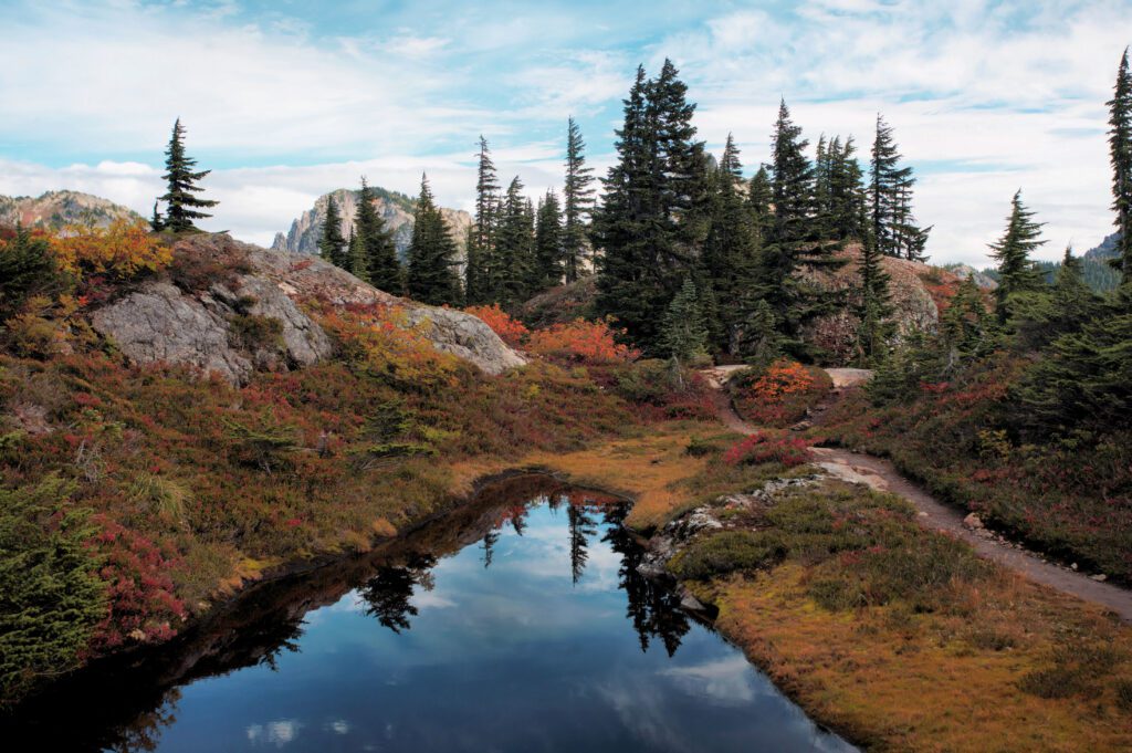
If you can afford to watch and wait, keep an eye on the forecast and go out on a sunny day in early October. Autumn colors paint an impossibly beautiful landscape, and the bulk of the crowds has gone home for the season. Yay!
Tips for Hiking Near Snoqualmie Pass
For each of these hikes below, you will need an annual Northwest Forest Pass ($30) and one of the most user-friendly ways to purchase it is online at REI.
You can also get one last minute if you stop in North Bend – all of the gas stations off exit 31 should have them. Some trailheads may also provide day passes, but I have found that option to be unreliable on more than one occasion.
Speaking of North Bend, exit 34 is your last opportunity to fuel up without paying an arm and a leg at the ski summit. If you’re running late or accidently pass the exit, there is a Chevron off exit 53, but don’t say I didn’t warn you about the extortionist rates.
The Best Hikes in Snoqualmie Pass
It’s finally time for the good stuff! The title here could be taken as fighting words by some, because there are countless hiking trails near Seattle in the Pass that could be called “the best”. But these all-star recommendations show off the dramatic beauty and impressive variety offered by Snoqualmie Pass hiking trails.
These are in order of difficulty, starting with the easiest option – but they all bring the wow-factor!
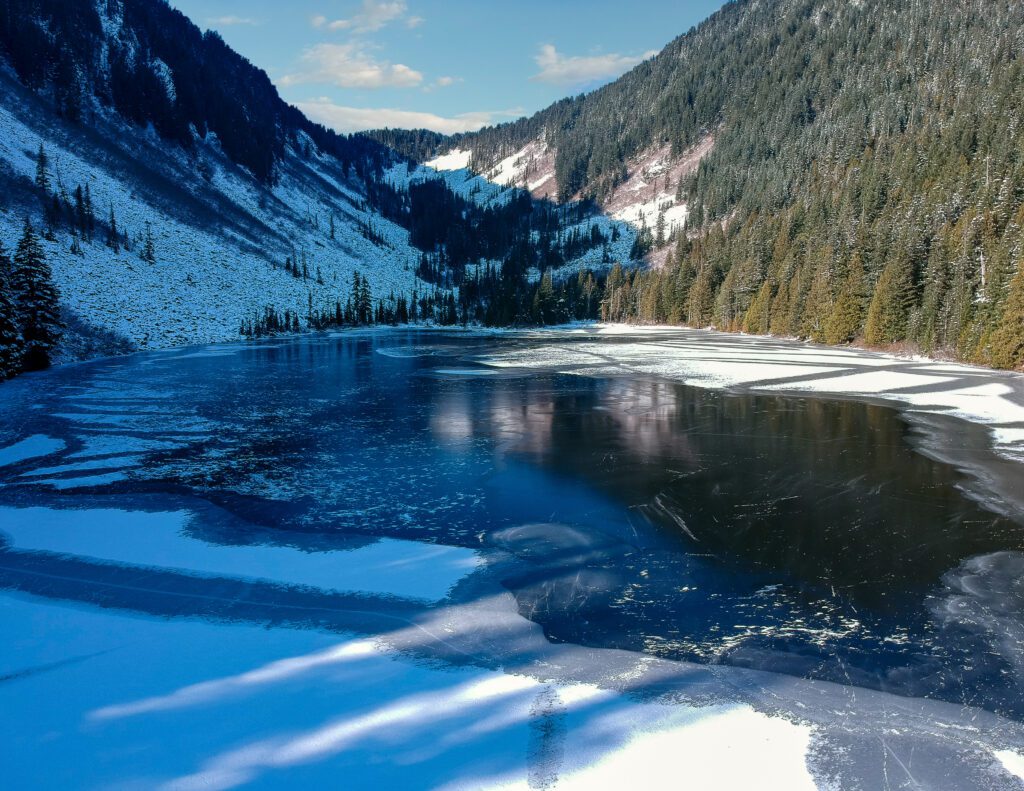
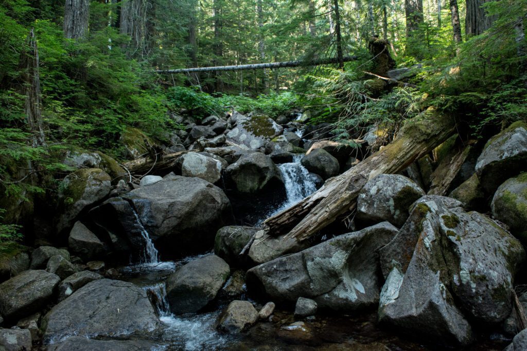
Franklin Falls

- Length: 2 miles (this can become 8 miles in the winter due to road closures)
- Elevation Gain: 364 ft.
- Trail Type: Out & back
- Difficulty: Easy
- Trailhead Location
In warmer months, this is the ideal hike for a family with young children looking to enjoy the splendor of the Alpine Lakes Wilderness. With a well-maintained trail that includes stairs and man-made barrier walls, just about everyone can feel safe on the way to the falls. It would also be perfect for an avid hiker who only has a half day available, but still wants to see something beautiful!
This modest hike feels more like a casual stroll through the forest as the gently sloped trail takes you back one mile. In no time at all, you’ll find yourself face to face with the thundering 70-foot drop of Franklin Falls.
If your group wants to get closer to the action, there is a path that follows the side of the rock wall and takes you to the stone beach next to the waterfall. There is plenty of mist though, so grab the hands of any children to prevent slipping, get your poncho, and expect to get wet if you go this way (you should!).
Thanks to a thick tree canopy, short trek, and water destination, you can have a comfortable experience on even the hottest day of the year. But as an added bonus, Franklin Falls is also accessible by snowshoe throughout the winter.
The water runs year-round, and the rockery becomes an other-worldly display of icicle formations when temperatures start to freeze. Just keep an eye on winter road closures because it can close all the way out to I-90, which will add an extra 6 miles to your excursion.
Talapus and Olallie Lakes
- Length: 6.2 miles, roundtrip
- Elevation Gain: 1,220 ft.
- Trail Type: Out & back
- Difficulty: Moderate
- Trailhead Location
If you’re looking for a way to ease into overnight trips, look no further. With a moderate trail grade and easily accessible campsites, this hike will help your back readjust to carrying that massive backpack after a long winter. As you follow directions to the trailhead, beware that deep potholes in the forest service road might actually be out to get you.
Once you’re parked and ready, the trail starts on a wide path that is heavily shaded and on the cooler side. But you’ll warm up soon enough as you reach steeper switchbacks along Talapus Creek.
As you climb, the path is clear, signs are easy to read, and there are several changes in grade making for plenty of opportunities to pay more attention to your surroundings than your burning muscles. It might be tempting to cut some of the switchbacks in flatter areas, but please stick to the path and turnpikes.
The lakes are only a mile and a half apart so you can technically visit both before deciding where to stay. Each has lakeside campsites (get there early) with just the right amount of whimsy. Talapus, my favorite of the two, sits under a gorgeous little valley and has all sorts of floating logs to crawl on.
We used some rope to build a temporary raft and I tugged my husband around on his new vessel. Back at shore we camped under big hemlock trees adorned in old man’s beard, which gave the area a delightfully Dr. Seuss-ish vibe.
Overall, this is a fun day hike and a great place to begin overnight adventures. But remember that fires are prohibited in the lake basin so bring extra layers and get creative with your meals! This is also a popular snowshoeing destination in the winter but not recommended for beginners.
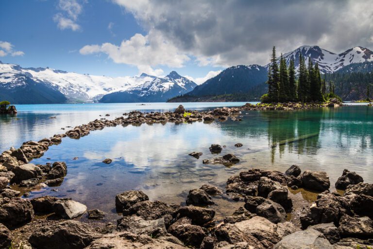
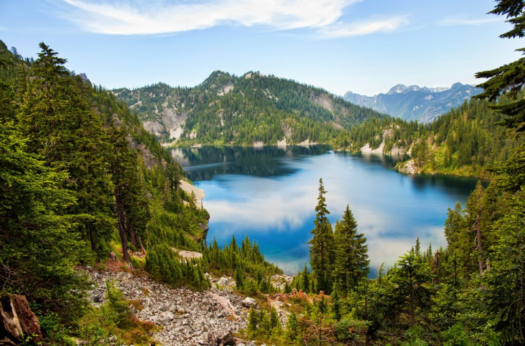
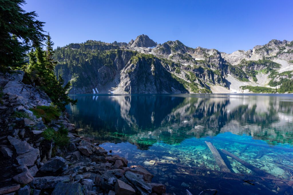
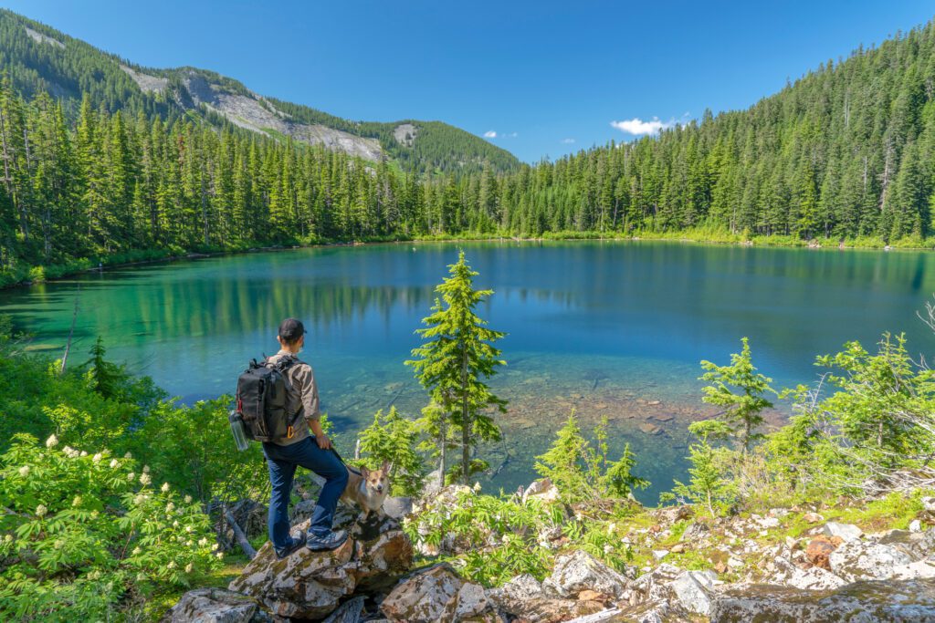
Snow Lake and Gem Lake
- Length: 10 miles, roundtrip
- Elevation Gain: 1,800 ft.
- Trail Type: Out & back
- Difficulty: Moderate-Difficult
- Trailhead Location
Snow Lake is the most visited in the entire Alpine Lakes Wilderness and is among the best hikes near Seattle. That statement says a lot about the views, as well as the traffic you will encounter here – so to use repetition for emphasis, start early in the morning!
Beginning at the north side of the Alpental Ski Area parking lot, the trailhead couldn’t be more accessible. The hike begins right away, with a steep incline and steps that are regularly maintained by Forest Services. After a few hundred feet the trail changes to a more gradual incline for about a mile until you’re met with jagged terrain where rock blasting created a dramatic walkway.
After another stretch, you’ll begin the steepest climb to the saddle where you’ll see Snow Lake for the first time. But don’t stop here! Time to meander down the switchbacks lined with delicious berries in the late summer and fall.
400 feet down you’ll cross a multi-level waterfall, which is often easy to climb and a perfect place for dogs to grab a drink. The trail seems to go on for a while at this point, but you’ll know when you reach your destination! Turquoise and glassy, the lake is stunning!
Eat lunch and dip your feet in the cold water before hitting the trail again for Gem Lake. Follow the main path across a fun log, bridge, then wander through the woods as the trail swoops up, down, and around. There are miniature meadows and rock scrambles along the way, ensuring you’ll never get bored. But bring bug spray!
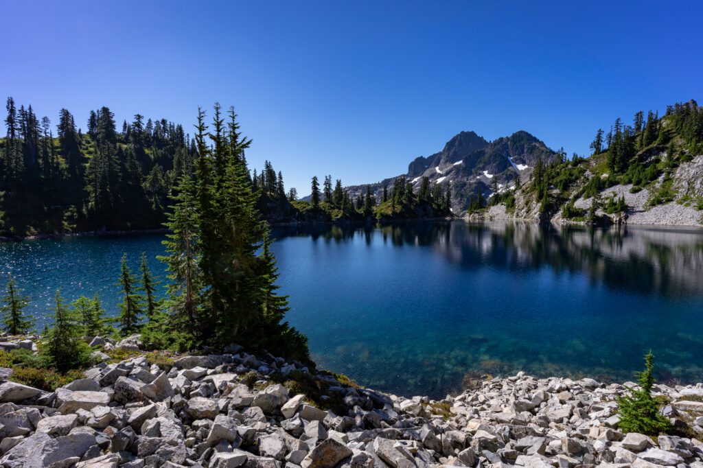
Gem Lake is a spectacular sight with angular mountain peaks that descend straight into the water. If you’re early enough to snag a campsite, you’re in for a real treat. Take in the mountain air and soothe sore muscles by taking a dip in the water before the sun sets. You won’t be wondering why these trails are so popular!
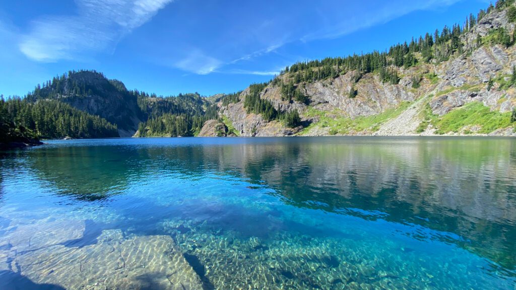
Annette Lake
- Length: 7.5 miles, roundtrip
- Elevation Gain: 1,800 feet
- Trail Type: Out & back
- Difficulty: Moderate
- Trailhead Location
Considered by many as the crown jewel of Snoqualmie Pass, the hike to Annette Lake might just have the most bang for your buck on this list. The well-maintained trail introduces you to a tumbling waterfall after just a few minutes and continues on at comfortable, steady climb until you reach a flat walk to Annette Lake. The casual hiker can enjoy a full day of activity without much risk of hurting for the next week.
If you have time at the start (or end) of your day, there is a lovely half mile loop on the Asahel Curtis Nature Trail from the trailhead that involves two bridges and lush forestland. It’s totally worth taking! Then, once you’re heading up the main path, you’ll see seasonal wildflowers, several water crossings, and views of both Granite Mountain (the last on our list) Humpback Mountain along the talus slopes.
Once you arrive at picturesque Annette Lake, notice not just the surrounding peaks, but also a waterfall at the east shore. Head that direction for the camp sites and take time to explore the area. If you only have time for one hike on your trip, Annette Lake is the quintessential alpine wilderness experience!
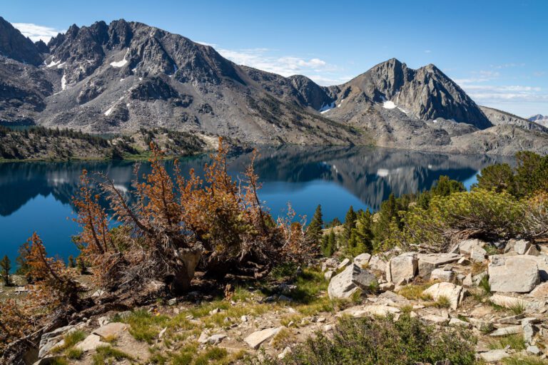
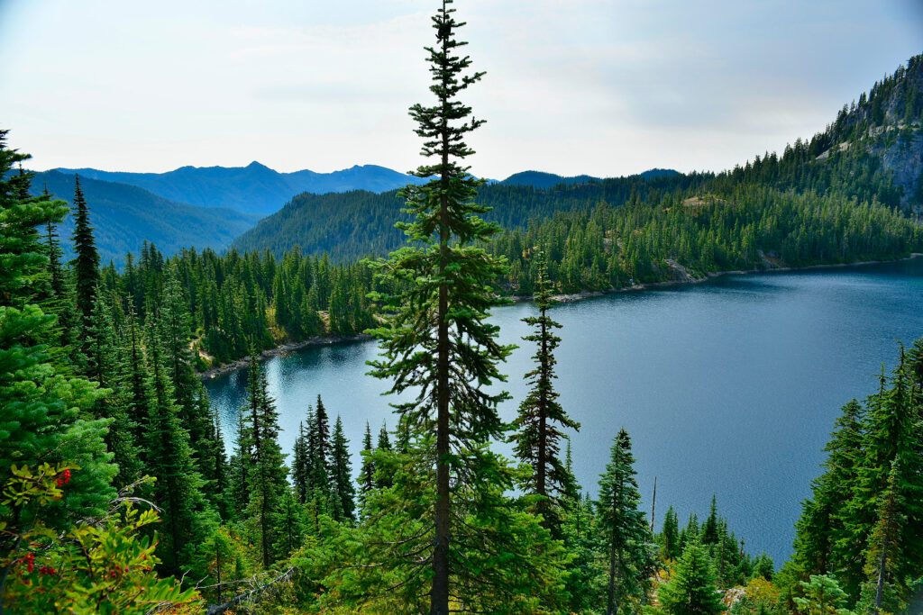
Rachel Lake and Rampart Lakes
- Length: 9 miles, roundtrip
- Elevation Gain: 2,529 ft.
- Trail Type: Out & back
- Difficulty: Difficult
- Trailhead Location
If you want a unique lake experience, then the trail to Rachel and Rampart Lakes is for you. But as a steep, bumpy, and tricky-to-navigate hike, this one is not recommended for beginners.
The first 2.5 miles are more moderate compared to the final mile before reaching Rachel Lake. Beware – the terrain is pretty uneven with plenty of roots and rocks to trip on. Stay focused on the trail but look up to get your bearings pretty often so you don’t accidently leave the main path for an overgrown forest road. This is particularly important in the switchbacks. Hikers also report some wasp nests during the summer, so walk with a purpose to clear the area if you hear buzzing!
After muscling through the final stretch, you’ll reach a tranquil and trout filled Rachel Lake. This is a popular destination in its own right, but after taking time to unwind and recalibrate, you’d be remiss to skip the Rampart Lakes. Follow the sign that says “Trail” up the rocky switchbacks and see as Rachel Lake becomes even more beautiful below you. At the top, turn left and note that the rest of the hike involves plenty of trail junctions, so be mindful and read signs.
You’ll start seeing small lakes along the main trail as you close in on the two largest ones at the end. These dreamy, pothole lakes have a multi-tier infinity pool vibe and are filled with happy swimmers all summer long. They are the most unique lake experience on this list, and really in the region. Soak this up as a long day hike or stay overnight as an alternative to the Enchantments (if you didn’t win the lottery to get up there).
Ira Spring Trail to Mason Lake
- Length: 6.5 miles, roundtrip
- Elevation Gain: 2,420 feet
- Trail Type: Out & back
- Difficulty: Difficult
- Trailhead Location
This hike is always referred to by both its trail and destination for good reason. Miles before reaching Mason Lake you’ll be surrounded by mountain views, wildflowers, and dreamy meadows, all of which promise to send you home with even more photos than normal.
You’ll get started with almost a mile of shaded trail, but once you’re under direct sunlight it’ll stay that way for the rest of the hike – so don’t forget the sunscreen! The real work begins about halfway up as steep switchbacks make up a lot of the total elevation gain. Take time to catch your breath and look around.
Follow signs for Bandera Mountain until the top of the ridge where you’ll descend 300 feet to reach Mason Lake. The water is clear, cold, and inviting after a few hours in the hot sun, so claim a shoreside boulder and hop in.
If you’re feeling energetic on the way back, there is an offshoot at the Bandera Mountain junction where you can make a scenic 700-foot climb in just over half a mile to reach bonus lake and mountain views!
It’s worth doing, but when I tried to take a friend who was new to hiking, she turned around halfway up and decided she no longer trusted my judgment. Moral of the story: be mindful of the skills and experience levels of the people in your group.
Granite Mountain

- Length: 8.6 miles, roundtrip
- Elevation Gain: 3,800 ft.
- Trail Type: Out & back
- Difficulty: Very difficult
- Trailhead Location
Last on our list is a grueling trek with a view that cannot be beat. The Granite Mountain Trail is very avalanche prone in the winter, so give plenty of time for the snow to melt before heading up. From the Pratt Lake trailhead right off I-90, you’ll have 1.2 miles of moderate incline to warm up.
Then at the junction, turn right and realize that the steep avalanche chute you were looking at is actually your route. The narrow, rocky trail will lead you up brutal switchbacks with the only saving grace being shade protecting you from the hot sun. You’ll cross the chute in about a mile and then continue the climb.
The high meadows will be a welcome respite and you’ll start to see some amazing views. But carry on because it’s not over, and the now rockier trail will need even more of your attention so you don’t fall or get lost. You’ll catch a glimpse of the old fire lookout (your destination) signaling that you’re a mile away. Keep fighting because when you complete that final scramble… WOW!
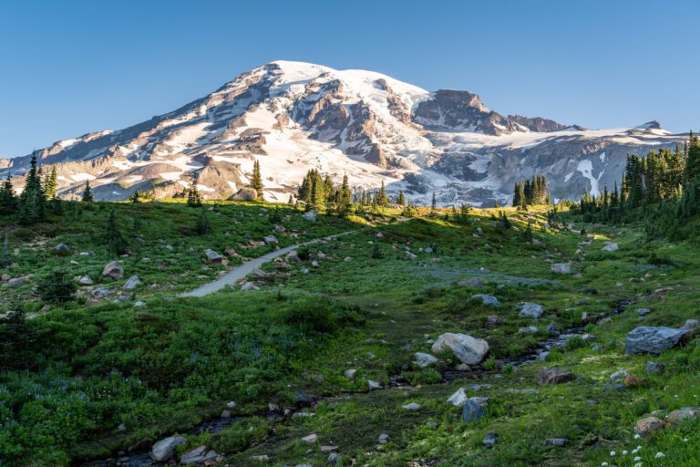
This lookout was built in 1924, rebuilt in 1955, and is now a piece of preserved history. They certainly knew what they were doing because it feels like you can see to the end of the earth. On a clear day, Mount Rainier, Mount Stuart, Mount Baker, the Teanaway, and all the glory of the Cascades are in view. There are no words to do it justice!
Where to Eat & Drink Post-Hike: Great Recovery Meals
Thankfully, there are great dinner options up there! A local favorite is a stylish pub called Commonwealth (along with its brewery neighbor, Dru Bru). I recommend the 906 Burger which is made with longhorn beef from a nearby farm in Ellensburg… And the wedge fries on the side are a dream come true after a long day of hiking.
If you’re not in the mood for high-quality bar food, there is a hidden gem of a pizza place inside Lee’s Summit Grocery called Pie for the People. Truly nothing about this place will look appealing and there is nowhere to eat inside (it has a gas station vibe), so grab a table at Dru Bru where you can eat your pizza and have a beer.
When you call in your order, if it’s the owner who answers, you will be greeted by a man who sounds irritated to hear from you. If you show up even 10 minutes later than he said your pizza would be ready, he might have already sold it to someone else. But everyone around here will tell you the poor customer service is worth it, because he makes some of the best (and MASSIVE) pizzas in the state.
MORE TO EXPLORE IN THE PACIFIC NORTHWEST
If you’re planning a trip to the Pacific Northwest, we’ve got you covered with all sorts of super detailed travel guides to our favorite places in Washington and Oregon.
- Seattle: Find the perfect place to stay in Seattle, use our itinerary and complete Seattle city guide to plan your weekend in Seattle (we also have a guide to one day in Seattle for shorter trips), find a new hike near Seattle to tackle, and plan your next day trip or weekend getaway.
- Portland: Get a local’s take on what to do in Portland and where to stay in Portland, plan your weekend itinerary (we also have a guide to one day in Portland for shorter trips), find the best hikes in and around Portland, and discover the best day trip and weekend getaway destinations.
- Road Trips: Explore the best of the Pacific Northwest on a 14 day Pacific Northwest road trip. Plan an amazing Washington road trip or Oregon road trip with our detailed guides, including a couple of itineraries that you can copy/paste.
- The Oregon Coast: Explore the best of the Oregon Coast on a 7 day Oregon Coast road trip. Discover the best hikes on the Oregon Coast, and figure out what to do in Cannon Beach and Astoria.
- Hiking in Oregon: Get a local’s take on the best hikes in Oregon, the most spectacular Oregon waterfalls, and dive deeper into each region with our guides to the best hikes at Mt. Hood, in the Columbia River Gorge, and more.
- Hiking in Washington: Add to your Washington hiking bucket list with our guide to the best hikes in Washington. Then dive into our regional hiking guides to discover the best hikes near Seattle, hiking at Mount Rainier, in Olympic National Park, in the North Cascades, and at Mount Baker.
- Mount Rainier National Park: Plan the perfect trip to Mount Rainier with our guides to the best things to do, the best hikes, and how to plan a perfect day trip to Rainier.
- Olympic National Park: Explore the best that Olympic National Park has to offer – the best hikes, a complete itinerary, and exactly where to stay in Olympic National Park.
- North Cascades National Park: The least visited of the National Parks in Washington, learn how to plan a perfect itinerary, and figure out the best hikes to add to your list.
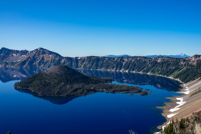
- Crater Lake National Park: Discover the best that Oregon’s only national park (isn’t that crazy?) has to offer with our guide to planning your Crater Lake itinerary, and our guide to the best hikes in Crater Lake. Plus, a guide to planning an amazing Seattle to Crater Lake road trip.