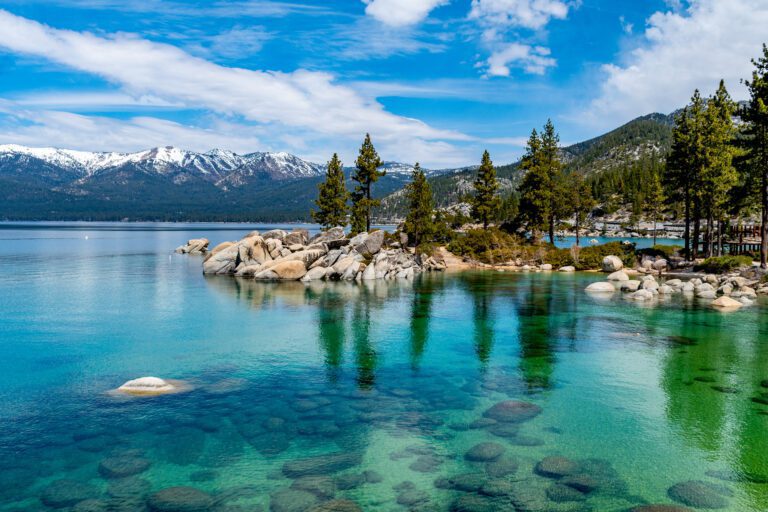
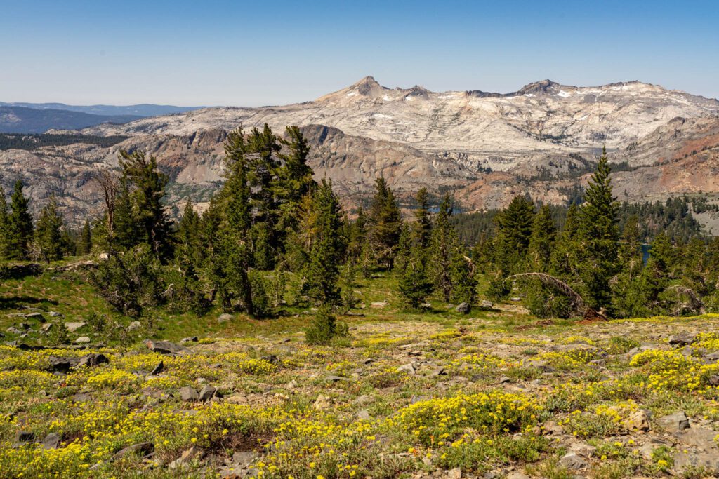
15 Outrageously Beautiful Hikes in Lake Tahoe, California
Lake Tahoe is a hiker’s paradise, with hundreds of miles of trails, multiple mountain ranges, more than 150 lakes, several wildernesses, national forests, and state parks in the basin. Whether you’re looking for an easy stroll, a thigh-burner, or a multi-day backpacking adventure, you can find it all here.
Many of the trails are easily accessible AND come with incredible views. One of the toughest parts about hiking in Lake Tahoe will be picking which trails you want to tackle, which is why we’ve put together this list of the best hikes in Lake Tahoe.
These are all hikes that you can do in a day – some take a few hours, some take most of a day.
Planning a trip to Tahoe? You won’t want to miss our 3 day Tahoe itinerary to plan a perfect long weekend summer adventure.
Disclaimer: Some of the links below are affiliate links, which means that if you click on one and purchase something, we make a small portion of the sale at no additional cost to you. It goes without saying that we would never recommend something we wouldn’t use or do ourselves.
When to Visit Lake Tahoe
Summer is the best time to hit the trails in Tahoe. You can expect plenty of sunshine and warm days. For the best chances of snow-free trails, come in July and August. It’s also the peak tourist season, with higher prices, and a lot more people.
If you’re concerned about crowds and sky-high prices, visit in September and October to escape both. The weather is still nice, though occasional snow showers are possible. Several area trails also show off their fall colors as the quaking aspens turn to gold and orange.
May and June are good times to chase waterfalls and see wildflowers in bloom. But snow on the ground is a real risk, particularly at higher elevations. A lot will depend on the previous winter and the snowpack.
And you can certainly hike in the winter as well, as long as you are prepared for the snow. Snowshoes, crampons and other winter hiking gear will come in handy.
Tips for Hiking in Lake Tahoe
While some of these tips are applicable for hiking in general, many are due to the unique nature of exploring the trails in Tahoe.
All of the hikes are at elevation, with most starting at 6,000 feet and above. If you’re coming from sea level, take some time to acclimatize and take your time on the trails.
Bring more water than you think you need. You’re at elevation and will need it. You won’t always find a water source during your hike. And when you do, always filter it.
Wear sturdy shoes with good support and traction. Some trails include sections of loose rock, scree, and talus. Hiking poles are also helpful.
Bring layers. It can be cold and windy at the top of many peaks. The weather can change rapidly. Always keep an eye on any developing storms. You don’t want to get caught on an exposed ridge or mountaintop during a lightning storm! Always check weather and trail conditions before starting a hike.
The sun is brutal here. Some trails offer limited or no shade. Wear a hat and sunscreen. Polarized sunglasses help cut the sun’s glare.
Tahoe is in bear country, though the black bears are more likely to be afraid of you than not. If you are camping overnight, always use a bear box or hang your food out of reach.
It’s a good idea to bring bug repellent. Yes, mosquitos can and do live at this elevation, particularly when there’s standing water from snow melt.
It’s generally a good idea to start your hikes early in the day, particularly for popular hikes. Not only will you avoid exposure during the hottest part of the day, you can also beat the crowds and get a parking spot.
Wondering what to wear on a hike? Check out our guide to what to wear hiking for our exact hiking wardrobe, and recommendations on what to wear in each season.

15 Amazing Hikes in Tahoe: A Local’s Guide
Now that you are all prepped, here’s a list of the best hikes in Tahoe, broken down by region and ease.
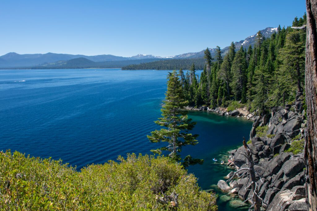
Hikes in South Lake Tahoe
Some of the most iconic Tahoe hikes can be found around the South Shore. From scenic hikes around Lake Tahoe to hikes in Desolation Wilderness, here are some of the best trails in South Lake Tahoe.
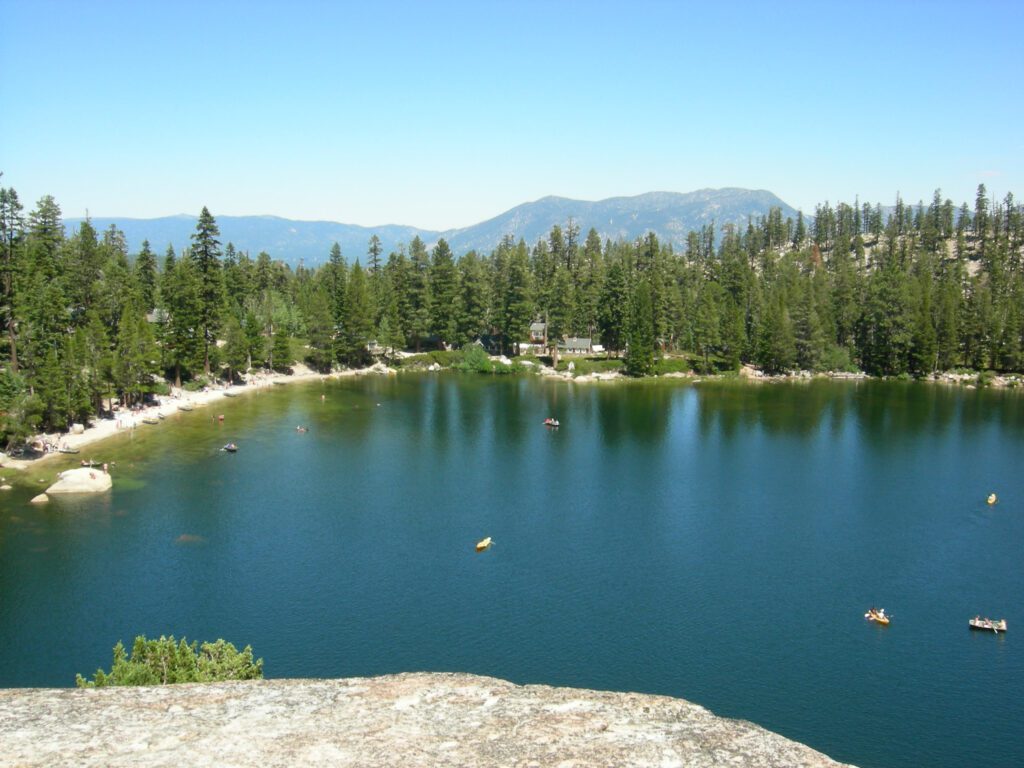
Eagle Lake

- Length: 2 miles
- Elevation Gain: 500 ft.
- Trail Type: Out & Back
- Difficulty: Moderate
- Trailhead Location
- Permits: Required if going past Eagle Falls into Desolation Wilderness; free at the trailhead
- Parking: $5 at parking lot, fills up very early; free along the road
This is one of the most popular hikes in the Tahoe, and one of the best in terms of bang for buck. With a little effort and some elevation gain, you can see a waterfall, an alpine lake and enjoy sweeping lake views and the dramatic granite landscape of Desolation Wilderness.
Follow signs for the Upper Eagle Falls Trail. You’ll go up a steep section of granite stone steps. After 0.2 miles, you’ll see Eagle Creek Bridge crossing above the cascading Upper Eagle Falls.
This is a great spot to stop for photos and to enjoy the views. There’s also a side interpretive loop you can take that leads to some benches and a nice viewpoint of Emerald Bay and Lake Tahoe.
After the bridge, you’ll soon cross into Desolation Wilderness. The trail opens up across granite slabs with great views of Lake Tahoe and the surrounding canyons and cliffs before you start climbing again. At 0.9 miles you’ll see a junction.
Go right to head to Eagle Lake. You’ll soon reach the lake, but continue a little further to your left until you see a mass of boulders. The views of Eagle Lake here are breathtaking. Also breathtaking is a dip in the cold alpine waters, which I recommend on a hot day.
If you still have energy and time, you can continue on and up to reach the three Velmas, Dicks, and Fontanallis lakes.
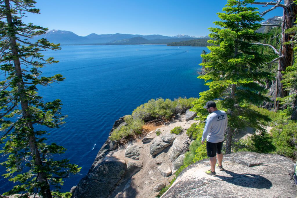
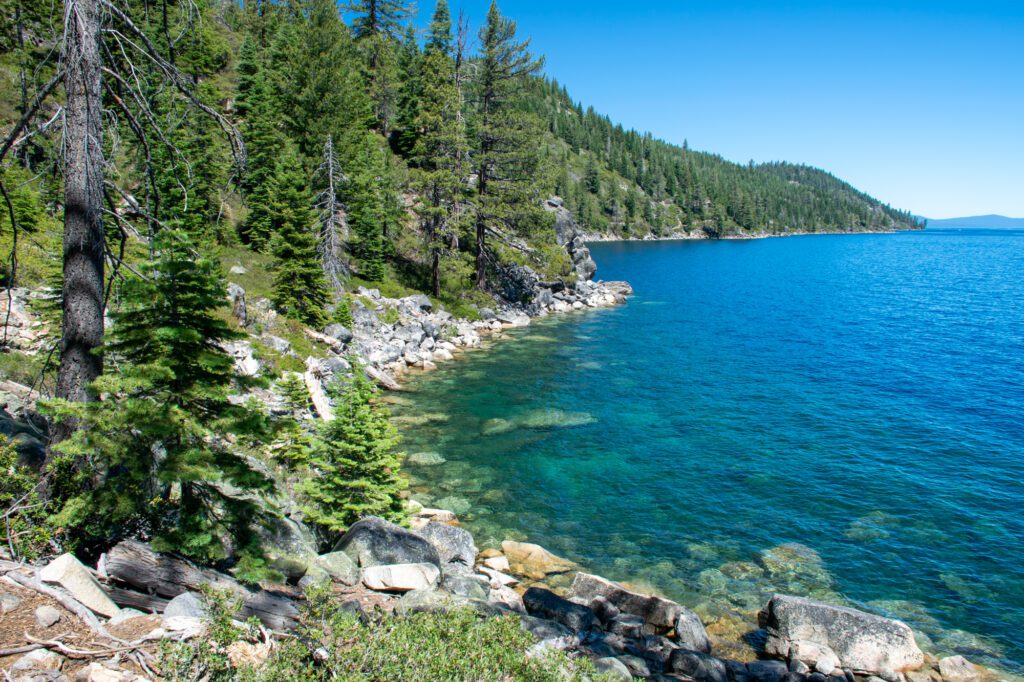
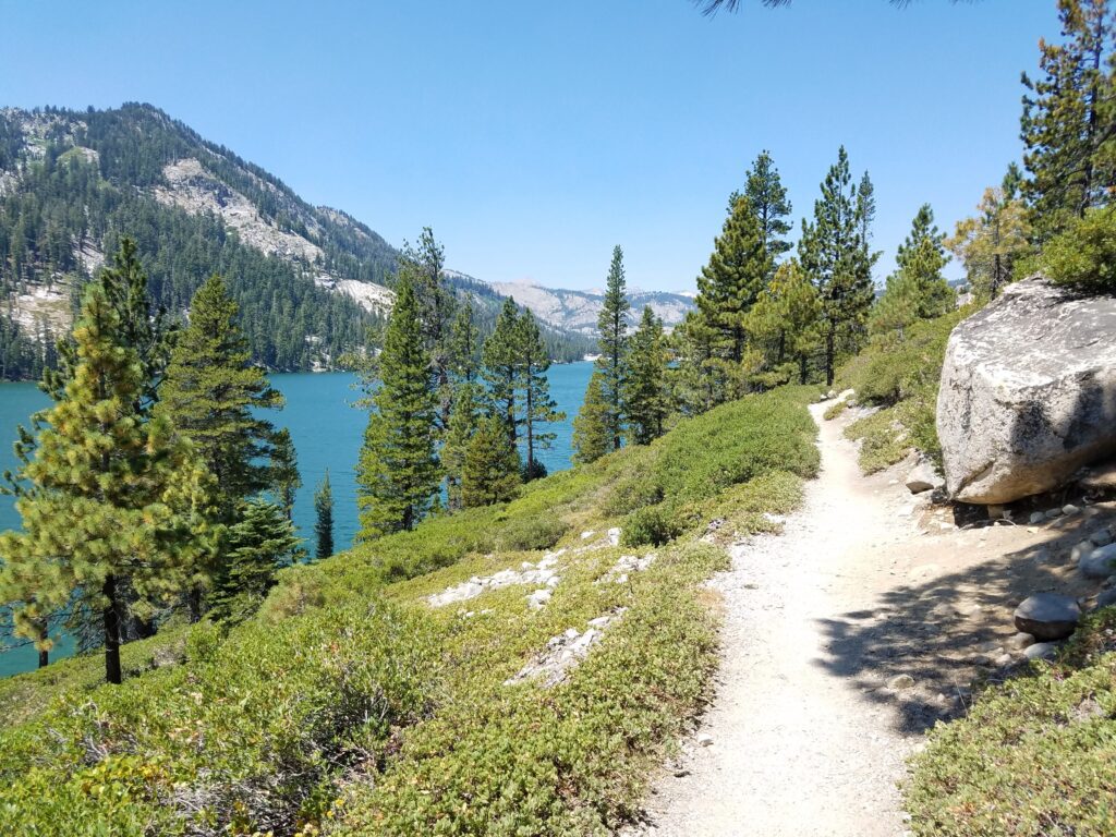
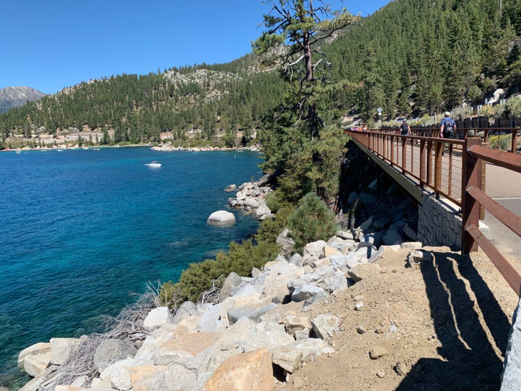
Rubicon Trail
- Length: 12 miles
- Elevation Gain: 1,400 ft.
- Trail Type: Out & Back
- Difficulty: Moderate
- Trailhead Location
- Parking: $10 at D.L. Bliss State Park (and also Vikingsholm)
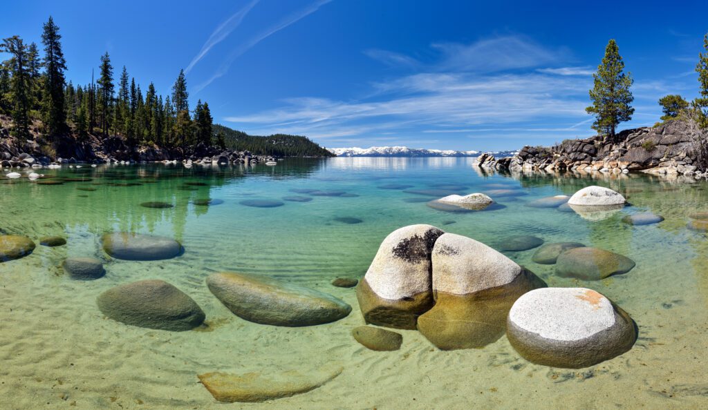
This is one of the best Tahoe hikes for easy, scenic lake views. Connecting D.L Bliss State Park and Emerald Bay State Park, the trail hugs the shoreline of Lake Tahoe for most of its length, with fantastic views pretty much the whole way.
You can start from either end, but I like to start and end at D.L. Bliss State Park, and spend time at the beach afterwards. Starting near Calawee Cove Beach, follow the Rubicon Trail south, and take a left at the first junction.
The trail is mostly flat, with some short up-and-down sections. About 0.5 miles in, there’s a spur trail leading to the historic Rubicon Lighthouse, worthwhile if you want to check out the highest elevation lighthouse in the country.
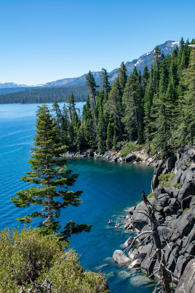
Enjoy the dramatic views over the cliff’s edge as you walk along the trail, hundreds of feet above Lake Tahoe. There are even sections carved right into the cliff! There are stunning views and vista points galore, as the trail winds its way around coves and ducking in and out of the forest.
Eventually the trail will cut inland and drop out in Emerald Bay, where it will continue near the water. Keep your eyes out for eagles and ospreys. You’ll pass by several pretty coves and a boat-in campground before reaching Vikingsholm, a stunning Scandinavian-style castle that you can tour in the summer, at 4.5 miles.
If you have access to a second car and parked it at the Vikingsholm, you can end your hike here. Otherwise, turn around back the way you came or continue on to Eagle Point before exiting or turning around.
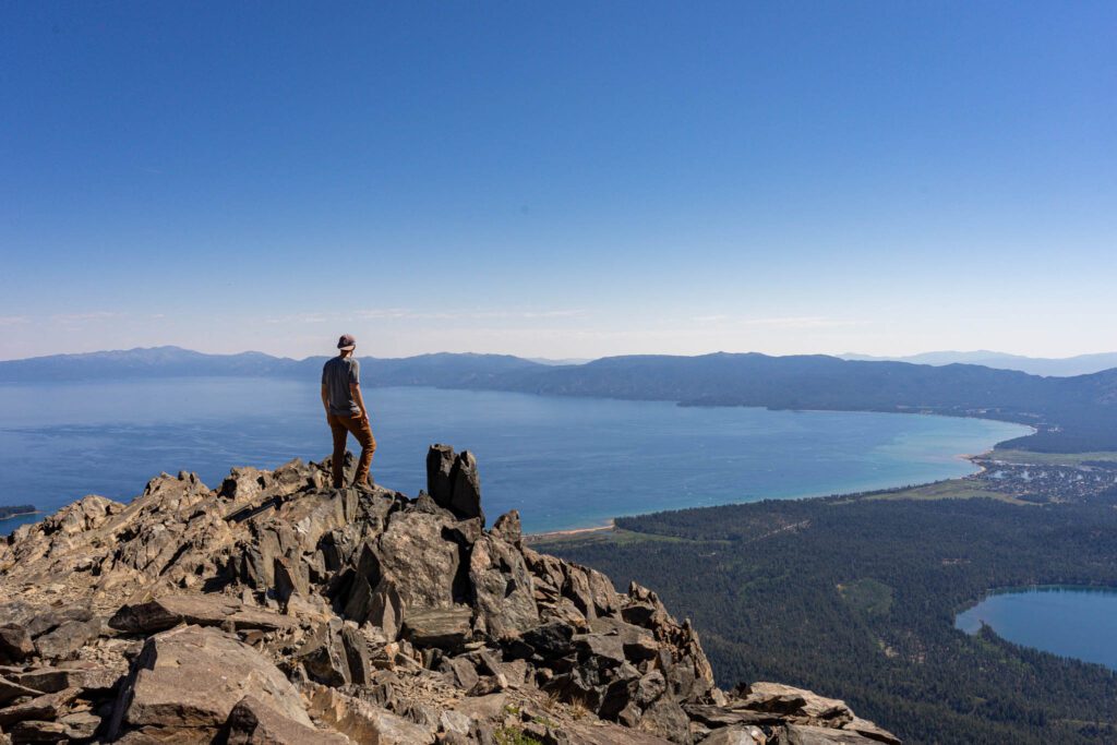
Mount Tallac
- Length: 9.8 miles
- Elevation Gain: 3,400 ft.
- Trail Type: Out & Back
- Difficulty: Hard
- Trailhead Location
- Permits: Yes, to enter Desolation Wilderness; day hikers register for free at trailhead
- Parking: Free but can fill up on weekends
Towering over Lake Tahoe, Mount Tallac lives up to its Washoe name, meaning “Great Mountain.”
It’s a serious butt-kicker, but an absolute classic and one for the peak baggers and those who want to earn their views. The ascent is punishing, but you’ll be rewarded with epic views over the Lake Tahoe Basin from the summit at 9,735 feet.
The first part of the hike, to two alpine lakes, is fairly moderate. You’ll start hiking through the forest before popping out on a ridge overlooking Fallen Leaf Lake. Cross into Desolation Wilderness after 1.7 miles, and you’ll reach Floating Island Lake (named for a small grassy island that exists on the lake from time to time) shortly after that.
Around 2.5 miles, you’ll reach Cathedral Lake, named after a nearby cliff. This is a good spot to rest as the remainder of the hike will be brutal.
In the final section, you’ll gain 2,000 feet of elevation in 2.4 miles. The trail is rocky, with talus fields, and there’s no shade. Long switchbacks eventually lead to a crest at 3.5 miles, which you’ll follow, past wildflowers, shrubs and groves of stunted conifers, to a junction at 4.5 miles with the trail to Gilmore Lake.
Go right and you’ll reach an exposed ridge shortly after that. Follow the ridge the last 150 vertical feet to the top, scrambling or boulder hopping as needed.
As you stand at the summit, look out over the sweeping views that you just earned. It’s one of the best in the Tahoe Basin.
Want to tackle Mt. Tallac? Make sure to read our trail guide for the hike to Mt. Tallac.
Echo Lakes
- Length: 5.2 – 12 miles
- Elevation Gain: 500 – 1,800 ft.
- Trail Type: Out & Back
- Difficulty: Moderate to Hard
- Trailhead Location
- Permits: Yes if you go past Echo Lakes into Desolation Wilderness; day hikers can register for free at the trailhead
- Parking: Free but fills up quickly during summer
- Other: Water taxi ($20/person, $8/dog), July 4 to Labor Day
Located near Echo Summit, Lower and Upper Echo Lakes are two pretty alpine lakes in a granite basin that serve as a popular gateway into the Desolation Wilderness backcountry. With just a few hours, you can hike part of the Pacific Crest Trail, enjoy scenic views, and two (or more) alpine lakes.
The trail tracks the PCT along the northern edge of the lakes and starts behind Echo Lakes Chalet, on the shore of Lower Echo Lake. A dirt trail will take you gradually uphill until it levels out above the lakes, with great valley and lake views.
You’ll pass by some Jeffery pines, but the trail is largely exposed with limited shade, and rocky at parts.
At 2.5 miles, there’s a path leading down to the lake and a boat dock. Jump in the water for a refreshing swim. For those that don’t want to walk back, you can take a water taxi. There’s a direct line phone at the dock or use your cell phone.
For those with more energy, you can also continue on further to several other lakes, including the scenic Tamarack Lake (1.5 miles further), Lake of the Woods with great fishing (2.5 miles further), or the surreal Aloha Lake (3.5 miles further), which I highly recommend.
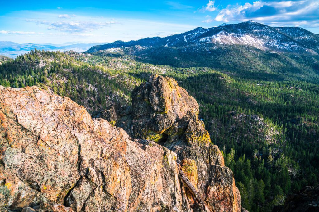
Castle Rock
- Length: 1.8 miles/2.8 miles
- Elevation Gain: 350 ft.
- Trail Type: Out & Back/Loop
- Difficulty: Moderate
- Trailhead Location
- Parking: Free near trailhead
- Other: Peregrine falcons sometimes nest near the summit, which can impact access
This is one of my favorite hikes and one I take visitors on. I happen to live nearby, but it’s also an easy hike with a great payoff at the end, where you’ll feel like you’re on top of the world with jaw-dropping views of Lake Tahoe. You have to scramble a bit for the best views, but that’s part of the fun. There are also a bunch of climbing routes here.
You can do the hike as a quick out and back or a longer loop. Since the best part is the view at the end, I recommend the out and back. Especially if you’re carrying a backpack full of climbing gear!
Start at the metal gate south of the Kingsbury North Trailhead. Follow the mostly level dirt trail until the Tahoe Rim Trail junction and turn right. At the next junction, turn left and follow the trail up for Castle Rock. This is the most strenuous part of the trail, as you’ll be heading steadily uphill for 300 feet, but it’s quite short.
Follow the orange markers to get to an easy viewing ledge. For better views, you will need to scramble up the rocks to a higher, more exposed, ledge. There are a number of ways up, just be careful and don’t push beyond your comfort levels. This is also a great sunset spot—bring headlamps for the walk back.
Take a right at the bottom of the hill to go back the way you came, or go left to complete the loop in a clockwise direction, following signs for the Kingsbury North Trailhead. You can also do the loop going counterclockwise, starting at the Kingsbury North Trailhead.
Carson Pass to Winemucca Lake
- Length: 5 miles
- Elevation Gain: 600 ft.
- Trail Type: Out and Back
- Difficulty: Moderate
- Trailhead Location
- Parking: $5 at Carson Pass, $8 at Woods Lake, parking lot can fill up, especially on weekends
Located in the Mokelumne Wilderness south of Tahoe, the hike to Winemucca Lake is one of the most popular in the Carson Pass region. The moderate trail offers interesting terrain, beautiful alpine scenery, and an abundance of wildflowers in season.
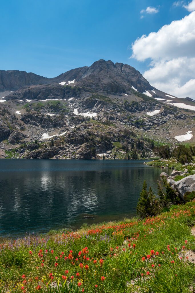
Starting at the Carson Pass trailhead, follow the Pacific Crest Trail south through a forested section for around 1 mile until you get to Frog Lake. At the junction, take a right to follow the Winemucca Lake Trail. From here on out, you’ll be in an open area, with the peaks of Round Top and the Sisters in the distance.
During the height of summer, the entire area is blanketed with wildflowers as far as the eye can see. Lupines, columbines, blooming paintbrush, and Sierra lilies are just some examples. At Winemucca Lake, enjoy a picnic lunch on the boulders, relax, go for a swim, or fish.
For those with more energy, there are several options to extend your hike. Peak baggers may want to climb to the summit of the 10,381-foot Round Top (expect some proper scrambling to get to the true summit).
Another option is to continue on to Round Top Lake (1 mile further), or Fourth of July Lake (another 1.5 miles after Round Top Lake). You can also make it a loop and return via Woods Lake (5.5 miles total), or from Round Lake via the Round Top Lake Trail (6.5 miles total), passing by the Lost Cabin mine on your way back.
Hikes in North Lake Tahoe
North Lake Tahoe also offers a wealth of fantastic hiking trails. If you are staying on the North Shore, here are the best hikes in North Lake Tahoe to tackle.
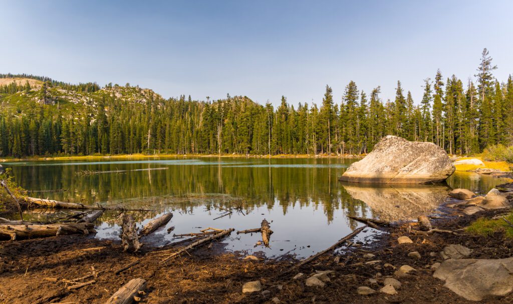
Five Lakes
- Length: 5 miles
- Elevation Gain: 1,100 ft.
- Trail Type: Out & Back
- Difficulty: Moderate
- Trailhead Location
- Parking: Free along the road
As one of the prettiest and most accessible hikes in the Granite Chief Wilderness, the Five Lakes Trail is also one of the most popular. You’ll enjoy expansive views, pretty wildflowers and five pristine alpine lakes at the end.
Climb steadily for the first 0.5 miles, along a hillside dotted with manzanita and scattered firs and pines. As you ascend, you’ll enjoy increasingly open views over the canyon and the Alpine Meadows ski area. Take your time if you need to, as the whole hike is pretty short. There’s also virtually no shade. You’ll reach a ridge at around 1.2 miles.
Continue climbing up a bit further until you cross over into the Granite Chief Wilderness. The trail levels out as you enter into a forest of red firs. There’s a trail around to all the lakes, which can be a bit tough to follow. I recommend just exploring and finding your favorite lake.
The largest lake is considered the prettiest of the five, which also makes it the busiest. It’s got some excellent boulders for sunbathing. Reward yourself with a cool dip and that picnic you packed. You can also fish here for rainbow trout.
Feeling ambitious? You can continue onwards to hike along a portion of the Pacific Crest Trail (another 500 feet up).
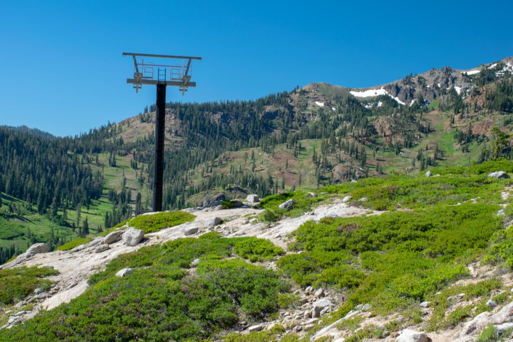
Shirley Canyon to High Camp
- Length: 4.2 miles
- Elevation Gain: 2,000 ft.
- Trail Type: One way
- Difficulty: Hard
- Trailhead Location
- Parking: Limited parking along Squaw Creek Road and Squaw Creek Way, but more parking can be found in the Squaw Valley lot
The hike from Shirley Canyon to High Camp is steep, but rewarding, with two waterfalls, an alpine lake, and stunning scenery and views along the way.
At the end, you can enjoy the many amenities of Squaw’s High Camp, including a pool, hot tub, skating rink, restaurant, and bar. Plus you can catch a free ride back down on the aerial tram, with epic views the whole way.
Look for brown trail signs and blue blazes painted on the rocks showing you the way, though you will largely be following Shirley Creek. You’ll reach the first waterfall, with a 15-foot plunge, at 0.3 miles.
Continue upwards and take a left at the junction, across a granite slab, until you reach the second waterfall at 0.8 miles. From here until Shirley Lake, you’ll pass through steep sections of granite slabs. Just before Shirley Lake, the trail crosses woodland and meadows with wildflowers in season.
Enjoy a dip in the lake, or just press on to High Camp. From here it’s a little over a mile to reach High Camp, though you will have to cross a field of talus near the summit.
Reward yourself at High Camp before you take the aerial tram back down. Just make sure you get there before the last one (typically at 5:30 pm, but double check before you head out).
Picnic Rock
- Length: 3.2 miles
- Elevation Gain: 750 ft.
- Trail Type: Out & Back
- Difficulty: Moderate
- Trailhead Location
- Parking: Free along the pullout
Located just south of Brockway Summit, between Kings Beach and Truckee, Picnic Rock is a short and quick hike that leads to a stunning viewpoint. The hike does go steadily uphill, but the payoff is definitely worth it. It’s good for families with kids.
Head up the dirt trail until you see a sign for the Tahoe Rim Trail. You’ll be hiking a very short part of the 165-mile-long trail that circles Lake Tahoe. The trail climbs steadily up, through a series of switchbacks through the forest. There’s plenty of shade and you’ll start to see some filtered views of the lake.
At 1.2 miles, you’ll come to a junction. Take the spur trail to the left and follow the signs to the viewpoint. The trail gets even steeper at this point, but it’s only a little further to reach a series of rock outcroppings that give you 360-degree views of Lake Tahoe and the Sierra Crest. If you’ve packed a picnic as the name suggests, this is a great spot to enjoy it.
Mount Rose
- Length: 10.6 miles
- Elevation Gain: 2,400 ft.
- Trail Type: Out & Back
- Difficulty: Hard
- Trailhead Location
- Parking: Free at trailhead but fills up quickly
At 10,776 feet, Mount Rose is the third highest peak around Tahoe, and the highest on the north shore. It’s a tough hike, but one that rewards you with incredible views over Tahoe, the Nevada high desert and the Sierra Nevada range, along with a waterfall, alpine lake and plenty of stunning mountain scenery along the way.
The trail starts off with a quick uphill, but then levels off along a ridge with views of Tahoe Meadows and Lake Tahoe. You’ll cross a saddle and through the woods before dropping down into a meadow. You’ll reach Galena Creek and Galena Falls at around 2.5 miles.
Depending on the timing, the area might be bursting with wildflowers.
Many people turn around at this point, but it’s well worth continuing on to the summit, despite the punishing and largely exposed ascent (around 1,800 feet) from this point.
Take a right at the junction just past the waterfall. You’ll climb around 700 feet for the next 1.5 miles until you reach another saddle, and another junction.
Take another right and then make the final push, which will take you up another 1,100 feet in less than 1.5 miles. Expect a series switchbacks and loose rock. Take your time. You’re at nearly 11,000 feet.
At the summit, don’t forget to sign your name in the register. Catch your breath and enjoy the spectacular, panoramic views of Lake Tahoe, the Carson Range and Reno from the summit. You can even see up to Lassen on a clear day. It can be extremely windy up top. Warm layers and piled rock walls help somewhat.
Marlette Lake
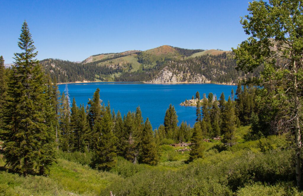
- Length: 10 miles
- Elevation Gain: 1,000 ft.
- Trail Type: Out & Back
- Difficulty: Moderate
- Trailhead Location
- Parking: $10 at the trailhead
Follow the signs for Marlette Lake until you connect with the North Canyon Trail, which turns into a single track that climbs steadily through North Canyon’s mixed forests. If you’re here in autumn, the groves of quaking aspen put on a pretty show. After 4 miles, you’ve reached the highest point on the trail and will descend the last 0.5 miles to the south shore of pretty Marlette Lake.
Check out the fish spawning station, take a dip in the lake to cool off, then enjoy a picnic lunch. If you continue left around the lake, you’ll reach a dam and the start of the Flume Trail, one of the most iconic Tahoe mountain biking trails. If you go right around the lake for another mile, you’ll reach the Marlette Overlook with great views of Lake Tahoe.
Easy Hikes in Tahoe
Sometimes you’re not up for a big hike. Whether you have limited time, or little kids in tow, here are some great easy hikes in Lake Tahoe.
Angora Lakes
- Length: 1.2 miles
- Elevation Gain: 250 ft.
- Trail Type: Out & Back
- Difficulty: Easy
- Trailhead Location
- Parking: $10 (bring exact cash) at parking lot, fills up early
Easily accessible, the Angora Lakes Trail lets you enjoy two alpine lakes, water sports, fishing, family fun and some of the best cliff jumping around.
A dirt road will take you gently uphill through a pine and fir forest. After 0.3 miles, you’ll reach the quieter Lower Angora Lakes. Continue on another 0.3 miles to reach the Upper Angora Lakes. There’s a sandy beach with shallow water for swimming.
The Angora Lakes Resort (open mid-June through mid-September) rents SUP boards, kayaks and rowboats, cabins (book a year in advance) and snacks, including their world-famous fresh-squeezed lemonade.
Those looking for a little more excitement should take the trail to the left and continue to the far side of the lake, where you’ll find cliffs up to 60 feet to jump off from. Water shoes to help with the climb back from the water.
Tahoe East Shore Trail
- Length: 6 miles
- Elevation Gain: 120 ft.
- Trail Type: Out & Back
- Difficulty: Easy
- Trailhead Location
- Parking: Paid and free parking at Tunnel Creek Café, and some pullouts along the road
It might be a bit of a stretch to call this a hike, as it’s more of a gentle stroll. But the views and beach access can’t be beat. In just 3 miles (one way), you’ll cross 16 vista points and 11 beach access points.
The trail starts near the Tunnel Creek Cafe, on the mountain side of Highway 28. After about a mile, the trail crosses a tunnel and hugs the shoreline for the last 2 miles. There are numerous interpretive exhibits along the way.
I recommend taking your time, and popping down to check out various beaches and coves along the way. It’s a great spot for sunset, with your choice of amazing viewing spots.
Tahoe Meadows Nature Trail
- Length: 1.3 miles
- Elevation Gain: 50 ft.
- Trail Type: Loop
- Difficulty: Easy
- Trailhead Location
- Parking: Free at the trailhead, can fill up
Located near the Mt. Rose summit, this gently graded trail is an easy way to experience a pretty and lush subalpine meadow filled with wildflowers and wildlife.
It’s ideal for families with small children, and also wheelchair accessible. Wooden boardwalks cross over streams and marshy areas. Enjoy views of Mt. Rose and Slide Mountain along the way. Look for interpretive signs along the way.
Summit Lake
- Length: 4.5 miles
- Elevation Gain: 400 ft.
- Trail Type: Out and Back
- Difficulty: Easy
- Trailhead Location
- Parking: Free at trailhead and plentiful
Located near Donner Summit, the Summit Lake trail is an easy hike to a small, tree-lined lake that’s perfect for the whole family. You’ll follow the Pacific Crest Trail Access Trail for a mile, then the Pacific Crest Trail itself for another mile, passing through a tunnel to cross underneath I-80.
At the next junction take a right. After a forested section, you’ll reach a pretty meadow full of wildflowers from spring to summer. Take another right at the next intersection, through another forested section and you will reach the south corner of Summit Lake. Take your time and enjoy the seclusion at this quiet and peaceful lake.
Plan an Unforgettable California Adventure
Heading to California? We’ve got all sorts of super detailed, in-depth California travel guides written by locals to help you plan an amazing trip.
- San Francisco: We’ve got a guide to spending 3 days in SF, one day in San Francisco for planning a shorter trip, and a complete guide to finding the perfect place to stay in San Francisco. We also have guides to 14 perfect weekend getaways from San Francisco and the best day trips in the Bay Area. Oh, we almost forgot, here are the 15 best hikes near San Francisco, written by two Bay Area locals.
- Los Angeles: Read our perfect 2 Day L.A. itinerary, our guide to spending one amazing day in L.A. (with two versions!), and a guide to helping you figure out where to stay.
- San Diego: Learn how to spend a day in San Diego, a weekend in San Diego, and where you should stay.
- Lake Tahoe: Plan the perfect summertime adventure with our 3 day Tahoe itinerary, guide to the best hikes, and our guide to the best things to do in Tahoe.
- Santa Barbara: We have a guide to planning a weekend in Santa Barbara, and a guide to a day trip to Santa Barbara from Los Angeles if you’re pressed for time.
- Mammoth Lakes: To plan a perfect getaway in the Eastern Sierra, read our guide to the best things to do in Mammoth Lakes in the summer. Plus, our guide to the best hikes in Mammoth, featuring the epic climb to the top of Duck Pass.
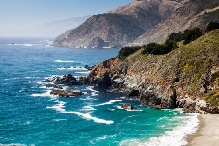
- Big Sur: Plan the perfect weekend away with our complete Big Sur itinerary.
- Yosemite National Park: Plan an amazing trip with our guide to planning an amazing Yosemite itinerary, and our guide to choosing where to stay at Yosemite.
- Joshua Tree National Park: Plan the perfect trip with our perfect weekend itinerary (or a day trip, if you have less time), a guide to the best hikes, and some cool places to stay in Joshua Tree.
- Death Valley National Park: We have a SUPER detailed guide to planning the perfect Death Valley itinerary, and a guide to the best hikes in Death Valley National Park.
- California Road Trips: See the best of the Pacific Coast Highway on our San Francisco to San Diego road trip, or make the trip up Highway from on a Los Angeles to SanFrancisco road trip. If you’re more into mountains than beaches, a Highway 395 road trip from Los Angeles to Lake Tahoe might be more your speed.