Hiking in the San Francisco Bay Area: A Complete Guide
Looking for a guide to hiking in the Bay Area? You’re in the right place! We’re two (former) Bay Area locals who lived in the San Francisco Bay Area for a decade together (Alysha grew up in the Bay Area), and we’ve done all sorts of hiking near San Francisco.
One of our favorite parts about cities like San Francisco (along with Seattle and Portland, which is where we now live) is the combination of thriving cities and amazing access to outdoor activities.
From San Francisco, you can go south, east, or north and find world-class outdoor activities, like the towering redwoods on the northern California coast, to the best stretch of coastline in the world in Big Sur on the drive from San Francisco to Los Angeles.
Even within just an hour of San Francisco, there is a stunning array of hikes with all sorts of different scenery. Whether you’re looking for a long, grueling hike to the top of Mount Tamalpais, or a nice easy hiking trail in San Francisco itself, we’ve got you covered.
We love hiking – many of our travels are specifically planned to go hiking – and we’ve done as many of the best hikes near San Francisco that we could fit in over nearly a decade of living here.
Here’s a (former) local perspective on the best hikes in the Bay Area – all within about an hour of San Francisco.
Disclaimer: Some of the links in this post, like hotel links, are affiliate links, meaning at no additional cost to you, we make a little bit of money if you click through and book. That being said, we would never recommend something to you that we don’t stand behind 100%.
A Quick Bay Area Geography Overview
Before we get into the hikes themselves, we should take a second to talk about the geography of San Francisco and the surrounding area.
The best part about the Bay Area is that you can essentially drive in any direction and find yourself in the middle of world-class wilderness.
We lived in San Francisco for almost a decade, and still feel like there are parts of the Bay Area that we haven’t explored together.
There are a few hikes in San Francisco itself (or on the outskirts of the city, more accurately). These hikes are a great addition to any San Francisco itinerary if you’re visiting the city, or they make a solid day out if you live here.
There are two places that we’re going to focus on because we think they’re the best places to go hiking near the city – north of the city, and east of the city.
It’s worth noting that we’re keeping these hikes to about an hour away from San Francisco, which means places like Mount Diablo State Park don’t quite make the cut.
Though it’s still worth a trip out there, especially in the spring and fall when temperatures are a bit cooler.
North of the City: Marin County
North of San Francisco is Marin County, which is where Alysha grew up and where her mom still lives, which is where we spent most of our time from 2020 to 2023 (when we moved to Portland).
There are a couple of different areas within Marin that have some amazing hikes.
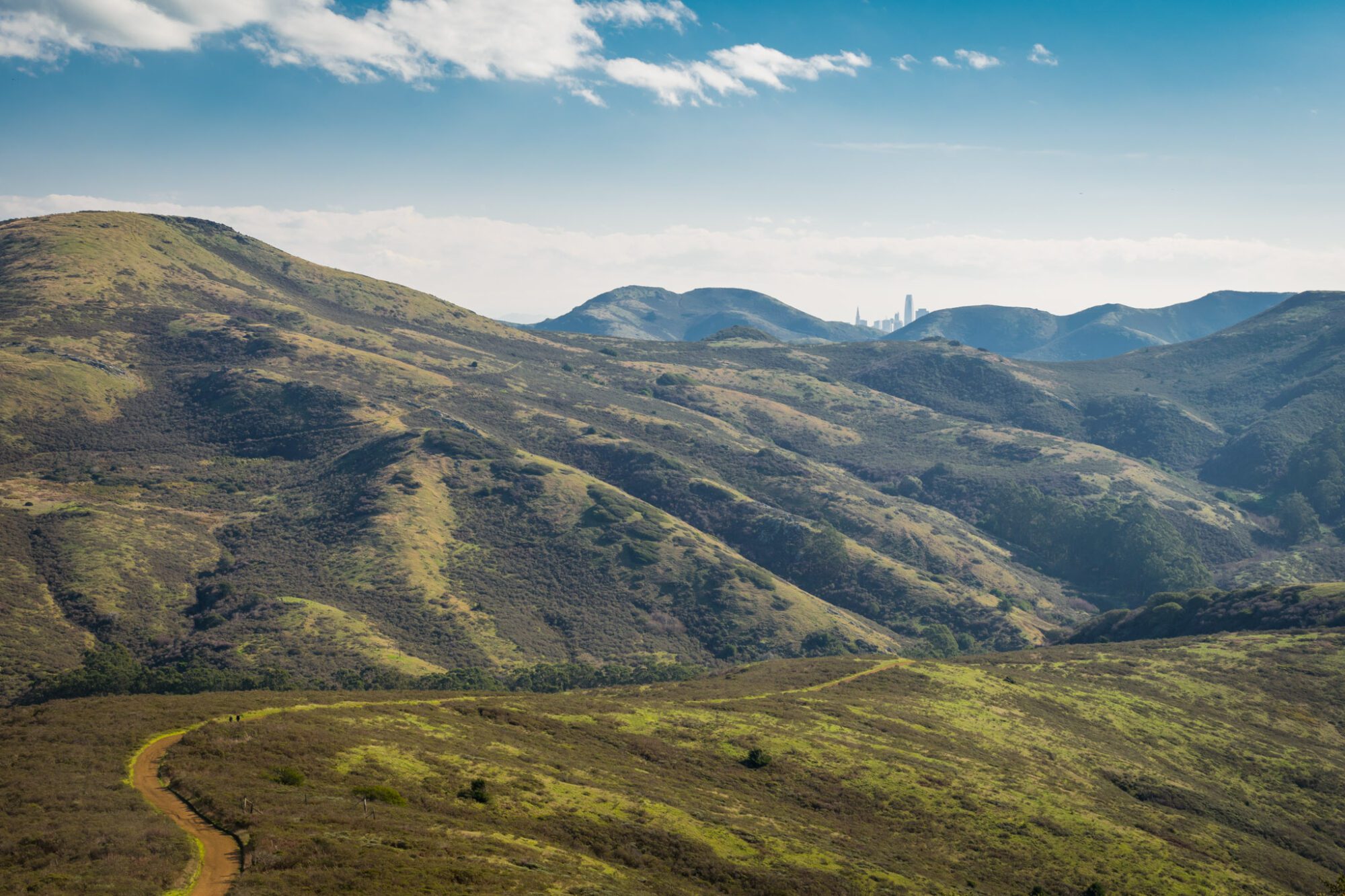
Going closest to the city to furthest, there’s the Marin Headlands, known for their amazing rolling hills and bluffs and coastal views.
Then there’s Mt. Tamalpais, which has it all – redwoods, coastal views, and sweeping views across the bay from its East Peak.
Last, but certainly not least, is Point Reyes National Seashore, which has an amazing array of great hikes, all of which are heavy on the coastal scenery.
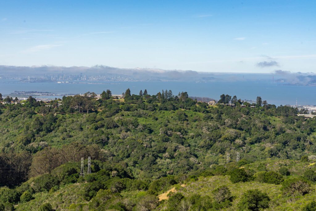
East of the City: Oakland and Berkeley
Just across the Bay Bridge, you’ll find Oakland and Berkeley. The hills above these two East Bay cities are chock full of hiking trails, which we had the opportunity to really dig into when we lived here for six weeks recently.
In Oakland, you’ll find a string of regional parks, headlined by Redwood Regional, which has one superb hike featuring, you guessed it, redwoods!
Berkeley is home to the Berkeley Hills (go figure) and Tilden Regional Park.
Both areas give you great views of the city, and are full of accessible hiking trails for all experience and fitness levels.
Hiking in the Bay Area: The 15 Best Hikes near San Francisco
Now, onto the list of hikes!
We’ve put together this list of our favorite hikes within about an hour of San Francisco, and we hope to help you discover a new hike to add to your list whether you’re a novice hiker, or you’re a grizzled trail veteran on the prowl for a new trail to tackle.
Or, and this is the most likely scenario, you’re somewhere in between like us.
Unlike Oregon and Washington, the hiking trails in California are decidedly NOT dog-friendly.
State Parks (like Mt. Tam) do not allow dogs on hiking trails, and neither do National Recreation Areas (like the Marin Headlands and Pt. Reyes).
A Note Before We Jump In: All of the hikes that you’ll find below are within an hour of the city of San Francisco, which means they’re perfect for a day trip from San Francisco.
Some lists that we’ve seen out there include hikes as far out as Tahoe, which is four hours away from San Francisco (not counting the inevitable Tahoe traffic to get there). And that’s not really near San Francisco, or even in the Bay Area.
So we’ve omitted those, and kept it tightly focused on the area around San Francisco.
Obviously, this list doesn’t include every single hike that you COULD do in the Bay Area. Instead, it’s a list of our favorites. And we’re DEFINITELY biased having spent most of our time in the city and north of the city.
Hikes in San Francisco (Inside the City Limits)
There are a couple of good hikes within the San Francisco city limits, which means you don’t even have to leave the city to get a good hike in!
The Lands End Trail
- Length: 4.5 miles
- Elevation Gain: 600 feet
- Trail Type: Point-to-point
- Difficulty: Easy
- Pass Required? None
- Dog-Friendly? Yes, on a leash (but can’t take them on the bus)
- Trailhead Location: Lands End Main Parking Lot
We really recommend that everyone who comes to San Francisco walk the Lands End Trail starting from Ocean Beach and Sutro Baths, and going all the way to the bridge.
It’s an iconic hike – definitely one of the best hikes in San Francisco itself – and the views of the Golden Gate Bridge get better and better as you traverse the coastal route approaching it.
The first thing to know is that this is a point-to-point trail. If you don’t have a car, great! Get yourself to the trailhead via public transportation (on Muni, the number 5 bus runs straight down Fulton and drops you near the trailhead) or a ridesharing service.
If you have a car, park at one of the parking lots near Sutro Baths, and plan on taking a rideshare back to your car when you’re done.
The second thing to know is that you should definitely do this hike from west to east, starting at Sutro Baths and ending at the bridge. That way the Golden Gate Bridge is in front of you the entire time.
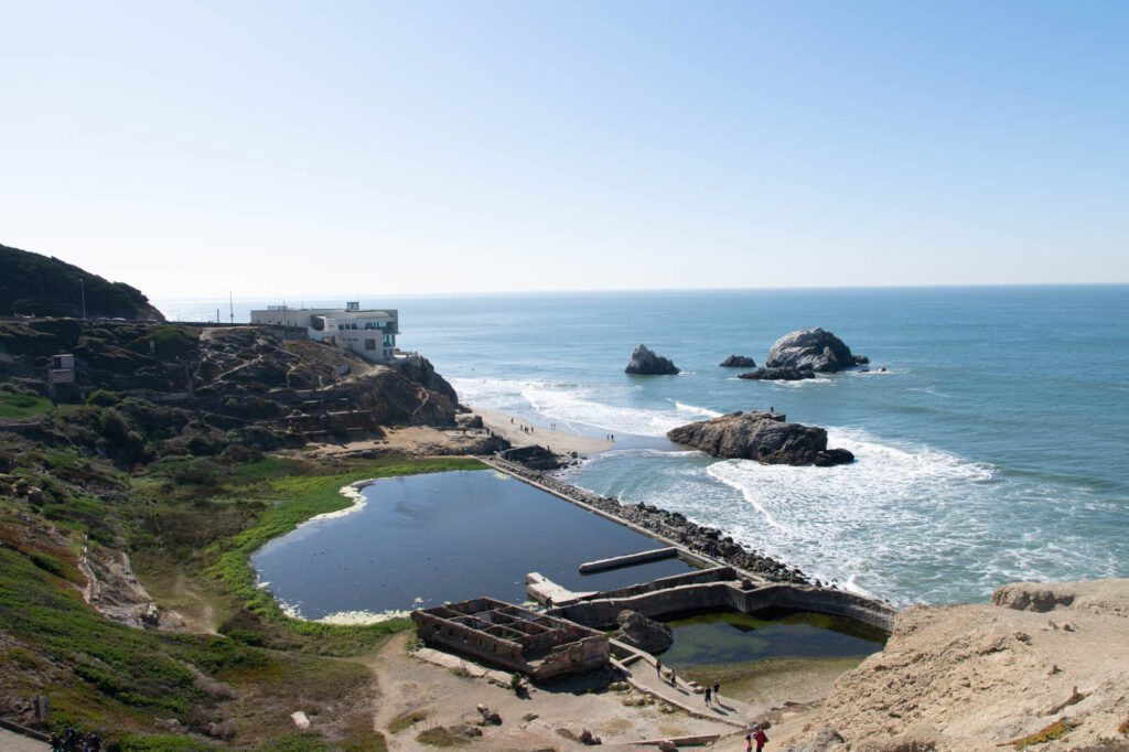
Start from Sutro Baths, which is a cool spot to visit in its own right. In the late 1800’s, a bathhouse was built here by some rich guy, and it didn’t do so well as a business.
Eventually, they burned to the ground, and the land was never developed. Instead, it became a part of the Golden Gate National Recreation Area in 1974.
Today, you can walk out onto the ruins of the baths, which are right on the ocean.
Pro-tip: There’s a fantastic view of Ocean Beach from Sutro Heights (here), which is a short walk up the hill from Sutro Baths.

From Sutro Baths, connect to the Lands End Trail via Point Lobos (great ocean views from here). At points, it becomes the Coastal Trail – as long as you’re walking east along the coast, you’re probably in the right place.
Your next stop is the Lands End Labyrinth, which is a turnoff to the left at ¾ of a mile in. Head down the hill to check out the “labyrinth,” which is a collection of stones arranged in a nice set of circles looking out over the ocean.
Continue along the coastal trail, which will take you through the ultra bougie neighborhood known as Sea Cliff on your way to Baker Beach.
From Baker Beach, you’ll have a spectacular view of the bridge, especially from the northern end of the beach. Which also happens to be a nude beach – know that going in.
When you’re done at Baker Beach, take what’s known as the sand ladder back up to the trail, and continue on to the Golden Gate Bridge.
There are a bunch of cool photo opportunities at the WW2 era batteries along the way. Make sure to stop here for the Golden Gate Bridge framed by a couple of very photogenic trees.
You’re basically at the end of the trail here. Make your way over to the toll plaza, and walk across the bridge if it’s clear out. Then, grab your ride either home or back to your car.
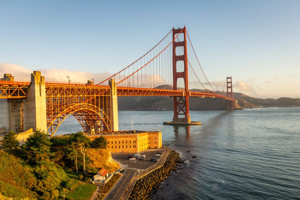
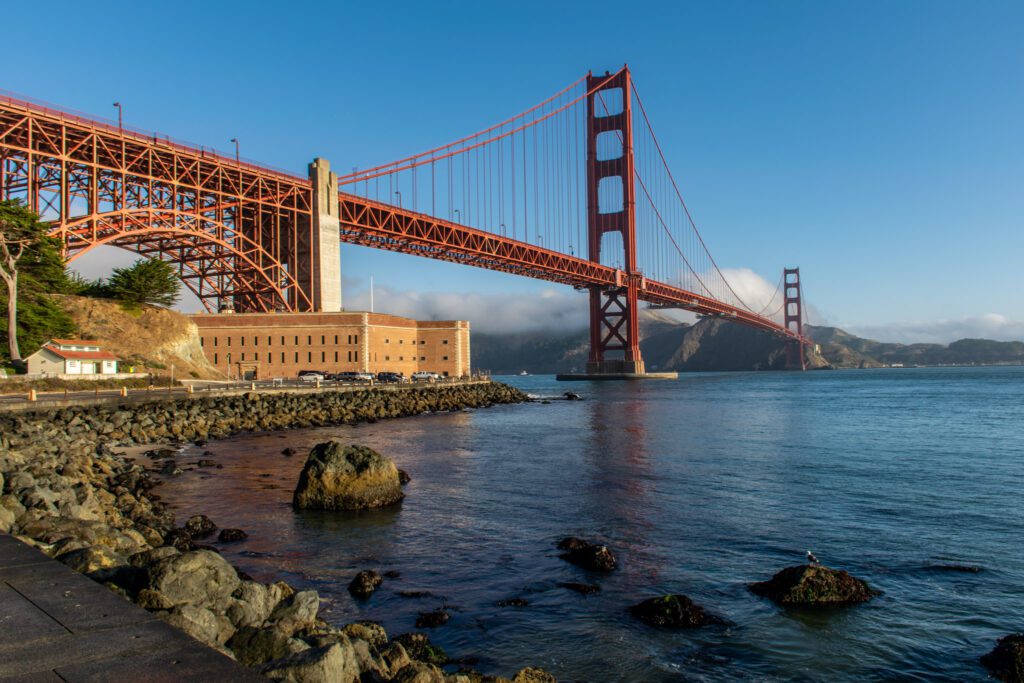
Golden Gate Bridge to Sausalito
- Length: 4.2 miles
- Elevation Gain: 200 feet
- Trail Type: Point-to-point (Take the Ferry Back!)
- Difficulty: Easy
- Pass Required? None
- Dog-Friendly? No, because they can’t go on ferry
- Trailhead Location: Golden Gate Bridge Toll Plaza
This is another one of our favorites because it involves walking across the Golden Gate, which we think everyone should do at least once in their lives, and going all the way to Sausalito, which has a great little strip of bars, restaurants, and shops that makes for a perfect day trip from San Francisco.
This is another one-way hike, which means you’ll need to find your way to the trailhead at the Golden Gate Bridge toll plaza (take the bus or a rideshare) and back from Sausalito (take the ferry!).
Start from the toll plaza and walk across the bridge. It will likely be windy, and it might be cold and foggy, which will mean it’s not the most pleasant hike in the world.
Once you reach the other end of the bridge, head to the viewpoint on the east side (right, if you’re walking north) of the bridge.
Take some pictures, then take the path that goes under the bridge, where you’ll connect with Conzelman road from this parking lot.
Follow that down to the water, eventually you’ll find yourself at Fort Baker. The Presidio Yacht Club is a cool stop for a drink here before you continue, if you’re looking for a nice place to take a break.
Walk along East Road to Alexander Avenue, then continue along Alexander Avenue and you’ll start to see the beauty of Sausalito, with the colorful houses on the hills overlooking the San Francisco Bay.
Eventually, Alexander Avenue turns into 2nd Street (briefly) before you hit the Bridgeway, which is the main drag in town.
Stop at Lappert’s for ice cream, Copita for tacos and margaritas, and browse the other shops on this stretch.
To get home, head to the ferry dock and catch a ride back to the city.
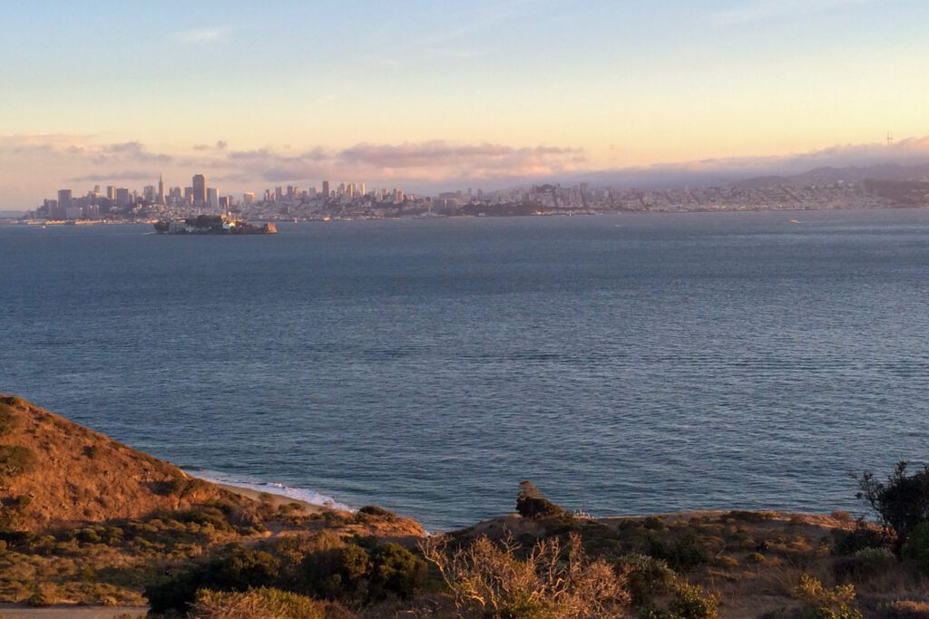
Angel Island
- Length: 6 miles
- Elevation Gain: 488 feet
- Trail Type: Loop
- Difficulty: Moderate
- Pass Required? None
- Dog-Friendly? No
- Trailhead Location: Angel Island Ferry Terminal
This is a weird one because Angel Island is the island in the middle of the bay (that’s not Alcatraz), and to access it, you have to take a ferry either from the city, or from Tiburon / Sausalito in Marin.
It’s a California State Park, and there are a bunch of good hiking trails on the island that give you a pretty spectacular view back towards the San Francisco Skyline.
You can also camp overnight on Angel Island, which we got to do a few years ago, but permits are super competitive and it’s walk-in camping, so you’ll have to carry your gear from the ferry to your campsite (which probably isn’t an issue for backpackers, but might be if you’re expecting car camping).
The best hike on Angel Island is the Perimeter Loop, which gives you amazing views of the city from the south end of Angel Island.
It’s six miles long, but it’s relatively flat (500 feet of elevation gain over six miles) and is suitable for most people – bring plenty of water and snacks.
Another option would be hiking up the peak of Mt. Livermore, but that means you’ll miss the views on the south end of the island.
Bring a picnic lunch for when you’re done – there’s a nice grassy area at the ferry dock where you can lounge in the sun and wait for the ferry to arrive.
Hikes in the East Bay: Oakland, Berkeley, and Beyond
The thing we like about hiking in the East Bay is that wherever you go, there are going to be a never-ending number of hiking trails that all connect to each other in a sprawling web of paradise for explorers.
That means you’ll be able to customize your hike based on what you’re in the mood for, whether it’s a short and sweet loop through the redwoods, or a long, grueling climb to one of the ridges in the East Bay.
With that in mind, here are our favorites, but remember that you can probably make these hikes either shorter or longer, depending on what you’re looking for.
Inspiration Point to Wildcat Peak (Tilden Regional Park)
- Length: 4 miles
- Elevation Gain: 450 feet
- Trail Type: Out and Back
- Difficulty: Moderate
- Pass Required? None
- Dog-Friendly? Yes, on a leash
- Trailhead Location: Inspiration Point Trailhead
This hike starts from a parking lot along Wildcat Canyon Road at the eastern edge of Tilden Regional Park. From there, you essentially follow a paved trail – Nimitz Way – for the majority of the climb up to Wildcat Peak.
At a hair under two miles in, you’ll turn off onto the Wildcat Peak Trail, which takes you the last 0.2 miles up to the lookout.
From there, you’ll have a nice view of the City, the Bay, and the Golden Gate Bridge to the west, and the San Pablo Reservoir and Mount Diablo to the east.
You can also extend this hike by making it a loop, following the Wildcat Peak Trail down to Jewel Lake and heading back to the parking lot via Loop Road and the Meadows Canyon trail.
We like this loop because the hike down the Wildcat Peak Trail gives you an ever-changing sweeping view of San Francisco and the Golden Gate as you descend.
The ascent back to the trailhead isn’t particularly difficult or interesting, though.
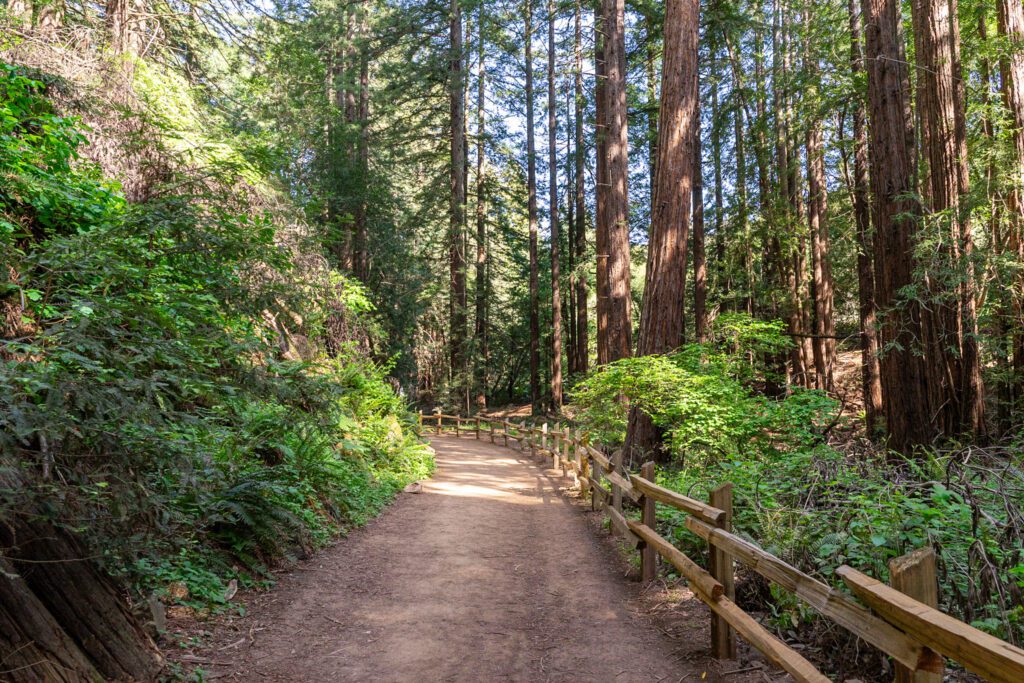
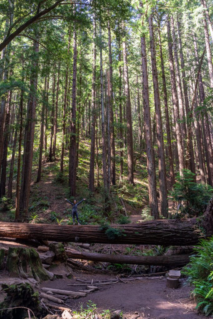
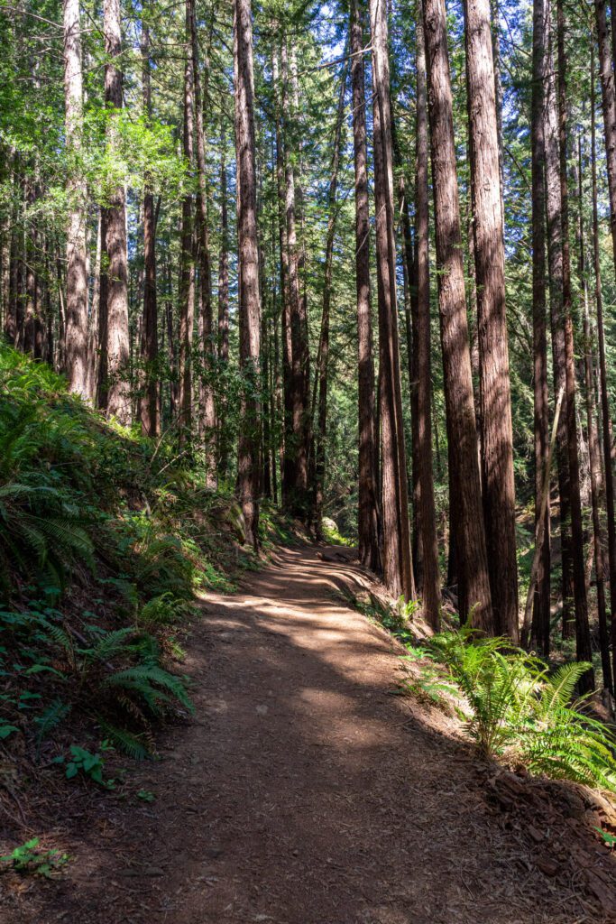
Stream Trail to French Trail (Redwood Regional Park)
- Length: 4.5 miles
- Elevation Gain: 1,000 feet
- Trail Type: Loop
- Difficulty: Moderate
- Pass Required? None
- Dog-Friendly? Yes, on a leash
- Trailhead Location: Canyon Meadows Staging Area
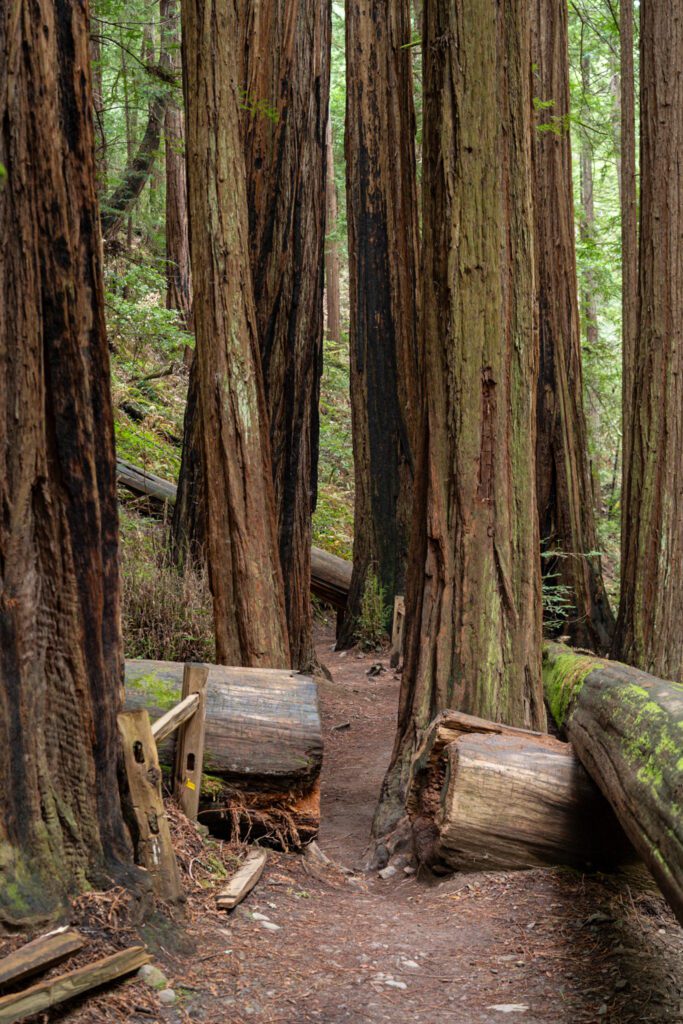
We had hiked in Redwood Regional Park before, but I honestly never knew that there was a real life redwood grove over in the hills above Oakland until our last trip out there.
We hiked from the Skyline Boulevard parking lot on our previous trips, and this time we made our way to the east end of the park at the Canyon Meadow Staging Area to start our hike, which is where we’d recommend you head.
From here, you can do a lovely loop through the redwoods by taking the Stream Trail to the northwest from the parking lot, following it to the Tres Sendas Trail, which is on the left at about two miles into the hike.
The trail meets up with the French Trail, which makes its way back the way you came with rolling hills through the redwoods. Finally, cut back to the Stream Trail via the Chown Trail to return to the Canyon Meadows Staging Area (and your car).
The hike is a little harder than we expected, particularly once you get onto the French Trail which follows a ridge through the middle of the park and goes up, then down, then up, then down again for a couple of miles.
Still, it’s the best part of the hike, and it’s firmly in the moderate category.
While the redwoods here aren’t as impressive as the ones on the Northern California Coast, it’s worth the short trip out there to see them.
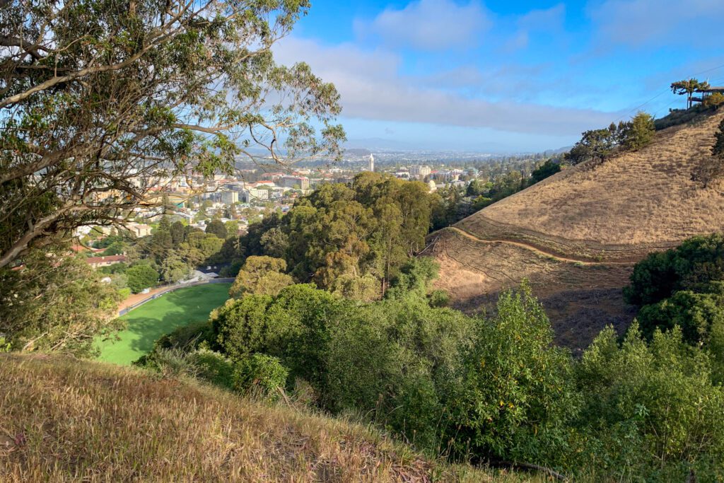
Panoramic Hill, Chaparral Peak and Strawberry Canyon Loop (Berkeley Hills)
- Length: 6.5 miles
- Elevation Gain: 1,500 feet
- Trail Type: Loop
- Difficulty: Moderate
- Pass Required? None
- Dog-Friendly? Yes, on a leash
- Trailhead Location: Trailhead 1, Stonewall Panoramic Trail
Before we get to the hike itself, let’s talk about parking.
Nearly all of the parking that we could find for this hike was two hour parking, Monday to Friday 8am to 6pm if you don’t have a neighborhood permit.
Which was an issue, since it was about 7:40am on a Tuesday. That means that you can park here without worrying about getting a ticket at three times:
- Monday to Friday as long as you leave before 10am.
- Monday to Friday if you start after 4pm.
- Saturday and Sunday anytime.
Now, this hike gets crazy busy on weekends, so while you can technically park near the trailhead without worrying about timing, you SHOULD worry about timing in terms of crowds and actually getting a parking spot.
Start this trail before 8am on weekends to give yourself the best chance to park.
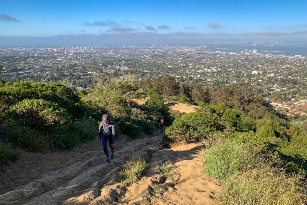
This is a great hike in the Berkeley Hills that takes you up a steep ascent to Panoramic Hill, where you’ll be able to see both San Francisco and Oakland, among other things.
From there, you’ll continue the ascent, following a ridge to the high point on the trail, Chaparral Peak.
Then you’ll loop back around the back side of the loop on the border of Tilden Regional Park before meeting up with the Strawberry Canyon Trail and wandering through some neighborhoods to get back to your car.
All-in, it’s just over 6 miles, which means it’s going to take you around three hours, give or take half an hour based on your hiking experience and fitness level.
If you’re trying to get a morning hike in before work (or you’re worried about parking hours), you can cut this loop short in a couple of different ways.
We think that the best part of this hike is the first mile or two, so if you’re short on time, focus on that.
You could do the short but steep climb to Panoramic Hill, which is about 1.5 miles round trip with 650 feet of elevation gain.

Or, if you want to go a little further, climb up past Panoramic Hill (the climb just after the viewpoint gets crazy steep) and continue along the ridge to a point at 1.8 miles in, where you can take the cut off to your left and meet up with the latter part of the loop to take you back to the trailhead.
This is, roughly, four miles with just under 1,000 feet of elevation gain.
There are portions of this trail that are SUPER steep and rocky. It was harder than we expected in places, but nothing so hard that most hikers won’t be able to do it.
Bring plenty of water though, as the first part of the loop is fairly exposed (the last part of the trail on the descent is nicely shaded).
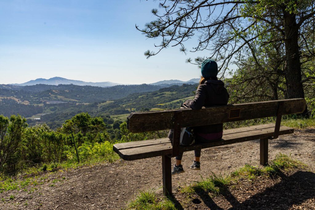
Hikes in Marin County (the Headlands, Mount Tamalpais, and Point Reyes)
Marin County, which is north of the city, is our favorite place to go hiking in the Bay Area. It’s also where Alysha grew up, and the local knowledge certainly helps.
Here are our favorite hikes in Marin.
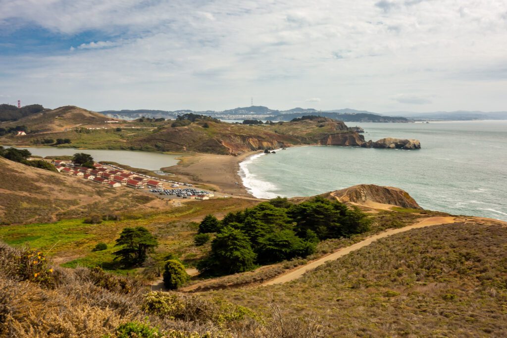
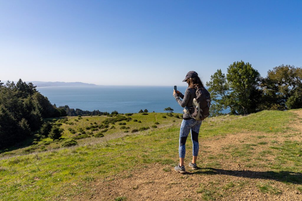
Tennessee Valley Trail + Coastal Trail (Golden Gate National Recreation Area)
- Length: 3.5 miles (5.5 miles with loop in headlands)
- Elevation Gain: 150 feet (1,200 feet with loop in headlands)
- Trail Type: Out and Back
- Difficulty: Easy
- Pass Required? None
- Dog-Friendly? No
- Trailhead Location: Tennessee Valley Trailhead
This is one of the best bang-for-your-buck trails in all of California if you want coastal views. If you do it as an out and back hike to the beach, it’s only 3.5 miles and fairly flat.
However, we think you should head north from the beach up onto the bluffs, where you’ll not only have a great view of the beach and rugged coastline, but you’ll be able to see San Francisco, the Golden Gate Bridge, and Sutro Tower.
Head out to the viewpoint above Muir Beach before circling back and heading back to the trailhead.
Start from the Tennessee Valley Trailhead, which is a busy trailhead that fills up early on weekends (like basically every other trailhead on this list).
From there, do the 1.7 mile hike out to the beach, and head up to the viewpoint at the north end of the beach (referred to on Alltrails as the “WW2 lookout”).
Then, double back to the junction for the Coastal Trail, which takes you up to the bluffs above the beach to the north.
Don’t miss the short detour down to Pirate’s Cove along the way, which is a nice little semi-protected cove where you’ll be able to dip your feet in the ocean.
Continue until you get to the turnoff for the Coastal Fire Road, which will head up and to the right back towards the parking lot.
Take a second here to poke around and find a good view of Muir Beach below you, which is one of our favorite spots in Northern California.
Follow the fire road until it meets the Fox Trail, which is the trail that will take you back to your car. Along the way, look out for views of the city as you traverse the rolling hills.
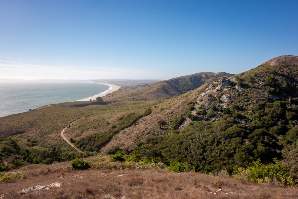
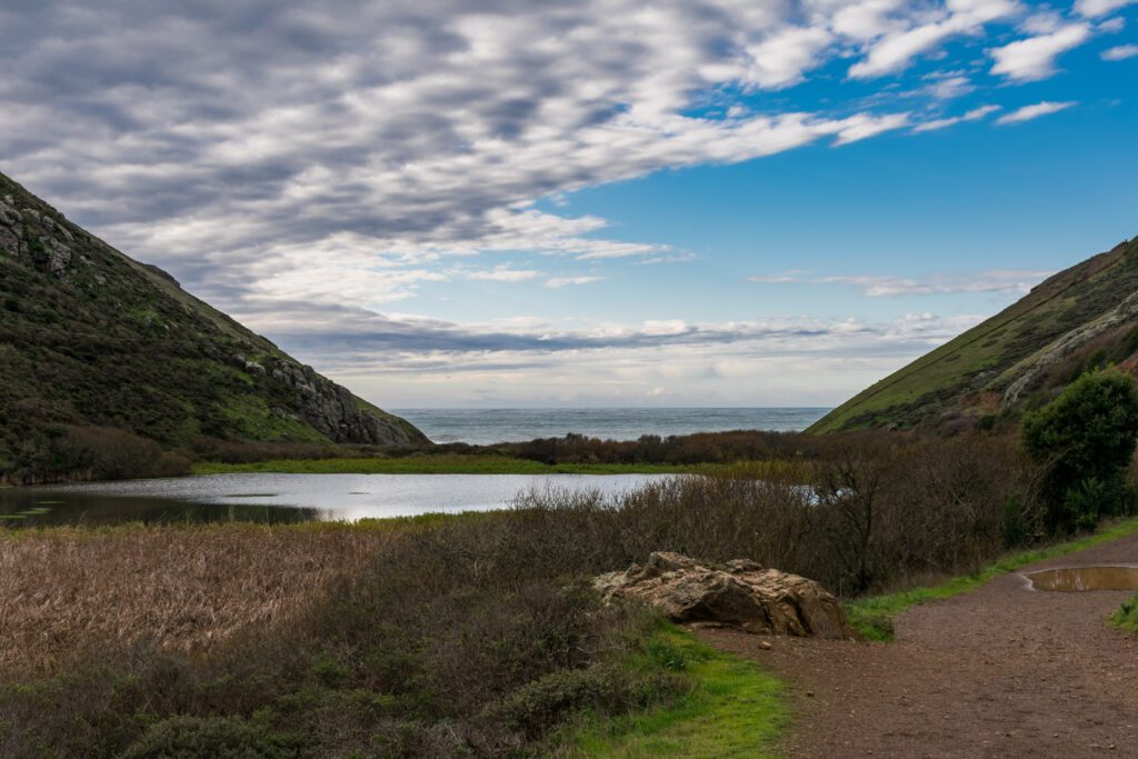
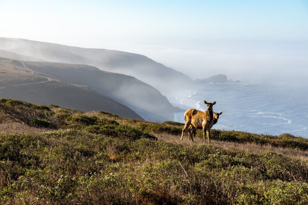
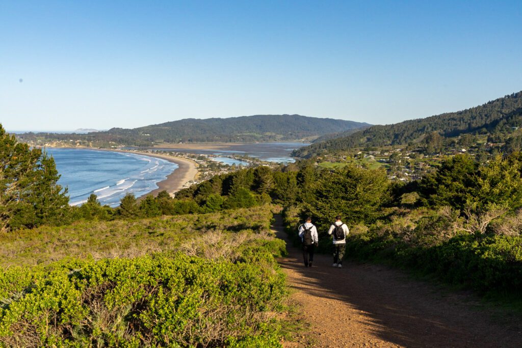
Tomales Point (Point Reyes National Seashore)
- Length: 9 miles
- Elevation Gain: 1,200 feet
- Trail Type: Out and Back
- Difficulty: Moderate
- Pass Required? None
- Dog-Friendly? No
- Trailhead Location: Tomales Point Trailhead
This is a fun trail not only for the spectacular views of the beautiful coastline around Point Reyes, but also for the wildlife.
There are TONS of elk along this trail. There were a couple of points along the trail where they were literally on the path and we had to wait for them to clear out (remember – they’re wild animals, so give them plenty of space).
There was even a mama elk and her baby that we sat and watched for a bit.
There are also plenty of spots to view whales during their migration seasons in the spring and fall!
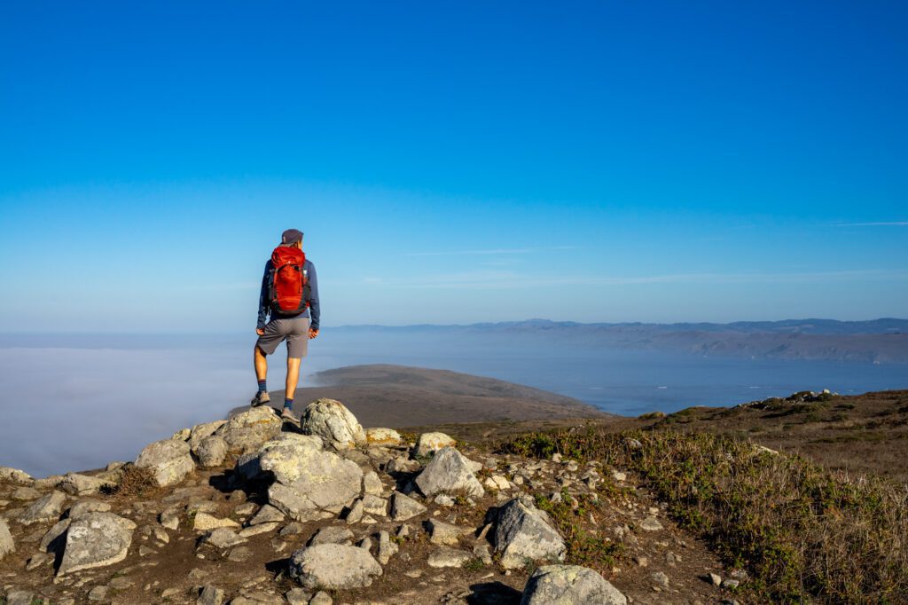
The trail itself is great – you’ll meander out onto the spit, with rolling hills and coastal views all the way through. At the end, for about the last mile, the trail turns to sand and becomes a little bit of a pain, but it’s all worth it for those views!
One thing about the views though. This part of California gets lots of fog. At all times. It’s nearly impossible to predict when it’ll be foggy, and when it’ll be sunny.
Make sure to pack plenty of layers and a windbreaker for this hike. You might not need them, but chances are you will.
The parking lot is small, and there’s not a whole lot of alternate places to park near the trailhead. Get there by about 8:30am on the weekends to make sure you get one of them.
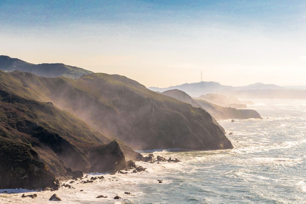
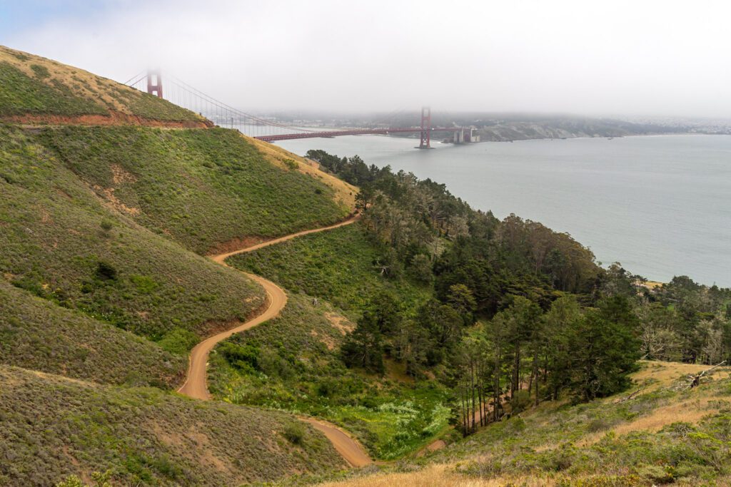
Coastal and Miwok Trail (Marin Headlands)
- Length: 5.5 miles
- Elevation Gain: 1,000 feet
- Trail Type: Loop
- Difficulty: Moderate
- Pass Required? None
- Dog-Friendly? Yes, on a leash
- Trailhead Location: Rodeo Beach Coastal Trailhead
We’ve done this hike numerous times, and it never disappoints. You’ll start at Rodeo Beach, which has tons of parking, though it still manages to get full on sunny weekend days.
The directions are fairly straightforward. Start out along the Coastal Trail, which takes you up onto the bluffs above Rodeo Beach and gives you some pretty great views of the city and coastline.
Follow the Coastal Trail until it meets the Wolf Ridge Trail, which you’ll be on for a hot second before you turn right and take the Miwok Trail, which is a fire road that will send you back down to the trailhead. More trail information, including maps, here.
There are some cool batteries up on the bluffs, which were in operation until more recently than you probably think, and the trail is always in great condition.
The best part of this hike is going to be the Coastal Trail, with its sweeping ocean views, cool batteries, and other former military installations.
The Miwok Trail, which is a wide fire road that’s also open to mountain bikers, is simply a means to an end – that end being getting back to the car.
You can do the loop in either direction – both ways are about the same in terms of difficulty and grade. We have always done it clockwise, but there’s no specific reason behind that decision.
You can extend this hike by adding on the short jaunt out to Point Bonita Lighthouse, which makes it 8.5 miles, but doesn’t add too much elevation.
To get to the lighthouse, which looks out over the Golden Gate and the San Francisco Bay, you cross a cool bridge, which is worth doing and seeing for yourself.
Keep in mind that the lighthouse itself is only open for short periods on the weekends, but you can still go out there and poke around.
You can also start this hike from the Marin Headlands Visitor Center, which has a small parking lot that fills up a little later than the main one, or the Miwok Trailhead, which has space for maybe 8-10 cars or so.
Kirby Cove (Marin Headlands)
- Length: 3 miles
- Elevation Gain: 550 feet
- Trail Type: Out and Back
- Difficulty: Easy
- Pass Required? None
- Dog-Friendly? No
- Trailhead Location: Golden Gate Bridge Viewpoint
If you’re looking to escape the crowds flocking to Battery Spencer to a beach with a great view of the Golden Gate, Kirby Cove is your best bet.
Park at Battery Spencer, but instead of following the crowds out to the viewpoint, take the trail that leaves from the southwest end of the parking lot.
There are so many good views along the first part of this trail it’s incredible.
It’s worth making a (very slight) detour to Battery Wagner, which has a fantastic view of the bridge. It’s about a quarter of a mile into the trail.
Continue the descent down to sea level (you lose 400 feet of elevation over just about a mile) and you’ll find yourself at Kirby Cove, where there’s a bathroom, a picnic area, and a TINY campground.
From the bottom, you’ll have a nice view of the bridge from the east side, which means this is a perfect sunset location.
Bring a picnic (and a bottle of wine), a picnic blanket, and enjoy as the sunset lights up the Golden Gate Bridge in a brilliant shade of red.
That sounds great, doesn’t it? The only problem is that about half the time (maybe more?) the story is actually going to be more like “put on your windbreaker and try not to blow away as you wait for the fog to clear on the bridge, which it might never do.”
Try to do this on a clear day if you can, but those are sometimes hard to come by.
If you want to camp here overnight, you’ll need to get very, very lucky. We haven’t gotten a site yet, but you can try here.
Mountain Home Inn to East Peak (Mount Tamalpais State Park)

- Length: 4 miles
- Elevation Gain: 1,500 feet
- Trail Type: Out and Back
- Difficulty: Moderate
- Pass Required? None
- Dog-Friendly? Yes, on a leash
- Trailhead Location: Mountain Home Inn
We have done this hike multiple times, and it’s a great hike. Plus, this particular route uses fire roads, which means it’s dog friendly!
There are multiple ways to hike to the East Peak. This is probably the shortest and most direct, and it’s one of a few good dog-friendly Bay Area hikes, so it makes the list.
You can also do this hike from Pantoll Campground – bring $8 cash for parking and don’t forget to put the tag on your dashboard! – which is just under 9 miles, with 1,600 feet of elevation gain.
It’s a harder hike, but it’s still doable. It’s arguably more scenic, too, passing by the Cushing Memorial Amphitheater and the West Point Inn en route to the East Peak. But it’s not dog-friendly, and we wanted AT LEAST one dog-friendly hike on the list.
To start, park at the parking lot across from the Mountain Home Inn. It’s along the Panoramic Highway, which is a gorgeous scenic drive, and it’s a relatively small lot, so try to get there as early as you can (pre-9am).
The hike starts by taking Hogback Road – a fire road – up to Railroad Grade fire road. From here, you connect to the Fern Creek trail, which takes you all the way to the parking lot for the East Peak.
Oh, right. There’s a parking lot here, which means people can drive right up to the peak. But doesn’t it feel better knowing you earned it?
Head back down the way you came.
Before the hike, stop at Equator Coffees in Mill Valley, which is one of our favorites.
Afterwards, head to Flour Craft Bakery – also in Mill Valley – and get some well-deserved treats and enjoy the sun on their great outdoor patio.
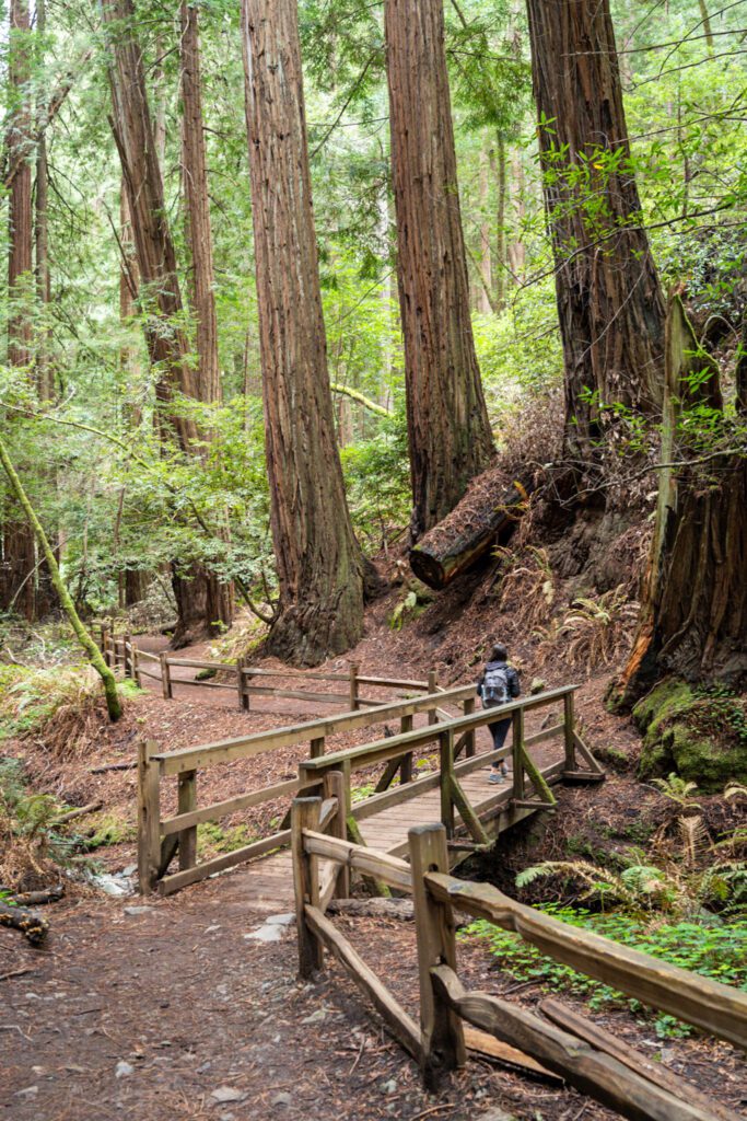
Matt Davis / Steep Ravine Loop (Mount Tamalpais State Park)
- Length: 7.5 miles
- Elevation Gain: 1,700 feet
- Trail Type: Loop
- Difficulty: Moderate
- Pass Required? None
- Dog-Friendly? No
- Trailhead Location: This small parking lot
This is one of the best hikes in Northern California if you’re looking for amazing coastal views and redwoods. We’ve done it a couple of times, and it never disappoints.
It’s a popular hike, so plan on being there early and there being a fair number of people out on the trail, especially on a weekend morning.
You can either start at the top or bottom of the trail. The top is at Pantoll Campground – parking here means you’ll need to pay $8 cash, and you’ll start with a descent and finish with an uphill climb.
The bottom is near Stinson Beach, where parking is free and the ascent to Pantoll Campground comes first, and you end with the downhill part.
We recommend parking in the small parking lot here – which means you need to be there SUPER early.
This means you’ll do the hike counter-clockwise from the bottom, starting with the ascent up the Dipsea Trail, and ending with the descent on the tight switchbacks of the Matt Davis Trail.
Start from the parking lot and head across the road to the path on the other side of the road, which is the Dipsea Trail.
Follow this for about a mile, making sure to turn around and admire the great coastal views over Stinson Beach behind you, before you come to a junction with a bridge crossing a small creek.
DO NOT TAKE THE BRIDGE. Veer left to stay on the Dipsea Trail, which takes you up a beautiful, forested gulch.
This section of the hike has it all – redwoods, a babbling brook, and a nice climb that will have you working hard for the scenery.
Eventually, you’ll arrive at Pantoll, which makes a great spot to stop and rest for a second before you hit the downhill section.
When you’re ready, head to the north end of the parking lot at Pantoll and find the Matt Davis Trail.
This part of the hike starts with a slight descent through the trees before emerging onto beautiful green bluffs overlooking the ocean. In the spring, this is an amazing place to see wildflowers!
This brief section of the trail will have your jaw dropping with its sweeping coastal views.
For the final part of the trail, you’ll descend a set of steep, tight switchbacks, which will have you thanking us for telling you to go counter-clockwise and avoid this climb.
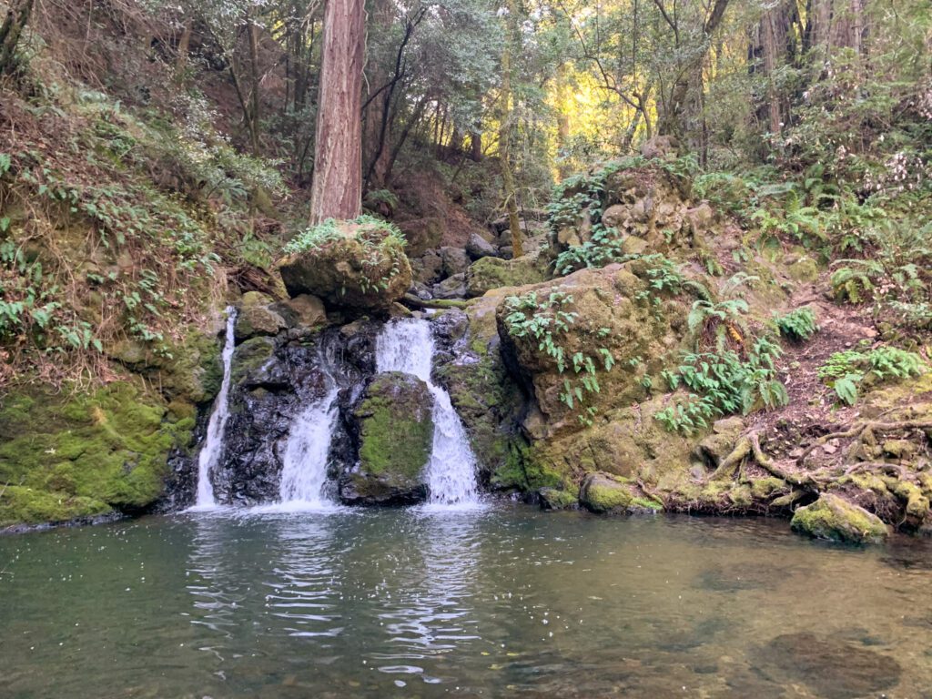
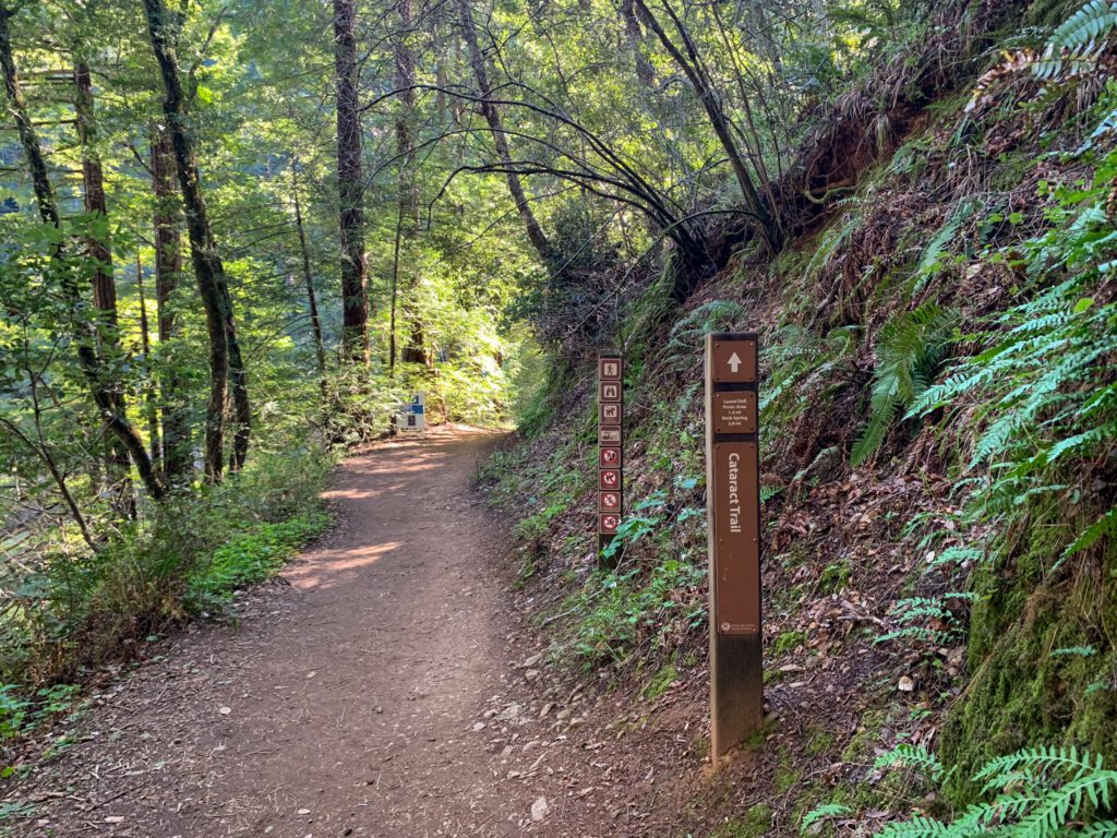
Cataract Falls (Mount Tamalpais State Park)
- Length: 5.5 miles
- Elevation Gain: 1,300 feet
- Trail Type: Out and Back
- Difficulty: Moderate
- Pass Required? None
- Dog-Friendly? No
- Trailhead Location: Rock Spring Trailhead
There are two ways to do this hike, which is basically an eight mile through hike with two access points, which means you’ll be hiking in and out from one of the access points (they’re too far apart to justify leaving a car at each trailhead and doing the full through hike).
Here are the ways to do it.
- If you’re coming from San Francisco, it makes the most sense to do it from the Rock Spring Trailhead.
- If you’re coming from Marin, it makes the most sense to start from the trailhead along Bolinas Fairfax Road. Parking is very limited and slightly sketchy along a curve in the road, so get there early.
- If you’re coming from the east (Oakland / Berkeley), the two are roughly equidistant, so check Google Maps.
The hike from the Rock Spring Trailhead is a longer one, because you have to hike for a bit to even get to the falls.
It meanders through the woods with a slight descent, following gurgling Cataract Creek. The interesting part of this hike starts about a mile in, where you’ll start to see waterfalls as you descend.
You probably don’t need to go all the way down to the lake, but we think you should make the descent down the switchbacks and stairs to see different parts of the falls.
That means you’ll need to be prepared to climb back up.
If you do it from the bottom, it’s significantly shorter, but harder. You’ll start with a climb up those aforementioned switchbacks and stairs, which is not easy.
You’ll pass a few different parts of the trail where you can stop and admire the falls before reaching the main attraction.
Continue along the creek until you reach the picnic area, which is about a mile and a half in, which makes a good rest stop and turnaround point.
Honestly though, you probably only need to do a mile of the trail to see the best parts of it, which makes this a pretty short hike with a nice climb at the beginning.
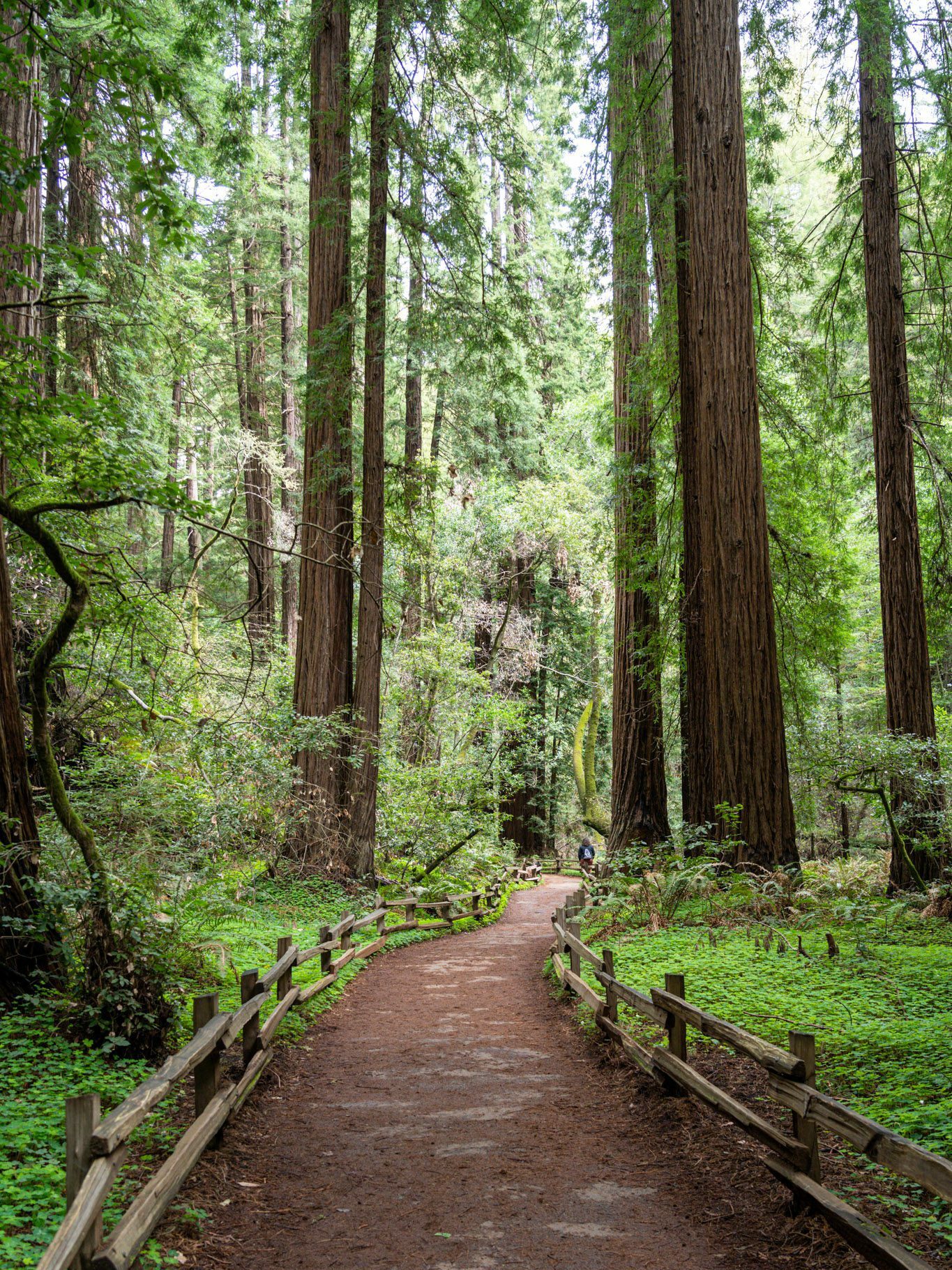
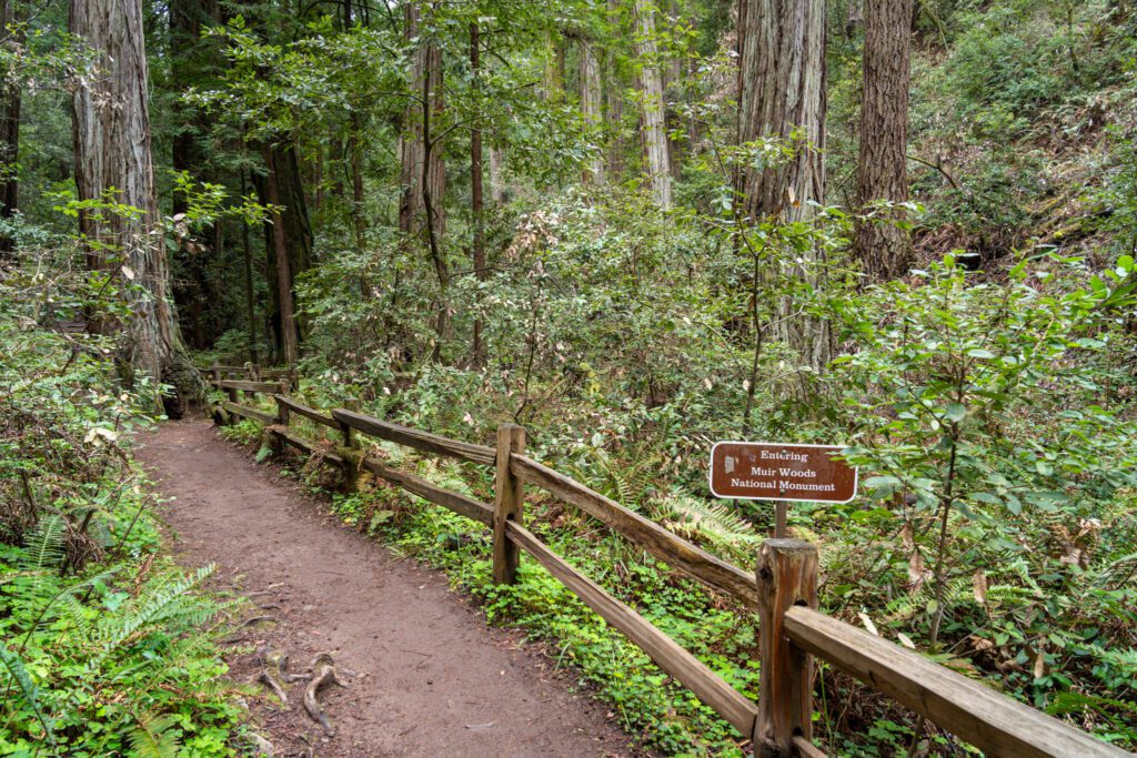
Fern Creek, Lost, and Canopy Trail (Muir Woods)
- Length: 3.5 miles
- Elevation Gain: 800 feet
- Trail Type: Loop
- Difficulty: Moderate
- Pass Required? America the Beautiful
- Dog-Friendly? No
- Trailhead Location: Muir Woods Visitor Center
This hike is the backdoor to Muir Woods, which you’d need a permit to visit and park in the main parking area.
No permit, which is used for parking and shuttling? No problem. Muir Woods is also accessible by hiking in, but YOU WILL still (technically) have to pay the entrance fee ($15), so this isn’t a way to get out of supporting our local parks.
You’ll need to park at the Mountain Home Inn along the Panoramic Highway, which is a relatively small parking lot and gets full early in the day, especially on weekends.
From there, cross the road to the western side and find the trail that starts you on the path down to Muir Woods. Turn right onto the Canopy Trail, and follow it alllll the way down to Muir Woods.
On the way back, take the Fern Creek Trail, which, as you might have gathered, follows Fern Creek.
Eventually you’ll reach a fork in the road where the Fern Creek Trail ends. Take a right onto the Lost Trail, which will connect you back up to the Canopy Trail and take you back to your car.
You could also do a similar loop starting from the Dipsea Trail and essentially do the same loop from a different starting point.
Other Great Hikes Near San Francisco
Here are some other options in the Bay Area, some of which are a little further than an hour away, which is why they don’t make the list.
Mount Diablo has some good hikes, but it’s at least 1.5 hours (without traffic) away from the city, which is why it’s not on this list. However, if you’re up for the longer drive, the Summit Trail (info here) is great year-round (though it’s going to be HOT in the summer), and the waterfall trail is a good winter / spring hike.
Mori Point in Pacifica is a nice, coastal hike. Go for the wildflowers in April and May, and for sunset on a clear day on the coast (which can be few and far between).
The Redwoods at Big Basin Redwoods State Park near Santa Cruz are another good destination, but they’re closed indefinitely due to some nasty wildfires in 2020. Unclear when they’ll be open to the public again, which is really sad.
Our Favorite Bay Area Hikes, Mapped
As promised, here are the trailheads for the hikes mentioned in this guide organized on a handy map to help you visualize how they all fit together.
Pro-tip: To view a full size version of the map, click on the “expand” icon in the top right.
When to Go Hiking in the Bay Area
The best part about the Bay Area is that these hikes are largely accessible year round. There’s not a whole lot of inclement weather – like snow or rain – and most of these hikes are at or around sea level, which means no lingering snow in the winter and spring.
That being said, there are some nuances that you should know about hiking in Northern California.
You might think that the summer (June – August) is the best hiking weather, but it depends.
- Along the coast, summer means fog, which can ruin those stunning coastal views that you’re hoping for as a payoff for your effort. Summers in San Francisco and up and down the coast are going to be cool, gray, and probably windy, so bring plenty of layers (which is good advice for anyone visiting San Francisco, really).
- Further inland, in places like Mt. Diablo and the surrounding area, summer means BLAZING heat. Temperatures can get into the 90’s and even above 100, so bring plenty of water and try to get an early start to beat the heat.
Fall is generally the best time to visit San Francisco, which holds true for hiking.
The coastal fog melts away, temperatures start to drop to a more bearable level in the East Bay, and the crowds of tourists start to thin.
This is a perfect time to hit the trails and do some exploring, but waterfalls will still be dried up from the summer months, and there’s a strong chance of fires, which seem to happen more and more frequently with each passing year.
Winter is actually a nice time to go hiking if you can find one of those beautiful sunny days. It does rain in the winter, but not as often as, say, Seattle or Portland, and there are plenty of sunny days in between.
It will get cold, so pack plenty of warm layers. The sun rises later and sets earlier, which can make it easier to catch sunrise without having to get up at an ungodly hour.
Spring is gorgeous, especially the short period where the rolling hills in the East Bay and Marin are a stunning shade of bright green (which lasts for a month or two before they turn brown – usually sometime in May).
Waterfalls will be roaring, so it’s a good time to tackle some of the best waterfall hikes near San Francisco like Cataract Falls or Alamere Falls.
Weather is a little more variable – you’ll get some rainy days and some cooler days – but you’ll also have those weeks that make you wonder if it’s already summer, where the sun is out and the temperatures are in the 70’s.