How to Plan the Perfect Death Valley Itinerary (3 Days)
The largest national park in the continental US, Death Valley is a land of extremes. It’s at once the hottest, driest, and lowest point in the country. It’s also home to a diverse ecosystem with an incredible assortment of landscapes—from dry basins and massive salt flats to rolling sand dunes, winding canyons, and snow capped mountain peaks, and even volcanic craters and waterfalls. Plus incredibly dark night skies.
Spread across 3.4 million acres, there’s plenty to see and explore in the park.
This 3-day Death Valley itinerary is based on my prior trips, so you can make the most of your limited time.
It covers all the key highlights to the park, including Zabriskie Point, the salt flats of Badwater Basin, and the Mesquite Flat Sand Dunes, in a way that makes logistical sense. It also provides helpful information to help make your trip to this unique place a success.
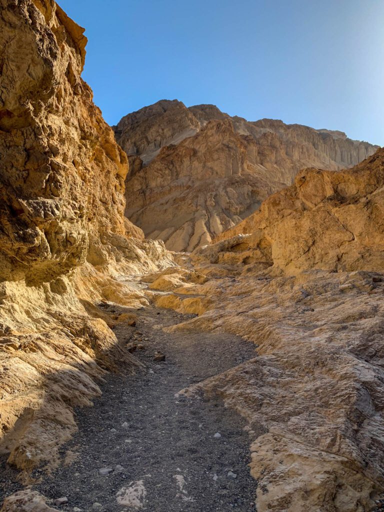
Planning a trip to Death Valley AND love hiking? We’ve got an entire guide to hiking in Death Valley that you’re definitely going to want to read.
Interested in exploring the national parks on the West Coast? Don’t miss our complete guide to all 13 West Coast National Parks where you’ll find an overview of things to do, places to stay, and links to our more detailed guides on each park.
Disclaimer: Some of the links in this post, like hotel and vacation rental links, are affiliate links, meaning at no additional cost to you we make a little bit of money if you click through and book. That being said, we would absolutely never recommend something to you that we don’t stand behind 100%.
Where is Death Valley National Park?
Death Valley is located in southeastern California and straddles the border of Nevada. It’s about 270 miles from Los Angeles and 130 miles from Las Vegas.
How to Get to Death Valley National Park
Getting to Death Valley is fairly easy from southern California and Las Vegas. Vegas is the slightly better place to fly into if you’re coming from out of town, but only by an hour or so.
From Las Vegas
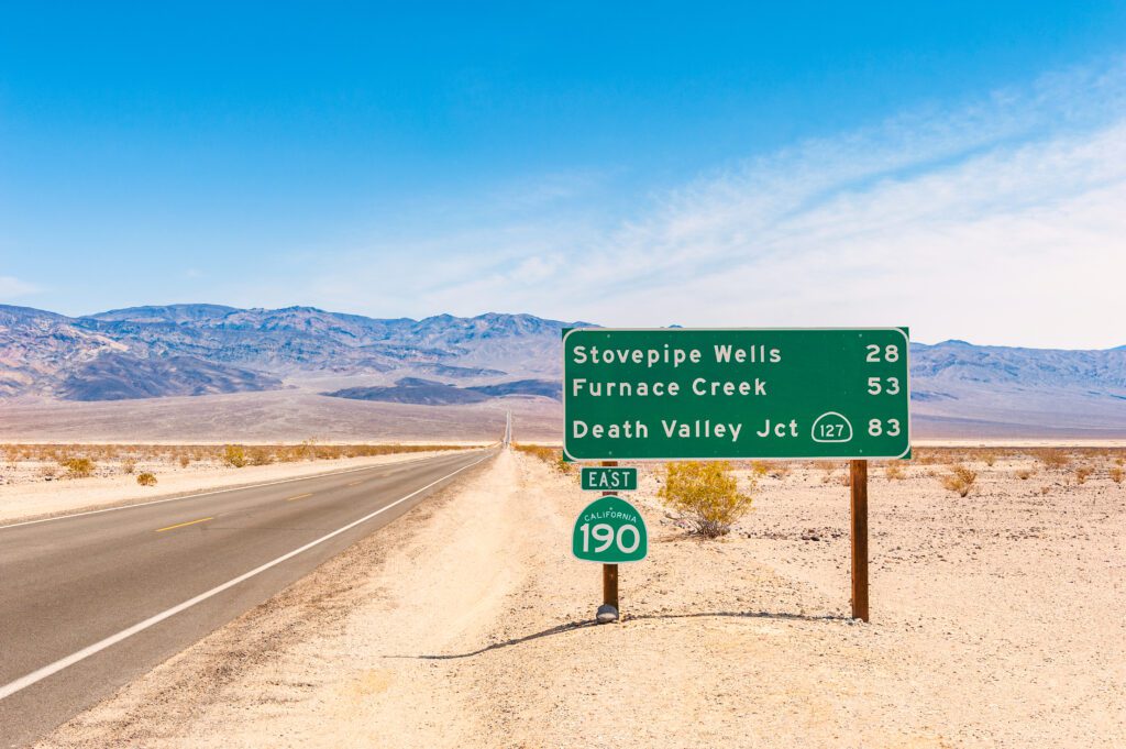
Take US-95 north for 88 miles to Lathrop Wells, and head south on NV-373 for 24 miles. NV-373 becomes CA-127. You’ll soon come to Death Valley Junction. Take CA-190 west into the park. After 30 miles, you’ll reach the Furnace Creek Visitor Center.
From Los Angeles
Take I-5 north to CA-14 north for 120 miles. At Indian Wells, take US-395 north for 42 miles. At Olancha, take CA-190 east. You’ll reach Panamint Springs in 45 miles. Stovepipe Wells is 29 miles east of Panamint Springs, and Furnace Creek is 53 miles east of Panamint Springs.
From Elsewhere
The closest airport to Death Valley is Las Vegas McCarran International Airport, 130 miles away. The second closest airport is Burbank’s Bob Hope Airport, 200 miles away. Wherever you fly into, you will still need to rent a car and drive the rest of the way to the park.
Getting Around Death Valley
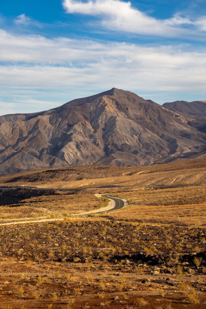
The only way to get around this massive park is by car, and it can take three hours to get from one side to the other. There are no shuttles or public transportation available. It’s best to bring a 4WD vehicle with high clearance (and experience driving it), as many interesting parts of the park, including the Racetrack, Cottonwood Canyon, and Saline Valley, are only accessible to 4WD vehicles. Don’t let the lack of a 4WD prevent you from visiting the park at all.
You can always rent one through Farabee Jeep Rentals in Furnace Creek, or enjoy the other more accessible sights.
Where to Stay in Death Valley National Park
Within the park, there are plenty of options in terms of camping, but your options become much more limited if you’re not up for camping. Or if you’re visiting in the summer, when temperatures can be above 130 degrees F, and campgrounds are closed.
Because Death Valley is a remote location, there really aren’t too many good options outside the park, so you’ll have to splurge on the in-park accommodations if you want to stay in a hotel in Death Valley.
Camping in Death Valley National Park
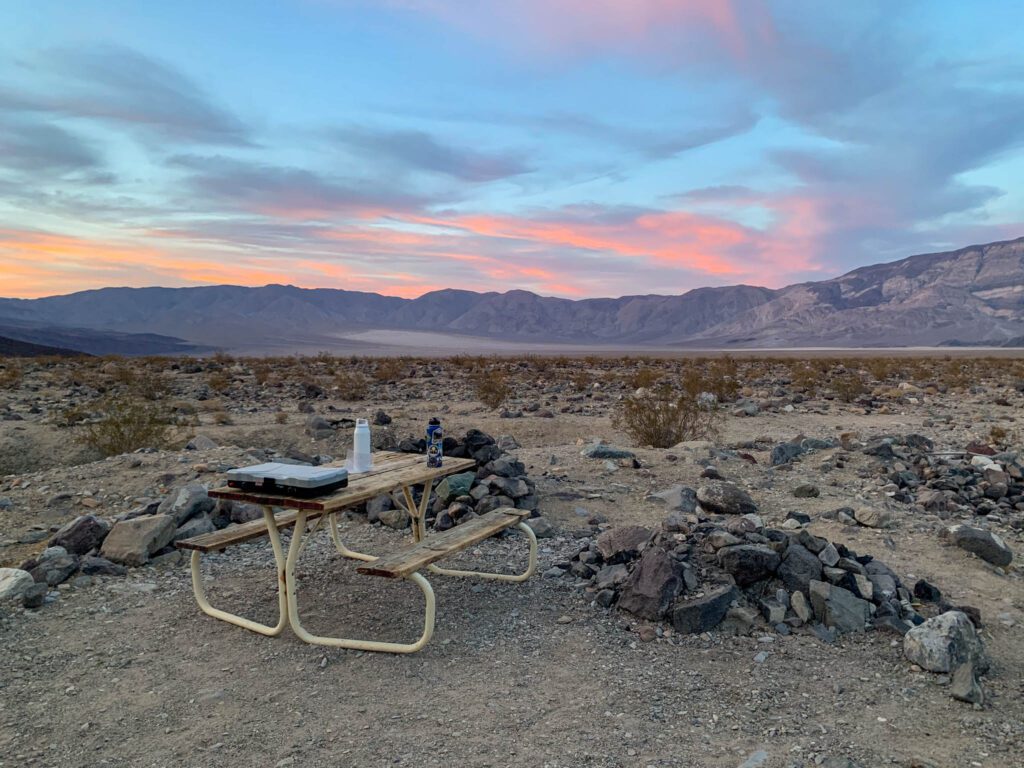
There are nine established campgrounds in the park, with four on the valley floor and five at higher elevations.
On the valley floor, only Furnace Creek is open year-round, with the remainder closed from mid April or May to mid-September or October.
The two highest elevation camps are closed for the winter, while the rest are open year-round. And with the exception of Furnace Creek (which takes reservations between mid-October and mid-April), all campgrounds are first-come, first-served. Reservations for Furnace Creek must be made at least two days and up to six months in advance.
Furnace Creek – Located right by the Furnace Creek Visitor Center, this is the most popular campground in the park. There are 136 campsites, offering picnic tables, fire rings or grills, drinking water, and flush toilets. This is the only campground with RV hookup sites (18 sites). The rest are drive-in or walk-in tent-only sites. Reservations are available from October 15 to April 15 and go quick.
Stovepipe Wells – Located around 30 minutes from Furnace Creek, this first-come, first-served campground offers 190 sites, including 28 tent-only sites, drinking water, picnic tables and fire rings, and flush toilets. The campground is open from late fall to spring and offers views of the Mesquite Flat Sand Dunes. For a fee, you can access the swimming pool and showers at Stovepipe Wells Village Resort next door.
Texas Springs – Located in the hills above Furnace Creek, Texas Springs is open from late fall to spring. This first-come, first-served campground offers great views, along with 92 sites, drinking water, picnic tables, fire pits, and flush toilets.
Mesquite Spring – This year-round campground at 1,800 feet is ideal for exploring the northern end of the park. There are 30 sites available, and includes drinking water, picnic tables, fire pits, and flush toilets.
Hotels in the Park
Like I mentioned above, your hotel options near the park are few and far between.
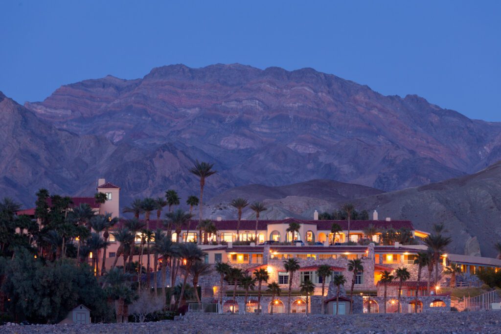
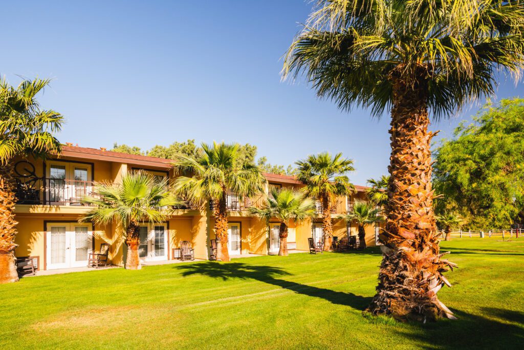
The Oasis at Death Valley – Located just minutes from Furnace Creek, the Oasis is a fitting name for this historic site, which consists of both the luxurious but pricey Inn at Death Valley (with 66 well-appointed rooms and 22 one- and two-bedroom casitas) and the family-oriented and more affordable Ranch at Death Valley (with 244 basic but clean and comfortable rooms). Amenities include several restaurants, cafes, and bars, outdoor pool, wellness center with spa, sauna, and fitness center, 18-hole golf course, tennis courts, Borax Museum, and gas station.
Stovepipe Wells Hotel – The Stovepipe Wells Hotel’s location makes for easy access to the Mesquite Flat Sand Dunes and Mosaic Canyon. The hotel offers 83 rustic rooms. There’s also an RV park with 14 full-hookup sites. Amenities include an outdoor pool, restaurant, saloon, general store, and gas station.
Panamint Springs Hotel – Located in Panamint Valley, around an hour from Furnace Creek, Panamint Springs is a rustic, western-style resort with 23 motel rooms, cottage, and a campground with 55 tent and RV sites and tent cabins. Amenities include restaurant and bar, general store, and gas station.
Outside the Park – Beatty, Nevada
A word of warning. Death Valley is huge, and depending on where you plan to visit, you could easily add over an hour to your drive by staying outside the park. Overall, the best place to stay outside the park is probably Beatty, Nevada.
Beatty is located about 40 minutes from Furnace Creek. You can find several budget-friendly options for lodging here, including the retro and quirky Atomic Inn (with basic but comfortable pet-friendly rooms that come with A/C, minifridge, and microwave), the pet-friendly Death Valley Inn & RV Park (with pool, hot tub, bbq facilities, and rooms with A/C, fridge, and microwave), and the family-run El Portal Motel (with seasonal outdoor pool and rooms with A/C, minifridge, and microwave).
Beatty also offers several restaurants, bars, and gas stations. Smokin’ J’s Barbecue serves up some seriously good barbecue.
Tips for Planning a Trip to Death Valley National Park
- The heat in Death Valley is no joke, with one of the highest recorded temperatures on the planet (134 degrees in 1913). Recently, temperatures have hit the high 120s numerous times. Even if you’re visiting outside of summer, you need to be prepared for the heat, as it can still get hot in the spring and fall. Make sure you have sun protection (sunscreen, hat, loose long-sleeves).
- It’s incredibly dry in Death Valley, which means you’ll want to drink even more water than usual. You can fill up water at Furnace Creek Visitor Center, Stovepipe Wells Village, Panamint Springs, and most campgrounds. Furnace Creek will be your best bet as the water there is actually cold.
- The Oasis at Death Valley offers several food and drink options, including the Last Kind Word Saloon, the Inn Dining Room, and 1849 Restaurant, and a few cafes. Both Stovepipe Wells and Panamint Springs have a restaurant and bar. All three locations also offer a general store where you can pick up snack items. As expected, everything is rather overpriced for what you get. It’s best to pack a cooler and bring food and drinks with you from outside of Death Valley.
- Many trailheads require a 4WD, or at least a high clearance vehicle, to get there. In some cases regular cars can make it, but it’s not guaranteed and a big risk to take in remote places with no cell coverage. Off-road tires are a good idea if you have them. At the very least, bring a spare tire (or two). The 4×4 roads are not maintained and flats are common. You can rent a 4WD through Farabee’s in Furnace Creek year-round, weather permitting.
- Fill up on gas outside of the park. There is gas at Furnace Creek (24 hours, unleaded and diesel), Stovepipe Wells (24 hours, unleaded only), and Panamint Springs (7:00 am-9:30 pm, unleaded only), but you will be paying $1-2 more per gallon than outside the park. It’s a good idea to carry some extra gas when exploring.
- Cell coverage is very spotty in the park (best around Furnace Creek and Stovepipe Wells). It’s best to have paper maps or have online maps downloaded on your phone.
The Complete 3 Day Death Valley Itinerary: A Detailed Guide
This itinerary assumes that you have three full days to explore the park. For the first two days, a regular car is fine, but you will want to have a high-clearance 4WD for the final day.
Day 1: Zabriskie Point, Dante’s View, Artist’s Drive, and Badwater Basin
You’ll have a long day from sunrise to sunset, but you will also get to see some of the most iconic sights in the park on your first day.
Zabriskie Point
5 miles / 8 minutes from Furnace Creek Visitor Center
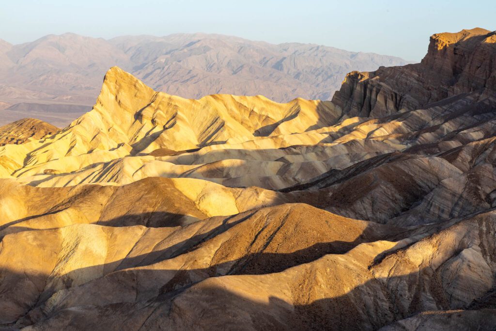
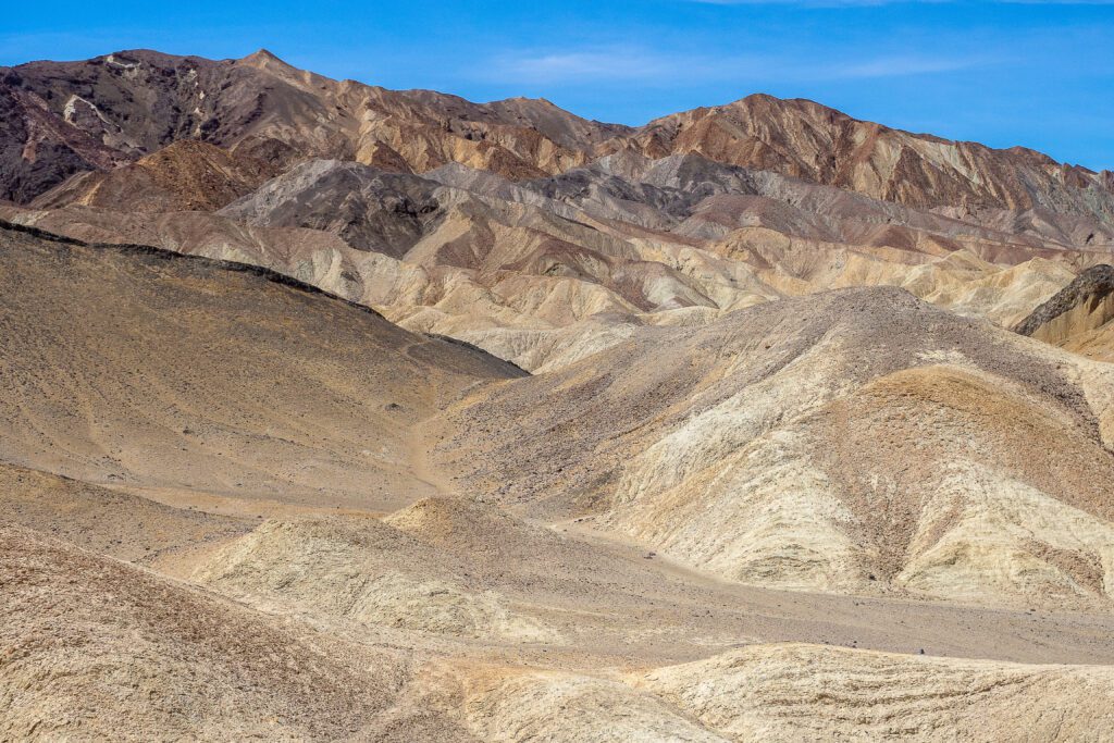
One of the most popular and iconic viewpoints in all of Death Valley, Zabriskie Point is a must-see. Best at sunrise (or sunset), it’s worth the super early start to get here in time to see the sun rise over the surreal landscape of the Furnace Creek Badlands to the north, with the Panamint Mountains in the distance, and the Twenty Mule Team Canyon to the south.
From the parking lot, it’s a short climb on a paved path to the viewpoint, which was named after Christian Zabriskie, the general manager of the Pacific Coast Borax Company. The prominent sharp peak you see in front of you is Manly Beacon, named after William Manly, a prospector on the 1949 expedition credited with naming the park Death Valley.

From here, you can either head back to your car and continue on to the next stop (Twenty Mule Team Canyon), or take a few hours and hike around the dramatic landscape below (the Badlands Loop, Red Cathedral, Golden Canyon/Gower Gulch are all great options. Get more details on our guide to the 10 Best Hikes in Death Valley).
Twenty Mule Team Canyon
1.3 miles / 3 minutes from Zabriskie Point
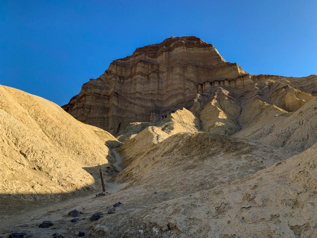
From Zabriskie Point, drive south just over a mile on CA-190 to Twenty Mule Team Canyon. The 2.7-mile one-way loop is unpaved, but suitable for most cars. With soft golden rock walls rising and falling on either side of the road, you’ll feel as if you’re on an amusement park ride of sorts. You can pull over at a few spots to hike up to a vista point to get a better view of the surrounding landscape. Look for the remnants of prospector tunnels and a large wooden house built in 1883 to serve miners.
The canyon was named after the twenty-mule teams that were used to transport 10-ton loads of borax from 1883 to 1889, although they didn’t go through this particular canyon. Star Wars fans may recognize the location as the road to Jabba’s palace.
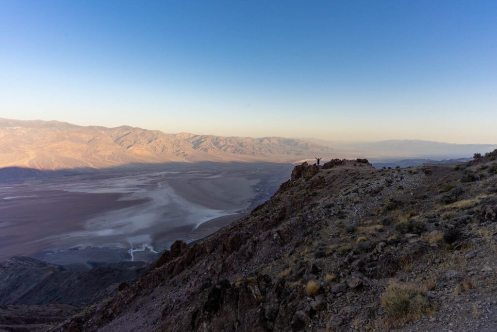
Dante’s View
20 miles / 45 minutes from Twenty Mule Team Canyon
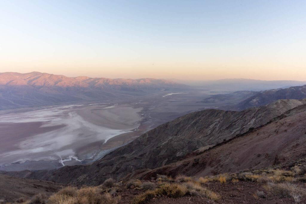
Continue south on CA-190 until you reach Dante’s View Road and turn right, driving 13 miles to the end. At 5,476 feet, it’s nowhere near the highest spot in Death Valley, but it’s one you can easily drive to that also offers panoramic views of the valley below. Not only that, but you can see both the lowest (Badwater Basin at 282 feet below sea level) and highest (Telescope Peak at 11,049 feet) points in the park. Star Wars fans may also recognize this as the Mos Eisley Overlook.
There’s a trail that goes north and it’s worth walking a little ways away to get a slightly different perspective on the valley below. Those up for a longer hike can continue on for the 8-mile out-and-back trail to Mt. Perry.
Lunch at Furnace Creek
25 miles / 35 minutes from Dante’s View
Time to break for lunch. If you’ve packed a cooler, you can stop anywhere and enjoy your lunch with a view. If not, you can try one of the restaurants at the Oasis at Death Valley.
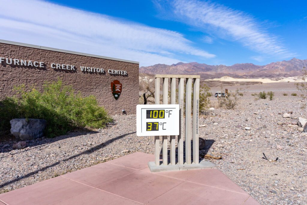
Afterwards, stop by the Furnace Creek Visitor Center if you haven’t already been. Besides paying for your entrance and picking up maps, the Visitor Center also has some good exhibits and you can sign up for ranger-led tours.
Note that even if you have an annual America the Beautiful pass, you still need to stop at the Visitors Center to show your pass and receive a paper ticket to display in your car.
Golden Canyon
3.5 miles / 6 minutes from Furnace Creek Visitor Center
Located near the start of Badwater Road, Golden Canyon is one of the most popular hikes in Death Valley. You’ll get up close to an incredible terrain of golden-colored canyons and badlands, and pass by some really iconic landmarks.
There are multiple variations of the route, including a 3-mile out-and-back to the Red Cathedral, a 4.3-mile loop that includes Gower Gulch, and a complete 7.8-mile circuit that also includes the Badlands Loop and Zabriskie Point. If you have the time, it’s worth completing the whole circuit. Star Wars fans may also recognize Golden Canyon as where the Jawas hid out and attacked R2-D2.
Alternatively, you can wait and do a shorter and easier hike to Natural Bridge a little later in the afternoon, especially if you’re short on time. It’s only 1-mile out-and-back with barely any elevation change, and will lead you to a large natural bridge.
For detailed write-ups of both hikes, check out our guide to the Ten Best Hikes in Death Valley.
Artists Drive and Artists Palette
6.5 miles / 8 minutes to start of Artists Drive from Golden Canyon
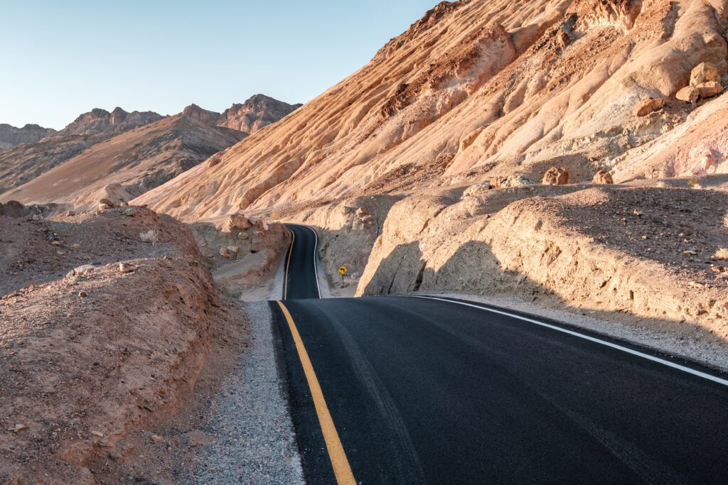
Located around 10 miles south on Badwater Road, Artists Drive is a scenic 9-mile one-way loop that twists and winds its way through the pastel-colored hills and canyons. You’ll end up back on Badwater Road, north of where you entered. Note that there’s a 25-foot limit on vehicles.
It’s a fun drive with lots of dips and curves. There are also tons of places to pull over and explore, which is well worth doing. About 5 miles in, turn off to the right to find a small parking lot to Artists Palette. Climb the small hill to an overlook where you can get a better view of Artists Palette.
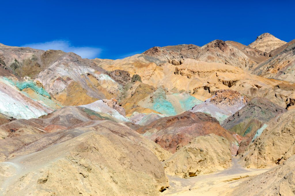
It’ll be immediately obvious why the area and drive are called what they are, with the hills displaying a dazzling array of colors in shades of red, orange, purple, and green—the result of oxidation of the various metals (iron, mica, and manganese) found in the rocks. The colors are especially concentrated and vibrant around Artists Palette and you can also get an even closer look by walking down and around the hills.
Star Wars fans may recognize the area from the Sandcrawler Station scenes and where R2-D2 was carried off by the Jawas.
Devils Golf Course
3.5 miles / 7 minutes from end of Artist Road
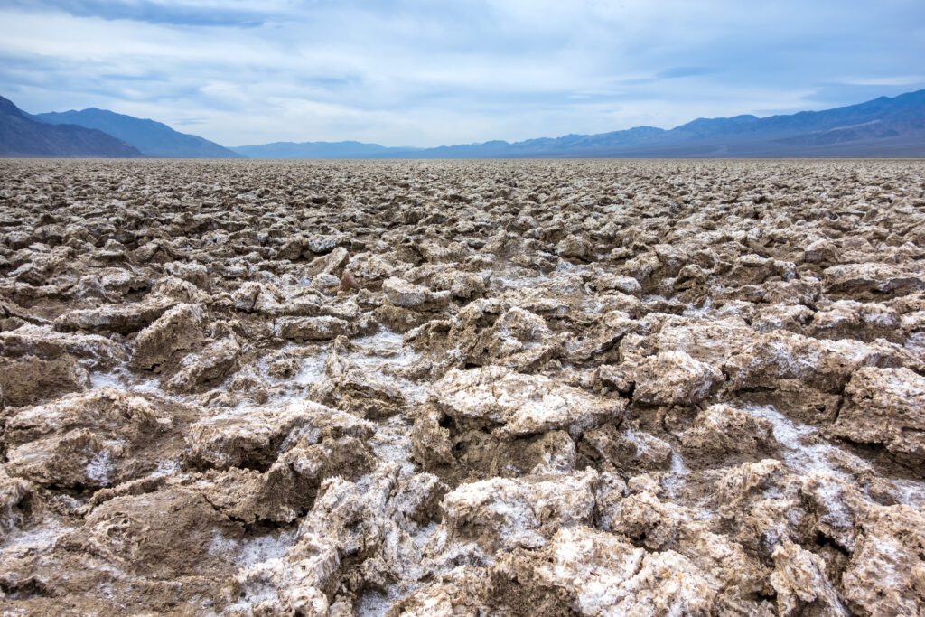
From Badwater Road, turn off onto a dirt road and drive for about a mile. Devils Golf Course is a large salt pan covered with large, jagged spires of salt deposits. It was formed when Lake Manly (also named after William Manly) evaporated. Groundwater constantly seeps up, adding to the salt formations, which are then shaped by the forces of wind and rain erosion into razor-sharp and jagged spires.
Early exploratory drill holes by the Pacific Coast Borax Company found the salt and gravel beds to extend down at least 1,000 feet, but more recent studies suggest that they actually extend many thousands of feet deeper.
The area takes its name from a 1934 National Park Service guidebook that said, “Only the devil could play golf on such rough links.” Listen closely for tiny pops and pings—the sounds of billions of salt crystals exploding in the heat.
Badwater Basin
10 miles / 15 minutes from Devils Golf Course
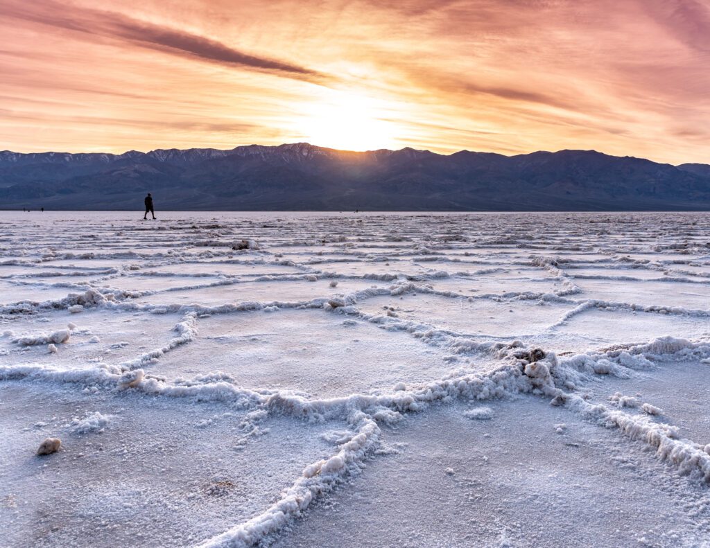
At 282 feet below sea level, this is the lowest point in North America. It’s also one of the hottest parts of Death Valley, so time your visit for early or late in the day. In this itinerary, think about catching the sunset here.
From the parking lot, stairs and a ramp take you to a wooden platform overlooking a sodium chloride (salt) pool. Don’t forget to look back at the mountains behind the parking lot at the small sign indicating where sea level is. Head down to the salt flats, which stretch out for 200 square miles. Go for as long as you want, but be aware that you will have to walk out for at least a mile to see the really dramatic salt polygons.
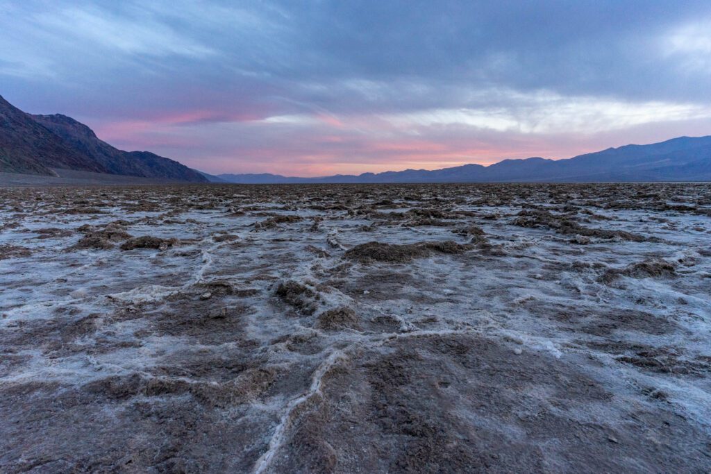
Lake Manly once covered this whole area. With no outlet, the lake evaporated tens of thousands of years ago, leaving behind the concentrated salt deposits (along with calcite, gypsum, and borax). Saltwater Basin is said to have gotten its name because a mule owned by an early surveyor refused to drink the (extremely salty) water here. It’s also a great spot for sunsets and for stargazing after the sun goes down.
Day 2: Mosaic Canyon, Darwin Falls, and the Mesquite Sand Dunes
Spend the day exploring some of the park’s history and diverse geology as you tackle the central and western areas of the park.
Harmony Borax Works
1.8 miles / 5 minutes from Furnace Creek Visitor Center

Death Valley has a history of borax mining, and you can learn more about that heritage at this quick stop, located just west of the Furnace Creek Visitor Center on CA-190. A short trail leads to this former borax processing site, which still has machinery and wagons in place.
Borax was found in the area in 1881. Harmony Borax Works was established shortly after that and began processing ore in 1883. At its peak, it had a team of 40 workers who produced three tons of borax daily. They then used twenty mule teams to haul the borax out of Death Valley. Work stopped just a few years after, and the plant and borax reserves eventually became part of the Pacific Coast Borax Company.
Salt Creek Interpretive Trail
13 miles / 18 minutes from Harmony Borax Works
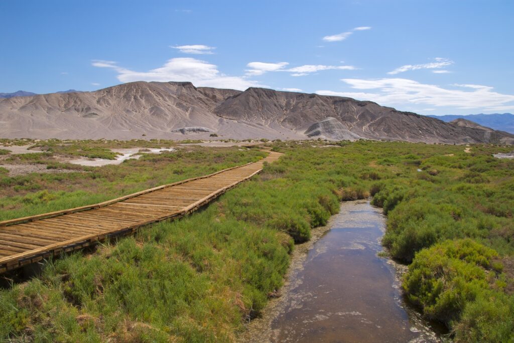
If you’re visiting in the spring, it’s worth making a stop at Salt Creek to look for the rare Salt Creek pupfish that lives here. Spring is when the pupfish are in spawn and they are most often spotted from March to May. Learn more about pupfish through interpretive signs along the trail, which is a short 0.5-mile stroll along a wheelchair-accessible boardwalk. The boardwalk is open all year, but water usually only flows from November through May. This is also a good place to spot birds.
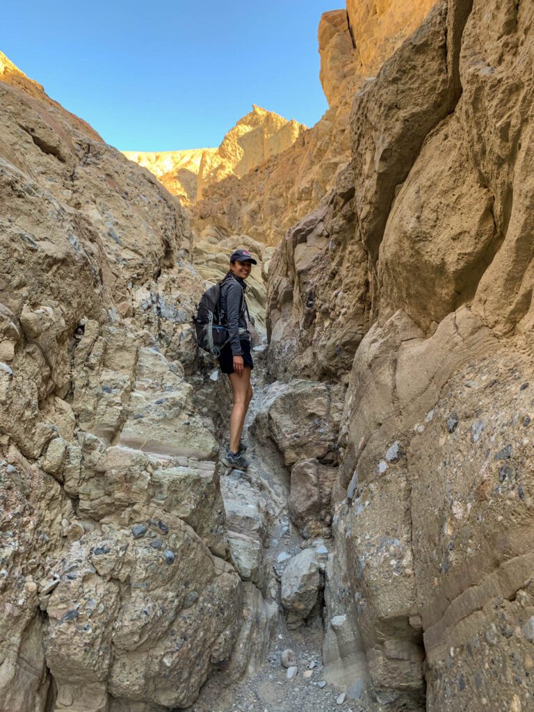
Mosaic Canyon
15 miles / 25 minutes from Salt Creek Interpretive Trail
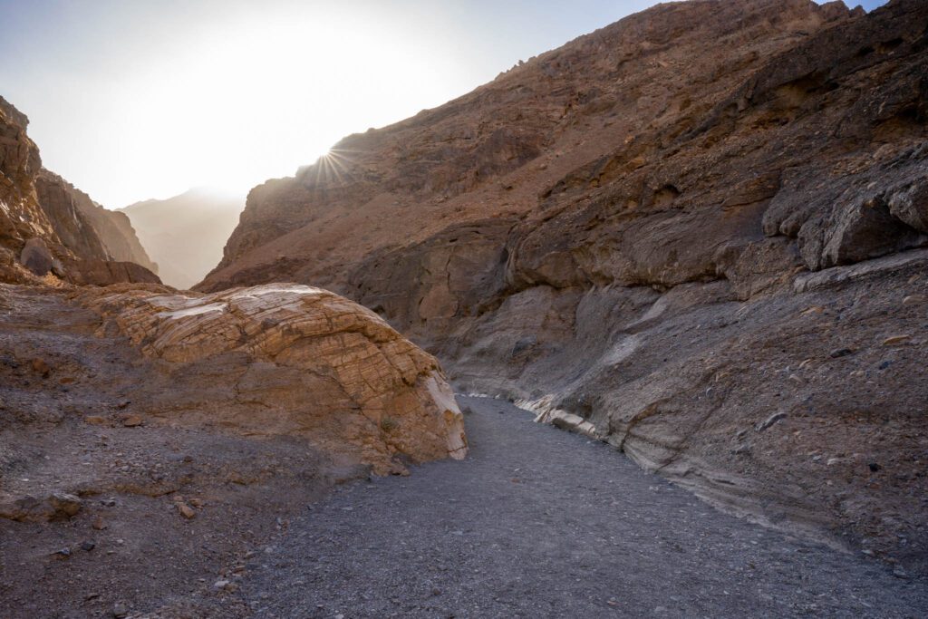
Located near Stovepipe Wells Village, Mosaic Canyon is one of the most popular hikes in Death Valley. It’s a 4-mile out-and-back hike that lets you see some really interesting geology. Plus it’s a fun hike. If you’re short on time, you can just do the first half mile.
The highlights are the canyons with smoothly polished Dolomite marble and mosaic breccia conglomerate, in which colorful fragments of different types of rock are cemented together. The first half mile is super narrow and twisty, which makes for a fun hike.
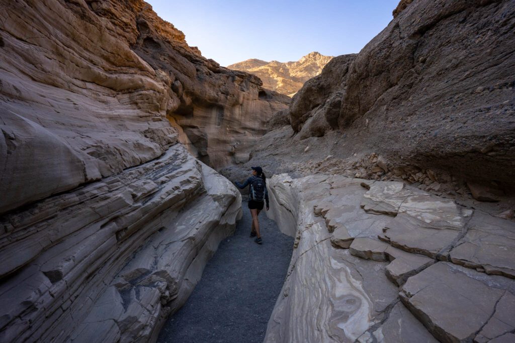

Continue further and you’ll pass by several sets of narrows, with dry falls and boulders to scramble over. Expect to share the canyon with others, though the further you go the fewer hikers there will be.
For lunch, take your pick of views if you’ve packed a cooler. Otherwise, backtrack a bit to Stovepipe Wells and grab lunch there, or wait until you get to Panamint Springs and the restaurant at the resort.
Darwin Falls
37 miles / 1 hour from Mosaic Canyon

Located just west of Panamint Springs, this year-round waterfall offers a lush surprise in the arid desert environment. The road there is unpaved and a high clearance vehicle is recommended, though most regular cars can make it as well.
It’s a fairly easy 2-mile out-and-back hike along an unmarked but easy to navigate path down a canyon. The scenery gets increasingly lush the further you go in the canyon, with willows, cattails, and other vegetation providing welcomed shade and greenery.
At the end, you’ll reach a 20-foot cascade that splits into two by a rock above a shallow pool. Do not swim here. Not only is it a fragile ecosystem, but it’s a water source for the surrounding area, including Panamint Springs. Those with more time and energy can extend the hike and explore the higher parts of the canyon, which passes several other waterfalls.
Father Crowley Vista Point
10 miles / 25 minutes from Darwin Falls
Back on CA-190, continue west until you reach Father Crowley Vista Point, near the western edge of the park. Sitting at 4,280 feet, the point overlooks Rainbow Canyon, with its colorful stripes. There’s also a dirt trail that leads to an overlook of Panamint Valley.
It’s named after Father John Crowley, also known as the Desert Padre. In the 1930s, Father Crowley would often stop at the point that now bears his name to admire the views during his travels between his home in Lone Pine and his parishioners in Death Valley
These days, the viewpoint is a popular spot for photographers and aviation fans to come here in hopes of spotting military test flights by fighter jets zipping through the canyons, which has also earned it the nickname of Star Wars Canyon. There’s no schedule but you might get lucky and get buzzed by a close flyby. The canyon was the scene of a fatal accident during a training run in 2019. An exhibit now commemorates the Navy pilot who lost his life and provides more information on the training flights.
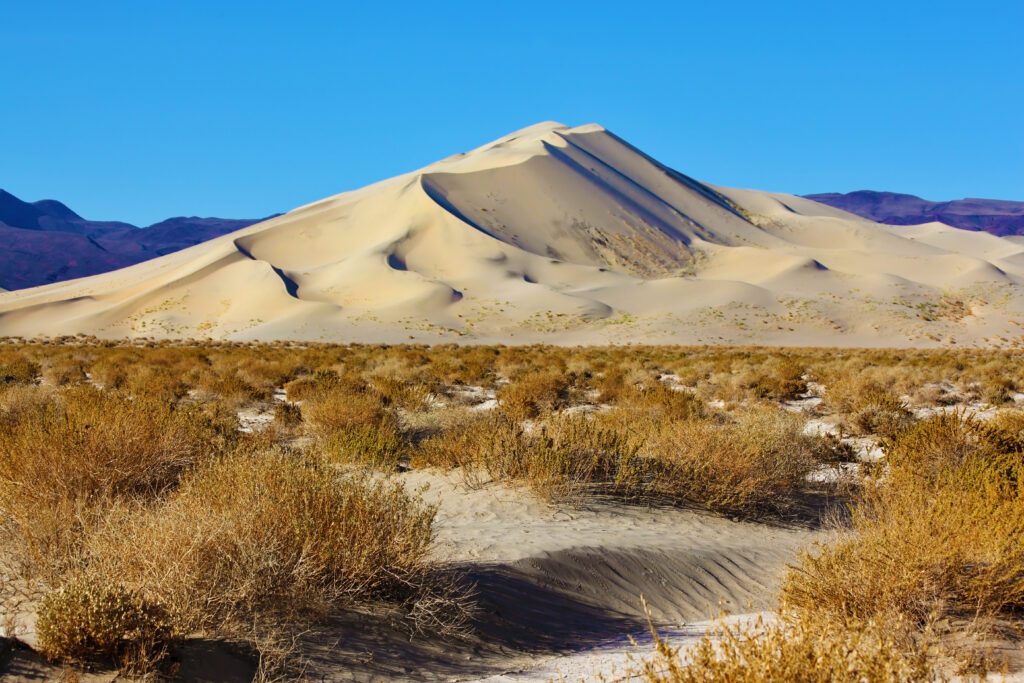
Mesquite Flat Sand Dunes
40 miles / 45 minutes from Father Crowley Vista Point

Head back towards Stovepipe Wells for your final stop of the day. Located 2.1 miles west of the village, these are the most popular and easily accessible sand dunes in Death Valley. Try to get there an hour or two before sunset to give you time to explore before you lose the light. Sunset is one of the best times to visit (and photograph) the sand dunes.
For you Star Wars fans, this is where they shot the scenes for C-3P0 and R2-D2’s trek across the deserts of Tatooine.
There’s no set trail so you can explore in any direction you want. The whole area covers 14 square feet. You might want to head towards the highest dune, which is about 130 feet tall. Just know that it will take longer than expected, as it can be slow going walking over sand. These are also the only dunes where sand boarding is allowed, so bring an old sled, board, or even some cardboard and have fun zipping down the dunes.
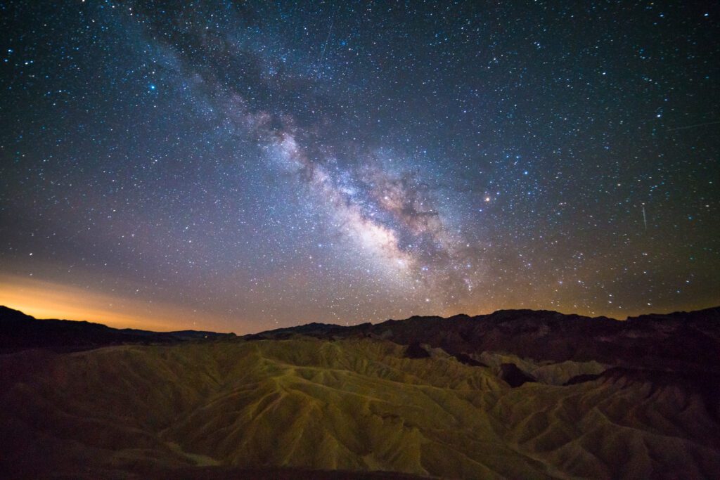
If you’ve stayed out long enough for it to get dark, and it’s a clear night, take some extra time to appreciate the incredible night sky. The Mesquite Sand Dunes area is one of the best spots for stargazing in this International Dark Sky park. Alternatively, time your visit for sunrise instead, which has the added benefit of pristine sands undisturbed by people, which make for better odds of spotting animal tracks.
Day 3: Titus Canyon, Ubehebe Crater, and Racetrack Playa
Spend your last day exploring the northern part of the park. This assumes you have a 4WD vehicle with high clearance. Otherwise you will be very limited on what you can see and do in this rough and remote area.
Titus Canyon
34 miles / 40 minutes from Furnace Creek Visitor Center to the start of Titus Canyon
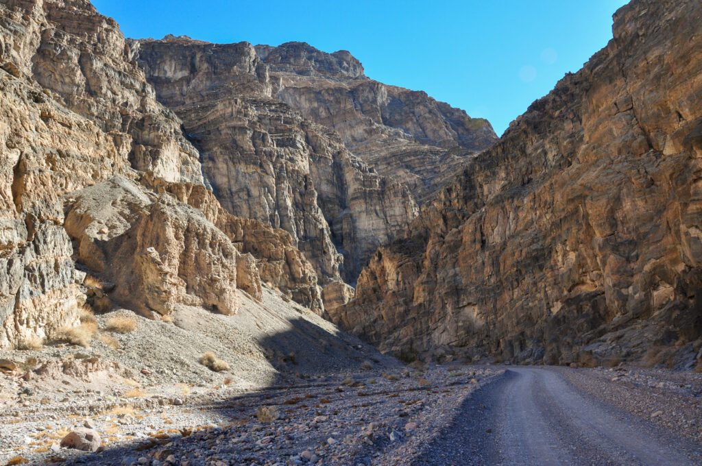
This is the most popular backcountry drive in Death Valley, and passes by narrow canyons, colorful rock formations, rugged mountains, petroglyphs, and a ghost town. The road can be rough and a high clearance vehicle is recommended. Don’t attempt this if rain is in the forecast, as the canyons are prone to flash floods. The entire road stretches for 27 miles and is one way, with the exception of the last 3 miles at the western end.
You’ll first pass by Titanothere Canyon, with fossil beds that date back more than 30 million years. At the Red Pass, the highest point of the road at 5,250 feet, stop and enjoy the views around you. You’ll next enter Leadville ghost town, which really only existed for a year in the 1920s. Several shacks and mines still remain, though be very careful exploring the mines. Titus Canyon is next, where you can look for bighorn sheep and petroglyphs.
The last 1.5 miles of the canyon is extremely narrow, and you may want to scout ahead before driving – the final stretch of the road is worth exploring on foot.
Scotty’s Castle
20 miles / 25 minutes from end of Titus Canyon
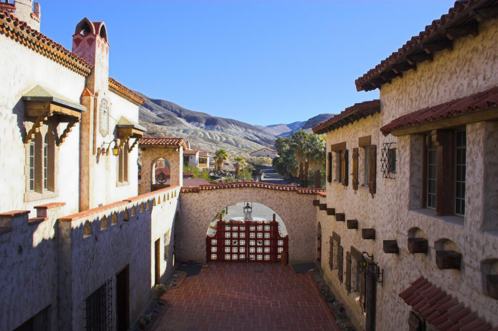
Located 53 miles north of Furnace Creek in Grapevine Canyon is a hidden oasis. The two-story Spanish Colonial and Mission Revival mansion is an architectural gem. Even more intriguing is the story behind its construction, which involved a shady gold prospector (Walter Scott) and a millionaire with bad health (Albert Johnson).
Scott was almost certainly swindling Johnson when the latter came for a visit to Death Valley to check out the gold mine he had invested in. Johnson never did see the mine but fell in love with the area, which also helped improve his failing health. He decided to build a mansion as a winter retreat, though he allowed Scotty to tell everyone that it was really Scotty’s mansion, built with the profits of his gold mine. Construction stopped in 1931 when Johnson realized that, due to a surveying error, he was actually building on federal land. With the start of the Great Depression shortly afterwards, the mansion, also known as Death Valley Ranch, was never completed.
Due to extensive flood damage, Scotty’s Castle is closed to visitors until at least 2022. However, there is one way to visit this site, and that’s as part of the Flood Recovery Walking Tour, offered seasonally from fall to spring.
Ubehebe Crater
8.5 miles / 22 minutes from Scotty’s Castle
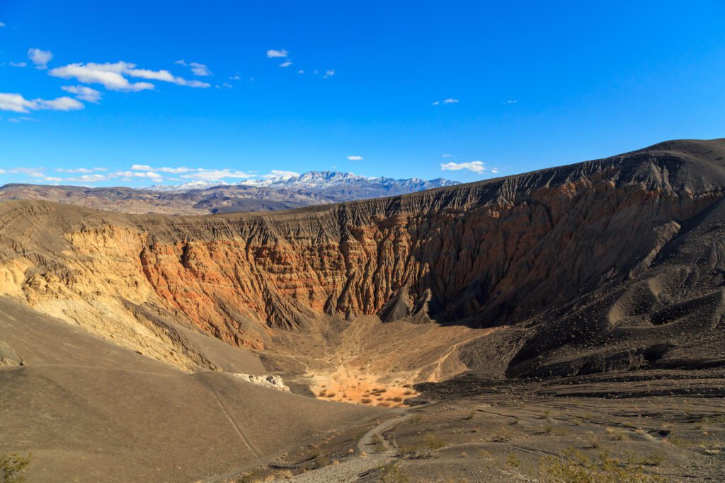
Not far from Scotty’s Castle is a chain of craters. The largest of these, Ubehebe Crater, is a sight to behold, at half a mile across and 600 feet deep. It’s a maar volcanic crater that formed when hot magma came into contact with groundwater, which led to a giant steam explosion and a large debris field of cinder all around.
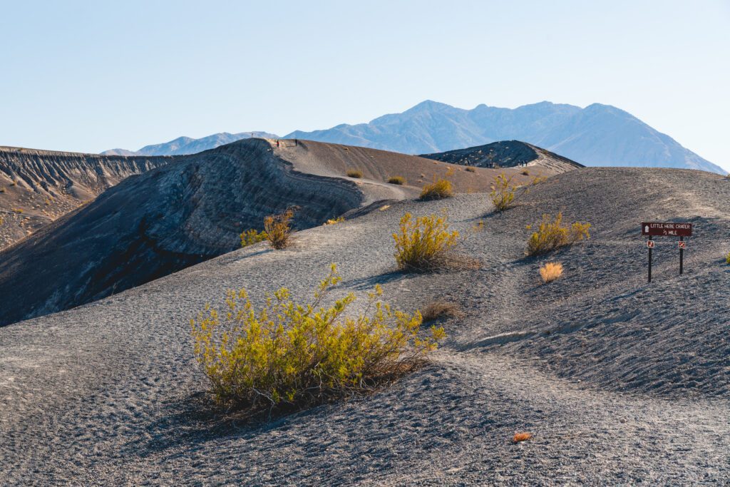
You can drive right up to the massive crater. An easy 2-mile trail around the rim lets you see the crater from all angles. You can also explore inside the crater, though the climb back up can be brutal. There’s also a smaller crater, Little Hebe, right next to its larger cousin that you can walk around as well.
Racetrack Playa
27 miles / 1 hour 45 minutes from Ubehebe Crater
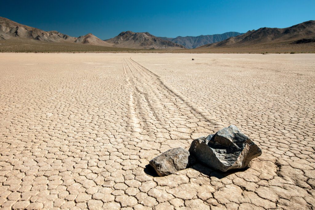
You definitely need a 4WD with high clearance, and heavy-duty tires, for this one, as the road is full of sharp rocks. Even so, you need to endure 28 miles of rough washboard to get there. But for those that are prepared and persist, the payoff is a first-hand view of one of the lingering mysteries of Death Valley: rocks that seemingly move on their own.
After around 20 miles, you will reach Teakettle Junction. At some point it became a tradition for visitors to leave a kettle there while taking an existing one with them. Continue straight, and at 26 miles, you will reach the Grandstand parking area at the northern end of the Racetrack, a dry lakebed (playa) that’s about 3 miles long by 2 miles wide.
It’s worth a stop to get an overview of the Racetrack. To see the moving rocks, though, continue driving another 2 miles south, then walk at least half a mile towards the southeast corner of the playa, where you will see rocks and the tracks that show their movement across the playa. Some of these rocks weigh hundreds of pounds, yet somehow manage to travel more than 1,000 feet, seemingly on their own.
A study conducted from 2011 to 2014 may have finally solved the mystery. It appears that the right conditions—a rain that then freezes, forming windowpane ice, followed by sunny days and light wind—is enough to move the rocks a good distance.
For those that can’t make it out to Racetrack Playa but want to see the moving rocks, the Bonnie Claire playa east of Scotty’s Castle, between the park and Highway 95, is a more accessible option.
What to Add With More Time?
Here are the top options if you have another day or two in Death Valley.
- Telescope Peak – The tallest peak in Death Valley (11,049 feet) is worth a hike for those with some extra time. It’s a classic hike that leads to incredible views at the summit. Expect it to take you five to seven hours. This is also a good option if you’re visiting Death Valley over the summer. Find a detailed description here in our guide to the Ten Best Hikes in Death Valley. 4WD with high clearance required to take you to the closest trailhead (Mahogany Flats Campground), but a regular car can make it other than the final 1.5 miles.
- Wildrose Charcoal Kilns – Located in Wildrose Canyon, these 25-foot tall, beehive-shaped kilns were built in the 1870s to provide fuel needed to process silver and lead ore. Today, they’re some of the best-preserved kilns in the Western United States. You can enter them.
- Eureka Dunes – At 700 feet tall, these are easily the largest dunes in Death Valley, and likely all of North America. Located in Eureka in the far north of the park, it’s best to visit near sunrise or sunset. If the conditions are right, you may hear the sand dunes “sing.” There is a dry camp at the base of the dunes. 4WD with high clearance recommended.
- Rhyolite and Goldwell Open Air Museum – Located outside the park on the way to Beatty, Rhyolite was once a prosperous town that boasted a three-story bank building, stock exchange, and electricity. Today, you can explore the ruins of the town, which include the three-story building, train depot, and the bottle house made from 50,000 bottles. Nearby, the Goldwell Open Air Museum showcases several outdoor sculptures, including Belgian artist Albert Szukalski’s rendition of The Last Supper.
What to Do With One Day in Death Valley
Even with one day, you can see many of the highlights of Death Valley.
Start with sunrise at Zabriskie Point and walk a short distance down into the badlands. Take a quick drive though Twenty-Mule Team Canyon, then head up to the Dante’s View overlook for panoramic views of the valley.
The winding and colorful Artists Drive is next, with a stop at Artists Palette to get a closer look at the colorful hills.
Afterwards, continue south on Badwater Road and make a quick stop at Devils Golf Course to check out the spiky formations. Take the short hike to Natural Bridge next before spending some time at the lowest point in North America at Badwater Basin. Walk out on the salt flats and get up close to the salt polygon formations.
End the day with sunset at Mesquite Flat Sand Dunes.
What to Do in Death Valley National Park with Two Days
If you have two days, you can still see some of the best of Death Valley.
Your first day itinerary will be similar to the one-day itinerary above, except you can add in the longer Golden Canyon hike either in lieu of or in addition to Natural Bridge.
You can also save the Mesquite Flat Sand Dunes for sunrise on day two.
Afterwards, hike Mosaic Canyon to appreciate the unique geology, then drive to the western part of the park. Hike to Darwin Falls and then make a quick stop at Father Crowley’s Vista Point.
Head back east, then complete the Titus Canyon backcountry drive. Stop at Scotty’s Castle if it’s open or you have tickets for a flood tour.
End your day with a visit to Ubehebe Crater and a hike around and into the crater, and around Little Hebe Crater.
Things to do in Death Valley Without a 4WD Vehicle
You can still see plenty of the highlights of Death Valley even without a 4WD with high clearance, including all of the stops on the first two days of the three-day itinerary listed above.
For the third day, you can also still make it to Scotty’s Castle, Ubehebe Crater, and the short two-way section at the end of Titus Canyon accessible to most vehicles.
Alternatively, you can complete the two-day itinerary above, but only drive the short two-way section at the end of Titus Canyon.
Note that weather can impact all roads, even ones normally accessible to all vehicles. In particular, heavy rains can cause flooding and close roads. Check on the latest conditions with a ranger before setting off.
You Might Also Like
- JOSHUA TREE: How to Plan an Amazing Joshua Tree Itinerary
- JOSHUA TREE: Where to Stay near Joshua Tree National Park
- JOSHUA TREE: 12 Stunning Hikes in Joshua Tree National Park
- JOSHUA TREE: The Best Time to Visit Joshua Tree National Park (+ the Worst Time)
- PALM SPRINGS: How to Spend an Amazing Weekend in Palm Springs
- HIGHWAY 395: A Perfect Los Angeles to Lake Tahoe Road Trip Itinerary