7 Incredible Hikes in Crater Lake National Park
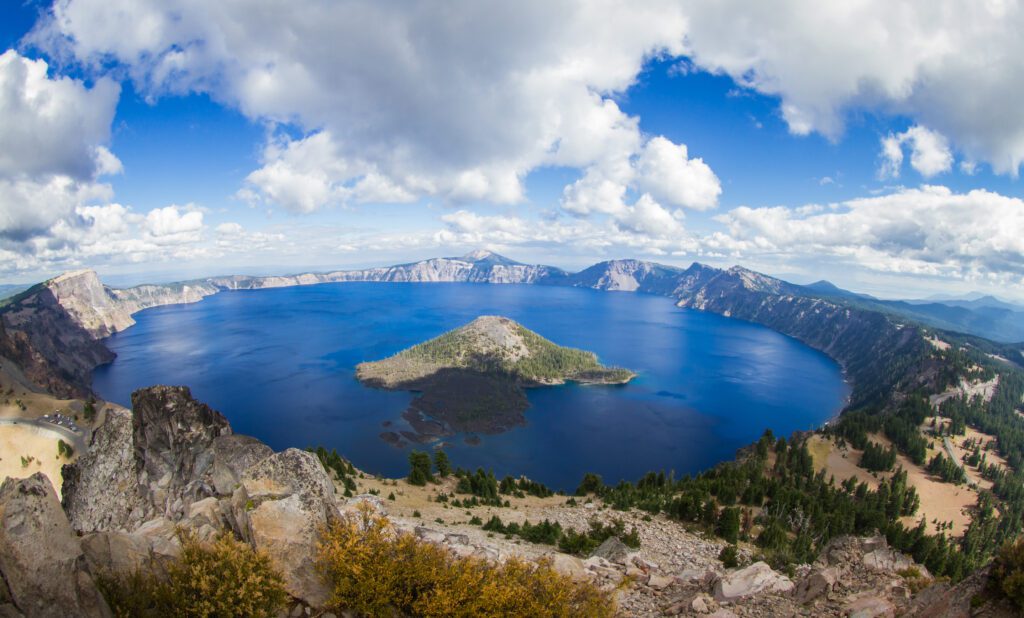
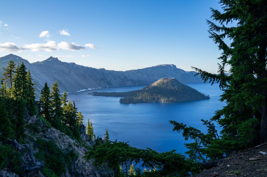
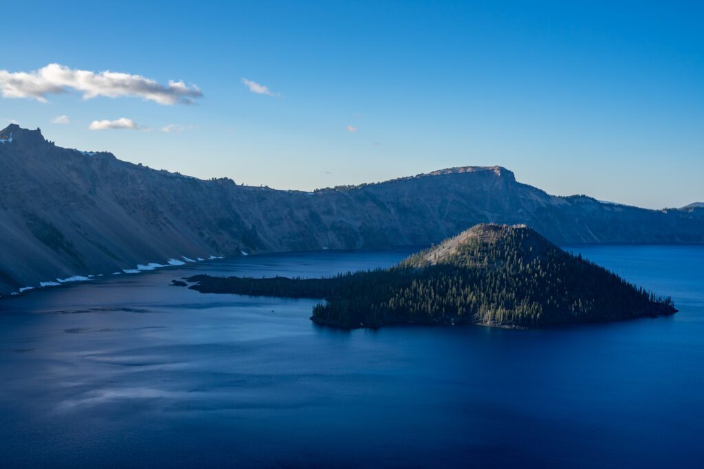
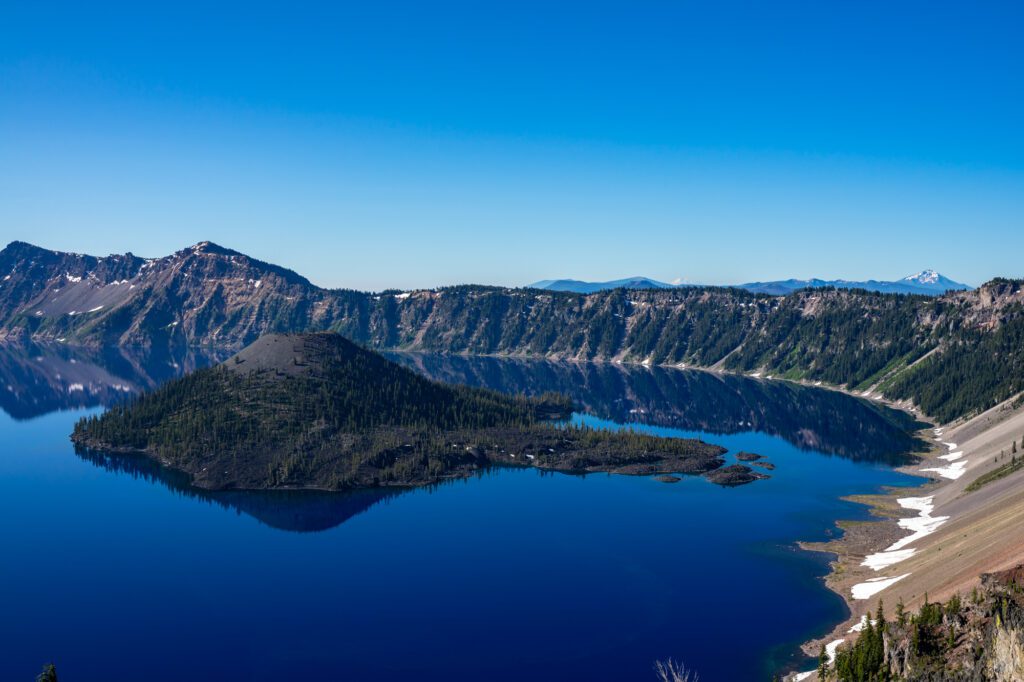
Crater Lake is by no means the largest lake in Oregon but it is the deepest, bluest, clearest, and most beautiful. And it’s not just the deepest in Oregon—at 1,943 feet it’s the deepest in the entire country and sixth deepest in the world.
The lake was formed over 7,500 years ago when the 12,140 foot tall volcano, Mount Mazama erupted and left a huge caldera that has since filled in with snow and rain.
Fun fact! Crater Lake is a bit of a misnomer since it isn’t exactly a crater, it’s a caldera. Calderas are formed when the magma chamber of a volcano is completely emptied and the remaining rocks collapse inwards, whereas a crater just refers to the depression left after rocks explode. As a kid, this misleading name led me to believe it was a meteor that formed the lake.
Needless to say, I was a little disappointed to learn it was a mere volcano. The more you know!
While there are many things to do at Crater Lake, the best activity by far is hiking. Nothing else lets you immerse yourself so well into the landscape and take in the splendor of the lake.
Below I’ll outline seven of the best hikes in Crater Lake National Park so you can enjoy the area, burn some calories, and experience this breathtaking lake from all angles!
As an avid hiker, backpacker, explorer, and Oregonian I’ll give you all the details you need to hit the ground running (or hiking, rather) when you visit Crater Lake.
Want more information on Crater Lake? For a more extensive run-down of the park including one- and two-day itinerary and travel and lodging tips, check out our guide to planning your Crater Lake itinerary. And if you’re coming from Seattle, you’ll want to read our guide to planning an amazing Seattle to Crater Lake road trip.
Disclaimer: Some of the links below are affiliate links, which means that if you click on one and purchase something, we make a small portion of the sale at no additional cost to you. It goes without saying that we would never recommend something we wouldn’t use or do ourselves.
Tips for Hiking at Crater Lake
Before we get into the specific Crater Lake hikes, let’s go over some quick tips that you’ll want to know before you head to the park.
- To get into the park, you’ll have to pay a $30 entrance fee per car. Or, you can get in with the America the Beautiful Pass, and if you’re planning on visiting more national parks in the year, this could be your best option. You only need to hit up three parks in 12 months to make buying the pass worth it!
- Hiking around Crater Lake exposes you to the elements so you need to dress appropriately. In the summer it can be brutally hot and there’s not a ton of shade so think lightweight layers, hats, and sunscreen. In the winter you’ll need to bundle up and at minimum you’ll need microspikes if not snowshoes (you can rent snowshoes at the Rim Village Cafe and Giftshop, but they’re only available from 10:00 am to 3:00 pm and you may have better luck renting them outside of the park).
- There’s only one gas station in the whole park (here on Google Maps) and it’s closed during the winter, so make sure you fill up beforehand!
- Be aware of the elevation change. I live in Portland which is more or less at sea level and going from 0 to 8,000 feet can really take a toll! Even if you’re in good shape, don’t push yourself and be sure to hydrate.
- For the love of God, wear decent shoes. Many of these trails are on hard, loose volcanic rock. Flip flops are fine for the beach or putzing around town, but not for hiking!
The 7 Best Hikes in Crater Lake National Park
Below are seven can’t-miss Crater Lake hiking trails that will take you all around the park whether you want to stand on the shores of the lake, climb to the tallest peaks, or take a more relaxing stroll around Mazama Village.
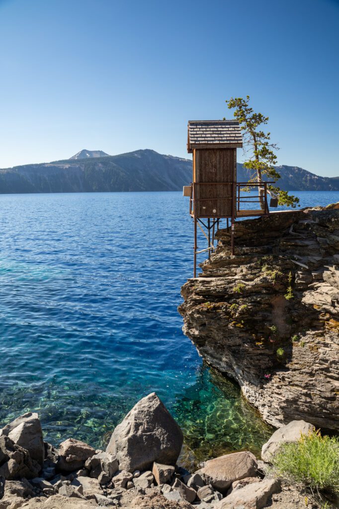
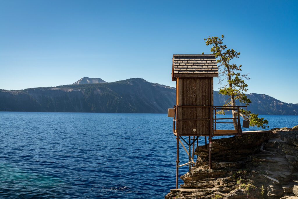
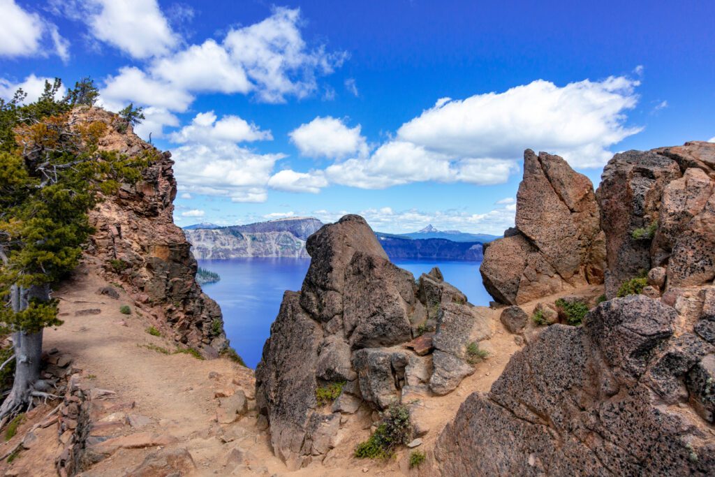
The Cleetwood Cove Trail
- Length: 2.0 miles
- Elevation Gain: 620 ft.
- Trail Type: Out & Back
- Difficulty: Moderate
- Trailhead: Cleetwood Cove Trail
“Cleetwood” was the name of the boat that was lowered into the lake in 1885 when it was first sounded with a weight tied to a spool of piano wire. Surveyors were keeping a close eye from the soon-to-be-named “Watchman” peak above. Today you can clamber up and down this trail and experience life from inside a volcano.
The trail itself isn’t long, but there’s little to no shade and the scree underneath can make for some unstable footing if you’re not being careful. It may be tempting to wear flip flops or sandals since you’ll want to swim or at least dip your toes in the water, but I implore you to wear real shoes. You’ll thank me.
There are several benches along the trail, so if you do need to take a breather (especially on the way up) they make for a nice pit stop. Once you’re down at the water there are bathrooms and places to sit and take in the view, and I swear the water looks even more blue and clear from down here.
I truly think everyone who’s able should go on this hike and go swimming (unless you’re there in winter). The water will be cold even in summer (average temp of 57 degrees) as the lake is fed solely through snow and rain runoff. There’s also a 35 foot cliff you can jump off of into the water for you daredevils out there!
Another fun option is to take a two hour boat tour which is offered about six times a day. Here you can tour the whole lake while learning about the park’s history and geology from a ranger. Or, you can take a ride over to Wizard Island (offered two times a day) where you can hike and swim and get a view of the lake that not many other people do.
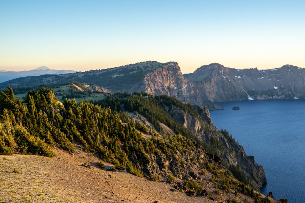
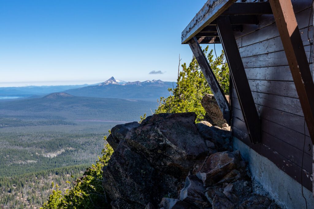
The Watchman Peak Trail
- Length: 1.7 miles
- Elevation Gain: 400 ft.
- Trail Type: Out & Back
- Difficulty: Moderate
- Trailhead: Watchman Peak Trailhead
Perhaps the most popular hike in the park, Watchman Peak is also one of the shortest but will still give you those iconic views of the lake. Although most hikes in the park could fit this description, this one really is a big “bang for your buck.”
The 8,013 foot peak is on the west side of the lake, and it was there that members of the U.S. Geological Survey watched over the crew that first sounded the lake, thus becoming the “watchmen.”

The trail is well graded and even when you get towards the top and start hitting switchbacks, it’s not too strenuous. There’s a nice observation station/fire lookout at the top that’s fairly accommodating but since this is the most popular hike, count on sharing the view with a lot of other people.
If you can swing it, this is a great option for a sunrise or sunset hike and you won’t find as many people there (certainly not at sunrise). But, even if you do hit it up at peak-busyness, just roll with it and know that everyone is there to appreciate this beautiful sight along with you.
The Garfield Peak Trail
- Length: 3.4 miles
- Elevation Gain: 1,069 ft.
- Trail Type: Out & Back
- Difficulty: Moderate
- Trailhead: Garfield Peak Trailhead
The Garfield Peak hike starts right at the Rim Village, so it’s very popular since it’s so easy to get to. That said, because it’s a slightly longer hike (but really none of them are too long) it’ll be slightly less busy than a hike like Watchman Peak.
If you’re serious about avoiding crowds you should go as early in the day as possible, or in the winter as it’s a great option for a snowshoe hike.
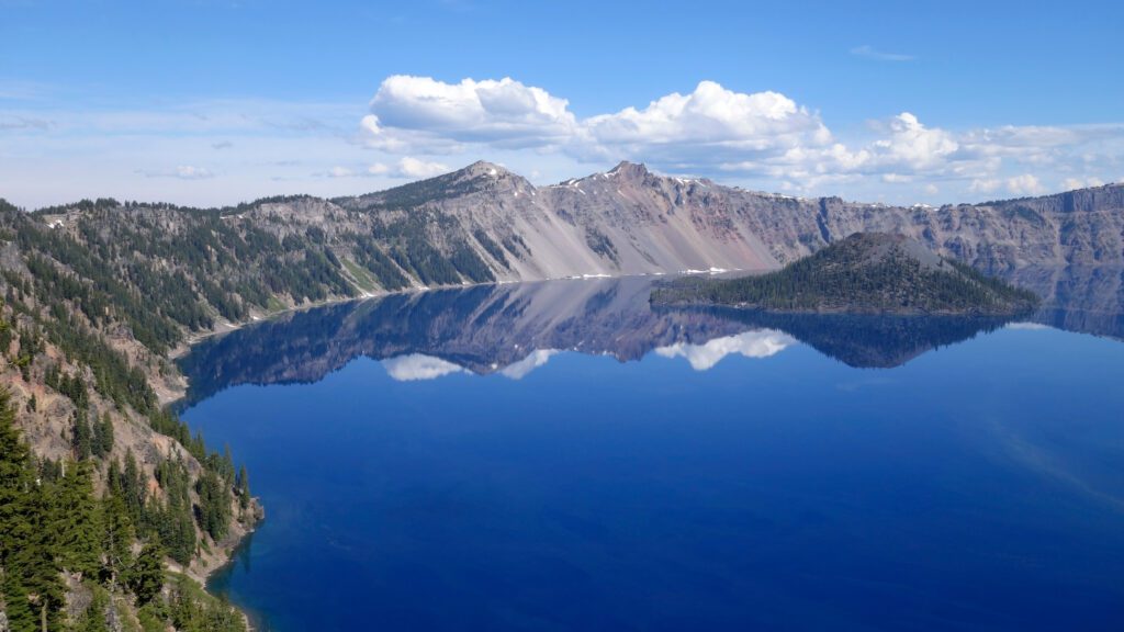
This is a nice, moderate hike that offers gorgeous views of the lake including Wizard Island and the Phantom Ship (so called because if you’re next to it on the water it looks like a ship and when the fog rolls in the “ship” appears and disappears).
There’s a steady incline the whole way and it’s pretty much just a straight shot to the top with no switchbacks. There isn’t a ton of room at the top to lounge around, but since the entire trail runs along the lake you get views the whole way up.
The Mount Scott Trail

- Length: 4.2 miles
- Elevation Gain: 1,259 ft.
- Trail Type: Out & Back
- Difficulty: Moderate
- Trailhead: Mount Scott Trailhead
Mount Scott is the highest point in the park and trekking up to the top will be well worth your effort. From the top at 8,949 feet you’ll get views not only of Crater Lake, but the entire area for miles. On a clear day you can see north toward Bend and view the Three Sisters, and south into California to see Mount Shasta.
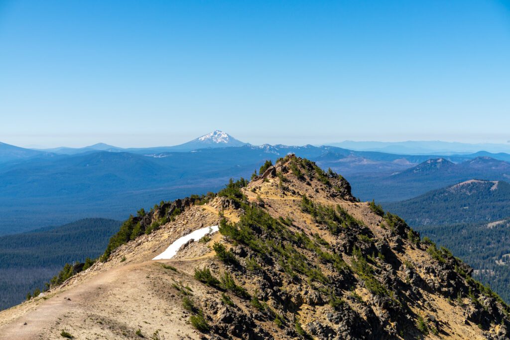
You’ll be about two miles away from the lake on its east side, but it will still loom large and many photographers like this spot because you can fit the whole lake in one frame. Mount Scott is definitely one of the best Crater lake hikes, and though you’ll be sharing the trail with others, it’s far enough away from the hubbub of Rim Village that it doesn’t feel too crowded.
You’ll likely see snow around the trail year round, but it should be clear enough during the summer months to do without much worry. And, like many of the peaks around the lake, there’s not much tree cover so wear sunscreen and a hat and stay hydrated.
It can get hot in the summer, and if you’re not used to the elevation you’ll get winded sooner than you think. At the top is a still-used fire lookout and you can sit on the rocks surrounding it to have a snack and take in your views before heading back down.
Discovery Point Trail
- Length: 2.4 miles
- Elevation Gain: 337 ft.
- Trail Type: Out & Back
- Difficulty: Easy
- Trailhead: Discovery Point Trail
They call it the Discovery Trail because it was here that John Wesley Hillman “discovered” Crater Lake in 1853. But, like many such “discoveries,” there’s been archeological evidence of Native American tribes living in this region since before Mazama blew!
At this time the settlers simply called it the “deep blue lake,” and it wasn’t until 1869 that it received the name “Crater Lake” from a local newspaper editor, Jim Sutton.
This is one of the easiest hikes in the park and also makes for a good winter hike. If the snow is pretty well packed and there hasn’t been a lot of fresh snow, you could swing it with microspikes. It’s even ski-able!
If you’re hiking in the summer months, Discovery Point is a great option for a sunset hike and the park rangers actually do guided hikes at this time of day if you’re nervous about navigating the trail in the dark.
Like Garfield Peak, the Discovery Point trail runs right along the lake so you get views the whole time from the south side of the lake, and from the top you’ll look straight onto Wizard Island.
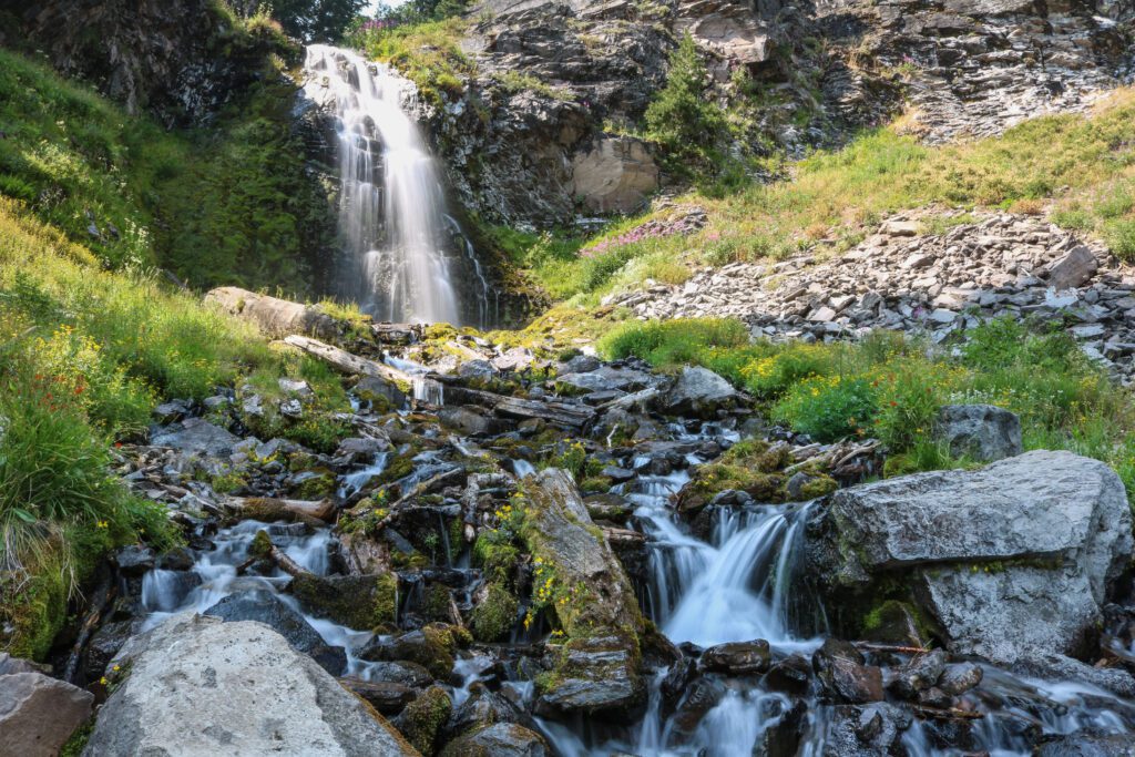
Plaikni Falls
- Length: 2.0 miles
- Elevation Gain: 137 ft.
- Trail Type: Out & Back
- Difficulty: Easy
- Trailhead: Plaikni Falls Trailhead
You get to Plaikni Falls from Rim Drive (the road that circumnavigates the lake, and btw you should totally drive the whole thing when you’re there). Look for the turnout to Pinnacles Drive (by the Phantom Ship Overlook) and the trailhead is only about a mile down the road away from the lake.
The parking lot is small and will fill up fast so it’s best to get there early. It’s easy to get to and very popular, so be prepared for crowds.
This trail is especially good for kids since it’s a relatively flat, short hike through old growth pine forests. It also has a nice payoff at the end with the simple, yet lovely falls that are fed through snow melt that resurfaces as Sand Creek Springs.
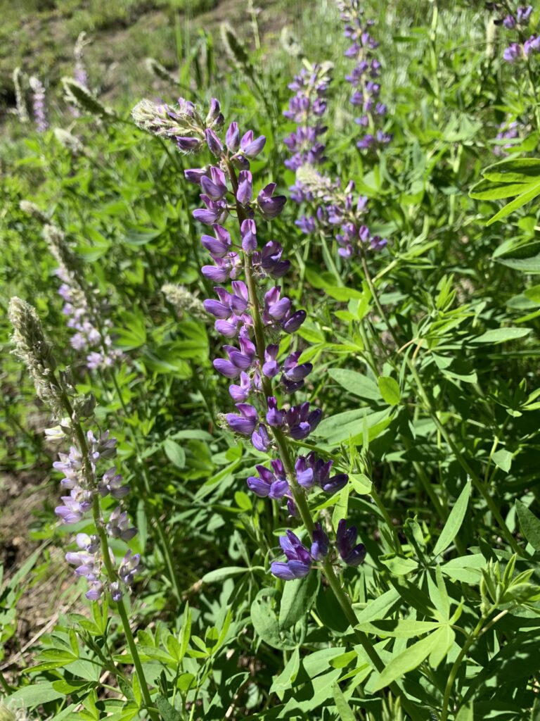
This is also a killer wildflower spot if you catch it in early summer. For maximum waterfall action try to go in the spring or early summer, as the flow tends to slacken in late summer.
Also worth your time is driving just five more miles down the road and checking out the Pinnacles Overlook to see the “fossil fumaroles,” where hot gas from Mount Mazama drove up pumice and ash to make an otherworldly landscape of spires shooting up from the ground.
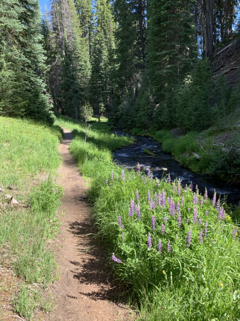
The Annie Creek Canyon Loop Trail
- Length: 2.1 miles
- Elevation Gain: 305 ft.
- Trail Type: Loop
- Difficulty: Easy to moderate
- Trailhead: Mazama Village Campground
Annie Creek is one of the easiest snowshoe options if you’re heading out in winter, and though this two mile loop hike isn’t next to the lake, it’s still lovely and a great way to see the area around the park. The trail is mostly level, and the steepest part is going down and up the switchback that takes you to Annie Creek.
The creek is also lovely in its own right especially when you walk by its pumice canyon walls. And if you hit it up in early summer it’ll be poppin’ with wildflowers!
This hike also has the added bonus of being far less crowded than many of the other hikes, and is a good option if you’re camped at Mazama Village and don’t feel like fighting the crowds up at the lake. Fun fact: Annie Creek is the source of all the drinking water in the park!
Want to discover more great hikes in Oregon? We’ve got a bunch of Oregon hiking guides for you.
- The 16 Best Hikes in Oregon: A Complete Guide to Hiking in Oregon
- Hiking at Mount Hood: Complete Guide to the Best Hikes at Mount Hood
- Hiking on the Oregon Coast: The 17 Best Hikes on the Oregon Coast
- Hiking in the Columbia River Gorge: 12 Amazing Hikes in the Gorge
- Hiking in Portland, Oregon: A Local’s Guide to the Best Hikes in Portland
- The 7 Best Hikes in Crater Lake National Park
- The Best Hikes near Hood River: A Complete Guide
When to Go Hiking at Crater Lake
The good and bad news about hiking at Crater Lake is that the non-snowy season is pretty darn short.
The park gets an average of 42 feet of snow a year. This often lasts into June and will pick back up in October. So if you’re only a fair weather hiker, the summer months are where it’s at, but if you’re down for a little (or a lot) of snow then you can go year-round!
The park is open year-round and is accessible by three different entrances, though the north entrance is closed during the winter months. The south and west entrances are open all the time and regularly plowed, but if there’s been heavy snow there might be a delay on this.
Even so, you should only head up there during the snowy months if you have a 4WD vehicle or traction devices. Check current road conditions here before you hit the road.
Summer Hiking
Crater Lake in the summer is undeniably beautiful.
You’ll have great weather, a very low chance of rain, and the best visibility.
Yes, you’ll be sharing your space with a lot more people, but heading to the park in the winter can be iffy. You won’t always know the trail conditions and there are several times when the cloud-cover and fog can obscure the lake almost completely.
Plus, when you visit in the summer, all the shops and cafes will be open and if you’re bold enough to go swimming, you’ll warm up right away on the shore.
Winter Hiking
Winter hiking at Crater Lake is its own kind of magic. However, just because you can get up to the lake doesn’t mean all the hikes will be accessible.
There are some you’ll be able to do as a snowshoe hike (guided or on your own) and these are fun and doable even if you’ve never done it before. The park sees so many visitors (over 750,000 a year) that even when there’s snow, the trails are pretty well packed down so it’s easy to stay on course.
This will require different preparations as far as gear goes, but let it be known that you can hike at Crater Lake year-round if you put your mind to it!
And really, seeing it in the snow has its perks since the majority of tourists come in July, August, or September.
More to Explore in Oregon
Enjoying this guide? We’ve got more Oregon travel guides to help you explore the best of Oregon and fall head-over-heels in love with it like we have.
- 25 Incredible Places to Visit in Oregon, the Best State in the Union
- How to Plan An Unforgettable Oregon Road Trip
- A Complete Oregon Coast Road Trip Itinerary
- 16 Incredible Hikes in Oregon
- One Day in Portland: The Best of Portland in a Day
- A Weekend in Portland: A Portland Itinerary for First Timers (Local’s Guide)
- Where to Stay in Portland: A Local’s Guide to 8 Areas to Stay
- The Best Hikes Near Portland (Local’s Guide)
- The Best Day Trips from Portland
- Amazing Weekend Getaways from Portland, Oregon
- The Best Things to Do in Hood River, Oregon
- What to Do in Cannon Beach: A Complete Getaway Guide
- How to Plan an Amazing Crater Lake Itinerary (1 or 2 Days)
- 24 Amazing Cabins in Oregon (Coast, Mountains, and More)
- Glamping in Oregon: 23 Cool Glamping Spots to Book for your Next Getaway