Hiking Near Hood River: A Complete Guide (for First Timers)
At just an hour away from Portland, Hood River is a great destination for both a day trip and a weekend getaway.
Hood River’s location in the Columbia River Gorge is what makes it a worthy destination. The town sits at an intersection of multiple different types of geography and climate, which means there is an incredible amount of diversity in terms of landscapes within an hour or so of Hood River.
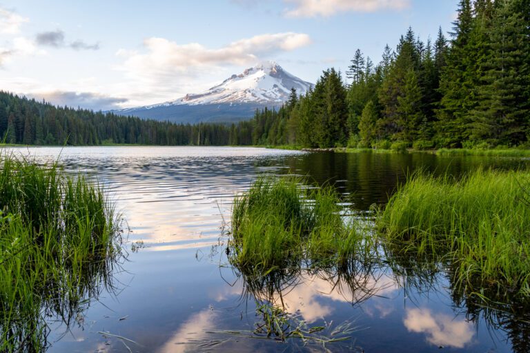
To the west, you’ll find lush forests and towering waterfalls along the Historic Columbia River Highway. To the south, it’s the Hood River Valley, full of amazing fresh produce and views of the surrounding mountain peaks. As you head north, you climb into a sub-alpine region at the foot of Mount Adams. And east is the high desert, where the dense forests and waterfalls give way to rolling golden hills.
That diversity of landscapes near Hood River means that, within 90 minutes of town, there’s a staggering number of amazing hikes with completely different payoffs.
In this guide, we’re going to cover the best hikes near Hood River based on our personal experience exploring. In the list below, you’ll find hikes that take you to gorgeous waterfalls, epic views of both the Gorge and the surrounding peaks of the Cascades, and, on occasion, both. Plus, everything you need to know to plan your hike – where to park, what pass you need, and more.
Sound good to you? Let’s get into it!
Disclaimer: Some of the links in this post, like hotel and vacation rental links, are affiliate links, meaning at no additional cost to you we make a little bit of money if you click through and book. That being said, we would absolutely never recommend something to you that we don’t stand behind 100%.
The Best Hikes near Hood River: A Complete Guide to 14 Amazing Hikes
Before we get into the list of hikes near Hood River, let’s talk about parking passes.
On the list below, you’ll find hikes in Oregon and Washington, in state parks and on national forest land. The parking pass situation can be confusing!
Which is why for each hike, we’ve included a bullet for which parking pass you’ll need to display at the trailhead.
Here’s a high-level summary of the passes you might need.
For this particular set of hikes, there are two passes you’ll need: a Discover Pass for the two hikes in Beacon Rock State Park (a Washington State Park), and a Northwest Forest Pass for the remaining hikes.
- A Discover Pass covers entrance to all of the state parks in Washington. A day pass costs $10, and an annual pass is $30. If you think you might make three or more visits to state parks in Washington (the other park near Portland is up on the southwestern Washington coast), then an annual pass makes sense. There are machines to buy a Discover Pass onsite at the trailheads for Beacon Rock and Hamilton Mountain, or you can buy one online.
- A Northwest Forest Pass covers all of the trailheads on national forest land in both Oregon and Washington State, and is essentially a must-have for hikers in either state because the vast majority of hikes are on federal land. However, the America the Beautiful Pass (colloquially, the “national parks pass”) covers all federal land in the country, including national forests. Basically, if you’re planning to visit two or more national parks in the next 12 months, buy an America the Beautiful Pass (you can get it online at REI). If not, just get a Northwest Forest Pass (also available at REI). There are usually day pass envelopes at trailheads, but you should know that the infrastructure on national forest lands is much less reliable (and you’ll need $5 cash).
We’re going to organize this list by distance from Hood River in terms of mileage.
This list is NOT an exhaustive list of every single hike within an hour of Hood River, but is a list of great hikes that we personally have done (mostly – there’s a couple that we haven’t gotten to yet, but are high on our to-do list) and enjoyed, and think you probably will too.
If you have a hike that you love and think should be on this list, reach out or leave us a comment below! We’d love to hear from you and find a new hike to add to our list!
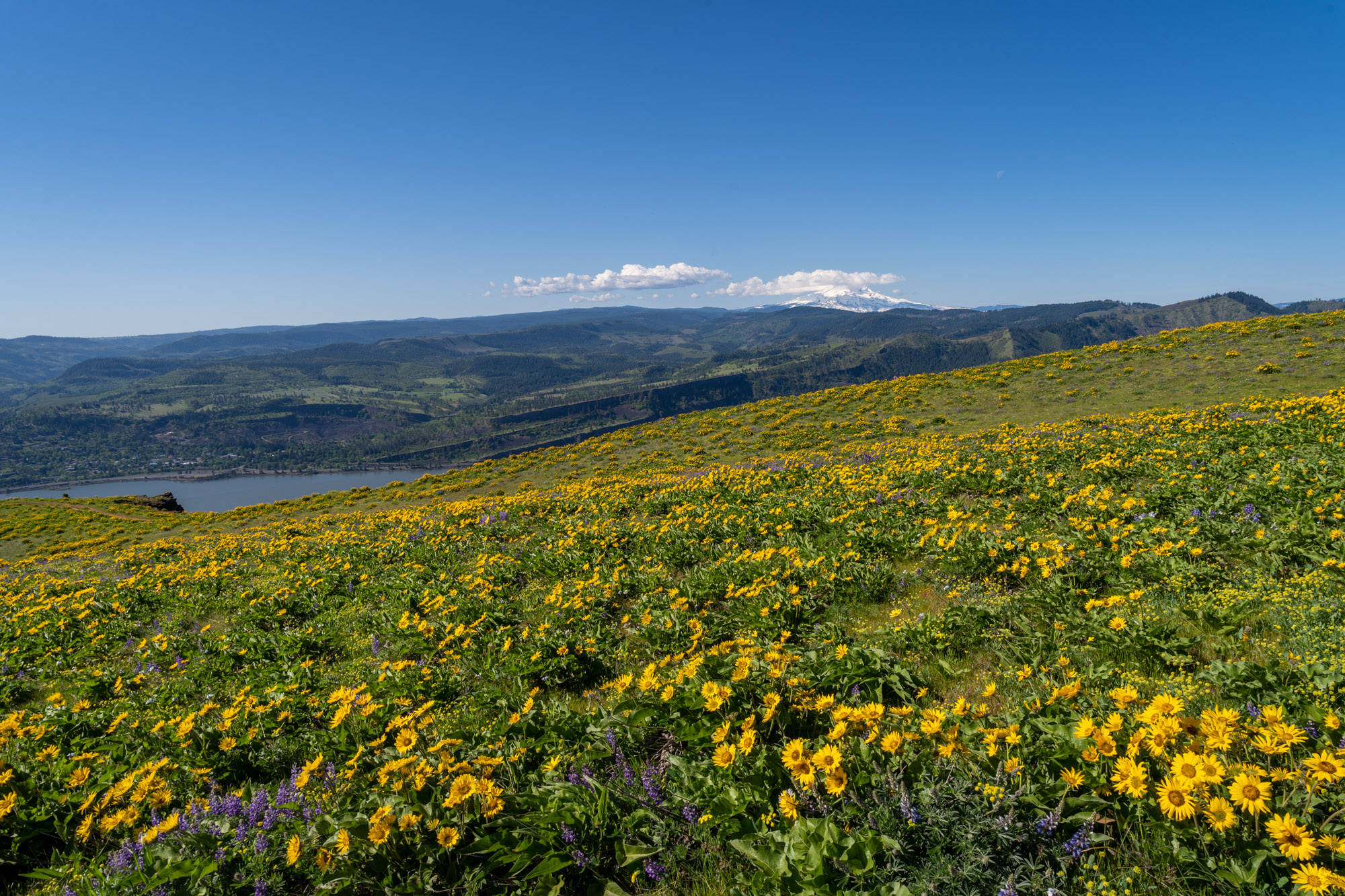
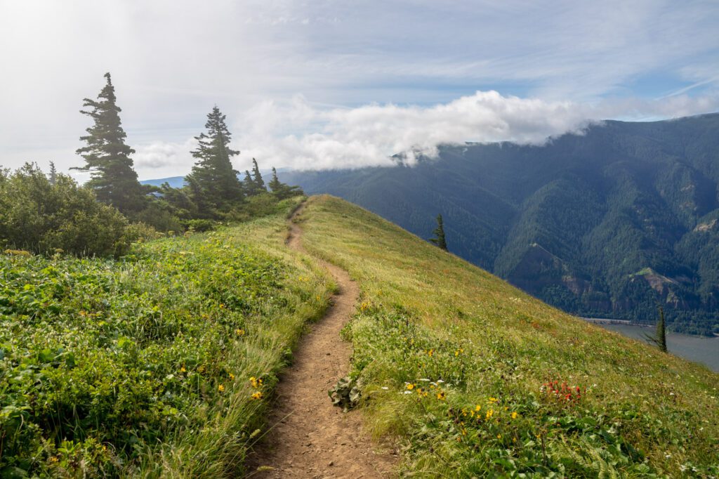
The Coyote Wall Trail
- Length: 6.2 miles
- Elevation Gain: 2,050 ft.
- Trail Type: Loop
- Difficulty: Moderate
- Dog-Friendly? Yes, on a leash
- Parking Pass: None
- Distance from Hood River: 7.6 miles / 17 minutes
- Trailhead Location
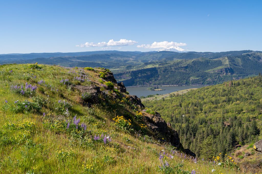
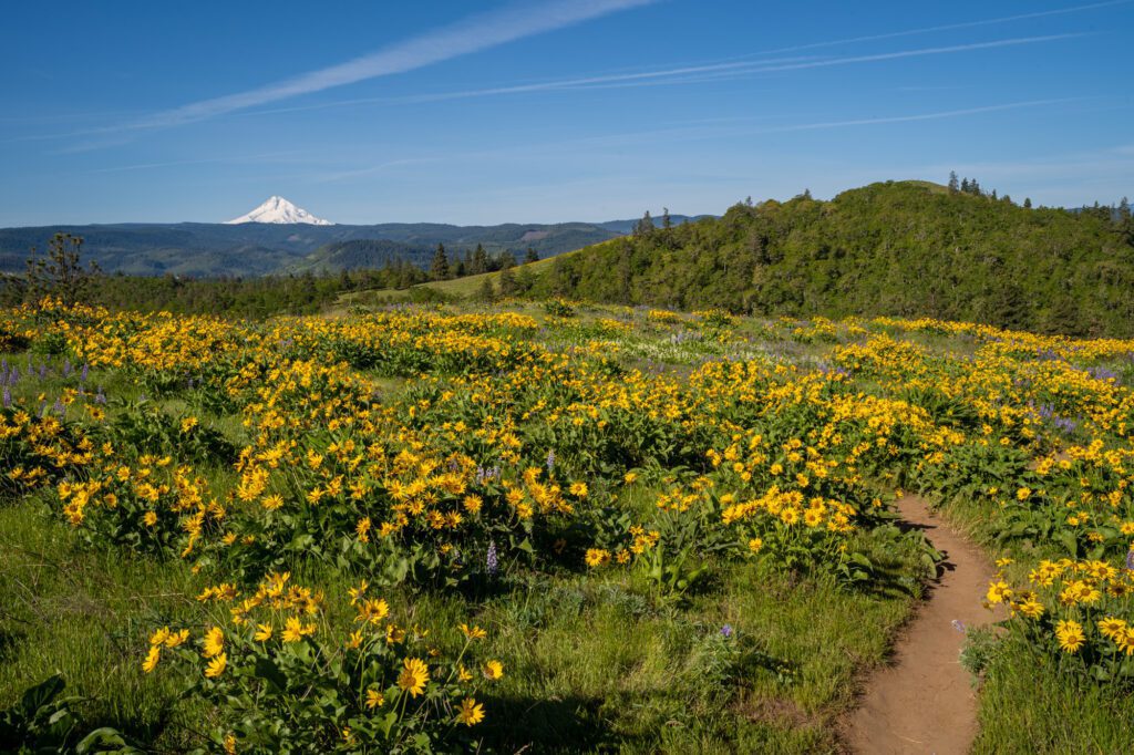
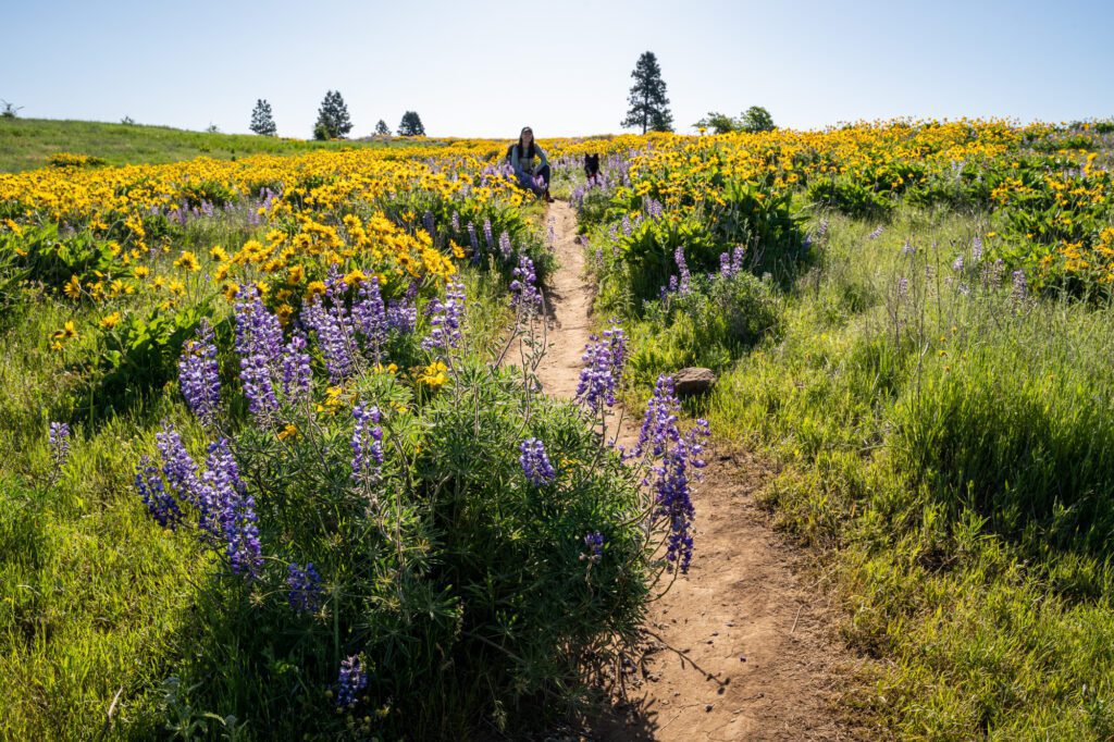
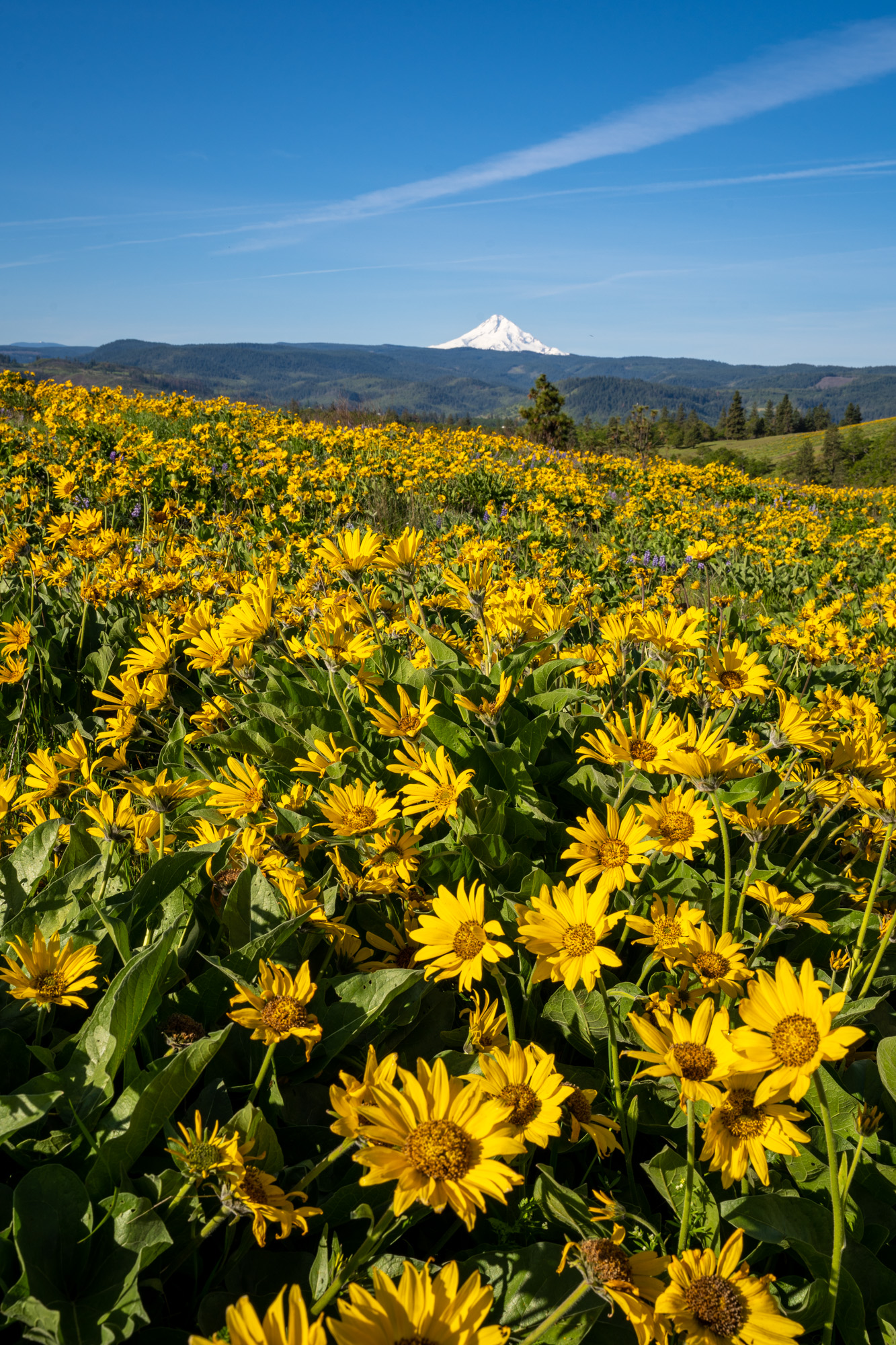
Three of the things we like about hiking in the Columbia River Gorge are the waterfalls, the wildflowers, and the sweeping views of the Gorge. The Coyote Wall trail, which is located about 9 miles east of Bingen on the Washington side of Gorge, has two of the three – wildflowers and Gorge views.
It’s a popular trail, both for mountain bikers and hikers, especially in the spring when wildflowers like lupine and balsamroot blanket the grassy hillsides with Mount Hood looming in the background.
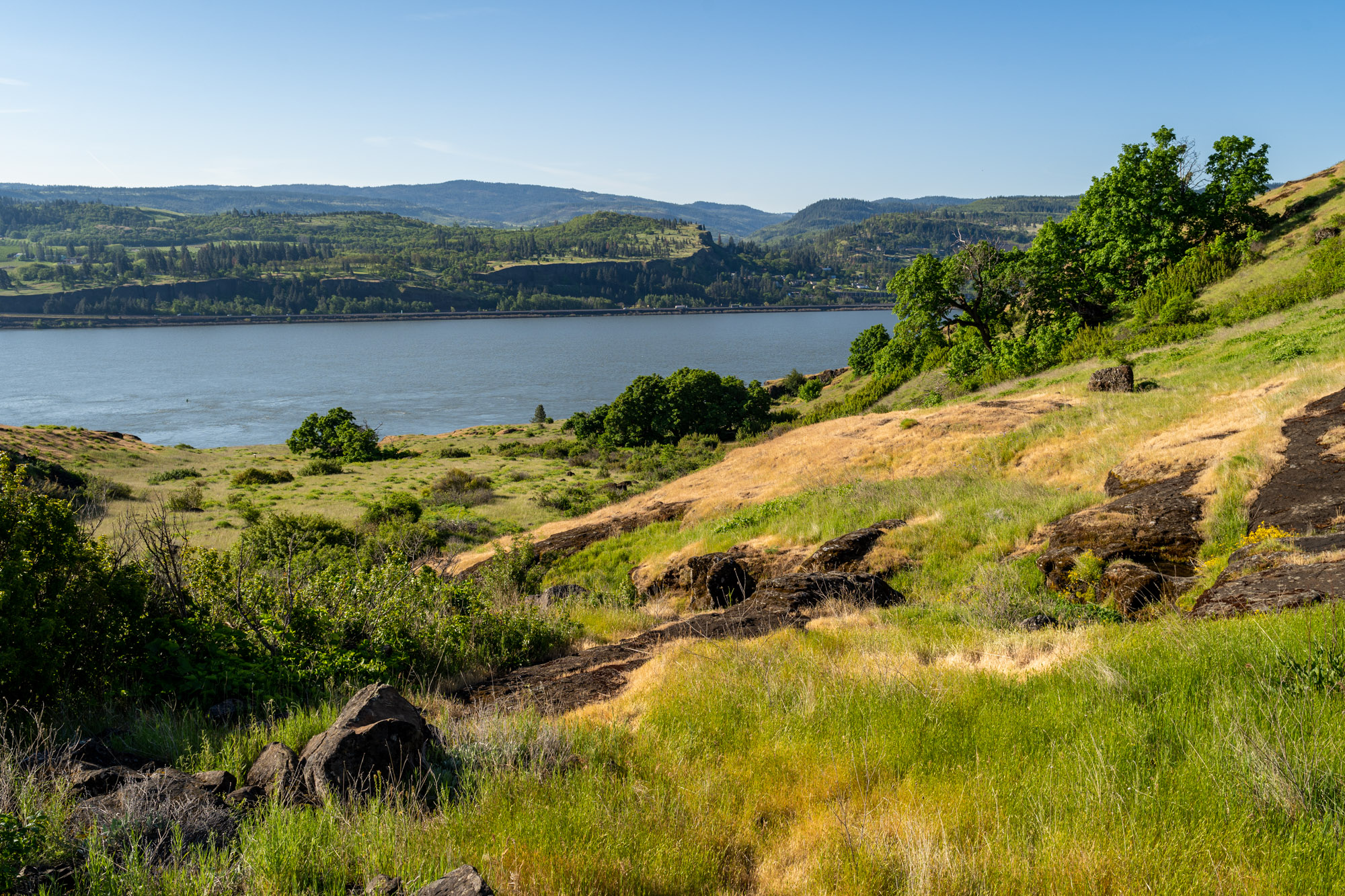
The trailhead is right off of Highway 14 on the Washington side of the Gorge, and you’ll need to cross the Hood River Bridge to reach it if you’re coming from the Oregon side (remember the $2 toll each way).
There is only room for 24 cars in the parking lot, so you’re going to want to get here early on weekends, particularly when the wildflowers are out (usually sometime between late April and mid-May). There is a single bathroom at the trailhead.
There is a wide ranging network of trails in this area, but there are two main routes to consider – the loop trail (tackle it clockwise to go up the steep section and save your knees with a more gradual descent) and the out and back trail (which follows the Little Maui Trail for a longer, more gradual climb and descent).
It’s worth noting here that the loop includes the Little Moab Trail (the steeper, more direct route up to the Coyote Wall trail), which has some steep dropoffs along the cliff and is rockier. If you’re apprehensive about heights (or if you have a dog), we’d recommend the slightly longer out and back version.
When we hiked this trail in mid-May, it was peak time for wildflowers, especially at the higher elevations. We had to climb 1,200 feet of elevation or so before we found ourselves smack dab in the middle of what might just be the best display of wildflowers we’ve ever seen in our lives.
While the Dog Mountain Trail gets more fanfare – and for good reason, really – this hike is arguably a better bang-for-your-buck in terms of views and wildflowers versus effort. Plus, it’s less popular (and therefore less crowded) and you don’t need to deal with the Dog Mountain permit system.
Both rattlesnakes and ticks are common sightings on this trail, especially in the spring and summer, so keep an eye on your feet (and your pups) and check everyone for ticks after the hike.
Read More: Hiking the Coyote Wall Trail – Everything You Need to Know
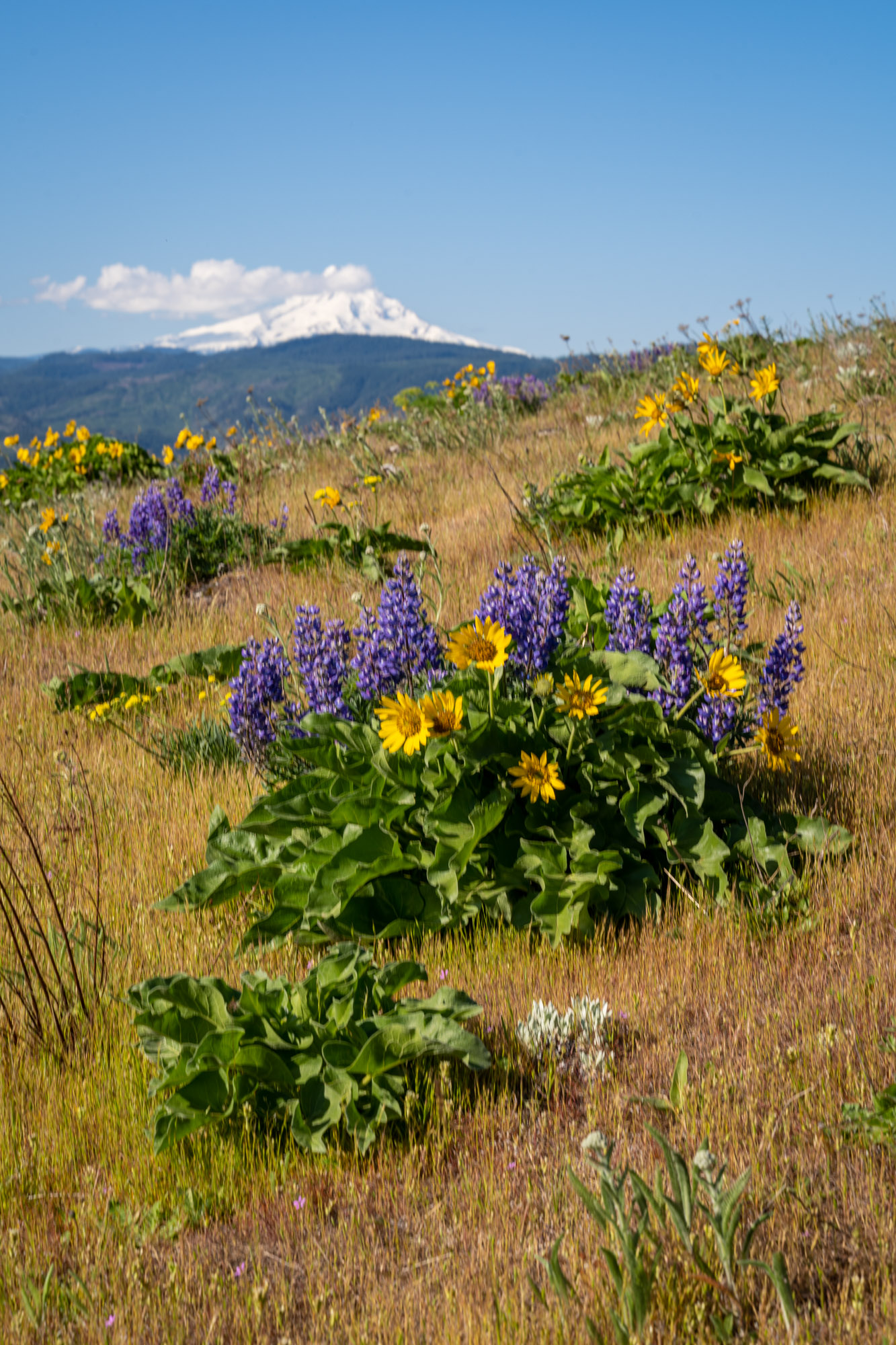
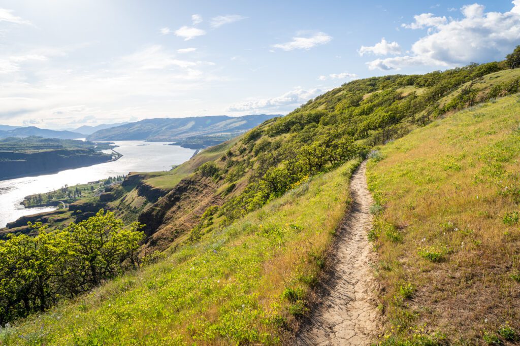
Memaloose Hills
- Length: 2.8 miles
- Elevation Gain: 600 ft.
- Trail Type: Lollipop
- Difficulty: Moderate
- Dog-Friendly? Yes, on a leash
- Parking Pass: None
- Distance from Hood River: 10 miles / 15 minutes
- Trailhead Location
Hot take: there is no better bang for your buck in terms of wildflowers to effort in the Gorge than the short loop at Memaloose Hills. While the display at places like Coyote Wall and Lyle Cherry Orchard were great, the never ending fields of balsamroot and lupine at Memaloose Hills blew us away when we were there in May of 2023.
The hike leaves from a tiny gravel parking lot off of the Historic Columbia River Highway (Highway 30) a few miles east of the town of Mosier, right next to the Memaloose Overlook.
There’s a network of trails here, but we’d do the lollipop that includes both Marsh Hill and Chatfield Hill. It doesn’t really matter which direction you hike in.
Atop both hills, you’ll find a dazzling display of flowers – lupine and balsamroot earlier in the season, with paintbrush and columbine coming in later in the season. There are also some nice views of Hood from the trail near the summits of both hills.
If you want to see incredible wildflowers, but aren’t able to do some of the more intense hikes like Dog Mountain and Coyote Wall, this would be a great option for you (and honestly, even if you can do those other hikes, we’d still highly recommend this hike too).
Dog Mountain
- Length: 6.5 miles
- Elevation Gain: 3,000 feet
- Trail Type: Lollipop
- Difficulty: Difficult
- Pass Required: Northwest Forest Pass (or America the Beautiful Pass) AND a weekend permit during wildflower season (April to June, roughly)
- Dog Friendly: Yes – on a leash
- Distance from Hood River: 14 miles / 23 minutes
- Trailhead Location: Dog Mountain Trailhead
Dog Mountain is a popular one, and for good reason. But it’s also tough, and you’ll need to be ready for a slow and steady trudge through the forest to get to the views awaiting you at the top.
Well, it’s popular for two good reasons, really. The views, and the wildflowers in the early summer.
It’s so popular, in fact, that they had to implement a permit system a few years ago to limit the number of people on the trail on weekends (information on permits – which are required for weekends from April to June – here).
But believe us when we tell you that you are going to WORK for those views and wildflowers.
We did this trail when we were in the best shape of our lives, living in a van and hiking 8-10 miles a day in the summer, and it was still a tough hike. You’ll climb nearly 3,000 feet over 3-ish miles, which is a lot of vertical feet per mile.
The other thing to know is that there’s a non-zero chance that you’ll leave the trailhead on a sunny summer morning and reach the top of the hike to find it socked in, with no view to speak of. We know because that’s what happened to us on our first time out there! All that work, no view. Bummer!
There are two ways to do this hike – as an out-and-back hike, following trail 147C (at the fork, go right), which is a slightly shorter and easier hike, or as a lollipop (which we’d do counterclockwise).
The last half mile of the hike up to the summit is the most spectacular part, where you’re following the ridge line towards the summit, passing Puppy Dog Summit along the way (which is probably the best view on the entire hike).
This is where you’ll find the lush wildflower meadows in the early summer (target May for peak bloom, though it totally depends on the year).
Lyle Cherry Orchard Trail
- Length: 5 miles
- Elevation Gain: 1,200 ft.
- Trail Type: Out and Back
- Difficulty: Moderate
- Dog-Friendly? Yes, on a leash
- Parking Pass: None
- Distance from Hood River: 15 miles / 25 minutes
- Trailhead Location
This hike is a few miles east of Coyote Wall on the Washington side, and is a much less trafficked trail compared to most of the other hikes on the Washington side we’ll mention in this guide.
However, we tackled this hike on a recent trip out to the Gorge on a weekday afternoon, and we were pleasantly surprised with both the views of the Gorge (especially given the relatively easy climb) and the wildflowers on display. The best part? We saw only three other groups out on the trail.
You’ll start from a small gravel lot right off of Highway 14 with room for just a few cars, and immediately begin climbing. As you’re climbing, you’ll get some nice Gorge views starting at about 0.3 miles in, and the views get continually more impressive the higher you get.
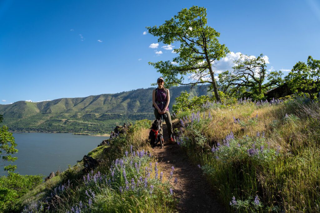
At the 1.1 mile mark, you’ve completed the bulk of the climbing and you’ll find yourself atop a ridge heading east, which you’ll follow for the rest of the hike with some slight elevation changes along the way. This is where we found the best wildflowers in May.
Once you’re on the ridge, you’ll follow it for 1.2 miles, completing a little lollipop at the end before coming back the way you came.
We saw (read: almost stepped on) a rattlesnake hanging out on the trail, so keep your eyes peeled. Ticks and poison oak are also things to watch out for here.
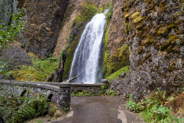
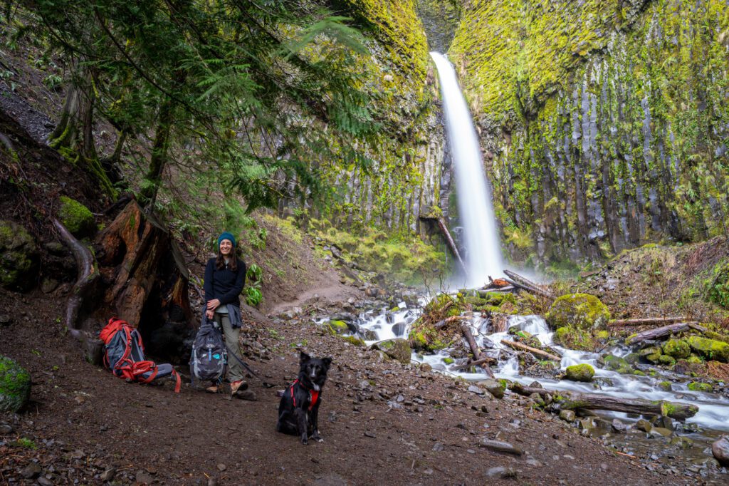
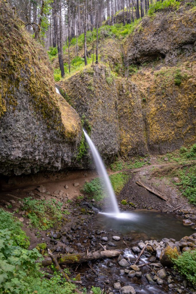
Dry Creek Falls
- Length: 4.4 miles
- Elevation Gain: 885 feet
- Trail Type: Out and Back
- Difficulty: Easy
- Pass Required: Northwest Forest Pass (or America the Beautiful Pass) if you park at the Bridge of the Gods trailhead
- Dog Friendly: Yes – on a leash
- Distance from Hood River: 20 miles / 25 minutes
- Trailhead Location: Bridge of the Gods Trailhead (alternate: Harvey Road Trailhead)
Of the waterfall hikes in the Columbia River Gorge, Dry Creek Falls is among the least trafficked. That’s not to say you’re going to have the trail all to yourself on a Saturday morning in the summer, but it’s going to be less crowded than other nearby trails like Latourell Falls and Wahclella Falls.
The hike starts at the small parking lot at Tollbridge Park next to Bridge of the Gods (there’s an alternate parking area here). You’ll immediately jump on the Pacific Crest Trail and follow it for just over two miles, until you reach the falls.
It’s a steady uphill grade for the first mile or so, then it’s a mostly flat stroll through the woods to finish. Along the way, you’ll pass through a section of forest that was burned during the Eagle Creek fires in 2017.
The falls themselves are gorgeous, especially when it has been raining because you get a vivid green moss growing on the rocks surrounding them. The waterfall is only (only, ha!) 74 feet tall, but it looks more impressive because you’re viewing it from below.
We’ve done this hike in the dead of winter, and the falls were roaring. If you’re looking for a nice hike to do in the winter months, this is a good option.
Read More: How to Hike the PCT to Dry Creek Falls
Wahclella Falls

- Length: 1.9 miles
- Elevation Gain: 250 feet
- Trail Type: Lollipop
- Difficulty: Easy
- Pass Required: Northwest Forest Pass (or America the Beautiful Pass)
- Dog Friendly: Yes – on a leash
- Distance from Hood River: 23 miles / 25 minutes
- Trailhead Location: Wahclella Falls Trailhead
We did this hike on a recent trip out to Hood River, and it’s another beautiful waterfall that requires relatively little effort to get to.
The hike begins from a small parking lot near the town of Bonneville – home to the dam of the same name – where there are only about 6-8 parking spots. Parking is going to be an issue here – we wouldn’t recommend showing up on a Saturday afternoon and expecting to find a spot.
You’ll leave the trailhead and follow Tanner Creek the entire way out to the falls. Near the falls, it becomes a cool canyon, with high, steep rocky walls. At the top of the walls, you can see the damage that the Eagle Creek Fire caused back in 2017, with burnt trees lining the top of the canyon.
At the 0.6 mile mark, you’ll hit a fork in the trail, which is where you’ll decide which direction to go on the lollipop. We’d head right, and do it counterclockwise, which has you approaching the falls from the bottom.
It’s a multi-tiered waterfall, but you can really only see the main falls from the base, which tumbles 60 feet into the pool below.
Read More: How to Hike the Gorgeous Wahclella Falls Trail
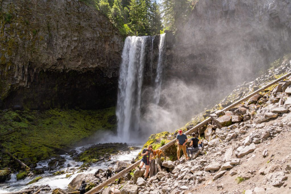
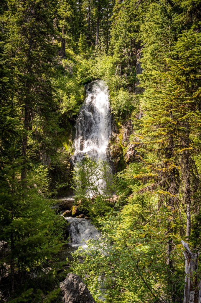
Tamanawas Falls
- Length: 3.4 miles
- Elevation Gain: 600 feet
- Trail Type: Out and Back
- Difficulty: Easy / Moderate
- Dog Friendly: Yes – on a leash
- Pass Required: Northwest Forest Pass
- Distance from Hood River: 25 miles / 30 minutes
- Trailhead Location: Tamanawas Falls Trailhead
This hike blew us away, mostly because we weren’t quite sure what to expect when we embarked on the trail on a sunny July morning. Turns out, Tamanawas Falls is both one of the best waterfalls in Oregon, and one of the best hikes near Hood River!
The parking lot / trailhead for this hike is right along Highway 35 south of Hood River, on the eastern slopes of Mount Hood. It’s a popular trail, and there are NO PARKING signs along the highway on either side of the trailhead (though people routinely ignore them), so you should aim to arrive at the trailhead by 9:00 am at the latest, particularly on weekends.
It’s a pretty easy hike to get to the falls, and the trail follows a creek for the majority of the way. Is it just us, or is there something soothing about hiking with the white noise of a babbling brook accompanying you?
There’s one tricky part that is a short but slick, rocky climb immediately before you get your first glimpse of the falls. Take it slow in both directions, and be careful. Alysha – the most experienced hiker in our group – actually slipped on the rocks here, and walked away with a nasty purple bruise.
The falls themselves are magical, tumbling 100 feet off of a ledge into the creek below. You’re not likely to have it to yourself, but that’s okay. It’s a great payoff, especially considering the relatively low effort to get there.
Read More: How to Hike the Beautiful Tamanawas Falls Trail
Beacon Rock
- Length: 1.5 miles
- Elevation Gain: 600 feet
- Trail Type: Out and Back
- Difficulty: Moderate
- Pass Required: Discover Pass (machines at trailhead)
- DogbFriendly: Yes – on a leash
- Distance from Hood River: 27 miles / 33 minutes
- Trailhead Location: Beacon Rock Trailhead
We have mixed feelings on the hike up the face of Beacon Rock. On the one hand, it’s kind of fun because you’re climbing straight up the face of a huge rock (Beacon Rock) via a set of 52 brilliantly engineered switchbacks that were built over a century ago.
However, it’s a very popular and crowded trail, and it’s not much fun trying to navigate those switchbacks as you’re dodging other hikers going in either direction.
The views on the way up are pretty good, especially to the west as you climb the first section of trail. The view from the top is okay, but it’s partially obscured by trees.
In terms of parking, there are two big lots on either side of the trailhead, right off of Highway 14, which runs along the Washington side of the Gorge. There are flush toilets here, along with a machine to buy a Discover Pass (day or annual) near the bathrooms.
Families with small children: Before you tackle this hike, understand that this is not as “easy” as the mileage makes it seem. It is quite literally straight up the side of the rock, and we saw multiple families with small children who were not having a good time. I’m guessing the parents were second-guessing their decision. Be aware that it’s not an easy stroll!
Read More: Everything You Need to Know to Hike the Beacon Rock Trail
Hamilton Mountain
- Length: 8 miles
- Elevation Gain: 2,200 feet
- Trail Type: Lollipop
- Difficulty: Moderate / Difficult
- Pass Required: Discover Pass (machines at trailhead)
- Dog Friendly: Yes – on a leash
- Distance from Hood River: 27.5 miles / 35 minutes
- Trailhead Location: Hamilton Mountain Trailhead
Hamilton Mountain has everything that makes hiking in the Columbia River Gorge special, all in one hike. Waterfalls, views of the Gorge and surrounding mountain peaks, and a good workout? Check!
It’s on the Washington side of the Gorge in Beacon Rock State Park, and to get to the trailhead you’ll want to cross the bridge from Hood River to Bingen, and follow Highway 14 west along the Washington side of the Gorge. Turn right into Beacon Rock State Park – don’t park in the lots on the side of the road, which add a mile to the hike!
Our favorite way to do this hike is as a lollipop. The reason? You’ll get to take in the views at the Saddle, which are arguably the best views on the entire hike.
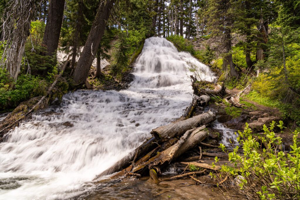
The trail starts with a climb up to Rodney Falls, which is a cool multi-tier waterfall (definitely make the quick detour up to the upper falls and Pool of the Winds, which is unique). Then, you’ll cross Hardy Creek over a picturesque footbridge, passing the base of the falls, and continue climbing to a fork in the trail.
To complete the lollipop, take a right here to tackle it counterclockwise, which means a steep ascent and more gradual descent (better for the knees!).
You’ll hit a steep section of trail with a bunch of tight switchbacks, and then you’ll emerge at Little Hamilton Mountain. It’s not the summit, but it is the best view of the entire hike, we think.
From here, the trail continues up along the ridge, with views of the Gorge that get better with every few hundred feet of climbing. Eventually, you’ll enter the forest and hit some steep switchbacks before you reach the summit.
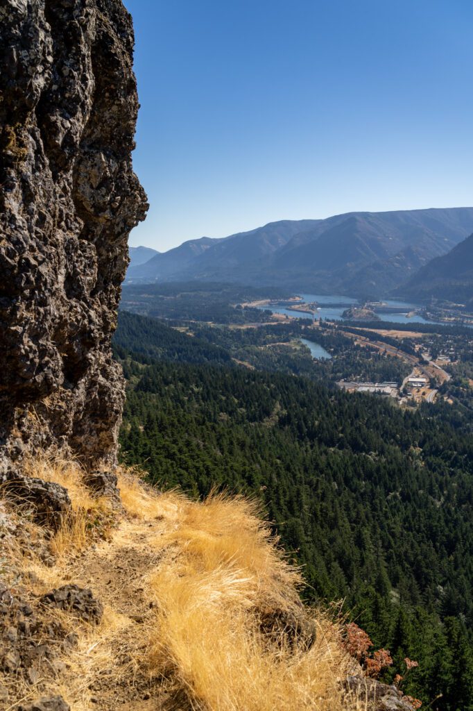
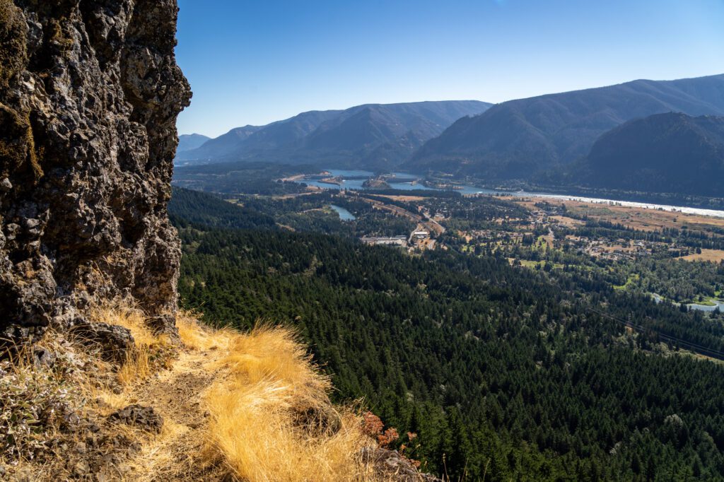
Which is disappointing, because there’s not really much of a view at the summit itself. Instead, head left at the fork and continue for another half mile to the Saddle, which is an impressive view that includes Table Mountain, Mount Adams, and the Bonneville Dam in the Gorge.
Follow the Equestrian Trail down (though we’ve heard Don’s Cutoff is more picturesque) to meet up with the Hardy Trail, which meets up at the fork in the trail where you went right before, concluding the lollipop section.
Read More: Everything You Need to Know to Hike the Stunning Hamilton Mountain Trail
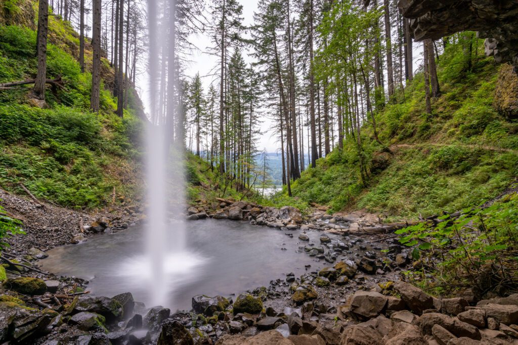
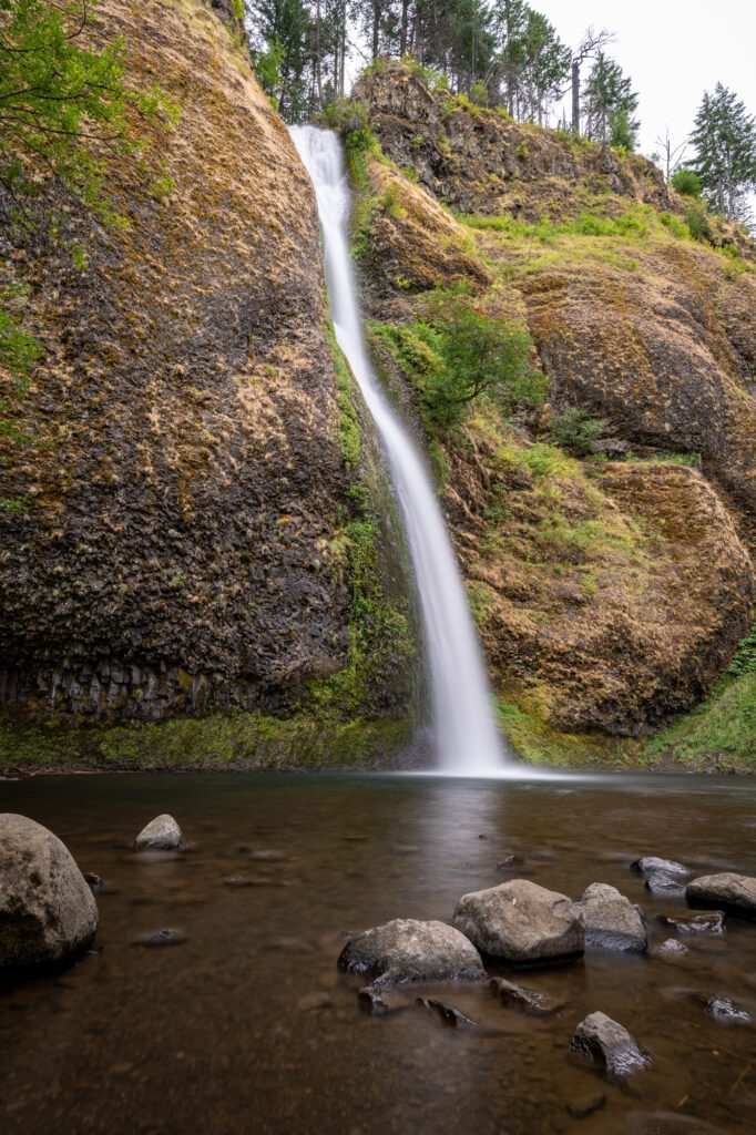
Horsetail Falls to Ponytail Falls
- Length: 0.9 miles
- Elevation Gain: 330 feet
- Trail Type: Out and Back
- Difficulty: Easy
- Pass Required: Northwest Forest Pass (or America the Beautiful Pass)
- Dog Friendly: Yes – on a leash
- Distance from Hood River: 30 miles / 32 minutes
- Trailhead Location: Horsetail Falls Trailhead
In terms of the ratio of reward to effort, it doesn’t get much better than this pair of waterfalls in the Columbia River Gorge. The first is right on the side of the road, so the effort is minimal. The second is a short 0.5 mile climb – it’s surprisingly steep, though – up the hill behind Horsetail Falls.
Horsetail Falls – the first of the two waterfalls here – is so named because of its shape (there’s a sign at the trailhead explaining different styles of waterfalls, which I found interesting). It’s 174 feet high, tumbling off of the high rocky ledge into Horsetail Creek below.
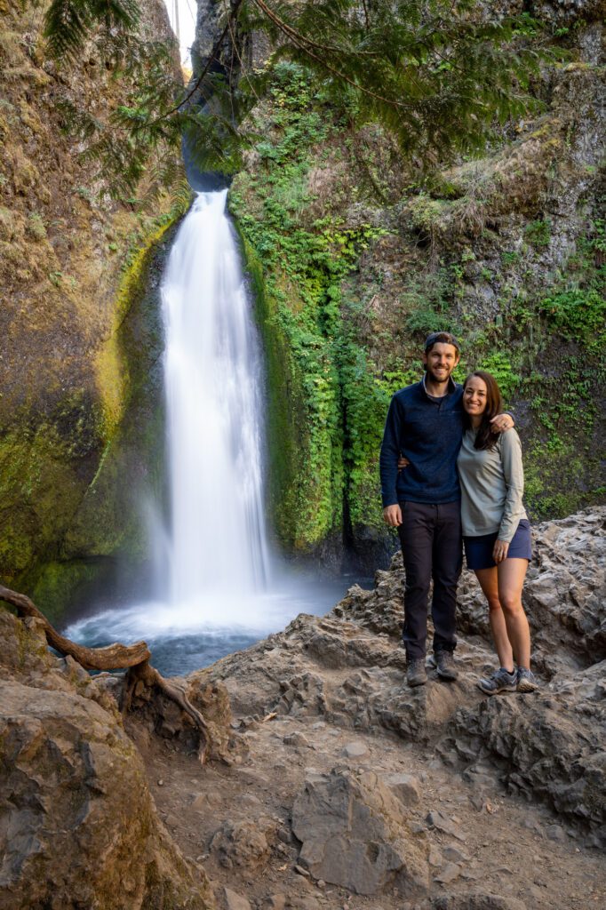
The second of the waterfalls, which is a quick 0.5 mile climb up behind the lower falls, seems to have two names – Ponytail Falls and Upper Horsetail Falls. Either way, this was my favorite between the two because you can walk behind the falls, which is a unique way to experience a waterfall.
You’ll have to tackle a series of steep switchbacks on the way up, but the reward is worth the effort.
The parking lot here is pretty small, with room for about 10-12 cars at the trailhead. However, turnover should be pretty quick, so as long as you’re prepared to wait a few minutes for a spot, you should be able to get one. Or, even better, get an early start (before 9:00 am) and have the falls all to yourself!
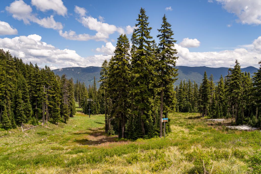
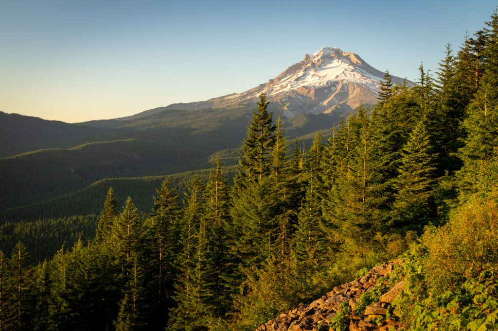
Umbrella and Sahale Falls Loop
- Length: 5 miles
- Elevation Gain: 950 feet
- Trail Type: Loop
- Difficulty: Moderate
- Pass Required: Northwest Forest Pass
- Dog Friendly: Yes – on a leash
- Distance from Hood River: 35 miles / 45 minutes
- Trailhead Location: Umbrella Falls Trailhead
On our most recent trip up to Mount Hood, we did this hike with some friends, and it was a crowd pleaser! From the northern half of the loop – the way back to the trailhead, if you follow our advice – you’re hiking across ski runs, and there are some lovely wildflowers and views from the trail.
First of all, we want to make it super duper clear that you don’t really get a good view of Sahalie Falls on this trail. We don’t even think it’s worth doing the short spur trail down to the “viewpoint.” Instead, after your hike, drive to this bridge, which has an excellent view of Sahalie Falls.

Now that we have that little preamble out of the way, we do think this hike is absolutely worth your time.
The best way to do it, we think, is to park at the main parking lot for Mount Hood Meadows (here on Google Maps), and do the hike counterclockwise, which means a slow descent on the first half of the loop, and a steeper climb through gorgeous alpine meadows at the end.
We prefer to avoid steep descents, which is why we chose to do it that way.
You’ll start at Umbrella Falls, which is a nice waterfall that cascades down a rocky slope.
A bit after the falls, you’ll hit a trail junction, where you’ll turn right and head slightly downhill for a long while. Eventually, you’ll hit the Elk Meadows Trailhead, where there’s a bathroom if you need it, and a quarter mile later you’ll take a left at the trail junction to follow the Umbrella Falls Trail #667 back to the trailhead.
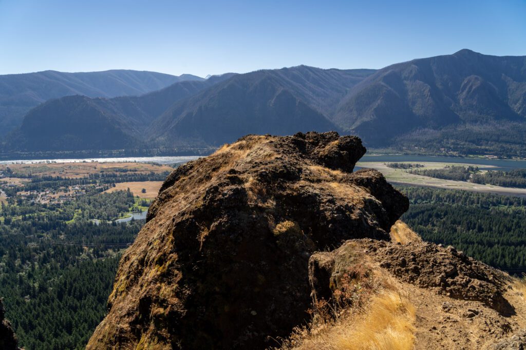
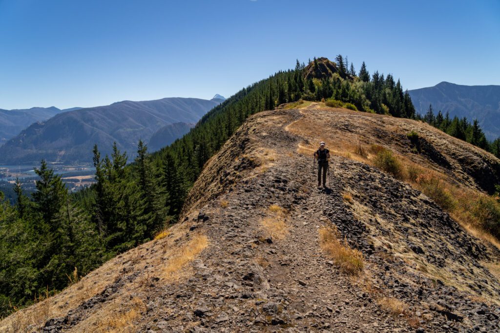
Sleeping Beauty Trail
- Length: 2.4 miles
- Elevation Gain: 1,350 feet
- Trail Type: Out and Back
- Difficulty: Difficult
- Pass Required: Northwest Forest Pass (or America the Beautiful Pass)
- Dog Friendly: Yes – on a leash
- Distance from Hood River: 38 miles / 1 hour 10 minutes
- Trailhead Location: Sleeping Beauty Trailhead
After doing this hike, we decided that if this hike were within 45 minutes of Portland, it would be PACKED (and would definitely be on our list of the best hikes near Portland).
However, the fact that it’s tucked up Highway 141 past Trout Lake (and a long stretch on a dirt forest road) means that it’s far less busy than, say, Tom, Dick, and Harry Mountain at Mount Hood, which has a similar payoff for more effort.
We mentioned the forest road – let’s talk about that really quickly. It’s totally fine for most passenger vehicles, at least when we did it. There is a section right before you reach the trailhead that is full of deep potholes, but 80% of the cars parked at the trailhead when we left were sedans (like a Honda Civic, and someone even brought their BMW, which seems brave).
Basically, it’s doable for almost any car out there, so no need to worry about the road in the summer.
The trail, though, is something you should worry about. Mostly because it is an unrelenting, steep climb. Sure, it’s short. From trailhead to summit, you’re only going to have to cover 1.2 miles. How bad could it be?!
By early September, we’re generally in pretty good hiking shape. We tackled Beacon Rock and Hamilton Mountain the day before, and woke up feeling good. That is, until we started up this trail, and we were sucking wind by mile 0.1.
Basically, you’ll climb through the forest straight uphill – and there are sections of this trail that are STEEP – get a quick break as the trail levels out for a short time, and then make the final, rocky ascent up to the summit.
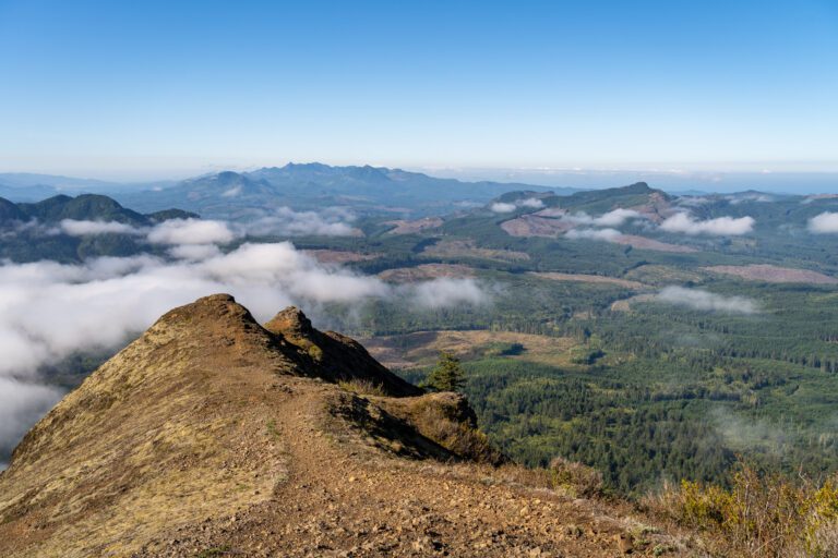
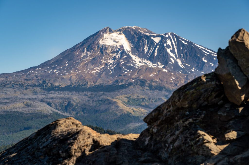
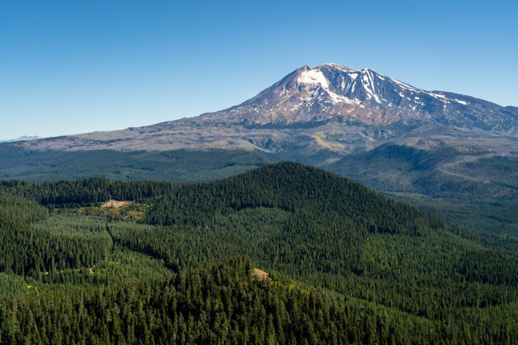
The reward, though, is well worth the effort. 1.2 miles and 1,300 feet of vertical climbing later, you’ll reach the summit. From the rocky outcropping at the top (and on a clear day), you’ll have an unobstructed, close up view of Mount Adams’ southwestern face.
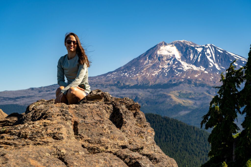
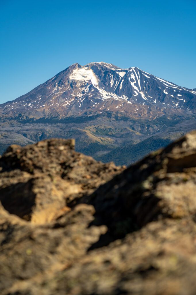

Plus, a great view of Mount Hood to the south, and somewhat obstructed views of Mount St. Helens and Mount Rainier.
It’s pretty easy to see why this was a prime location for a fire lookout in the early 1900’s. Today, all that’s left are the concrete feet and foundation.
Read More: How to Hike the Jaw-Dropping Sleeping Beauty Trail
Tom, Dick, and Harry Mountain
- Length: 9 miles
- Elevation Gain: 1,700 feet
- Trail Type: Out and Back
- Difficulty: Moderate / Difficult
- Pass Required: Northwest Forest Pass (or America the Beautiful Pass)
- Dog Friendly: Yes – on a leash
- Distance from Hood River: 44 miles / 50 minutes
- Trailhead Location: Mirror Lake Trailhead
This hike is amazing, and it’s only about 50 minutes away from the town of Hood River, though it is on the opposite side of Mount Hood. It’s a beautiful drive, and you’ll pass through the lush Hood River Valley (where you should definitely stop on your way back for some wine or cider and fresh fruit) and climb the eastern slopes of Mount Hood on your way to the trailhead.
Because it is so accessible from Portland, this hike is popular. The parking lot is relatively big, with room for 50-60 cars or so, but it does fill up on weekend mornings in the summer. Again, we can’t say this enough – get an EARLY START!
Part of the reason it’s so popular is the fact that it shares a trailhead (and trail) with the shorter, more accessible hike up to Mirror Lake, which is a big destination for families. You’ll make the same journey, and leave 90% of the other people on the trail behind as you ascend from Mirror Lake up to Tom, Dick, and Harry Mountain, which is a series of three peaks on the ridge above the lake.
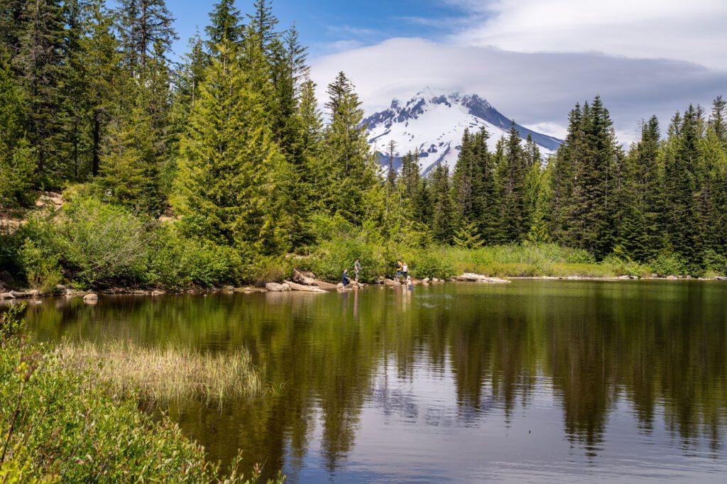
From Mirror Lake, you’ll climb steadily along a ridgeline with some great flowers (rhododendrons!) in the early summer, and some fantastic peek-a-boo views of Mount Hood’s snowy peak across the Sandy River Valley.
The trail turns to the left, and you’ll make your final climb up to the main viewpoint of this hike, which is good enough for most hikers. On a clear day, you’ll have a great view of Mount Hood, with four other peaks in the Cascade Range – St. Helens, Adams, and Rainier to the north, Jefferson to the south – also making an appearance.
The trail continues along the ridge, but it becomes significantly harder to follow from there. There are some great views to be had, but they’ll involve some light route finding and scrambling. On our first time up this trail, we went to the second peak, and thought that was good enough for us.
Read More: Everything You Need to Know to Hike the Tom, Dick, and Harry Mountain Trail near Mount Hood
Ramona Falls

- Length: 7.1 miles
- Elevation Gain: 1,000 feet
- Trail Type: Lollipop
- Difficulty: Easy / Moderate
- Pass Required: Northwest Forest Pass
- Dog Friendly: Yes – on a leash
- Distance from Hood River: 61 miles / 1 hour 20 minutes
- Trailhead Location: Ramona Falls Trailhead
Another fantastic waterfall, though it’s a little further from Hood River than some of the previous ones on this list. We’re really stretching the definition of “near Hood River” here, but we think this hike is worth the extra driving.
The hike itself is really nothing particularly special, but the payoff is magical.
Getting to the trailhead involves a slightly bumpy dirt road – that is closed from December to April – which was totally passable by our minivan (which means it’s fine for most cars).
The trickiest part of this hike is the river crossing. To get to the falls, you’ll need to cross the Sandy River, which can be rip-roaring in the spring and early summer with all of the snowmelt running off into it. The Forest Service used to install a seasonal bridge here, but after one too many washouts, they’ve done away with that idea.
Now, we’re on our own to get across the river. There are a bunch of logs that you can scoot across on your butt. We do think this would be challenging to do with a dog, especially earlier in the season, which is something to keep in mind if you’re traveling with a furry friend.
After the river crossing, it’s an easy loop to the falls. We’d tackle the loop counterclockwise, which has you going up the less interesting part of the trail – a part of the Pacific Crest Trail – and returning through the dense forest on the Ramona Falls Trail.
The waterfall is only 120 feet tall – which is still very tall, to be clear – but the more impressive part of this particular waterfall is the way the water cascades down the moss-laden rocks. It feels like it’s nearly as wide as it is tall, which is a unique type of waterfall that you don’t see very often.
P.S. If you’re coming from Hood River, you should absolutely ignore Google Maps’ suggestion to take forest roads around the north side of Mount Hood. That road is usually not great. Instead, take Highway 35 south out of Hood River, and connect with Highway 26 West towards Government Camp. Much more pleasant! We know because we tried that route and had to turn around because the road was completely washed out.
Even More Great Hood River Hikes
Here are five more hiking trails near Hood River to add to your list. They’re all on our list, but we haven’t quite made it out to them just yet!
Spirit Falls: This trail gets closed in the summer to avoid risk of wildfires, which is why we haven’t done it yet. It’s a short, steep hike up to a beautiful waterfall that turns a brilliant shade of blue in the sunlight. More information here.
Panther Creek Falls: Another great waterfall north of the town of Carson off of Wind River Highway (near Falls Creek, above). The waterfall is basically visible from the parking lot. It’s another dirt forest road situation, but should be fine for most cars. More information here.
Falls Creek Falls: Probably the coolest waterfall on the Washington side of the Gorge, this is a bit of a trek to get to, involving a slightly bumpy forest road. We’d do the short version of the hike that takes you to the base of the falls. More information here.
Tom McCall Point: We decided against this hike in the summer heat, and we’ll come back in the spring when it’s both cooler and full of wildflowers. It’s not an easy hike, but we’re drooling over the pictures of the Gorge from the plateau. More information here.
YOU MIGHT ALSO LIKE
- HOOD RIVER: What to Do in Hood River: 12 of the Best Things to Do Near Hood River
- COLUMBIA RIVER GORGE: The 16 Best Hikes in the Columbia River Gorge According to 2 Locals
- COLUMBIA RIVER GORGE: How to Hike the Hamilton Mountain Trail in the Gorge
- COLUMBIA RIVER GORGE: Hiking the Gorgeous Wahclella Falls Trail in the Gorge
- PORTLAND: How to Spend One Amazing Day in Portland, Oregon
- PORTLAND: A Perfect Weekend Itinerary for Portland, Oregon
- PORTLAND: 21 Incredible Hikes near Portland: A Complete Guide to Hiking in Portland
- PORTLAND: 7 Amazing Day Trips from Portland, Oregon