How to Hike the Spectacular Duck Pass Trail in Mammoth Lakes
A never-ending string of blue-green, crystal-clear alpine lakes. A grueling climb to 11,000 feet above sea level. Amazing views over the lakes and surrounding mountainous landscapes from the top of Duck Pass. Plenty of places to pull over and admire the sheer natural beauty of the Eastern Sierra. This hike has everything you’re looking for in a high-altitude summer adventure in the mountains.
Is the Duck Pass Trail the perfect summer hike in the Eastern Sierra? We think it’s a top contender, at the very least. Although there are so many amazing hikes in Mammoth and the surrounding area that it’s nearly impossible to choose just one.
In this guide, we’ll give you all the information you need to know to hike to the top of Duck Pass and beyond to Duck Lake confidently, comfortably, and safely. We’ll start with practical tips and things to know, then give you a detailed trail description (with plenty of pictures!) so you know exactly what to expect on your hike.
Disclaimer: Some of the links below are affiliate links, which means that if you click on one and purchase something, we make a small portion of the sale at no additional cost to you. It goes without saying that we would never recommend something we wouldn’t use or do ourselves.
Trail Overview
Before we get into the other details you need to know to hike up to Duck Pass, here is an overview of the trail.
- Distance: 10 miles
- Elevation Gain: 1,700 feet
- Trail Type: Out and Back
- Trailhead Location: Duck Pass Trailhead (Coldwater Creek Campground)
- Highlights: A string of high-elevation alpine lakes perfect for swimming and fishing, and outstanding views over the surrounding valley from the top of Duck Pass.
- Starting Altitude: 9,100 feet
- Highest Altitude Reached: 10,800 feet
- Dogs allowed? Yes
Getting to the Trailhead
The trailhead for this hike is at the southeast corner of Coldwater Campground just outside of Mammoth Lakes.
To get there from the town of Mammoth, head southwest out of town up Lake Mary Road. Climb past Twin Lakes until you reach a left turn for Coldwater Campground. Pass all the way through the campground to the far end, where you’ll find two different trailheads. The first is Emerald Lake, and the second is the trailhead for Duck Pass, which is the one you want here.
You can also take the trolley from the town of Mammoth Lakes – you can take the Lakes Basin trolley, which will get you from the village up to Lake Mary Marina, but will add a significant distance to your hike (1.5 miles or so).
There isn’t a parking or entry fee, but there is no parking allowed in the campground if the trailhead is full, which means you’re going to want to get here early on a summer weekend to avoid adding an extra mile or so each way.
If you happen to be camping at Coldwater Campground (like we did), the trailhead is walkable from the campground, which is ideal because you don’t have to worry about parking.
There are bathrooms, a bear box, and water at the trailhead (you can get the water from spigots in the campground).
Tips for Hiking the Duck Pass Trail to Duck Lake
Here are some practical tips and things to know before you hit the trail.
The altitude is no joke. This hike starts at a hair under 9,000 feet above sea level, and climbs to just under 11,000 feet. Which is high. Really high. Make sure you’ve had at least 24 hours in Mammoth (more would be better) to acclimate to the altitude before attempting this hike. It will feel harder than it should. Take it slow, drink plenty of water, and spend some time relaxing at one of the many alpine lakes along the way. Know the signs of altitude sickness, and be prepared to turn around if you or someone in your group is not feeling well.
The sun is also no joke. It gets hot in the summer in Mammoth, despite the elevation. When we did this hike, it was at least 90 degrees on our way down. And that was at about 11am. The hardest part of the hike – the climb up to Duck Pass – is fully exposed after 10am in the summer. It will be hot, so wear sun protection like sunscreen, polarized sunglasses, and a sun hat, and drink plenty of water. Bring at least 2L of water per person. We each carry two of these collapsible Platypus water bottles, or a 3L Gregory Hydration reservoir. You could also bring a water filtration system to filter water along the way. We use the Platypus Gravity Filter when we’re backpacking and would highly, highly recommend it.
Get an early start. I feel like I say this about every hike, but getting an early start is particularly important here for two reasons. First, the parking situation. The lot is big, but it gets full on summer weekends. If you don’t get a spot, you will have to park a mile away from the trailhead and walk in, which adds two miles to your hike. Second is Duck Pass. Like I mentioned above, the pass will be in full sun by about 10am. We were roasting alive coming DOWN the pass in the full sun, and the people heading up didn’t look like they were having the best time. Better to do that climb in the shade, like we did.
Afternoon thunderstorms in the summer. Every single day we were in the Eastern Sierra, there were thunderstorms in the afternoon between 2pm and 5pm (give or take an hour on either end). If there’s one place you don’t want to be during that thunderstorm, it’s up on Duck Pass. Another reason to get an early start, and you probably want to bring a rain jacket and waterproof pants (I have this rain jacket – women’s version here), just in case.
Wear sturdy footwear. The climb up to Duck Pass is all loose rocks. There’s a lot of potential for slipping or rolling an ankle, so you’ll want to be prepared with a pair of sturdy hiking boots with good traction and solid ankle support. Alysha has the Columbia Newton Ridge boots, which we think are an outstanding budget hiking boot, particularly at the sub-$100 price point.
Mosquitoes. Like most alpine lakes in July and August, you’re going to encounter mosquitoes during the summer months. We must have hit this trail at exactly the point where all the baby mosquitoes hatched, because every time we stopped for more than thirty seconds, we were swarmed by them. As long as you keep moving, they won’t bother you too much, but bring some bug spray for the times you stop and rest or be prepared to be eaten alive.
The Hike: A Complete Trail Guide
Now, onto the hike itself. For organizational purposes, we’re going to split this trail into four parts:
- The Initial Climb to Skelton Lake
- Skelton Lake to Barney Lake
- Climbing Duck Pass
- The Hike Down to Duck Lake
Below, you’ll find a play-by-play of our experience on the hike to help you figure out what to expect along the way.
The Initial Climb to Skelton Lake
Distance: 1.4 miles
Elevation Gain: 600 feet
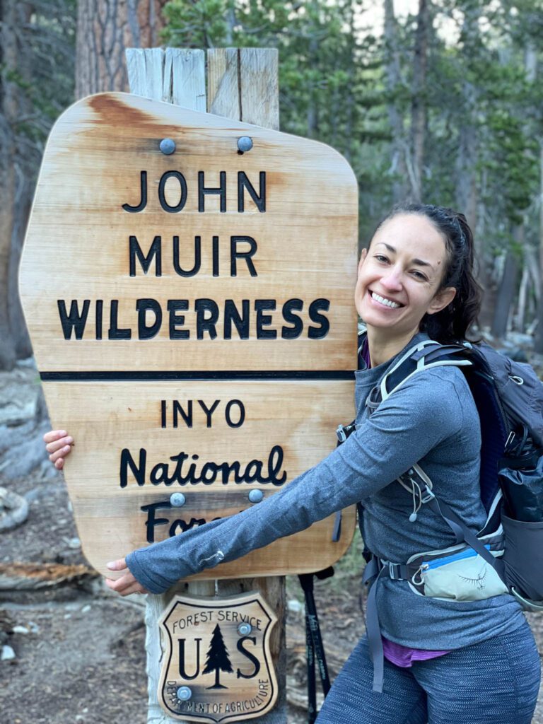
From the minute you enter the forest at the trailhead, the trail starts with a steep ascent. Initially, it climbs without switchbacks, and you’ll pass the sign that tells you you’ve entered the John Muir Wilderness at about 0.2 miles.
At 0.8 miles (and more than 500 feet of elevation gained!) there’s a short offshoot trail to Arrowhead Lake, which is shaped like… an arrowhead. Surprise!
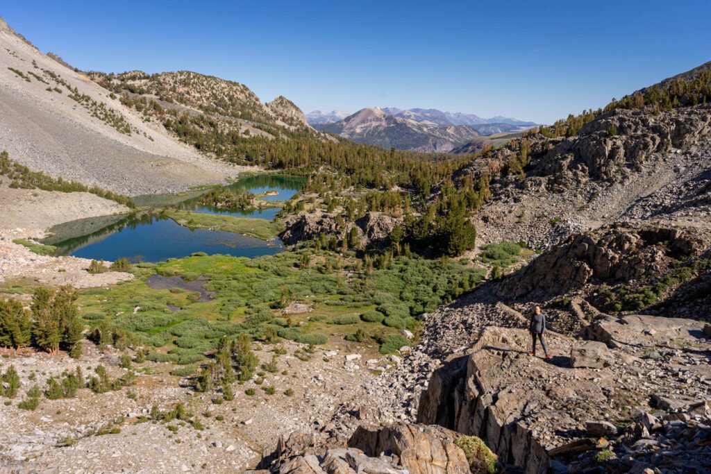
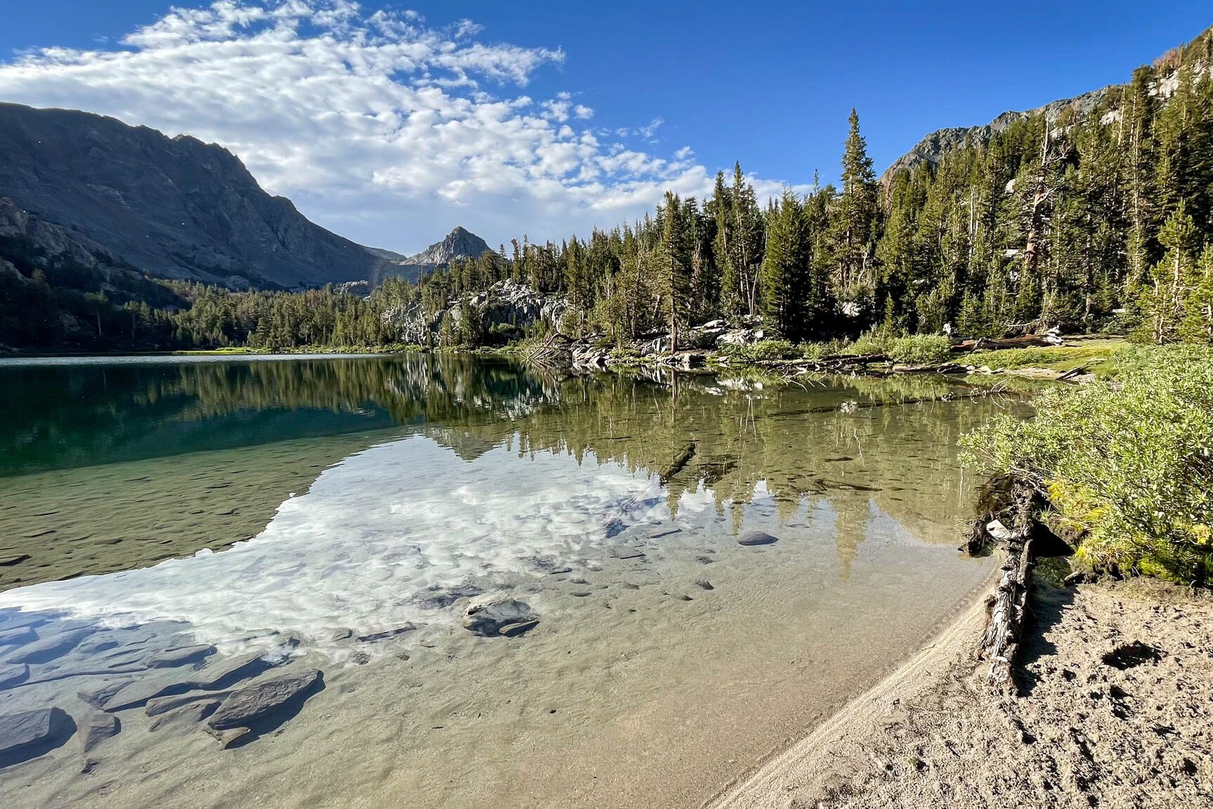
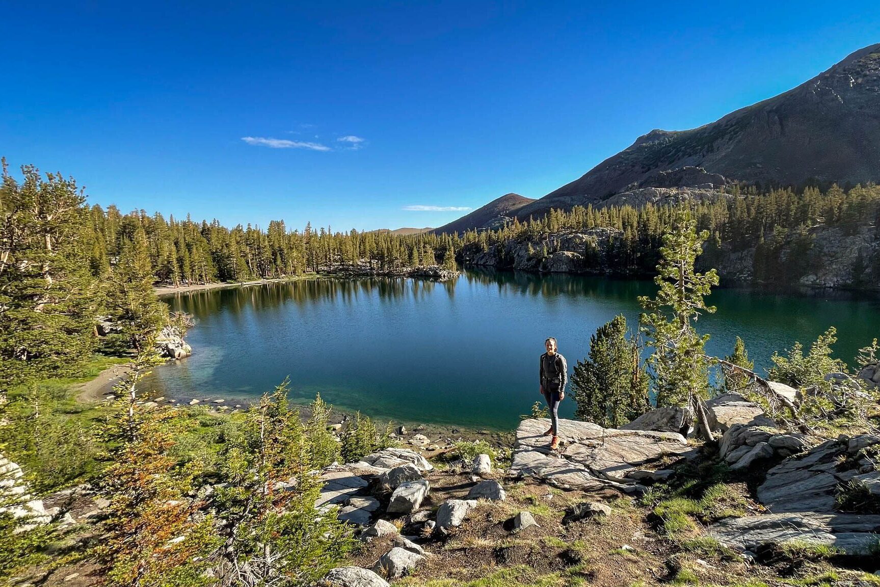
From here, the trail actually levels out a little bit, and becomes a much more pleasant hike in the woods. You’ll gradually wind your way to Skelton Lake at 1.5 miles in, which makes for a great stopping point. Skelton Lake is a pretty big lake, and there were plenty of people lining the shore with their fishing poles and picnic lunches.
Skelton Lake to Barney Lake
Distance: 1.4 mile
Elevation Gain: 400 feet
The trail hugs the southeastern shore of Skelton Lake, climbing gradually as you admire the views to your left over the lake below. There are some good spots just off the trail to take some pictures with the multicolored hills in the background.
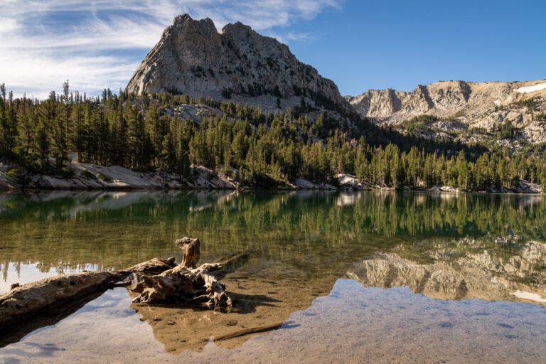
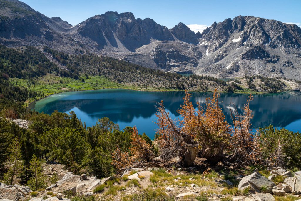
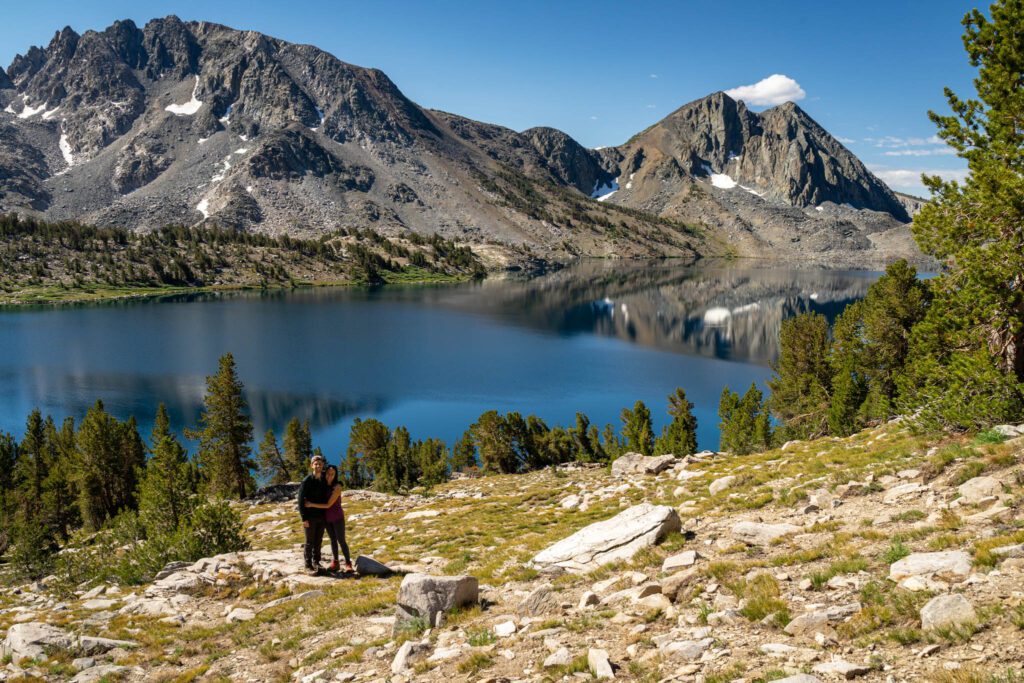
At 2.3 miles in (and 1,200 feet gained), you’ll have a short, steep climb that leaves you at the top of a ridge overlooking Barney Lake below, which was actually our favorite lake along the hike. Wondering where you’re going? Duck Pass is at 10 or 11 o’clock if you’re looking out over Barney Lake from here.
There are great campsites for backpackers at the far end of the lake closest to Duck Pass (permit required) that would make a good overnight base for climbing up and over the pass.
You’ll cross a creek with a makeshift wooden bridge, and off to the left is Red Lake, a smaller alpine lake that was our chosen lunch spot on our way back down. That’s five alpine lakes so far, but who’s counting?

Head along the trail on the left side of the lake to reach the base of Duck Pass.
Climbing Duck Pass
Distance: 0.6 miles
Elevation Gain: 600 feet
Compared to climbing Aasgard Pass when we were hiking the Enchantments, which is essentially a full-on scramble with full backpacking packs that climbs nearly 2,000 feet in less than a mile with no marked trail, this was a piece of cake.
Taken on its own, this climb is tough. Easily the hardest part of the hike. Take a break at the bottom, eat a snack, drink some water, and steel your resolve for the climb ahead. The reward, both in terms of the view back over Barney Lake and Duck Lake on the other side of the pass, are well worth the effort.
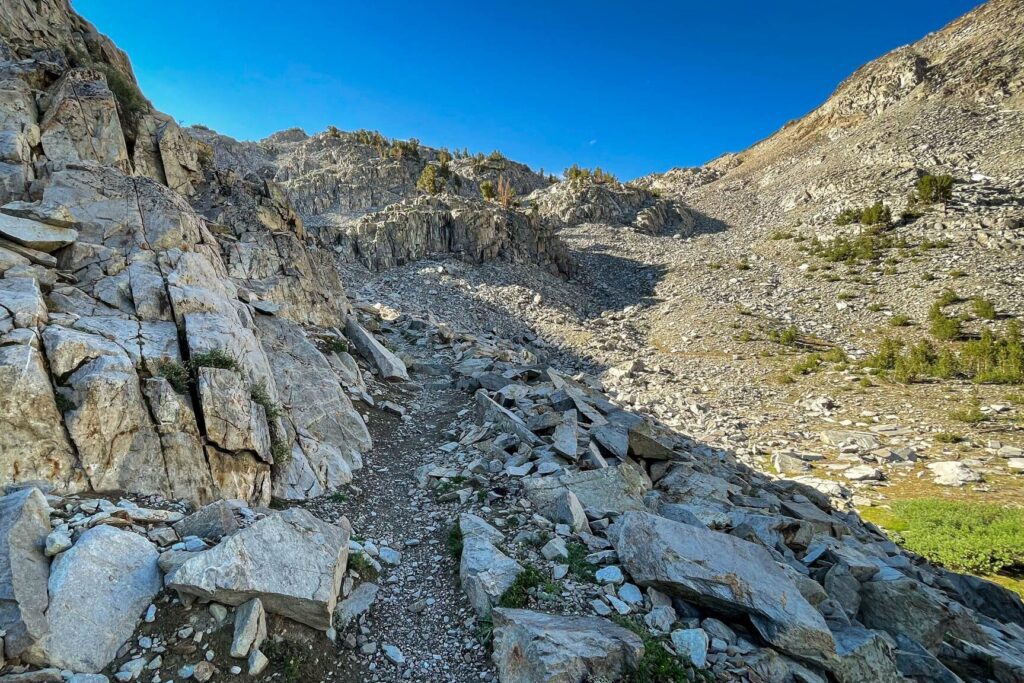
The base of Duck Pass is at about 2.7 miles in. The top of the pass is at 3.4 miles, so you only have to go ¾ of a mile to get there. But over that distance, you’re climbing 600 feet. That’s 800 feet of elevation gain per mile. Anything over 600 is firmly in the “hard” category in our book.
The trail turns to loose rock and gravel here, which is why we recommended sturdy hiking boots above. Trekking poles are also going to be a knee-saver on the way down, and you won’t catch us on the trail without them at this point.
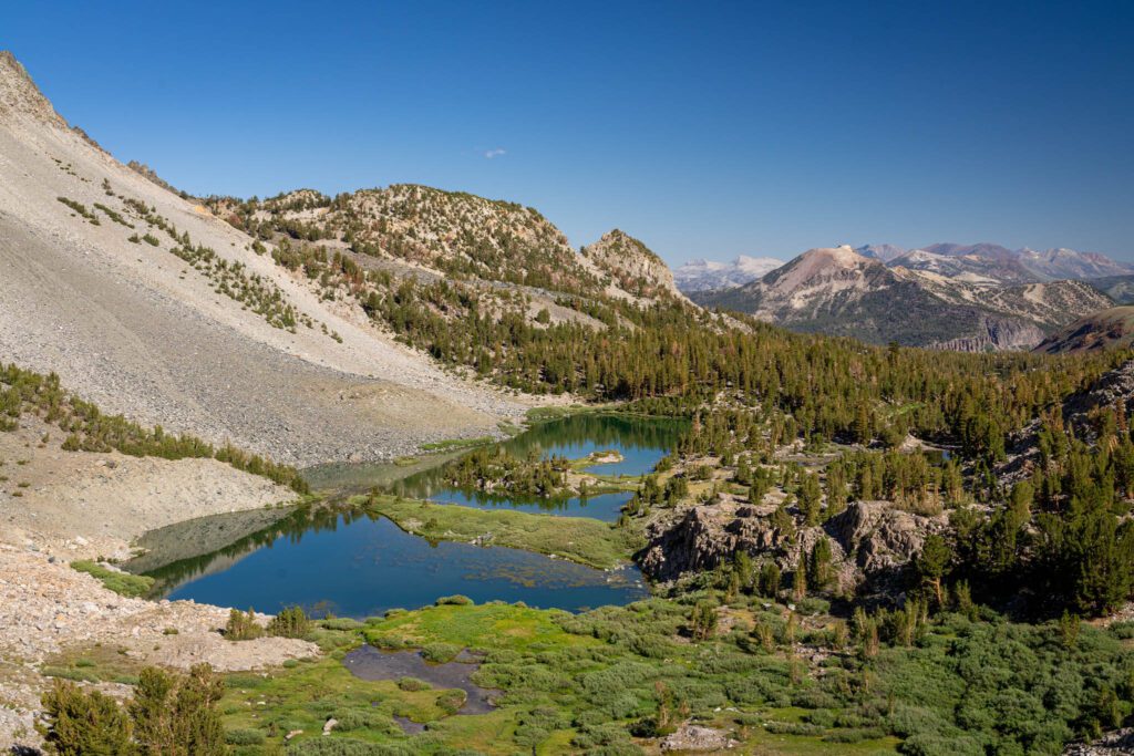
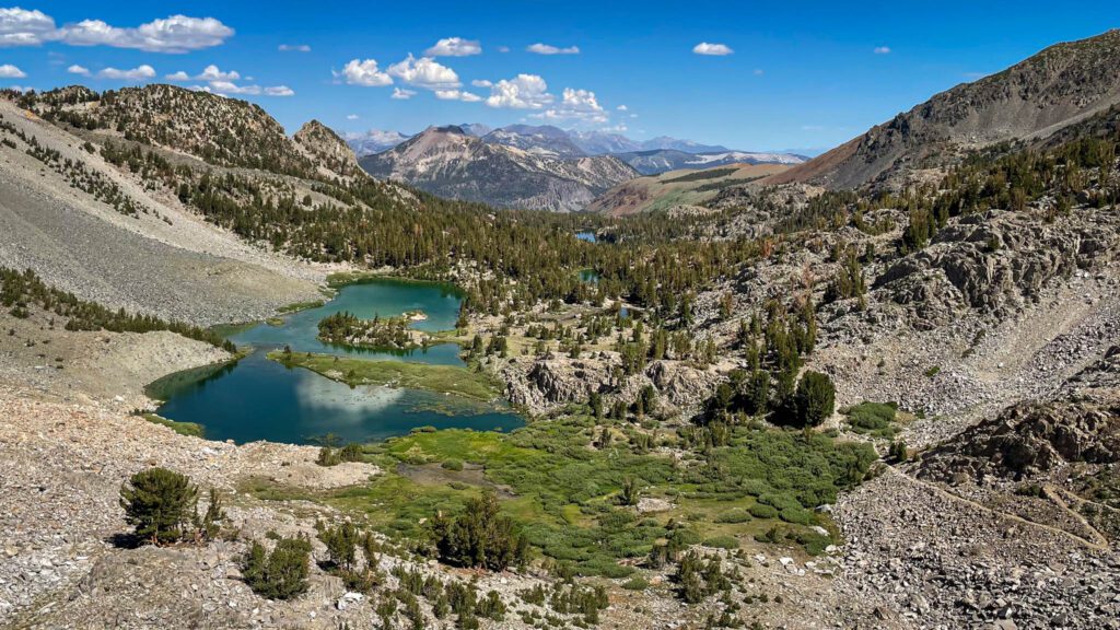
About halfway up, the views back over Barney Lake start to turn spectacular. You’ll have a view of the blue-green waters of the lake itself, plus the backdrop of towering mountains in the background. This view alone puts it on our list of the best hikes in California.
At the top, high-five your hiking buddy and start the descent down to Duck Lake. Just remember, what goes down must come back up at some point. But the good news is after that quick climb back up, it’s allllll downhill from there.
The Hike Down to Duck Lake
Distance: 1.1 miles
Elevation Gain: 300 feet (on the way back)
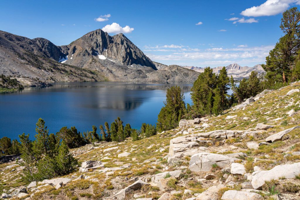
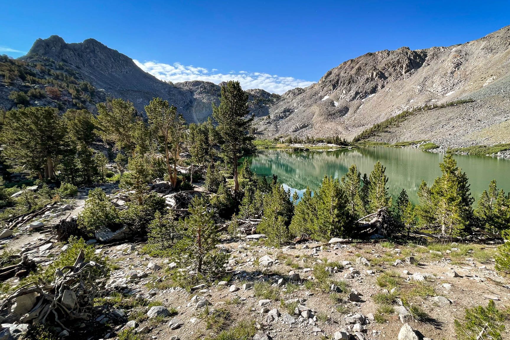
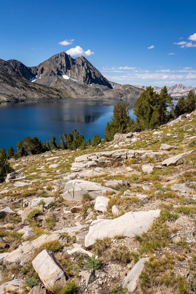
From the top of the pass, take a left and head down the rocky path towards the northeast shore of Duck Lake. You’ll hike around the edge of the lake and make your way to nearby Pika Lake, ANOTHER alpine lake (we’re at seven now, if you’re keeping track).
There are some great spots along the way to stop and take a break with fantastic views of Duck Lake. Keep in mind that you’re up above 10,000 feet here – when I stood up after relaxing for a bit, I was a little light headed and dizzy.
Pika Lake isn’t particularly impressive, and we think the best part of this stretch is actually the views of Duck Lake from above. If you’re not up for the extra mile or two, walk a short ways from the trail junction at the top of the pass, plop down, and enjoy the view while you catch up on snacks and water before you make the trek back down.
On the way down, follow the trail the way you came. It feels a lot shorter, and the views back towards Barney Lake from the top of the pass are right in front of you as you’re descending.

When to Hike to Duck Lake
This is definitely a hike for the summer and early fall. At over 10,000 feet high, Duck Pass generally has snow from mid-October to June (though it depends on the year, the snowpack, and the weather). In the summer, the sky is blue and
HIGHWAY 395: How to Plan an Epic Highway 395 Road Trip (L.A. to Lake Tahoe)
MAMMOTH LAKES: What to Do in Mammoth Lakes in the Summer
MAMMOTH LAKES: 9 Outrageously Beautiful Hikes in Mammoth Lakes
LAKE TAHOE: The Best Things to Do in Lake Tahoe in the Summer
LAKE TAHOE: 15 Stunning Hikes Near Lake Tahoe
LAKE TAHOE: How to Spend 3 Amazing Days in Lake Tahoe
DEATH VALLEY: How to Plan an Amazing Death Valley Itinerary
YOSEMITE: A Picture-Perfect 2 Day Yosemite Itinerary

Plan an Unforgettable California Adventure
Heading to California? We’ve got all sorts of super detailed, in-depth California travel guides written by locals to help you plan an amazing trip.
- San Francisco: We’ve got a guide to spending 3 days in SF, one day in San Francisco for planning a shorter trip, and a complete guide to finding the perfect place to stay in San Francisco. We also have guides to 14 perfect weekend getaways from San Francisco and the best day trips in the Bay Area. Oh, we almost forgot, here are the 15 best hikes near San Francisco, written by two Bay Area locals.
- Los Angeles: Read our perfect 2 Day L.A. itinerary, our guide to spending one amazing day in L.A. (with two versions!), and a guide to helping you figure out where to stay.
- San Diego: Learn how to spend a day in San Diego, a weekend in San Diego, and where you should stay.
- Lake Tahoe: Plan the perfect summertime adventure with our 3 day Tahoe itinerary, guide to the best hikes, and our guide to the best things to do in Tahoe.
- Santa Barbara: We have a guide to planning a weekend in Santa Barbara, and a guide to a day trip to Santa Barbara from Los Angeles if you’re pressed for time.
- Mammoth Lakes: To plan a perfect getaway in the Eastern Sierra, read our guide to the best things to do in Mammoth Lakes in the summer. Plus, our guide to the best hikes in Mammoth, featuring the epic climb to the top of Duck Pass.
- Big Sur: Plan the perfect weekend away with our complete Big Sur itinerary.
- Yosemite National Park: Plan an amazing trip with our guide to planning an amazing Yosemite itinerary, and our guide to choosing where to stay at Yosemite.
- Joshua Tree National Park: Plan the perfect trip with our perfect weekend itinerary (or a day trip, if you have less time), a guide to the best hikes, and some cool places to stay in Joshua Tree.
- Death Valley National Park: We have a SUPER detailed guide to planning the perfect Death Valley itinerary, and a guide to the best hikes in Death Valley National Park.
- California Road Trips: See the best of the Pacific Coast Highway on our San Francisco to San Diego road trip, or make the trip up Highway from on a Los Angeles to SanFrancisco road trip. If you’re more into mountains than beaches, a Highway 395 road trip from Los Angeles to Lake Tahoe might be more your speed.