9 Outrageously Beautiful Hikes in Mammoth Lakes
Nestled in the Eastern Sierra Nevada Mountains and surrounded by the Inyo National Forest and the Ansel Adam and John Muir Wilderness areas, the area in and around Mammoth Lakes is home to astounding natural beauty, and more than 300 miles of hiking trails. Mammoth Lakes hiking is one of the best ways to appreciate the dramatic landscape of jagged peaks, pristine alpine lakes, wildflower meadows, and lush forests.
This list of the best hikes in Mammoth Lakes will help you narrow down your many options. All of these hikes can be completed in one day, and nearly all of them offer epic views, along with one or a few beautiful alpine lakes along the way.
I live in Lake Tahoe, just two hours away from Mammoth Lakes. I’ve been a frequent visitor over the years to enjoy the many outdoor activities available around Mammoth Lakes, including hiking many of the trails.
Disclaimer: Some of the links in this post, like hotel and vacation rental links, are affiliate links, meaning at no additional cost to you we make a little bit of money if you click through and book. That being said, we would absolutely never recommend something to you that we don’t stand behind 100%.
When to Go Hiking in Mammoth Lakes
The hiking season in Mammoth Lakes typically runs from late spring (May) to fall (October), though it will depend quite a bit on the weather and snowpack from the previous winter.
Summer is probably the best time to plan a hiking trip to Mammoth Lakes. You can expect plenty of sunshine and there are tons of beautiful alpine lakes to cool off in.
Nearly all area trails and campgrounds should be open, especially by July and August. Summer is also the peak season, meaning larger crowds and higher prices. Book your accommodations well in advance, and arrive early if you are camping at a FCFS campground.
September and October are great months for hiking, especially if you want to escape the crowds.
The weather is still quite pleasant and ideal for hiking. The area is also home to many aspens, and fantastic fall colors. Early October is usually your best bet for leaf peeping, though the season can run from late September to late October, depending on the elevation.
Check the Mono County fall colors website for the latest on timing. Most campgrounds are open through September or October, depending on the weather.
May and June are good times to see rushing rivers, full waterfalls, and wildflowers in bloom. However, snow on the ground and on trails is a real possibility, especially at higher elevations.
Depending on the season, you might still be able to ski and snowboard at Mammoth Mountain during this time. If you’re planning on an early hiking season trip, it’s best to check conditions before finalizing plans and setting out on the trails.
The Mammoth Ranger District of the Inyo National Forest and the Mammoth Lakes Welcome Center are both good places to check on various conditions.
Things to Know Before Tackling These Mammoth Hikes
Here are a few tips to help you prepare for hiking in Mammoth Lakes.
Be prepared for the altitude: Mammoth Lakes sits at 7,881 feet and many hikes start at above 8,000 feet, with a few starting above 9,000 feet. If you’re coming from sea level, give yourself enough time to acclimatize before attempting these hikes, especially the more difficult ones. Take your time while hiking, have sufficient sun protection, and make sure to stay well hydrated.
Sun Exposure: Mammoth Lakes gets on average 300 days of sunshine a year. Plus the sun is stronger at higher elevation. Some trails have limited to no shade, which we have tried to indicate. Make sure you wear sun protection, like a hat, sunscreen, and polarized sunglasses.
What to Bring: Wear sturdy shoes with good support and traction. Hiking poles can be helpful for certain hikes. You’ll probably want your swimsuit as there are a lot of lakes in the area, and most of the hikes pass by at least one if not several. Insect repellent is also a good idea as mosquitos can be an issue at certain times of the year despite the high elevation. Download offline trail maps (or carry physical maps) as cell reception is very limited.
Bring LOTS of water: Bring more water than you think you need – at least 2 liters per person. It’s always a good idea to bring a water filter for when you do find a water source during your hike. Also be sure to pack enough snacks to keep you going.
Be prepared for unpredictable weather: It can get hot in the summer, even at high elevations. But bring layers just in case. Afternoon thunderstorms can be common over the summer, so you’ll want to pack a rain jacket, and avoid being in exposed areas during those times.
Get an Early Start: Many of the hikes are very popular, so you’ll want to get an early start to secure a parking spot. The shuttle is an option but can add distance to your hike. Plus an early start will help avoid exposure during the hottest part of the day.
Permits: Most day hikes do not require permits, with the exception of the trails that start in the Red Meadow/Devils Postpile area, as you need to take paid shuttle bus in from the Mammoth Mountain Adventure Center (unless you’re camping in the immediate area, qualify for exceptions, or are arriving before 7:00 am or 7:00 pm, in which case you still need to pay a transportation fee).
Wilderness permits are required for overnight hikes in the John Muir and Ansel Adams Wilderness areas (which cover many of these hikes), and can be picked up from the Mammoth Lakes Visitor Center or reserved online at Recreation.gov.
The 9 Best Hikes in Mammoth Lakes: A Complete Guide
These are nine of the best hikes in Mammoth Lakes, organized from the easiest to the most difficult.
They can all be done in one day, though some (like Minaret Lake) can also be completed as an overnight hike (in which case, a permit is required).
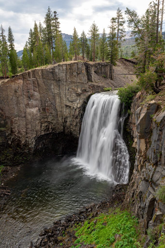
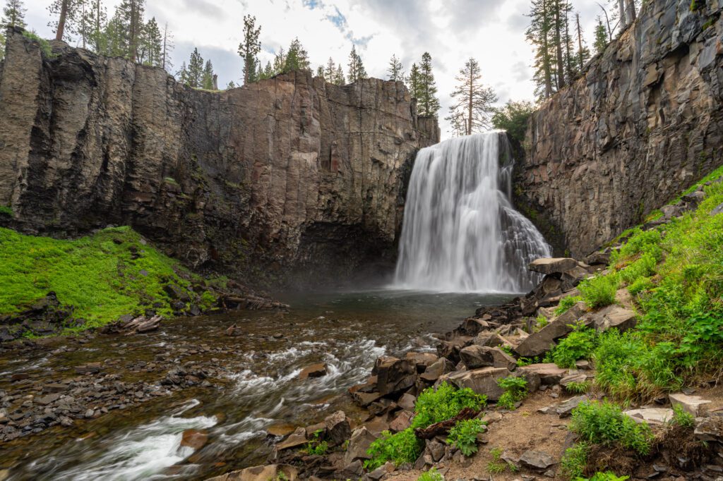
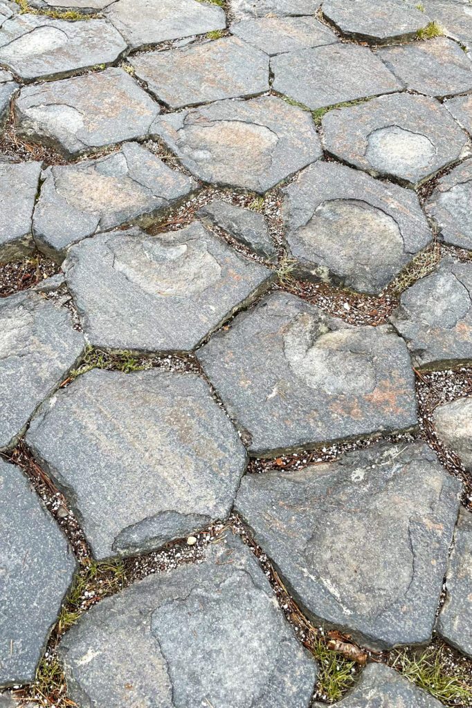
Devils Postpile and Rainbow Falls
- Length: 3-5 miles
- Elevation Gain: 500 feet
- Trail Type: Out and Back
- Difficulty: Easy
- Dog-Friendly? Yes
- Pass Required: Yes (shuttle)
- Trailhead Location: Devils Postpile Ranger Station or Rainbow Falls Trailhead near Red Meadows Resort
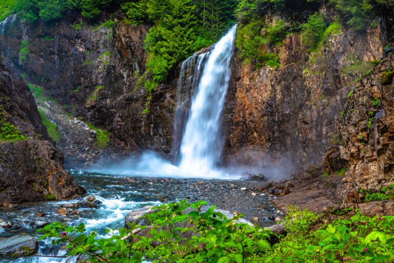
A geologic wonder, Devils Postpile National Monument was formed by volcanic forces around 100,000 years ago, and features unusual hexagonal basalt columns more than 60 feet tall, while the 101-foot Rainbow Falls is the highest falls on the Middle Fork of the San Joaquin River and named for the rainbows that often appear. An easy hike connects both wonders.
It’s an easy 0.5-mile walk from the Devils Postpile Ranger Station to the basalt columns.
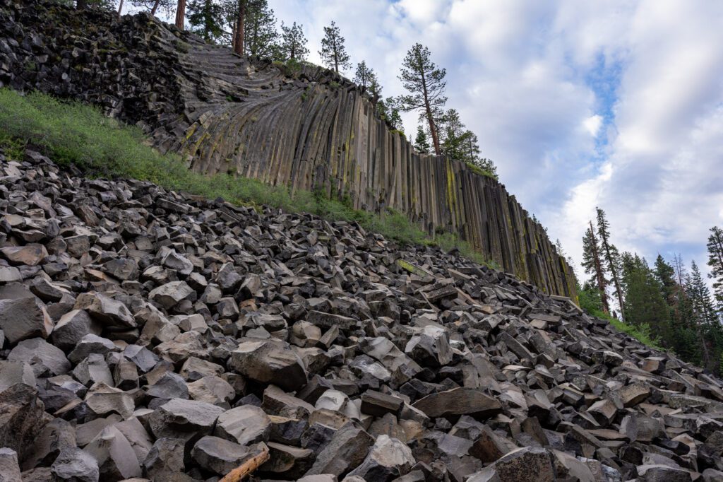
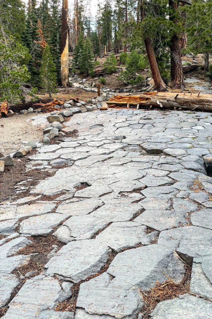
There’s a short but steep trail up to the top of the columns that will give you a better view of the formations from above. Afterwards, continue for 2 more miles to reach Rainbow Falls.
Late morning or midday are usually the best times for seeing the namesake rainbows.
There are two overlooks from above, but you can hike down to the base of the falls for a different perspective. You can also continue another half mile along the trail to another small waterfall, the Lower Falls.
Return the way you came to the ranger station, or cross over the San Joaquin River and return along a section of the Pacific Crest Trail, which will be a less crowded option.
Alternatively, go half a mile further to the Rainbow Falls Trailhead near the Red Meadows Resort, where there is another shuttle bus stop. You can also start the hike from here instead of the ranger station.
Devils Postpile National Monument is only open over the summer. Opening dates are weather dependent, though typically from mid June to mid October, while the shuttle usually runs through mid September.
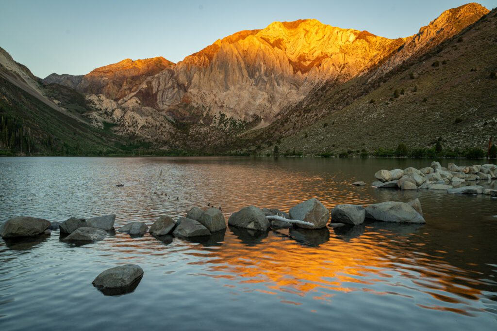
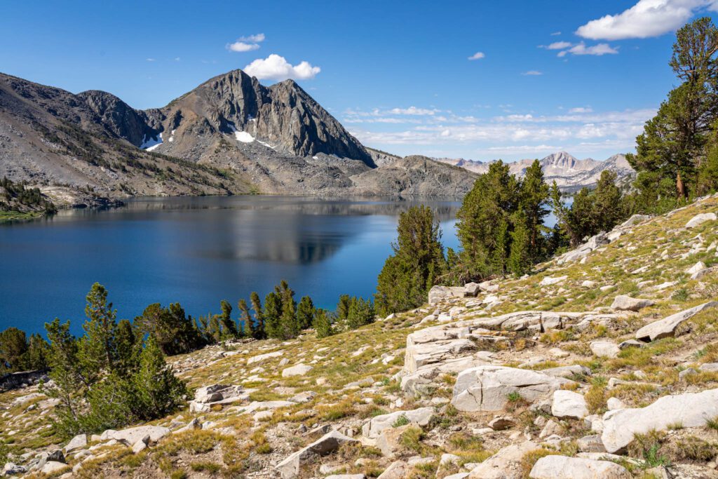
The Convict Lake Loop
- Length: 3 miles
- Elevation Gain: 200 feet
- Trail Type: Loop
- Difficulty: Easy
- Dog-Friendly? Yes
- Pass Required: None
- Trailhead Location
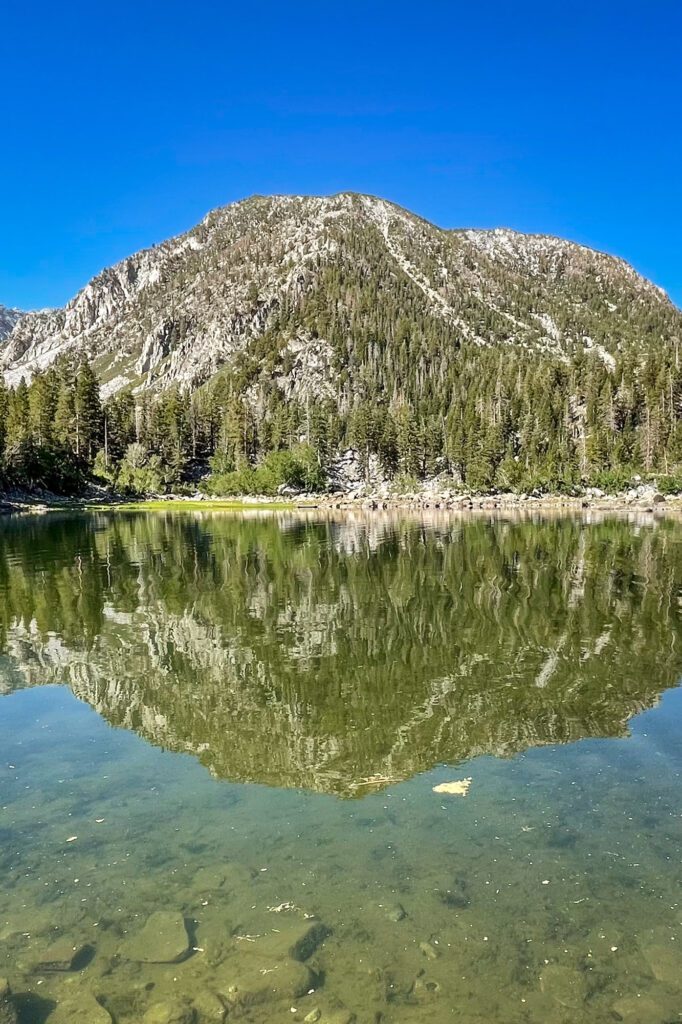
Located just 10 miles away from Mammoth Lakes, Convict Lake is one of the prettiest in the area, with clear and deep blue waters and backed by Mount Morrison and Laurel Mountain. You can also drive right up to the lake.
The lake was named after a shootout in 1871 that occurred here between escaped convicts from Carson City and the posse that was sent after them, which resulted in the deaths of two locals (including Robert Morrison, for whom the mountain is named).
Today, it’s a popular destination for hiking, fishing, boating, and camping, with a seasonal marina, resort, store, restaurant, and forest service campground.
The easy 3-mile Convict Lake Loop Trail that goes around the lake and through the sagebrush, pine, and aspen is one of the best hikes near Mammoth Lakes, especially in the fall.
From the trailhead near the marina, head up a sagebrush covered moraine, which leads to a nice overlook of the lake in less than half a mile. Descend down to the loop trail where you can go left (clockwise) or right (counter-clockwise), though these directions assume the latter.
You’ll first pass through a largely shade-less stretch along the lake, with steep side trails leading down to the water. The trail will then wind around left to follow the lake, and you’ll enter a pleasant stretch of aspens and cottonwoods, which are stunning in the fall.
You’ll soon pass by a junction with some backcountry wilderness trails. Continue left to stay on the lake loop trail, with the other trails heading up Convict Canyon towards Lake Dorothy and Mildred Lake.
Next will be a boardwalk that passes over the various tributaries of Convict Creek.
After the boardwalk ends, the trail climbs up the steeper southern shoreline, before ending at a sandy Fisherman’s beach near the day-use and picnic area. You can follow the paved road back to your car, or cut down to the trails closer to the water.
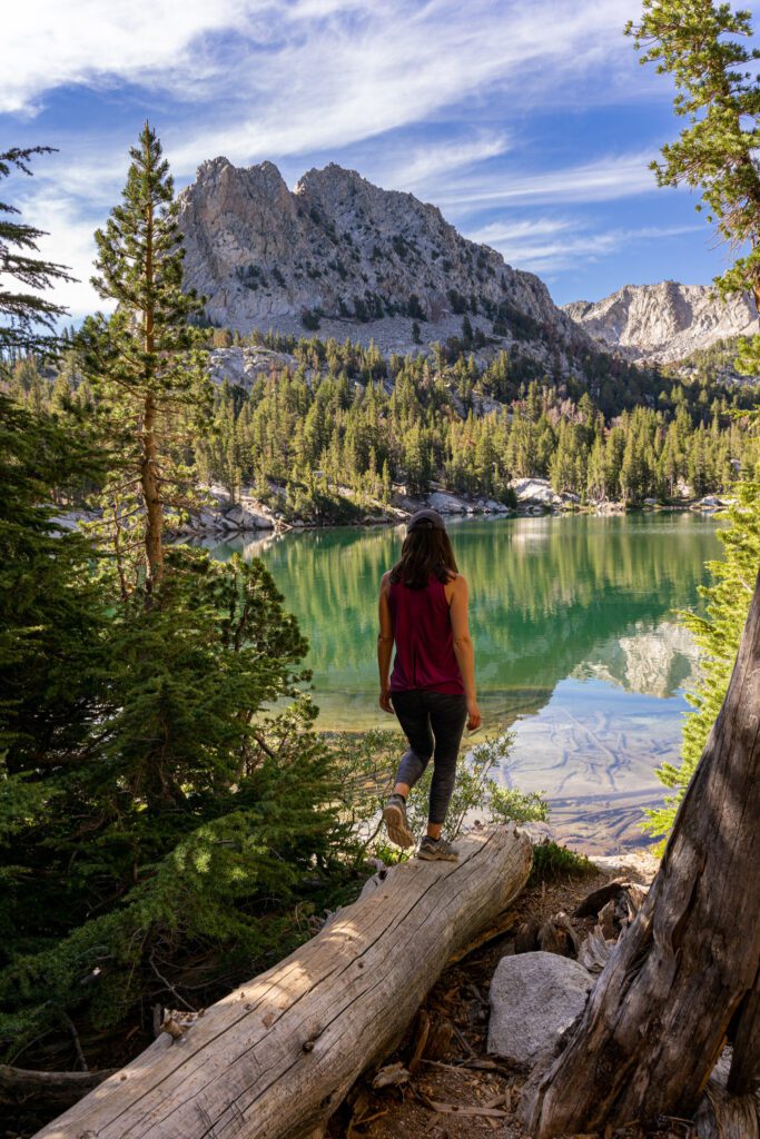
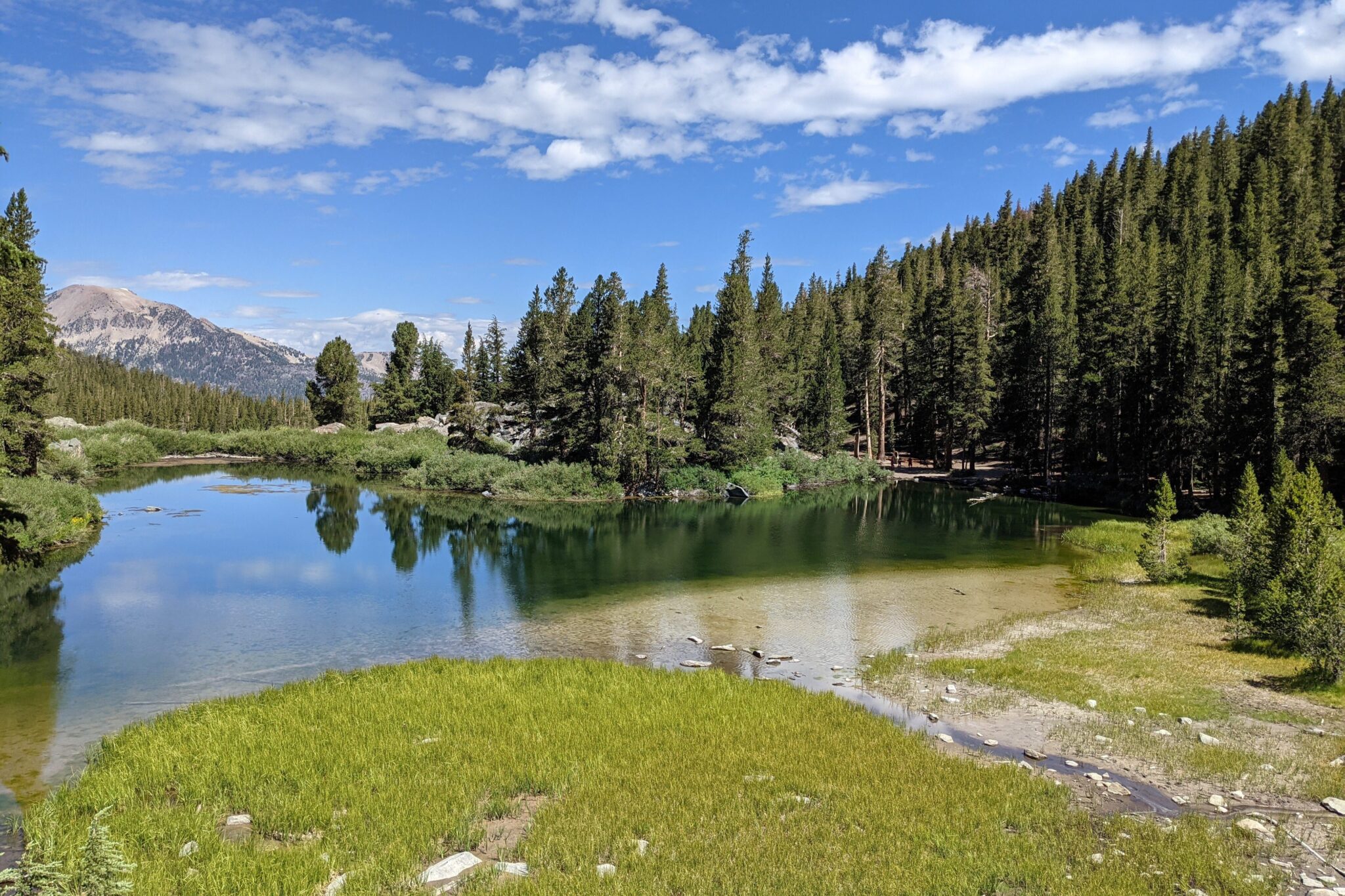
The Emerald Lake Trail
- Length: 1.6 miles
- Elevation Gain: 380 feet
- Trail Type: Out and Back
- Difficulty: Easy
- Dog-Friendly? Yes
- Pass Required: None
- Trailhead Location (at the Coldwater Campground)
This is an easy hike as it’s less than 1 mile from the trailhead to reach Emerald Lake. There is some elevation gain but at less than 400 feet, it’s one of the gentler hikes. It’s an ideal trail for beginners, families with kids, anglers, and as a warm-up. There’s also a good amount of shade for most of the hike.
The Emerald Lake Trailhead shares a parking lot with the Heart Lake and Duck Pass trailheads at the Coldwater Campground. Find the trailhead at the west end of the parking lot.
The trail begins through the forest and will start winding uphill, following Coldwater Creek for about a half a mile. You’ll gain most of the elevation in this first stretch.
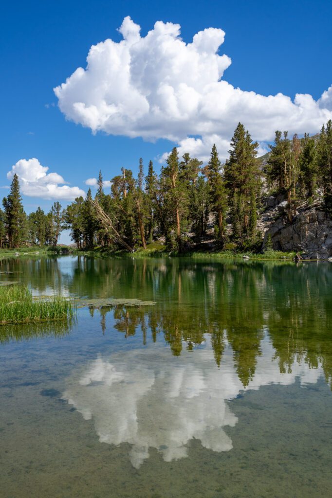
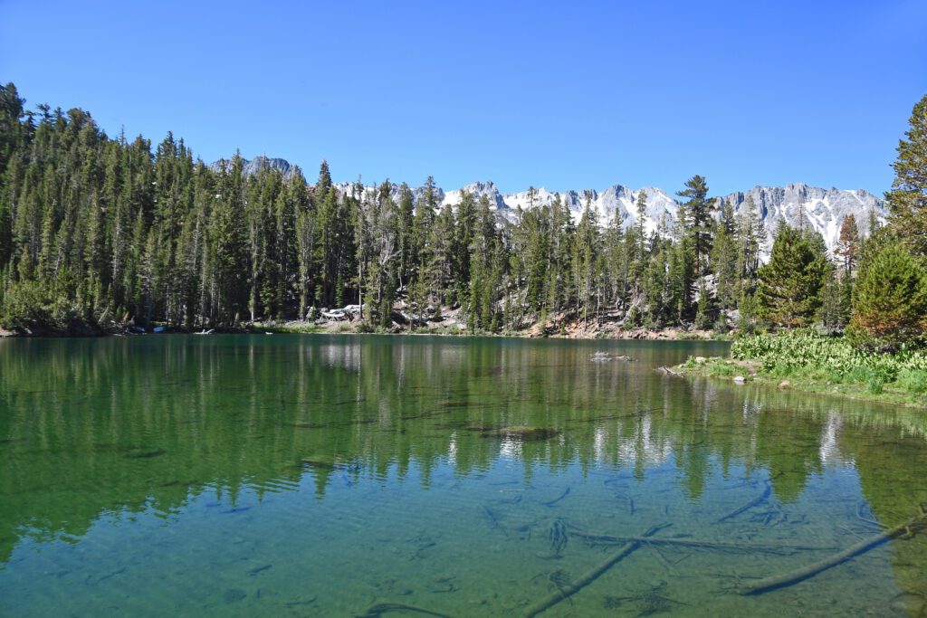
The trail will then level out and the trees will clear to reveal Emerald Lake at 0.75 miles and 9,482 feet.
Enjoy the fantastic views of Emerald Lake, with a forest of green behind, and craggy peaks beyond that. In the summer, look for wildflowers near the lake. The lake is also a good spot to fish for rainbow and brook trout.
You have the option to extend the hike to either Skelton Lake or Sky Meadow. Take the left fork near the lake to continue 1 more mile to Skeleton Lake and Arrowhead Lake (and even further for Barney Lake and Duck Lake).
Another option is to take a right and follow the Sky Meadows Trail to Gentian Meadow and Sky Meadow. This will extend your hike by 2 miles and 700 feet in elevation.
The striking crag towering above the scenic meadow with Cold Water Creek flowing through it is known locally as Blue Crag. In the summer, the wildflower displays along the route are stunning, and you might even see a waterfall in a wet year.
The Duck Pass Trail
- Length: 10 miles
- Elevation Gain: 1,700 feet
- Trail Type: Out and back
- Difficulty: Moderate / Hard
- Dog-Friendly? Yes
- Pass Required: None
- Trailhead Location (at the Coldwater Campground)
This moderately difficult 10-mile out and back trail is one of the best Mammoth Lakes hikes. It’s also extremely popular, and once you’re at the high point on the pass, it’s easy to see why.
Besides the stunning mountain scenery, you will also pass by several incredible alpine lakes along the way.
Leave yourself plenty of time to complete the Duck Pass trail if you want to explore the many lakes along the route. You’re starting out at 9,100 feet and topping out at nearly 11,000 feet, so make sure you’re acclimated (and expect it to feel tougher than it should).
You’ll also want to start the hike early, as the pass is fully exposed by mid morning over the summer.
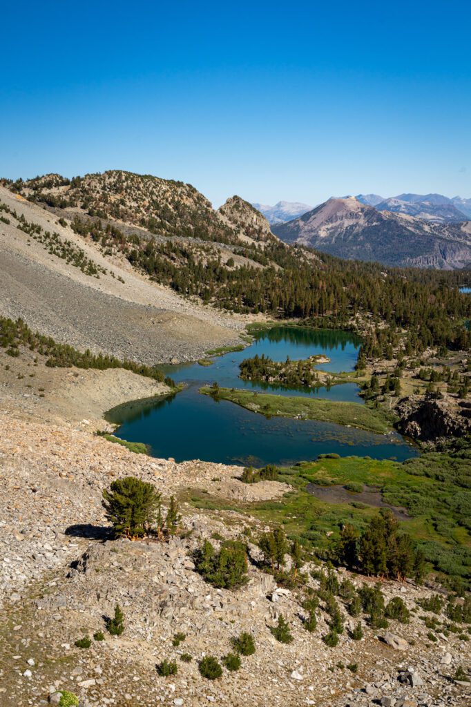
The trailhead begins from the Coldwater Campground and starts climbing steadily right away. Less than a mile in, and 500 feet up, is a spur trail that leads to the aptly named Arrowhead Lake.
The trail then levels out a bit before passing Skelton Lake in half a mile. Continue around Skelton Lake, and then climb another mile and 400 feet to the beautiful turquoise waters of Barney Lake.
After crossing a creek and passing the small Red Lake, you’ll reach the toughest part of the hike, with another 600 feet of steep and talus-covered slope to go before you reach Duck Pass.
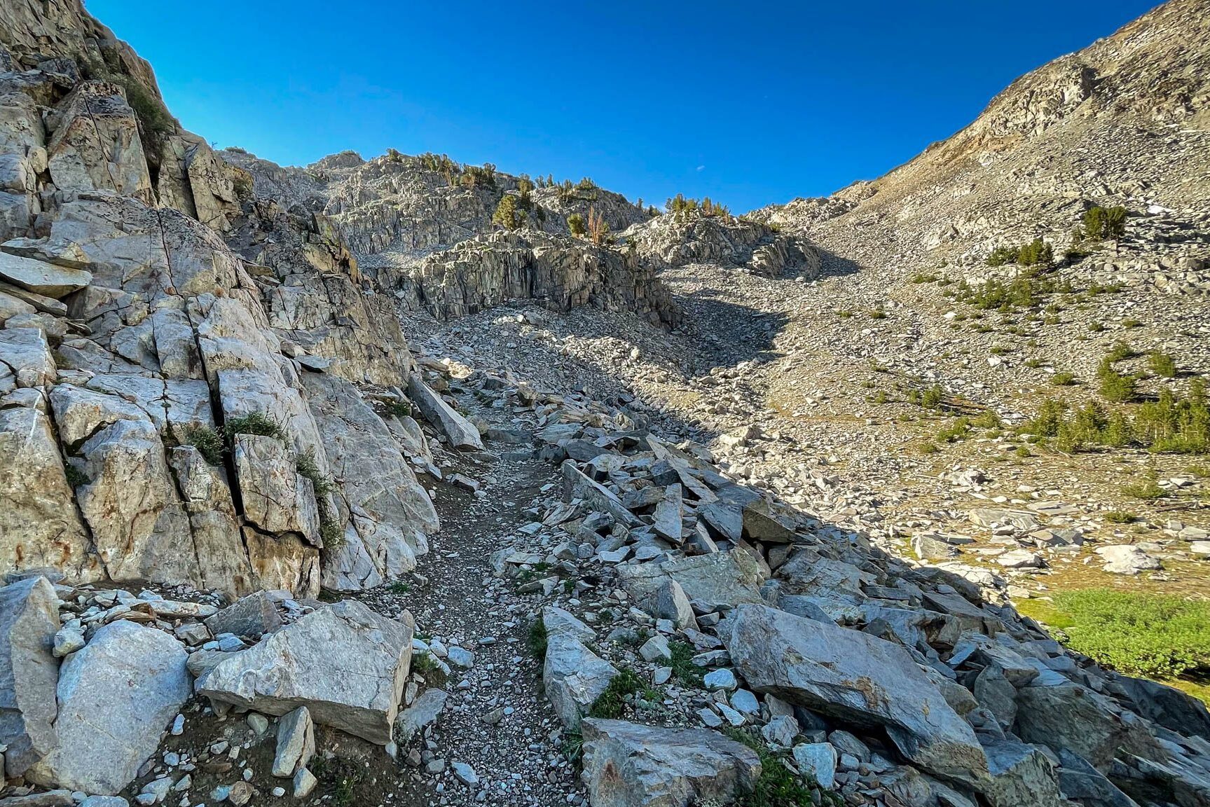
Take a few breaks as you go up and don’t forget to look back over and enjoy fantastic views of Barney Lake. Soon, you’ll top out at Duck Pass, at 10,814 feet.
Drop down 300 feet and go one more mile to reach the deep blue waters of Duck Lake, one of the largest natural lakes in the area.
If you have the energy, you can continue on another half mile to nearby Pika Lake.
For a more detailed description of hiking the Duck Pass Trail, check out our review here.
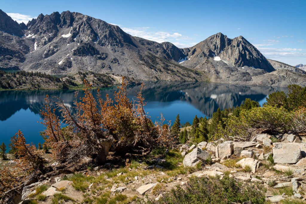
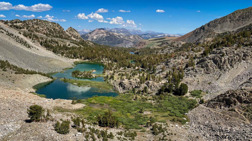
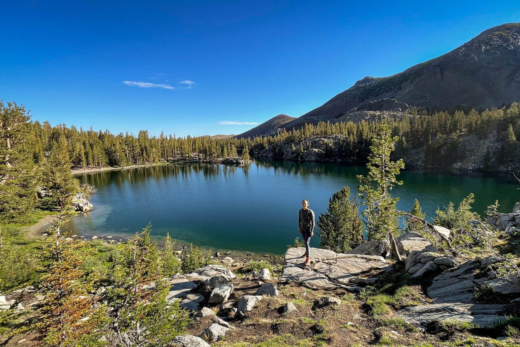
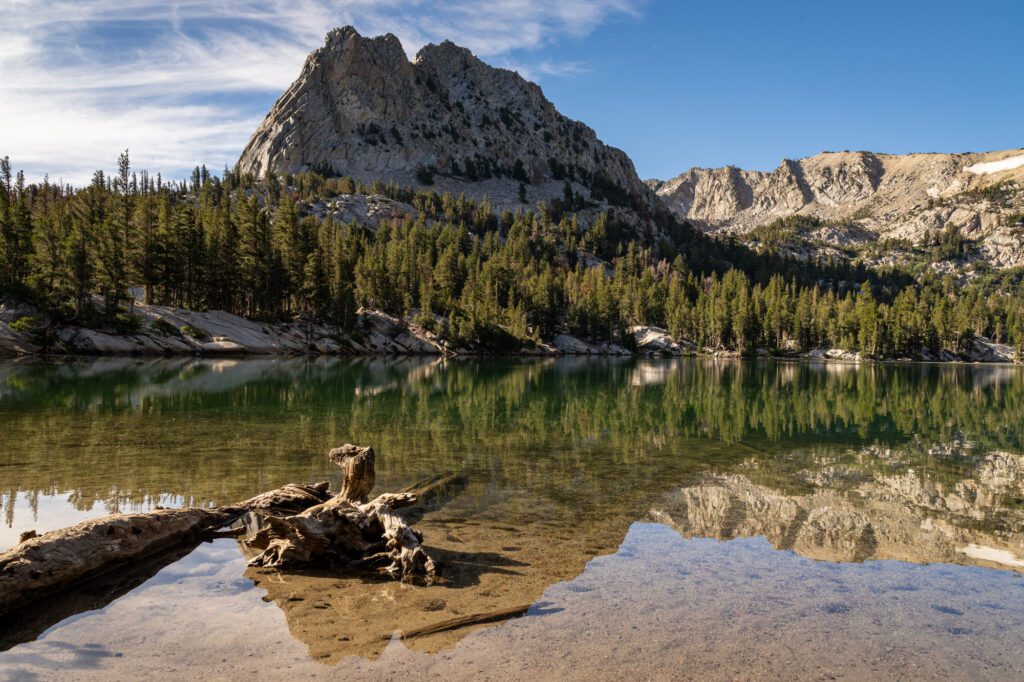
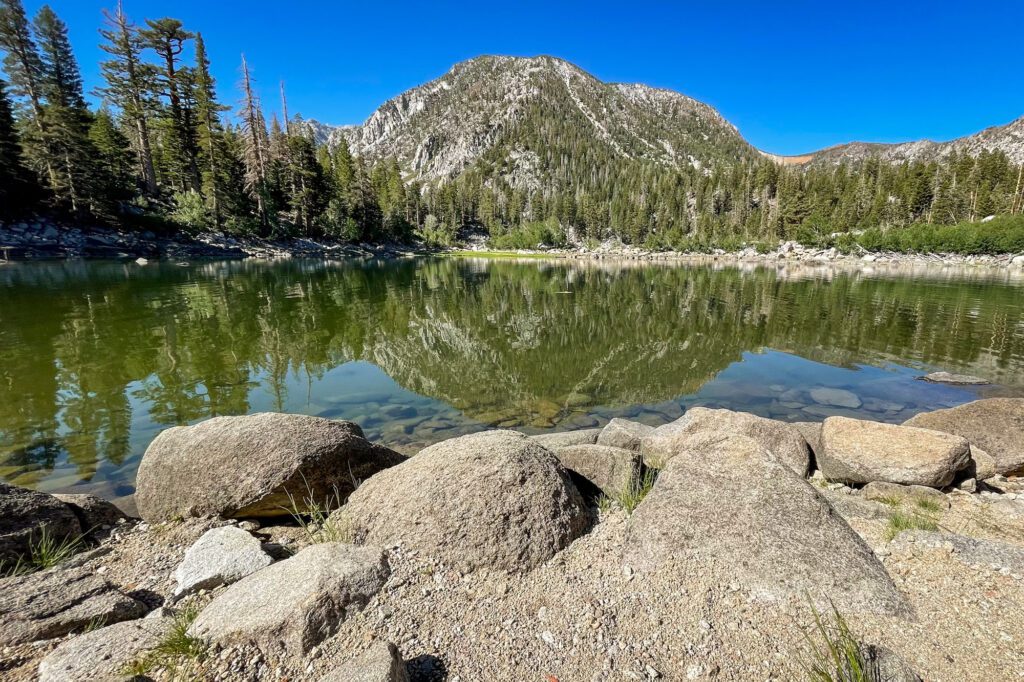
The Crystal Lake Trail
- Length: 3 miles
- Elevation Gain: 800 feet
- Trail Type: Out and Back
- Difficulty: Easy / Moderate
- Dog-Friendly? Yes
- Pass Required: None
- Trailhead Location (near Lake George)
This is a short and somewhat easy hike (though rated moderate for the elevation), and a great introduction to hiking in the Lakes Basin. There’s shade for most of the way, with fantastic views, and the trail leads to a beautiful lake below an epic crag.
It’s a popular trail though, so expect to see other people along the way.
From the Crystal Lake trailhead, start off on a gentle slope, which quickly turns into a series of switchbacks that levels out for a bit before another set of switchbacks.
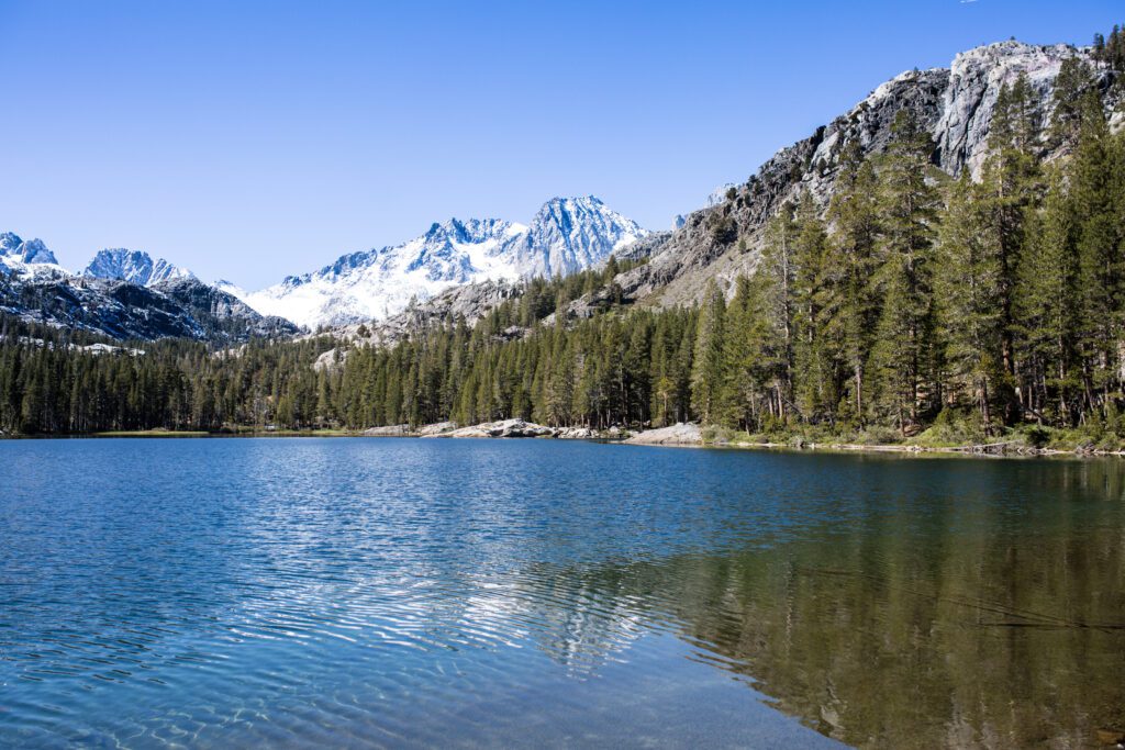
You’ll see Crystal Crag ahead of you, but don’t forget to look back for fantastic views of Lake George, Lake Mary, and several other lakes in the Lakes Basin.
The trail forks at 1.3 miles. Head left to continue on to Crystal Lake. You’ll soon top out at 9,730 feet, then descend around 120 feet to the outlet of Crystal Lake.
There are trails both to the left and right of the lake. Head left for a gentler trail that leads to several beaches and easy access to the crystal clear water. Head right for steeper boulders where you can go cliff jumping when the lake is full.
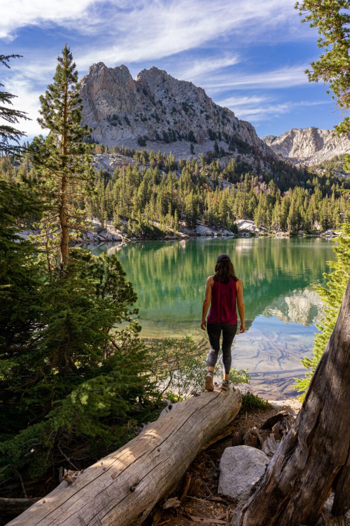
The 13-acre lake is popular with adventurous anglers, and is home to brook and rainbow trout along with a golden trout hybrid. Climbers, meanwhile, head straight to the 10,364-foot Crystal Crag, home to a variety of alpine, sport, and trad climbing routes.
You can also turn this into a longer trek. Head back to the fork and take the other trail, which will take you up to Mammoth Crest, adding another 2 miles and 700 feet in elevation gain.
At the top, you’ll be rewarded with a colorful volcanic landscape and sweeping vistas of the Mammoth Lakes Basin, the Minarets, Mount Ritter, and Banner Peak. This can also be done as part of the Mammoth Crest Loop, along with Duck Pass and Duck Lake.
The Sherwin Lakes Trail
- Length: 4.5 miles
- Elevation Gain: 850 feet
- Trail Type: Out and Back
- Difficulty: Moderate
- Dog-Friendly? Yes
- Pass Required: None
- Trailhead Location
This easy to moderate hike takes you to a series of five pretty lakes. Due to its relatively lower trailhead elevation (only 7,800 feet!), it’s also a good option for the spring and early summer.
It’s also less crowded than some of the other hikes in the Mammoth Lakes region, though expect to see locals and their dogs along the trail and at the various lakes.
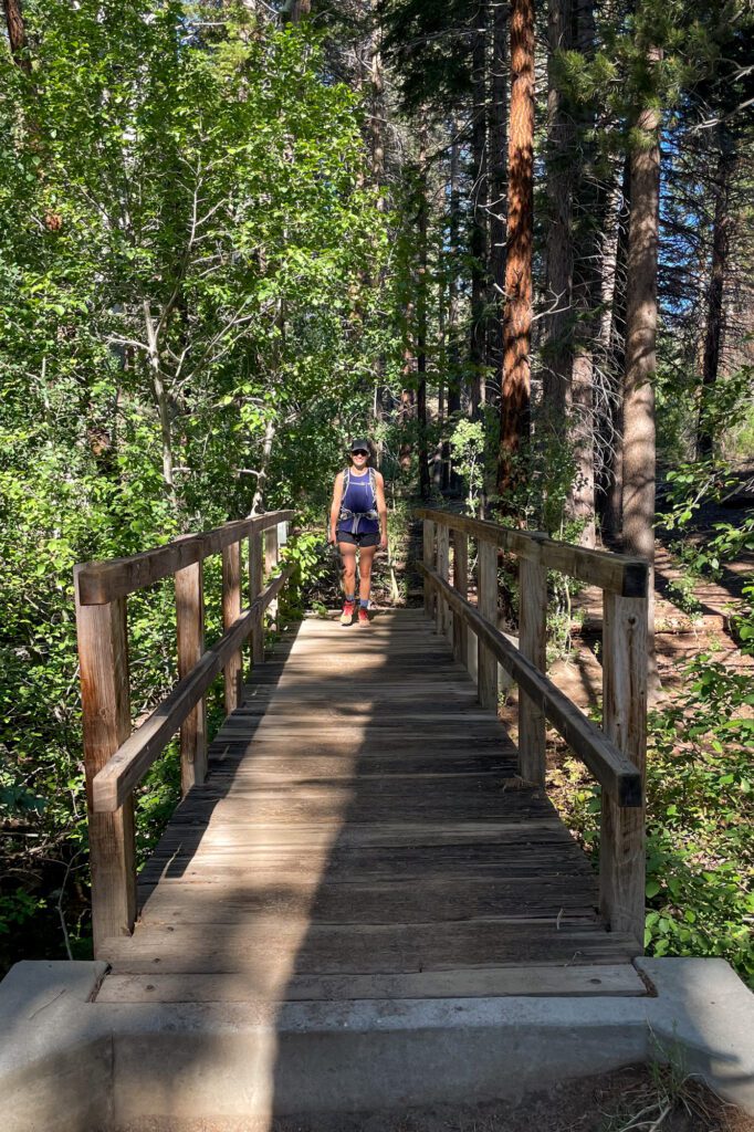
From the trailhead at the end of the Sherwin Creek Road, start the hike along a dirt path through the shrubs.
Once you cross a wooden bridge over Sherwin Creek, you’ll start climbing through a forest of pine and fir before a series of switchbacks up a moraine. As you ascend, the trees will start thinning out, opening up to views of Mammoth Lakes and Long Valley.
The trail then flattens out for the last quarter mile, and you’ll soon reach the lower of the two bigger Sherwin Lakes. Look for colorful golden aspens in the fall along the south and west side of the lake.
You can scramble to the west of the first large Sherwin Lake to find the second large Sherwin Lake. To find the three smaller lakes, go downstream from the upper lakes. The lakes are also popular spots for fishing and you can see trout leaping out of the waters.
You have an option to extend the hike by another 3 miles and 1,000 feet of elevation gain by continuing on to Valentine Lake at the very end of Sherwin Canyon. It’s within the John Muir Wilderness so if you plan on camping at Valentine Lake, you’ll need to grab a wilderness permit.
The Heart Lake Trail
- Length: 2.5 miles
- Elevation Gain: 550 feet
- Trail Type: Out and Back
- Difficulty: Easy / Moderate
- Dog-Friendly? Yes
- Pass Required: None
- Trailhead Location (at the Coldwater Campground)
This easy to moderate hike leads to a pretty heart-shaped lake and stunning views of the surrounding mountains, with the option to explore the ruins of a mine.
It’s not as popular as Duck Pass, so it’s rarely crowded. In the summer, the area is also dazzling with wildflower displays. There are sections of shade along the route, including a few groves of aspens, which are beautiful in the fall.
The Heart Lake Trailhead shares a parking lot with the Duck Pass Trailhead at the Coldwater Campground. Find the trailhead to Heart Lake at the northeast end of the lot.
The ruins of the Mammoth Consolidated Gold Mine can be found at the very beginning of the trail along a half-mile loop, which you can explore either at the beginning or end of the hike. Partially restored, the site is home to some of the original mining offices, mill, mining equipment, and mine shafts dating back to the 1920s and 1930s.
Beyond the mining site, you will cross Mammoth creek and go past an information sign. At the junction shortly after, take a right and then another right at the next two junctions. The trail will start climbing at this point, and the slope will be steep and rocky with long switchbacks, but you’ll have great views of Red and Gold Mountain and Mammoth Crest along the way.
In the summer, look for wildflowers covering the slope. The trail eases after a half a mile, and after 1 mile there will be a split in the trail to an upper and lower route to the lake.
You can take either one, as they meet back up. Find pretty Heart Lake at 9,610 feet, with a trail that goes around the lake. Go for a dip, or fish if you brought a pole.
Make sure you climb the knoll on the west side of Heart Lake for fantastic views of the Lakes Basin, including Lake Mary, Crystal Crag, Mammoth Mountain, the Minarets, Banner Peak, and the Ritter Range.
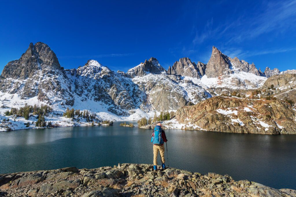
The Shadow Lake Trail
- Length: 8 miles
- Elevation Gain: 1,050 feet
- Trail Type: Out and Back
- Difficulty: Moderate
- Dog-Friendly? Yes
- Pass Required: Yes (shuttle)
- Trailhead Location (Agnew Meadows)
One of the jewels of the Eastern Sierra, beautiful Shadow Lake sits below the majestic peaks of the Ritter Range. Enjoy river, canyon, and forest views, along with ancient and gnarled juniper trees before you reach a waterfall and Shadow Lake. It’s easy to see why this is one of the most popular hikes in the Devils Postpile area.
The trailhead starts at Agnew Meadows. In the summer, that means taking the shuttle in, which adds 0.2 miles to the trail. Look for signs for the Shadow Lake/River Trail, which starts off at a gentle stroll. Look for wildflowers around Agnew Meadows in the summer.
You’ll then drop down around 300 feet to the San Joaquin River and follow the River Trail. Pass by Olaine Lake around 2 miles in, and take a left at the junction just afterwards for Shadow Lake.
After you cross the bridge spanning the San Joaquin River, the climbing starts, and it’s a series of shade-less switchbacks and stone steps 750 feet up the river gorge.
Take breaks to enjoy views of the canyon and the gnarly junipers alongside the trail as you go up. You’ll also enjoy views of the Shadow Creek Falls for the last 0.5 mile of the ascent, with Shadow Lake shortly after that at 8,737 feet. Take some time to enjoy the epic views.
The trail levels out and continues around Shadow Lake until it connects with the John Muir Trail. Head back or continue on another 2.5 miles and 600 feet in elevation to Ediza Lake.
The Minaret Lake Trail
- Length: 14 miles
- Elevation Gain: 2,400 feet
- Trail Type: Out and Back
- Difficulty: Difficult
- Dog-Friendly? Yes
- Pass Required: Yes (shuttle; also wilderness permit required if staying overnight)
- Trailhead Location
Located at the foot of the jagged edges of the Minaret Pinnacles in the Ritter Range, Minaret Lake is one of the most scenic lakes and hikes in the area. It’s a challenging hike of 7 miles in each direction, but the views are spectacular the whole way and it’s well worth the tough trek up 2,400 feet.
Start at the Devils Postpile Ranger Station and head south to cross a bridge over the Middle Fork of the San Joaquin River. The trail will start climbing up through a pine forest, connecting with the John Muir Trail in about a half a mile.
Continue climbing for 2 miles until you reach Johnston Lake, with the possibility of a water crossing early in the season. After the small lake, which is a good spot for a break and snack, take a left at the junction to follow Minaret Creek as it climbs steadily upwards through a series of switchbacks, passing several waterfalls along the way.
Around 2.5 miles after Johnston Lake, take a left at the next junction. The next 2 miles, and especially the last mile, are the steepest part of the trail, but with the payoff of incredible views of granite spires in every direction.
If you’re attempting this early in the season in May or June, be aware that there might still be snow on this last section. You’ll soon reach the east shore of Minaret Lake, framed by jagged granite peaks in dramatic fashion.
Take the time to soak in the views, which are some of the best in the Eastern Sierra. If you’re doing a day hike, head back the way you came. If you are overnighting, find a nice site near the lake’s shore.
For more ideas of what to do in Mammoth Lakes over the summer besides hiking, check out this guide to the Best Things to Do in Mammoth Lakes Over the Summer.
You Might Also Like
- HIGHWAY 395: How to Plan an Epic Highway 395 Road Trip (L.A. to Lake Tahoe)
- MAMMOTH LAKES: What to Do in Mammoth Lakes in the Summer
- MAMMOTH LAKES: Hiking the Outrageously Beautiful Duck Pass Trail
- LAKE TAHOE: The Best Things to Do in Lake Tahoe in the Summer
- LAKE TAHOE: 15 Stunning Hikes Near Lake Tahoe
- LAKE TAHOE: How to Spend 3 Amazing Days in Lake Tahoe
- DEATH VALLEY: How to Plan an Amazing Death Valley Itinerary
- YOSEMITE: A Picture-Perfect 2 Day Yosemite Itinerary
Plan an Unforgettable California Adventure
Heading to California? We’ve got all sorts of super detailed, in-depth California travel guides written by locals to help you plan an amazing trip.
- San Francisco: We’ve got a guide to spending 3 days in SF, one day in San Francisco for planning a shorter trip, and a complete guide to finding the perfect place to stay in San Francisco. We also have guides to 14 perfect weekend getaways from San Francisco and the best day trips in the Bay Area. Oh, we almost forgot, here are the 15 best hikes near San Francisco, written by two Bay Area locals.
- Los Angeles: Read our perfect 2 Day L.A. itinerary, our guide to spending one amazing day in L.A. (with two versions!), and a guide to helping you figure out where to stay.
- San Diego: Learn how to spend a day in San Diego, a weekend in San Diego, and where you should stay.
- Lake Tahoe: Plan the perfect summertime adventure with our 3 day Tahoe itinerary, guide to the best hikes, and our guide to the best things to do in Tahoe.
- Santa Barbara: We have a guide to planning a weekend in Santa Barbara, and a guide to a day trip to Santa Barbara from Los Angeles if you’re pressed for time.
- Mammoth Lakes: To plan a perfect getaway in the Eastern Sierra, read our guide to the best things to do in Mammoth Lakes in the summer. Plus, our guide to the best hikes in Mammoth, featuring the epic climb to the top of Duck Pass.
- Big Sur: Plan the perfect weekend away with our complete Big Sur itinerary.
- Yosemite National Park: Plan an amazing trip with our guide to planning an amazing Yosemite itinerary, and our guide to choosing where to stay at Yosemite.
- Joshua Tree National Park: Plan the perfect trip with our perfect weekend itinerary (or a day trip, if you have less time), a guide to the best hikes, and some cool places to stay in Joshua Tree.
- Death Valley National Park: We have a SUPER detailed guide to planning the perfect Death Valley itinerary, and a guide to the best hikes in Death Valley National Park.
- California Road Trips: See the best of the Pacific Coast Highway on our San Francisco to San Diego road trip, or make the trip up Highway from on a Los Angeles to SanFrancisco road trip. If you’re more into mountains than beaches, a Highway 395 road trip from Los Angeles to Lake Tahoe might be more your speed.