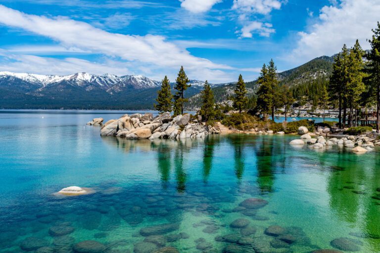
San Francisco to San Diego Road Trip: A Complete Guide
A drive down the California coast is one of the most beautiful road trips you can take in the US. I’m a California native, and have lived in the Bay Area, San Diego, and Los Angeles – so I know a thing or two about road tripping through the state!
Below, I’ll give you all the information you need to plan an incredible San Francisco to San Diego road trip, with a 7-day itinerary that features the must-see spots along the way (plus options for 3 and 5 day alternatives, if you have less time).
You’ll see everything from wildlife like elephant seals and pelicans, to sandy beaches and picturesque coastal sunsets.

Disclaimer: Some of the links in this post, like hotel and vacation rental links, are affiliate links, meaning at no additional cost to you we make a little bit of money if you click through and book. That being said, we would absolutely never recommend something to you that we don’t stand behind 100%.
Where to Start and End Your SF to San Diego Road Trip
For the one-week road trip itinerary below, you’ll be starting in San Francisco and ending in San Diego.
If you want to truly commit to the full Pacific Coast Highway experience, you can add three to four extra days, starting further north in Leggett (where the PCH starts) and making your way south.
Leggett is about 200 miles north of San Francisco (about a 3.5-hour drive, if taking Highway 101), and Highway 1 primarily goes right along the coast before leading into San Francisco.
If you decided to start your trip in San Francisco, you’d want to fly into either San Francisco International Airport (SFO) or Oakland International Airport (OAK), and then make the drive north.
For the itineraries below, you’ll still fly into one of these airports. SFO has better routes, and it’s closer (and more convenient) to get to the city and the first stop on the road trip itinerary below.
However, OAK typically has less weather delays, and will be far less crowded than SFO.
Since the first stop is just south of San Francisco, you won’t want to fly into San Jose International Airport (SJC). It’s southeast of that stop, and will just add unnecessary driving time to your trip. Plus, traffic is awful around San Jose – you’ll want to avoid it at all costs if you can.
At the end of your journey, you’ll want to fly out of San Diego International Airport (SAN), which is just north of Downtown San Diego.
The Road Trip Route
You’re going to spend this trip (mostly) driving on the PCH! Once you’re at the end of the Pacific Coast Highway in Dana Point (Orange County), you’ll continue driving down the coast on I-5.
Something to be aware of is that the PCH sometimes merges and runs concurrently with Highway 101 (like around Ventura and Santa Barbara). Don’t let that confuse you – you’re still on the right path!
There will also be some moments where it’s more efficient to go off Highway 1 – I’ll mention where in the road trip itinerary below.
How Many Days Do You Need to Drive from San Francisco to San Diego?
Driving from San Francisco to San Diego is completely doable in one day if you’re just trying to get from city to city.
Rather than driving the Pacific Coast Highway, most people who just need to get from point A to point B will take I-5 up the middle of California.
It’s a pretty boring drive, but you’ll only be in the car for about 8 hours (possibly a bit longer, depending on traffic).
That said, this road trip is more about the journey than the destination – there’s a ton to see along the Pacific Coast Highway! – so I’ve included a Pacific Coast Highway road trip itinerary that spans 7 days below.
If you can’t commit to a whole week, you’ll also find 3 and 5-day itineraries after the 7-day option.
A Complete 7-Day San Francisco to San Diego Road Trip Itinerary
Here’s your comprehensive guide on taking a road trip down the Pacific Coast Highway! If you’re planning on spending some time in San Francisco before hitting the road, check out this post on what to do during a 3-day weekend in the city.
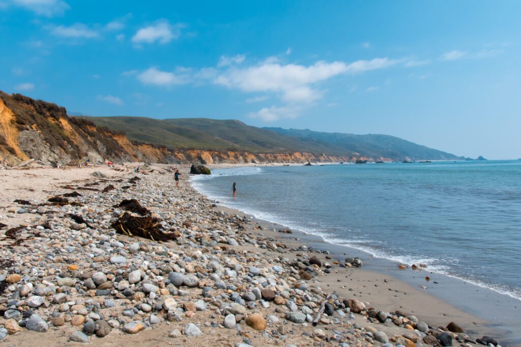
Day 1: San Francisco to Santa Cruz
After arriving in San Francisco the day before and getting a good night’s rest, it’s time to hit the road!
Spend day 1 of your Pacific Coast Highway road trip checking out some gorgeous beaches along the coast and doing a couple easy hikes before making your way to Santa Cruz.
Hike, Grab Coffee, and Enjoy the Beach in Pacifica
Start off the day with a bit of hiking around Mori Point via the Mori Point Loop Trail, which is 2.5-miles (with a 396-foot elevation gain). This moderate blufftop trail gives you gorgeous views of the rugged coastline.
If you’re not up for the full loop, you can easily hike out to Mori Point (labeled “The Point” on the AllTrails map linked above), and then head back on the same trail you hiked out on.
For parking, park at the Mori Point Parking Lot, or along Mori Point Road or Bradford Way (be mindful of street parking signs in the area). There are a few trails in the area, so make sure you’re starting out on Upper Mori Trail.
The trailhead is just a short walk south of the parking lot, on Mori Point Road.
After your hike, drive about two miles down the PCH to Soul Grind Coffee for a caffeine boost (if you need a bit more, they have breakfast items too). Grab your coffee and walk down to Pacifica State Beach to take in the view.
Grab a Bite to Eat and Explore the Beach in Half Moon Bay
Now it’s time to continue down the coast for some food and drinks in Half Moon Bay. Make your way to Half Moon Bay Brewing Co. (about a 15-minute drive from Soul Grind Coffee) for some brunch/lunch. This casual spot has both indoor and outdoor seating with views of the water.
A visit to Half Moon Bay isn’t complete without a stop at the beach. Make your way south to Redondo Beach (park here).
You can take in the view from atop the bluffs, or make your way down to the beach. There are a few paths down to the beach, including some right by the parking lot – but these ones are a bit steeper.
Make your way up the dirt path north of the parking lot to find some easier paths down the bluffs. You’ll definitely want to be wearing some good shoes for the descent (no flip flops!).
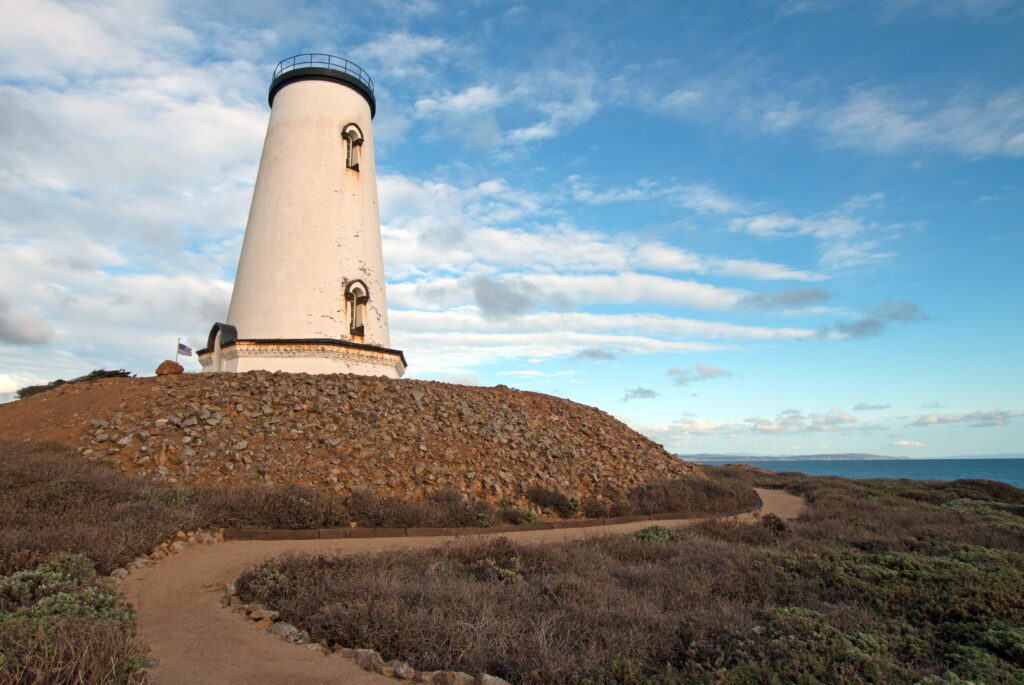
Check Out Pigeon Point Lighthouse State Historic Park
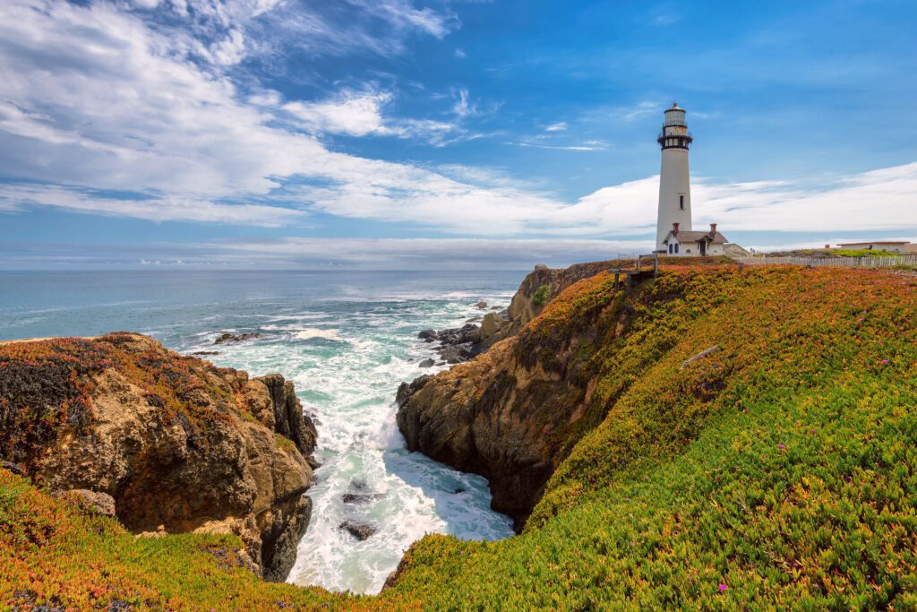
Next on the itinerary is Pigeon Point Lighthouse in Pescadero, which is about a 30-minute drive from Redondo Beach in Half Moon Bay.
This lighthouse has been in operation since 1872, and is one of the tallest lighthouses in the US. While you can’t go in the lighthouse, you can admire it from the outside.
There’s also a short dirt path along the cliffs that you can follow that leads you down to a small beach.
Hike at Big Basin Redwoods State Park
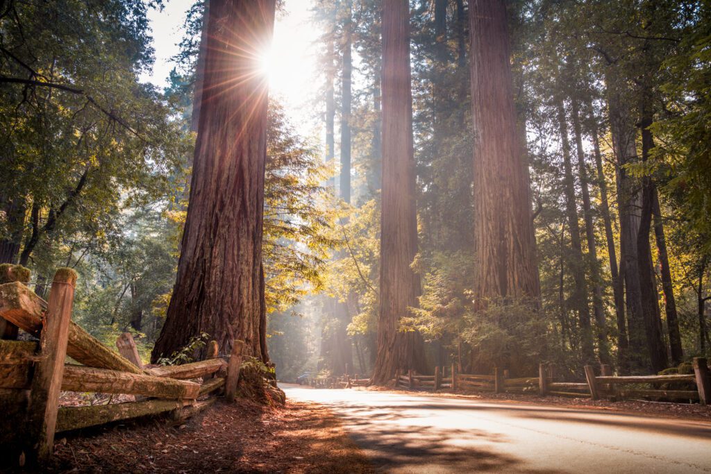
Get back in the car and continue driving down the PCH for about 10 minutes until you get to the trailhead for the Skyline to the Sea Trail Short Loop, which is a part of Big Basin Redwoods State Park.
This easy trail is 2.9-miles long, and has a 298-foot elevation gain. It’s a great hike to get up close to some of California’s famous redwood trees!
Important note: this hike (and others in the park) is currently closed indefinitely due to the 2020 fires, so be sure to check the state park link for current park status.
If it’s still closed during your visit, stop by Año Nuevo State Park instead (about three miles north) to hike the Año Nuevo Point Trail, an easy 4.3-mile coastal trail.
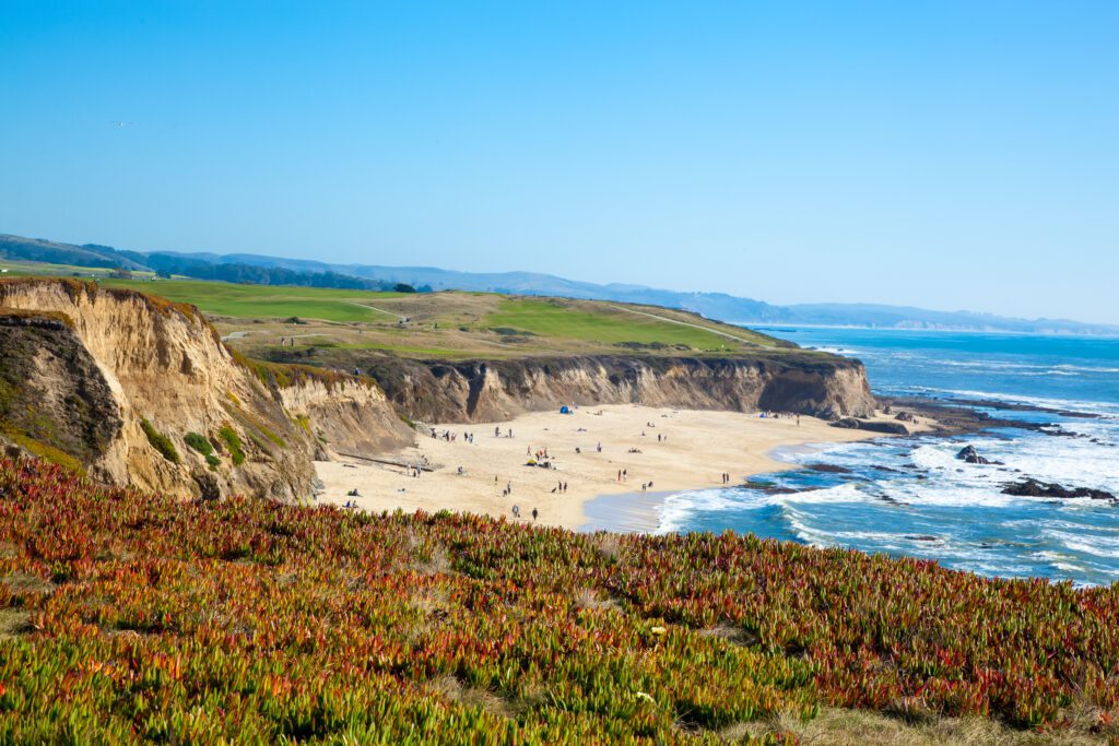
Watch the Sunset at Natural Bridges State Beach
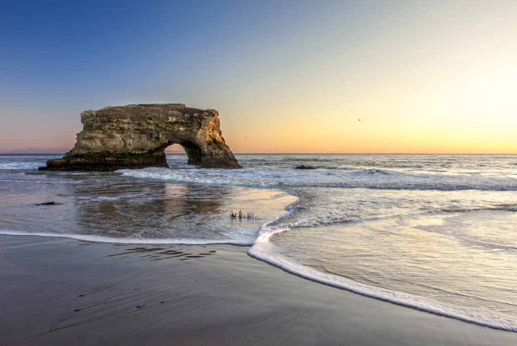
Once you get back to your car, it’s time to make your way down to Santa Cruz, where you’ll be staying for the night. On the north side of Santa Cruz is Natural Bridges State Beach, which is about a 25-minute drive (17.5 miles) south. Stop by to enjoy the sunset before getting to your hotel for the night.
Note that there is a $10 fee to park in the lot.
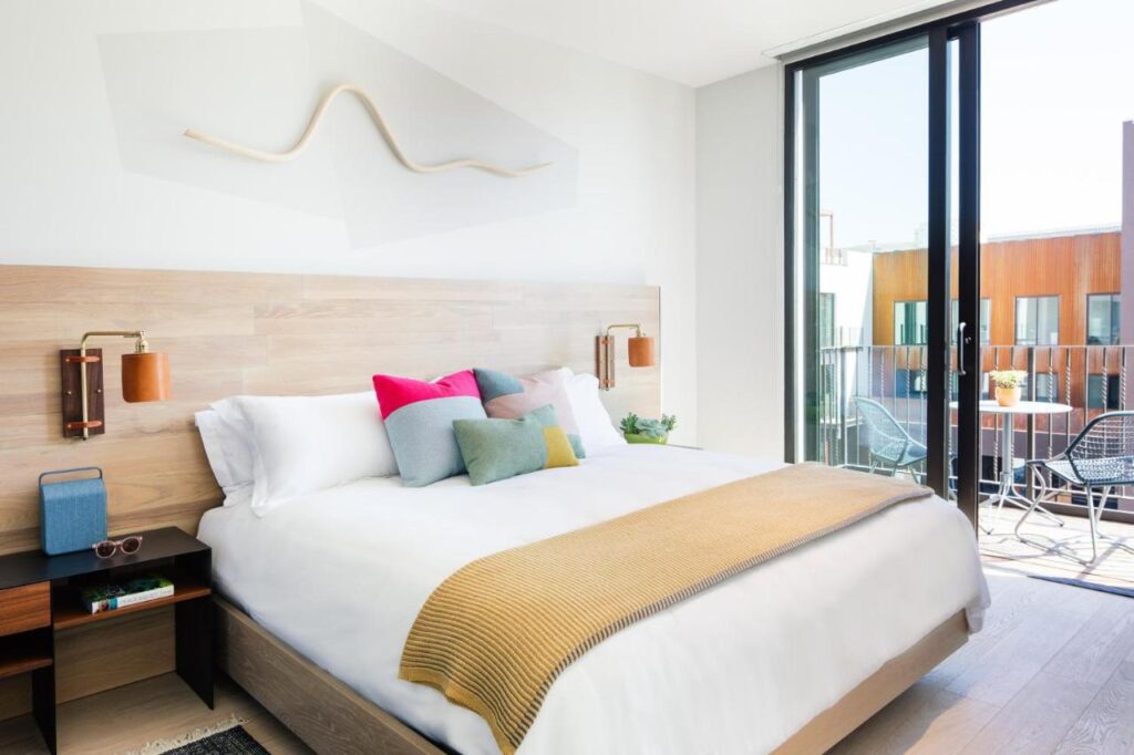
Where to Stay in Santa Cruz
Here are a few hotel options in Santa Cruz, as well as a campground if that’s more your style:
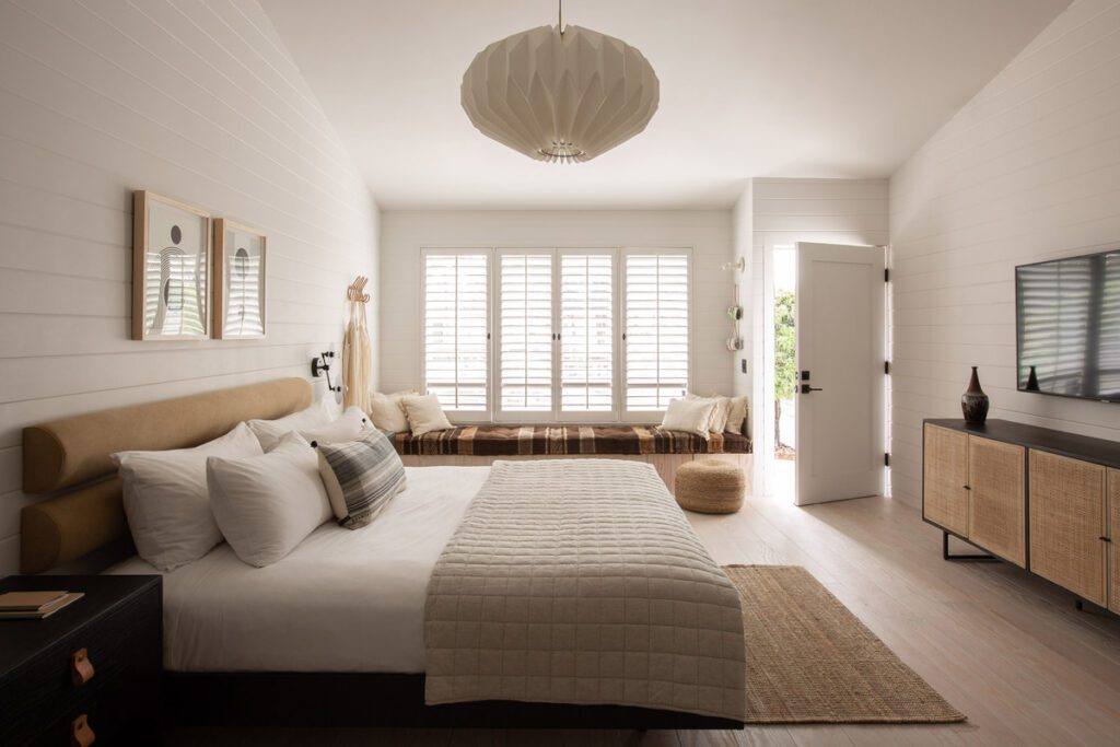
- Ocean Pacific Lodge: This hotel is in the heart of Santa Cruz, just a short walk away from the wharf. It has spacious rooms with queen and king beds, and there is also an outdoor pool on-site.
- Hotel Paradox: This trendy, modern hotel is just a mile away from the beach, and has both rooms and suites available. It has an outdoor pool with a poolside bar, sundeck, gym, and restaurant on-site.
- Ocean Echo Inn & Beach Cottages: If staying on the beach is important to you, this boutique inn is the accommodation for you. There are rooms available, as well as cottages, some of which have full kitchens.
- Henry Cowell Redwoods State Park Campground: This campground is less than five miles away from the heart of Santa Cruz, but is tucked away in a quiet area amongst the redwoods. There are over 100 tent and RV sites, and reservations can be made online.
Day 2: Santa Cruz to Carmel
On the second day of your road trip, you’re going to slowly make your way 45-miles down the coast to Carmel-by-the-Sea, enjoying Santa Cruz, Capitola, Monterey, and Pebble Beach along the way.
Get Your Caffeine Fix
First things first: grab some coffee. Two great options in the area are Cat & Cloud and Verve Coffee Roasters.
Both coffee shops have multiple locations sprinkled throughout Santa Cruz, so look on their location page to find an option close to where you’re staying.
Spend the Morning in Santa Cruz
Before heading down the PCH, spend a bit of time exploring Santa Cruz. Walk or drive down to the Santa Cruz Beach Boardwalk, an iconic spot with classic rides and amusement park vendors that has been in operation since 1907.
Unfortunately for thrill-seekers, the rides don’t open until the late morning, but you can still walk along the boardwalk before making your way to Santa Cruz Beach. If you’d like, you can continue walking up the coast to Santa Cruz Wharf to get an amazing look at the coast from the water.
Walk Around Capitola
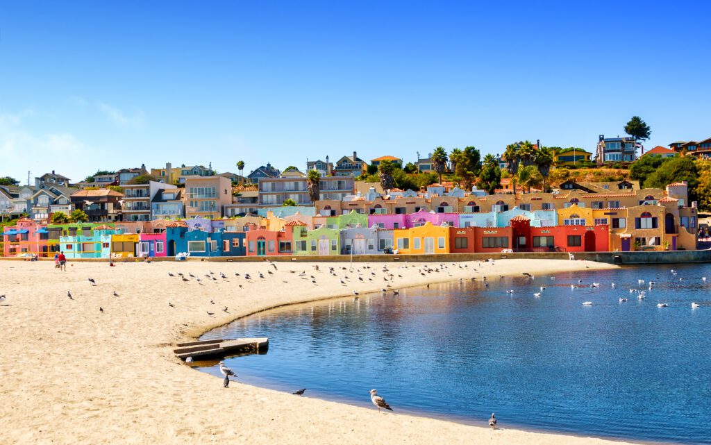
Hop in the car and head to Capitola, which is about five miles down the road. Park the car near Capitola Beach, and then start by walking around the village, which has plenty of local shops, restaurants, bars, galleries, and cafes.
Next, make your way to Capitola Beach, walking north to check out Venetian Court. These iconic, brightly-colored Mediterranean-style cottages are commonly photographed, and while you can’t go inside (it’s a private hotel), you can admire them from the sand. They’re located right on the beach – you won’t miss them!
As you’re coming or leaving, be sure to also drive over Soquel Creek (via Stockton Ave.) to get a view of Soquel Creek Railroad Bridge, a now out-of-service bridge from the late 1800s that towers over the creek.
Eat Lunch and Enjoy the Afternoon in Monterey
Next, you’ll continue down the PCH for just under 40 miles (the longest stretch you’ll drive today) and make your way to Monterey. First stop: lunch. Check out Old Fisherman’s Grotto or First Awakenings (both sit-down service), or try Randy’s Sandwich Shop for something quicker.
After lunch, make your way over to Cannery Row (and be prepared for some walking!).
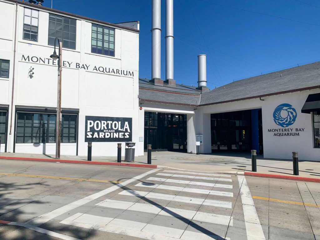
Cannery Row was the site of sardine canneries through the 20th century, and now features plenty of fun shops and galleries to browse. Make your way down the street until you hit the next stop: Monterey Bay Aquarium.
The oceanfront Monterey Bay Aquarium is often considered one of the best aquariums in the US. It features over 80,000 animals and plants and has more than 200 exhibits, including a sea otter exhibit and a giant kelp forest (which is one of the tallest aquarium exhibits in the world).
Once you’re done at the aquarium, continue walking along the coast to make your way towards Lovers Point. Right outside of the aquarium, you’ll find the Monterey Peninsula Recreational Trail – follow this path. As you walk, be on the lookout for sea lions on the coast!
After you’ve made it to Lovers Point, turn back and head towards your car. Need a caffeine or sugar boost (or both?) before the next stop? Stop by Captain + Stoker for coffee or Revival Ice Cream.
Drive to Carmel-by-the-Sea Via the 17 Mile Drive
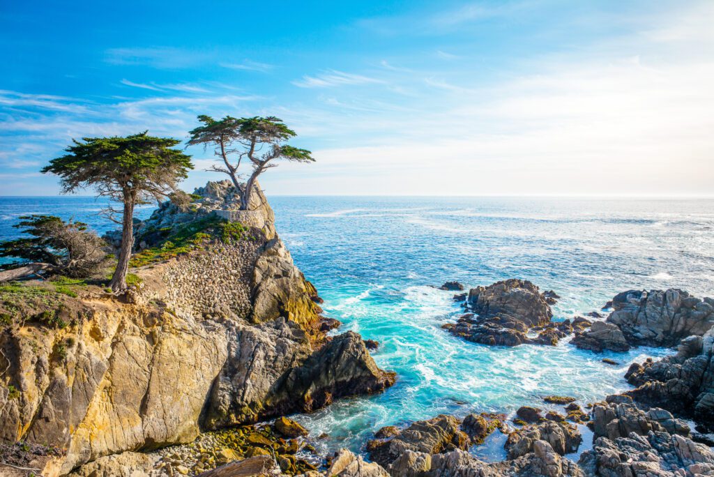
For this portion of the road trip, you’re going to stay off the PCH for a bit to make your way to Carmel via the 17 Mile Drive in the Pebble Beach area.
This drive takes you along the picturesque rocky coast and through beautiful forested areas. Enter at the Pacific Grove Gate and pay the $10.75 fee, and then drive down the road just under a mile to turn right and start the official drive (you’ll see a sign).
There are plenty of lookouts along the way, so stop as you’d like. I’d recommend the Restless Sea Lookout (the most turbulent section of the coastline in the area), the Cypress Point Lookout, and the Lone Cypress Tree Lookout (this one is an iconic spot – definitely stop here!).
Follow the road south, eventually making your way to the Carmel Gate to exit the drive and get to your hotel for the night.
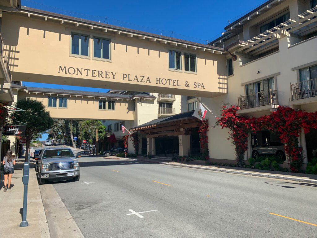
Where to Stay in Carmel
Here are a few great accommodations in Carmel:
- The Getaway Carmel: This boutique hotel is another great option in the middle of Carmel. It has both rooms and suites available, some of which have fireplaces.
- Carmel Mission Inn: Carmel Mission Inn is located just off the PCH, and is just a short drive away from the main dining and shopping area in Carmel. This modern hotel offers rooms and suites, and has a pool, fitness center, and restaurant.
- Candle Light Inn: This modern elegant inn is located just steps away from the many amazing restaurants and shops in Carmel. Rooms are spacious, and upgraded rooms have fireplaces.
- Saddle Mountain Ranch Campground: This campground is seven miles east of Carmel, and has RV and camping sites available, as well as gazebo and luxury tent sites. There are also cabins available for rent, and there is an outdoor pool on-site. Reservations for any of the campsites and cabins can be made online.
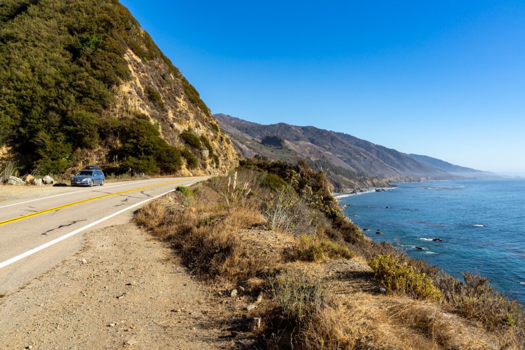
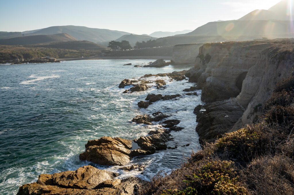
Day 3: Big Sur
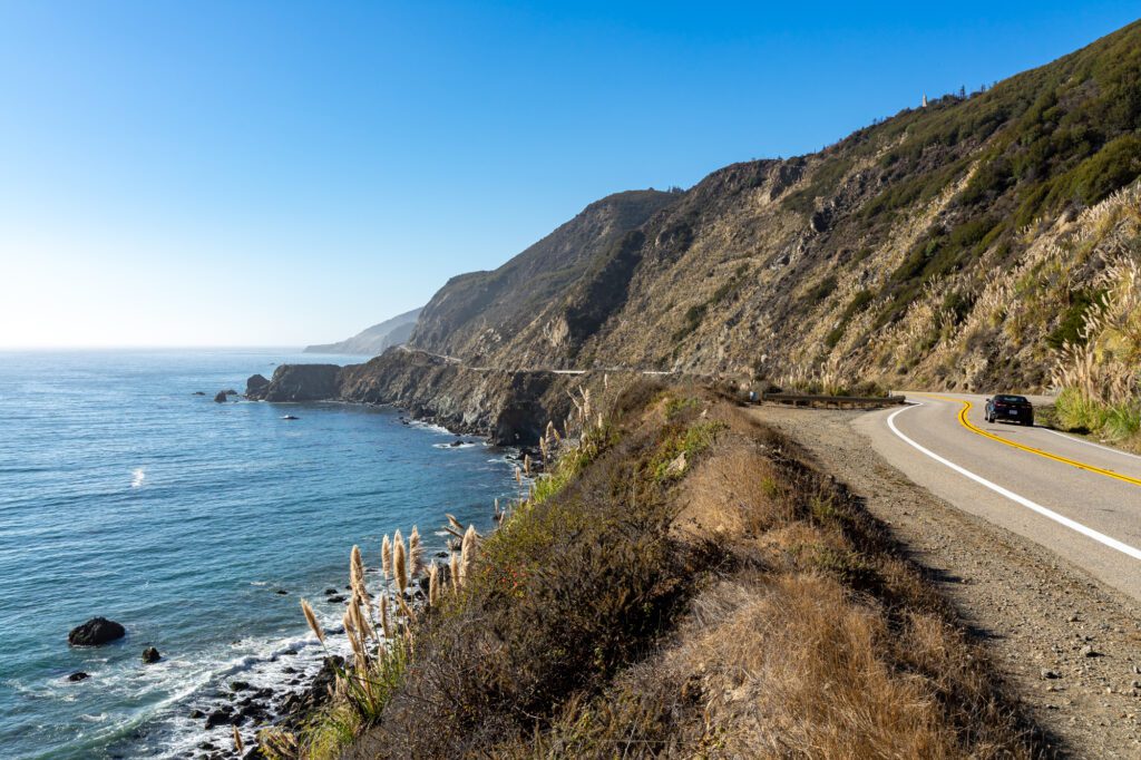
This day in the Pacific Coast Highway itinerary is dedicated to hiking in and exploring Big Sur.
If you want to make the most of the day, be sure to get out early – it’s a full day ahead! If you aren’t able to hit up every spot on this day, you can also circle back tomorrow and check out the sights that are on the southern side of Big Sur.
Just head into Cambria (where you’ll be staying) when you’re ready to call it a day, and make plans to drive back up the PCH in the morning.
Two more important notes: first, you won’t find a ton of restaurants or shops in Big Sur, particularly outside of the Posts area. Plan accordingly and bring along food and plenty of water. Second, be sure to fill up on gas in Carmel before heading into Big Sur. Gas stations are few and far between in the region, and they are pricey.
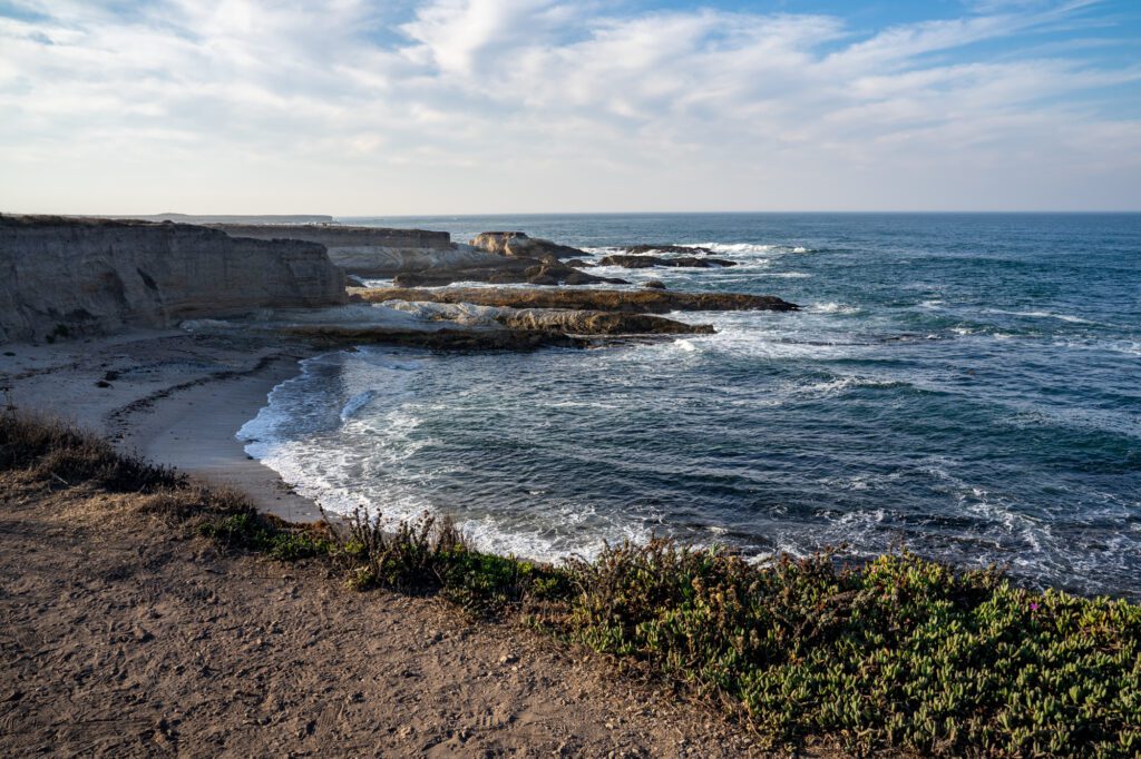
Hike at Point Lobos
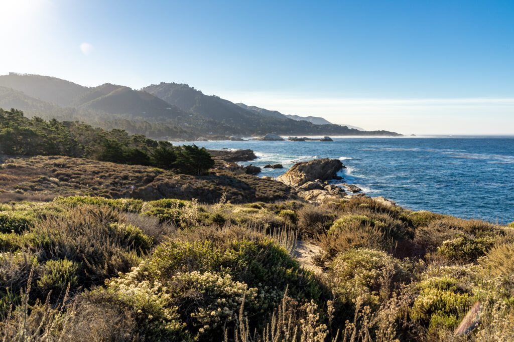
Start the day hiking at Point Lobos State Natural Reserve, a beautiful coastal reserve just north of Big Sur. The full Point Lobos Loop Trail is 6.7 miles long, but you’re going to want to focus on the southern side of the point for today.
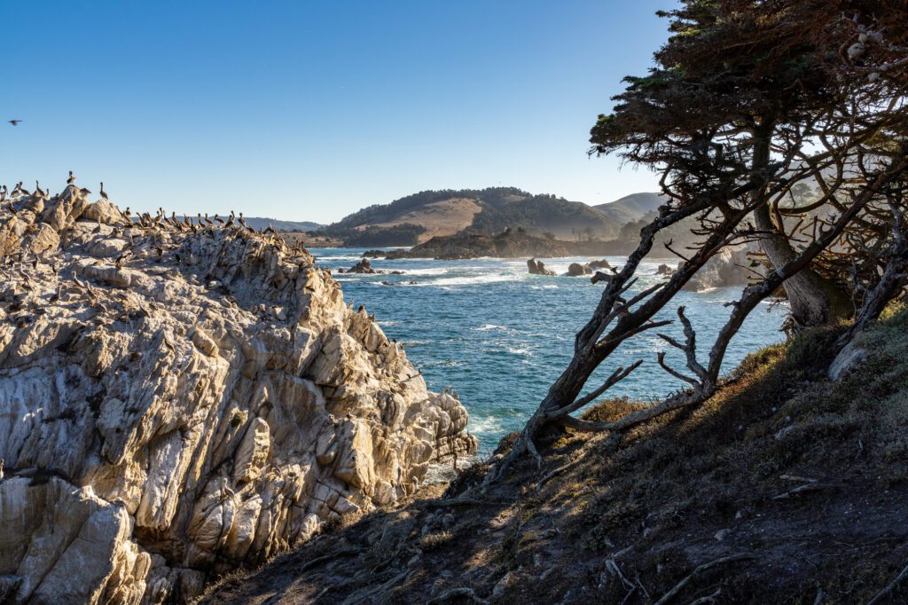
Make your way to Bird Island Lookout, and then hike north along the Bird Island Trail to walk by China Cove. Continue up the trail to connect to Point Lobos South Shore Trail, following it up to Sea Lion Point before heading back to your car. For parking, you can park in the lot ($10 fee), or park along the PCH and walk into the park (no charge).
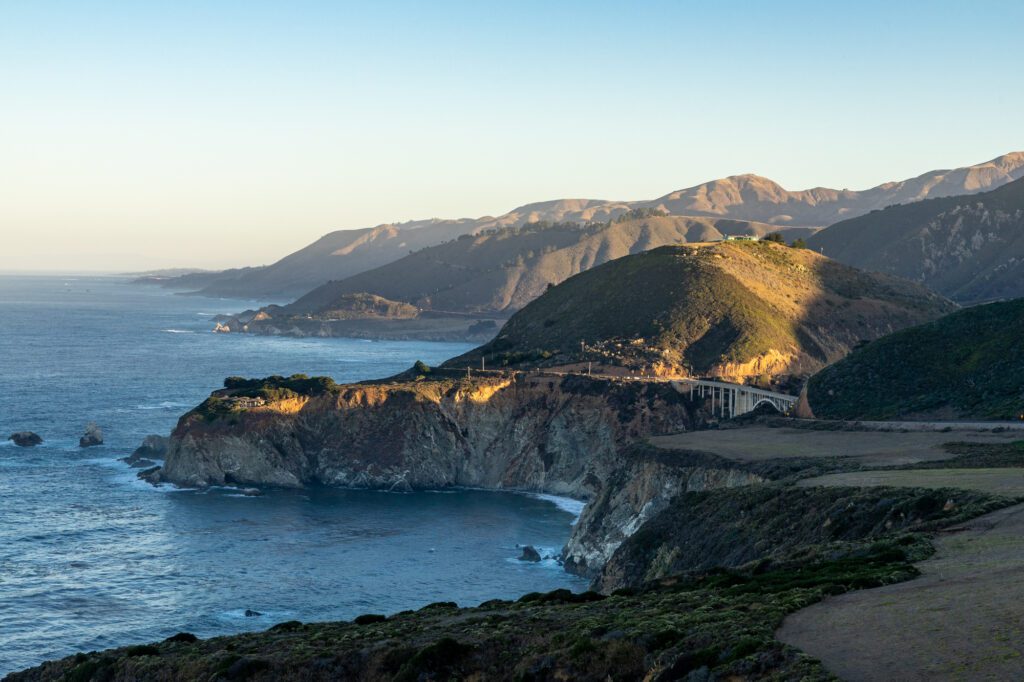
Check Out Bixby Creek Bridge
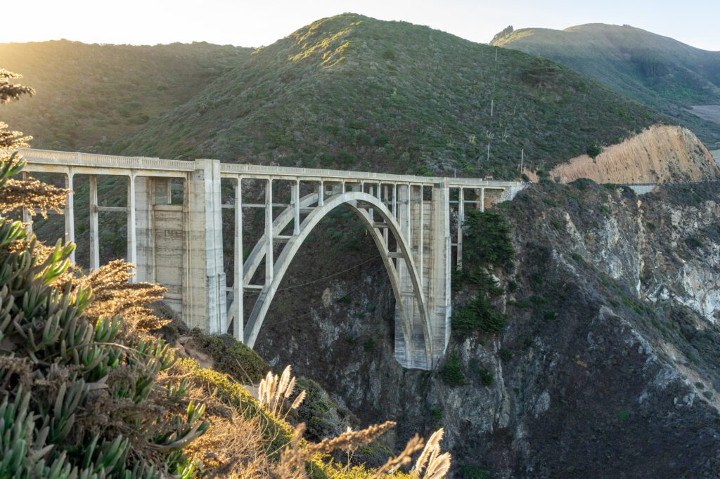
Next, you’ll head down to PCH for 11 miles until you get to Castle Rock Viewpoint to get a look at Bixby Creek Bridge, an iconic concrete bridge (the tallest of its kind) that was built in the 1930s.
The parking area to the right can get a bit crowded so you might need to wait for a spot, but people cycle in and out fairly quickly. No hiking required – you’ll be able to see the bridge from right off the road!
Stop by Point Sur State Historic Park to See the Lighthouse
Drive 5.5 miles down the PCH and then turn right into Point Sur State Historic Park, where the Point Sur Lighthouse is located. This lighthouse was built in 1889, and is still operational today.
You can walk around the lighthouse, as well as get beautiful views of the coast to the north and south from the point.
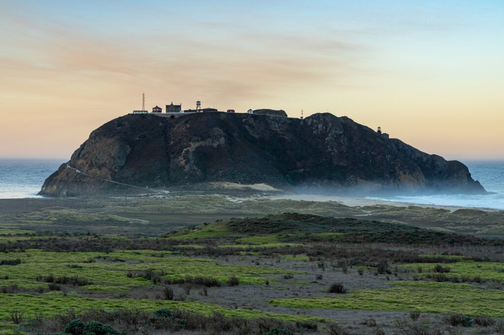
Quick note: they do offer tours of the lighthouse, although they are three-hours long. If this interests you, be sure to check if they have tours the day you’re passing through, and just omit a few of the Big Sur stops to allow for ample time for the tour.
Hike and Enjoy the Beach at Andrew Molera State Park
Drive about three miles down the PCH until you can turn right into Andrew Molera State Park for a hike and a bit of beach time. Pass through the park attendant kiosk and pay for a day use pass ($10) – this will give you access into all the other day use lots in the multiple state parks in the area (except for Pfeiffer Beach – more on that below).
Park, and then follow the signs in the parking lot for the Creamery Meadows Trail. This easy 2.4-mile out-and-back trail will take you right down to the beach.
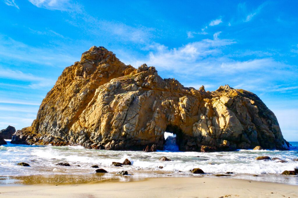
Hang Out at Pfeiffer Beach
After your hike, you’ll head about 8.5 miles down Highway 1 and turn right onto Sycamore Canyon Road to make your way down to Pfeiffer Beach.
This iconic Big Sur spot is known for its purple sand and massive rock formations, and it’s a beautiful spot to hang out, take photos, or go for a beach walk. This beach is a part of Los Padres National Forest, rather than the state parks in Big Sur, so your day use pass won’t work to park here – you’ll have to pay $12.
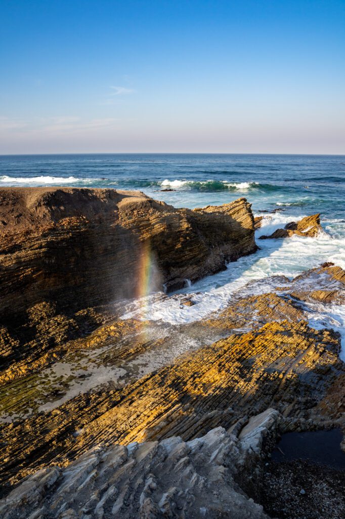
Check Out McWay Falls
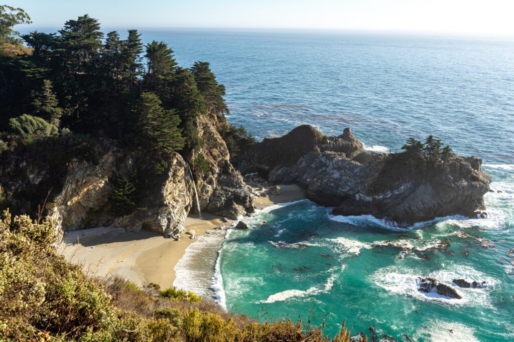
McWay Falls – located in Julia Pfeiffer Burns State Park – is one of the must-see spots in Big Sur, and it’s located about 10 miles down the PCH from the entrance to Pfeiffer Beach. This gorgeous waterfall is located in a picturesque cove and falls right on the beach.
To see the falls, park at McWay Falls Parking (your day use pass from earlier will work here, but if you skipped the stop, be sure to follow the self registration instructions posted in the parking lot). Go through the tunnel under the highway, and then follow the path out to the viewpoint – the trail is 0.6 miles out-and-back.
Hike at Limekiln State Park
Important note: at the time of writing this, the trails in Limekiln State Park are closed indefinitely due to fire damage from late 2020. Be sure to check out the Limekiln State Park website for trail status. If the trail is closed, continue down the PCH into Cambria.
If the trail is open, from McWay Falls, you’ll drive about 15 miles down the PCH and turn left into Limekiln State Park, where you can park using your day use pass.
Follow the signs from the parking lot for the Hare Creek and Limekiln Trail, a 2.2-mile out-and-back trail that takes you along the creek through a dense forest and up to some lime kiln ruins that haven’t been in use since the late 1800s. The trail also leads you to the base of Limekiln Falls.
Where to Stay in Cambria/the Surrounding Area
After your day in Big Sur, you’ll want to continue south to your accommodations for the night.
If you want to stay in a hotel, Ragged Point Inn is your best option, as it is only about 22 miles south of Limekiln State Park.
For camping, Kirk Creek is a great option, as it is just a couple miles south of the park. The two other hotel options are in Cambria, about 43 miles south.
- Ragged Point Inn and Resort: This rustic cliffside hotel offers beautiful views of the Big Sur coast. There are both rooms and deluxe rooms available, many of which have fireplaces and patios with ocean views. There is a restaurant on-site, as well as a coffee and wine bar and sandwich stand.
- White Water: This small, luxury bohemian-style hotel (which is located right across from the beach) has both rooms and suites available, many of which have fireplaces and ocean views. They serve alcoholic drinks and small bites in the lounge, and the rooms come with complimentary coffee and pastries.
- Moonstone Landing: Just down the street is the boutique and family-owned hotel Moonstone Landing. All rooms have fireplaces, patios or balconies, and full or partial views of the ocean.
- Kirk Creek Campground: This campground is part of Los Padres National Forest, and sits on top of an ocean bluff. It has 40 tent and RV sites, and reservations can be made online (this is a popular spot, so reservations are essential).
Day 4: Cambria to San Luis Obispo
On day 4, you’re going to backtrack just a bit up the PCH to check out Hearst Castle and San Simeon, and then make your way back through Cambria before heading to Morro Bay and San Luis Obispo.
See the Piedras Blancas Light Station and Elephant Seals in San Simeon
Backtrack up the PCH just a bit (about 15 miles) for a tour of Piedra Blancas Light Station in San Simeon, which was built in the 1870s and is still operational today.
Advanced reservations are required for self-guided tours (there are docents on-site who can give you additional information), and fees are currently $10 per person. Openings depend on the season, so check the website to see if the lighthouse is open during your visit.
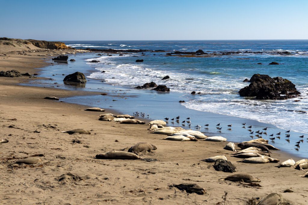
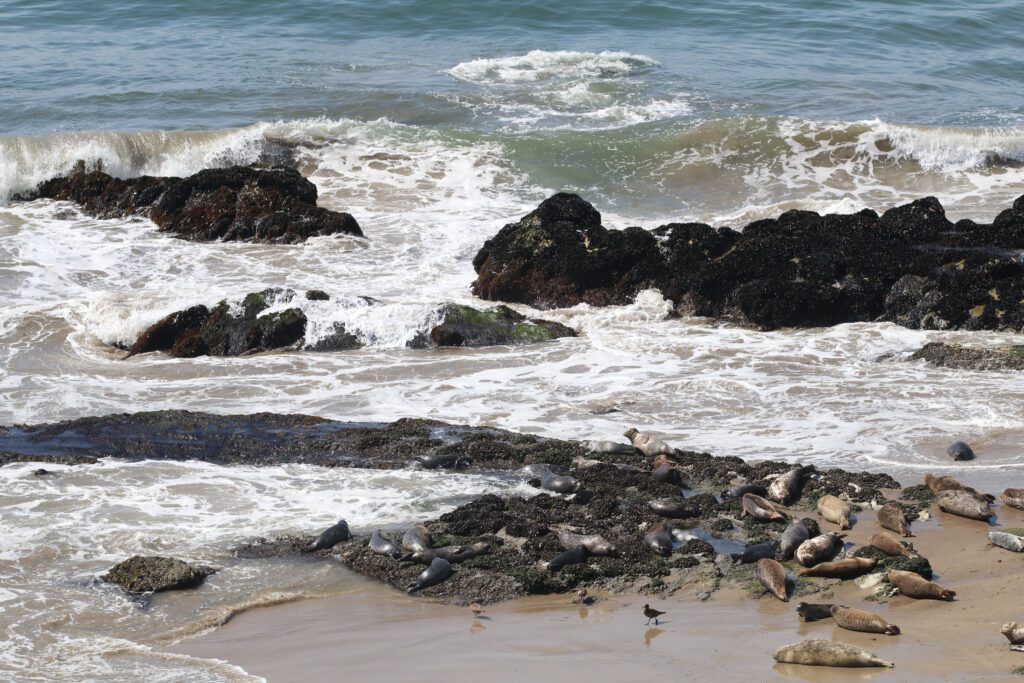
As you make your way back down the PCH for the next stop, be sure to stop by the Elephant Seal Viewing Point to see the largest seals in the northern hemisphere.
The Piedras Blancas Elephant Seal Rookery is the only elephant seal rookery in the world, and you can admire them (for free!) from this viewpoint.
Tour Hearst Castle in San Simeon
Next, head just a few miles down the road to the historic Hearst Castle (important note: at the time of writing this, Hearst Castle is closed for tours due to road repairs, and is expected to reopen in early 2022. Check the website for the most up-to-date information).
Construction of Hearst Castle started in 1919, and continued for nearly 30 years until it was transformed into what it is today: an opulent hilltop estate with 115 rooms, on a property with acres of gardens and beautiful pools.
The main house features William Randolph Hearst’s art collection, and you also get incredible views of the coast below.
There are three 60-minute daytime tours available. The “Grand Rooms Tour” is a must for first-time visitors, and tickets start at $25 for adults.
After your tour, you’re allowed to continue walking around the gardens on your own – but keep in mind that you must reserve at least one tour in order to get access to the property.
Advanced reservations are required, so be sure to schedule your tour online before visiting. When visiting, you’ll need to park at the Hearst Castle Visitor Center, and then take a shuttle up to the estate prior to your tour time.
Grab Lunch in Cambria
After your visit to Hearst Castle, you’ll make your way back into Cambria for lunch.
Hidden Kitchen (known for savory and sweet variations of their blue corn waffles), Boni’s Tacos (a casual taqueria that also has a food truck), and Cafe on Bridge Street (sandwiches, burgers, and salads) are all great options.
Check Out Morro Rock in Morro Bay
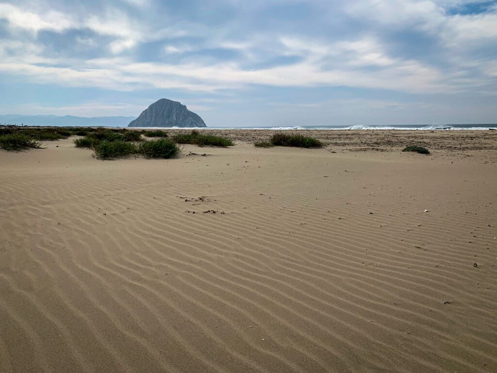
Once you’ve finished lunch, hop back in the car and drive 20 miles south to Morro Bay, and make your way to Morro Rock Beach.
Morro Rock is a massive rock formation (sometimes referred to as the “Gibraltar of the Pacific”), and is a historic landmark. This rock was formed around 23 million years ago from the plug of a volcano, and stands at 576-feet tall.
Admire the views of the rock, and enjoy a walk down the beach. Be sure to also keep an eye out for sea otters!
Enjoy Dinner and Drinks in San Luis Obispo
Hop back on the PCH and make your way down to San Luis Obispo, which is about 14.5-miles south of Morro Rock Beach. Grab some dinner at Old SLO BBQ in the downtown area (the location on Higuera Street).
After dinner, if you’re in the mood for a beer, head to Barrelhouse Brewing Co. If you’d prefer a cocktail, head over to the bar at Sidecar. Both of these spots are just down the street from Old SLO BBQ.
Where to Stay in San Luis Obispo
Here are a few hotels to consider for your stay in SLO:
- Hotel San Luis Obispo: Located in the downtown area, this modern urban resort has both rooms and suites available. There are multiple dining and bar options on-site, as well as a pool, spa, and fitness studio.
- Granada Hotel & Bistro: This historic upscale boutique hotel (which was built in 1922) is located downtown, and has 17 rooms. There is a restaurant and bar on-site, and the hotel has bikes available to borrow to explore SLO.
- San Luis Creek Lodge: This bright and airy modern hotel is located just a mile away from downtown. There are queen and king rooms available, which come with complimentary local coffee and pastries.
Day 5: San Luis Obispo to Santa Barbara
On day 5, you’ll start off with some easy hiking and beach time, and then continue south towards Santa Barbara, enjoying some wine tasting and other treats along the way.
Hike the Bluffs in Montaña de Oro State Park
Start the day with a bluff-side walk in Montaña de Oro State Park, a beautiful oceanside park.
For this stop, you’ll be going a bit off the PCH, which you might’ve noticed technically ended in Downtown SLO where it intersects with Highway 101. You’ll drive west via Los Osos Valley Road for about 30 minutes (just over 16 miles) from SLO to Montaña de Oro State Park.
When you’re done, you’ll head back towards SLO the same way you came to connect with Highway 101, and then make your way to the next stop (Avila Beach).
In the state park, the Bluff Trail has an easy walking path that gives you incredible views of the coast. Park near the trailhead, and follow the signs for the trail. While the full path is 4.1-miles, you can easily go as far as you’d wish on this out-and-back trail and then turn back.
Enjoy the Beach and Check Out a Farm in Avila Beach
After your hike, you’ll backtrack a bit, following Los Osos Valley Road to connect with Highway 101 just south of Downtown SLO, making your way to Avila Beach.
First stop is Pirate’s Cove. Park at the Pirate’s Cove parking lot, and then follow the Cave Landing Trail down to Smuggler’s Cave.
Backtrack up the trail just a bit to follow the off-shoot that goes down to Pirate’s Cove Beach for a beachside walk.
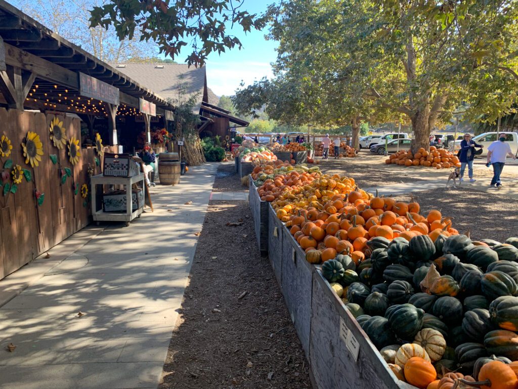
After the beach, head over to Avila Valley Barn, which is just two miles away from Pirate’s Cove. The farm stand (which is big!) and sweet shop are both open daily, so pick up some goodies to take home or food for the road (or to enjoy on the property).
They also have a smokehouse if you want a heartier lunch, and you can spend some time interacting with the animals, going on a hayride, or picking your own fruits and vegetables.
Check the website for up-to-date hours and information – besides the farm stand and sweet shop, these activities aren’t open daily, and some are seasonal.
Grab a Treat and Walk Down the Pier in Pismo Beach
Once you’ve wrapped up at the farm, you’ll drive about five miles down Highway 101 into Pismo Beach. If you need a caffeine boost, stop by Scorpion Bay Coffee. If you’re in the mood for something sweeter, try Surfside Donuts or Old West Cinnamon Rolls.
From there, walk through town and down to the Pismo Beach Pier, where you can continue your stroll before making your way back to the car.
Go Wine Tasting in Los Olivos
Next, you’ll continue down the coast to enjoy a bit of wine tasting, but first, a quick note about the PCH.
You’ll notice that the PCH starts up again in Pismo Beach, going straight through the downtown area. While you can continue down the PCH to the next stop if you want, it’s going to be more efficient to continue down Highway 101, so I’d recommend taking that route instead.
This portion of the PCH isn’t too exciting, and you’ll connect back up with Highway 1 before heading into Santa Barbara.
Drive down Highway 101 to make your way to Koehler Winery, which is about 48 miles south of Pismo Beach. This winery in the Santa Ynez Valley has a large outdoor area with open seating, and an extensive tasting menu that allows you to build your own flight.
Another highlight: there are emus on the property! Koehler also does not require reservations (unless you’re with a larger group), so it’s the perfect road trip stop.
Not into wine? Then head into the town of Los Olivos and stop by Tin City Cider’s taproom and do a cider tasting instead!
Check Out Solvang

Once you’ve finished your tasting, head down to Solvang, which is about an 11-mile drive from Koehler Winery. Solvang – AKA the Danish capital of America – is a small town known for its picture-perfect Danish-style architecture and fun shops and restaurants.
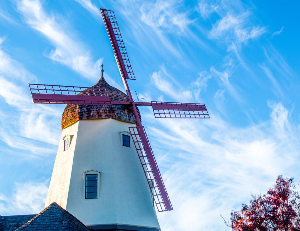
Stroll down Copenhagen Drive and the surrounding streets, and be sure to snap a photo of the Solvang Windmill. There are plenty of unique boutiques throughout town, as well as tasting rooms if you want to try a bit more wine (McClain Cellars is a great choice).
You also can’t stop in Solvang without trying some aebleskivers, which are fluffy Danish pancake balls. Stop by Solvang Restaurant to order some – it has a walk-up window for to-go orders, so you don’t need to dine indoors.
Enjoy Dinner and Drinks in Santa Barbara
After exploring Solvang, make your way into Santa Barbara (33 miles away) for dinner and drinks. For dinner, try Bluewater Grill (a seafood restaurant with views of the water), Loquita (a Spanish tapas restaurant), or Los Agaves (a traditional Mexican restaurant).
Once you’re done eating, head into The Funk Zone for drinks. This is Santa Barbara’s arts and culture district, with plenty of wine tasting rooms and bars. Many of the tasting rooms close on the earlier side, but Paradise Springs Winery is a great spot that stays open a bit later.
Alternatively, for beer, try Figueroa Mountain Brewing Company, and for cocktails, try Test Pilot (a fun tiki bar).
P.S. We have a whole guide dedicated to spending a day in Santa Barbara, which you can pull ideas from for your evening and morning.
Where to Stay in Santa Barbara
Once you’re ready to call it a day, spend the night at one of these accommodations in Santa Barbara:
- Agave Inn: This trendy, southwestern-style inn is a great budget-friendly option, and is located just a couple miles from the Downtown Santa Barbara area. There are both rooms and suites available, and the suites have kitchenettes.
- Hotel Indigo Santa Barbara: Hotel Indigo is located in Santa Barbara’s trendy Funk Zone, and is just a short walk from the beach. There are both rooms and suites available, and there is a fitness center and restaurant on-site.
- The Waterman: This hotel is also in the Funk Zone, just a few blocks away from the beach. There are queen and king bed rooms available, and there is an outdoor pool on-site.
- Refugio State Beach Campground: This campground is 20 miles west of downtown Santa Barbara, and is perfect for those who want to camp on the beach. There are 63 sites, and reservations can be made online.
Day 6: Santa Barbara to Santa Monica
Start the morning exploring Santa Barbara, and then make your way down the coast for some hiking before getting into Santa Monica.
Caffeinate and Explore Santa Barbara
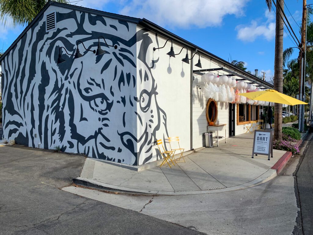
Kick off the morning with a cup of coffee from either Dune Coffee Roasters (two locations in the downtown area) or Dart Coffee Co.
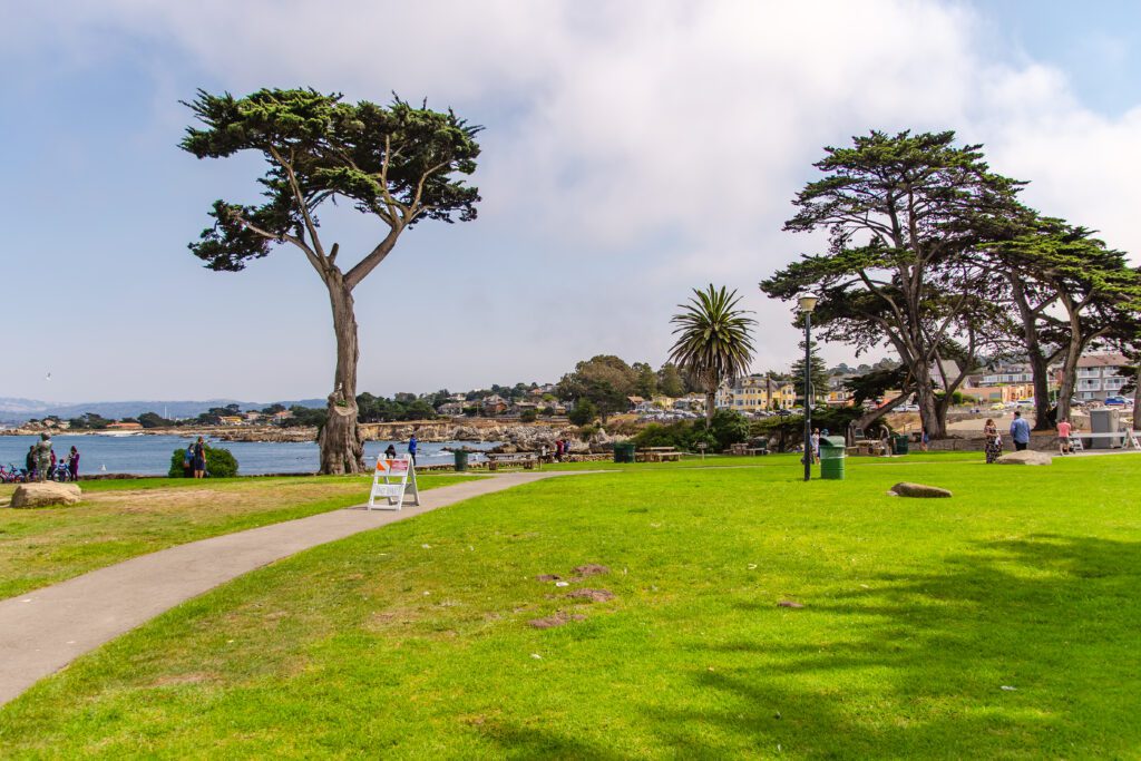
Take your drink and walk over to Stearns Wharf for a morning stroll down the pier – you’ll get really nice views of the palm tree lined coast!
Next, walk down State Street and make your way to the Santa Barbara County Courthouse. This Spanish-Colonial style historic landmark was built in 1929, and is far more ornate than your average courthouse, featuring large murals and impressive tilework.
After walking around the exterior gardens, be sure to climb the Clock Tower (located on the Anacapa Street side) for panoramic views of the city.
Do an Easy Hike and Watch the Seals in Carpinteria
Once you’re done in Santa Barbara, drive about 13 miles down the PCH/Highway 101 (they’ve merged at this point) into Carpinteria. Park in the lot at the end of 4th Street, and then follow the Carpinteria Bluffs Trail through the Tar Pits Park, which features natural asphalt lakes.
Continue going south down the trail, and make your way to the Carpinteria Seal Sanctuary, which is just past the pier. While this whole out-and-back trail is 2.7-miles, you can turn back at this point – you’ll get more hiking later in the day!
Grab Lunch at Ventura Harbor Village
Hop back on the road and drive for about 20 miles down to Ventura to get some food in Ventura Harbor Village.
This waterside village has shops and plenty of restaurants, and is also a fun place to walk around and admire the boats docked in the harbor. Grab some fish and chips (or other delicious casual seafood) at Andria’s Seafood Restaurant and Market.
Hike in Malibu
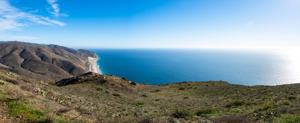
Next, head 23 miles down the coast and make your way into Malibu to do a hike in the Santa Monica Mountains in Point Mugu State Park. Turn left onto Sycamore Canyon Road (you’ll see the Point Mugu State Park sign) and pay the day use fee at the kiosk ($3 per hour per car, or $12 for the day) before parking.
Walk down Sycamore Canyon Road until you can turn left on Scenic Trail, starting the Point Mugu Scenic and Overlook Trails loop. This whole trail is 2.7 miles with a 413-feet elevation gain, and you’ll get incredible views of the mountainous coast from above.
Hang Out at El Matador Beach
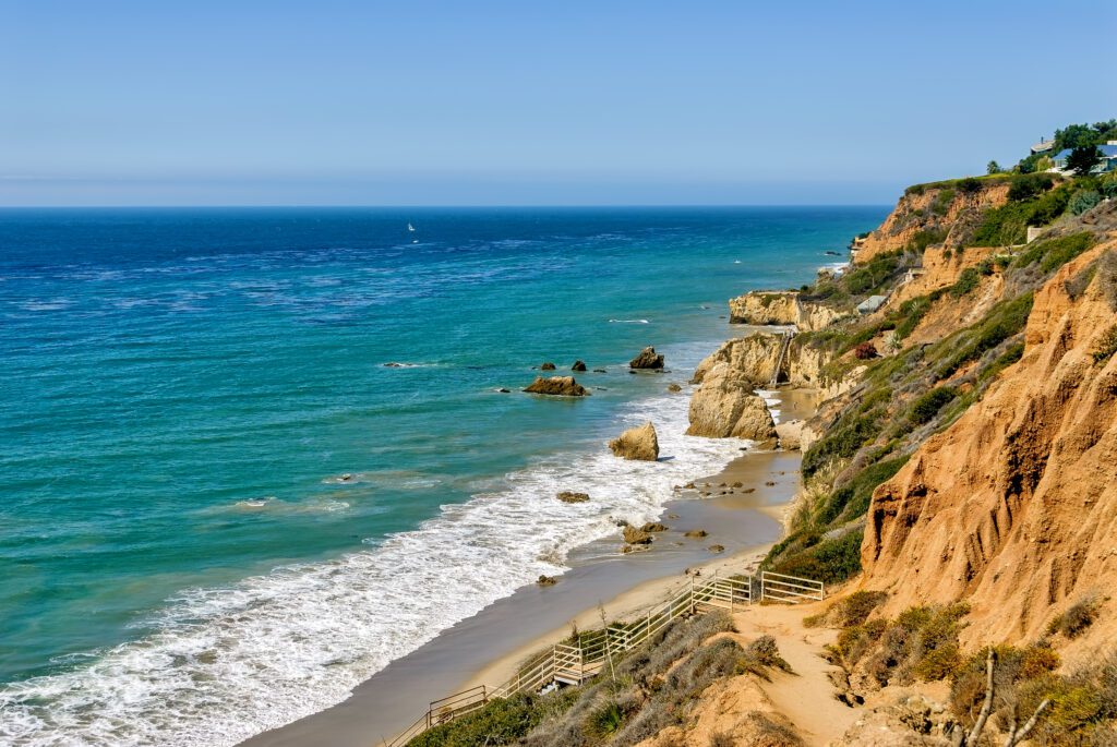
After your hike, you’ll spend a bit of time at one of Malibu’s most iconic beaches: El Matador Beach, which is about 8.5 miles down the PCH. El Matador is known for its large rock formations and caves.
This beach is part of the state parks system, and you’ll need to pay the $8 fee through one of the pay machines or on an app (or you can park on the road for free and walk down).
Watch the Sunset and Get Dinner and Drinks in Santa Monica
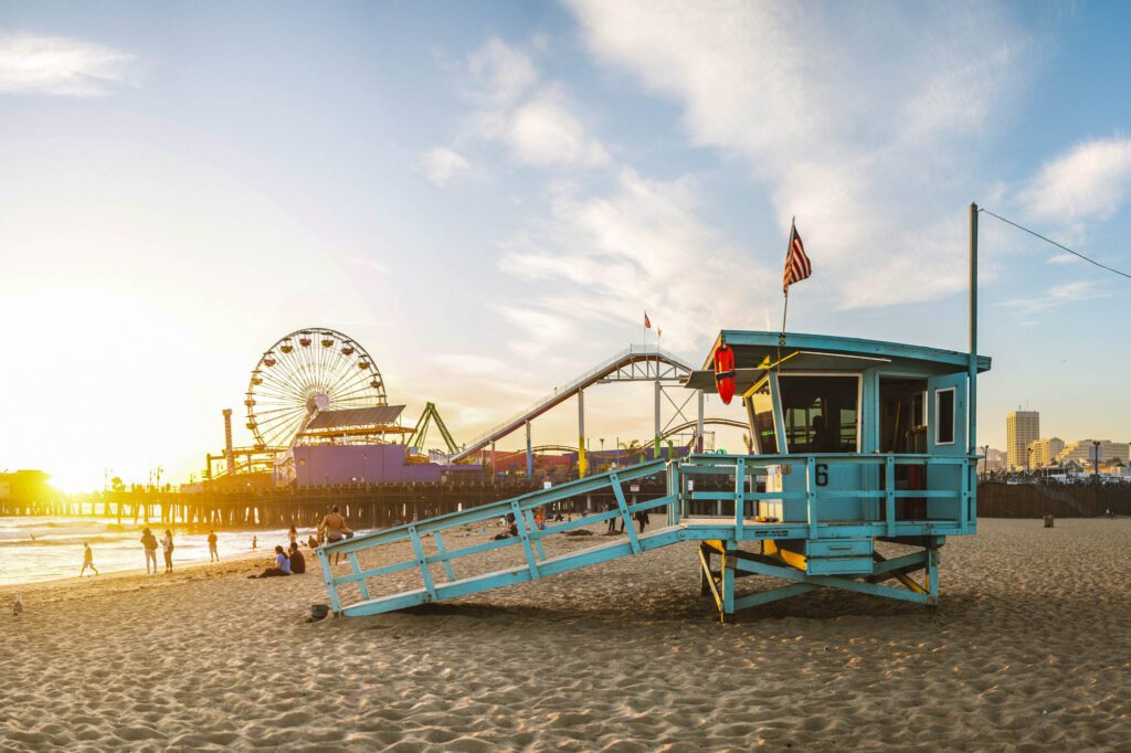
Get back in the car and drive about 25 miles down the highway to get to your final stop for the night: Santa Monica. Quick tip: traffic along Highway 1 in this area can get crazy (welcome to Los Angeles!), so mentally prepare yourself before you get back in the car!
Before dinner (or after, depending on your timing), be sure to catch the sunset. Palisades Park – the long park that parallels Ocean Avenue – is a great place to watch the sun go down.
For dinner, stop by Birdie G’s, a trendy restaurant serving creative comfort food and great cocktails. If you want something closer to the downtown area, try TŪMBI Craft Indian Kitchen, a modern Indian restaurant and bar. For after dinner drinks, stop by The Bungalow, a popular bar with a gorgeous outdoor garden and game room.
Where to Stay in Santa Monica/Venice
Here are a few hotels that you can check out in Santa Monica, as well as a more budget-friendly option in Venice Beach (just south of Santa Monica).
Psst! We have an entire guide dedicated to helping you find the perfect place to stay in Los Angeles – check that out for more details.
- Santa Monica Proper: This luxury hotel is tucked away, but still within walking distance of the restaurants and bars in Santa Monica, as well as the beach. There are rooms and suites (many with terraces), and there is a rooftop pool, spa, and fitness center on-site.
- Palihouse Santa Monica: This eclectic, Mediterranean-style boutique hotel has been in operation since 1927, and is just a couple blocks away from the beach. There are rooms, studios with kitchens, and multi-room “residences” available, and there is a restaurant open for breakfast and lunch on-site.
- The Georgian : The Georgian is an art deco-style hotel dating back to 1933 that is right across the street from the beach, and a short walk from the Santa Monica Pier. There are both rooms and suites available, as well as a restaurant on-site.
- The Kinney: This Venice hotel is a more budget-friendly option, and is located just a few steps away from the many shops and restaurants on trendy Abbot Kinney. This colorful hotel has both rooms and suites, and there is a breakfast restaurant on-site.
Day 7: Santa Monica to San Diego
On your last day, you’ll explore Venice before checking out some of the beach towns in Orange County and San Diego, with a bit of light hiking along the way.
You’ll spend a bit more time in the car today, and will undoubtedly run into some traffic, so make sure you download some podcasts or good music!
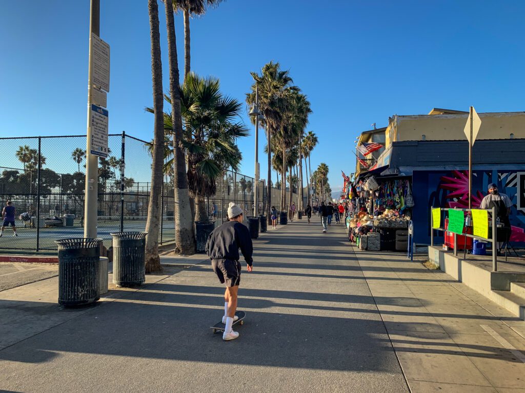
Grab Coffee and Stroll Around Venice
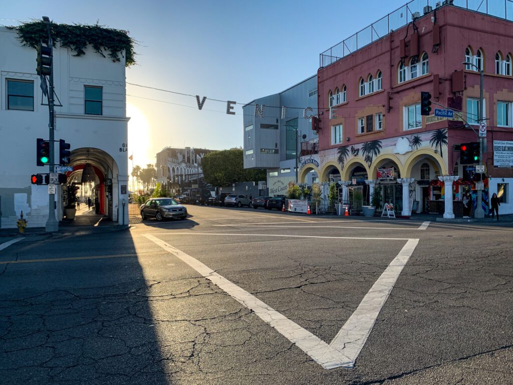
Head about three miles south of Santa Monica to Venice, and pick up some coffee at Intelligentsia on Abbot Kinney. If you’re a donut-for-breakfast kind of person, I’d recommend also walking down the street to grab one (or a box) from Blue Star Donuts.

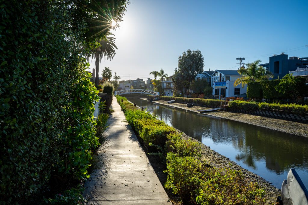
Next, walk over to the Venice Canals. These man-made canals were constructed back in the early 1900s, bringing a bit of Venice, Italy to Los Angeles. There are walkways and bridges that allow you to explore the residential area.
From there, walk down South Venice Boulevard towards Ocean Front Walk, following this oceanside path to Windward Plaza. You’ll pass by street vendors, and likely see some performers as well. You can also walk over to the Public Art Walls to check out the graffiti, and of course, walk down to the water.
Do an Easy Coastal Hike in Palos Verdes
After Venice, drive about 20 miles down the PCH to the trailhead for Bluff Cove Trail in Palos Verdes. Park on the northern side of the trail on Paseo Del Mar, and then walk south along the trail.
The walking path is only about half a mile long, but it gives you beautiful views of the coast. Take in the view and walk as far as you’d like before turning back to your car.
Eat Lunch in Huntington Beach
Next, head about 30 miles south to Huntington Beach to grab lunch.
Right on the PCH, you can try Burnt Crumbs (gourmet sandwiches and burgers) or Lemonade (a cafeteria-style restaurant with healthier options known for its variety of lemonade flavors).
A bit more inland, you can try Mama’s on 39, a popular comfort food restaurant with an all-day breakfast menu.
Enjoy the Coast in Laguna Beach
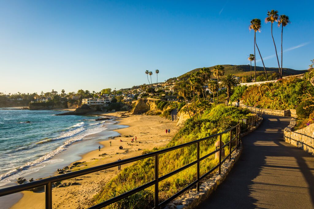
Continue down the PCH for about 15 miles to get to Laguna Beach. Here, you’ll head to Heisler Park, which sits above the water. This park features different art installations, and has multiple staircases that lead down to the small beaches in the area.
Explore the walking path, eventually making your way to the Heisler Beach Staircase to get down to the beach, where there are plenty of cool tide pools to check out.
Walk Through Encinitas
Next, drive about 48 miles down the coast to Encinitas, a laid back beach town in San Diego county.
Drive by the classic Encinitas sign, and grab an ice cream at Gelato 101, or a coffee at Better Buzz.
Do a bit of window shopping in the cool vintage shops and local boutiques, and be sure to get a view of the beach from D Street Viewpoint Park.
Get Dinner and Drinks in La Jolla Before Heading Home
If you have some time to spare before your flight home, stop in La Jolla to celebrate the end of your road trip with some dinner and drinks.
To enjoy some beautiful coastal views while you dine, I recommend getting dinner and drinks at George’s at the Cove, a multi-level restaurant that has both casual and more upscale dining rooms.
Alternative Road Trip Itineraries: 3 & 5 Days
If you don’t have a whole week to spare, here are some condensed itineraries that will get you down to San Diego a bit quicker.
3-Day Itinerary
On day 1, you’ll go from San Francisco to Monterey. Grab coffee at Soul Grind Coffee in Pacifica, and then drive south to do the Skyline to the Sea Trail Short Loop hike in Big Basin Redwoods State Park. After your hike, you’ll stop by Natural Bridges State Beach in Santa Cruz before grabbing lunch in town.
Next, drive down to Monterey to enjoy the Monterey Bay Aquarium, followed by a walk out to Lovers Point. Enjoy dinner in Monterey before calling it a night.
On day 2, you’ll drive from Monterey to Santa Barbara. Pick up snacks and lunch to-go to enjoy later in the day, and then drive into Big Sur. Stop by the viewpoint to see Bixby Creek Bridge, and then make your way down to Pfeiffer Beach.
Next, drive south and enjoy the short hike out to McWay Falls. Continue towards San Simeon for a tour of Hearst Castle. Make your way into Santa Barbara for dinner and drinks.
On your final day, stop by the Santa Barbara County Courthouse and Stearns Wharf before driving down to El Matador Beach. Grab lunch in Santa Monica, and then drive south to Heisler Park in Laguna Beach for a coastal walk. Finish your 3-day road trip with dinner and drinks in La Jolla.
5-Day Itinerary
On day 1, you’ll go from San Francisco to Monterey, just like in the 3-day itinerary – so follow the day 1 itinerary above!
On day 2, you’ll drive down to San Luis Obispo. Pack up snacks and lunch for the day, and drive through Big Sur, stopping by the Bixby Creek Bridge Viewpoint, Pfeiffer Beach, and McWay Falls. Hike the Hare Creek and Limekiln Trail in Limekiln State Park, and then head to San Simeon for a tour of Hearst Castle. Drive into SLO for dinner and drinks.
On day 3, you’ll make your way down to Santa Barbara. Hike the Bluff Trail in Montaña de Oro State Park before driving to Avila Beach, where you’ll follow the Cave Landing Trail to Smuggler’s Cave and Pirate’s Cove Beach.
Stop by Avila Valley Barn to grab some food and check out the farm, and then do some wine tasting at Koehler Winery in Los Olivos. Make your way into Santa Barbara for dinner and drinks.
On days 4 and 5, you’ll drive from Santa Barbara to Santa Monica, and then Santa Monica to San Diego. Days 6 and 7 in the 7-day itinerary above follow this timeline, so just use those guides for your final two days!
When to Plan a San Francisco to San Diego Road Trip
There’s no bad time to do this road trip, but some seasons are a bit more favorable over the others. If possible, I’d recommend doing this trip in the late summer or fall. The weather will be warm, skies should be clear, you likely won’t run into rain, and crowds won’t be as crazy in the popular stops.
In the early summer, there’s a good chance you’ll deal with some classic “June gloom” – which means foggy (and sometimes windy) weather.
You’re also more likely to run into rain in the winter and spring.