9 Incredible Hikes near Mt. Baker: A Complete Guide
From the alpine forests to the glacial peaks, the Cascade and Olympic Mountain Ranges in Washington state have some of the best hiking in the continental United States. Mt. Baker National Forest, encompassing a vast section of northwestern Washington, is no exception.
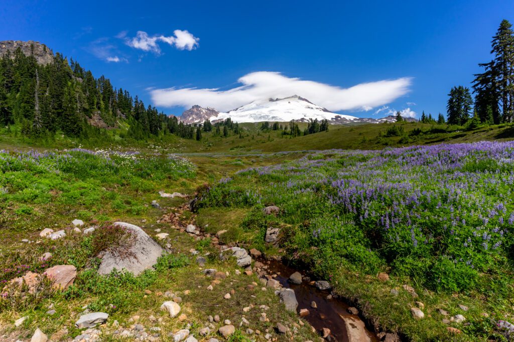
This underrated forest offers some of the most spectacular hiking in Washington, with fewer crowds than other parks. The best hikes near Mt. Baker boast wildflower-dotted valleys, snowy peaks, and alpine lakes; the quintessential Pacific Northwest wilderness that I daydream about whenever I am anywhere else in the world.
The Pacific Northwest is the closest place I have to call home, having grown up as a third culture kid and then transitioning into my nearly full-time nomadic life. Even though much of my year is spent elsewhere around the world, Seattle has been my home base off and on for over a decade.
Whenever I’m gone, I dream of summers gone by and summers to come spent exploring valleys and slopes among the Cascade Mountains in western Washington, where I came to fall in love with hiking and the mountains.
Over the years, Mt. Baker has increasingly become one of my favorite hiking spots. In many ways, I feel as though I’m just getting started.
Disclaimer: Some of the links in this post, like hotel and vacation rental links, are affiliate links, meaning at no additional cost to you we make a little bit of money if you click through and book. That being said, we would absolutely never recommend something to you that we don’t stand behind 100%.
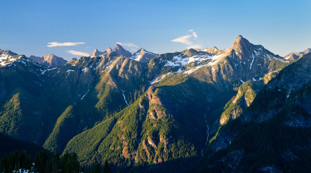
Mt. Baker Geography: A Quick Overview
Sitting about thirty miles east of Bellingham and sixteen miles south of the Canadian border in northwestern Washington, Mt. Baker is a heavily glaciated volcano in the Cascade Mountain Range and the third highest mountain in Washington state.
Mt. Baker has held a deep significance for the indigenous peoples of the Pacific Northwest for centuries, known as “Kulshan” in Lummi, “Kobah” in Skagit, and “Quck Sam-ik” in Nooksack.
In Mt. Baker-Snoqualmie National Forest, you will find an abundance of history and wilderness, from glaciated peaks and snow fields, to lush meadows and old growth forests.
Mt. Baker hiking trails span a vast area stretching from the Central to the North Cascades.
While the Mt. Baker region is quite expansive, Mt. Baker can generally be categorized into two primary hiking areas: Mt. Baker highway, which is north of the mountain, and the Baker Lake area, which is in the southern sector.
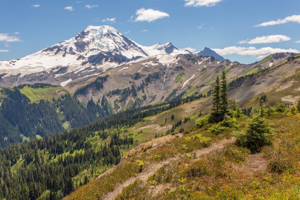
The Mt. Baker Highway (Hwy 542)
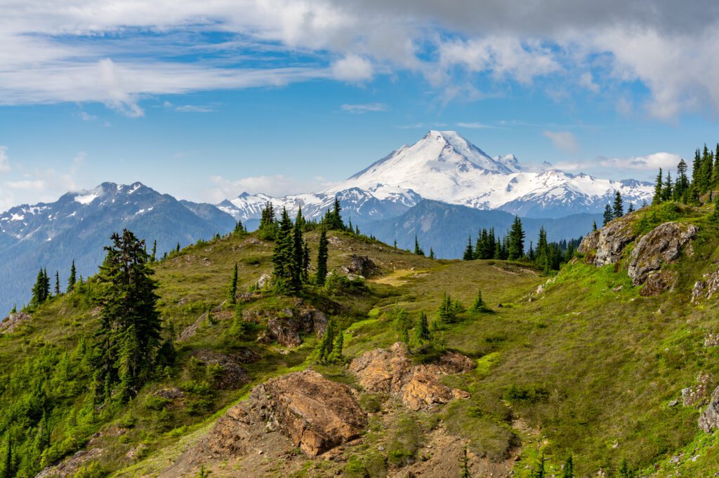
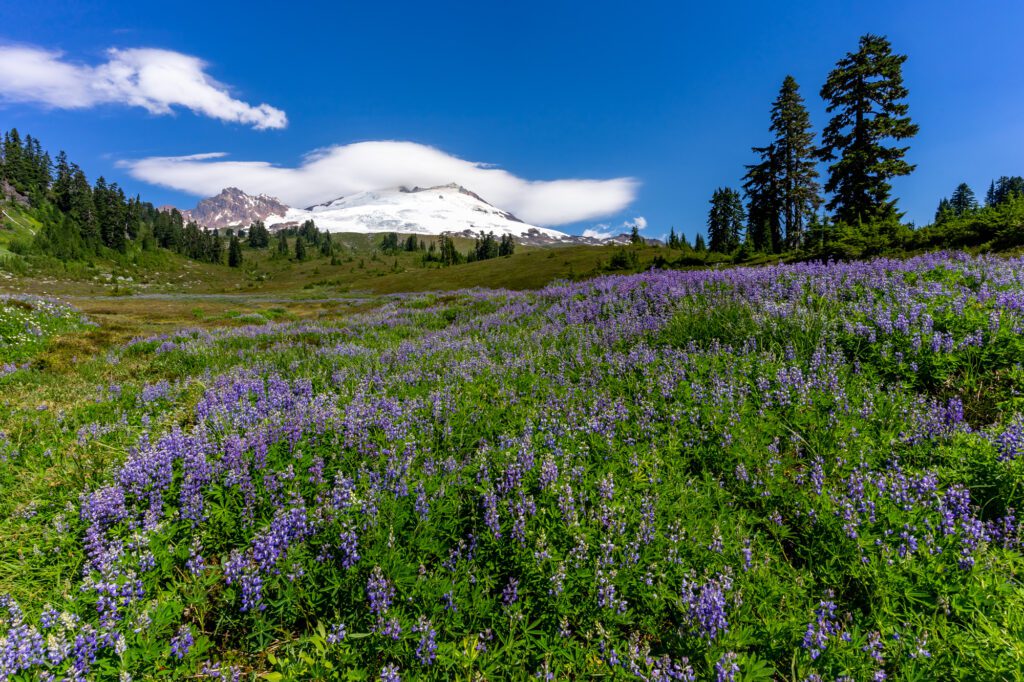
The northern sector of Mt. Baker is home to splendid hikes where views of snow capped Mt. Baker, Mt. Shuksan, and other rugged peaks are the backdrop to wildflower-speckled meadows, rushing creeks, and glacial lakes; a few of the key components to almost all of my favorite hikes in Washington.
To reach this sector, start driving on Mt. Baker Scenic Byway in Bellingham, follow along the North Fork Nooksack River, and eventually reach Artist Point, where the majority of hiking near Mt. Baker is clustered.
Here, you can take a short stroll to the highly photogenic Picture Lake before heading further into the forest for more strenuous hikes.
Baker Lake
Southeast of the mountain lies the Baker Lake area, which is reachable from the Baker River Highway.
This section of the forest offers a range of moderate lower elevation and early season hikes. Around Baker Lake, you’ll find an easy trail to walk along and a number of campsites.
This is the same highway that runs through the North Cascades, which makes it easy to add one of these hikes onto your North Cascades itinerary if you find yourself with some extra time.
The Best Time to Go Hiking at Mt. Baker
The hiking season in Mt. Baker National Forest is all-too brief, albeit glorious while it lasts.
I find it challenging to pack in as many hikes in the region as possible and attempt to fill every summer and early fall weekend, and even weekdays (a bonus of working remote and freelance!) with hikes that I can.
Mt. Baker hikes open early summer after the snow has melted from the trails and close after the first snowfall. Although this depends on the year, the hiking season generally lasts from late June to mid-October.
July and August are the peak summer months when wildflowers are blooming. While the sun-soaked blue skies and long days are my favorite time to enjoy Mt. Baker, this also means trails will be more crowded and campgrounds fill up quickly.
Late September through early October offer spectacular displays of fall foliage, Mt. Baker boasts some of the best fall colors in Washington state. Blueberry bushes turn shades of red, purple, and orange, while fireweed turns a rich red and mountain ash become golden yellow. Lake Ann and Yellow Aster Butte are two of my favorite hikes for fall colors in Mt. Baker.
November through June, trails are shut for the season. However, come winter, you can hit the slopes in some of Washington’s best ski and snowboarding areas at Mt. Baker or try your hand at snowshoeing or cross-country skiing around Baker Lake area or Artist Peak, which offers a 4-mile round trip snowshoe trail over relatively flat terrain with views of Baker Lake and the Cascades.
Although I’ve always been a fair-weathered hiker, I spent this past season in Washington during winter for the first time in years. I found a new appreciation for winter hiking, enchanted by the frozen lakes and evergreens draped in layers of white snow.
Tips for Hiking Around Mt. Baker
Research the hike and the current trail conditions beforehand to know if there is anything to be cautious of, such as road closures, bugs, or potentially dangerous trail conditions.
Come prepared and pack sufficient water, protein and energy-rich snacks, layers appropriate for the season, sun protection, and a flashlight. In the fall, always pack a raincoat because weather is unpredictable and appropriate hiking gear to navigate muddy, slippery trails.
Look out for wildlife that might be living among the forests you’re walking through in Mt. Baker. Creatures such as deer, mountain goats, marmots, pika, and black bears can be sighted within the forest. Remember to be respectful of their habitat!
Arrive early at the trailhead to ensure that you find parking and beat the crowds as much as possible. This will also help you to beat the heat. I love nothing more than hiking in the crisp, fresh mountain air in the morning and arriving at the summit as the sun is coming out, just in time for a lunch break and a swim in a lake if that’s an option on the hike. By autumn, the days are much shorter, so it is advisable to start the hikes on the early side to ensure you’ll be back to your car before dark.
The Best Hikes Near Mt. Baker
With over 1,500 miles of hiking trails, there is no shortage of hiking options in the vicinity of Mt. Baker and within the Mt. Baker National Forest.
From shorter hikes with modest elevation gain, to lengthier hikes with lofty ascents, from treks through old growth forests to those traversing grassy meadows and boulder fields, there is an incredible range of options appropriate for every type of hiker.
Here are some of my recommendations for the best hikes near Mt. Baker.
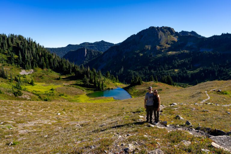
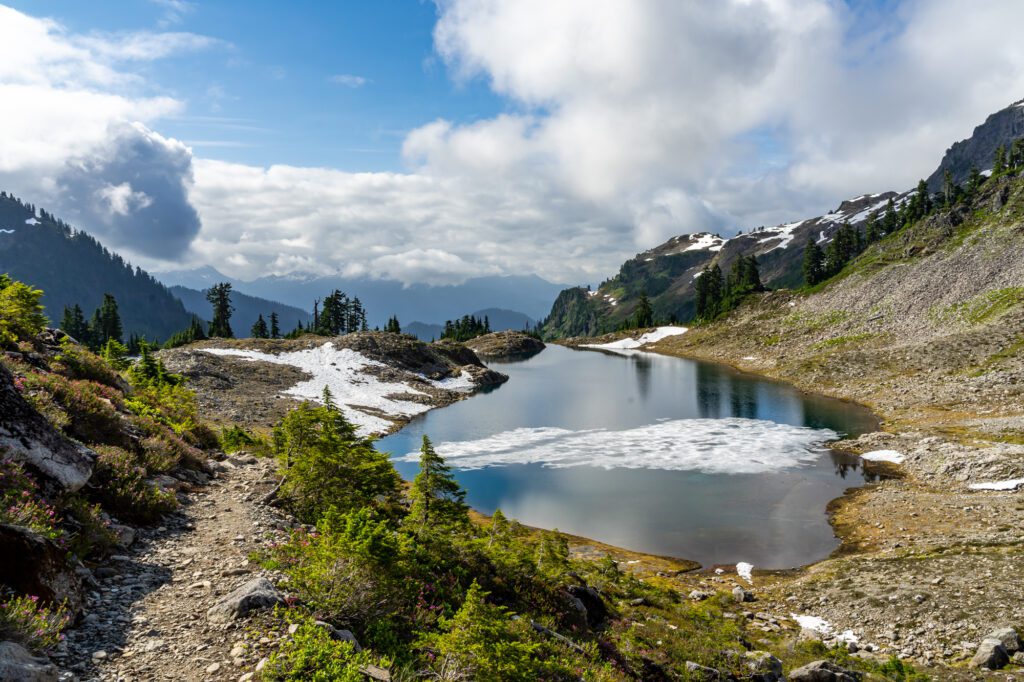
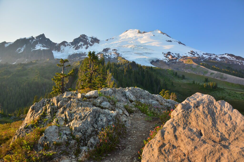
The Lake Ann Trail
- Length: 8.2 miles
- Elevation Gain: 1,900 ft.
- Trail Type: Out & Back
- Difficulty: Moderate
- Trailhead Location
Lake Ann is one of the first hikes I did in Mt. Baker and still holds a certain nostalgia for me. The hike starts out from a paved lot with sufficient parking before descending through subalpine forest.
The trail weaves in and out of forest and open meadows, giving a mix of views and shade.
As you walk through the Mt. Baker Wilderness, the trail will level off and cross over boulder fields, meadows dotted with wildflowers, and trickling streams.
The rocky path eventually levels off into a well-maintained trail through covered forest that eventually opens up into a basin with spectacular views of Mt. Baker, Mt. Shuksan, and Artist Point.
Ascend over rocky basins that come to life with colorful wildflowers during late summer months. Descending down to the shores of Lake Ann, you’ll find yourself amidst a very green grassy forest, which is the perfect spot for lunch with up-close views of Mt. Shuksan.
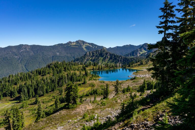
The Chain Lakes Loop Trail
- Length: 6.5 miles
- Elevation Gain: 1,820 ft.
- Trail Type: Loop
- Difficulty: Moderate
- Trailhead Location
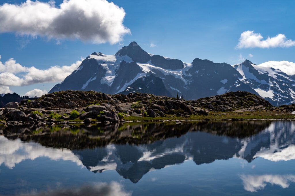
Chain Lakes offers what hiking in the Pacific Northwest is all about in my opinion: trails winding through grassy meadows, vivid views of the snow-covered North Cascades, and alpine lakes for swimming.
This hike can be started from three different parking lots, meaning you can hike this trail from a number of different directions.
Whether you choose to hike Chain Lakes clockwise or counterclockwise depends on if you prefer to climb first and then descend the steep Wild Goose Section (clockwise) or prefer to hike down the steep section first before ascending up to Herman Saddle (counterclockwise).
Either way, you’ll end up with a significant ascent and descent ahead of you with views over Mt. Baker, Table Mountain, Mt. Shuksan, and a spread of green valleys and lakes below. I’ve done the hike both directions and honestly find that each has their own merits.
The ultimate reward of Chain Lakes is Bagley Lakes, where you can cool off in the blissful water as a reprieve before continuing on your way. If you’re shy of cold water, just make the plunge without thinking too much.
Jumping right into the water helps me get over my reservations and once I’m soaking in the refreshing lake, I have no regrets.
The Yellow Aster Butte Trail
- Length: 7.5 miles
- Elevation Gain: 2,550 ft.
- Trail Type: Out & Back
- Difficulty: Difficult
- Trailhead Location
The fiery shades of orange, red, and yellow make Yellow Aster Butte a popular choice come fall, and one of my personal favorites for fall foliage in Washington.
There really is no bad time to endeavor on this hike though, as the expansive meadows are brushed with brilliant wildflowers during spring and summer, making this hike an exceptional one throughout the seasons.
Yellow Aster Butte is one of the more challenging hikes in Mt. Baker, with an elevation gain of almost 1500 feet in the first mile and a half. I personally don’t mind the elevation gain, enjoying the challenge and relishing in the rewards that much more at the end.
The trail crosses an avalanche pass, so it is best hiked when it is snow-free. You’ll walk through woods full of varied trees and meadows blooming with lupine and heather.
After the initial ascent, the trail flattens out to give you a rest before switchbacks lead up to the summit of Yellow Aster Butte. You’ll soon forget about the climb once you reach the top, which looks straight into the face of the pointed, snow-capped peaks of the North Cascades.
Note from Matt & Alysha: The road to this trailhead is long and bumpy, but we made it up with our Honda Odyssey with only one problem area. Passenger vehicles should be find – take it slow!
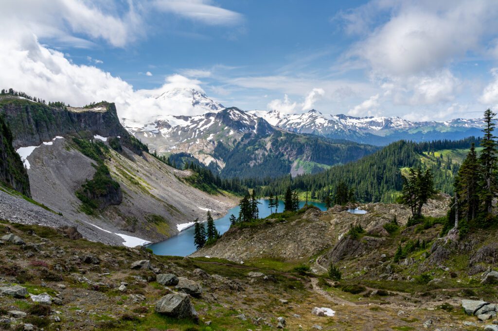
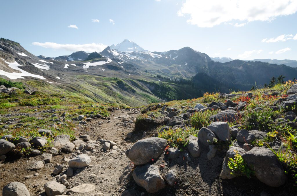
The Ptarmigan Ridge Trail
- Length: 9 miles
- Elevation Gain: 1,350 ft.
- Trail Type: Out & Back
- Difficulty: Moderate
- Trailhead Location
To reach this rocky hike, park in the lot for Artist Point and start off on the Chain Lakes Trail. After 1.1 miles, you’ll reach a junction from which you will go straight to start on the Ptarmigan Ridge trail. Follow the trail down, across, and up crests and open terrain, passing lupine and blueberry patches.
Note that there is very little shade on the trail, which can be challenging on a sunny day. Washington mountains can get unexpectedly hot during the summer, so I always pack extra water and hydration tablets to be prepared.

After crossing beneath Coleman Pinnacle across patches of snow, you will be privy to views of Mt. Baker and Coleman Pinnacle, which is a great place to take off your backpack and rest for a bit. To the south, you’ll spot views of the stunningly green Goat Lake.
From here, you hike up to a plateau, which is more or less the pinnacle of the hike. The path leads down to Goat Lake but you may want to use this as your turnaround point, as the trail down is quite precarious with loose gravel.
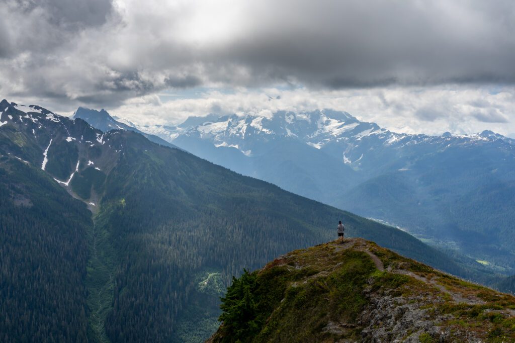
The Hannegan Peak Trail

- Length: 10.4 miles
- Elevation Gain: 3,100 ft.
- Trail Type: Out & Back
- Difficulty: Difficult – Very Difficult
- Trailhead Location
At the end of Hannegan Pass Road, you’ll find a parking lot, which is also where the hike begins. Enjoy a relatively moderate first couple of miles that takes you in and out of shady forest glades and across small waterfalls.
I appreciate the gentle grade at the start of the hike, which was a necessary warmup to ease into the more challenging latter half of the hike.
The grade eventually increases, turning into steep switchbacks that will bring you to Hannegan Pass, which makes for a perfect spot to take a snack break with views into North Cascades National Park.
Ahead lies an even more challenging section of the trail, where you will climb 1,000 ft. of elevation gain in just over a mile. Once you catch your breath at the top, the summit of Hannegan Peak will stun you with 360 views of the Cascades, including Goat Mountain, Ruth Mountain, and Mt. Baker.
Come prepared with snacks, water, and energy, and the payoff at the top will be well worth the effort.
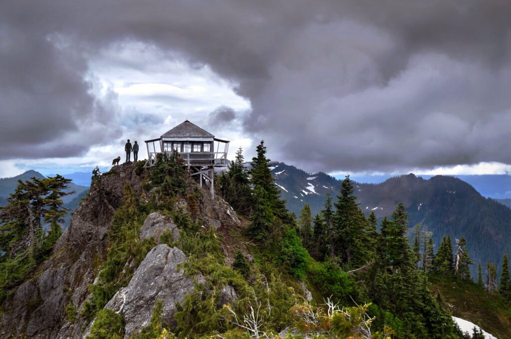
Park Butte Lookout
- Length: 7.5 miles
- Elevation Gain: 2,200 ft.
- Trail Type: Out & Back
- Difficulty: Moderate
- Trailhead Location
NOTE: This hike is the only one on this list that is on the southeast side of Baker, near Baker Lake.
This popular hike brings you to an historic fire lookout with panoramic views of the North Cascades. From the parking lot, which fits around 40 cars, you will head to the trail and cross over Sulphur Creek.
Before long, there will be an intersection with Scott Paul Trail and you will continue left, walking through a meadow of wildflowers during the summer and salmonberries, blueberries, and huckleberries come autumn.
Eventually you’ll cross over boulder fields before entering old-growth forest, where you will climb up through yellow cedar and hemlock.
Enjoy the backdrop of Koma Kulshan as you pass through meadows, which are ablaze with flaming red bushes in the autumn.
To reach the pinnacle of the hike—the lookout tower—you’ll have to climb a ladder.
Fire lookouts are a staple feature of many Washington hikes and were formerly used to look for fires in the mountains. At this point, stand amidst fir trees, where you can relax and take in the surrounding views of Black Buttes, the Twin Sisters, and the Nooksack River Valley.
Note from Matt & Alysha: Another somewhat bumpy road, particularly at the beginning when you turn off of the paved road. Definitely passable as long as it’s not wet and muddy – Homer, our Honda Odyssey – made it up just fine.
Artist Ridge
- Length: 1.2 miles
- Elevation Gain: 200 ft.
- Trail Type: Out & Back
- Difficulty: Easy
- Trailhead Location
This short but sweet hike starts out from the parking lot of Artist Point. Due to snow conditions, the Artist Ridge trail is accessible for less than three months a year, making the time that it is open quite crowded.
The entirety of this mostly flat hike offers stunning views of Mt. Baker and Mt. Shuksan, as well as views of smaller mountains in the distance. You will pass by gnarled trees, stumps, glacial lakes, and wildflowers that emerge in late summer along the way.
Unfortunately, the hike’s accessibility and undeniable views have attracted many crowds over the years, which have had an apparent impact on the wilderness and might be a deterrent to more adventurous hikers.
While it wouldn’t be my personal choice for a Mt. Baker hike, if you’re looking for a quick and easy jaunt through some spectacular Mt. Baker terrain accessible for all ages and physical levels, Artist Ridge may be worth the visit.
Winchester Mountain
- Length: 3.4 miles
- Elevation Gain: 1,300 ft.
- Trail Type: Out & Back
- Difficulty: Easy – Moderate
- Trailhead Location
The rocky and potholed road that leads to the parking lot for Twin Lakes trailhead, where the route for Winchester Mountain also starts, requires a high clearance vehicle.
It’s just past the trailhead for Yellow Aster Butte, and it’s at that point where the road gets really rough, narrow, and sometimes steep.
More days than not, I’m not thrilled with the idea of navigating a difficult road to a hike. However, if you have the right vehicle, don’t let a bad road deter you because some of the best hikes in Washington lie at the end of a tiring drive.
If you can manage the bumpy road there, this moderate hike to Winchester Mountain will bring high rewards.
The trailhead starts between the Twin Lakes, climbing gradually up a trail dotted with blueberries. The route eventually opens up, offering views that only get better with each step.
Continue straight (to the left is a rough, vertical, snow-covered scramble that should be avoided), until you make the final climb to the lookout point.
At the summit, relax with panoramic views of Mt. Baker, Mt. Larrabee, the Twin Lakes, and Tomyhoi Lake and Tomyhoi Peak. With a sprawling area up top amidst evergreens and grassy valleys, I have enjoyed passing the afternoon reading a book and enjoying the views.
The Skyline Divide Trail
- Length: 9.0 miles
- Elevation Gain: 2,500 ft.
- Trail Type: Out & Back
- Difficulty: Moderate – Difficult
- Trailhead Location
The trail for Skyline Divide starts at the end of Forest Road 37, where there is a parking lot with room for about 30 cars and additional parking along the side of the road.
Beware of the switchbacks and potholes along the way, which make for a bumpy ride best fit for a high clearance vehicle.
Much of the path is exposed so bring sunscreen and sufficient water. For the first couple of miles, you will walk on a moderately steep incline through a forest of fir and hemlocks until you reach the ridgeline.
As you emerge, you’ll come face-to-face with Kulshan and Shuksan and continue walking through the Mt. Baker Wilderness.
Marvel at the fireweed, lupine, and glacier lilies blooming along the way, which eventually turn into paintbrush, heather, and other flower varieties as the terrain becomes rockier.
At the summit of the sixth knoll, you will reach the peak of the hike with incredible views of Kulshan and the North Cascades in the distance. Sit down, catch your breath, and soak up the incredible setting for as long as you please.
Note from Matt & Alysha: We actually avoided this one, since the road is long and bumpy, and we figured it would be an hour-long, white-knuckle journey in our low-clearance minivan. High-clearance, 4WD vehicles are strongly recommended.
Places to stay near Mt. Baker
Camping
There are dozens of campgrounds within the vicinity of Mt. Baker. There are spots to camp near most of the major hikes and trails, although these are typically hike-in only. If you prefer campsites that are accessible by vehicle instead of backpacking, there are a number of options as well.
North – Along the Mt. Baker Highway
Silver Fir Campground: Located north of Mt. Baker, Silver Fir Campground is situated in the forest along the North Fork Nooksack River. Camp beneath the shade of silver fir and western cedar trees just a short walk away from the river and a sunny gravel bar. Picnic tables, fire pits, drinking water, and garbage services are all available at Silver Fir.
Douglas Fir Campground: Douglas Fir is also located in the northern sector of Mt. Baker, situated on the banks of the North Fork Nooksack River in the North Cascades. Set up camp among the stunning forested scenery equipped with picnic tables and fire rings. The campground has access to hiking trails and opportunities to kayak and whitewater raft on the river.
South – Around Baker Lake
Panorama Point Campground: Halfway up the basin and on the western shore of Baker Lake, Panorama Point Campground is a popular choice for camping south of the mountain. Pitch your tent among the forest with views of the lake. While the setting is lovely and offers access to drinking water and a boat launch, do note that it is a popular site for fishing and gets particularly busy during Sockeye fishing season.
Swift Creek Campground: This lakeside campground located about halfway up Baker Lake offers spectacular views over the water with about 50 private campsites. Here you’ll also find picnic tables, grills, and a boat launch.
Cabins Near Mt. Baker
If your idea of a good time is hiking by day, and staying in a cozy cabin, soaking in a hot tub under the stars by night, here are some options for you.
Cedar Point Cabin (sleeps 2-4): This chic cedar cabin nestled into the forests of Glacier is the perfect stay for a couple. Cozy up in front of the fireplace or relax in the hot tub after a day of hiking along the nearby Nooksack River or skiing the slopes of Mt. Baker.
Shuksan Cabin (sleeps 6): Retreat to this woodsy hideaway with your family or friend group, complete with tall ceilings and gorgeous woodwork. Relax on the deck amidst the mossy trees with the sound of Glacier Creek in the background.
Mountainview Lodge (sleeps 8): Bring your family or go with a group of friends to this charming 1970’s renovated cabin showing off views of the mountains from the vaulted ceiling windows. Take a soak in the hot tub after a day of hiking or gather around the firepit come nighttime.
MORE TO EXPLORE IN THE PACIFIC NORTHWEST
If you’re planning a trip to the Pacific Northwest, we’ve got you covered with all sorts of super detailed travel guides to our favorite places in Washington and Oregon.
- Seattle: Find the perfect place to stay in Seattle, use our itinerary and complete Seattle city guide to plan your weekend in Seattle (we also have a guide to one day in Seattle for shorter trips), find a new hike near Seattle to tackle, and plan your next day trip or weekend getaway.
- Portland: Get a local’s take on what to do in Portland and where to stay in Portland, plan your weekend itinerary (we also have a guide to one day in Portland for shorter trips), find the best hikes in and around Portland, and discover the best day trip and weekend getaway destinations.
- Road Trips: Explore the best of the Pacific Northwest on a 14 day Pacific Northwest road trip. Plan an amazing Washington road trip or Oregon road trip with our detailed guides, including a couple of itineraries that you can copy/paste.
- The Oregon Coast: Explore the best of the Oregon Coast on a 7 day Oregon Coast road trip. Discover the best hikes on the Oregon Coast, and figure out what to do in Cannon Beach and Astoria.
- Hiking in Oregon: Get a local’s take on the best hikes in Oregon, the most spectacular Oregon waterfalls, and dive deeper into each region with our guides to the best hikes at Mt. Hood, in the Columbia River Gorge, and more.
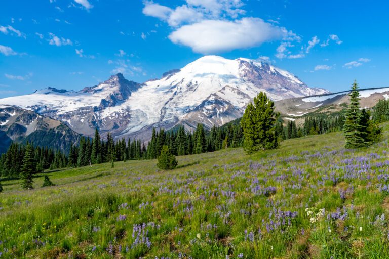
- Hiking in Washington: Add to your Washington hiking bucket list with our guide to the best hikes in Washington. Then dive into our regional hiking guides to discover the best hikes near Seattle, hiking at Mount Rainier, in Olympic National Park, in the North Cascades, and at Mount Baker.
- Mount Rainier National Park: Plan the perfect trip to Mount Rainier with our guides to the best things to do, the best hikes, and how to plan a perfect day trip to Rainier.
- Olympic National Park: Explore the best that Olympic National Park has to offer – the best hikes, a complete itinerary, and exactly where to stay in Olympic National Park.
- North Cascades National Park: The least visited of the National Parks in Washington, learn how to plan a perfect itinerary, and figure out the best hikes to add to your list.
- Crater Lake National Park: Discover the best that Oregon’s only national park (isn’t that crazy?) has to offer with our guide to planning your Crater Lake itinerary, and our guide to the best hikes in Crater Lake. Plus, a guide to planning an amazing Seattle to Crater Lake road trip.