Hiking near Portland, OR: A Complete Guide for First Timers
A big part of the reason that we’ve fallen head over heels with Portland is the fact that there is so much incredible natural beauty within about 90 minutes of our front door. Towering snow capped peaks? Mount Hood has us covered. Rugged rocky coastline? The Oregon Coast is exactly 90 minutes from our front door! And we haven’t even gotten to the spectacular waterfall hikes in Silver Falls State Park and the incredible hikes in the Columbia River Gorge yet.
The point is, no matter what kind of hike you’re in the mood for, you’ll find it near Portland.
Between living here and our numerous trips before we decided to commit to living here, we’ve done A LOT of hikes. We’re avid hikers, and make it a priority to hit the trail once a week when we can.
Which means that we’ve personally done every hike on this list AT LEAST once. So you can think of this list of the best hikes near Portland as an ever-evolving list that we’ll add to over time as we discover more and more trails.
Each of these hikes is within 90 minutes of the city, and makes for an excellent day trip from Portland to get out of the city and experience Oregon’s diverse natural beauty for yourself.
For each hike, we’ll give you an overview, the important trail details like distance and elevation gain, and link to a place where you can read recent trail reports to see what conditions are like at the moment.
Sound like what you’re looking for? Great! Let’s dive into hiking in Portland and talk about our favorite trails.
Disclaimer: Some of the links in this post, like hotel and vacation rental links, are affiliate links, meaning at no additional cost to you we make a little bit of money if you click through and book. That being said, we would absolutely never recommend something to you that we don’t stand behind 100%.
A Complete Guide to the Best Hikes Near Portland
Portland has some great hikes, both within its city limits, and within a short drive of the city center.
Below, you’ll find our top picks for hiking near Portland, divided into hikes that are actually in Portland, hikes that are just outside of the city, and hikes that are a little further out (90 minutes max), and make for a perfect for a day trip from Portland.
In both sections, we’re going to roughly organize the hikes by our favorites, which is completely subjective, but also probably the most useful for you, dear reader, as you’re looking for hikes to add to your list.
It’s not the most scientific way to organize them, but that’s probably okay.
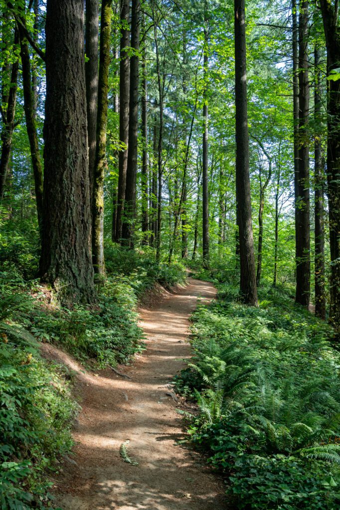
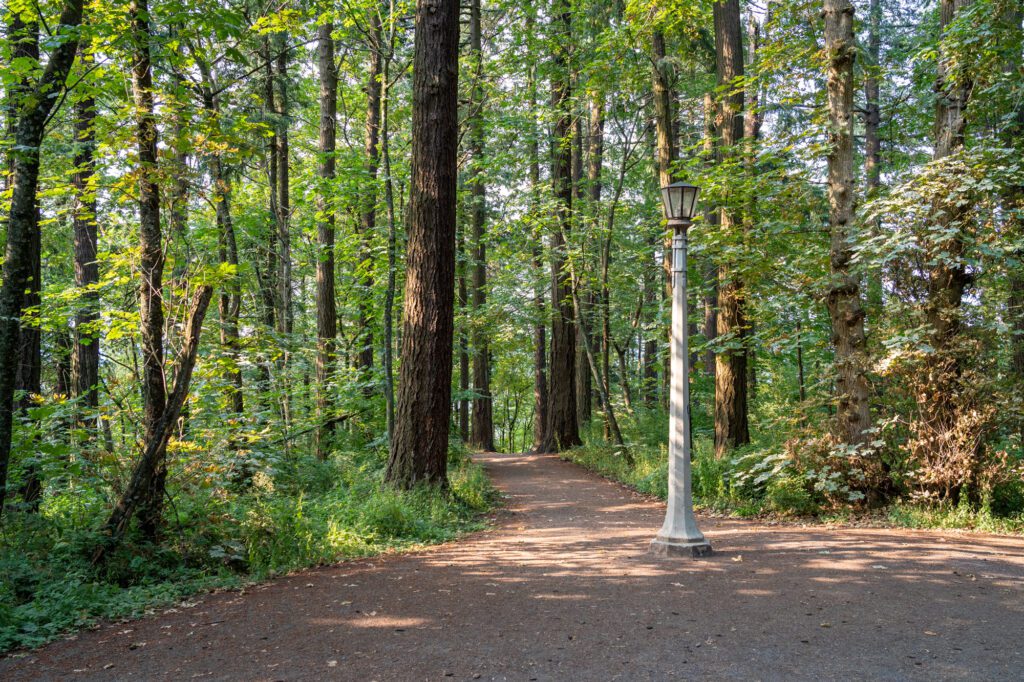
9 Great Portland Hikes Within the City Limits
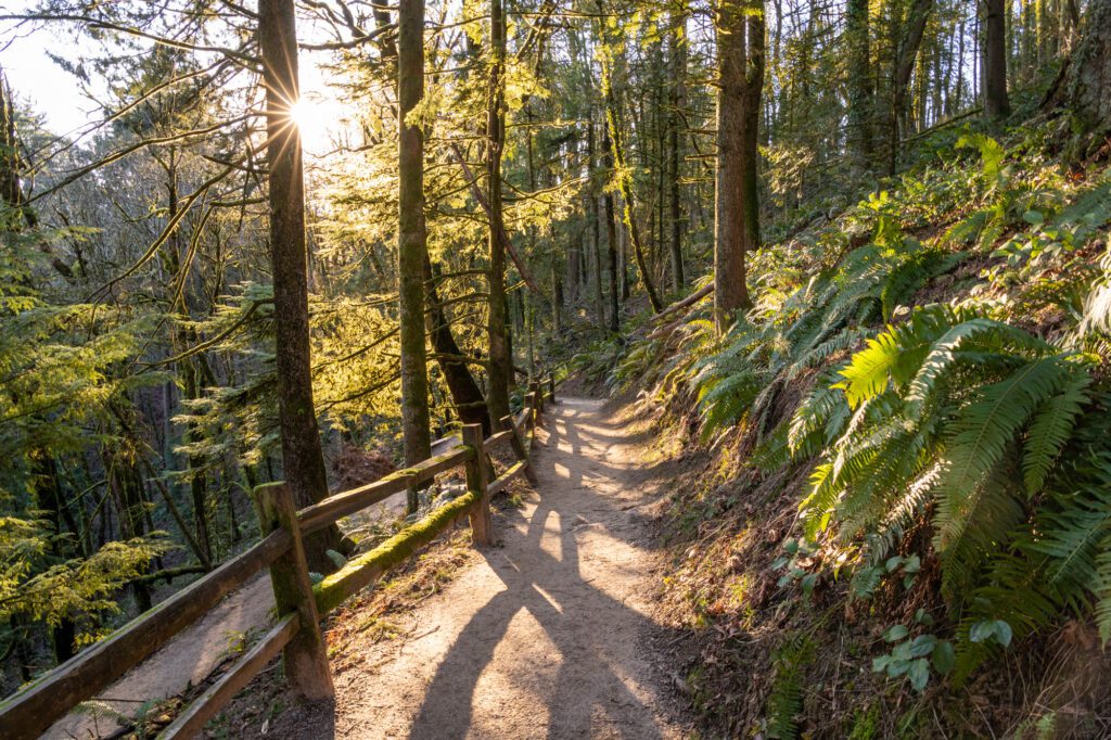
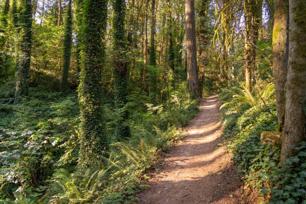
One thing to know about hiking trails in Portland: in places like Forest Park, Mt. Tabor, and Tryon Creek State Park, there’s a nearly endless combination of trails, weaving through the forest, across creeks, and to various viewpoints.
Below, we’ve given you our picks for the loops we liked, but know that you can make each of them shorter or longer according to what you’re looking for.
The Washington Park Loop (the Long One!)
- Length: 4.8 miles
- Elevation Gain: 750 ft.
- Trail Type: Loop
- Difficulty: Easy / Moderate
- Dog-Friendly? Yes, on a leash
- Parking Pass: None (paid parking in Washington Park)
- Trailhead Location
We love this trail! We were looking for a hike through Washington Park that combines both the International Rose Test Garden and Hoyt Arboretum, and stumbled across this five mile route.
We think it’s the best bang-for-your-buck hike in Portland.
There are a nearly unlimited number of trails in Washington Park, but this is our favorite because it hits both the roses and Hoyt Arboretum, which are our two favorite parts of the park.
Along the way, you’ll also see the archery range in the park, the Japanese Garden, the Vietnam Veterans of Oregon Memorial, and plenty more.


There are a couple of different ways to do this hike, and it basically comes down to whether you’re driving or not, and whether you want to pay for parking or risk not finding a spot. Here’s the quick breakdown:
- If you don’t have a car: Take the MAX Line (red or blue) to the Oregon Zoo / Washington Park stop, and start / end the loop there. You could also walk up the hill to the rose garden from the Northwest District if you were feeling extra energetic.
- If you have a car, and are willing to pay $8 for parking: Park at either the Rose Garden or the Zoo.
- If you’re cheap and want free parking: Park on Fairview Blvd – roughly here – and start the loop there heading in either direction.
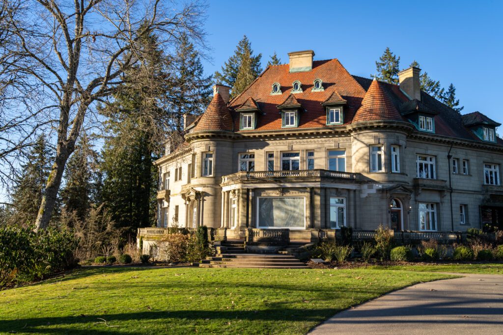
Lower Macleay Trail to Pittock Mansion
- Length: 5 miles
- Elevation Gain: 950 ft.
- Trail Type: Out & Back
- Difficulty: Moderate
- Dog-Friendly? Yes, on a leash
- Parking Pass: None
- Trailhead Location
If you only have time for one hike in Portland, this is our choice for you. It starts from the Lower Macleay Trailhead in northwest Portland, where there are bathrooms and a small parking lot.
From the trailhead, you’ll head into the heart of Forest Park, starting with a flat, meandering walk along the creek. About a mile in, you’ll hit the Witch’s Castle, which is a spooky looking building that used to be a ranger station and restroom, but was destroyed in the 60’s and never rebuilt.
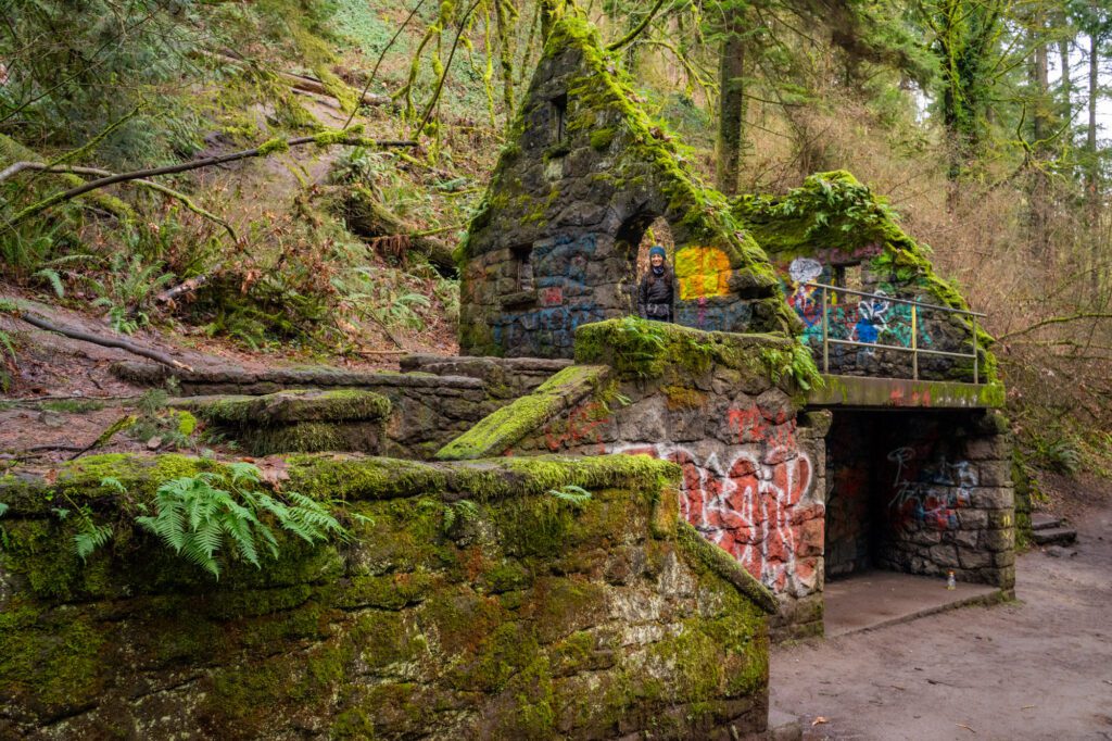
Today, it’s Insta-famous, with all sorts of graffiti covering nearly every surface. It’s very…odd. Peak Portland.
After spending a second there, continue along the trail. You’ll cross a bridge across the creek, and that’s where the climbing starts in earnest. It’s all uphill from here!
You’ll climb some switchbacks up to the Upper Macleay parking lot, where you’ll need to cross the road, and start up even more switchbacks on the other side.
It’s a good climb, and you’ll probably be breathing a little bit harder when you arrive at Pittock Mansion than the people who are getting out of their cars after driving there.

Admire the views, check out Pittock Mansion, and head back down the way you came when you’re done.
You could do this two other ways, depending on what you’re looking for.
- To make it shorter, start at the Upper Macleay Trailhead, but know that you’ll miss the Witch’s Castle.
- Do it one way from the trailhead to Pittock Mansion and continue into Forest Park and over to the International Rose Test Garden and Hoyt Arboretum. Just get a Lyft (or a ride) to the trailhead.
Note that the parking lot at the trailhead is small, but there’s plenty of street parking in the adjacent neighborhood if it’s full when you get there.
Read More: The Hike to Pittock Mansion: A Complete Guide to Portland’s Best Urban Hike
Marquam Trail to Council Crest Park

- Length: 3.1 miles
- Elevation Gain: 750 ft.
- Trail Type: Out and Back
- Difficulty: Moderate
- Dog-Friendly? Yes, on a leash
- Parking Pass: None
- Trailhead Location
This was our favorite section of the 4T trail, which is why it makes the list here!
You’ll start from the trailhead in Marquam Nature Park, and embark on a semi intense climb through old growth forests to an excellent viewpoint up at Council Crest Park.

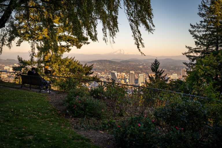
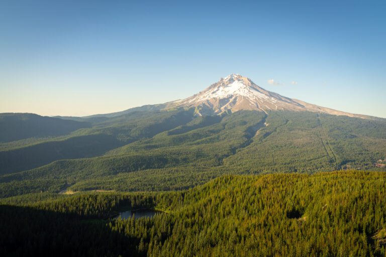
From Council Crest, you can see north up to Mount St. Helens, and east to Mount Hood. This is a great sunset spot, so we’d recommend doing this hike in the afternoon if you can swing it.
If you don’t have a car and still want to do this trail, taking the Portland Aerial Tram up and back down is actually a great option to reach the trailhead.
It adds about a mile and 250 feet of climbing (on the way back to the tram), but it’s a beautiful view from the top station of the tram.
The 4T Trail

- Length: 4.2 miles (this is the hiking portion of the trail)
- Elevation Gain: 600 ft.
- Trail Type: Loop
- Difficulty: Easy / Moderate
- Dog-Friendly? No dogs allowed (because of public transportation)
- Parking Pass: None (though you will pay for parking)
- Trailhead Location (the best place to start is the Oregon Zoo)
This is one of the more unique hikes in Portland. If you follow the 4T trail, you’ll make a giant loop around downtown Portland, using four different modes of transportation (trail, tram, train, trolley) to navigate the city.
It was one of the first hikes we did upon moving to Portland, and it’s a fun experience to share with visitors because you see the city from different angles than you usually would.
Plus, the view from both Council Crest Park and the Portland Aerial Tram are spectacular.
Tackling this trail was a little complicated, and we found it hard to find reliable information on the internet helping us figure out things like where to start, what direction to go, and other important logistical questions.
So we wrote a guide! If you’re interested in this hike, you should read our guide to hiking the 4T Trail.
Here’s the summary. Begin at the Oregon Zoo and start a forested climb up to Council Crest Park where, on a clear day, you can see multiple snowy peaks like St. Helens and Mount Hood.
Head down the Marquam Trail to the top of the Portland Aerial Tram, where you’ll embark on a scenic three minute journey down to the river level.
From the base of the Aerial Tram, hop on the Portland Streetcar and head downtown. To complete the loop, take the MAX back to the Oregon Zoo (although, if you’re starting from downtown Portland, you’ll start with the MAX ride to the zoo).
All in, it will cost you between $8 and $11 to do this trail, which covers the aerial tram and tickets on the MAX and Streetcar (or a day pass).
There’s more to it, so we’d really encourage you to read our guide to the 4T trail to figure out exactly how to do the hike!
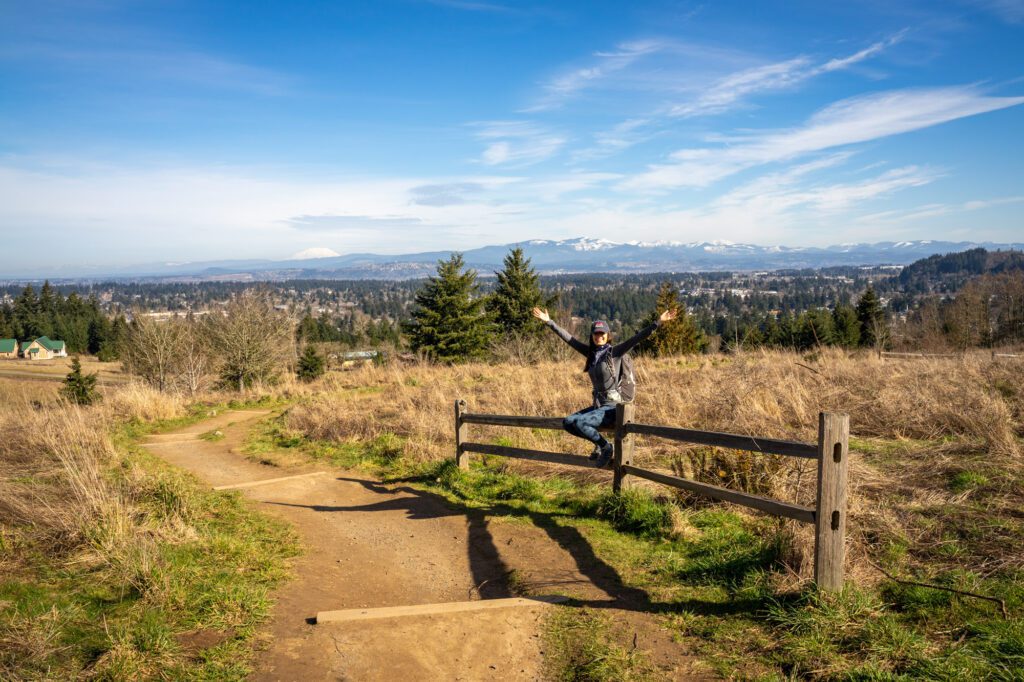
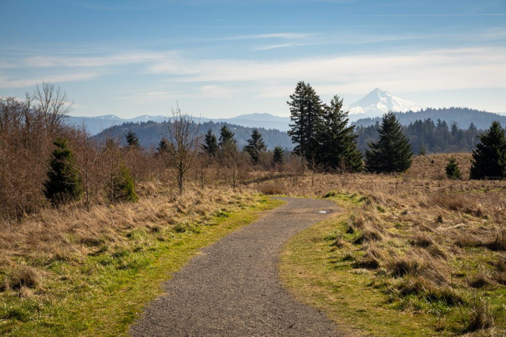
The Powell Butte Loop Trail
- Length: 4.1 miles
- Elevation Gain: 554 ft.
- Trail Type: Loop Trail
- Difficulty: Easy / Moderate
- Dog-Friendly? Yes, on a leash
- Parking Pass: None
- Trailhead Location
This hike is best on a clear day, because from the summit of Powell Butte, which is an extinct volcano, you can see Mount St. Helens, Mount Hood, AND Mount Adams.
We saw a clear day in the forecast, woke up to some sun, and booked it out to the trailhead before the precious winter sun went away.
The hike starts from a relatively small trailhead with plenty of parking for a weekday, but I’m sure it gets packed on weekends.
You’ll follow a wide, paved path along the northern edge of the park before taking a right at the fork to take Holgate Lane, which leads you down into the forested area.
Meander through the ferns and tall trees before taking a left up the stairs and connecting with the Elderberry Trail, which is where the hike gets very woodsy, and connect with first the Cedar Grove Trail, then the Hawthorne Trail, which leads you most of the way around the western edge of the park and ends at the Summit Trail.
From there, make the return down to the parking lot after you spend some time admiring the views of the different mountains in all directions.
It’s a good urban hike in Portland, and like most of the parks in Portland, there’s a nearly endless number of trails that you can connect and explore, so hiking here never gets old.
The Mount Tabor Blue Loop Trail
- Length: 2.2 miles
- Elevation Gain: 250 ft.
- Trail Type: Loop
- Difficulty: Easy
- Dog-Friendly? Yes, on a leash
- Parking Pass: None
- Trailhead Location
Mount Tabor is an extinct volcano in southeast Portland, and from viewpoints on the west side you can get a nice vista of downtown Portland.
Like a lot of the other parks in Portland, there’s a nearly endless number of different hiking trails you could combine here.
We did the Blue Loop, which is just over a mile and takes you up to the summit, down to the southwest side of the park around the two reservoirs, and back up to the summit before returning to your car.
You can combine parts of the Blue and Green Trails to do a slightly longer loop – roughly two miles – that takes you around the entire boundary of the park in a big loop.
For this one, you’ll walk on the outside edge of the big reservoir, and climb through the trees back up to the summit.
The color coded markers along the trail make it super easy to figure out where you’re going.
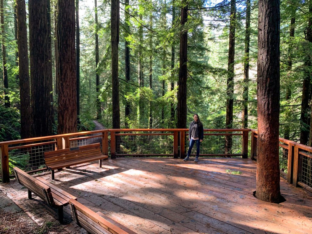
Hoyt Arboretum
- Length: 2.4 miles
- Elevation Gain: 400 ft.
- Trail Type: Loop
- Difficulty: Easy
- Dog-Friendly? Yes, on a leash
- Parking Pass: None
- Trailhead Location
We love this one too, and it’s BARELY a hike, but we wanted to include it anyway because it was so cool.
There is a whole system of trails within the Arboretum – 12 miles worth, to be exact – and we did what is marked as the 1 hour loop (which took us 20 minutes), plus a little bit of exploring on the south side of the park.
Did you know that an arboretum is like a botanical garden, but for trees? Me neither. In the Hoyt Arboretum, they have 6,000 trees of more than 2,000 different species! You’ll see redwoods, spruce, and a magnolia collection, among other things.
We’d recommend combining the 1 hour loop, which takes you to the gorgeous Redwood Deck, and along the Spruce and Redwood sections, and the 2 hour loop, which takes you along the south end of the park, for a total of 2.4 miles.
There are tons of interpretive signs along the trail – make sure to stop along the way to learn about all the different species of trees and shrubs you’re passing.
Parking will cost you $2 per hour at the trailhead (machines take cards, or you can use Parking Kitty, Portland’s parking app), but we realized afterwards that you can basically park along the road pretty much anywhere there’s not a “no parking” sign for free.
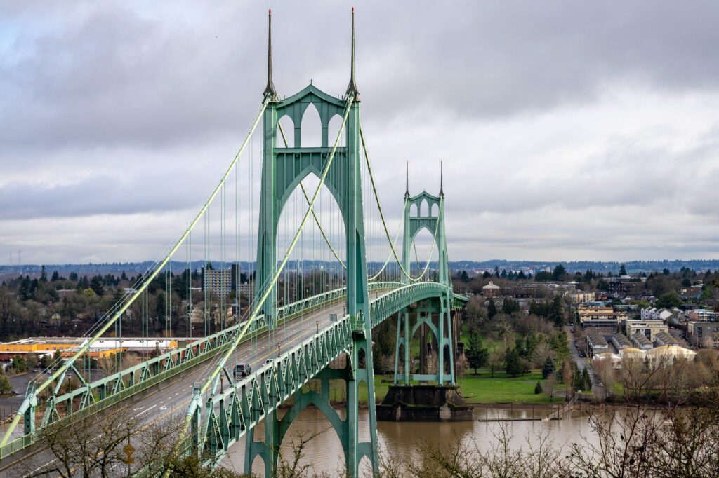
The Forest Park Ridge Trail
- Length: 4 miles
- Elevation Gain: 900 ft.
- Trail Type: Out and Back
- Difficulty: Moderate
- Dog-Friendly? Yes, on a leash
- Parking Pass: None
- Trailhead Location
The reason this hike is on this list is mainly the first quarter of a mile, which is where you get the spectacular view of the St. Johns Bridge. From there, it’s a good workout, but the views are nothing special.
You’ll climb through the densely packed trees of Forest Park, eventually reaching a fire road that serves as the turnaround point.
The parking lot for the trail is along NW Bridge Avenue, and is a tiny pullout along the side of the road. From there, walk back up the road to find the trailhead.
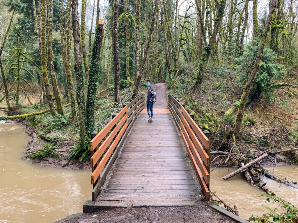
Tryon Creek Triple Bridge Loop
- Length: 3.5 miles
- Elevation Gain: 541 ft.
- Trail Type: Loop
- Difficulty: Easy
- Dog-Friendly? Yes, on a leash
- Parking Pass: None
- Trailhead Location
This was our first hike in Portland’s city limits, and it didn’t disappoint. It was a gray winter day, and it was foggy and lightly misting, but that didn’t stop us from hitting the trail.
It’s crazy that this is in Portland, because it feels like you’re out in the woods (aside from when you randomly pass houses next to the trail).
You’ll meander through the woods, crossing several bridges over the creek, and gently climbing and descending with the rolling hills. It was actually pretty pleasant in the rain, although it was muddy in spots.
Thing to Note: When we were there, the Terry Riley Bridge at the northern end of the loop was closed, but you can do the North Horse Loop instead.
8 Amazing Hikes Just Outside of Portland (Within ~45 Minutes)
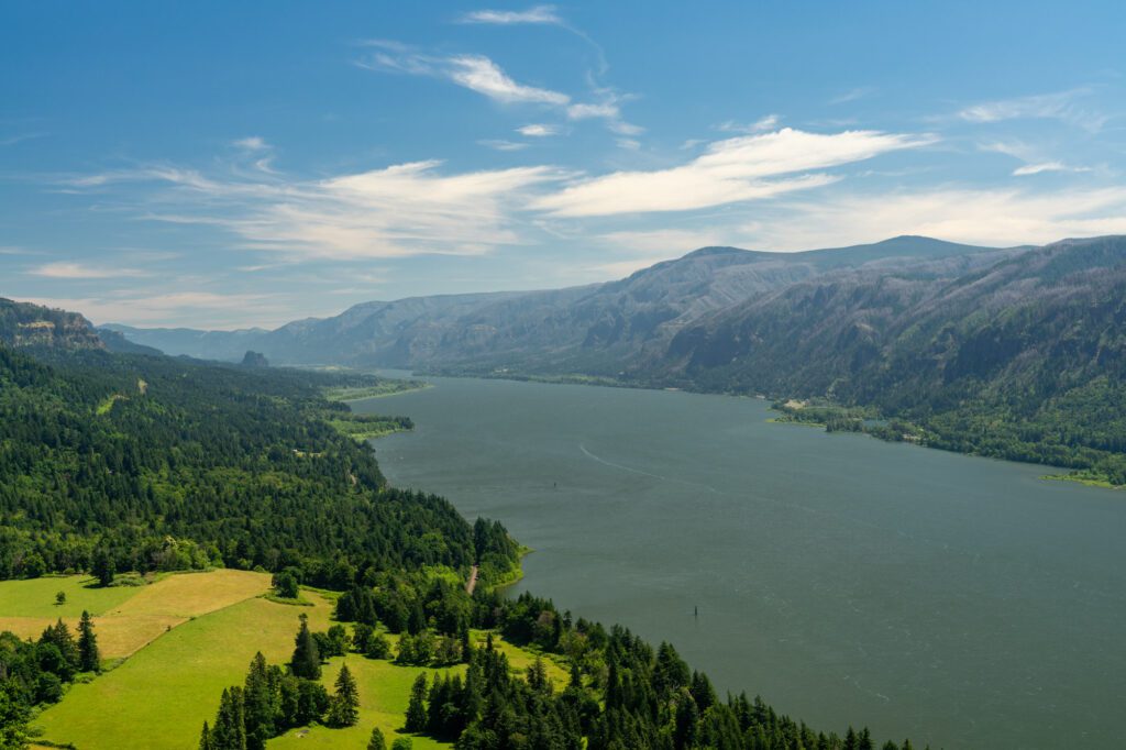
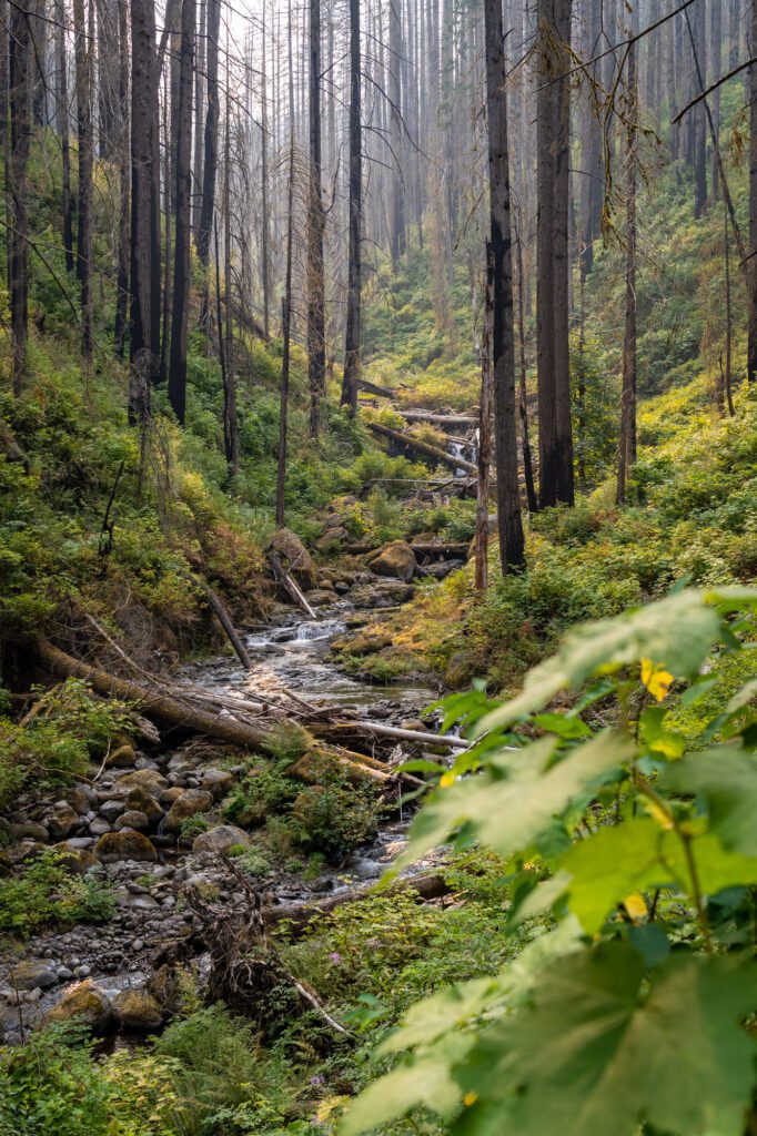
Just outside of Portland, you’ll find a smorgasbord of amazing hikes, mostly in the Columbia River Gorge, with a few out on the Oregon Coast and at Mount Hood that are worth having on the list.
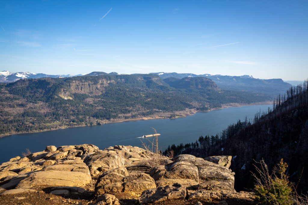
Dog Mountain (Columbia River Gorge)
- Length: 7.4 miles
- Elevation Gain: 2,800 ft.
- Trail Type: Loop
- Difficulty: Moderate / Hard
- Dog-Friendly? Yes, on a leash
- Parking Pass: Northwest Forest Pass (plus additional weekend permit in spring / summer)
- Trailhead Location: Dog Mountain Trailhead
Dog Mountain is on the Washington side of the Gorge, which means it’s a little harder to get to from Portland than many of the hikes above, which are mostly on the Oregon side (except for Cape Horn). However, if you’re up for a tough hike, this is worth the journey.
It’s pretty much an uphill slog the entire way up, but the views of the Columbia River Gorge from the top and, if you hit it at the right time, the spectacular bounty of wildflowers along the way, make the juice worth the squeeze.
We first did this hike on a beautiful summer morning, and got to the top only to find one big poof of fog shrouding the summit.
Despite the fact that we sat up in the cold, wet mist for ten minutes to see if it would break, we still loved this hike. There’s an excellent viewpoint just below the summit that was not obscured by fog, and the views along the trail nearby are special.
This hike is incredibly busy in the months of May and June, as the wildflowers start to pop in the Columbia River Gorge. There is now a permit system that is required to park at the trailhead on weekends during the summer months. You can find more details here.
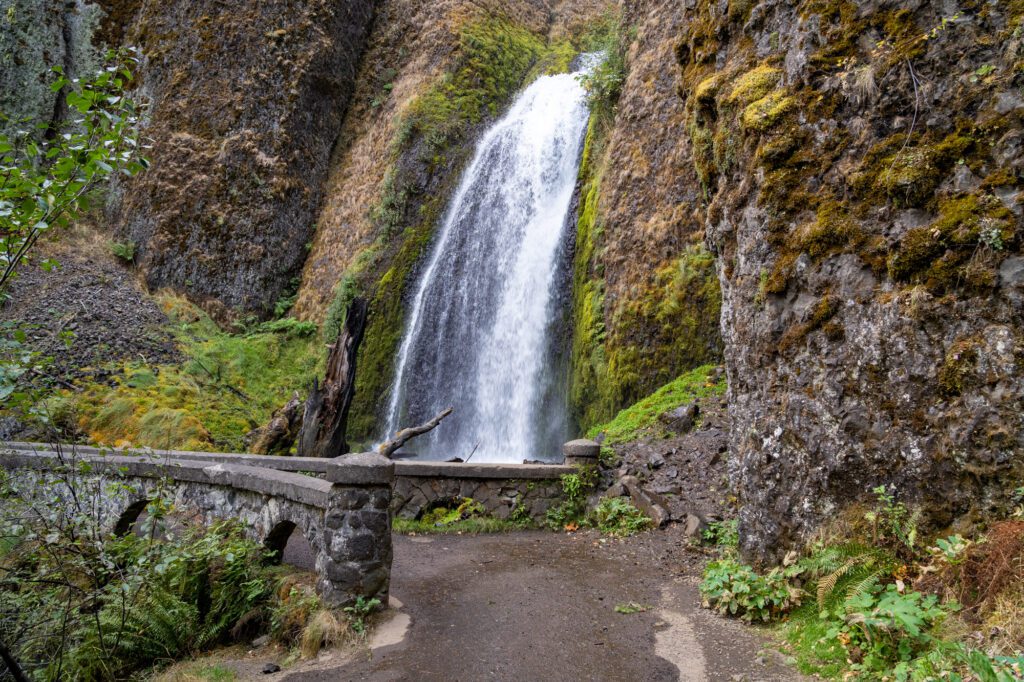
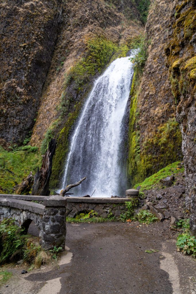
Latourell Falls
- Length: 2 miles
- Elevation Gain: 650 ft.
- Trail Type: Loop
- Difficulty: Easy / Moderate
- Dog-Friendly? Yes, on a leash
- Parking Pass: None
- Trailhead Location
This is a great add-on to the hike at Multnomah we mentioned above. It’s a short two mile loop with a little bit of climbing along the way, but it’s pretty accessible for most hikers.
The trailhead is also just off of the Historic Columbia River Highway, which is a fun drive to do on your way out to the Gorge. Make sure to stop at the Vista House and Scenic Women’s Forum Viewpoint for some excellent views of the Gorge!
Do this one clockwise. Start with the climb up and to the left of the parking lot, which takes you to Upper Latourell Falls, a unique waterfall with two distinct levels.
Then, you’ll loop down and around to the Lower Falls, which is the real stunner. It’s a 249 foot tall waterfall, which is nothing when you compare it to Multnomah Falls, but is certainly impressive when you consider it in its own right.
At one point near the end of the loop, you’ll come to the road. If you turn right here, it takes you back to the parking lot across a bridge. DON’T DO THAT.
Instead, cross the road and follow the trail under the bridge and to the base of the falls. You can get there either way, but this is the way you should do it.
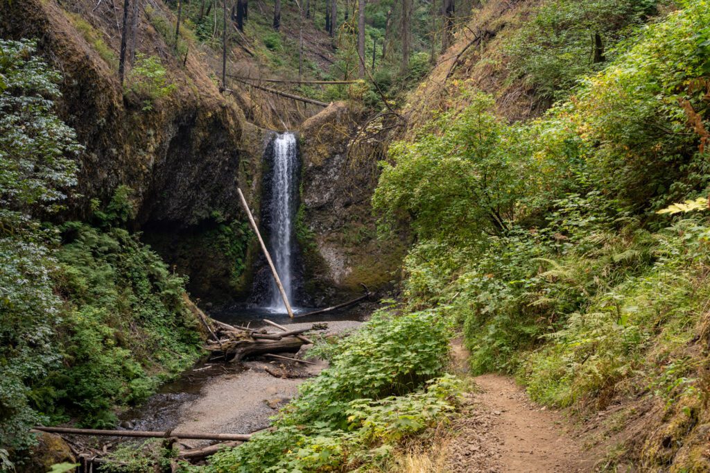
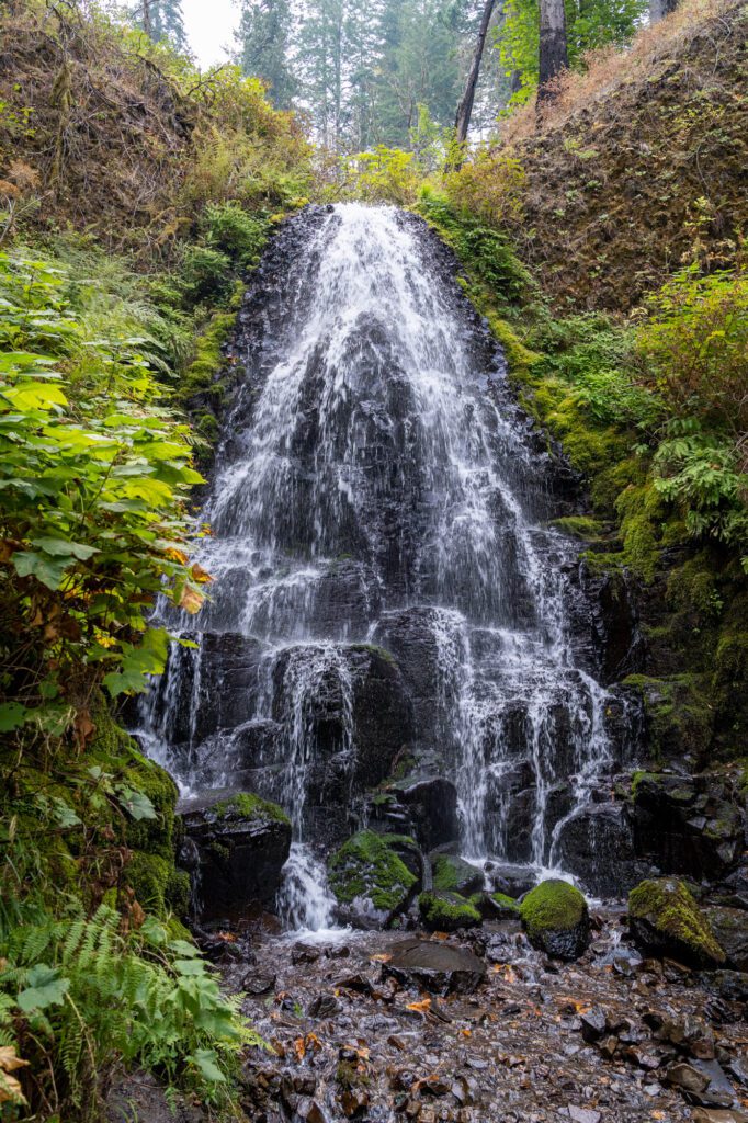
Dry Creek Falls
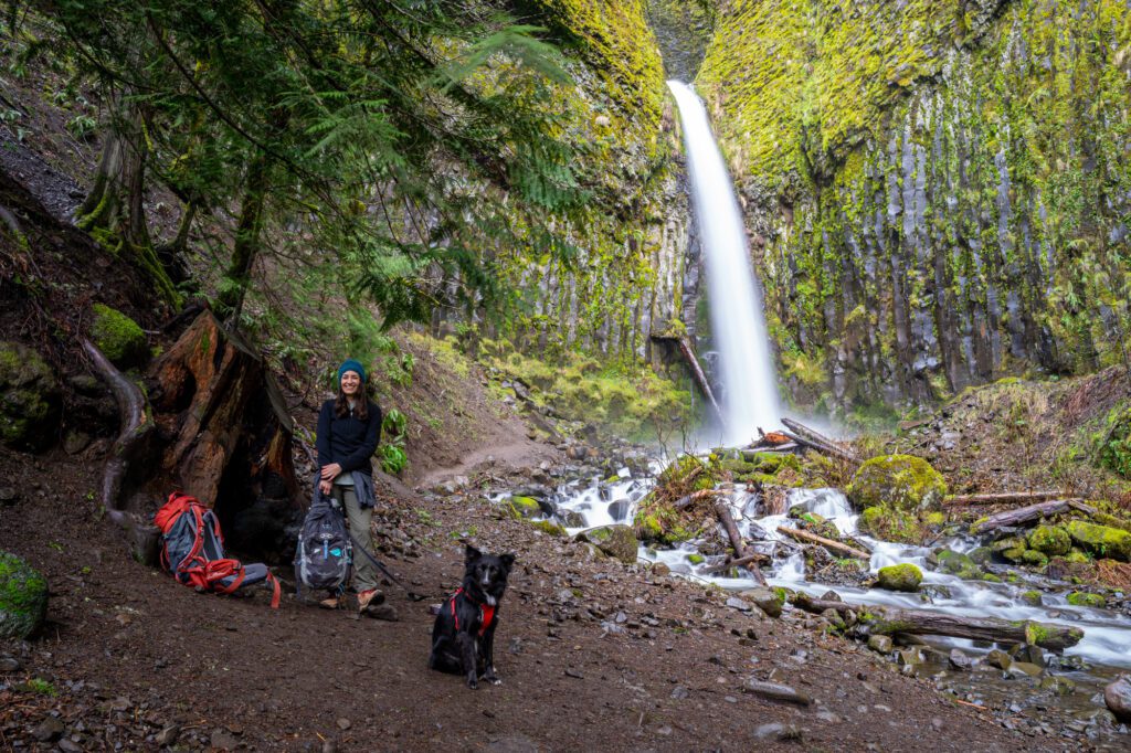
- Length: 4.4 miles
- Elevation Gain: 1,600 ft.
- Trail Type: Out and Back
- Difficulty: Easy / Moderate
- Dog-Friendly? Yes, on a leash
- Parking Pass: Northwest Forest Pass
- Trailhead Location
This was our first winter hike in Oregon, and it didn’t disappoint. Now, it has become one of our favorites because it’s a manageable distance, a nice waterfall, and it’s less crowded than many of the other Gorge options.
In the summer months, the waterfall might be a little less strong, but it was rip-roaring in February! We’ve also done it later in the spring, and it was equally impressive.
The trail starts at the Bridge of the Gods Trailhead, though there is more parking on the road leading to the trail.
From there, it’s a straightforward, steady climb up to the falls. You’ll pass a couple of trail junctions – at the last one, take a right, which takes you up to the falls.
It’s an easy trail, climbing just 800 feet over two miles or so, though it does get muddy along the way.
Read More: Hiking the PCT to Dry Creek Falls – A Complete Trail Guide
Cape Horn
- Length: 7.5 miles
- Elevation Gain: 1,600 ft.
- Trail Type: Loop
- Difficulty: Moderate
- Dog-Friendly? Yes, on a leash
- Parking Pass: None
- Trailhead Location
Cape Horn is a hike in the Columbia River Gorge, but it’s on the WASHINGTON side of the river, which is important because there are only a few places to cross the river once you head out of Portland.
It’s easiest to cross into Washington State on I-5, then head east into the Gorge along the Washington side.
The trailhead has a relatively small parking lot, and there’s no overflow parking allowed on the roads nearby (though people certainly do it), so you’ll want to get there as early as possible to get your parking spot.
Along the way, there are a couple of great viewpoints out into the Gorge, both east and west. The hike gets right down to business as you leave from the trailhead, starting a series of switchbacks that have you climbing roughly 800 feet over a mile and a half to the first of many viewpoints.
You’ll meander through the forest, eventually crossing a road before you get to the next viewpoint at 4.2 miles in, which is also the turnaround point when the loop is closed (see below).
The loop isn’t possible between Feb 1 and mid-July in order to protect the Peregrine Falcon nesting area, but you can still do an Out and Back hike when the loop is closed.
The Out and Back to the furthest point on the trail is going to be 8.6 miles with 1,600 feet of elevation gain.
Angels Rest
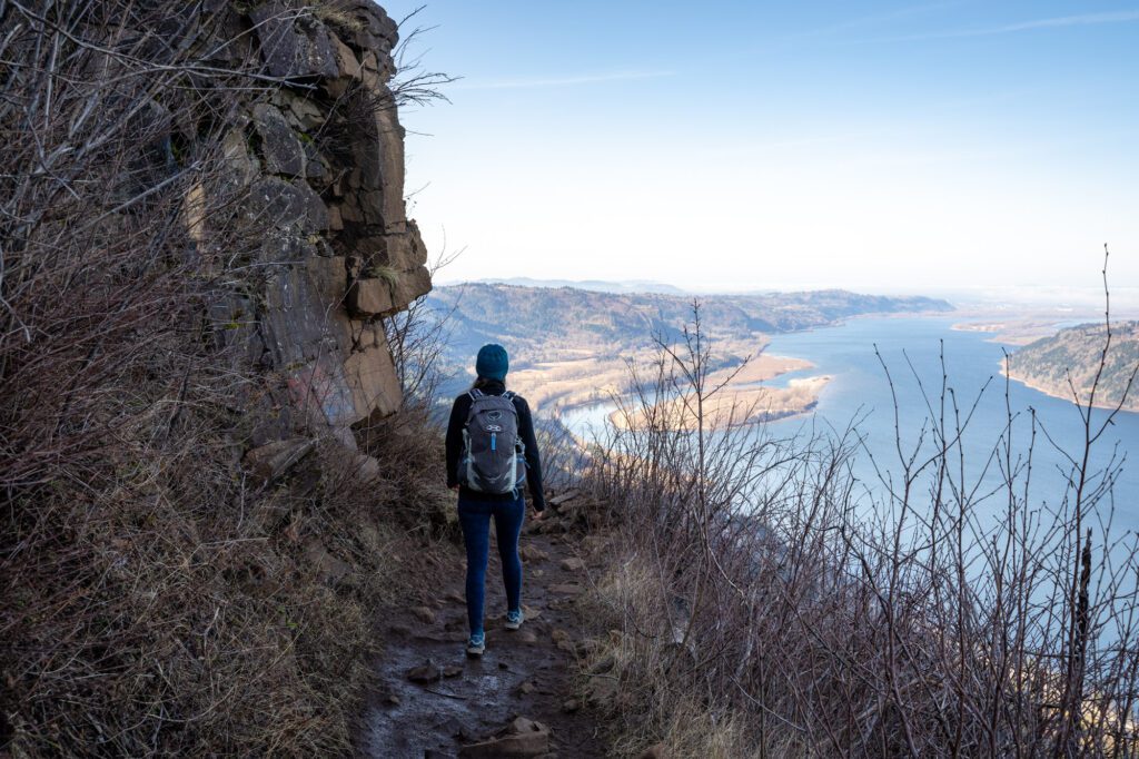
- Length: 4.5 miles
- Elevation Gain: 1,500 ft.
- Trail Type: Out and Back
- Difficulty: Moderate
- Dog-Friendly? Yes, on a leash
- Parking Pass: Northwest Forest Pass
- Trailhead Location
This is our most recent hike in the Columbia River Gorge, and it’s one of the best hikes in the area for its sweeping views of the Gorge at the top.
It’s a climb to get there, but it’s well worth the effort when you’re sitting at the ledge overlooking the Gorge.
It starts from the Angels Rest Trailhead, roughly 30 minutes outside of Portland. You’ll embark on a series of switchbacks interspersed with steadier climbs for the first mile and a half, with a few points where you have a preview of the view of the Gorge you get from the top.
At 1.5 miles in, the trail turns into tight switchbacks as you make the final ascent to the top. You’ll cross a mini boulder field that is really nothing to be concerned about, and then find yourself at an intersection of trails, which was a little confusing. Luckily, we had the map downloaded.
Follow the trail out towards the river for a bit and you’ll arrive at the viewpoint.
It’s a pretty constant climb from the trailhead to the top, so you’ll need to be prepared for that. It also was somewhat muddy, and there were remnants of snow left over from a recent snowstorm (we hiked it in February).
Waterproof hiking boots and trekking poles will be useful here.
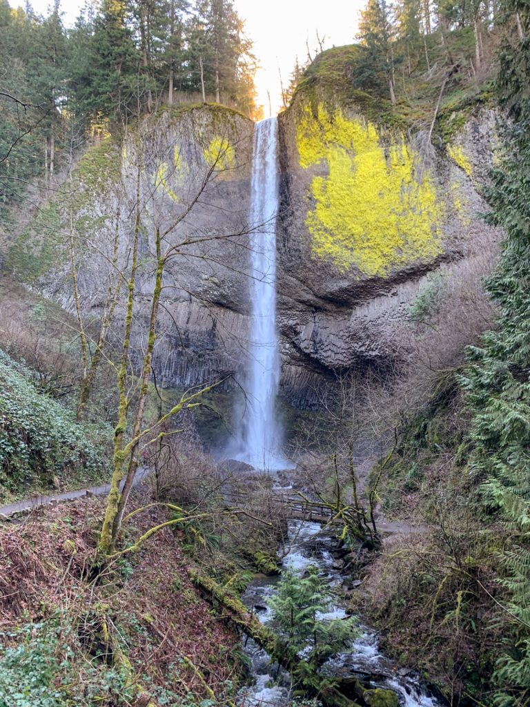
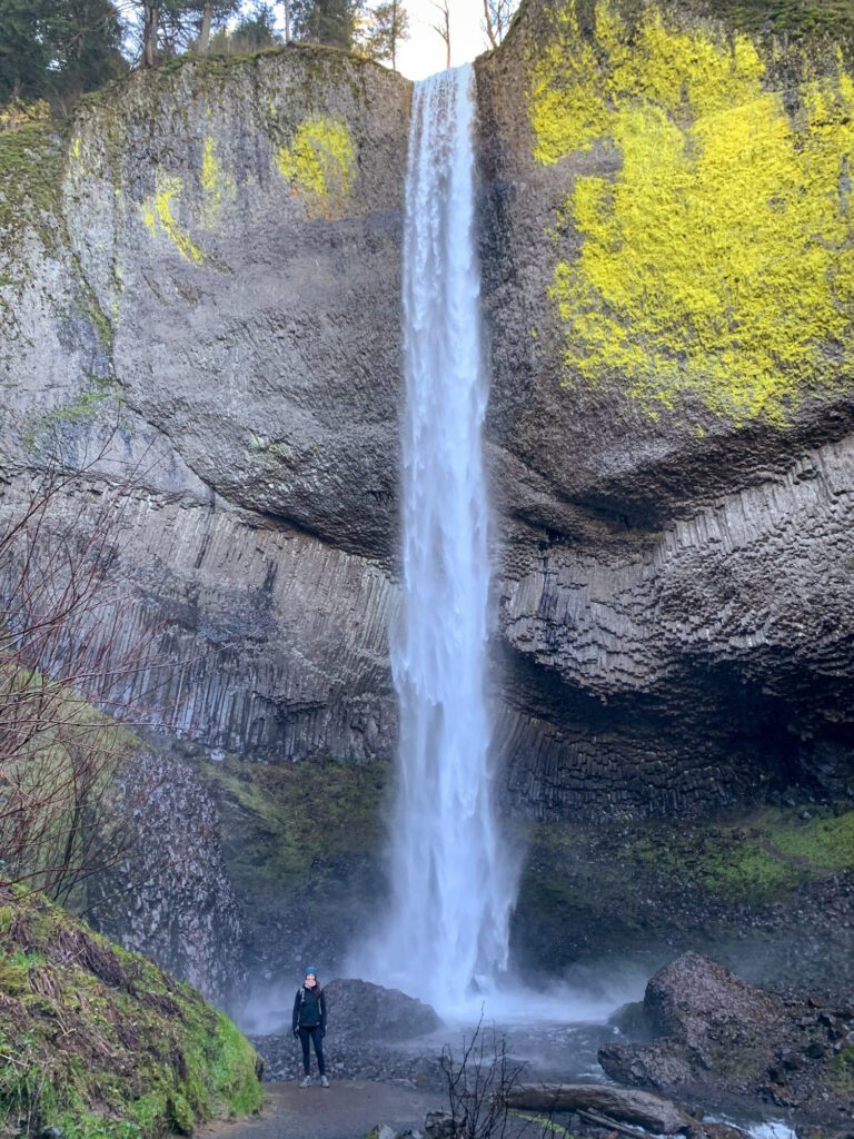
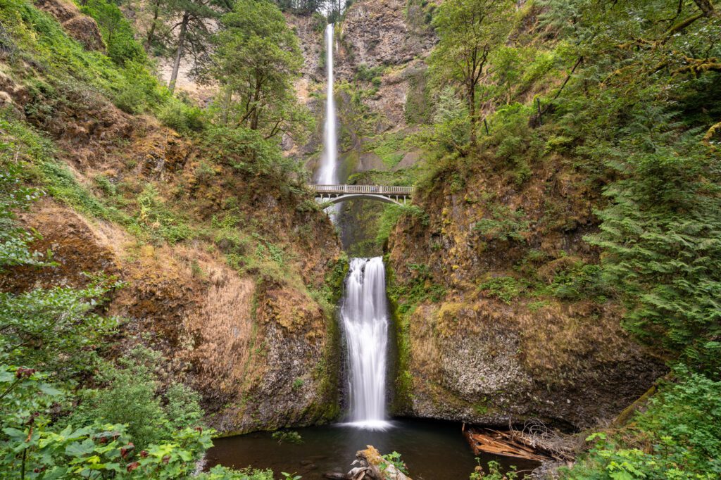
Multnomah & Wahkeena Falls
- Length: 5.6 miles
- Elevation Gain: 1,800 ft.
- Trail Type: Loop
- Difficulty: Moderate
- Dog-Friendly? Yes, on a leash
- Parking Pass: None
- Trailhead Location
Multnomah is the king (or queen) of the waterfalls in the Columbia River Gorge. It’s a whopping 600+ feet tall, and should absolutely be at the top of your list of day trips from Portland – it’s about 30 minutes outside of the city.
Most people walk up to the viewpoint on the bridge, head back to their cars, and head home.
But we think you should put on your hiking boots, strap on your daypack, and do the loop up and around Multnomah, passing nearby Wahkeena Falls on your way back.
Because Multnomah Falls is so popular, you’re going to want to do this one early in the day to get a parking spot and beat the crowds. Plus, the falls itself is so much more peaceful without hundreds of people jockeying for the best photo spot.
We recommend doing this trail clockwise, starting with the climb up to the top of Multnomah, then hitting Wahkeena on the way back down.
The trail starts up the switchbacks to the left of the falls, aggressively climbing 700 feet over the course of a mile. When you reach the top of Multnomah Falls, there’s a nice viewpoint that’s worth a quick detour.
The trail continues climbing over the next mile and a half or so, and you’ll pass multiple smaller falls along the way.

Eventually, you’ll reach the high point, which isn’t marked or really all that special, and it’s all downhill from there.
You’ll pass Fairy Falls on the switchbacks on the way down, and then Wahkeena Falls at the base of the trail.
From there, you’ll follow a mostly flat trail along the side of the road back to your car at Multnomah.
Read More: Hiking the Multnomah – Wahkeena Falls Loop Trail (Helpful Trail Guide)
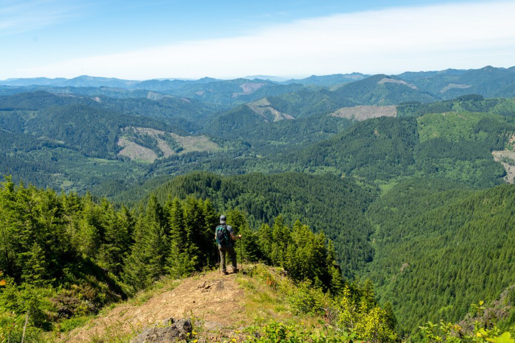
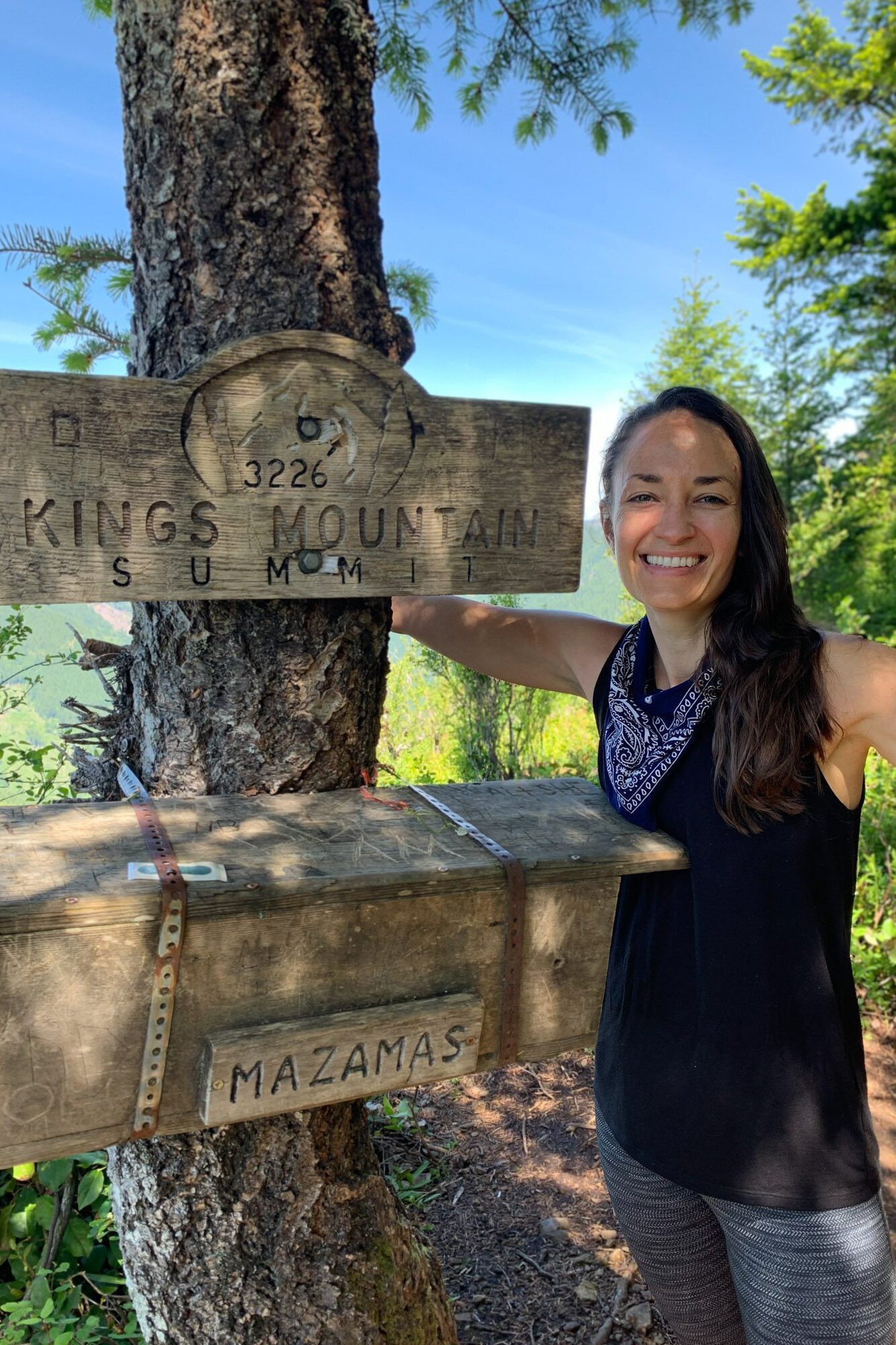
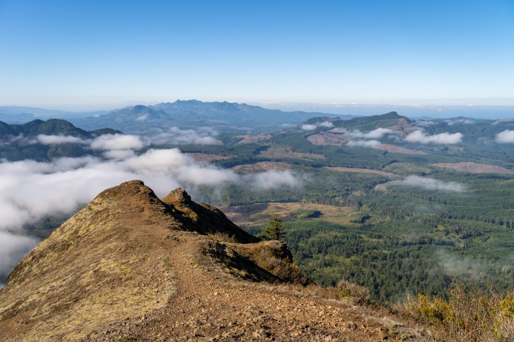
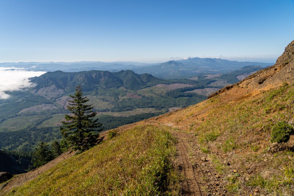
Kings Mountain
- Length: 5 miles
- Elevation Gain: 2,500 ft.
- Trail Type: Out and Back
- Difficulty: Hard
- Dog-Friendly? Yes, on a leash
- Parking Pass: Northwest Forest Pass
- Trailhead Location
This hike is actually not in the Columbia River Gorge- it’s out towards the coast, due west of Portland along Highway 6, which takes you to Tillamook. It’s part of Tillamook State Forest.
We did this hike on the way back into Portland from a trip out to the coast, and we went in knowing exactly what we were getting ourselves into.
This hike is STRAIGHT up. 2,500 feet of elevation gain over 2.5 miles, which is no joke.
This hike is for people in good shape, and you’re going to need hiking boots with good traction for the climb through the dense forest, which is often muddy and slippery.
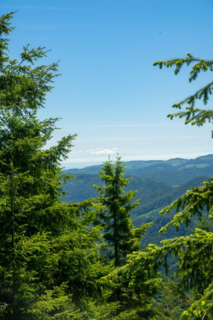
All that being said, it’s a great workout, and from the summit you can see Mount Hood to the east, and the coast to the west.
At least on a clear day. The views are worth the climb – take your time, bring plenty of water and snacks, and get to the trailhead early because the parking lot only has room for 10-15 cars with no overflow parking.
Warrior Rock Lighthouse Point Trail
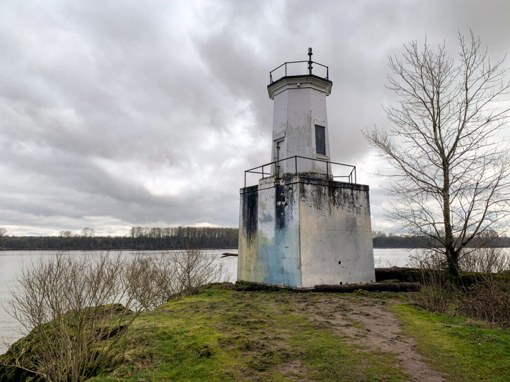
- Length: 6.5 miles
- Elevation Gain: None
- Trail Type: Out and Back
- Difficulty: Easy
- Dog-Friendly? Yes, on a leash
- Parking Pass: Sauvie Island Recreation Permit (READ DESCRIPTION)
- Trailhead Location
This hike is at the north end of Sauvie Island, which takes a while to get to from Portland.
However, once you’re on Sauvie Island, you might just forget that you’re anywhere near a big city as you drive past farm after farm, with bald eagles sitting high in the trees, and all sorts of amazing birds hanging out around the island.
IMPORTANT: There’s plenty of parking at the trailhead, though you will need to buy a Sauvie Island recreation permit, which you can get at these locations (we got it at Cracker Barrel right as you come across the Sauvie Island Bridge from Portland). Buy it BEFORE you head out to the trailhead, otherwise you’ll have to double back a long way. It’s going to cost you $10 for the day, or $30 for an annual pass.
The hike out to Warrior Point Lighthouse is an easy, family-friendly one. It’s essentially flat, though it is 6 miles there and back.

One thing to note – This hike can be SUPER muddy in the winter, so don’t wear your new white Nikes on this one.
The Lighthouse itself is nice, and the beach nearby is worth stopping on for a rest and a snack before you head back the way you came.
Hiking Further Afield: Great Hikes within 90 Minutes of Portland
If you’re up for some driving, there are some truly spectacular hikes to be had within 90 minutes of Portland.
It’s a long drive for a day trip, but we think these hikes are worth it. Many of them make our list of the best hikes in Oregon, and are worth doing at least once in your lifetime.
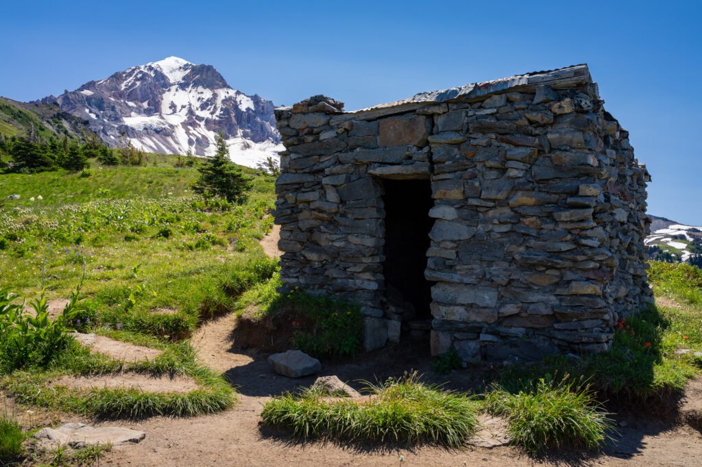
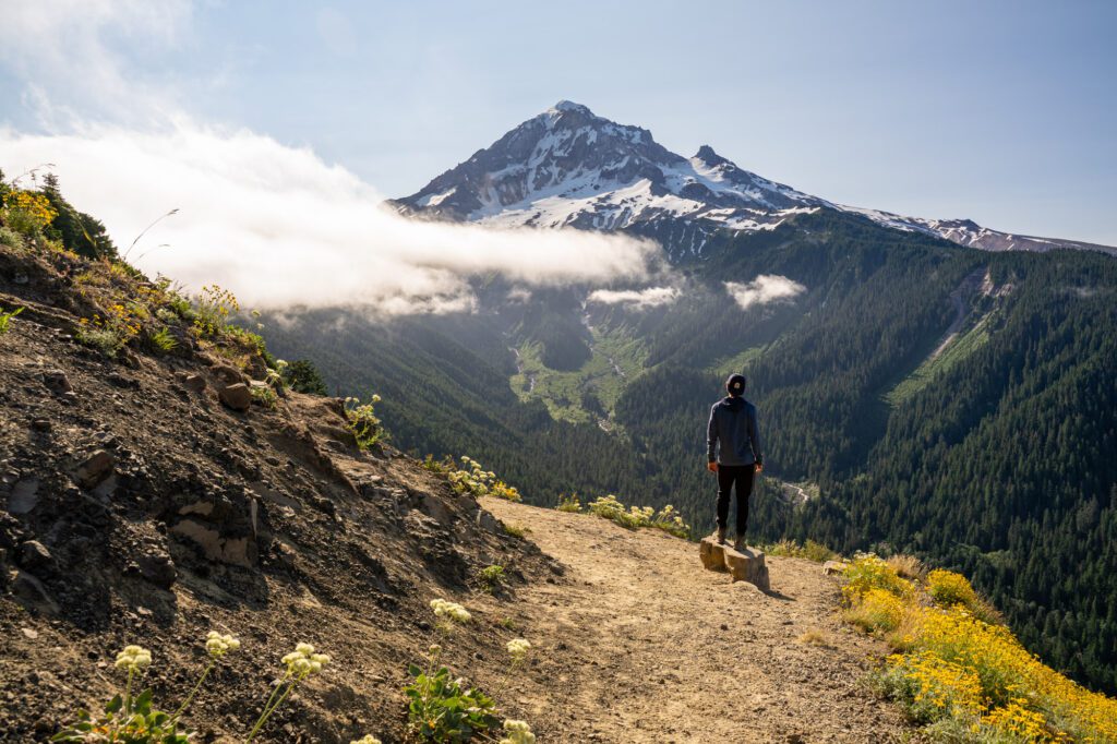
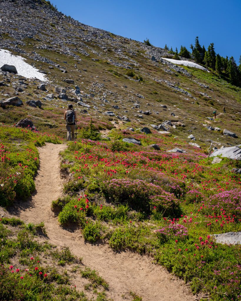
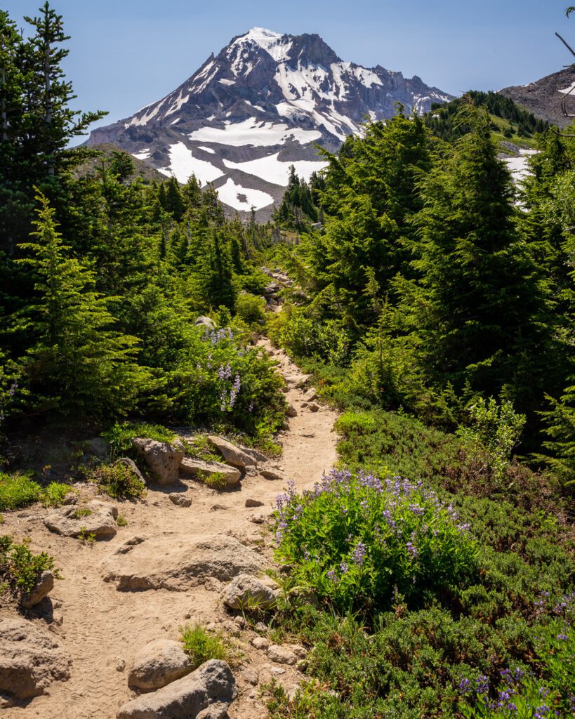
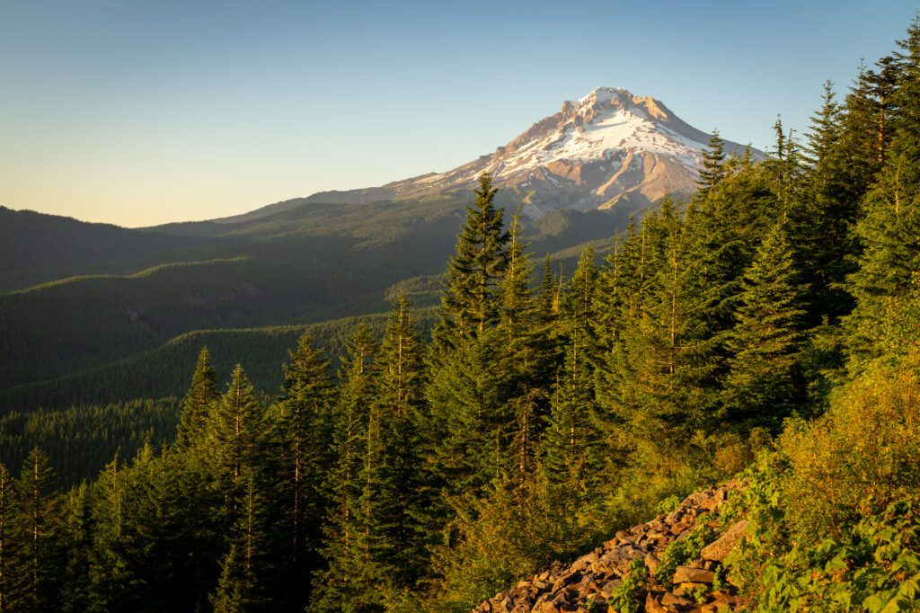
McNeil Point (Mount Hood)
- Length: 11 miles
- Elevation Gain: 2,700 ft.
- Trail Type: Lollipop
- Difficulty: (Very) Hard
- Dog-Friendly? Yes, on a leash.
- Parking Pass: Northwest Forest Pass
- Trailhead Location
I’m fairly certain that this is our favorite hike in the entire state of Oregon.
However, I’m also not certain that we would do it again anytime soon. This hike is TOUGH, y’all, and you need to be prepared for a long, strenuous hike when you set out.
That means proper footwear, lots of snacks, plenty of water, and a map (which can be digital).
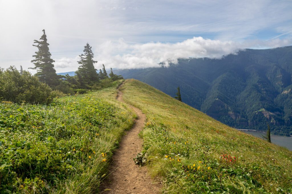
The first mile or so of the trail gets you up to the Pacific Crest Trail, which takes you out to Bald Mountain, our favorite view in the state of Oregon.
In the summer, the wildflowers and stunning view of Mount Hood here are spectacular. It’s hard to believe that it could get any better than this!
From there, it’s a long uphill hike that is relatively steady in terms of elevation gain. Eventually, you’ll reach the lollipop section of the hike.
THIS IS IMPORTANT: The right side of the lollipop involves what is essentially an all-out scramble that we would definitely not recommend coming down. For that reason, we’d do the lollipop counter-clockwise, doing the steep scramble on the way up, and coming down the more steady, established trail.
If the scramble section makes you nervous, you can also do this hike as an out and back, following the left side of the lollipop to the top, and coming back down the same way. It adds a mile and a half to the distance, though.
This is actually what we did, because we got to the top and realized that we weren’t into the idea of a downhill scramble, so we went back the way we came.
Read more in our McNeil Point Trail guide, where we go over your different route options.
At the top, there’s a cool stone shelter, and an up-close-and-personal view of Mount Hood. You’ll climb up the ridge, getting closer and closer to the face of Hood as you climb. It’s gorgeous up there, if not a little windy.
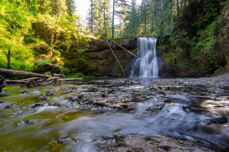
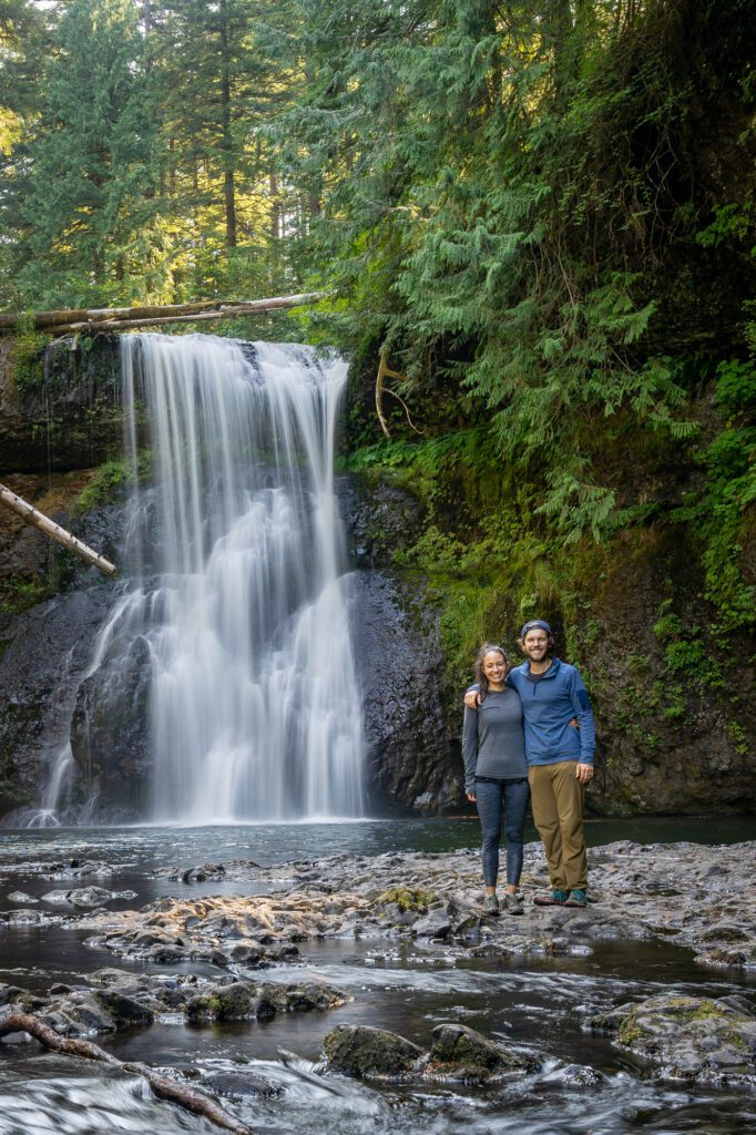
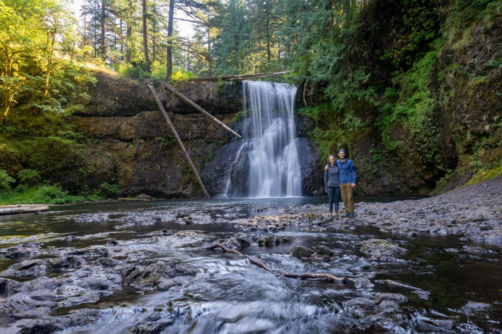
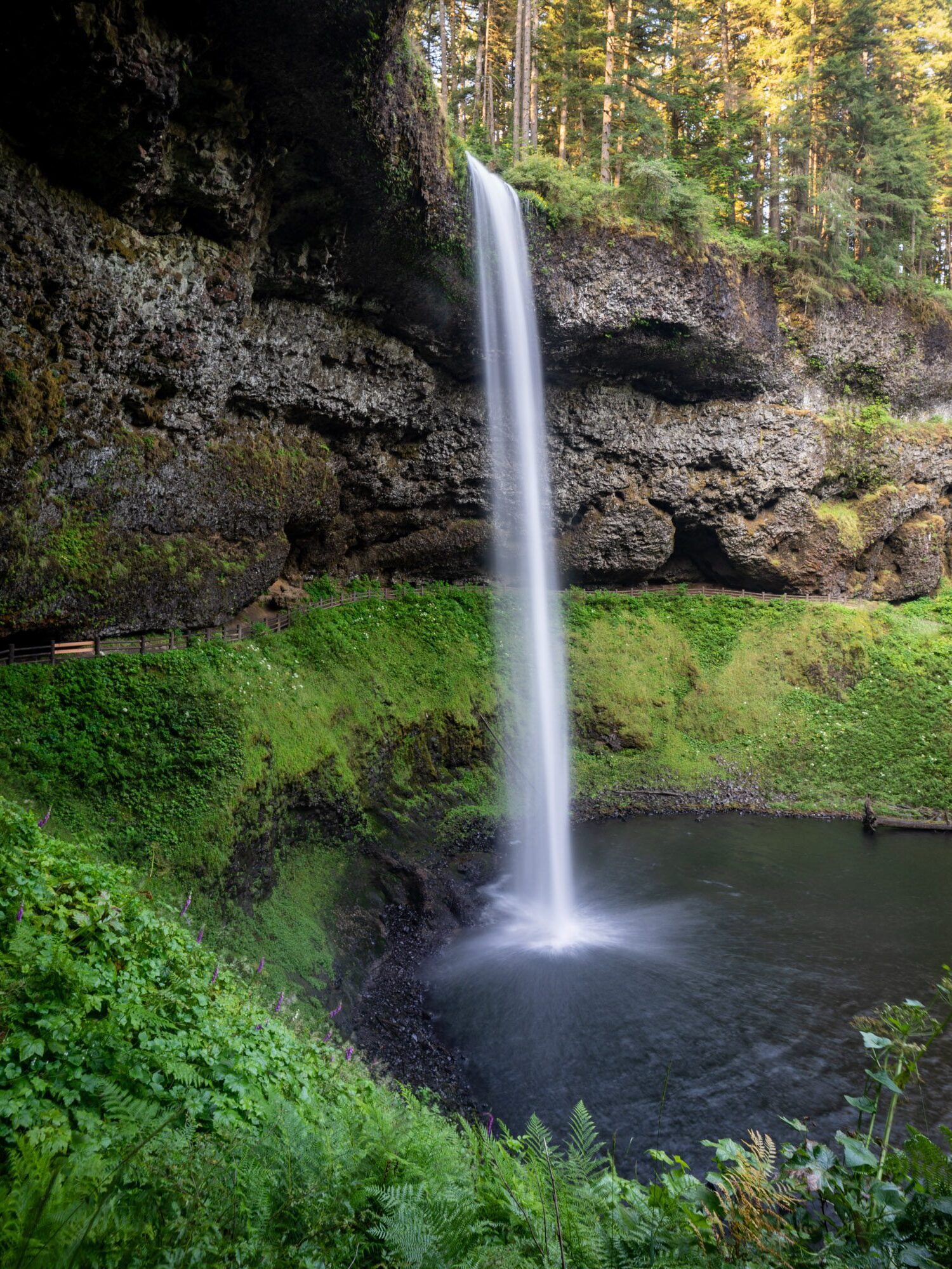
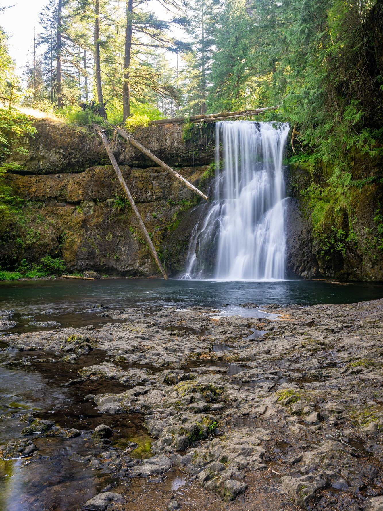
The Trail of Ten Falls Loop (Silver Falls State Park)
- Length: 7.5 miles
- Elevation Gain: 1,200 ft.
- Trail Type: Loop
- Difficulty: Moderate
- Dog-Friendly? No dogs allowed
- Parking Pass: Oregon State Parks Pass
- Trailhead Location
The Trail of Ten Falls down in Silver Falls State Park might be the best waterfall hike in Oregon, which is a state FULL of amazing waterfalls.
The name pretty much describes the hike – you’ll do a big loop through Silver Falls, and along the way you’ll see TEN different waterfalls.
It’s magical.
The hike itself isn’t particularly hard, though it is a little bit long to be in the “easy” category. The loop combines the Canyon Trail and the Rim Trail, and the best part of the loop (where you’ll find all the waterfalls) is the Canyon Trail.
We’d start at the main parking lot near South Falls, a 177 foot waterfall tumbling off of a rocky bowl, and go clockwise, starting with the Canyon Trail and ending with a forested walk back to the car on the Rim Trail.
Don’t miss Upper North Falls on the eastern side of the loop!
P.S. It’s well worth stopping in Salem, the capital of Oregon, on your way home if you have the time. We love the freshly fried donuts at Bigwig, and Xicha Brewing’s beer and tacos would make excellent recovery food.
For more information, including logistics and a trail report, read our guide to hiking the Trail of Ten Falls.
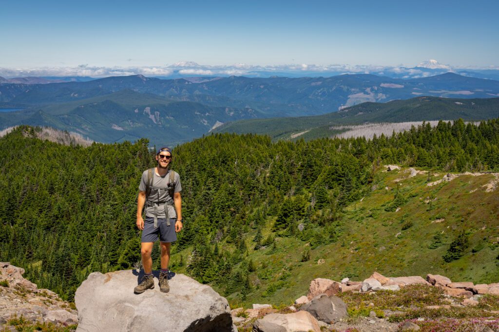
Tom, Dick, and Harry Mountain (Mount Hood)
- Length: 9 miles
- Elevation Gain: 1,700 ft.
- Trail Type: Out and Back
- Difficulty: Moderate / Hard
- Dog-Friendly? Yes, on a leash.
- Parking Pass: Northwest Forest Pass
- Trailhead Location
We’ve now done this hike a couple of times, and it’s a fantastic hike that is surprisingly accessible from Portland. The Mirror Lake Trailhead is where you’ll want to park, and it’s an hour and 15 minutes from Portland, right off of Highway 26.
Because of that accessibility, this can be a busy trail. Best to either start early in the morning (before 9:00 am) if you’re doing it on a weekend.
Or, do what we’ve done and start later in the afternoon to catch the view of Mount Hood at the top in the soft golden glow of the setting sun. Just make sure to bring a headlamp for the way down!
This trail gets busy because it shares the first half of the trail with a much easier hike up to Mirror Lake, which brings tons of families with kids out on sunny summer weekends to frolic in the lake.
Once you pass the lake – about halfway into the ascent – the crowds thin out and you’ll have the trail mostly to yourself.
The distance above reflects the entire hike to all three peaks (Tom, Dick, and Harry), but most people only go to the first peak, which is the main viewpoint. To that point, it’s eight miles roundtrip.
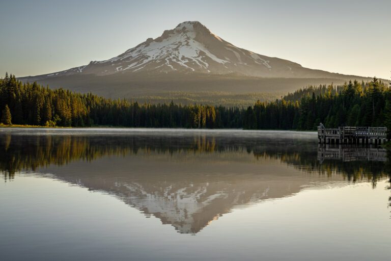
It’s a rocky plateau with excellent views of Mount Hood’s southern face across the Zigzag Valley, with Mirror Lake in the foreground.
On a clear day, you can also see Mount St. Helens, Mount Adams, and Mount Rainier to the north (barely), and Mount Jefferson to the south.
The last half mile of the ascent requires some scrambling and light route finding as you traverse the ridge. We’ve gone to the second viewpoint, which is worth it to leave the crowds behind and have the view to yourself, but is a little tricky at times.
You can also backpack this trail, and sleep up on the ridge (which is something that’s on our bucket list).
Be aware that there are limited opportunities for water once you’re up on the ridge, so fill up down at Mirror Lake.
For more information, including logistics and a trail report, read our guide to Tom, Dick, and Harry Mountain.
Ramona Falls (Mount Hood)

- Length: 7.1 miles
- Elevation Gain: 1,000 ft.
- Trail Type: Lollipop
- Difficulty: Easy / Moderate
- Dog-Friendly? Yes, on a leash.
- Parking Pass: Northwest Forest Pass
- Trailhead Location
Yet another spectacular waterfall hike within 90 minutes of Portland! This one is a relatively easy hike that takes you to a cascading falls that tumbles 120 feet into the creek below.
However, rather than a waterfall like Multnomah, which is cool because of the volume and power of water, the beauty of Ramona Falls is the snaking, silky streams of water that create a wall of cascades.
It’s pretty cool, and is pretty different from most of the waterfalls in the Gorge and down at Silver Falls.
By far the hardest part about this hike is crossing the Sandy River. There used to be a seasonal bridge across the river, setup by the Forest Service.
But after years of washing out, they decided to stop placing the bridge going forward, so it’s up to you to find a log to use to traverse the Sandy River.
When it’s really moving – spring and early summer – it can be treacherous. And it creates a bottleneck on the trail when people are slowly crossing.
If you’re not stoked about crossing the river, and are comfortable adding a little over a mile on either end of the hike, you can start from the Top Spur Trailhead instead.
That route takes the river crossing out of it (though there is still a much more manageable creek crossing you’ll have to do).
The Saddle Mountain Trail

- Length: 4.8 miles
- Elevation Gain: 1,800 ft.
- Season: Year Round (unless it has been really cold)
- Trail Type: Out and Back
- Difficulty: Moderate / Difficult
- Dog Friendly? Yes, on a leash (see note on mesh along trail below)
- Pass Required: None (even though it’s in an Oregon State Natural Area)
- Trailhead Location
We got to the trailhead on a Friday morning at about 8:00am after driving almost exactly 90 minutes from Portland.
It was two days after the Saddle Mountain trail had opened after two (ish) years of being closed, and we were greeted with what felt like a thick blanket of coastal fog at the trailhead.
Keep in mind, this hike is popular because it takes you up to the highest point in the northwest corner of Oregon, where you have views from the ocean to the Cascades.
“Well, we came all the way out here, might as well head up and see if it clears” we told ourselves as we started up the trail.
Turns out, that was a fantastic decision, because the 1,800 or so feet of climbing took us above the fog line, and we were treated to spectacular views out over northwest Oregon (and southwest Washington State).
From the viewpoint at the top of Saddle Mountain, we could see clear out to the Pacific Ocean and up to the mouth of the Columbia River, which Lewis and Clark traversed a few hundred years ago.
In the other direction, all of the mountains were out. Mount St. Helens, Mount Adams, and Mount Hood were visible directly to the east, and Mount Rainier could even be glimpsed out to the northeast!
The trailhead for Saddle Mountain is out on Highway 26, about 90 minutes east of Portland just before you get out to the coast.
The thing to know about this hike is that the first half is on the easier side of the moderate category, and the last half of this hike gets progressively harder until the last quarter mile, which we think is firmly in the “difficult” category.
It starts with a winding climb through the forest, and ends with a steep, rocky climb to the summit after the saddle.
On the way back from the hike, we were talking about how this hike would make an excellent start to a day trip from Portland out to Cannon Beach, where you could have lunch, shop in Cannon Beach, and hang out at one of the many beaches for the afternoon before heading home.
One note for dog owners: The top half of the trail – from the saddle to the peak, mostly – is covered in what is essentially chain link fence laid down along the trail. We took our dog Lupine up with us not realizing this, and while she didn’t have any injuries, she definitely was not a fan of it, and I can see it being troublesome for dogs, especially bigger ones.
The Best Hikes Near Portland, Mapped
Here is a handy map so that you can visualize exactly where the hikes we’ve mentioned in the guide above are located.
When to Go Hiking in Portland
Like most of the Pacific Northwest, hiking in Portland is best during the summer. However, unlike a lot of places – like Mount Hood, Bend, and Mount Rainier – you CAN hike during the winter if you’re prepared for the elements.
In the summer, you’ll find long, warm days that are the perfect time to get outside. Hit the trail early, before the heat of the day, and spend the afternoon refueling.
The downside to summer is that trails are PACKED. You’ll need to be prepared to get up early and get out to the trailhead before 8:00 am on weekends to guarantee parking, and even then getting a parking spot can be tricky.
Spring is a good time to go hiking – particularly those precious spring days where it feels like summer is finally here, only to find yourself rudely set straight when it rains for the next ten days.
Expect variable temperatures and rain, but the waterfalls are going to be roaring!
Fall is a great time to hike, with warm days and relatively little precipitation until later in the season. This is probably the best combination of weather and crowds. Plus, you’ll get some nice fall color, especially out in the Gorge.
Unlike most places in the Pacific Northwest, you can go hiking in the winter here in Portland. We know because we did it.
We stayed a month in Portland in February to make sure we could handle winter in the Pacific Northwest, and spent our days exploring Portland’s hiking trails.
Is it ideal hiking weather? No, probably not. It’s cold and wet. But if you’re prepared with appropriate gear, then it’s really no big deal at all.
I always say that if you don’t do things when it’s raining in the Pacific Northwest, then you’ll never get to do anything!