How to Plan the Perfect Los Angeles to San Francisco Road Trip
As a California native, I’m probably a bit biased, but I think a drive up the Golden State’s coast is one of the most exciting and beautiful road trips you can take. There’s a diversity of hikes, beaches, and cool points-of-interest, and each town you pass through along the way is incredibly unique.
If you’re planning a Los Angeles to San Francisco road trip, you’ll find all of the information you need to plan your trip in the travel guide below.
Planning a San Francisco to Los Angeles road trip instead? Just flip the itinerary around and off you go!
Disclaimer: Some of the links in this post, like hotel and vacation rental links, are affiliate links, meaning at no additional cost to you we make a little bit of money if you click through and book. That being said, we would absolutely never recommend something to you that we don’t stand behind 100%.
How Many Days Do You Need to Drive from Los Angeles to San Francisco?
You could pretty easily do this drive in a day. It’s a relatively straight shot up I-5 between California’s two main cities, and it’s a well trafficked route.
However, if you take that route, you’re going to be missing just about everything that makes driving from Los Angeles to San Francisco special. The coastal beauty, winding narrow road with incredible views around every bend, charming oceanfront towns, and more.
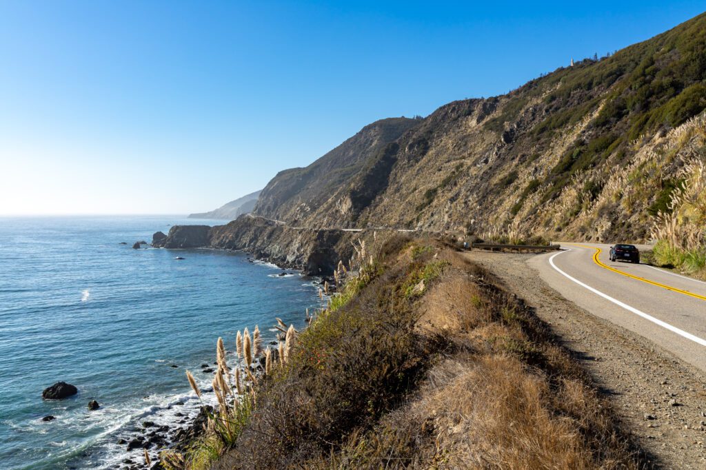
To experience those things, you’re going to need to drive along Highway 1 – the coastal route between Los Angeles and San Francisco – which is longer and slower.
We think that the absolute minimum amount of time you need is three days. With that, you’ll be able to make a few stops, but you’ll be pressed for time and won’t be able to do as much along the way.
Five or seven days gives you more time to do some good hikes, explore some of the cities along the coast (like Santa Barbara and Santa Cruz), and take it a little slower, basking in the warm California sun and enjoying this incredible stretch of coast.
If you want to spend some time in Los Angeles or San Francisco on either end of the trip, we’d recommend 10 days or more. Both cities really deserve two days each at a minimum, but we understand time is a luxury.
P.S. We have guides to spending a day in San Francisco and a day in Los Angeles, if that’s all the time you can find for those cities.
The Route for Driving from Los Angeles to San Francisco
When driving from Los Angeles to San Francisco, you have two main route options: the coastal route or the main highway through the state, I-5.
Like we mentioned above, the I-5 route is useful if you’re just looking to get from point A to point B as quickly as possible. For the majority of this drive (which takes about 6 to 7 hours without stops), you’ll find yourself on a rather unexciting section of the I-5 in the middle of California.
The coastal route, on the other hand, is longer but far more enjoyable. This is the route that you’ll follow for the road trip outlined below.
You’ll want to spend at least two days on this route, but can easily make it a week-long trip. The actual driving time is about 9 hours, but you’ll have plenty of great places to stop at along the way.
This route largely takes you on Highway 1 – also known as the Pacific Coast Highway (or PCH). You’ll hop on this highway in Santa Monica, and make your way up the coast until you hit San Francisco!
One thing to note is that Highway 1 occasionally merges and runs concurrently with Highway 101. This happens in Ventura through Gaviota, and again near Pismo Beach. It’s something to be aware of so that you aren’t confused on your trip!
Recommended Itineraries for the Drive from Los Angeles to San Francisco
Here, you’ll find three sample itineraries for a 3-day, 5-day, and 7-day trip. They include some of the recommended spots below so that you can make the most of your Pacific Coast Highway trip!
Consider this the short version of how to spend your time on the California coast – below this section, we have a deep dive on the best stops to make along the drive with more detail on each destination.
With 3 Days
While I’d recommend adding more time to your itinerary if you can, you’ll still be able to check out some of the most beautiful sights between L.A. and San Francisco with just three days.
Here’s how you can break down your 3-day road trip.
- Day 1: Malibu + Santa Barbara + Stay in San Luis Obispo
- Day 2: San Luis Obispo + Big Sur + Stay in Monterey
- Day 3: Monterey + Santa Cruz + Pacifica + Stay in San Francisco
Day 1: Malibu + Santa Barbara + Stay in San Luis Obispo
Start with an easy hike in Malibu at Point Dume Natural Preserve, and then walk down to Westward Beach. Drive about an hour and 15 minutes to Santa Barbara.
Stop at Lilly’s Taqueria for lunch, and walk over to Dune Coffee for a caffeine boost – this will give you a chance to stroll down the picturesque State Street in the downtown area.
Drive inland to hike Inspiration Point Trail.
After your hike, you’ll drive an hour and 45 minutes north to San Luis Obispo. Get dinner at Old SLO BBQ and drinks at Sidecar.
Stay downtown at Granada Hotel & Bistro.
Day 2: San Luis Obispo + Big Sur + Stay in Monterey
Start your day with coffee and pastries from Scout Coffee, or grab a bigger breakfast at Seeds. Drive over to the Bishop Peak Trail trailhead (about 10 minutes), and hike up to the peak.
Get back in the car, and head over to Cambria for lunch at The Hidden Kitchen. Leisurely drive through Big Sur, stopping by McWay Falls (about an hour and 25 minutes from Cambria), Pfeiffer Beach, and Bixby Creek Bridge.
After the bridge, drive into Monterey (30 minutes north), and grab dinner at Old Fisherman’s Grotto.
Stay at the charming Green Gables Inn.
Day 3: Monterey + Santa Cruz + Pacifica + Stay in San Francisco
Spend the morning at Monterey Bay Aquarium. Walk up to Lovers Point before hitting the road and making your way to Santa Cruz (about an hour drive).
In town, grab lunch at Lúpulo Craft Beer House or Mozaic, and then drive about half an hour up the coast to do an easy hike at the Marsh Trail in Big Basin Redwood State Park.
Drive about an hour north to Pacifica, and do the Mori Point Loop Trail. Once you’re done, head into San Francisco!
Drop your rental car off, head into the city, and stay at the CitizenM San Francisco.
With 5 Days
Adding just two days to your itinerary will give you the chance to see a lot more of the California coast. This is what a 5-day itinerary will look like.
- Day 1: Malibu + Stay in Santa Barbara
- Day 2: San Luis Obispo + Morro Bay + Stay in Cambria
- Day 3: Big Sur + Point Lobos State Natural Reserve + Stay in Carmel-by-the-Sea
- Day 4: Monterey + Stay in Santa Cruz
- Day 5: Half Moon Bay + Pacifica + Stay in San Francisco
Day 1: Malibu + Stay in Santa Barbara
Visit Malibu Lagoon State Beach, and then do an easy hike in Malibu at Point Dume Natural Preserve.
Drive an hour and 15 minutes to Santa Barbara, and grab lunch at Lilly’s Taqueria or La Super-Rica Taqueria. Drive 15 minutes inland to hike Inspiration Point Trail, and then head back to the coast to relax by the water at West Beach.
Enjoy a glass of wine in The Funk Zone before grabbing dinner at Loquita.
Stay for the night at Palihouse Santa Barbara.
Day 2: San Luis Obispo + Morro Bay + Stay in Cambria
Start the day with coffee at Dune Coffee before driving about an hour and 45 minutes to San Luis Obispo.
In SLO, go for a hike at Bishop Peak Trail before heading downtown for lunch at Old SLO BBQ.
Drive about 35 minutes over to Montaña de Oro State Park and hike the Bluff Trail (you can easily cut it down if this is too much hiking in a day).
Drive another 30 minutes to Morro Rock Beach, and then grab a casual seafood dinner at Giovanni’s Fish Market.
Head up to Cambria (about 25 minutes), and stay at White Water for the evening, which is right on the ocean.
Day 3: Big Sur + Point Lobos State Natural Reserve + Stay in Carmel-by-the-Sea
Get breakfast in Cambria at The Hidden Kitchen or Lily’s Coffee House.
Drive about an hour and a half into Big Sur, and make your way to McWay Falls. Grab lunch at Big Sur Deli, and then head over to Pfeiffer Beach.
Stop by Bixby Creek Bridge on your way out of Big Sur, and then visit Point Lobos State Natural Reserve to do (at least part of) the loop trail.
You’ll end in Carmel-by-the-Sea. Get dinner at La Bicyclette, and stay at the Candle Light Inn.
Day 4: Monterey + Stay in Santa Cruz
Spend the morning doing the 17-Mile Drive, and then head into Monterey for lunch at Old Fisherman’s Grotto or Randy’s Sandwich Shop.
Check out the excellent Monterey Bay Aquarium, and drive an hour to Santa Cruz.
Spend some time exploring the Santa Cruz Beach Boardwalk before making your way to Natural Bridges State Beach.
For dinner, check out Mozaic or Laili, and then stay at Ocean Pacific Lodge.
Day 5: Half Moon Bay + Pacifica + Stay in San Francisco
Grab coffee and a quick bite at Cat & Cloud before driving 30 minutes north to hike the short Marsh Trail in Big Basin Redwood State Park.
Drive 10 minutes to Pigeon Point Lighthouse, and then another 25 minutes to Redondo Beach.
Stop for lunch at Half Moon Bay Brewing Co., before making your way to Pacifica (about 15 minutes) to do two hikes before heading into San Francisco: Pedro Point Headlands Trail and Mori Point Loop Trail.
With 7 Days
With a 7-day road trip, you’ll be able to add Channel Islands and San Simeon to the itinerary, and dedicate more time to many of the destinations, particularly in the southern half of the trip. Here’s a look at what a week-long journey will look like.
- Day 1: Malibu + Stay in Ventura
- Day 2: Channel Islands + Stay in Santa Barbara
- Day 3: Santa Barbara + Stay in San Luis Obispo
- Day 4: Morro Bay + San Simeon + Stay in Cambria
- Day 5: Big Sur + Point Lobos State Natural Reserve + Stay in Carmel-by-the-Sea
- Day 6: Monterey + Stay in Santa Cruz
- Day 7: Half Moon Bay + Pacifica + Stay in San Francisco
Day 1: Malibu + Stay in Ventura
Hike at Los Leones Trail, and then drive to Broad Street Oyster for lunch. Go right across the street to Malibu Lagoon State Beach before driving up to do the easy hike at Point Dume.
Hang out at Zuma Beach, and then drive about an hour to Ventura. Grab dinner at Lure Fish House, and stay at the Pierpont Inn.
Day 2: Channel Islands + Stay in Santa Barbara
Head over to Ventura Harbor to catch an Island Packers Cruise to Santa Cruz Island, and then do an Adventure Sea Cave Kayak tour (or another tour) with Santa Barbara Adventure Company (note: this should all be booked in advance!).
Once you’re back in Ventura, drive 35 minutes up to Santa Barbara. Grab dinner at Loquita, and stay at Palihouse Santa Barbara.
Day 3: Santa Barbara + Stay in San Luis Obispo
Start the day with coffee from Dune Coffee, and then drive over to Inspiration Point Trail for a hike.
Head back into town for post-hike tacos at Lilly’s Taqueria or La Super-Rica Taqueria before making your way to San Luis Obispo (about an hour and 45 minutes).
Here, you’ll do another hike at Bishop Peak Trail.
Get dinner at Old SLO BBQ, drinks at Sidecar, and stay downtown at Granada Hotel & Bistro.
Day 4: Morro Bay + San Simeon + Stay in Cambria
Grab coffee and a small bite to eat at Scout Coffee, or have a bigger breakfast at Seeds. Drive to Montaña de Oro State Park (35 minutes) and go for a hike on the Bluff Trail.
Head another 30 minutes over to Morro Bay, where you can get lunch at Giovanni’s Fish Market. Stop by Morro Rock Beach before driving 40 minutes to the Elephant Seal Viewing Point in San Simeon.
Stop at Piedras Blancas Light Station, and then backtrack a bit to Cambria to grab dinner (try Robin’s Restaurant) and stay the night at White Water.
For Days 5, 6, and 7: Follow days 3, 4, and 5 from the 5-day itinerary above!
The 12 Best Stops to Make on a Los Angeles to San Francisco Road Trip
Now that we’ve covered the basics, let’s dive into the major stops to make on your drive from Los Angeles to San Francisco. The sections below go over the highlights to check out in each area.
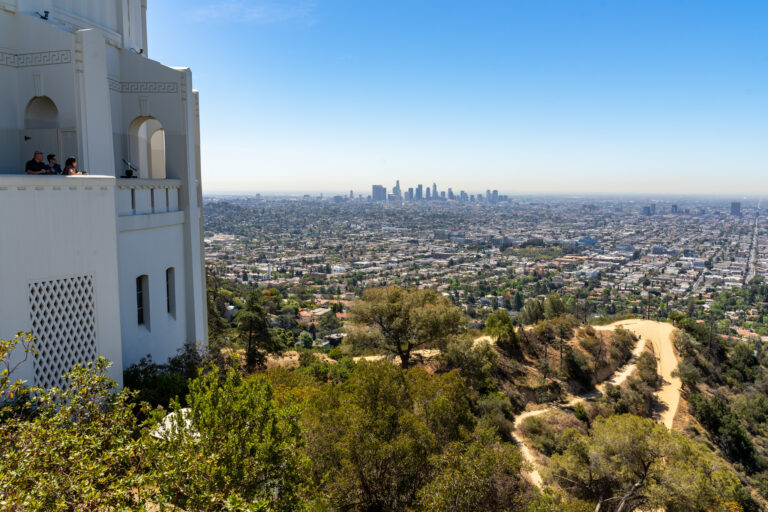
Planning to spend some time in Los Angeles before your road trip? Here are some L.A. travel guides to help you plan your time.
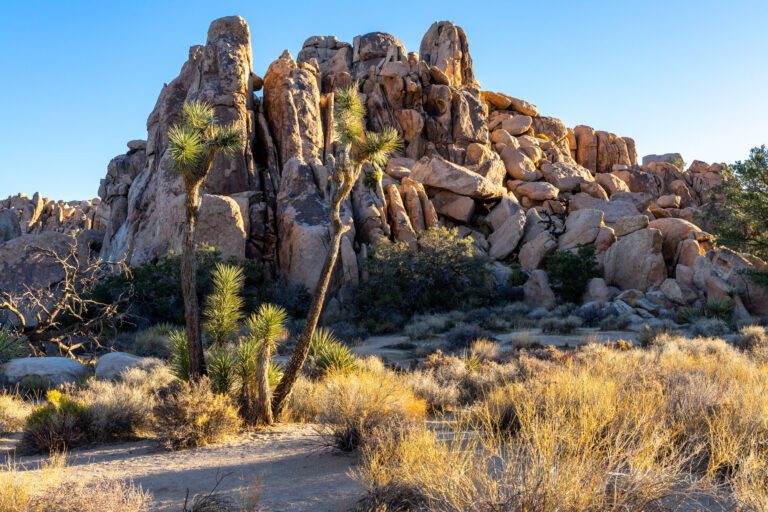
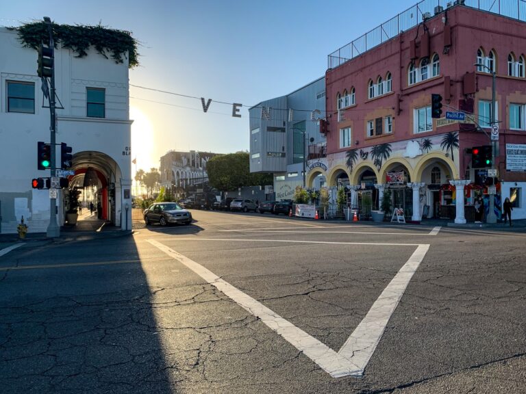
Malibu
Drive Time from Santa Monica to Malibu: 35 minutes / 18 miles
To kick off your road trip, you’ll start in the beautiful coastal town of Malibu. Malibu is home to a variety of state parks and natural areas, with amazing hikes and some of the best beaches in Southern California.
Here are a few of the key spots to check out:
Los Leones Trail: This trail is technically in Pacific Palisades, which is just south of Malibu. The 4.4-mile moderate out-and-back trail takes you up the mountain to get sweeping views of the coast.
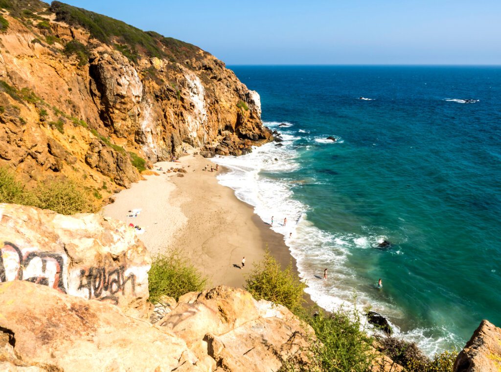
Malibu Lagoon State Beach: This state beach is famous for being one of the birthplaces of modern-day surf culture. Just north of the beach, there’s a salt marsh that you can explore, and on the opposite side of the beach you’ll see the Malibu Pier. There’s an easy 2-mile path that you can follow to explore the lagoon, beach, and pier. Parking at one of the lots will cost $3.00 per hour.
Point Dume Natural Preserve: This gorgeous reserve sits on top of an oceanside bluff, and offers beautiful views of the coast. An easy 1.4-mile trail goes around the small preserve, and will guide you to some amazing overlooks. You can also follow it down to Westward Beach. There’s a limited number of street parking spots on top of the bluffs, but you can also park at the beach lot.
Zuma Beach: Just a couple miles north is Zuma Beach, one of Malibu’s largest and most famous beaches. This sprawling beach is a great spot to hang out, jump in the water, or catch the sunset. The lot costs $0.25 per 10 minutes, with a max charge of 90 minutes.
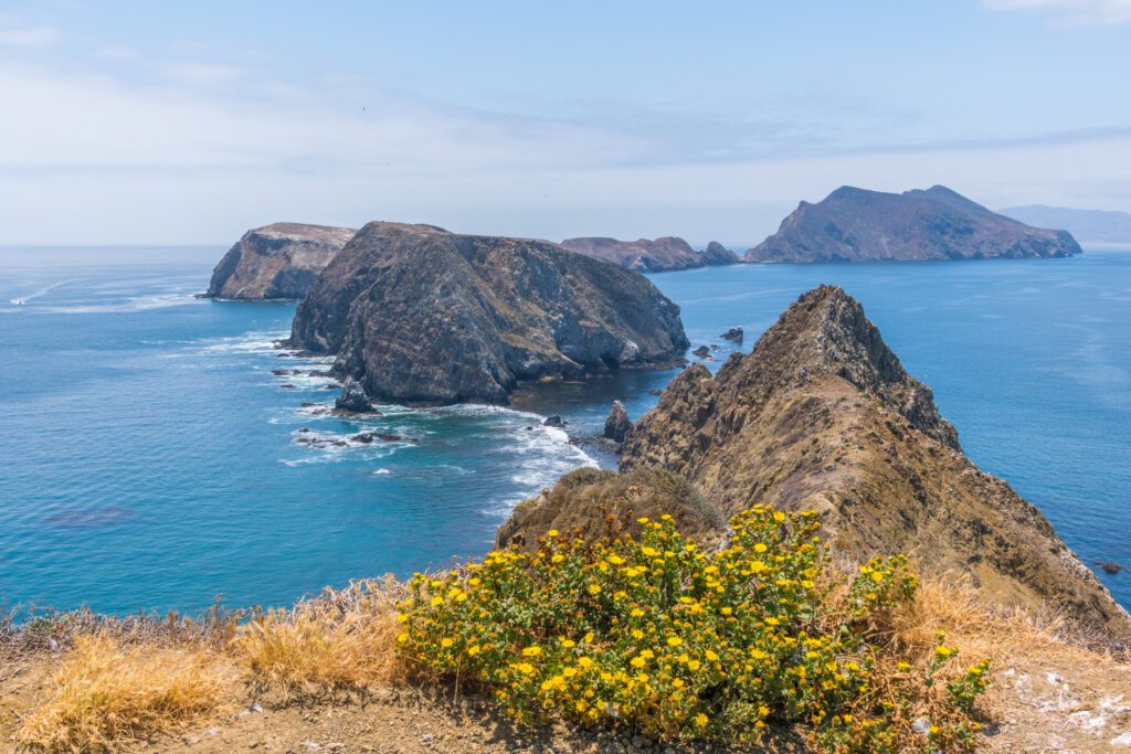
Channel Islands National Park
Drive Time from Malibu to Ventura: 50 minutes / 40 miles
The remote location of Channel Islands (which is located off the coast of Ventura) makes it one of the least visited national parks in California, but this means it’s that much more special for those who decide to visit! This national park has five islands where you can hike, snorkel, kayak, and explore sea caves.
Keep in mind that, if you do decide to visit the Channel Islands, it will take up a full day of your road trip.
A one-way boat ride to the most popular island takes an hour, and you’ll also want ample time to explore. Another very important note is that you need to book tours and boat rides in advance.
We’ll go over the specifics on how to get to Channel Islands below, but first, here are some of the things you can do:
Santa Cruz Island Kayaking and Snorkeling Tours: Santa Barbara Adventure Company offers guided kayaking and snorkeling tours around Santa Cruz Island, which is the biggest and most visited island in this national park. You can choose to either kayak or snorkel, or pick a tour package that does both. This is the best way to explore the coast, see some marine life, and venture into the iconic sea caves.
Potato Harbor Trail: This easy Santa Cruz Island trail is 4.9 miles long and has a 603-foot elevation gain. It brings you along the coastal bluffs, and also explores some of the scenery further inland. It’s accessible via the Scorpion Anchorage harbor.
Pelican Bay Trail: This trail is another popular Santa Cruz Island option that’s accessible via Prisoners Harbor. The moderate 4.0-mile hike (which has an elevation gain of 820 feet) takes you on an out-and-back trail that goes along the gorgeous coast.
Getting There: You can get to any of the five islands via Island Packers Cruises. They have daily trips to Santa Cruz Island (with boats going to both of the marinas mentioned above), and also have regular trips to the other islands. These do sell out, so you’ll want to book your ride in advance online. The adult fare for a one-way ticket is currently $31.50. Transportation is not available on the island, so you’ll be exploring by foot or by kayak once you arrive!
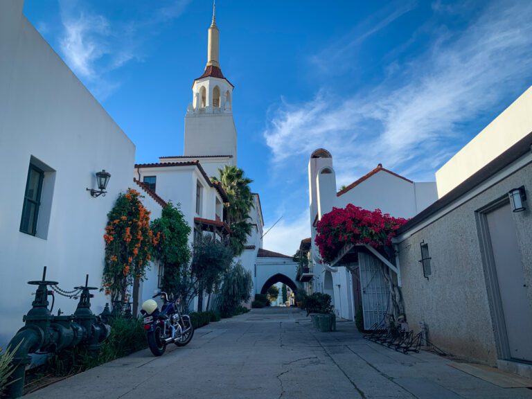
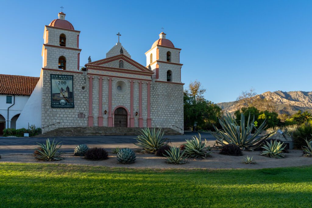
Santa Barbara
Drive Time from Ventura to Santa Barbara: 45 minutes / 25 miles
Santa Barbara is a vibrant coastal city that offers just about everything you could want: picturesque beaches, a variety of hikes, and great bars and restaurants.
We have an entire guide dedicated to helping you plan an amazing day in Santa Barbara (or a weekend in Santa Barbara, if you’re lucky enough to have more time).
Here are some of the best spots to eat, drink, and explore.
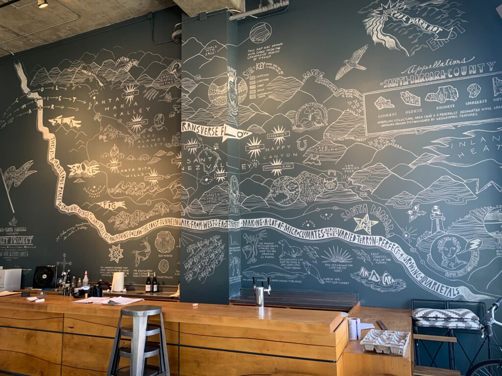
Wine in The Funk Zone: The Funk Zone is the city’s arts and culture district, and is home to excellent tasting rooms that feature wines produced at Santa Barbara County Vineyards. A few spots to check out are Santa Barbara Wine Collective, Pali Wine Co., and The Valley Project. You can also take a look at the Urban Wine Trail for more options in the greater Santa Barbara area!
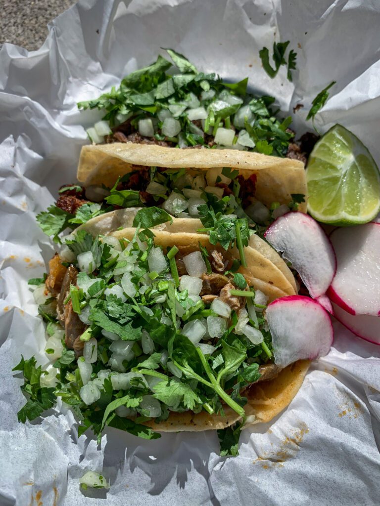
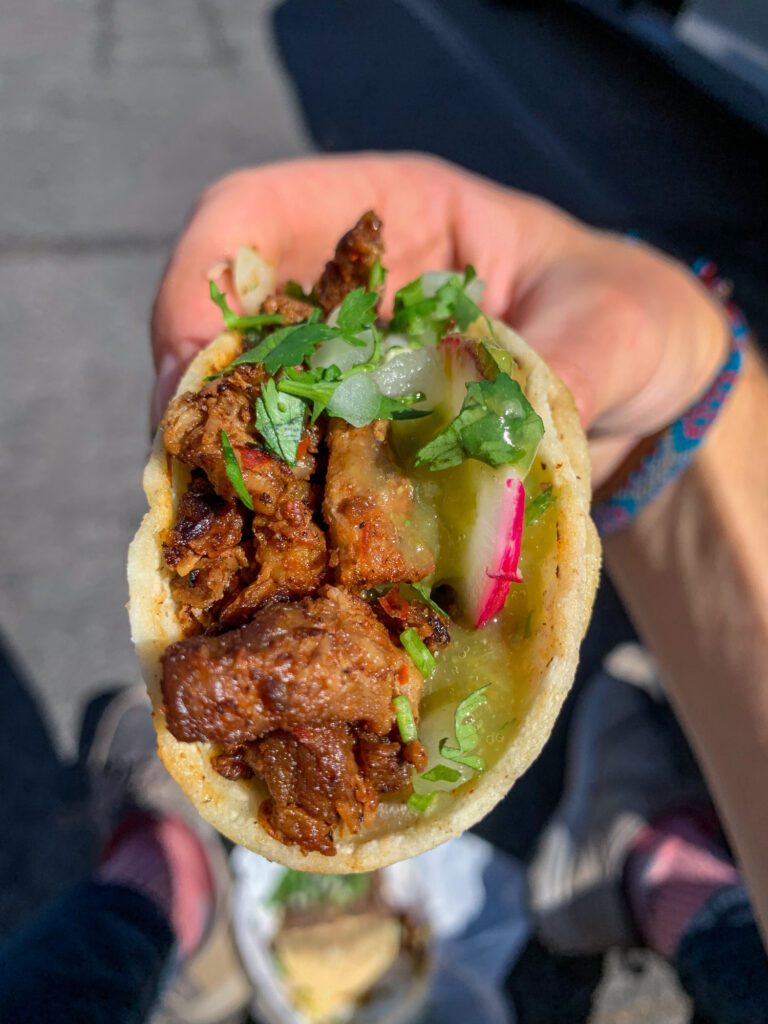
Tacos at Lilly’s Taqueria or La Super-Rica Taqueria: Santa Barbara has some amazing Mexican food, so you won’t want to miss out as you’re passing through. Fun fact about La Super-Rica Taqueria: it was one of Julia Child’s favorites!
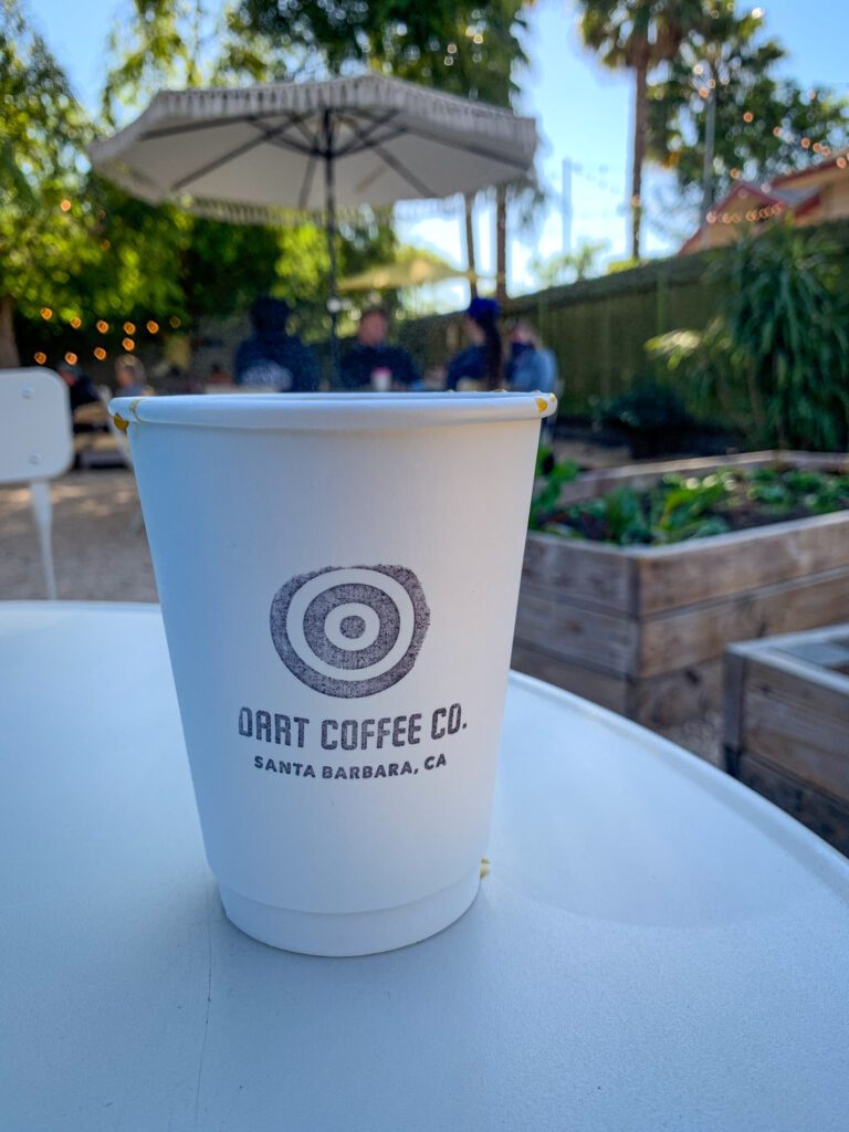
Coffee at Dune Coffee or Dart Coffee Co.: If you’re in need of a caffeine boost, you’ll want to stop at one of these coffee shops. There are two Dune locations in the Downtown Santa Barbara area, and Dart (which is located in The Funk Zone) has a beautiful garden space.

Inspiration Point Trail: This gorgeous hillside out-and-back trail leads you to an outlook where you’ll get gorgeous views of the coast and Downtown Santa Barbara. This moderate hike is 3.4 miles long, and has a 935-foot elevation gain.
Rattlesnake Canyon Trail: If you’re looking for a bit more of a workout, this is another great option in the hills that offers beautiful views of the ocean and surrounding mountains. The 4.4-mile out-and-back trail has an elevation gain of 1,604 feet.
Leadbetter Beach: If you want to spend some time at the beach, consider Leadbetter. This spacious, palm-tree lined beach is a popular spot for surfers and paddle boarders.
San Luis Obispo
Drive Time from Santa Barabra to San Luis Obispo:1 hour 40 minutes / 95 miles
The town of San Luis Obispo – located on the central coast – is incredibly charming and lively, and the vast natural area surrounding SLO can’t be missed. There’s no shortage of great places to eat, drink, and hike, but here are a few recommendations:
Food at Old SLO BBQ: While you’re in town, stop at this spot for some mouth-watering BBQ. There are two locations in SLO, but head to the one downtown on Higuera Street.
Drinks at Sidecar: Just up the street from Old SLO BBQ, this is the place to be if you’re looking for an expertly made craft cocktail. This bar and restaurant also has a small dinner menu with some delicious comfort food dishes.
Coffee at Scout Coffee: If you want a locally roasted cup of coffee or a freshly baked pastry, head to the downtown Scout Coffee location on Garden Street.
Bishop Peak Trail: Bishop Peak is one of the must-visit spots in SLO, as it offers stunning panoramic views of the area. Hike up to the peak via this moderate 3.4-mile out-and-back trail, which has a 1,130-foot elevation gain.
Reservoir Canyon Loop Trail: On the opposite side of town is this moderate 5.4-mile loop trail, which has a 1,400-foot elevation gain. During the rainy season, you may spot a small waterfall, and you’ll also get lovely views of the town from up above.
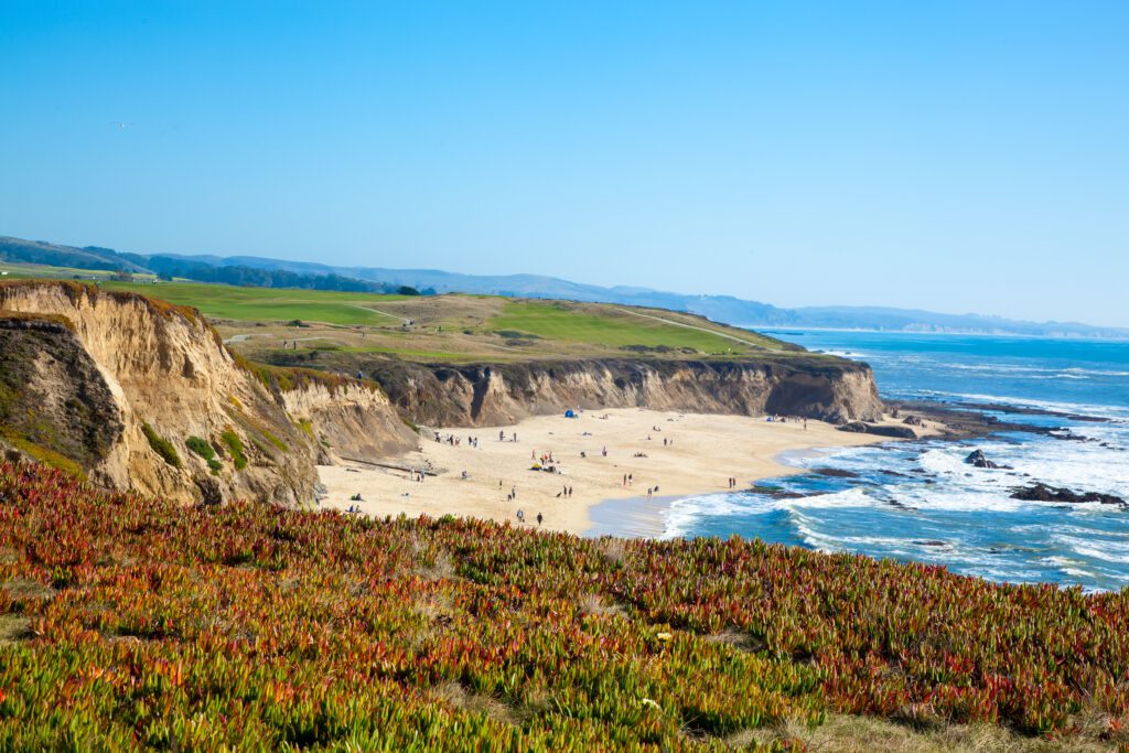
Morro Bay
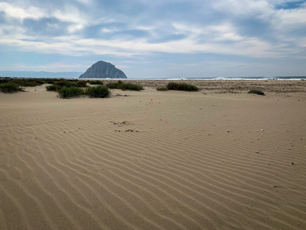
Drive Time from SLO to Morro Bay: 20 minutes / 13 miles
Head 20 minutes up the PCH (Pacific Coast Highway) and you’ll find yourself in Morro Bay, an idyllic seaside town that is often referred to as the Gibraltar of the Pacific.
This quiet coastal community has miles of beaches to explore, and it’s also a great place to spot marine life! Here are a few places you can’t miss as you’re passing through:
Morro Rock: Morro Bay is most well-known for this massive 576 foot rock formation, which is right on the beach. This historic landmark was formed approximately 23 million years ago from a volcanic plug. Check out the giant rock, and then go for a stroll down Morro Rock Beach.
Otters by the Marina: You won’t want to leave Morro Bay without seeing some otters! The Morro Bay T Pier (and the walkway near the pier) is a great place to spot them.
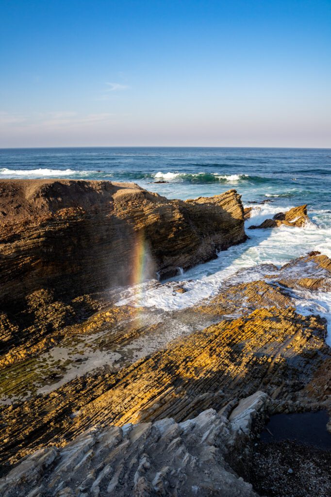
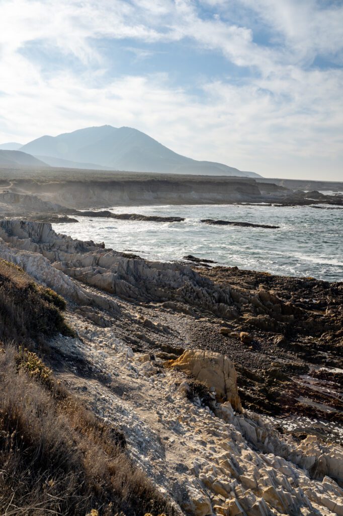
Montaña de Oro State Park: This coastal state park is technically just south of Morro Bay in Los Osos. It’s a stunning spot to get in some hiking on top of the oceanside bluffs and enjoy the view. One of the best trails in the park is the easy 4.1-mile Bluff Trail. Here are a few pictures from that trail.
San Simeon
Drive Time from Morro Bay to San Simeon: 30 minutes / 30 miles
As you continue north on your L.A. to San Francisco road trip, you’ll pass through San Simeon, a small coastal village that’s home to the world-famous Hearst Castle. The historic museum is closed due to road renovations, but is expected to reopen sometime in 2022. If it’s open when you visit, you can book tour reservations in advance online.
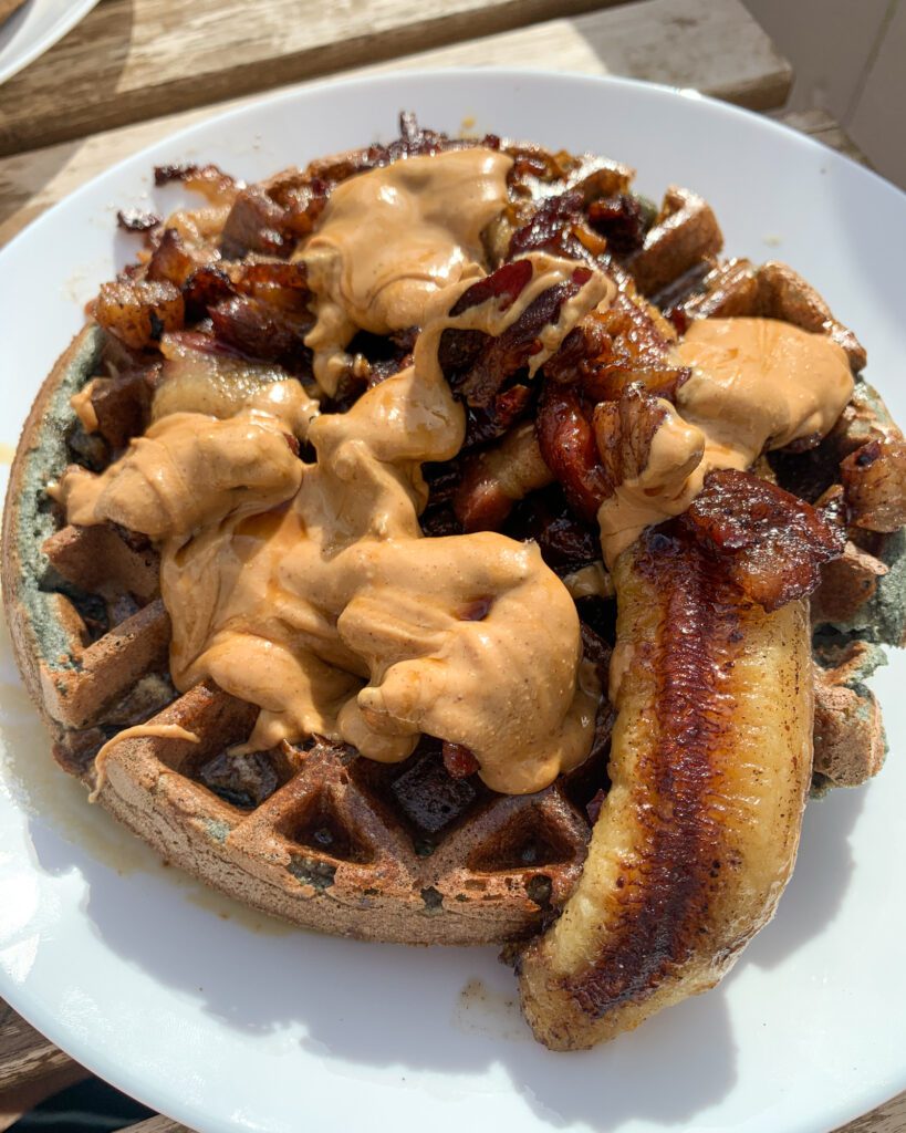
Before getting to San Simeon, you’ll pass by the small town of Cambria. Stop by The Hidden Kitchen for breakfast or lunch – they have a variety of delicious sweet and savory blue corn waffle dishes!
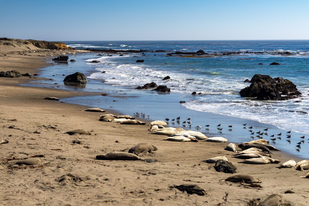
While continuing to drive up the coast, you’ll want to make a quick stop at the Elephant Seal Viewing Point, where the Piedras Blancas Elephant Seal Rookery (the only elephant seal rookery in the world) is located. Here, you’ll have a chance to see the largest seals in the northern hemisphere (bonus: it’s free!).
Just about two miles up the PCH, you’ll pass by Piedras Blancas Light Station, which was built in the 1870s. You can book a self-guided tour of the still-operational lighthouse online. Advanced reservations are required, and a tour currently costs $10. Hours vary from season to season, so check the website for the most current opening information.
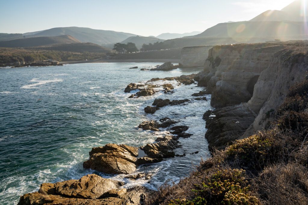
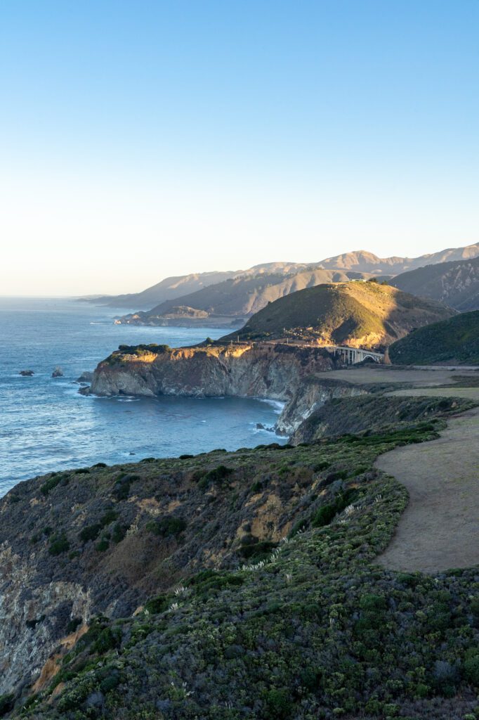
Big Sur
Drive Time from San Simeon to Big Sur (Pfeiffer Beach): 1 hour 30 minutes / 65 miles
Big Sur is one of the spots you absolutely cannot miss during this road trip. This rocky coastal region (which spans over 70 miles) includes multiple state parks and reserves, and is also partially managed by Los Padres National Forest. These are the top sights that you won’t want to miss:
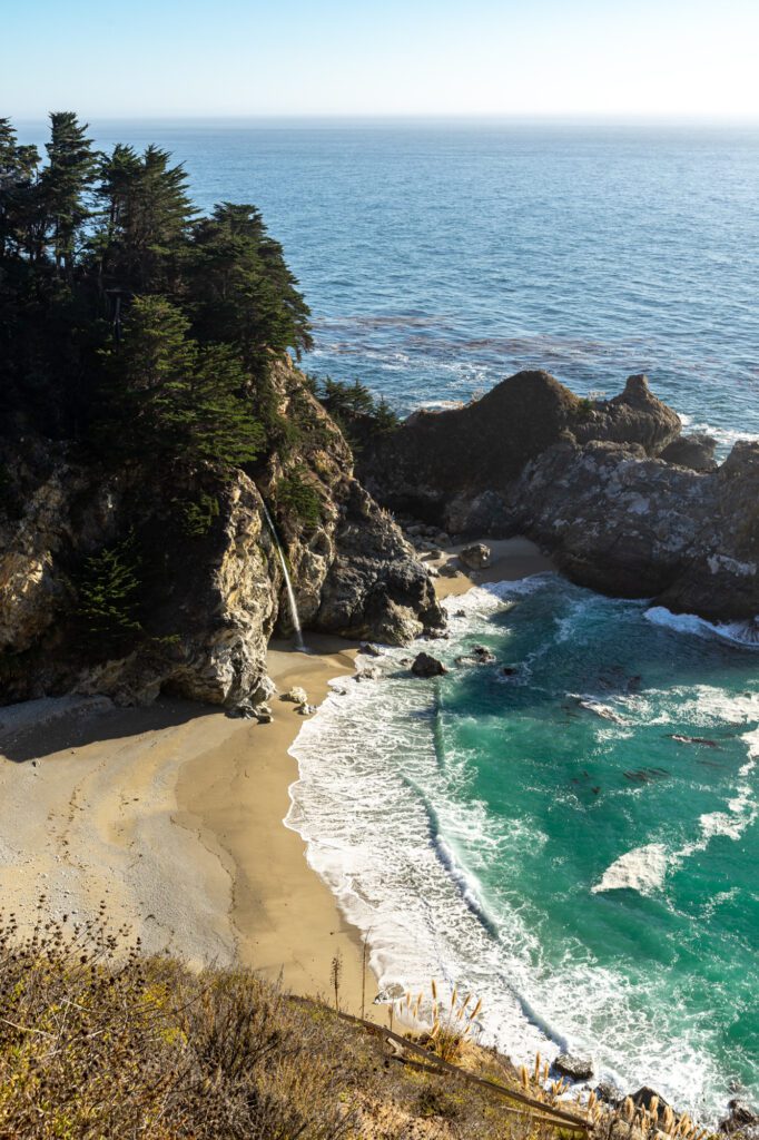
McWay Falls: McWay Falls is located in Julia Pfeiffer Burns State Park, and is one of Big Sur’s most famous (and most photographed) sights. You’ll park at the lot on the opposite side of the highway (don’t forget to buy a $10 day use pass – there’s self-registration instructions at the lot), and then follow the 0.6-mile walking path to get a view of the falls.
Partington Cove Trail: If you want to get in a bit of hiking while in Big Sur, check out this 1.1-mile and 347-foot elevation trail, which is also part of Julia Pfeiffer Burns State Park. The out-and-back trail splits off into two parts. The northern section leads you to a small, rocky beach, and the southern section takes you through a tunnel from the 1880s, and eventually leads you to Partington Cove.
Pfeiffer Beach: Pfeiffer Beach – Big Sur’s most popular beach – is known for its purple sand and massive, picturesque rock formations. It’s managed by Los Padres National Forest, so you will need to pay a separate $12 day use fee.
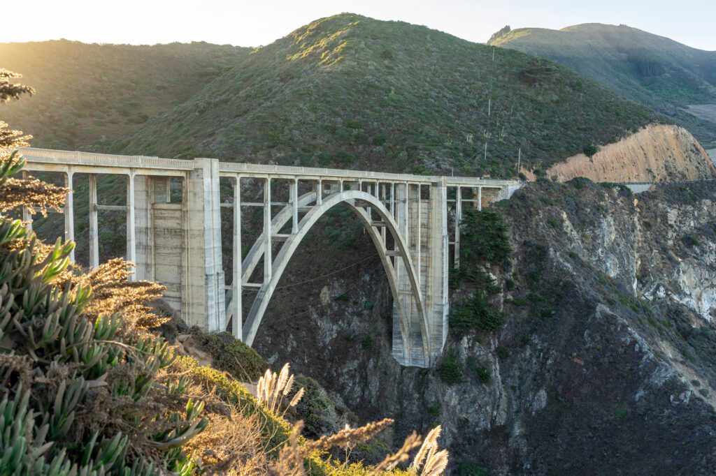
Bixby Bridge: This concrete bridge (which was built in the 1930s) is up there with McWay Falls as one of Big Sur’s most photographed locations. You’ll get the best view of the bridge from Castle Rock Viewpoint.
PS: We have an entire, detailed guide to exploring Big Sur. Make sure to read that for plenty more details!
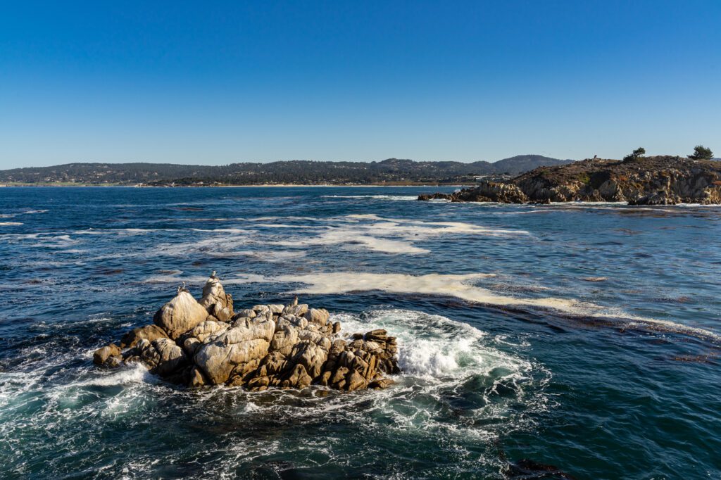
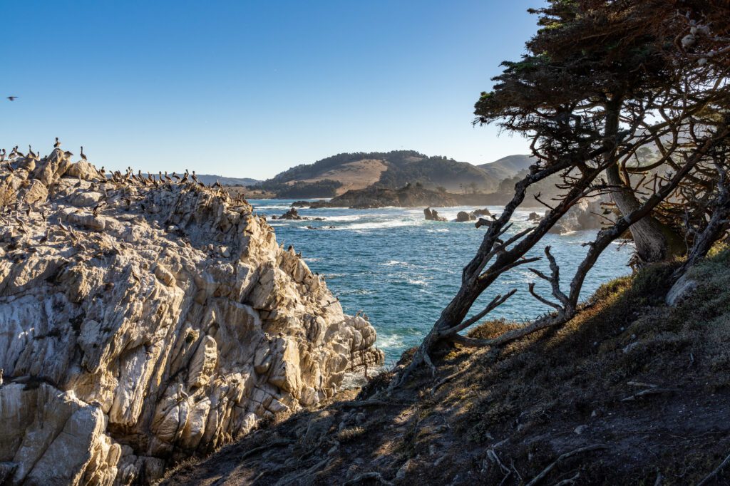
Point Lobos State Natural Reserve
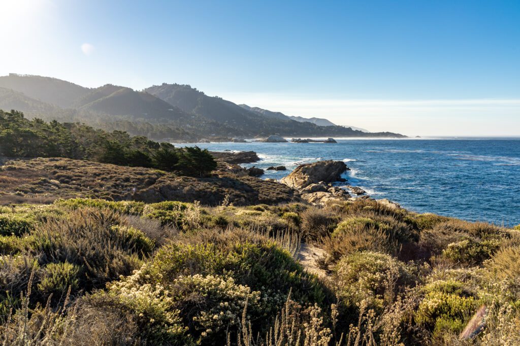
Drive Time from Big Sur (Pfeiffer Beach) to Point Lobos: 30 minutes / 22 miles
As you continue north and make your way out of Big Sur, you’ll hit Point Lobos State Natural Reserve.
This incredibly scenic tree-covered reserve is located right on the water, and you’ll get plenty of amazing views of the rocky coast. You can also expect to see plenty of marine animals and unique birds!
There is a full 6.7-mile loop trail that goes around the entire reserve, and it’s absolutely worth doing the entire loop to get the full experience. You can park at one of the lots for $10, or park along the PCH for free and walk into the reserve.
Monterey
Drive Time from Point Lobos to Monterey: 15 minutes / 7 miles
Monterey is a charming coastal city located just about 7 miles up Highway 1 from Point Lobos State Natural Reserve. There’s no shortage of things to do in Monterey, but here are a few of the sights and activities you can’t miss while passing through:
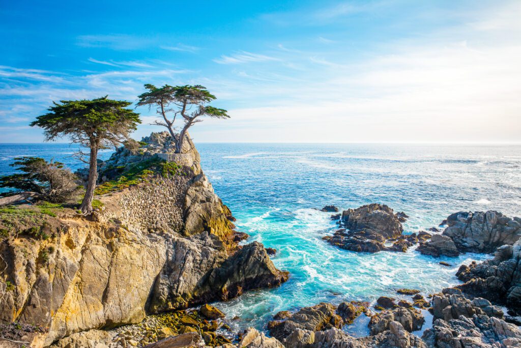
17-Mile Drive: This stunning drive is located just south of Monterey in Pacific Grove and Pebble Beach. The loop takes you along the rocky coast and through densely forested areas, and there are plenty of places to park and take in the view. This drive is located in a gated neighborhood, and you’ll need to pay a fee (currently $11.25 per car) at the gate. You can enter the drive at the Highway 1 Gate, and exit at the Samuel F.B. Morse Gate and head into Monterey.
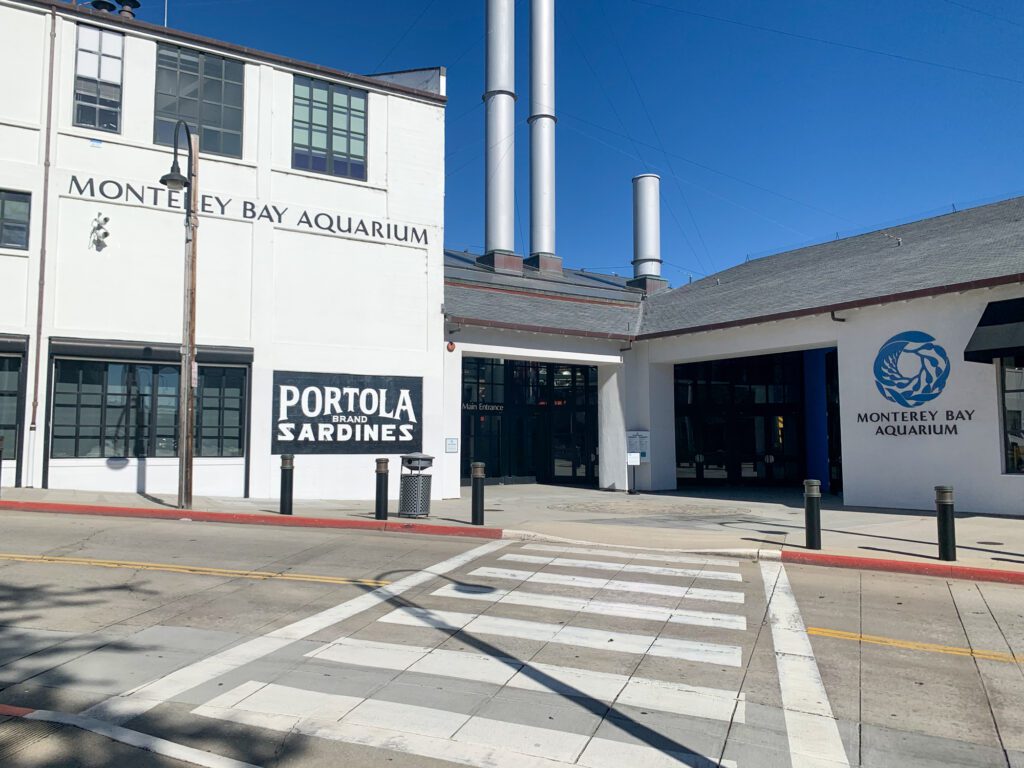
Monterey Bay Aquarium: This oceanfront Monterey Bay Aquarium is considered one of the absolute best in the US, and is definitely worth a visit. There are over 200 exhibits to explore, including the sea otter exhibit and giant kelp forest. Adult tickets are currently $49.95.
Coastal Walk to Lovers Point: Just over a mile up the coast from the aquarium is Lovers Point, a gorgeous rocky coastal spot. Follow the Monterey Peninsula Recreational Trail to get there from the aquarium, and enjoy the beautiful ocean views on your way up (keep an eye out for sea lions!).
Coffee at Captain + Stoker: If you need a caffeine boost, one of the best places to get a really good cup of coffee is Captain + Stoker. This coffee shop also offers a variety of teas, as well as some smaller bites to eat.
Dessert at Revival Ice Cream: For those with a sweet tooth, you can get amazing, high-quality handcrafted ice cream at Revival.
Santa Cruz
Drive Time from Monterey to Santa Cruz: 1 hour / 45 miles
Next up on your road trip is Santa Cruz, which is just about 40 miles up the coast from Monterey. This laid-back oceanside city has gorgeous beaches and some amazing hikes in and around town. Here are some recommendations on places to check out during your visit:
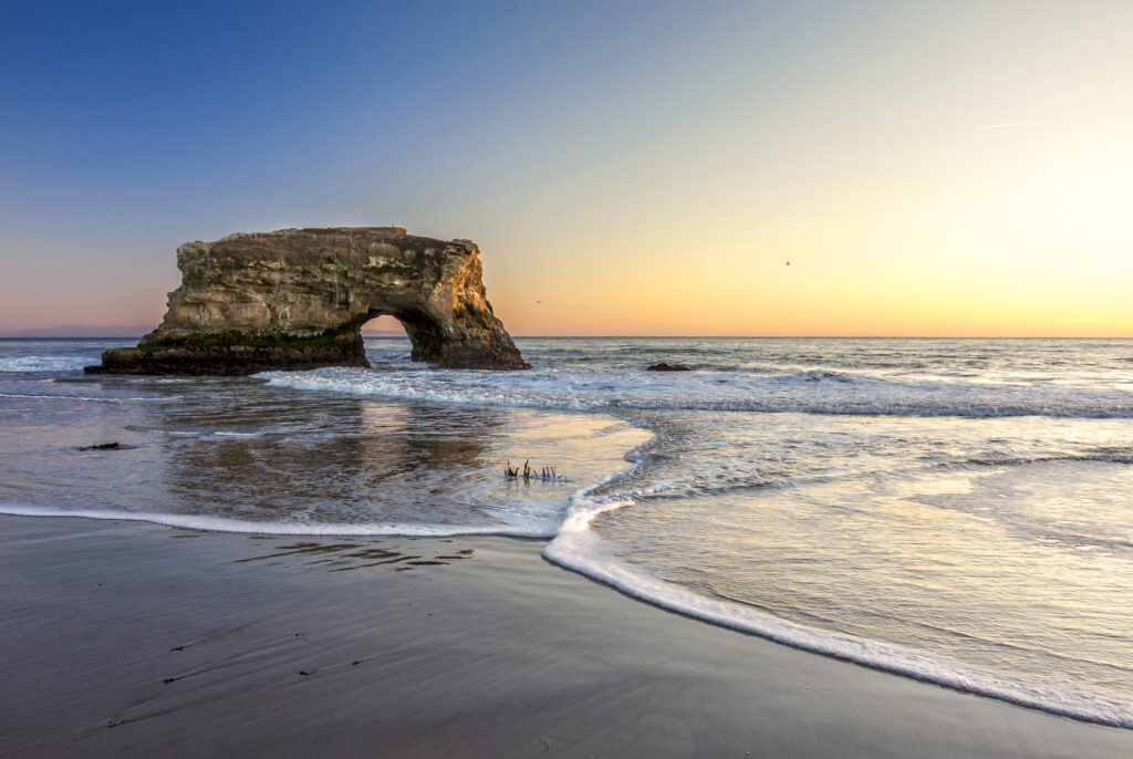
Natural Bridges State Beach: This beautiful beach has cool tide pools to explore, as well as plenty of opportunities to see marine wildlife and birds. Keep in mind that you will need to pay $10 to park.
West Cliff Drive Trail: This easy out-and-back walking path is 4 miles long, and takes you along the beautiful ocean cliffs. Natural Bridges State Beach is located on the opposite end, so you can combine this walk with a visit to the beach.
Santa Cruz Beach Boardwalk: For a bit of child-like fun, head over to the iconic Santa Cruz Beach Boardwalk. It’s the oldest amusement park in the state, dating back to 1907. You’ll find plenty of attractions, but even if you don’t plan on hopping on any rides, you can enjoy a stroll through this colorful beachside amusement park. Fun fact: two of the rides (The Giant Dipper and Looff Carousel) are National Historic Landmarks.
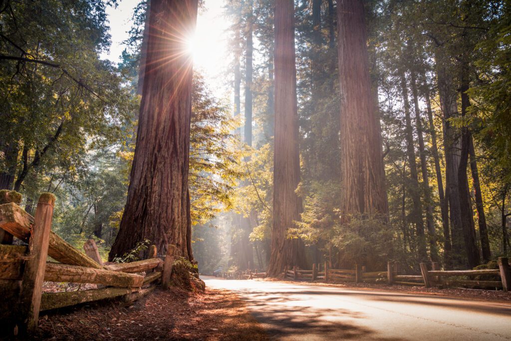
Big Basin Redwood State Park: This state park – which is California’s oldest – is located north of Santa Cruz. Unfortunately, much of the park is closed due to wildfire damage – check the park website for the most up-to-date info. One easy and beautiful hike that is currently open is the Marsh Trail, an out-and-back trail that is just under a mile long. While it’s currently closed, if it reopens when you visit, another great hike is the Skyline to the Sea Trail Short Loop. This easy hike is 2.9-miles long, and has a 298-foot elevation gain.
Año Nuevo State Park: Just up the road on the coastal side of the highway is Año Nuevo State Park, which may be best known for being one of the biggest elephant seal breeding colonies in the world. A scenic coastal hike to check out is the easy Año Nuevo Point Trail, which is 4.3-miles long.
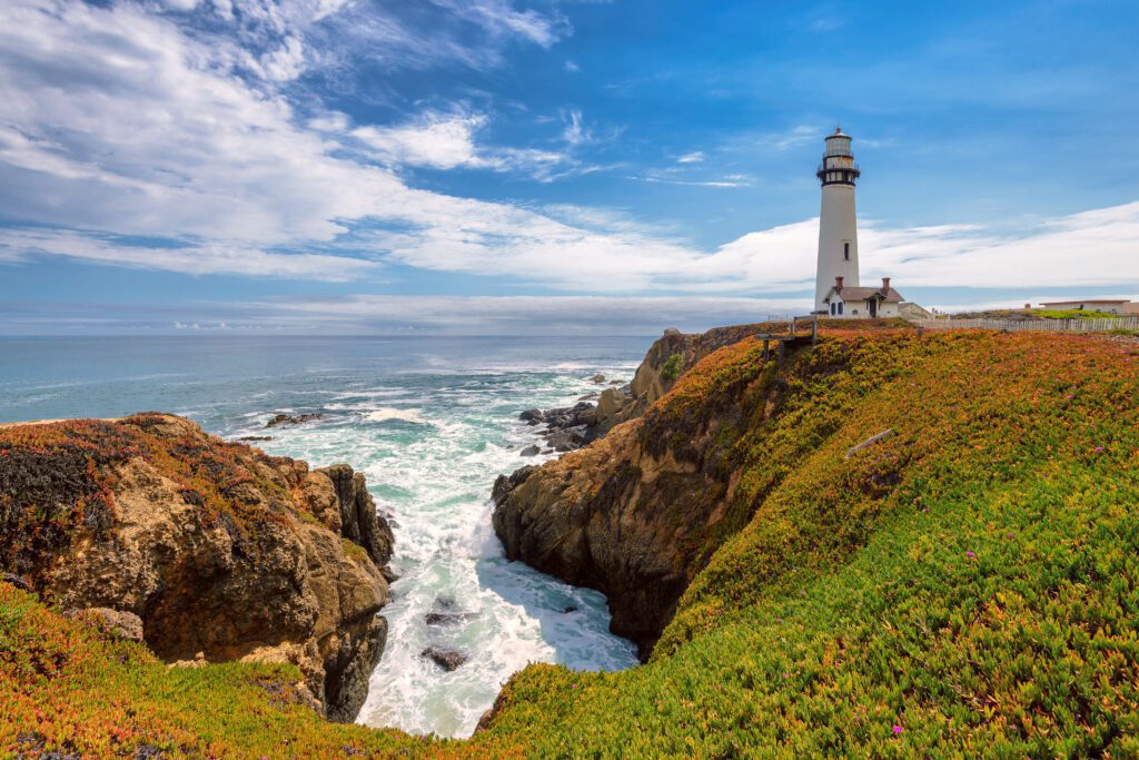
Half Moon Bay
Drive Time from Santa Cruz to Half Moon Bay: 60 minutes / 50 miles
Head 30 miles up the coast, and you’ll find yourself in the peaceful beachside town of Half Moon Bay. Here are some places to check out in the area:
Pigeon Point Lighthouse: Before you get to Half Moon Bay, you’ll pass by this lighthouse, which has been in operation since 1872. You can’t go into the lighthouse, but you can follow the dirt path and check out the exterior.
Redondo Beach: This beautiful beach has scenic eroded bluffs, and is a great spot for tidepooling. You can park here, and then follow one of the paths down to the beach. There are some easier descents north of the parking lot. Alternatively, if you’re up for a beach walk, you can park at Poplar Beach, and walk south to Redondo Beach.
Half Moon Bay Brewing Co.: This casual brewpub is open for brunch, lunch, and dinner, and has a great outdoor seating space with views of the bay.
Pacifica
Drive Time from Half Moon Bay to Pacifica: 20 minutes / 14 miles
The final must-see town you’ll pass through on your Los Angeles to San Francisco road trip is Pacifica! It’s the perfect place to get in some peaceful hiking and beach time before heading into the city. Here are some spots to check out:
Mori Point Loop Trail: This 2.5-mile blufftop trail offers beautiful views of Pacifica’s rugged coastline. It’s rated as moderate, and has a 396-foot elevation gain.
Pedro Point Headlands Trail: Further south at Pedro Point you’ll find a moderately rated 2.4-mile loop trail, which has a 610-foot elevation gain. It brings you out to an overlook of Pedro Point, and through the beautiful headlands.
Devil’s Slide Trail: Just south of Pedro Point, you’ll find this paved coastal trail, which you can also bike along. This easy out-and-back trail is 3.1-miles long and has a 436-foot elevation gain, and takes you down to an old military bunker.
Pacifica State Beach: For your final beach stop on this road trip, consider hanging out at the idyllic Pacifica State Beach, which is a popular surf spot.
Planning to spend some time in San Francisco before you head home? Here are some San Francisco travel guides to help you plan your time.
Where to Fly In and Out for Your L.A. to San Francisco Road Trip
For this road trip, you’ll fly into Los Angeles, and then head home from San Francisco. Here’s what you need to know about the airports in these areas.
Flying into Los Angeles
You have three airport options around the L.A. area: Los Angeles International Airport (LAX), Hollywood Burbank Airport (BUR), and John Wayne Airport (SNA) located in Orange County.
LAX (Los Angeles International Airport)
LAX – Los Angeles International Airport – is located on the coast near Marina Del Rey. It is by far the largest of the three (it’s the biggest on the west coast) and therefore has the most flight options.
That said, LAX gets insanely busy, and can be a hassle to get in and out of (especially if you’ll be using a rideshare – it’s recently become a nightmare!). Keep this in mind when looking at flights.
BUR (Hollywood Burbank Airport)
An alternative option is Hollywood Burbank Airport, which is located in Burbank.
This airport is much smaller and far less busy, so grabbing your bag and getting out of the airport is typically a pretty easy experience (and getting a rideshare is a breeze). With this in mind, I always prefer flying in and out of Burbank, but since it’s smaller and has fewer flights, this isn’t always an option.
Another factor to note is that BUR is further from the road trip route than LAX – it’s about a 30-mile drive from the southern part of Malibu. This isn’t necessarily a bad thing, especially if you’re planning on spending a day or two in Los Angeles before hitting the road – just something to keep in mind!
SNA (John Wayne)
Your third option is John Wayne Airport in Santa Ana, which is approximately the same size as BUR.
This airport is about a one and a half to two-hour drive south of LAX, so you will be adding some travel time – but it’s definitely not a bad option if you’d like to see some of the sights in Orange County!
Besides that, the only downside to SNA is that, like BUR, you’re not going to have as many flight options.
Which is Best?
I’d recommend looking at flights heading into BUR or SNA first, since these airports are less stressful to navigate. If there aren’t any good options, you’ll be able to find a flight that works for you at LAX.
Flying out of San Francisco
Once you’ve completed your drive from L.A. to San Francisco, you’ll want to fly out of either San Francisco International Airport (SFO) or Oakland International Airport (OAK).
San Jose International Airport (SJC) – which is about an hour south of SFO – is also an option, but only if you’re not planning on going into San Francisco.
There are two major benefits of flying out of SFO. One is that this airport is much bigger than OAK, and has far more flight options. The other benefit is that it is conveniently located closer to the city.
That said, SFO has more flight delays when compared to OAK (due to the fog), so you may have to deal with some last-minute travel hiccups when heading back home.