15 Spectacular Waterfalls In Oregon To Explore Now
What is it about waterfalls that’s so intriguing? Is it the raw power of water spilling over the side of a cliff? The deafening roar? The mist that engulfs and cools your body? The deep, churning pools of blues and greens?
There’s something undeniably awe-inspiring about standing next to a waterfall and feeling its energy course though your whole body. And, if you’re a waterfall junkie forever chasing that high, make a beeline for one the best states ever to go waterfall hunting—Oregon.
The Pacific Northwest has the most waterfalls in the entire country and Oregon is home to over 1,600 of them, second only to our even-wetter neighbor to the north, Washington. Ever since I was a kid growing up in Oregon, I’ve been fascinated and drawn to waterfalls but never realized how lucky I was to live in an area with so many of them.
I just took it for granted that everyone had amazing waterfalls in their backyard. Sadly, this simply isn’t the case, so those of you who grew up waterfall-deprived will just have to come out here and find them!
Today, I’ll show you 15 of the best Oregon waterfalls around the state that you can go explore.
Disclaimer: Some of the links in this post, like hotel and vacation rental links, are affiliate links, meaning at no additional cost to you we make a little bit of money if you click through and book. That being said, we would absolutely never recommend something to you that we don’t stand behind 100%.
The 15 Best Waterfalls in Oregon
These stunning Oregon waterfalls are mainly found on the western side of the state, since eastern and southern Oregon are much drier and high-desert-y than out here in the west. Consequently, you’ll see far fewer waterfalls over there.
These parts of the state are still 1,000% worth visiting, but if we’re just talking about waterfalls here (and we are), stick to the moisture-rich regions of the west.
I’ll present the following waterfalls starting with my favorite and moving down the line to my still-favorite-but-not-quite-most-favorite. You see, it feels like a disservice to rate one as “better” than another because each offers something unique and rewarding depending on where you’re located, what kind of hike (or drive) you’re looking for, and who you’ve got with you.
So my disclaimer is that just because you’ll find some of these at the bottom of my list, they are not at the bottom of my heart. They’re like children; I love each of them the same for different reasons (at least that’s what my mom used to say).
Multnomah Falls

Nearest city: Portland
Drive time and distance from Portland: 35 minutes / 30 miles ***Please read description for parking info***
How could we not start with Multnomah Falls?! The grandaddy (or grandmama?) of them all. Along with Mt. Hood and Haystack Rock, Multnomah Falls has got to be one of the most iconic Oregon landmarks out there, and it has every right to be—it’s incredible!
As the tallest and most iconic waterfall in the state standing at 611 feet, this spot sees over two million visitors each year, making it one of the most visited natural areas in the entire Pacific Northwest.
You can view the falls right from the parking lot, but many choose to take the short hike up to the top, which is only about a mile long but will get your blood pumping. Many people underestimate how much of a climb it really is and you’ll often find unprepared tourists catching their breath on the side of the trail or turning around before reaching the top.
The one thing to note about the falls is it’s one of the busiest tourist destinations in the state and parking can (will) be a nightmare!
Go mid-week if you can, and even then try to get there before 8:00 am. Or better yet, hit it up on a rainy day to thin some of the crowds (but honestly, even when it’s pouring the place will be swarmed). Consider using the Sasquatch Shuttle if you simply must go on a sunny Saturday afternoon.
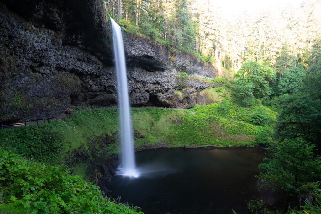
Silver Falls State Park
Nearest city: Silverton
Drive time and distance from Silverton: 18 minutes / 13 miles
If you live in the Salem area and can make it out to Silver Falls State Park easily throughout the year, then you can afford to just see one or two of the falls during each trip (and if you simply must just see one, go to South Falls).
But, if heading to Silver Falls is an event (which for me means driving more than 45 minutes), I highly recommend you see the whole shebang and do the entire Trail of Ten Falls. I mean, since you’re there you might as well see them all, right?
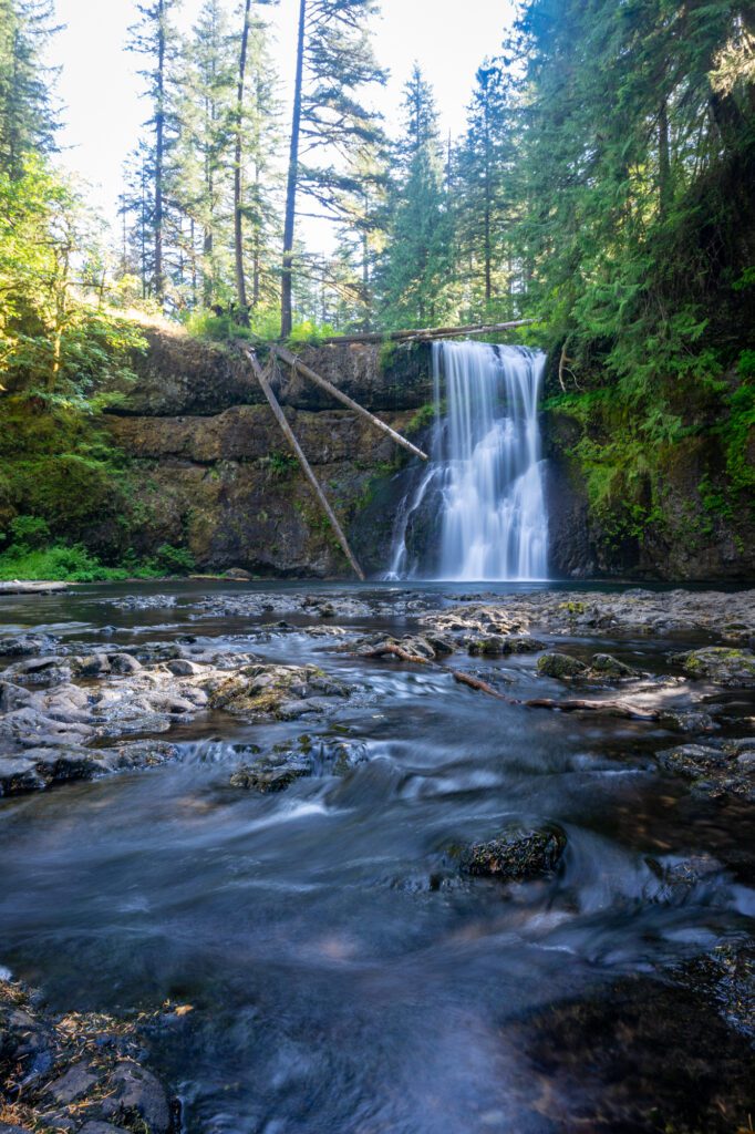
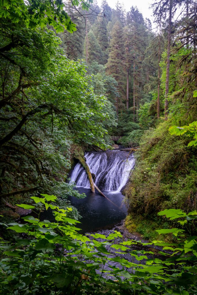
It actually doesn’t seem possible that a place like Silver Falls exists. It’s like someone created a waterfall-theme park, as if you’re walking around the set of Avatar.
I think the best time to see this place is in the autumn and when it’s raining (or just after a big rain) to maximize the sheer amount of water you’ll see and the forests will encircle you in rich yellows, reds, and oranges.
It would be hard to name the best waterfall of the bunch because there’s something so powerful about experiencing them all in one go, but South Falls certainly stands out because you can walk behind its 177 foot curtain.
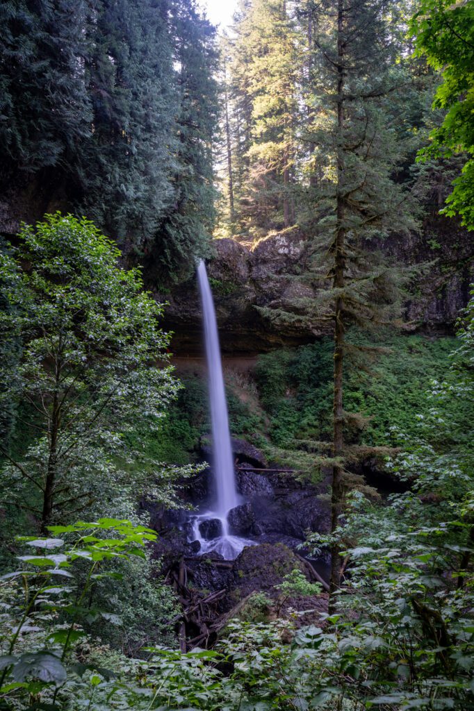
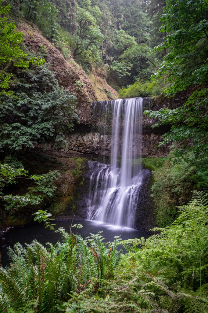
To be fair though, you can also walk behind Lower South Falls and North Falls too!
The Trail of Ten Falls loop is about 9 miles but there’s not a ton of elevation gain and it’s all very well-maintained. The only downside of these falls is that it’s so busy it’s impossible to have any kind of privacy, but what else would you expect from Oregon’s largest state park?
Ramona Falls
Nearest city: Government Camp
Drive time and distance from Government Camp: 28 minutes / 18 miles
Ramona Falls is one of the most photogenic waterfalls in Oregon next to Multnomah, but the two couldn’t be more different.
Whereas Multnomah is an extremely tall, plunge waterfall that’s forceful and spectacular in its own right, Ramona Falls cascades down over the rocks and fans out from its height of 120 feet.
The effect is that of a veil and when the sun hits it right it downright glows! And, although Ramona Falls is very popular, it’s a bit of a hike to get there which can weed out some of the more novice sightseers.
The trail itself is about 7 miles and though there’s not a ton of elevation gain, there is a potentially dangerous river crossing right at the beginning. Take care here and don’t get cocky—if there’s been heavy rains and the water level looks too high, opt for another hike—seriously.
This trail is best done in the summer or early fall to avoid this issue. There used to be a bridge there, but it kept washing out so the forest service decided to stop rebuilding it every year, reasoning that an unstable bridge is more dangerous than no bridge at all. This shouldn’t dissuade you though, just don’t be dumb and you’ll be fine!
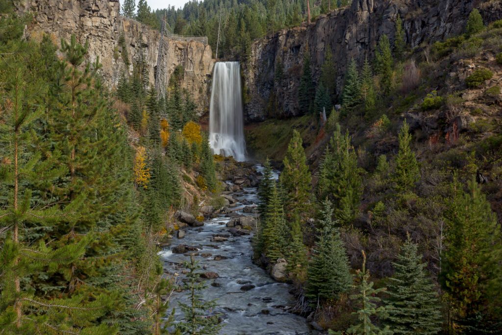
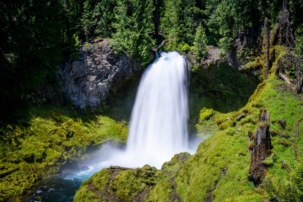
Tumalo Falls
Nearest city: Bend
Drive time and distance from Bend: 25 minutes / 13 miles
It’s hard to imagine a more picturesque waterfall than Tumalo Falls. Tumalo stands at 97 feet and its curtain of water drops down perfectly into the creek below. You’ll also get to see a number of baby waterfalls along the trail making this a jam-packed waterfall day.
If you’re not up for a hike, there’s an option to drive up to a viewpoint to see the falls, but be forewarned it’s on a very rocky and potholed road.
Even though you’ll encounter a little elevation gain, the 7 mile out-and-back trail isn’t hard and is really more of a long walk in the woods since you’ll basically be following the path of Tumalo Creek. Being so close to Bend this trail sees a lot of foot and mountain bike traffic, so be prepared to share the trail.
However, if you’re a winter warrior, the best time ever to do it (say me) is in the winter as a snowshoe hike.
If you don’t have any snowshoes, because who does, rent them in Bend at Pine Mountain Sports. Even for beginners, a snowshoe hike is doable because the trail is so well marked and graded, and the falls will look even more gorgeous surrounded by a winter wonderland.
Latourell Falls
Nearest city: Portland
Drive time and distance from Portland: 40 minutes / 30 miles. Note: Latourell is actually before Multnomah Falls on the 84, but there’s not a good exit to get there so you end up driving past it then doubling back to get to the trailhead.
Latourell Falls is a great alternative to Multnomah Falls in the Columbia River Gorge if you’re crowd-avoidant like me. The falls stands at 249 feet and is relatively easy to get to.
The trail is a 3 mile loop and I suggest taking it counter-clockwise to get your elevation gain out of the way at the beginning. It’s not a hard hike, but if you’re not a regular hiker or if you’re hiking with young kids, the first mile or so can be more of a moderate climb.
That said, once you make it to the upper falls (a lovely two-tier drop), the continuation of the loop is mostly flat or downhill.
What I like about this hike is that you get to see the lower falls right off the bat as it’s literally next to the parking area. Start going left up the trail for a nice (but crowded) viewpoint, then continue up the well-graded climb into the woods.
Many sightseers don’t bother with the actual trail so once you get past the parking area crowds, you won’t find the area too overrun with onlookers.
Towards the end of the loop you’ll cross over the Historic Columbia River highway and into Guy W. Talbot State Park which brings you back around and then under an old highway bridge to come up again to view the mighty falls. This is a great hike to pair with a drive up to the Vista House for sweeping views of the area.
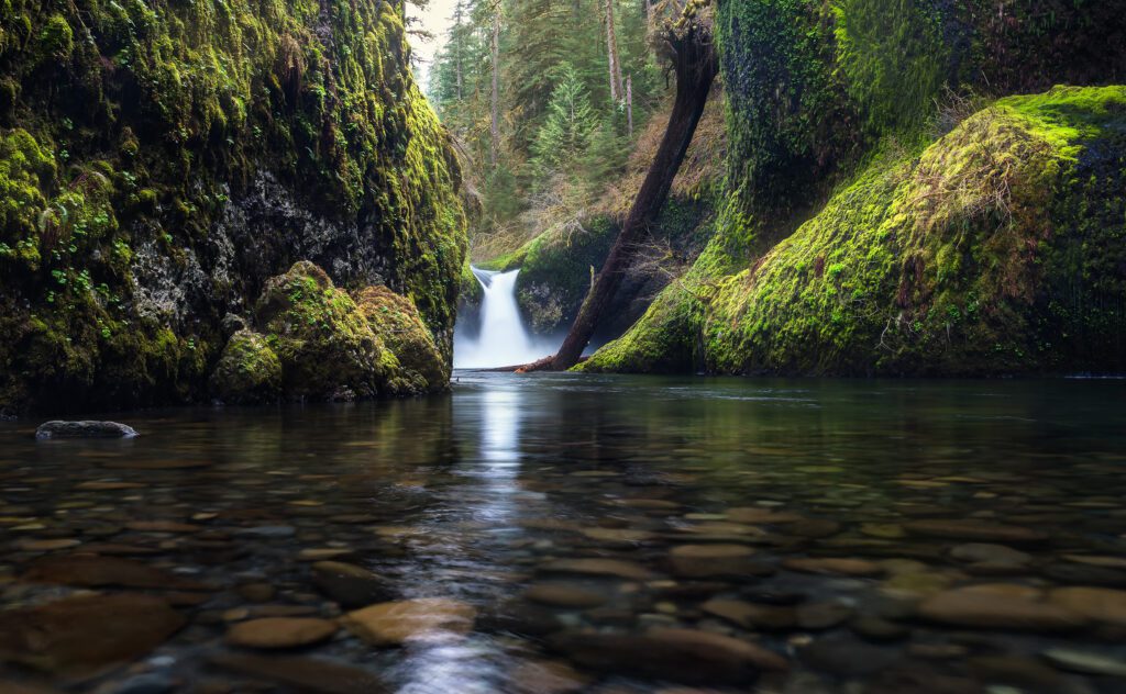
Punch Bowl Falls
Nearest city: Cascade Locks
Drive time and distance from Cascade Locks: 11 minutes / 6 miles
I have a special sense of excitement to be writing about Punch Bowl Falls because for about four years the trail was closed due to the Eagle Creek fire (thank you, 15 year old boy setting off fireworks!) and extensive storm damage in 2018. But now it’s back open and better than ever!
Punch Bowl Falls was a frequent destination in my youth and is one of the best Oregon waterfall hikes out there. Often referred to as a textbook example of a punchbowl falls (I know it’s confusing—it’s called “Punch Bowl Falls,” but it’s also the name for the category of waterfall that empties into a large “punchbowl”). Though it’s not terribly tall (only 35 feet), it’s still a sight to behold.
But my favorite part of this place? Swimming! This is a killer spot for some rock jumping and mid-hike swimming on a hot, summer day. The trail is an out-and-back that clocks in at around 4.5 miles and it’s not too difficult, though there are some harrowing spots where there’s a pretty shear drop off to one side.
If you feel like making it a longer day, continue on the trail to make it a total of 12 miles and head all the way down to Twister and Tunnel Falls (another walk-behind falls!) to see a total of eight waterfalls on this scenic hike without a ton of elevation gain.
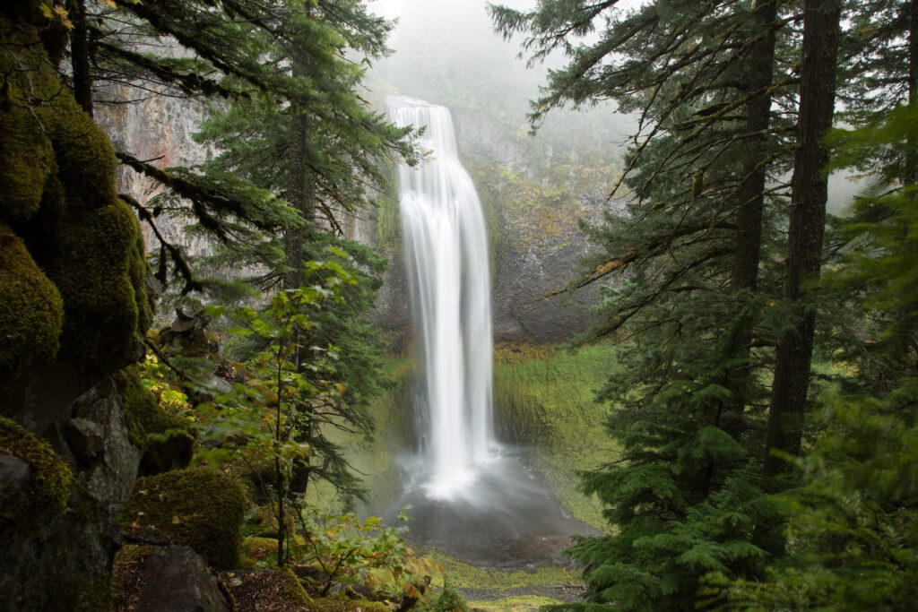
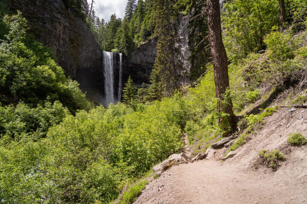
Salt Creek Falls
Nearest city: Oakridge
Drive time and distance from Oakridge: 28 minutes / 23 miles
Salt Creek Falls sits almost smack dab in between the Willamette Valley city of Eugene and the Cascades hub of Bend, so either city makes a good starting point to get here. These falls are tall, standing at 284 feet (the second tallest in Oregon) and you can take an easy one mile trail to see them.
You’ll get a spectacular view right off the bat from the trail, then it swings you around and up to see the falls from the top.
There used to be a trail that took you down to the bottom of the falls and though it’s been washed out, that doesn’t stop people from venturing down (me included) — just make sure you’re being cautious. And, though I’ve never seen these falls in the winter, I’ve heard tales that they’re best viewed when the rocks and trees surrounding it are covered in snow and ice.
If you’re feeling adventurous and want a longer hike (and another waterfall!), try this 5.5 mile loop that takes you past Salt Creek Falls and then to the smaller, but still pretty, cascading Diamond Creek Falls. Afterwards, hit up the 3 Legged Crane Pub in Oakridge for great food and beer!
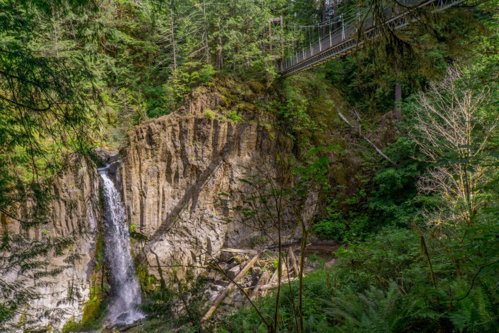
Drift Creek Falls
Nearest city: Lincoln City
Drive time and distance from Lincoln City: 36 minutes / 16 miles
Drift Creek Falls is kinda off the beaten path, but makes an excellent day trip if you’re looking for waterfalls on the Oregon coast. From Lincoln City, it’s only about a 35 minute drive, though the road is pretty windy and narrow.
The trail is well maintained and features a very cool, very long, very tall suspension bridge at the end. But, if you’re scared of heights, it may feel more perilous than exciting since it will sway a bit in the wind!
The bridge takes you up 100 feet over Drift Creek which gives you a unique vantage point to actually be looking down on the 66 foot falls below. You should definitely do this (if you can handle the heights), but I prefer the views from the bottom to really take in how amazingly powerful the falls are.
The trail itself is fairly easy at just a little over 3 miles and is a great option for kids.
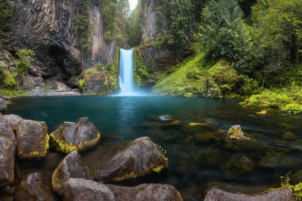
Toketee Falls
Nearest city: Roseburg
Drive time and distance from Roseburg: 1 hour and 5 minutes / 57 miles
Toketee Falls isn’t near much (unless you happen to live in Roseburg), so you really have to plan a trip here.
The good news is it happens to be near some other incredible out-of-the-way places that you can double or triple-up on to make a whole day of it (or better yet—a camping trip!).
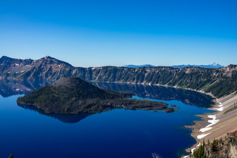
The most notable nearby attractions are the Umpqua Hot Springs that are a mere 10 minutes away; Watson Falls (very tall and pretty, but not a ton of water flow); and a modest, unassuming little pond called Crater Lake about an hour away (depending on road closures).
However, even though Toketee Falls is a bit remote, it still sees a good amount of traffic since it’s such a spectacular falls for such a short hike.
The Toketee Falls trail is only one mile round trip and is doable by most anyone, though you will hit a set of 200-ish stairs towards the end.
Once you make it, you’ll be greeted by a basalt amphitheater with the gushing Toketee Falls plunging into the pool below.
Toketee is the Chinook word for graceful, and these falls certainly fit the bill. I recommend hitting it up during October or November to see the beautiful autumn colors surrounding the picture perfect falls.
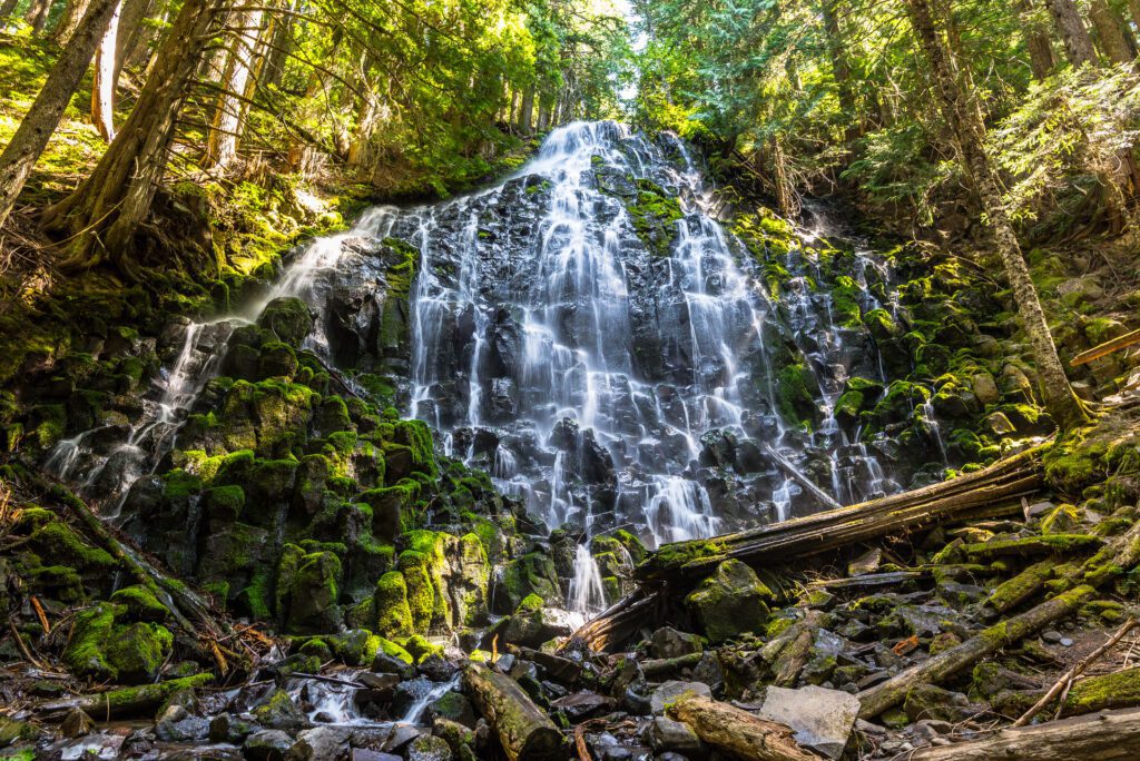
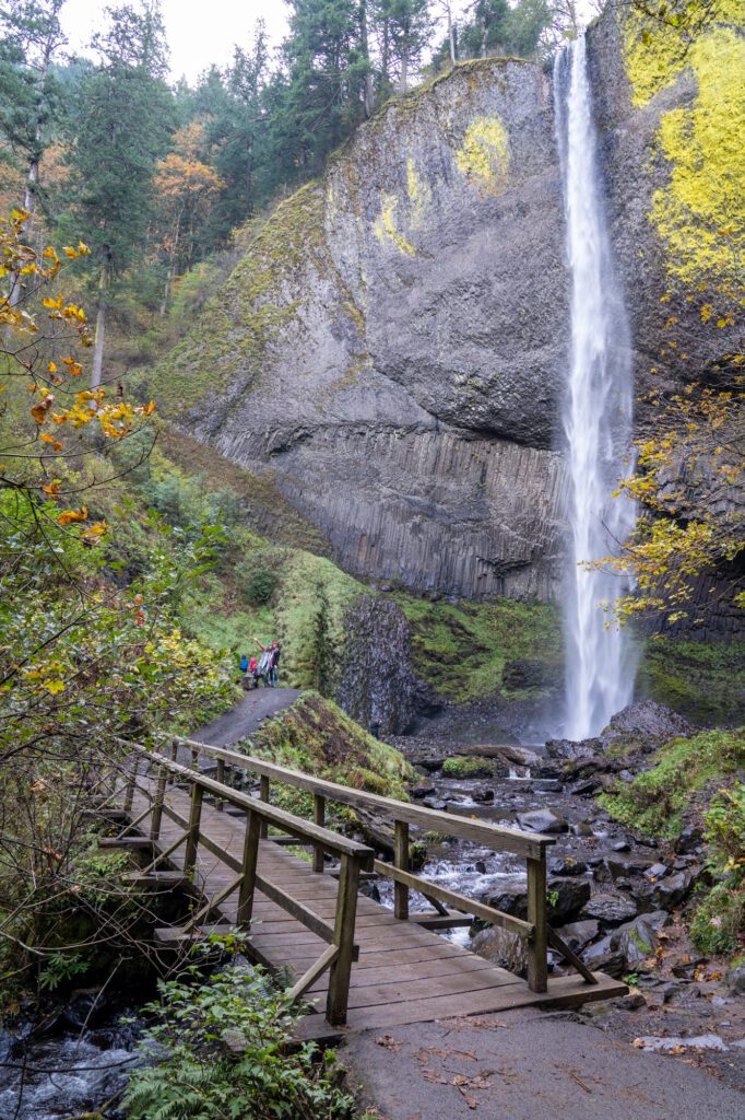
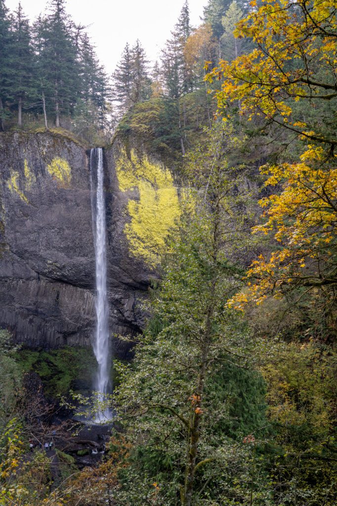
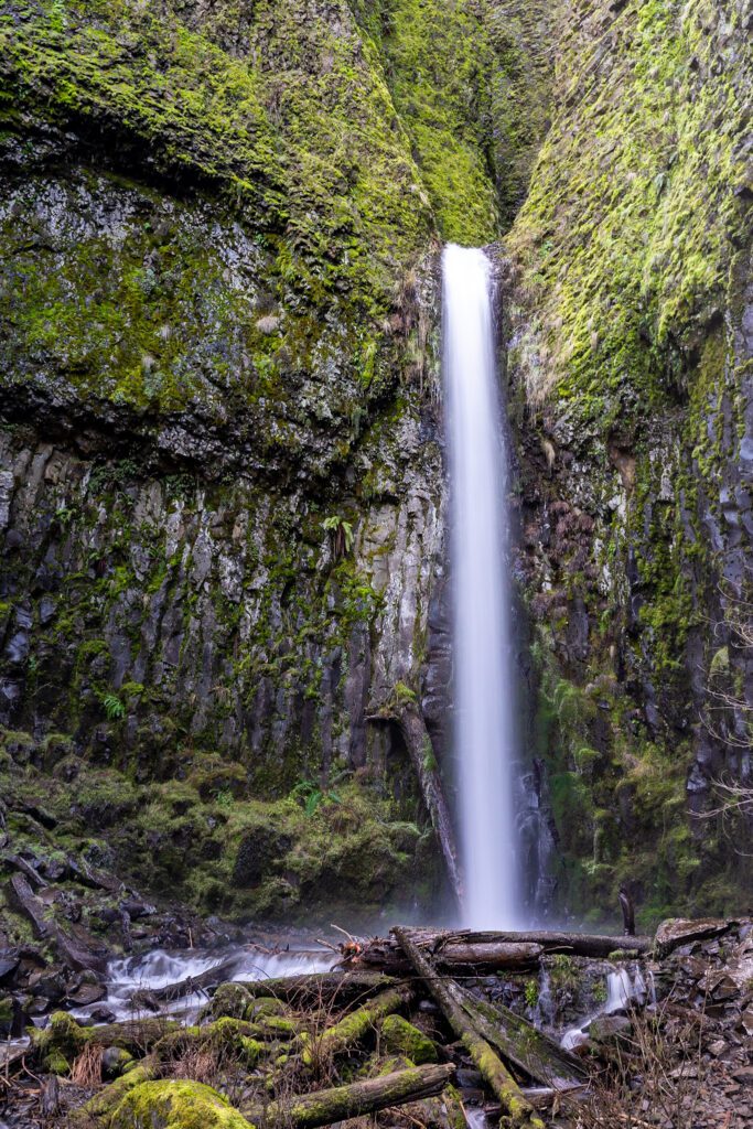
Tamanawas Falls
Nearest city: Parkdale
Drive time and distance from Parkdale: 14 minutes / 10 miles
The trail to Tamanawas Falls is only about 3.5 miles and should be doable for most people and kids (unless you’re trying it in the winter, and there’s snow and ice to contend with).
That said, with poles and decent shoes, this makes for an excellent winter hike, and the falls take on a new kind of beauty when seen in the frigid air and with the trees covered in snow. Plus, it’s one of those cool waterfalls that you get to walk behind, but this is only an option for the sure-footed as there’s not an actual trail that leads there.
Tamanawas Falls are about 110 feet high and drop in a perfect curtain of water that you can view right from the trail or scurry down to the base for a closer look (making sure to not slip on the wet rocks).

This serves as a good reminder to anyone who’s not accustomed to the always-wet, moss-covered life we’ve grown so used to here in the PNW, but slippery rocks are no joke and you should always exercise caution.
And, since this trailhead is so close to the cute little town of Parkdale, I’ll never pass up an opportunity to plug one of my favorite local breweries, Solera for hula hoops and mountain views!
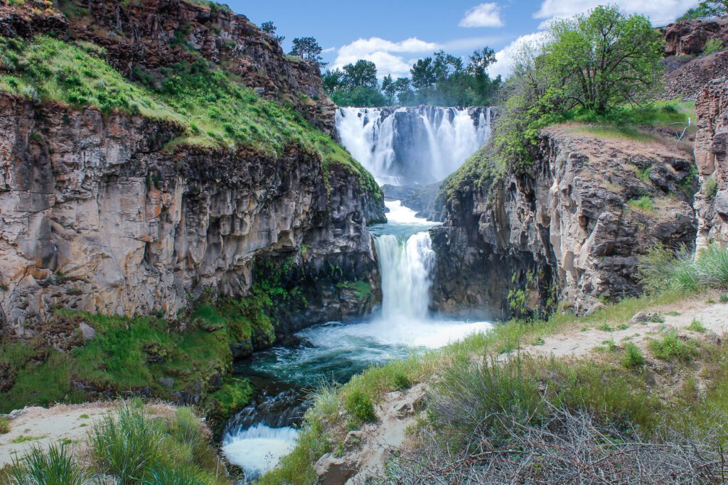
White River Falls
Nearest city: Maupin
Drive time and distance from Maupin: 16 minutes / 14 miles
If you read trail reports of getting to White River Falls, you’ll no doubt encounter more than a few tales of rattlesnakes along the path and in the general area. These are not lies, so if you suffer from ophidiophobia (had to look that up), this hike may not be your number one choice.
For those of us who may not love snakes, but aren’t exactly scared of them, there’s nothing to really be afraid of—just keep your eyes out and don’t go provoking a snake who’s just chilling and minding their own business. And don’t pick them up! I can’t believe I have to say that, but something like 85% of snake bites are on people’s fingers and hands. What’s wrong with you people?!
Snake warning out of the way — the White River is an extremely popular area for rafting and countless spots along the river feature white water rapids, but it’s here at the falls that they really turn into something special.
The White River Falls is a 90 foot, multi-tiered waterfall that really doesn’t see too much foot traffic (because most people are more interested in rafting?).
You can see the falls right from your car, but it’s worth it to take the short hike down to get up close and personal. There’s also a very cool old hydroelectric plant that was built in 1900 that you can explore and still see the old generators!
Abiqua Falls
Nearest city: Silverton
Drive time and distance from Silverton: 29 minutes / 18 miles
The actual trail down to Abiqua Falls is only about half a mile, but to get to it you have to drive down a very steep and rocky road. Also, even though the trail is short, it’s not that well marked (nor is the route you drive to get there), so if you’re not used to basic trail navigation you may want to download an offline map before you head out.
It’s also a very steep trail (that even has ropes on some sections to help you down), so is probably not the best choice for kids.
If you doubt your car’s capabilities, you can always park on Crooked Finger Road and walk the additional two-ish miles to the trailhead, and on a nice day you’ll see many non-4WD cars parked along the edge of the road as you get closer to the trailhead.
Abiqua Falls stand about 100 feet and drops down into a large pool that’s perfect for swimming on a hot summer day (but still be prepared for cold water!).
Since the road and trail are a bit tricky to trek down, the payoff at the end makes it all the more impressive! The falls are encased in a columnar basalt amphitheater and if you’re lucky enough to be the only ones there, it’ll feel like you’ve stepped into a different world.
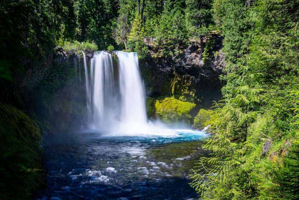
Sahalie & Koosah Falls
Nearest city: Sisters
Drive time and distance from Sisters: 37 minutes / 34 miles
Located on the McKenzie River, these falls are not to be confused with Sahale Falls (no ‘i’) near Mt. Hood, which is also lovely not not this.
You get two for the price of one on this easy 2.5 mile hike, and you’ll also see a number of mini cascades and small waterfalls as you hike along the sparkling blue McKenzie River (seriously though, could the water on the McKenzie be any more crystal clear and gorgeous?!).
Sahalie & Koosah Falls are both around 75 feet tall and though you can also drive right up to a pretty nice viewing platform, I suggest you take the trail because everything along the McKenzie is beautiful.
And if you’re ever looking for a great two-day through hike or single-day mountain biking trail, you’d be hard pressed to find anything more scenic than the entire 24-mile McKenzie River Trail.

But now back to the waterfalls! The trail stays fairly close to the highway so at times you may hear more ambient car noise than you’d like, but when you’re by the rushing waters of the two falls, it will all be drowned out anyway.
Both falls are nice anytime of the year, but given the low-ish elevation of this hike (stays under 3,000 feet), it’s usually doable nearly year-round and you’ll see more water flow in the late fall and winter.
Proxy Falls
Nearest city: Sisters
Drive time and distance from Sisters: 25 minutes / 13 miles
Both the upper and lower Proxy Falls are segmented, cascading waterfalls which means you won’t see the gushing surge of powerful water like you would with some of the others. That doesn’t mean it won’t be as gorgeous, just a bit more tranquil and serene.
This beautiful and easy trail takes you through lava fields and past both upper and lower Proxy Falls. And though you see photographers at nearly all waterfalls in Oregon, they feel especially prevalent here so you know there’s something magical going on.
Before your hike, I highly recommend popping into the fantastic Sisters Coffee Company for coffee and brunch to fuel your adventures.
Dry Creek Falls
Nearest city: Cascade Locks
Drive time and distance from Cascade Locks: the trailhead is literally in Cascade Locks – easy peasy!
The Dry Creek Falls hike runs along the PCT so you know you’ll get a well-maintained, well-graded route. It’s also a fairly busy trail, but much less so than its neighbors like Multnomah or Latourell. The trailhead is super easy to get to, but the parking lot only holds about ten cars and can fill up fast.
If this happens to you there’s another parking area two minutes away that I’ve always been able to grab a spot at. If for some reason that’s also full, you can really park anywhere on Cascade Locks’ main street and walk up to the trailhead, only adding about a quarter mile to your hike.
The 4.5 mile hike is just the right length to feel like you’ve done a little work and have “earned” your view.
These falls aren’t the biggest or best you’ve ever seen, but the hike in and the surrounding area is so stunning that taken as a whole, it truly deserves a spot on this list. The best part about it is looking up at the towering moss-covered rocks walls that enclose in on you.
The falls are 74 feet tall and you can scramble on some slippery rocks to the base of it to really feel its might. And as an extra perk, when you head back into Cascade Locks, you should definitely get a beer at Thunder Island Brewery (try my new favorite, their Tomorrow is a Ladder Day Pale).
These Amazing Oregon Waterfalls, Mapped
MORE TO EXPLORE IN THE PACIFIC NORTHWEST
If you’re planning a trip to the Pacific Northwest, we’ve got you covered with all sorts of super detailed travel guides to our favorite places in Washington and Oregon.
- Seattle: Find the perfect place to stay in Seattle, use our itinerary and complete Seattle city guide to plan your weekend in Seattle (we also have a guide to one day in Seattle for shorter trips), find a new hike near Seattle to tackle, and plan your next day trip or weekend getaway.
- Portland: Get a local’s take on what to do in Portland and where to stay in Portland, plan your weekend itinerary (we also have a guide to one day in Portland for shorter trips), find the best hikes in and around Portland, and discover the best day trip and weekend getaway destinations.
- Road Trips: Explore the best of the Pacific Northwest on a 14 day Pacific Northwest road trip. Plan an amazing Washington road trip or Oregon road trip with our detailed guides, including a couple of itineraries that you can copy/paste.
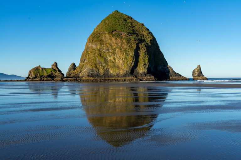
- The Oregon Coast: Explore the best of the Oregon Coast on a 7 day Oregon Coast road trip. Discover the best hikes on the Oregon Coast, and figure out what to do in Cannon Beach and Astoria.
- Hiking in Oregon: Get a local’s take on the best hikes in Oregon, the most spectacular Oregon waterfalls, and dive deeper into each region with our guides to the best hikes at Mt. Hood, in the Columbia River Gorge, and more.
- Hiking in Washington: Add to your Washington hiking bucket list with our guide to the best hikes in Washington. Then dive into our regional hiking guides to discover the best hikes near Seattle, hiking at Mount Rainier, in Olympic National Park, in the North Cascades, and at Mount Baker.
- Mount Rainier National Park: Plan the perfect trip to Mount Rainier with our guides to the best things to do, the best hikes, and how to plan a perfect day trip to Rainier.
- Olympic National Park: Explore the best that Olympic National Park has to offer – the best hikes, a complete itinerary, and exactly where to stay in Olympic National Park.
- North Cascades National Park: The least visited of the National Parks in Washington, learn how to plan a perfect itinerary, and figure out the best hikes to add to your list.
- Crater Lake National Park: Discover the best that Oregon’s only national park (isn’t that crazy?) has to offer with our guide to planning your Crater Lake itinerary, and our guide to the best hikes in Crater Lake. Plus, a guide to planning an amazing Seattle to Crater Lake road trip.