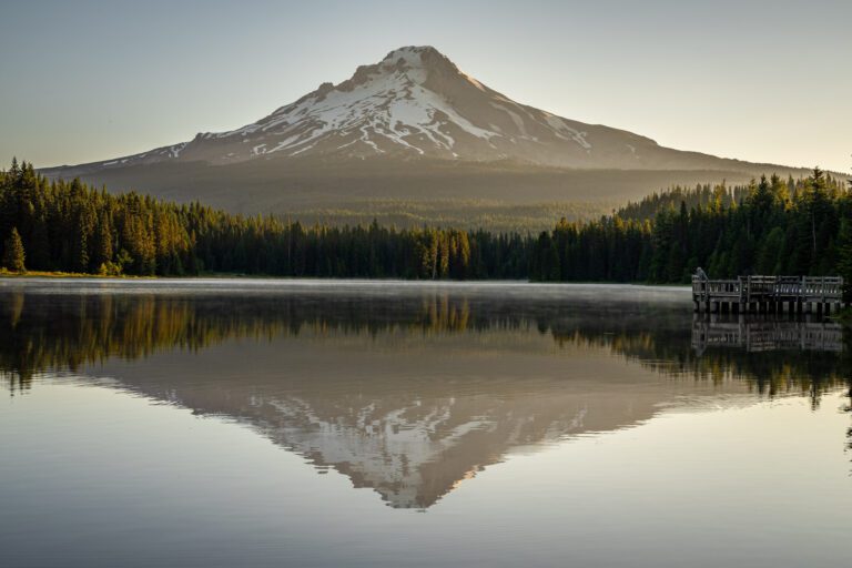
Hiking in the Columbia River Gorge: A Complete Guide
One of our favorite things about living in Portland is the fact that within 90 minutes of our front door, we can be at the trailhead for some of our favorite hikes in Oregon. Several of those hikes call the Columbia River Gorge home, and several of them are well under 90 minutes from our front door.
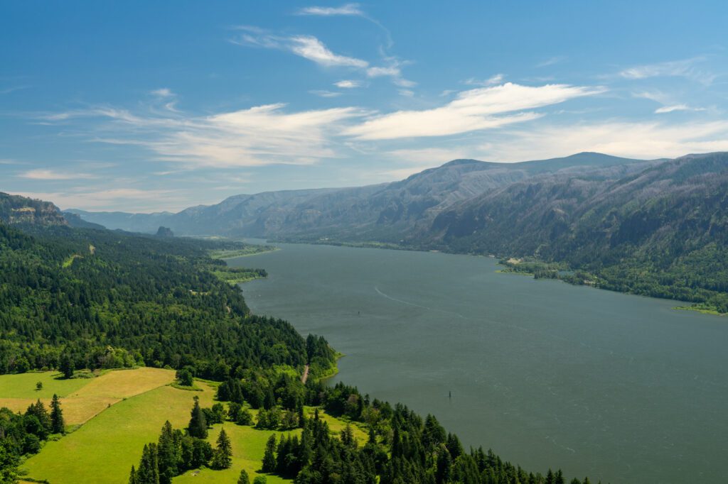
We love hiking in the Columbia River Gorge, which runs from Astoria at the northwest corner of Oregon all the way out to central Oregon (where it turns north into Washington), marking the border between Oregon and Washington State.
Most of the best hikes in the Columbia River Gorge are concentrated in the area between Portland and the Dalles (just past Hood River), split between the Oregon side and Washington side of the river. Which means they’re all within about 60 minutes of our front door (and yours, too, if you also live in Portland).
In this guide to the best Columbia River Gorge hikes, we’re going to take you through 15 of our favorite trails in the Gorge. They range from relatively easy waterfall hikes to strenuous climbs to epic views, so we’re confident you’re going to find a hike that you’re going to love.
For each hike, we’ll cover the trail details like distance and elevation gain, and give you a brief trail recap with details around what route to take and parking (which can be a bit of a hassle at trailheads in the Gorge).
Sound good to you? Let’s get into it!
Disclaimer: Some of the links in this post, like hotel and vacation rental links, are affiliate links, meaning at no additional cost to you we make a little bit of money if you click through and book. That being said, we would absolutely never recommend something to you that we don’t stand behind 100%.
What to Know Before Hitting the Trails in the Columbia River Gorge
Before we get into the hikes themselves, a few things to know before you hit the hiking trails in the Columbia River Gorge.
Parking at Trailheads Can Be a Nightmare
Parking at trailheads can be rough on weekends, so get there before 9am.
The proximity to Portland is a little bit of a double-edged sword in some ways. On one hand, it’s amazing to have world-class hiking and landscapes within 45 minutes of our front door.
On the other hand, there are around 2.2 million other people who also live that close to these Columbia River Gorge hikes, so parking can be tricky on weekend mornings in the summer.
Our advice: arrive no later than 9am if you want to ensure you have a parking spot. Better yet, plan an early morning or afternoon weekday adventure if you can swing it.
Multnomah Falls Parking Tips
There are two Multnomah Falls parking lots.
There is a tiny lot along the Historic Columbia River Highway that is closer to the falls, but traffic getting in and out is a nightmare. DO NOT PARK HERE (unless you have mobility issues).
The bigger lot, which is Exit 31 off of I-84 going in either direction, is a much better option because it’s huge, and it avoids the inevitable traffic jam on the two lane historic highway.
Timed use permits are required for Multnomah Falls parking lot in 2023. They are required to enter the Multnomah Falls parking lot off of I-84 (which we recommended above) between May 26 and September 4th, 9am to 6pm, due to congestion.
In all honesty, we’d strongly recommend doing Multnomah Falls before 9am anyway, which means you don’t need a permit and parking won’t be super competitive.
Permits go on sale two weeks in advance, and are generally plentiful on weekdays and competitive on weekends (though I’m sitting here in May and there are plenty of permits available for both of the next two weekends, including Memorial Day).
You can reserve your permit here.
Tolls to Cross the Two Bridges in the Gorge
Crossing the river costs $2 once you’re out in the Gorge.
We have these hikes split between the Washington side and the Oregon side, and you should be aware that, once you’re in the Gorge, crossing the river in either direction can only be done at the Bridge of the Gods in Cascade Locks, or in Hood River, and each will cost you a $2 toll in either direction.
If you want to save a little money, cross in Portland (we usually do at Highway 205 in Camas). Otherwise, be prepared with $2-$4 in cash to pay the toll at the toll booths (though Bridge of the Gods takes cards).
Passes and Permits for Hiking in the Columbia River Gorge
Because the Gorge spans both the Washington and Oregon side, there are a wider variety of passes and permits you might need to park at the various trailheads.
Here’s a little crash course in the parking permits you might need for these Columbia River Gorge hikes:
- For hikes in Washington State Parks (like Beacon Rock or Hamilton Mountain), you’ll need a Discover Pass, which is the Washington State Parks pass. It comes in either a day pass ($10) or an annual pass ($30), which means it’s worth buying if you think you’ll make three visits to Washington State Parks in the next 12 months. You can either buy it onsite at the park, or in advance from the official website (takes longer) or at REI (can do in-store pickup or shipping).
- For hikes on National Forest land (like Wahclella Falls or Dry Creek Falls), you need a Northwest Forest Pass. It is $5 for a day use permit, or $30 for an annual pass that is good for 12 months. For what it’s worth, this is the pass we use most often. Some trailheads have either day use envelopes or a QR code where you can buy a day pass on arrival, but we’ve seen plenty of times where the envelopes were out or the internet didn’t work, so we’d buy it in advance at REI (either a day pass or an annual pass) if you can. If you’re planning on visiting three or more national parks in the next 12 months, it’s worth buying an America the Beautiful Pass instead, which covers all national recreation land including national forests and national monuments (buy it at REI here).
16 Incredible Columbia River Gorge Hikes
As we’ve spent more time out in the Gorge, we’ve realized that the Oregon side of the Gorge and the Washington side of the Gorge are completely different beasts.
The Oregon side is where you’ll find the lush evergreen forests and towering waterfalls – which is usually the first thing people think of when they think of the Gorge. So many waterfalls, in fact, that we have an entirely separate guide dedicated to waterfalls in the Columbia River Gorge!
The Washington side gets more sun, and the hikes on that side of the Gorge tend to be more about the sweeping views up and down the Gorge.
We’re going to split the hikes in the Columbia River Gorge up into two groups – the Oregon side and the Washington side – which we think is the best way to organize this list. Within each section, we’re ordering the hikes from west to east (heading away from Portland towards Hood River and beyond).
At the very bottom, you’ll find a map of the trailheads for each of these hikes so you can visualize where they are.
The Best Hikes in the Columbia River Gorge: The Oregon Side
Like we just said, the Oregon side is characterized by a cooler, wetter climate.
The power of water is more evident here, with rainfall and snowmelt from Mount Hood combining into a force that has created a paradise for waterfall chasers, with many of the best waterfalls in Oregon within a 15-20 mile stretch on the Oregon side of the Gorge.
Here are the best hikes in the Columbia River Gorge on the Oregon side, from west (closer to Portland) to east (further into the Gorge).
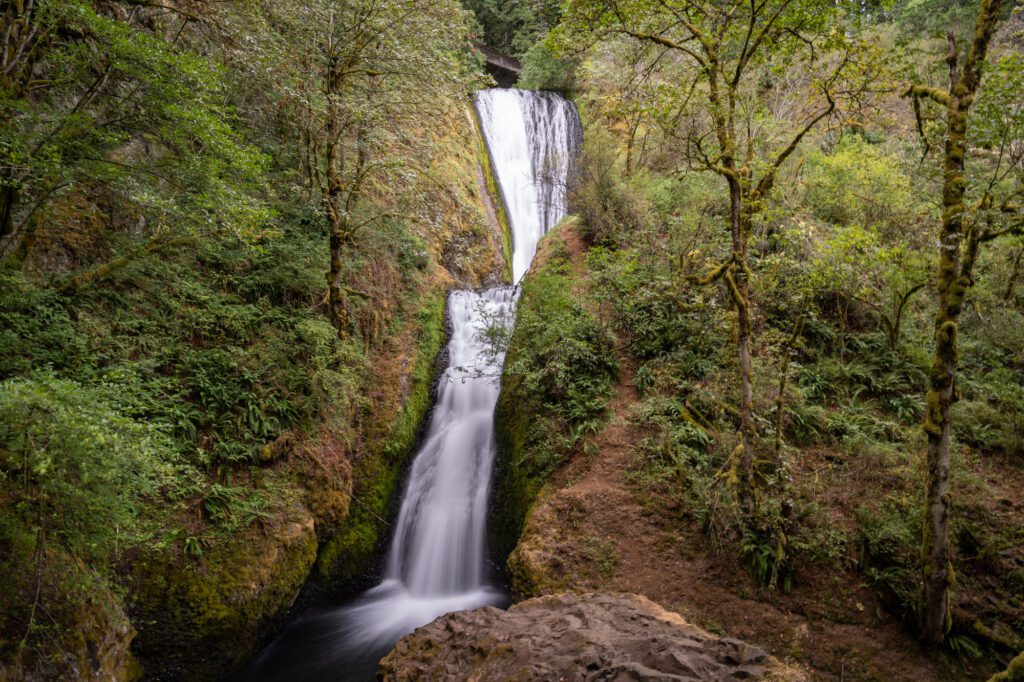
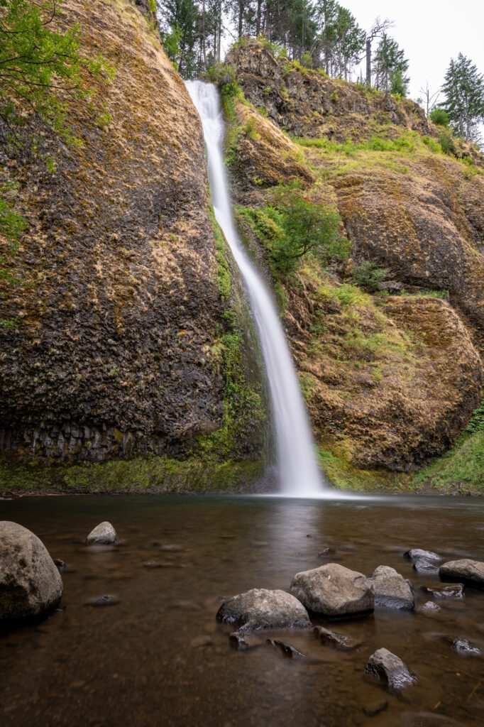
Latourell Falls

- Length: 2.4 miles
- Elevation Gain: 625 ft.
- Trail Type: Loop
- Difficulty: Easy
- Dog Friendly? Yes, on a leash
- Parking Pass: None
- Trailhead Location
Short and sweet, the Latourell Falls trail is a short hike featuring a couple of the Gorge’s best waterfalls. It also happens to be one of the closest to Portland, which makes it a popular destination on weekends in the spring, summer, and fall.
You’ll start your hike at the small (so get there early!) parking lot right off of the Historic Columbia River Highway with a view of the lower falls from above. Then, it’s a short hike up to the upper falls, which is a two-tiered waterfall that tumbles into the creek below.
From there, you’ll complete the loop, circling back around to approach the lower falls from below, which is even more magical than the view from above. It’s a 224 foot plunge, and it’s an impressive sight.
In the winter and spring, a vibrant yellow moss covers the rocks around the falls, making for particularly good pictures when you combine it with the high flow rate thanks to the rain and snowmelt.
Bridal Veil Falls
- Length: 0.5 miles
- Elevation Gain: 78 ft.
- Trail Type: Out and Back
- Difficulty: Easy (500 ft gain AND less than 5 miles)
- Dog Friendly? Yes, on a leash
- Parking Pass: None
- Trailhead Location
Bridal Veil Falls is another high reward-to-effort ratio. A short quarter mile well-maintained trail snakes its way down into a canyon, crossing a creek before arriving at a nice little waterfall with a viewing platform.
It’s a two-tiered, 120 foot tall waterfall, which is nothing to sneeze at, even out here in the Gorge! You can clearly see both tiers, too, which is fairly unique in the Gorge.
Some people scramble down to the base of the falls along an unofficial trail, but we wouldn’t recommend it (especially if it’s wet).
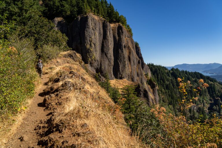
Angel’s Rest
- Length: 4.5 miles
- Elevation Gain: 1,476 ft.
- Trail Type: Out and Back
- Difficulty: Moderate
- Dog Friendly? Yes, on a leash.
- Parking Pass: None
- Trailhead Location
Angel’s Rest is a hike that breaks the mold for hikes on the Oregon side of the Gorge. As you’ve no doubt noticed, this side has a plethora of great waterfall hikes, but only a few hikes that take you up to a nice view of the Gorge.
Well, Angel’s Rest is one of those hikes, and it’s a very popular one.
The parking lot here is tiny, though there is a small overflow lot nearby. You’ll want to get here before 9am on weekends to get a spot in the lot.
To be completely honest, there’s nothing particularly special about the climb up to Angel’s Rest, which is a bald spot on the ridge with nice views up and down the Gorge. It’s a steady climb all the way from beginning to end.
The landscape starts forested, and slowly becomes more rocky as you approach the top. There’s a waterfall along the way, but it’s nothing particularly impressive when compared to the countless other waterfalls nearby.
The last section of this hike is a set of rocky switchbacks, but it’s nothing past moderate difficulty.
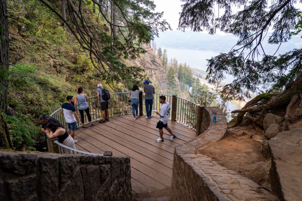
Once you get to the top, the views of the Gorge in both directions are great. In fact, we’d say they’re among some of the nicest Gorge views on the Oregon side. The top of the hike puts you atop the bluff overlooking the Gorge, and there are a few different viewpoints up there.
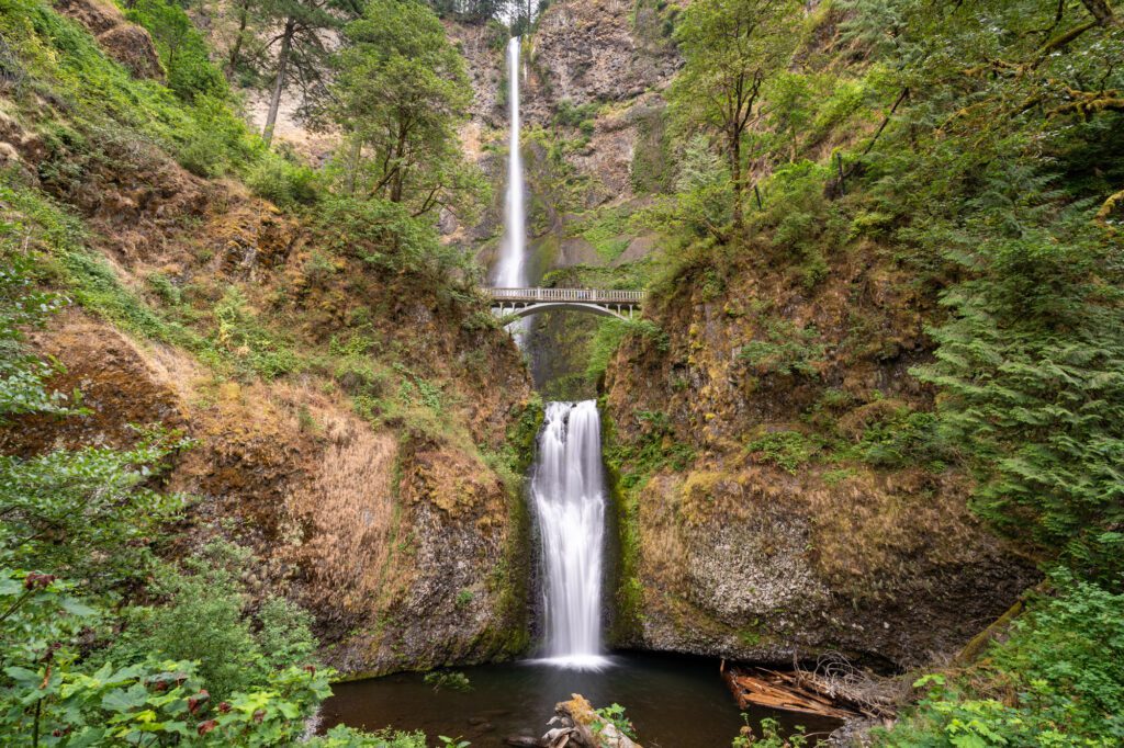
Multnomah Falls and Wahkeena Falls
- Length: 5.1 miles
- Elevation Gain: 1,640 ft.
- Trail Type: Loop
- Difficulty: Moderate
- Dog Friendly? Yes, on a leash
- Parking Pass: None
- Trailhead Location
We’ve done this hike a few times now, and our perspective on hiking near Multnomah Falls is generally that the hassle of dealing with parking and crowds isn’t worth it, and you can find a more pleasant hike in the Gorge.
Multnomah Falls is impressive and definitely worth seeing, but we’d do it first thing in the morning (before 9am, even earlier if you can swing it) and then move onto a different hike.
It’s also worth noting that we didn’t include the hike up to the top of Multnomah Falls in this guide because, well, it’s just not really that cool in our honest assessment.
However, if you absolutely MUST hike at Multnomah Falls, we’d do this nifty little loop that takes you up to the top of Multnomah Falls (again, not that cool), back up through the forest passing a couple of cool waterfalls and plenty of fern-laden forest (this is cool), and along a ridge above the falls before descending past a couple more waterfalls, most notably Wahkeena Falls.
A few things to note about this hike.
- Get an early start. Multnomah Falls is a zoo once the tour buses show up somewhere between 9am and 10am, and you want to be up and around the falls before that happens.
- Go clockwise, starting at Multnomah Falls. This gets you up to the falls and off into the forest ASAP before the crowds arrive. We made the mistake of going the other way on our last hike, and ran into tons of people coming down past Multnomah Falls.
- Where you park is important. We like to park at either the small Wahkeena Falls lot along the Historic Columbia River Highway (here on Google Maps) or the big Multnomah Falls lot off of I-84 (exit 31). DO NOT PARK in the Multnomah Falls lot along the Historic Columbia River Highway. It is tiny, it is always full, and there is always a major traffic jam on the road.
- Timed use permits are required from May 26 to September 24 in 2023. They’re required to park in the big Multnomah Falls parking lot off of I-84 between 9am and 6pm. They are available two weeks in advance, and you can get them here.
For even more information, we have an entire guide dedicated to hiking the Multnomah-Wahkeena Falls Loop Trail.
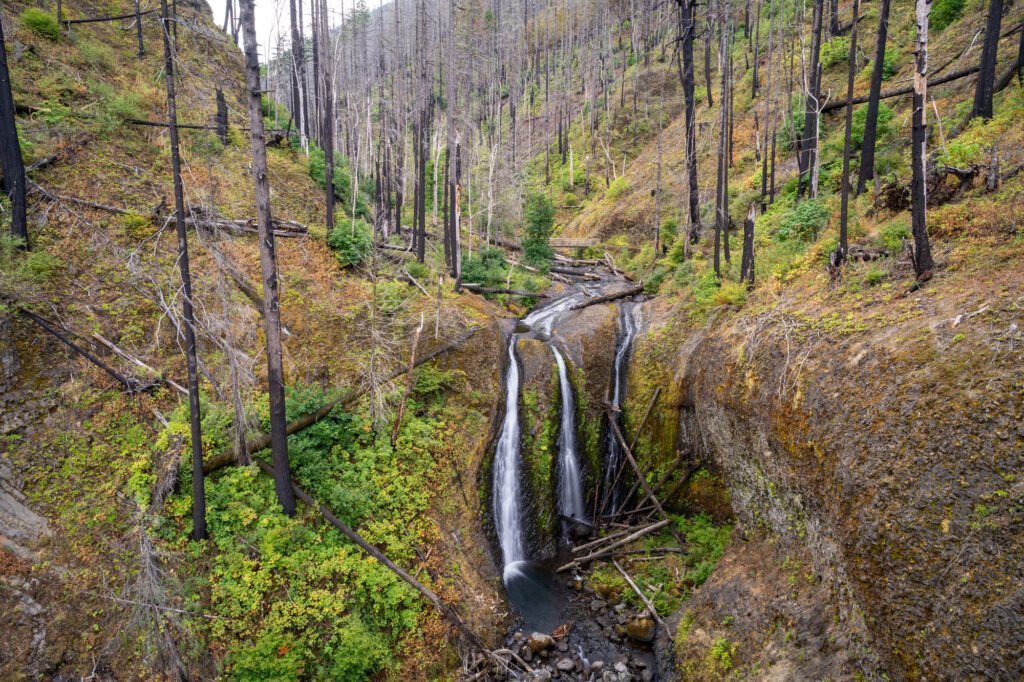
Triple Falls (via the Oneonta Gorge Trail)
- Length: 3.5 miles
- Elevation Gain: 800 ft.
- Season: Year Round
- Trail Type: Out and Back
- Difficulty: Easy / Moderate
- Dog Friendly? Yes, on a leash
- Pass Required: None
- Trailhead Location
This is a nice, easy hike that takes you on a journey through the Oneonta Gorge (it’s important to note that you’re not walking through the water, which is closed for the foreseeable future due to the Eagle Creek fire) to a three-pronged waterfall.
The hike starts at a small trailhead with no bathroom (and only room for 5-8 cars), and begins with a gentle climb that takes you up to the mouth of the Oneonta Gorge. From there, you stay high on the wall, following the creek up to Triple Falls.
Along the way, there are a couple of steep, rocky sections of climbing, and the trail is fairly narrow at times. It’s definitely not hard or dangerous, but it was a little surprising, at least to us.
Eventually, you arrive at Triple Falls, which you’re looking down at from across the creek. You can continue around the back of the falls to the wooden footbridge which keeps going up the Oneonta Gorge, but the views weren’t particularly great from there (we were hoping we’d get a better view down the Gorge).
Is it the most spectacular waterfall in the Columbia River Gorge? No. Is it a good alternative to being swamped with people at Multnomah or Latourell? Sure!
If you’re looking for an easy waterfall hike that toes the line between business/popularity and beauty of the waterfall, we’d put this up there with Wahclella Falls and Dry Creek Falls. And we’d slightly prefer both of those options over this hike, if we’re being honest.
There is a nice little add-on that you can do, which will take you over to Ponytail Falls (more on that in a second), which IS one of our favorite waterfalls in the Gorge.
At almost exactly one mile into the hike, the trail forks and the left fork veers off to a wooden footbridge over the creek, and continues up the hillside on the other side, eventually ending at Ponytail Falls, which is fun because you can walk behind it. It will add about 1.5 miles round trip to the hike.
We wish there was a loop, but the only way to make it a loop involves walking along the narrow Historic Columbia River Highway, which doesn’t seem like a good idea to us.
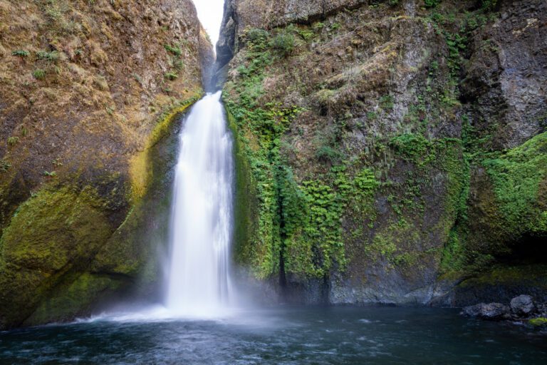
Horsetail Falls and Ponytail Falls
- Length: 0.9 miles
- Elevation Gain: 331 ft.
- Trail Type: Out and Back
- Difficulty: Easy (500 ft gain AND less than 5 miles)
- Dog Friendly? Yes, on a leash
- Parking Pass: None
- Trailhead Location
This is a great bang-for-your-buck hike to two nice waterfalls in the Gorge, one of which is right off the road.
That, of course, means that it’s a popular spot, and you’ll likely be fighting over parking spots in the relatively small lot (10-15 cars or so, no overflow along the road) if you visit over a weekend.
The first of the two waterfalls here is Horsetail Falls, and it is quite a sight to kick off the beginning to the hike.
Named, at least partially, for the type of waterfall (a horsetail waterfall looks kind of like, well, a horse’s tail if you squint a little bit), it tumbles 176 feet off of a ledge into the pool below.
From there, you’ll head left and immediately start climbing a set of switchbacks, gaining most of the elevation in the first quarter mile of the trail.
The switchbacks end, putting you on a ridge with some peek-a-boo views across the Columbia River to the Washington side of the Gorge. It’s a short walk along the ridge to Ponytail Falls, which is the final destination on this short Columbia River Gorge hike.
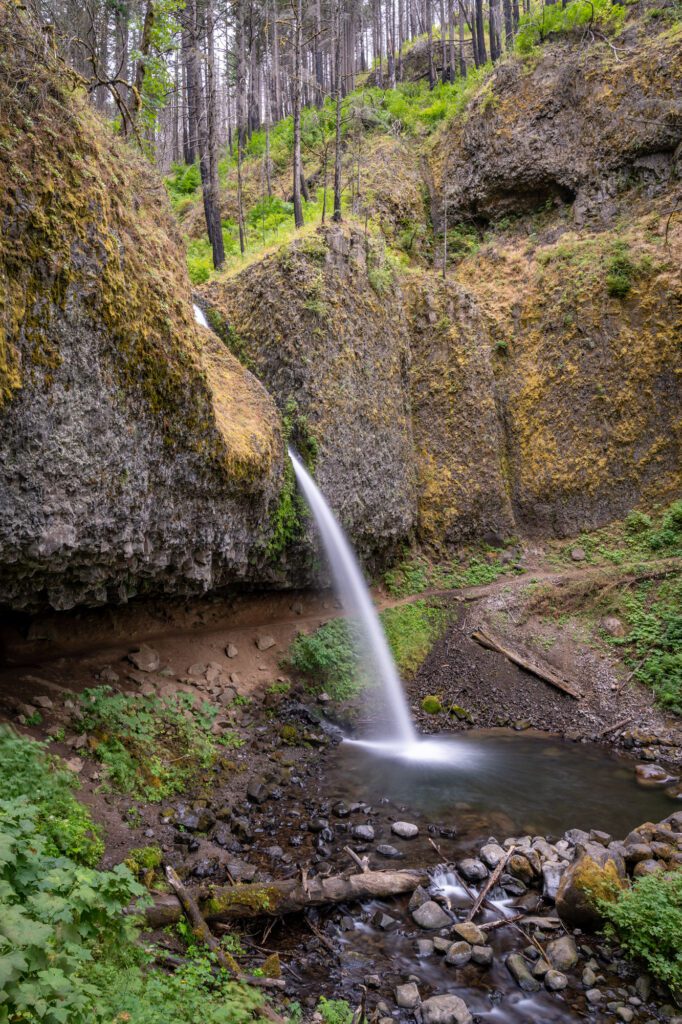
Ponytail Falls is equally scenic to the first waterfall on the trail. It’s smaller, yes, clocking in at just 75 feet, but the cool part about this particular waterfall in the Columbia River Gorge is that you can walk behind it!
And not in a “if you’re willing to go off-trail and do some scrambling” kind of way – the trail literally goes behind the falls.
Overall, a nice, easy hike for most levels, and a good option as a second hike in the Gorge after doing one of the harder ones earlier in the day.
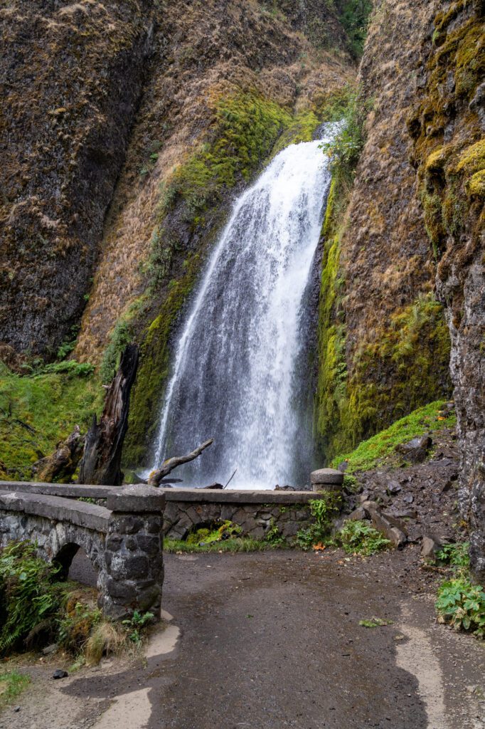
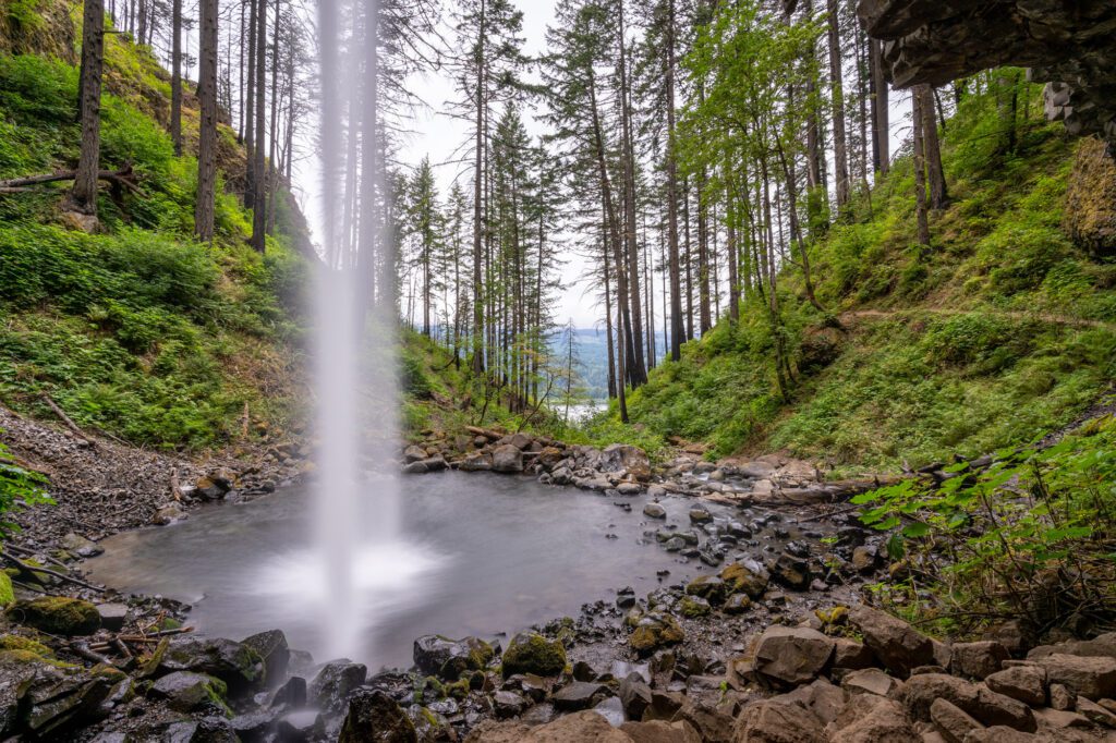
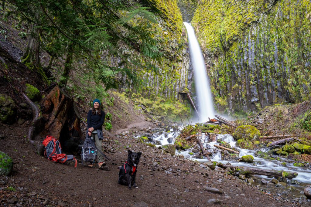
Wahclella Falls

- Length: 1.9 miles
- Elevation Gain: 223 ft.
- Trail Type: Out and Back
- Difficulty: Easy (500 ft gain AND less than 5 miles)
- Dog Friendly? Yes, on a leash
- Parking Pass: Northwest Forest Pass OR America the Beautiful Pass OR $5 Day Use Fee
- Trailhead Location
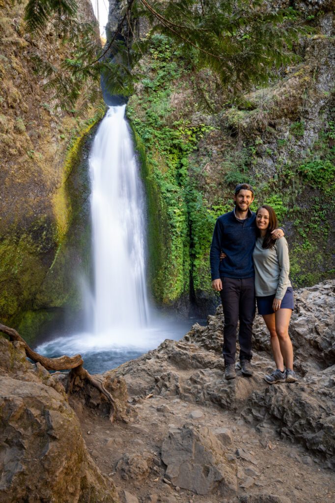
This is probably our favorite of the waterfall hikes in the Columbia River Gorge.
It’s relatively easy and accessible (we take visitors who aren’t into 7-10 mile hikes), it’s scenic and gives a nice overview of the Gorge’s unique geography (and insight into the Eagle Creek Fire, whose effects are clearly visible from the trail), and the waterfall itself is gorgeous.
Plus, it’s far enough from Portland that most of the crowds stop at Multnomah, and never make it this far east. That said, it’s a tiny parking lot (there is parking along the road), so be prepared to wait.
The trail is a lollipop, splitting about 0.6 miles into the hike. One side of the lollipop heads down to the level of Tanner Creek, crossing the creek over an elevated wooden bridge. The other side stays high, skirting the wall of the mini-gorge.
Both take you to the falls, and we’d head down first because it gives you a nice view of the falls as you make your way up the creek (we don’t really have a strong opinion, though).
The waterfall itself is a two-tiered plunge 120 feet high, though you can barely see the second tier of the falls from the trail.
Read More: The Wahclella Falls Trail: A Complete Guide to Our Favorite Waterfall Hike in the Gorge
Eagle Creek to Punchbowl Falls
- Length: 4.8 miles
- Elevation Gain: 1,020 ft.
- Trail Type: Out and Back
- Difficulty: Easy / Moderate
- Dog Friendly? Yes, on a leash
- Parking Pass: Northwest Forest Pass OR America the Beautiful Pass OR $5 Day Use Fee
- Trailhead Location
First of all, we haven’t gotten to this hike yet. Mostly because it was closed for years due to the damage from the Eagle Creek Fire back in 2017, but it has recently reopened (as of 2023)!
Second of all, this is a very popular hike in the summer because it includes a couple of swimming spots, some creek crossings, and a lot of water along the way. However, it is also very exposed in places, and you’ll want to be prepared for the heat with plenty of water and sunscreen.
Third of all, there are a couple of steep, rocky sections that you traverse using cables. This is not great for dogs or small children, though it doesn’t look too bad to Matt (who isn’t a fan of heights).
The parking lot is small, and there is an overflow lot closer to the highway if it’s full when you arrive (though it does add a little bit of distance to the hike).
You’ll start by following Eagle Creek for a mile with limited elevation gain. From there, the trail starts its ascent, with a couple of steep rocky climbs on your way to Punchbowl Falls.
If you’re up for more hiking, you can follow the Eagle Creek Trail onwards to Tunnel Falls (13.5 miles round trip), which is a long, hard hike, but passes numerous waterfalls on the way to Tunnel Falls, which is one of the best in the Gorge.
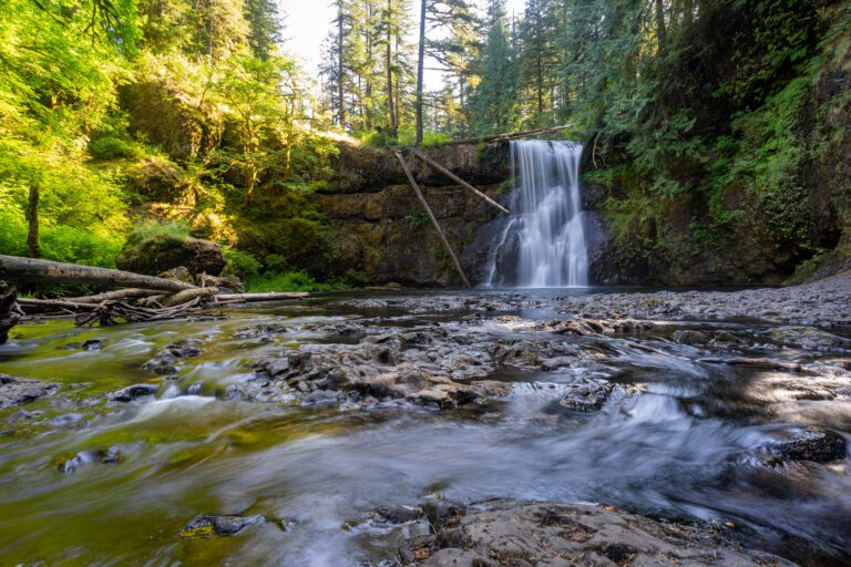
Dry Creek Falls
- Length: 4.4 miles
- Elevation Gain: 885 ft.
- Trail Type: Out and Back
- Difficulty: Easy / Moderate
- Dog Friendly? Yes, on a leash
- Parking Pass: Northwest Forest Pass OR America the Beautiful Pass
- Trailhead Location
Dry Creek Falls is an impressive waterfall in its own right, but the real draw, at least for us, is the fact that it’s one of the less trafficked trails in this stretch of the Gorge. We’ve done this hike a few times now, and we can count the number of groups we’ve seen on the trail on two hands.
You’ll start from the Bridge of the Gods Trailhead in Cascade Locks, which is a small lot with a bathroom. There’s an alternate lot on Harvey Road (here on Google Maps) right next to the actual trailhead, which is just a gravel strip with a few more parking spots.
You’ll follow a section of the Pacific Crest Trail for the vast majority of this hike, with a short stint on the Dry Creek Falls trail at the very end. It’s a very gradual ascent that you hardly even notice.
The one thing you will notice, however, is the damage to the trees wrought by the 2017 Eagle Creek Fire (are you noticing a theme here? It was a huge deal).
Dry Creek Falls itself is not the tallest waterfall out here, but it is a nice reward for a relatively low effort. It’s 74 feet high, and it’s particularly cool in the winter and early spring when it’s both rushing, and the rocks are covered in a bright green or yellow moss.
One of the coolest parts about the falls is actually the history associated with it. You can see the remnants of a water diversion system from nearly a century ago at the base of the falls, which was used to provide drinking water to residents nearby. This caused the creek below the diversion to run dry, hence the name.
Read More: Everything You Need to Know to Hike to Dry Creek Falls in the Gorge
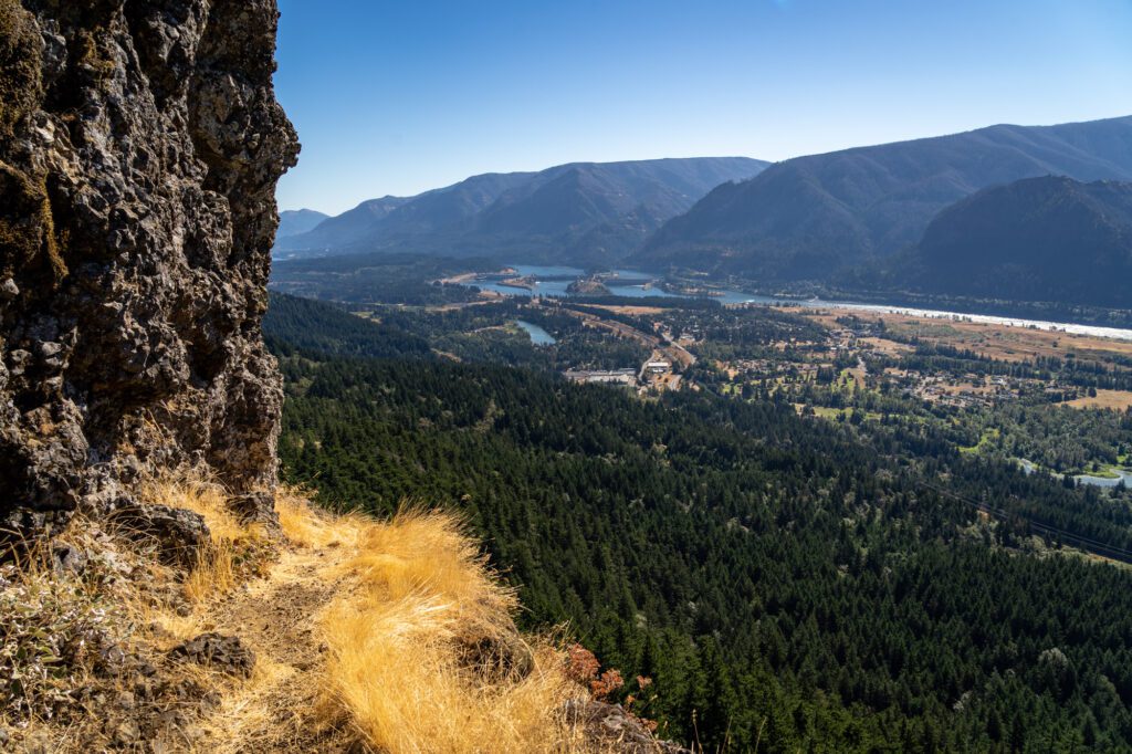
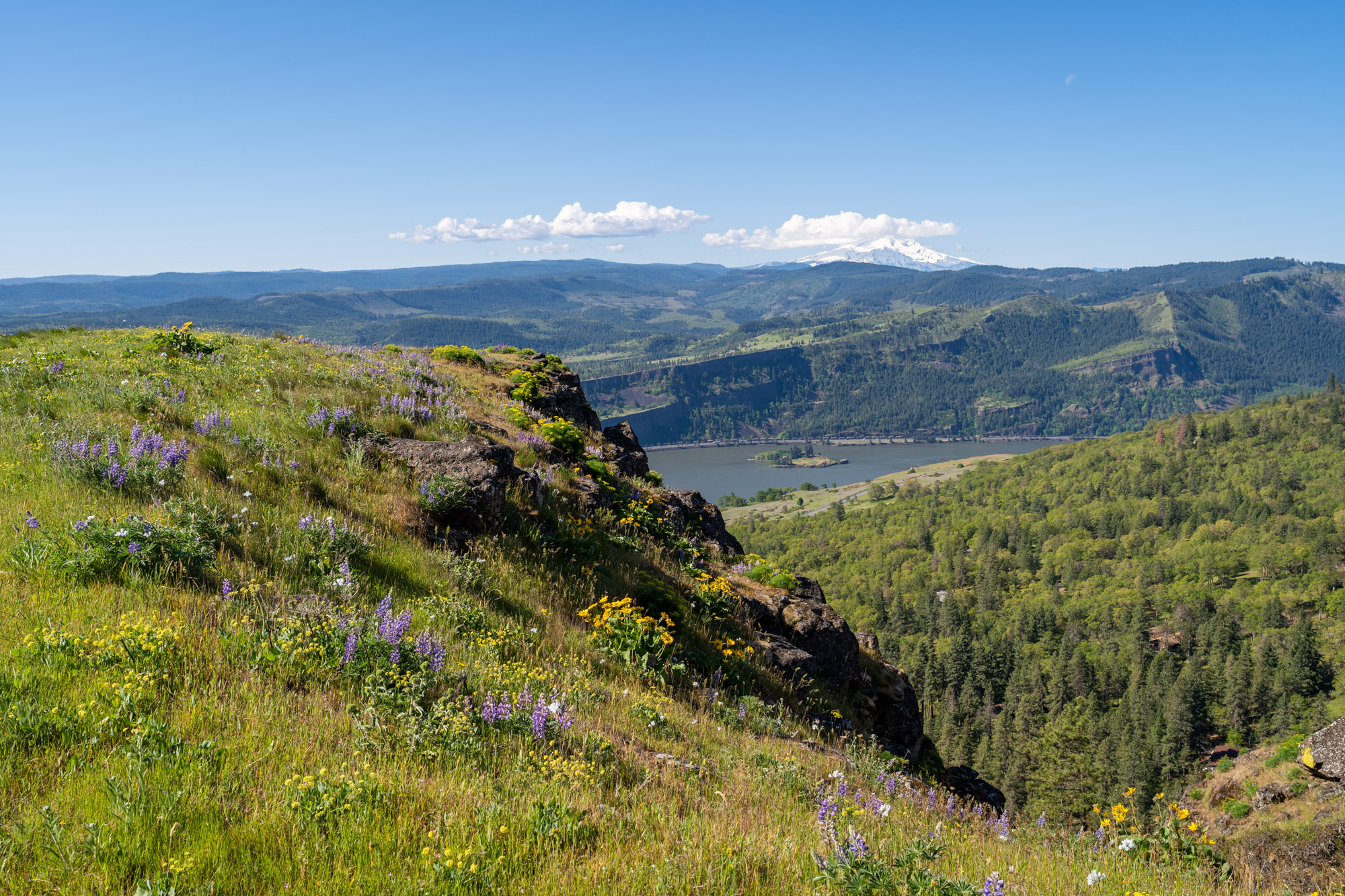
Memaloose Hills
- Length: 2.8 miles
- Elevation Gain: 600 ft.
- Trail Type: Lollipop
- Difficulty: Moderate
- Dog Friendly? Yes, on a leash
- Parking Pass: None
- Trailhead Location
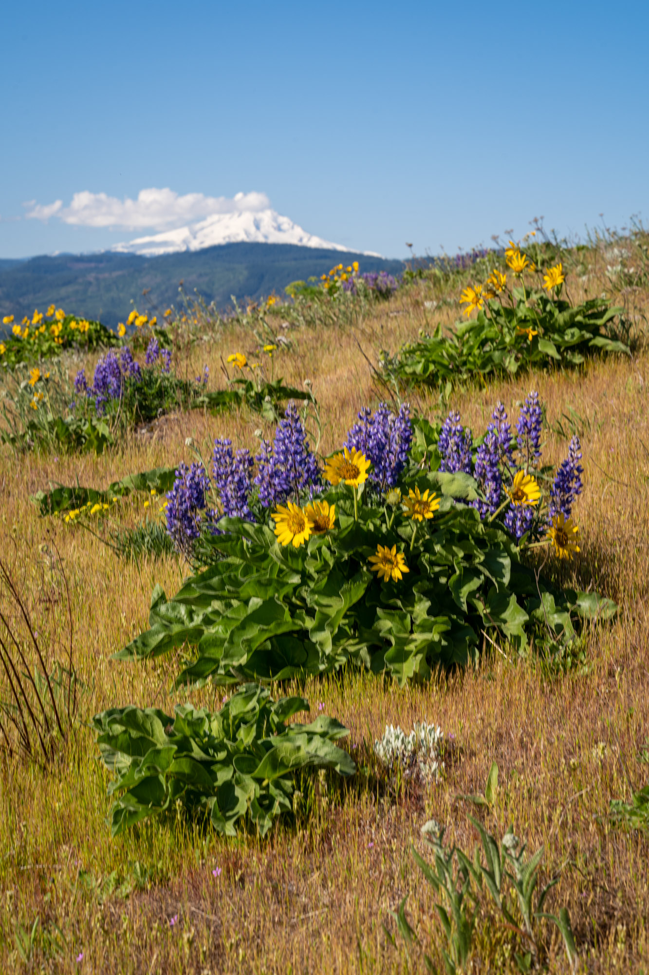
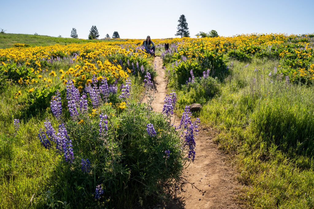
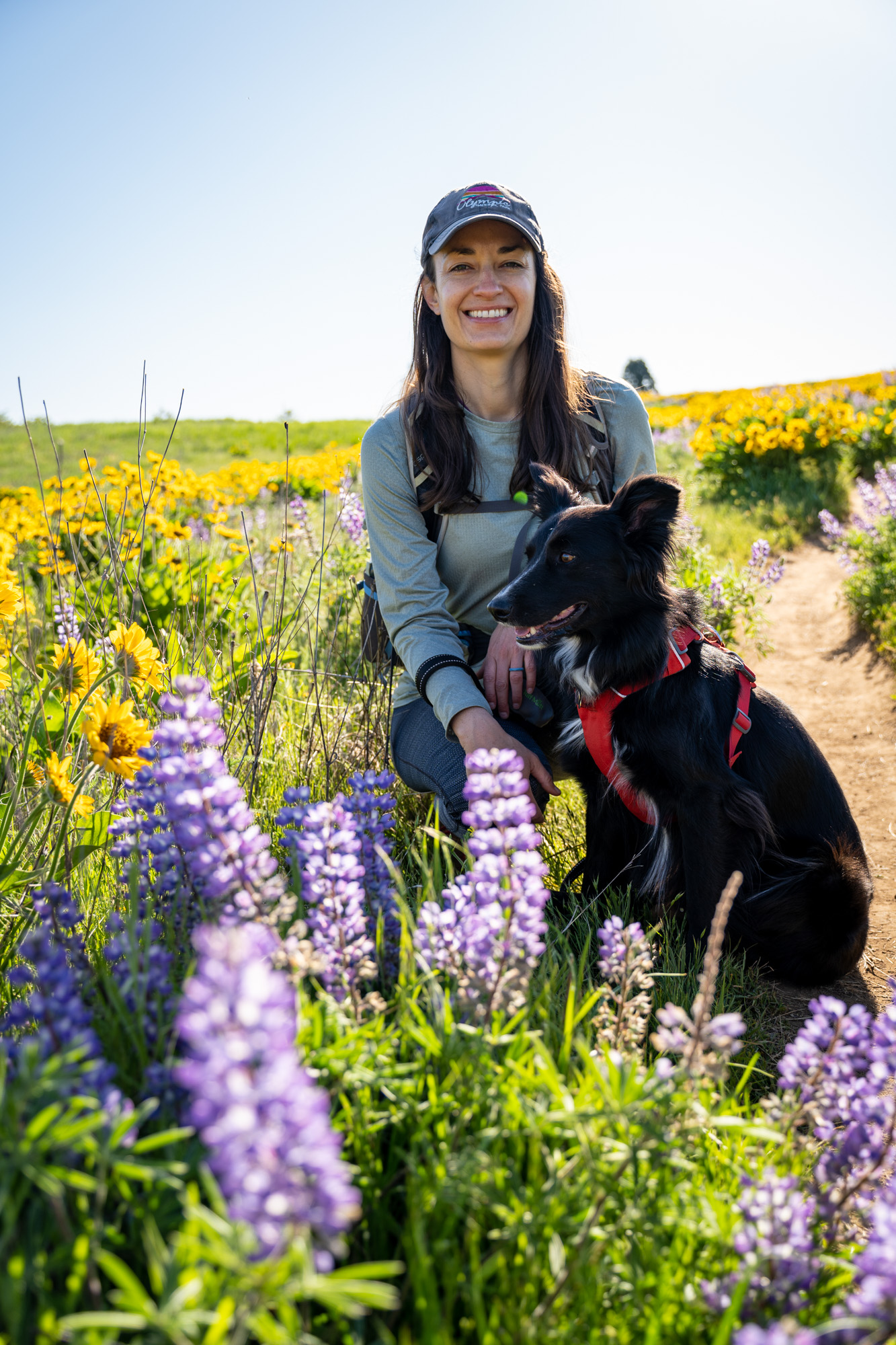
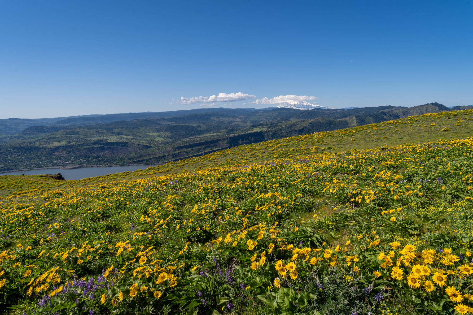
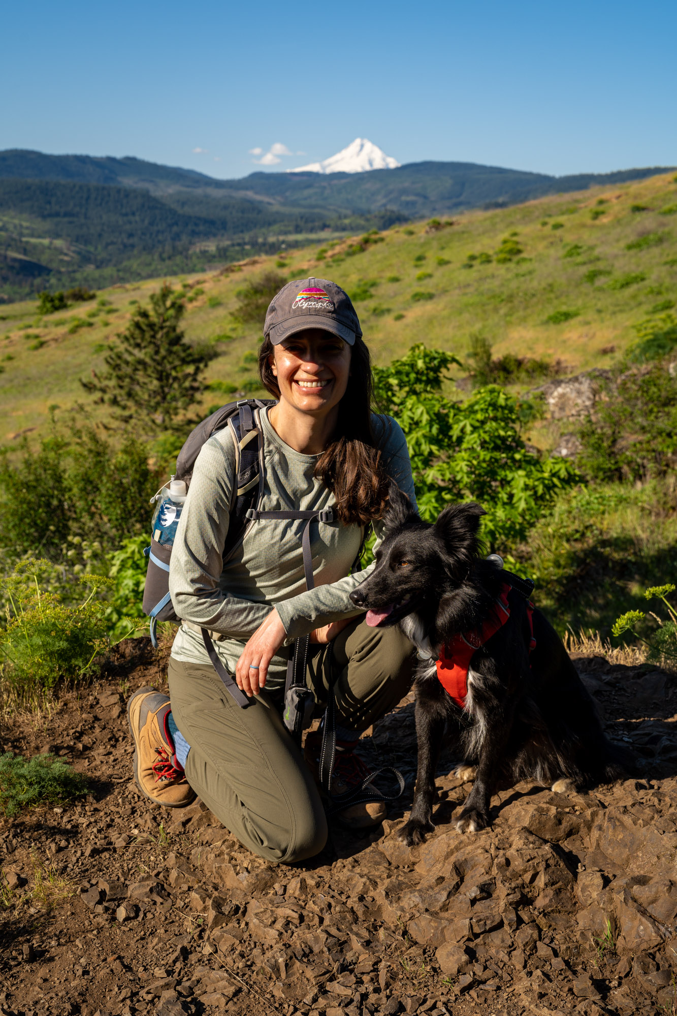
Come to Memaloose Hills in late April and early May for the wildflowers. It is, perhaps, the most impressive display of balsamroot and lupine that we have ever personally seen, blanketing the hillsides along this trail when we were there in May of 2023.
The parking lot for this hike is along the Historic Columbia River Highway, just east of the town of Mosier. There’s very limited parking at the Memaloose Overlook, with no bathroom at the trailhead.
There’s a small network of trails here that forms a figure eight, with the two hills – Chatfield and Marsh – as the focal points of either side of the adjoining loops.
It’s worth doing the entirety of the perimeter trail, taking in both summits (and more importantly, the wildflower blanketed slopes of the hills).
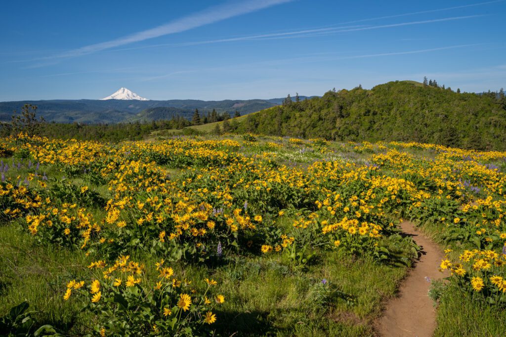
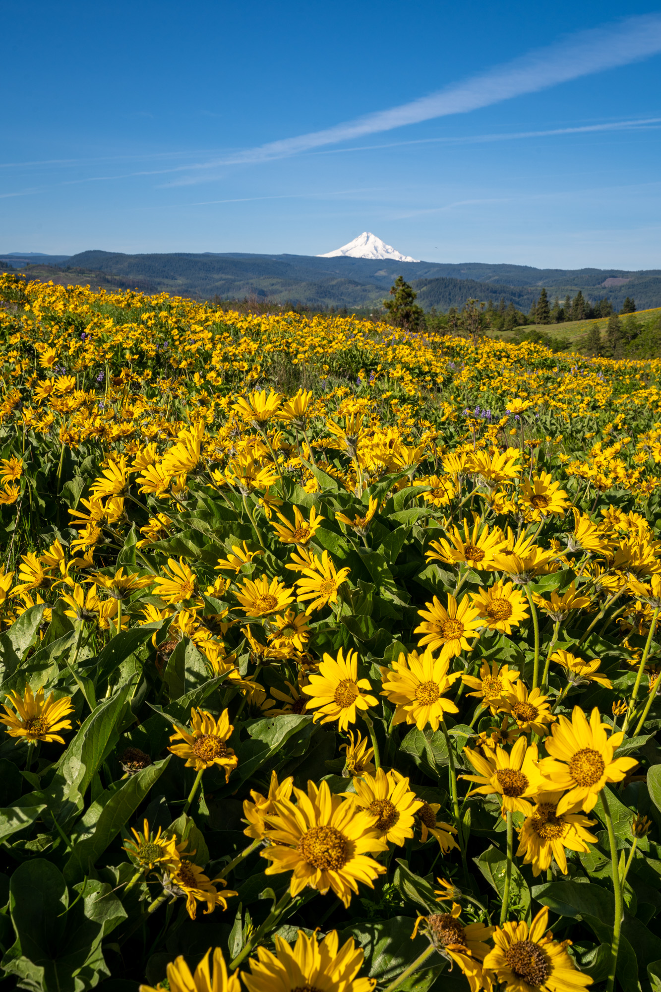
There are also some nice views of both Mount Hood and the Columbia River Gorge, particularly from Chatfield Hill and its southern slope.
Make sure to check yourself and your dog for ticks after the hike! They like to hang out in the tall grasses along the trail.
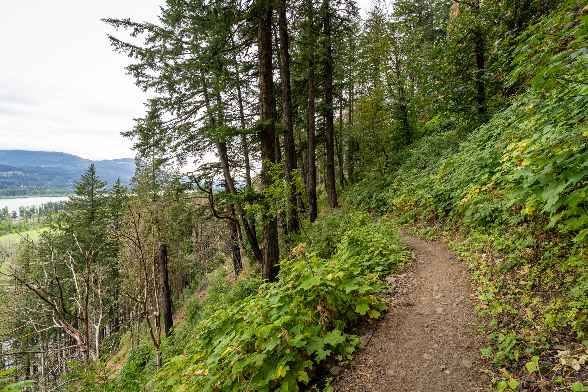
The Best Hikes in the Columbia River Gorge: The Washington Side
We love the Washington side of the Gorge, and often find ourselves staying over in the White Salmon / Bingen area when we plan a weekend trip from Portland to Hood River.
There are tons of great hikes to be had, and most of them are right off of Highway 14, the main road on the Washington side that runs from Vancouver, WA through Bingen and White Salmon.
It’s a little drier, likely because of the path of the sun and less tree cover, and the transition to the high desert seems to start a little bit earlier on the Washington side.
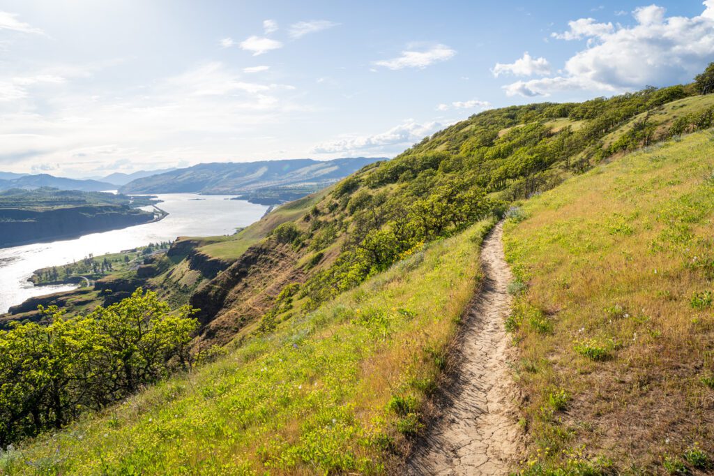
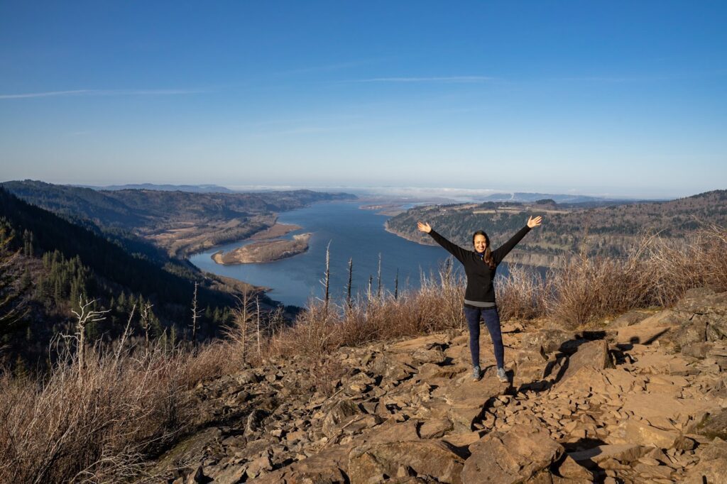
The Washington side of the Columbia River Gorge is a different animal from the lusher, greener Oregon side. While the Oregon side is known primarily for its waterfall hikes, we think the Washington side is better for those jaw-dropping views up and down the Gorge.
Of course, there are a few waterfalls on the Washington side. And there are several great views to be had on the Oregon side. But in general, that’s the way the cookie crumbles.
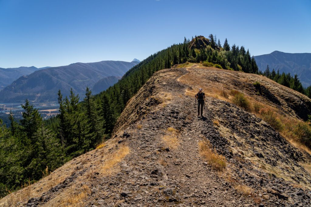
The Cape Horn Trail
- Length: 6.4 miles
- Elevation Gain: 1,348 ft.
- Trail Type: Loop or Out and Back
- Difficulty: Moderate
- Dog Friendly? Technically, yes, on a leash. However, they also advise “This is not a dog friendly trail because of steep cliffs. Please keep your dog at home.”
- Parking Pass: None
- Trailhead Location
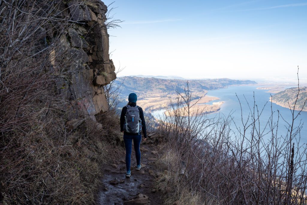
Closest to the Portland metro area of all the Gorge hikes on the Washington side at just over 30 miles away, the Cape Horn Trail is no slouch when it comes to views.
There are two specific viewpoints along this trail – the main viewpoint at 1.3 miles in, and the Windblown Fir viewpoint at the 3.7 mile mark (which makes a good turnaround point when the loop is closed – more on that below).
To be completely honest, this isn’t our favorite of the hikes out here, but it is the closest to the Portland / Vancouver area, and there are some nice views to be had.
It’s just that, in between those two views, there’s not much interesting scenery happening. ESPECIALLY if you can’t do the loop that takes you down along the cliffs. We don’t really even consider this hike unless the full loop is open, which is usually from July through February.
The trail starts with an aggressive set of switchbacks, climbing to the highest point of the trail (and one of the best views) at 1.3 miles in.
If you’re doing the loop, it’s all downhill from there…at least until the last mile and a half or so, where it’s a slow, steady incline back to the parking lot (if the loop is closed, it’s a steady climb back up, then a steep descent back to the parking lot).
The parking lot here is relatively big when compared to a lot of the hikes in the Gorge, but it still fills up somewhere between 9am and 10am on most summer weekends.
A note here: The lower section of this trail is closed annually for peregrine falcon nesting between February and July. You can still do the hike, but you won’t be able to do the lower section of the loop that skirts the cliffs. You have to make it an out and back, which makes it slightly longer.
The Beacon Rock Trail
- Length: 1.5 miles
- Elevation Gain: 574 ft.
- Trail Type: Out and Back
- Difficulty: Easy / Moderate
- Dog Friendly? Yes, on a leash
- Parking Pass: Discover Pass OR $10 Day Use Fee
- Trailhead Location
Short and sweet, the Beacon Rock trail takes you up a set of manmade switchbacks attached to the side of a basalt volcanic plug for a nice view of the Gorge from the top.
It’s not an easy climb by any means, but it’s doable for most people as evidenced by the numerous children you’ll probably encounter on the way up.
Be warned – this is not a particularly easy hike. We just mentioned kids, and it’s worth noting that we saw multiple kids in various states of meltdown on the way up.
This is probably not a destination in and of itself, but it’s a nice compliment to some of the other hikes on this list. We’d make sure to do it as early as possible, since it does get crowded and it’s a very narrow trail where it’s easy to get trapped behind other people.
Read More: Hiking the Beacon Rock Trail: Everything You Need to Know
The Hamilton Mountain Trail
- Length: 7.5 miles
- Elevation Gain: 2,100 ft.
- Trail Type: Lollipop
- Difficulty: Moderate / Hard
- Dog Friendly? Yes, on a leash
- Parking Pass: Discover Pass OR $10 Day Use Fee
- Trailhead Location
The Hamilton Mountain Trail is one of our favorite hikes in the Gorge, and it has everything you look for in a Gorge hike: a forested climb, a waterfall, and great views of the Gorge from the top.
The trailhead is inside Beacon Rock State Park, and the lot is big and there are nice flush toilets at the trailhead.
Some people do this as an out and back up to the summit, but we think you should do the lollipop trail, if you can, so that you make it up to the saddle, which is our favorite view of the hike.
Tackle the loop portion counter clockwise, heading up the Hamilton Mountain Trail to Little Hamilton Mountain (one of the better views on the hike) and climbing the aggressive switchbacks to the summit.
At the summit, prepare to be disappointed because there are no views to be had, but continue on to the saddle for a spectacular view of Hamilton Mountain and the Gorge beyond.
On the way down, it’s a more gradual descent down through the forest, which is part of the reason we’d recommend going this direction (aggressive descents are no fun).
Read More: The Incredible Hamilton Mountain Trail in the Gorge: A Complete Trail Guide
The Dog Mountain Trail
- Length: 6.5 miles
- Elevation Gain: 2,988 ft.
- Trail Type: Loop
- Difficulty: Hard
- Dog Friendly? Yes, on a leash
- Parking Pass: Northwest Forest Pass OR America the Beautiful Pass
- Trailhead Location
Dog Mountain is almost certainly the most popular hike in the Gorge, especially in the spring.
However, it is also worth noting that it also happens to be one of the hardest of the Columbia River Gorge hikes, so you’ll want to make sure you’re prepared with plenty of water, food, sun protection, and fitness.
The reason this trail is so popular is that, during the spring (May, ish), Dog Mountain puts on a SHOW of wildflowers. It’s such a popular place for wildflower spotting that they had to introduce a permit system on weekends during peak wildflower season to reduce congestion – more information here.
If you’re coming on a weekend (or a holiday Monday) in the spring (April through June), you’ll need to plan in advance and secure a permit before your hike. If they’re sold out for your date, they do hold 100 permits that are released three days in advance at 7am PST.
You need to print out your permit and have a physical copy to show rangers, otherwise you will get a ticket.
With those logistics out of the way, let’s talk about the hike.
The first thing we want to say – and this might be a controversial take, but we stand by it – is that Dog Mountain is probably the worst effort:pleasure ratio of the popular wildflower hikes in the Columbia River Gorge. We’d rank Coyote Wall, Memaloose Hills, and Tom McCall Point above Dog Mountain in terms of that ratio.
That certainly doesn’t mean Dog Mountain isn’t spectacular – it has some of the best Gorge views AND wildflowers on the Washington side of the Gorge – but you have to do 3,000 feet of climbing over three miles to get them.
We usually say anywhere from 600-800 feet of elevation gain per mile is tough, and this is up at 1,000 feet of elevation gain per mile on the climb up.
This is a very tough hike, don’t underestimate it. You need more than 1 liter of water per person, and a few snacks for the climb up. Plus sun protection, extra food and water for dogs, and a base level of fitness.
There are a couple of routes you can go. We’re always going to choose a loop trail over an out and back to change up the scenery, and Dog Mountain is no different.
We prefer more aggressive climbs and more gradual descents to save our knees, so we’d do this hike counterclockwise, heading up to the right, and coming down the left side of the loop.
Plus, there are a couple of good viewpoints on the way up if you take the “harder” route up, which make a nice place to rest and grab a drink of water as you climb.
Parking here is right off of Highway 14 on the Washington side of the Gorge, about 12 miles west of Bingen/White Salmon, and 54 miles east of Vancouver, WA. Parking is competitive, and is usually full by 9am or so on weekends in the spring (reminder to secure your permit!).
There are restrooms at the trailhead and, crucially, there is no overflow parking lot here.
If you want to avoid the parking situation on weekends and take public transportation, we have some great news. There is a shuttle from Hood River run by CAT that stops at the Skamania County Fairgrounds (here on Google Maps) that takes you out to Dog Mountain.
The shuttle runs every 30 minutes (ish) from 7:30am to 5pm (last shuttle to Dog Mountain at 1pm, last shuttle leaving from Dog Mountain at 5pm). Best of all, it’s FREE and it includes a permit to hike the trail! No reservations required – first-come, first-served.
The Coyote Wall Trail
- Length: 6.8 miles
- Elevation Gain: 1,624 ft.
- Trail Type: Loop
- Difficulty: Moderate
- Dog Friendly? Yes, on a leash
- Parking Pass: None
- Trailhead Location
We recently did the Coyote Wall Trail for the first time, and it was magical. The hike starts from a trailhead about 8 miles east of Hood River and Bingen right off of Highway 14.
The trailhead has parking for 24 cars (we counted), along with a few other spots along the road just outside the parking lot. There is also a pit toilet at the trailhead, which is always helpful.
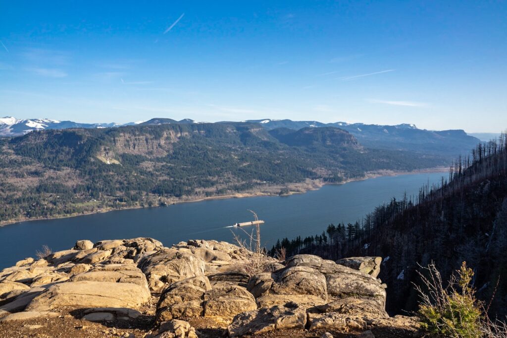
We didn’t really realize how striking the geology here is until we were driving through Mosier on the Oregon side of the river the next morning, where you have a great view of the “wall.” It’s basically a towering rocky spine that runs from the water level a few thousand feet up the wall of the Gorge.
You don’t really get a chance to see the scale of the wall unless you’re looking at it from afar, though you do get some nice views of it from above.
The hike itself is moderate. It’s a weird lollipop hike (we’d call it a reverse lollipop) where you have two options when it comes to ascending to the edge of the cliffs – one that is shorter, steeper, and rockier, one that is winding and more gradual.
Then, once you get up to the cliffs, the two routes meet up and you do an out and back section of the hike to the viewpoint at the end (where there’s another small lollipop section).
The draw for this hike is definitely the wildflowers in the spring (May and early June, mostly). We did this hike the second week of May, and after we got up to the ridge, it was an incredible, neverending display of wildflowers like balsamroot and Lupine.
The only thing to know is that you do need to do some climbing to get to them, similar to Dog Mountain.
There are also some great views of the Gorge, especially to the east, as you climb, and once you are up on the cliffs, you are high enough that you get some good views of Mount Hood across the Gorge.
Outside of the spring (and fall), we’d probably choose a different hike. This hike is very, very exposed with little tree cover, and it would be excruciatingly hot in the summer. In the winter when it rains, I’d imagine this hike is a mud bath.
Keep an eye out for rattlesnakes and ticks on this trail, especially in the spring and summer.
Read More: Everything You Need to Know to Hike the Coyote Wall Trail
The Lyle Cherry Orchard Trail
- Length: 5 miles
- Elevation Gain: 1,200 ft.
- Trail Type: Out and Back
- Difficulty: Moderate
- Dog Friendly? Yes, on a leash
- Parking Pass: None
- Trailhead Location
If you’re looking for a less popular alternative to hikes like Dog Mountain and Coyote Wall with some nice Gorge views and a modest display of wildflowers in the spring, this is a good option.
We did this on a spring afternoon, and were surprised at how much we enjoyed this hike.
It’s not as spectacular as those two more popular hikes nearby… but you don’t need a permit to hike it, and you don’t need to get into a fight to the death over parking.
The trailhead is right off of Highway 14 a few miles past the Coyote Wall Trailhead and past the tiny town of Lyle. There’s parking for 12-15 cars in the gravel lot, and there are no restrooms at the trailhead (so plan in advance!).
The hike is an out and back (or a small lollipop at the end) that takes you up a series of switchbacks to ascend to a ridge, which you then follow east out to a viewpoint with great views of the Gorge.
In the spring, there were some nice wildflowers (balsamroot and lupine, mostly), and we loved the views of the green hills of the Gorge in the spring.
Keep an eye out for rattlesnakes and ticks on this trail, especially in the spring and summer. Matt almost stepped on a rattlesnake on the trail because he was distracted by the wildflowers.
It’s also worth noting that, in the spring, there was a ton of overgrown poison oak along the trail, particularly in the forested section at the bottom and along the ridge.
The Best Time to Go Hiking in the Columbia River Gorge
As we mentioned above, one of our favorite parts about living in Portland is the fact that there is so much hiking within 90 minutes or so of our front door.
Outside of the hikes in Portland itself, the Columbia River Gorge is the closest hiking destination to Portland. And, as you’ll notice, the 50-60 mile stretch of the Gorge between Portland and Hood River (really, the Dalles) is absolutely PACKED with great hikes.
But wait, there’s more! The nice part about the Gorge is that it’s largely at sea level (ish), which means that except for a couple of trails at higher elevations, it’s largely accessible year round.
Plus, the fact that there are a variety of different ecosystems and terrains – from the lush evergreen forests and raging waterfalls on the Oregon side closer to Portland, to the arid high desert east of Hood River – means that there are great hikes to be had at just about any time of the year.
In general, the best time to go hiking in the Columbia River Gorge is spring to fall. But different hikes are better at certain times of the year. Here’s a quick overview.
In the spring (and winter as long as you’re prepared for rain and mud), the waterfall hikes are where it’s at. They’ll be raging thanks to the winter rain and spring snowmelt, which is a sight to behold.
Late spring is wildflower season in the Columbia River Gorge, and the hillsides of hikes further east like Dog Mountain, Coyote Wall, Memaloose Hills, and Tom McCall are bursting with shades of yellow, purple, red, and more.
Summer is the most consistent weather, which is great for hiking. It’ll likely be warm, dry, and you’ll have 14+ hours of daylight to spend out on the trail.
While the Columbia River Gorge doesn’t experience a ton of fall color, fall is still a nice time to hike with cooler temperatures and relatively stable weather. Waterfalls in the fall are decidedly less impressive after the dry summer, so we’d stick to hikes with a view in the fall.
Winter is a good time to hike the lower elevation waterfall trails like Latourell Falls and the Multnomah Falls Loop. Dog Mountain, Hamilton Mountain, Larch Mountain (notice a trend here? Mountain means it might have snow and ice) are all going to be covered in either snow, ice, or both.