A Perfect Los Angeles to Lake Tahoe Road Trip – Highway 395
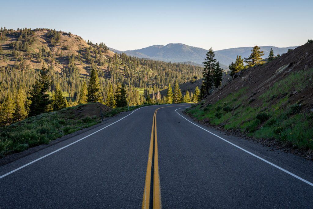
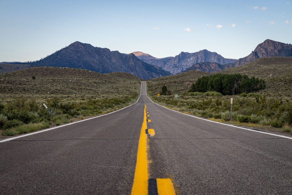
Running alongside the eastern edge of the Sierra Nevada mountains, Highway 395 is one of the most scenic roads in California. Highway 1 may get all the attention, but Highway 395 in California is just as impressive, and a Highway 395 Road Trip should be at the top of your list, especially if you are an outdoor adventure lover.
This is a road trip of epic proportions—from the desert to the mountains, you’ll pass by the lowest, hottest, highest, and oldest points of interest, along with ghost towns, surreal landscapes, film locations, hot springs, and so many lakes.
I live in Lake Tahoe and have driven Highway 395 numerous times. I know all the best places to stop, which I’ve listed out below in this guide to help you plan the perfect Highway 395 road trip. This guide assumes you start in Los Angeles and end up in Lake Tahoe.
Disclaimer: Some of the links in this post, like hotel and vacation rental links, are affiliate links, meaning at no additional cost to you we make a little bit of money if you click through and book. That being said, we would absolutely never recommend something to you that we don’t stand behind 100%.
How Many Days Do You Need for a Highway 395 Road Trip?
To really do this full Los Angeles to Lake Tahoe road trip justice, you should plan on spending 5 nights. An entire week or more is even better.
At a minimum, you should plan on spending 3 nights. Even then, you will be rushed and will have to make some tough decisions on what to cut out from your road trip. And while you can drive this entire stretch in less than a day, there’s not much point as you will miss out on just about everything.
That said, if you only have 3 nights or less, it’s still worth doing a portion of this road trip, either from LA to Mammoth Lakes/Bishop or from Reno to Mammoth Lakes/Bishop. You can then either drive back to your starting point, or fly out of Mammoth Lakes/Bishop.
Where to Fly in and Out of?
To start your trip, you can fly into Los Angeles International Airport (LAX) or Hollywood Burbank Airport (BUR). LAX is the largest airport on the west coast, and will offer the most options from just about anywhere in the country. BUR is a smaller and much nicer airport to fly into, assuming you can find a flight there at a reasonable price.
At the end of your trip, you’ll want to fly out of Reno International Airport (RNO). It’s a small airport and a breeze to travel from. It’s located about 45 minutes from the North Shore of Lake Tahoe and about 1 hour from the South Shore.
If you decide to do just a portion of the Highway 395 road trip, you can also fly in or out of Mammoth Yosemite Airport (MMH), located just 10 minutes away from Mammoth Lakes, or Eastern Sierra Regional Airport (BIH) in Bishop. Both airports are only available during peak summer and winter seasons, with limited flight options (semi charters from Southern California for MMH and on United via San Francisco for BIH).
When to Plan a Highway 395 Road Trip
Highway 395 is open year round, subject to certain portions being closed down during a major snowstorm.
Fire season, which is increasingly becoming a problem and can be unpredictable, could also potentially affect a portion or all of the areas covered by this road trip.
Fall is the best time for a Highway 395 road trip. The Eastern Sierra is one of the best places for fall colors on the west coast, and the stretch between Bishop and Bridgeport is particularly colorful with golden aspens. The leaf peeping season can run from late September to late October, though early October is usually a good bet.
Check Mono County’s fall colors website on the best timing. Fall is also a great time for hiking and other outdoor activities. Just about all area trails and campgrounds should be open, and the weather will be mild and pleasant for outdoor activities.
Summer is another good time for this road trip. It’s a great season for hiking and other outdoor activities, and a dip in one of the many lakes you will encounter will be particularly pleasant.
Summer crowds can be an issue, particularly on weekends, so you will want to book campsites and other accommodations in advance if possible. Summer is also not the best time for Death Valley, as the high temperatures can be dangerous.
Spring is also an option, particularly for wildflowers. However, depending on the winter before and the snowpack, you may be limited in terms of trails and campgrounds that are open. Late spring would be your best bet. Spring is also a good time for fishing along Highway 395.
It’s possible to do this road trip in the winter, but you will have to keep an eye on storms and road closures. Very few trails will be open, but snow sports are a good option at Mammoth Mountain, June Mountain, and the Lake Tahoe area. High passes like Tioga also won’t be open over the winter.
Things to Know Before Your Highway 395 Road Trip
Here are a few tips and considerations to keep in mind as you’re planning your trip.
- Road conditions: Check the Caltrans website for the latest in road conditions for driving Highway 395 in California, especially if you are traveling over the winter. For the Nevada portions of Highway 395, you can check the NDOT website.
- Cell coverage: It’s a good idea to carry a road atlas or to download offline maps onto your phone. Internet and cell coverage can be spotty, particularly around Death Valley and Alabama Hills. You’ll also have limited service for large portions of Highway 395, except when you are around the different towns.
- Elevation: You will cover a wide range of elevations on this road trip. Death Valley (at Badwater Basin) is the lowest, at 282 feet below sea level. Lone Pine is at 3,700 feet, while nearby Whitney Portal is at 8,374 feet. Mammoth Lakes is at 7,881 feet. Lake Tahoe is at 6,224 feet. Some of the hikes we’ve listed will take you to higher elevations. Just be aware of altitude, especially if you’re being active.
The Best Stops to Make on a Los Angeles to Lake Tahoe Road Trip on Highway 395
We’ve listed out 16 stops on this road trip that we think are worth your time.
Several places could easily warrant several days on their own, and for those, we’ve listed out some suggested things to do, as well as places to stay.
Depending on how much time you have, you may not be able to do everything listed. Feel free to pick and choose what sounds the most interesting to you.
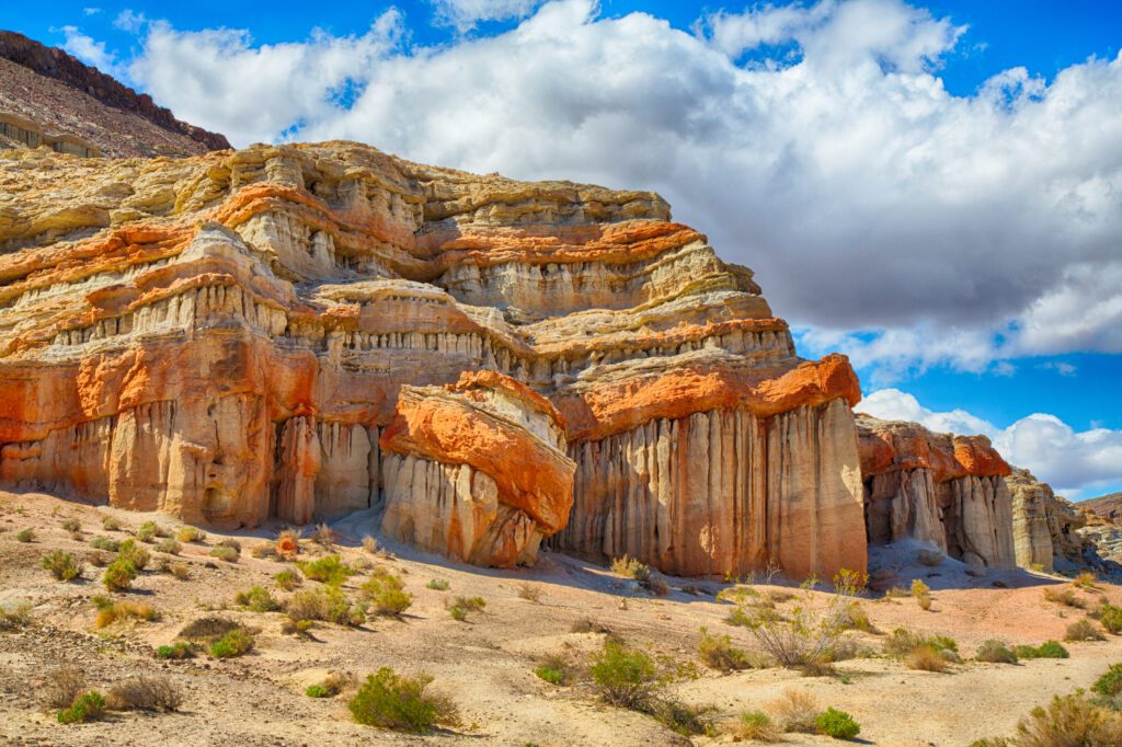
Red Rock Canyon State Park
Drive time from Los Angeles: 120 miles / 2 hours
Located in southern California (and not to be confused with Red Rock Canyon National Conservation Area outside of Las Vegas), near where the Sierra Nevada and El Paso mountains meet, Red Rock Canyon State Park is a hidden gem that impresses with its dramatic and colorful landscape of eroded badlands, colorful canyons, and fluted and folded cliffs and buttes in whimsical shapes.
It was once home to the Kawaiisu Indians, who left petroglyphs, and later a stagecoach stop, mine, and a backdrop for more than 100 movies and television shows.
Several miles of trails take you closer to the rock formations. Even with a short stop, you can try the easy 1.2-mile Hagen Canyon Nature Trail loop or the 1.0-mile Red Cliffs Trail loop.
Several driving routes that cut through the eastern portion of the park are only suitable for 4WDs.
Visit in the spring after a wet winter to see a dazzling display of wildflowers in the desert.
There’s also one campground with 50 FCFS primitive sites, picnic tables, fire rings, vault toilets, and potable water.
Death Valley National Park
Drive time from Red Rock Canyon State Park to Furnace Creek: 155 miles / 2.5 hours
Death Valley is not technically right off of Highway 395, but it’s such an amazing place that it deserves at least a day or two.
The largest national park in the continental US, it’s the hottest, driest, and lowest point in the country, with an incredible landscape of sand dunes, salt flats, canyons, and more.
However, if you’re visiting in the summer, you’re going to be limited on what you can do, as it gets seriously (and dangerously) hot. Temperatures can reach over 130 degrees F!
What to Do in Death Valley
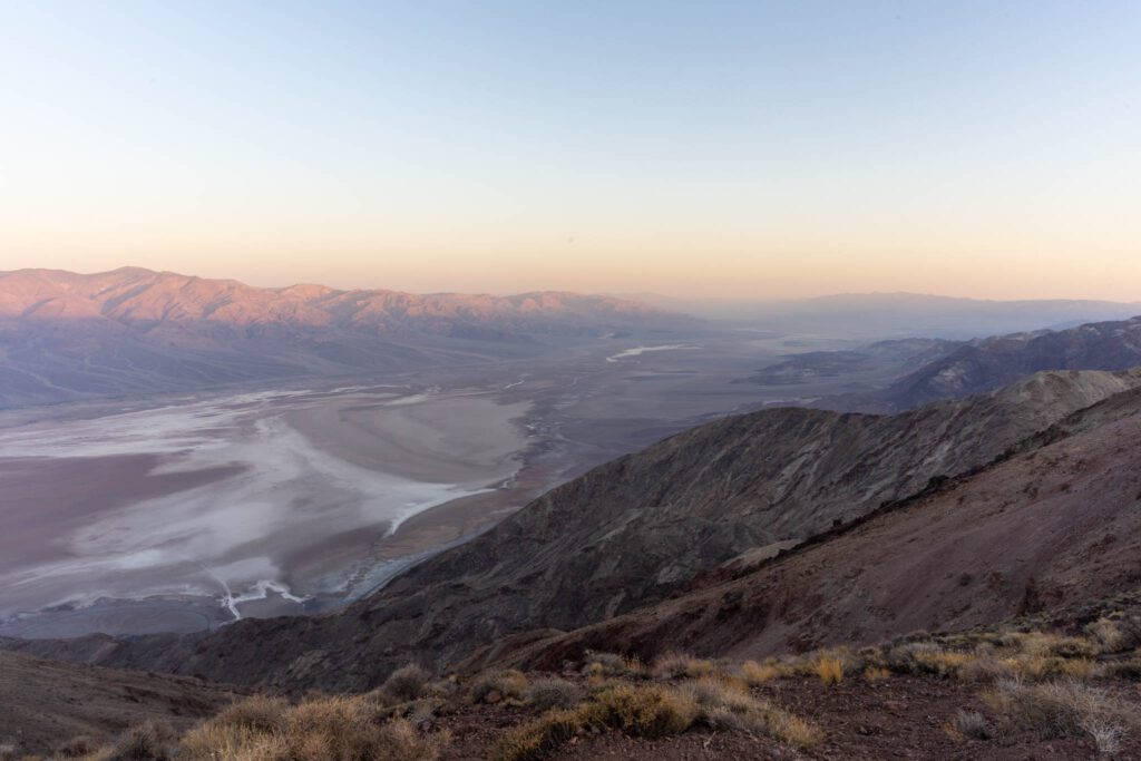
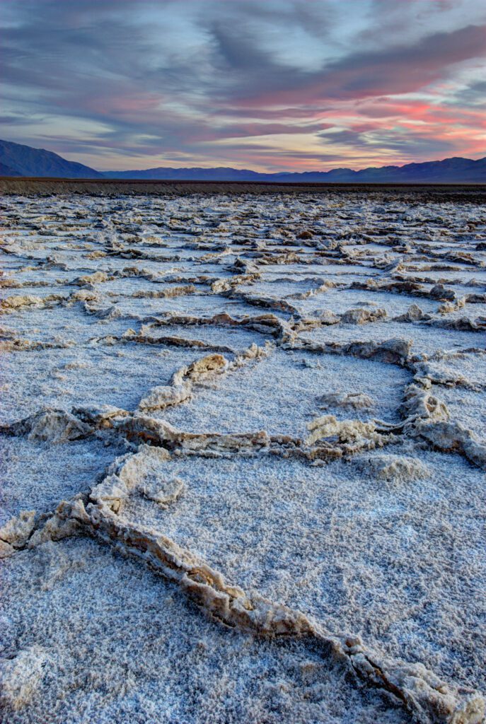
- Badwater Basin: At 282 feet below sea level, this is the lowest point in North America. It’s also the hottest, so time your visit for early or late in the day. It was once covered by a lake that has long since evaporated, leaving behind vast salt flats, which in some areas form dramatic polygons (though you have to walk out at least a mile to see the dramatic ones). Don’t forget to look to the mountains behind the parking lot to see the sign showing where sea level is.
- Artists Drive and Artists Palette: Artist Drive is a scenic 9-mile one way loop road that winds around the colorful and pastel-colored hills and canyons off Badwater Road. It’s a fun road to drive as there are a lot of curves and dips. About 5 miles in, is the turnoff for Artists Palette. An overlook on top of a small hill gives you a great view of the really concentrated colors in the hills.
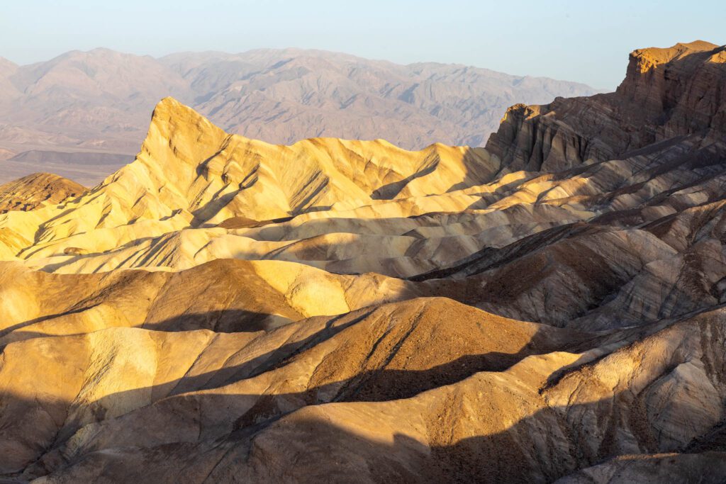
- Zabriskie Point: One of the most iconic viewpoints in the park, Zabriskie Point is best seen at sunrise or sunset. There’s a short hike up a paved path to a viewpoint, where you can see the surreal landscape of badlands stretching out before you, including the prominent sharp peak of Manly Beacon. You can hike down into the badlands, a hike that can include Gower Gulch and Golden Canyon.
- Mesquite Flat Sand Dunes: The most popular and easily accessible sand dunes in the park, the sand dunes stretch out for miles. Best seen at sunrise or sunset (or under a full moon), you can explore as far as you want, though expect slow going. It’s also the only place you can sand board. Bring cardboard or an old sled, though you can usually find abandoned sleds by the parking lot. The stars are amazing at night too.

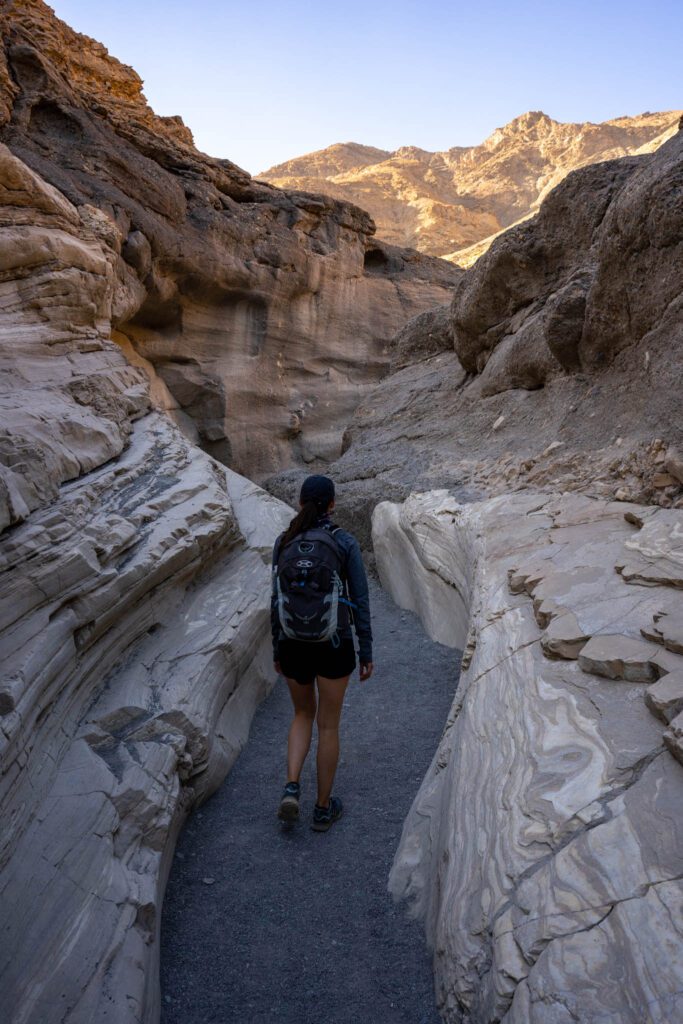

There’s so much more to do in Death Valley. Check out our 3 Days in Death Valley guide and guide to the 10 Best Hikes in Death Valley.
Where to Stay in Death Valley
Camping
There are 9 established campgrounds in the park, with four on the valley floor and five at higher elevation.
- Furnace Creek: Conveniently located right by the Furnace Creek Visitor Center, this is the most popular campground in the park, and offers 136 campsites. It’s the only campground with RV hookups. Amenities include picnic tables, fire rings, drinking water, and flush toilets. It’s also the only valley floor campground open year-round.
- Stovepipe Wells: Located near the Mesquite Flat Sand Dunes, this FCFS campground offers 190 sites. Amenities include picnic tables, fire rings, drinking water, and flush toilets. There’s a general store next door, and you can pay to use the swimming pool and showers at Stovepipe Wells Resort across the road. Open from late fall to spring.
- Texas Springs: Situated in the hills above Furnace Creek, this FCFS campground offers 92 sites. Amenities include picnic tables, fire rings, drinking water, and flush toilets. Open from late fall through spring, enjoy great views from the campground.
Lodging
Although very limited, there are some non camping options in the park.
- The Oasis at Death Valley: Located near Furnace Creek, this historic site includes the pricey but luxury Inn at Death Valley (with 66 rooms and 22 casitas) and the more affordable Ranch at Death Valley (with 244 rooms). There are several restaurants, bars, outdoor pool, spa, wellness center, fitness center, tennis courts, golf course, and gas station.
- Stovepipe Wells Hotel: Located near Mesquite Flat Sand Dunes, the hotel offers 83 rustic rooms, with amenities that include an outdoor pool, restaurant, saloon, general store, and gas station. There’s also a campground and RV park offering full hookup sites.
Lone Pine + Alabama Hills
The small town of Lone Pine is the gateway to Mount Whitney and the Alabama Hills.
Spanning 30,000 acres, rounded rocks and eroded hills of the Alabama Hills are sharply contrasted with the towering Sierra Nevada mountains behind it. A National Scenic Area, hiking, mountain biking, climbing, fishing, and photography are all popular.
Most of the roads in the area are unpaved, and while it would be helpful to have a 4WD with high clearance to really explore, you can still drive to the main attractions, particularly if you drive slowly and watch out for rocks and sandy patches.
What to Do in the Alabama Hills
- Movie Road: An easy way to explore the Alabama Hills, a drive along Movie Road will take you past the boulder strewn landscape, where more than 400 movies have been filmed, including hundreds of westerns, and more recently, Gladiator, Iron Man, and Django Unchained. Portions of the road have also become Instagram famous in recent years. From Lone Pine, drive along Whitney Portal Road for 2.5 miles to Movie Road. You can also drive the full 13 miles of the Whitney Portal Road to Whitney Portal, one of the trailheads to the 14,505-foot Mount Whitney, the tallest mountain in the continental US.
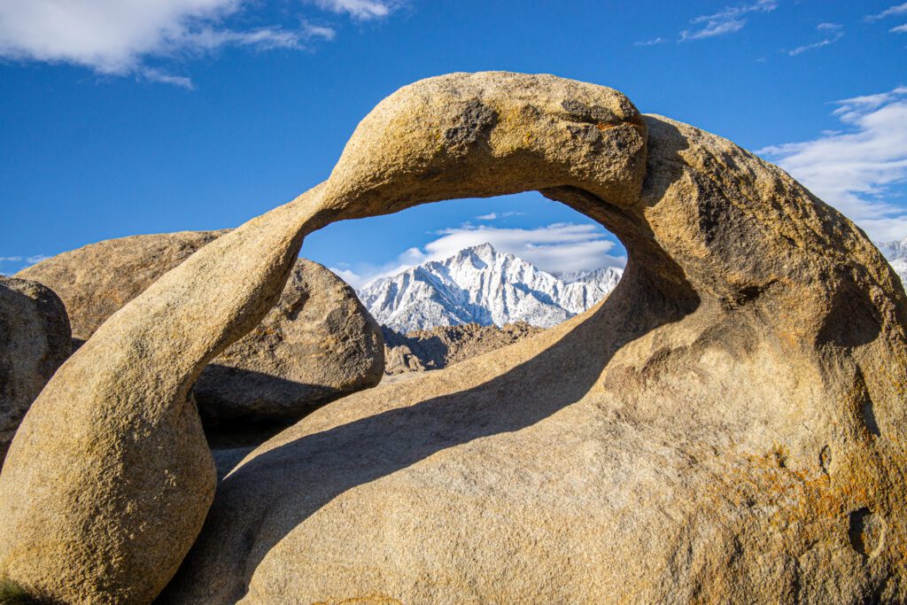
- Mobius Arch: There are numerous natural arches in the area, but Mobius Arch is probably the most famous, as it perfectly frames both Mount Whitney and Lone Pine Peak within its arch. Particularly popular at sunrise and sunset. It’s also a quick and easy walk along the Arch Loop Trail. Don’t miss Lathe Arch next to Mobius Arch. Other famous arches in the area include Eye of Alabama, Heart Arch, and Whitney Portal Arch.
- Rock Climbing: There are more than 300 routes in the area, with the majority bolted sports routes, though trad lines can also be found. Access is usually easy and the setting can’t be beat.
- Museum of Western Film History: This small museum in Long Pine is small but packs a lot in, and well worth a stop, especially if you’re a fan of westerns. There’s an extensive collection of movie props, memorabilia, costumes, and posters from the many films that have been shot in the Alabama Hills. Be sure to pick up the Movie Road self guided tour map.
Where to Stay
Camping
There are three established campgrounds in the area. Dispersed camping is also a fantastic option.
- Tuttle Creek Campground: This BLM campground offers 83 FCFS tent and RV sites (no hookups). Amenities include a fire pit, picnic tables, vault toilets, and seasonal potable water and dump station. There are great mountain views, but no shade. You can fish in the creek in season.
- Portuguese Joe Campground: This small county-run campground offers 20 sites for tents and RVs (no hookups), and can be reserved in advance. Amenities include picnic tables, fire grills, potable water, and vault toilets.
- Lone Pine Campground: Located on the Whitney Portal Road, near the base of Mount Whitney, this forest service campground offers 44 sites for tents and RVs (no hookups), and can be reserved in advance. Amenities include picnic tables, fire rings, bear proof lockers, vault toilets, and seasonal potable water. Limited shade but fantastic views.
- Dispersed Camping: The BLM recently started restricting where you can camp in the scenic area. You can find more (and the latest) information here. Note that there are 3 porta potties near the start of Movie Road and across from the parking lot for Arch Loop Trail. I recently stayed at a great site near the start of Movie Road with fantastic views of Mount Whitney and Lone Pine Peak.
Lodging
The town of Lone Pine is less than 3 miles away from Alabama Hills and offers several lodging options.
- Dow Hotel & Dow Villa Motel: A historic hotel built for the film industry, stars like John Wayne have stayed here. The motel section is newer and more comfortable rooms with air conditioning. There’s also an outdoor pool and hot tub, along with free WiFi.
- Whitney Portal Hotel and Hostel: A popular basecamp for those tackling Whitney, it also offers the cheapest rooms in town in their dorms. Modern hotel rooms with air conditioning are also available, along with free WiFi. Stock up in the general store.
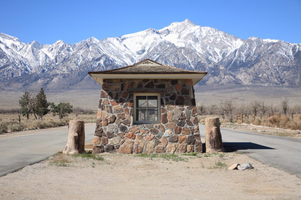
Manzanar National Historic Site
Drive Time from Lone Pine: 10 miles / 12 minutes
Marking a dark point in US history, Manzanar was one of ten internment camps during WWII.
More than 10,000 Japanese Americans were confined here between 1942 and 1945. There’s an excellent interpretive center with exhibits and films and the former barracks contain audio and video clips from former inhabitants.
Not much of the original camp remains, though some buildings have been reconstructed. A 3-mile self-guided driving tour lets you view different parts of Manzanar, including a small cemetery, where a monument (and numerous origami tributes nearby) stands.
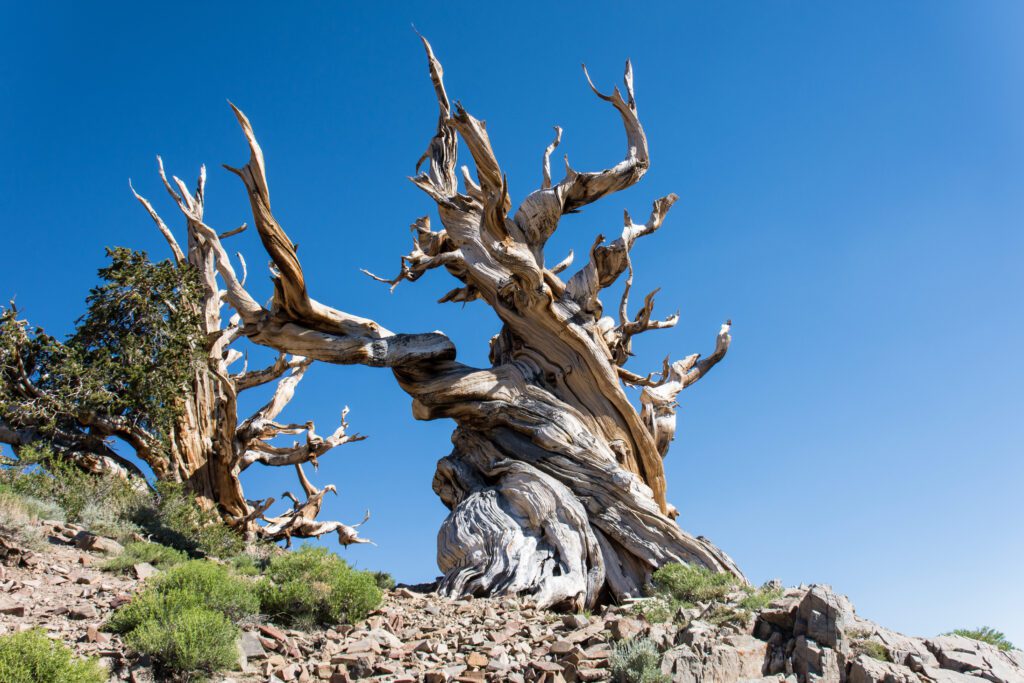
Ancient Bristlecone Pine Forest
Drive Time from Manzanar: 60 miles / 1 hour 20 minutes
Located above 10,000 feet on the slopes of the White Mountain, the Ancient Bristlecone Pine Forest is home to some of the world’s oldest living trees (which also make them the world’s oldest living things). Many of these twisty, gnarled trees are more than 4,000 years old!
Methuselah, the oldest known living tree, is 4,700 years old and can be found along the Methuselah Trail in Schulman Grove. The largest bristlecones can be found in the Patriarch Grove.
It’s a thrilling drive just to get to the forest, with fantastic views of the Eastern Sierra mountains along the way. From Highway 395, turn east on to Highway 168 and drive for 23 miles to the Schulman Grove Visitor Center. It’s a slow 12-mile drive on a narrow dirt road to get to the Patriarch Grove.
Bishop
Drive Time from Ancient Bristlecone: 38 miles / 60 minutes
Unless you’re a climber or boulderer (in which case you’ll want to add another day to this road trip and take a trip out to the Buttermilk Boulders), you will only be making a quick stop in Bishop to grab some food.
Stop at Erick Schat’s Bakery. They’re known for this sheepherder’s bread, but they also offer great pastries.
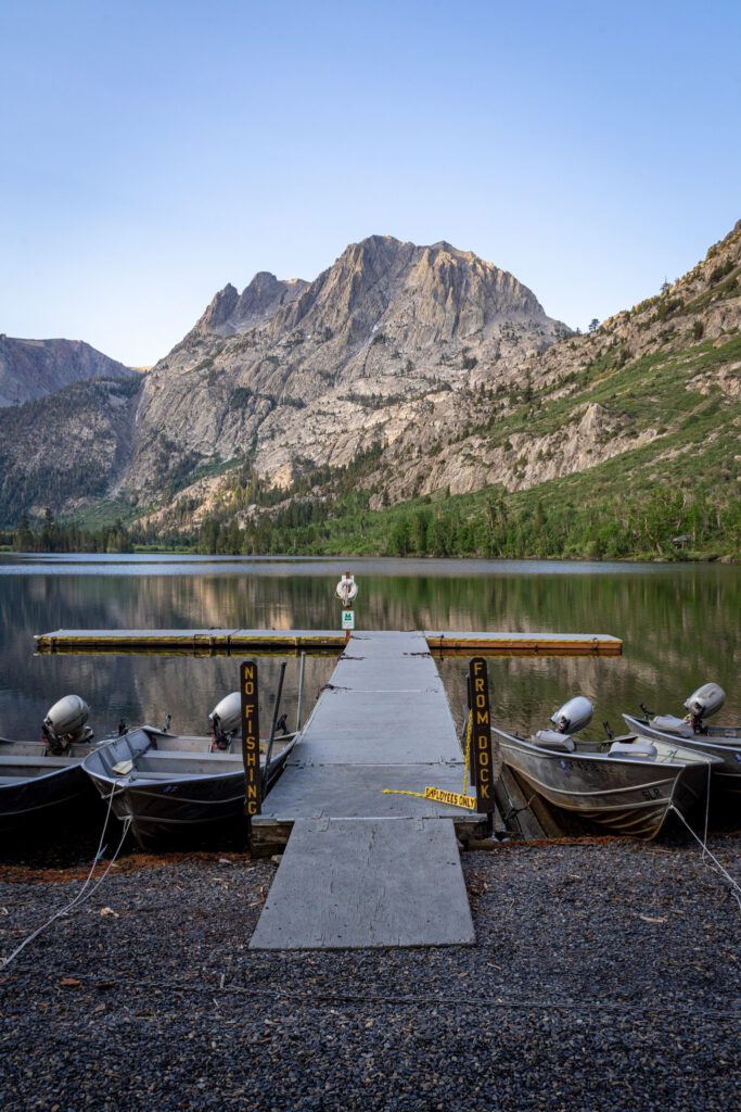
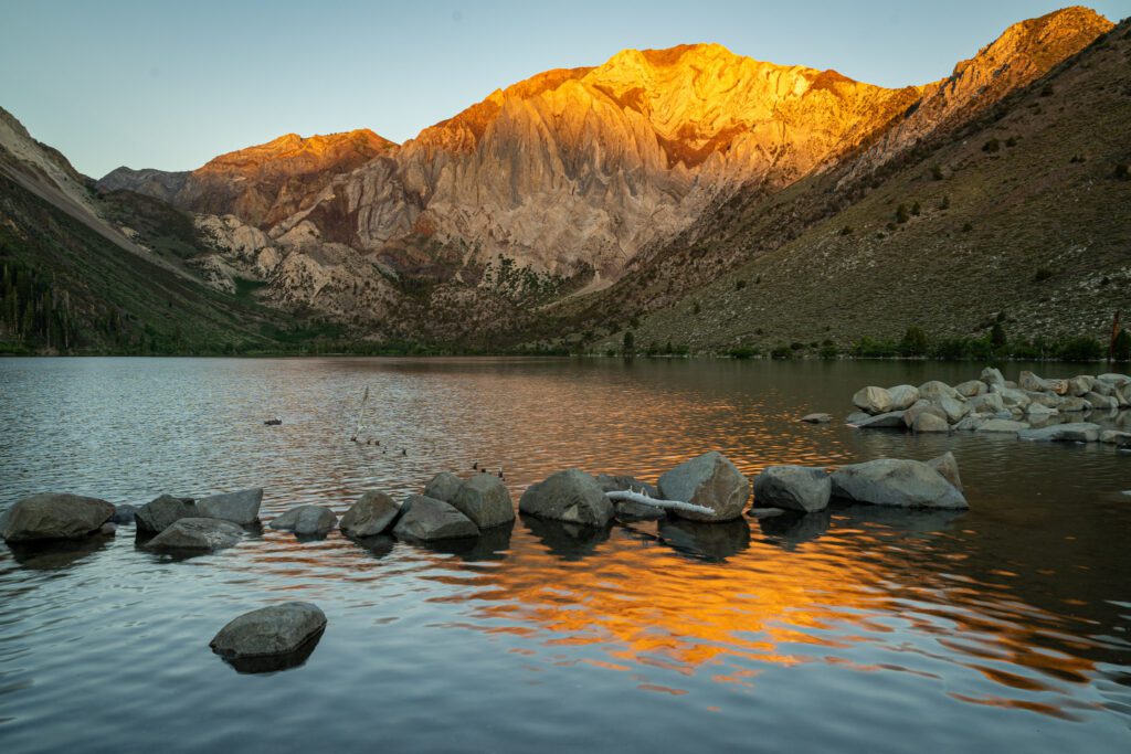
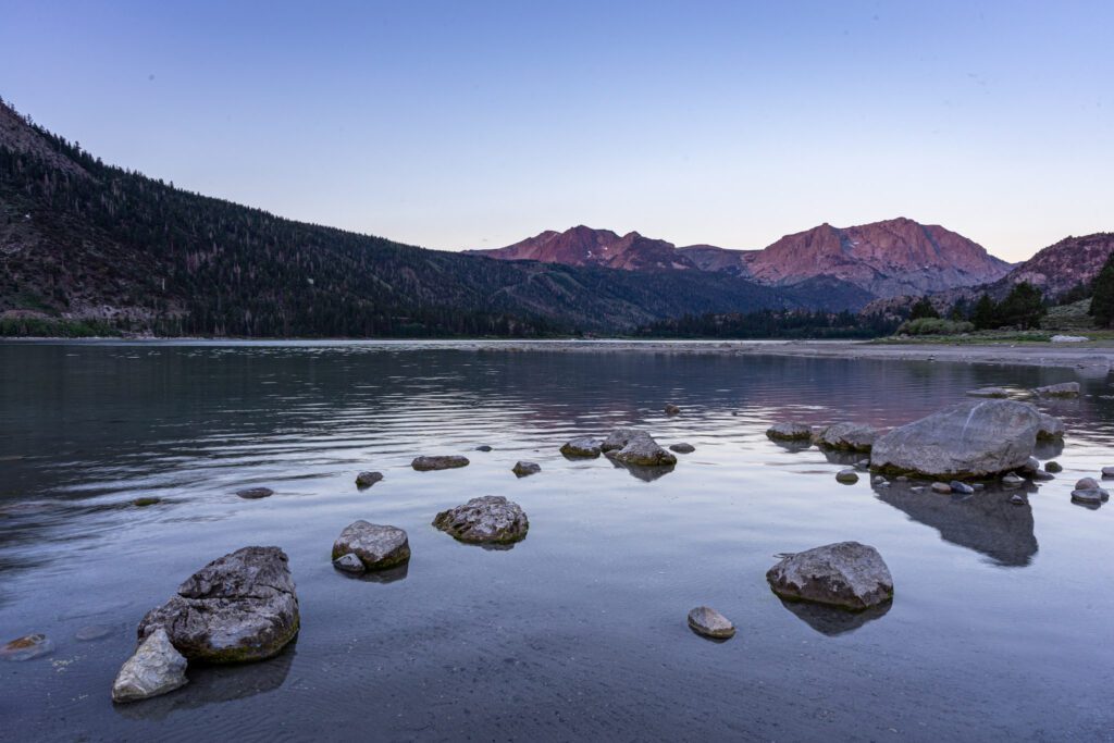
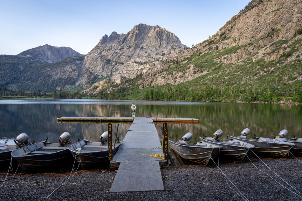
Convict Lake
Drive Time from Bishop: 35 miles / 40 minutes
With clear and deep blue waters framed by Mount Morrison and Laurel Mountain, Convict Lake is one of the prettiest lakes in the area.
You can also drive right up to the lake, just 2 miles off Highway 395. The lake was named after a shootout that occurred here between escaped convicts from Carson City and the posse, which resulted in the deaths of two locals.
There’s an easy 3-mile trail around the lake that passes through the surrounding sagebrush, pine, and aspens (particularly beautiful in the fall).
A seasonal marina (open April to October) offers rentals for kayaks, SUPs, motorboats and pontoon boats. The lake is also stocked with brown and rainbow trout, with spring and fall the best seasons for fishing.
There’s a seasonal forest service campground (open April to October) with 85 sites (with bathroom, showers, and picnic tables, but no hookups). The Convict Lake Resort is open year round and offers cabins and lodges, a small store, food truck, and restaurant (open for dinner).
Hot Creek Geological Site
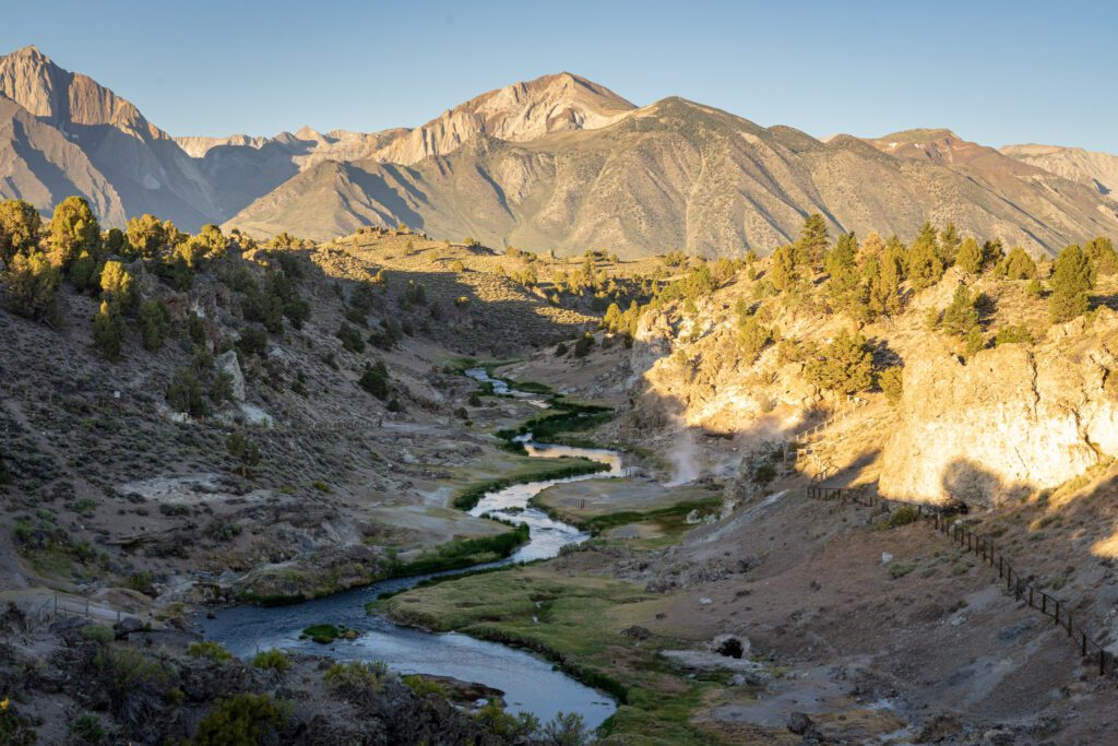
Drive Time from Convict Lake: 7 miles / 15 minutes
The Hot Creek Geologic Site is a hotbed of volcanic and geothermal activity. There’s a boardwalk that winds through the canyon and surreal landscape of boiling hot springs, steaming vents, geysers, fumaroles, and shimmering pools of light blue and turquoise waters, all with the scenic backdrop of the towering Sierra Nevada peaks.
Activity has increased in recent years so you just might see a geyser erupting.
Around 15 miles south of Mammoth Lakes, take the Hot Creek Hatchery Road and drive 2 miles before continuing on a gravel road for 3 miles.
From the parking area, it’s a short hike down to the canyon. The site is accessible year round, though winter access may require snowmobile, snowshoe, or skis.
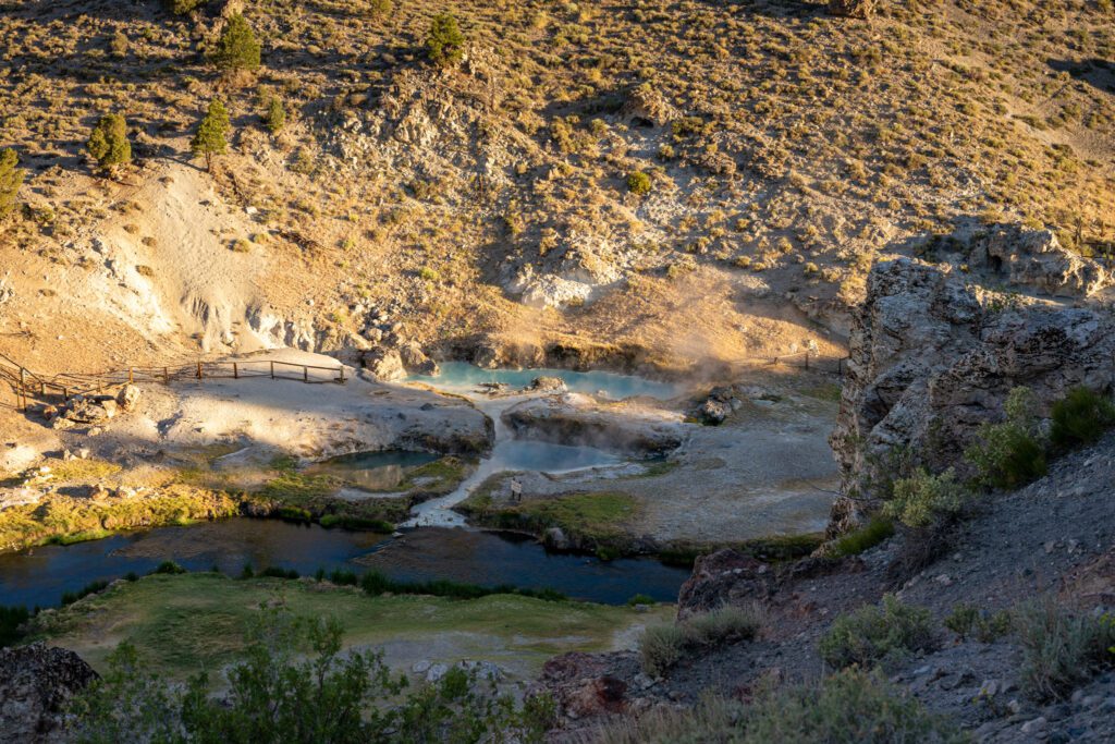
You can’t actually soak in the hot springs here, as the waters are too hot. Nearby Wild Willy’s Hot Springs is a good option if you actually want to soak.
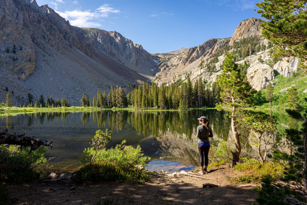
Mammoth Lakes
Drive Time from Hot Creek: 10 miles / 20 minutes
The town of Mammoth Lakes is a year-round adventure resort and playground, with Mammoth Mountain a top destination for skiing, snowboarding, and mountain biking.
The region is also home to 11 lakes, and fantastic hiking, horseback riding, and fishing.
What to Do
We have an entire guide dedicated to the best things to do in Mammoth Lakes in the summer. For more detail, definitely go read that.
In the meantime, here are the highlights.
Mammoth Scenic Loop: Starting just north of downtown, off Highway 203, this 16-mile scenic loop will take you past beautiful pine forests. Around 10 miles in, you will continue on to Dry Creek Road. Be sure to stop at the Inyo Craters. Earthquake Fault, around 1 mile west of the loop is also worth a stop. You’ll also pass by the trailheads to several hikes, including Obsidian Dome and Lookout Mountain. This is also a popular loop for road cycling.
Mammoth Mountain: Mammoth Mountain is a premier skiing destination, with massive terrain and a season that sometimes lasts until June. In the summer, the mountain turns into an epic mountain bike park, with more than 80 miles of single track that can be accessed via lifts. You can also take the gondola for amazing views from the top at 11,053 feet, along with an adventure center complete with ropes courses, climbing wall, zip lines and more. You can also take the gondola up and hike down.
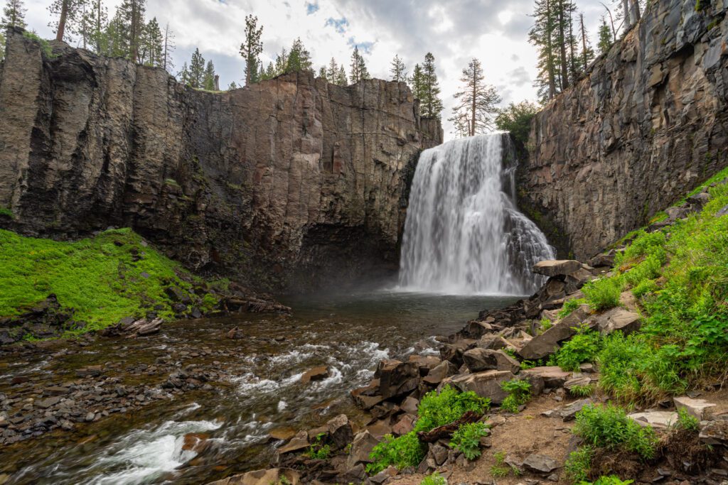
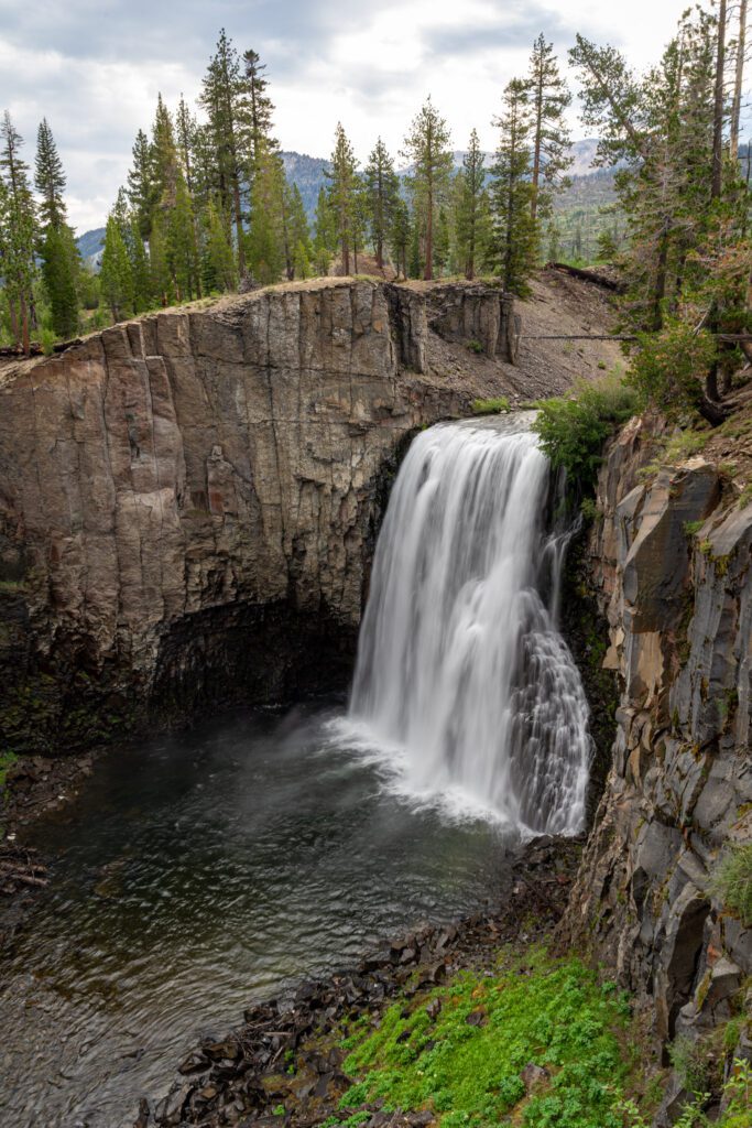
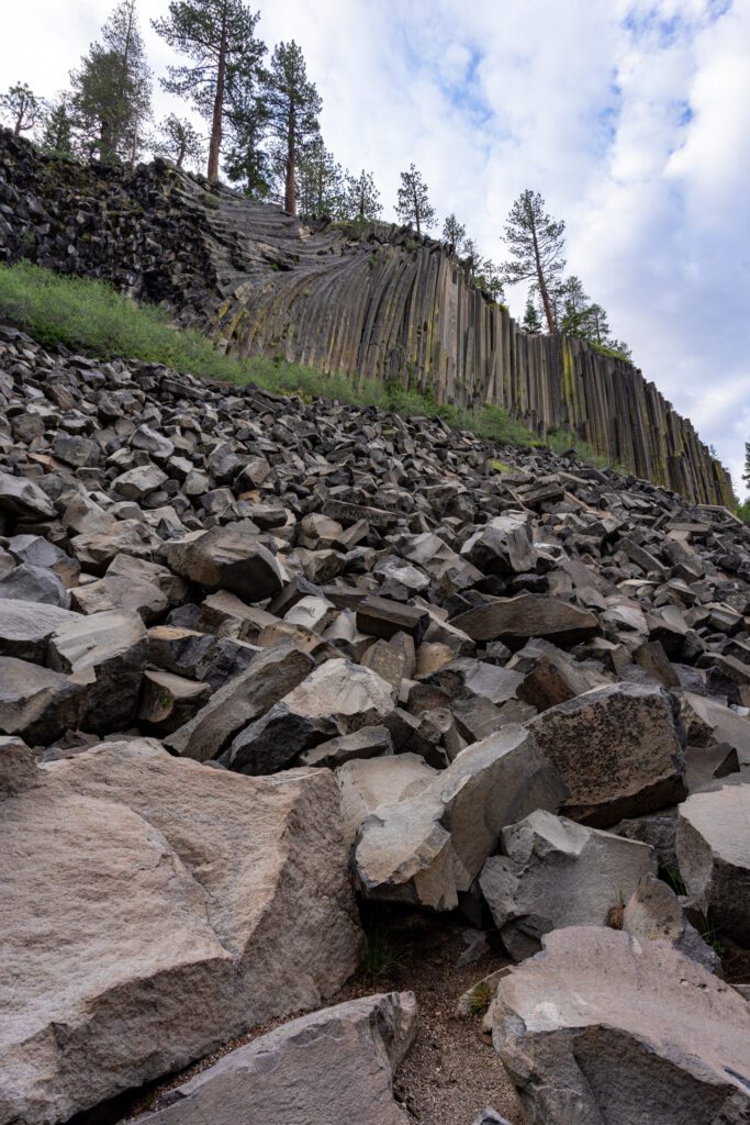
Devils Postpile National Monument and Rainbow Falls: Formed by volcanic forces 100,000 years ago, Devils Postpile is a geologic wonder of hexagonal basalt columns that reach over 60 feet tall. It’s an easy half mile hike from the ranger station to the columns. Take the short but steep trail up to get a better view of the unusual formations from above. Afterwards, continue for 2 more miles to reach the 101-foot Rainbow Falls. Time your visit for late morning or midday for the best chance of seeing the namesake rainbows. There are two overlooks from above, but you can also hike down to the base of the falls. Another half mile along the trail is another waterfall, the much smaller Lower Falls. Open seasonally, you must take a shuttle bus in unless you are camping in the area.
Duck Pass Trail: This moderately difficult 10-mile out and back trail is one of the best hikes in the Mammoth Lakes, and also very popular. You’ll pass by several lakes and enjoy stunning views of the region. The trailhead starts from the Coldwater Campground and starts climbing steadily. Less than a mile in is a spur trail to the aptly named Arrowhead Lake. You’ll pass Skelton Lake in half a mile. Continue climbing another mile to the beautiful turquoise waters of Barney Lake. After a creek crossing and the small Red Lake, you’ll ascend a steep, talus-covered slope to Duck Pass, at 10,814 feet. Drop down 300 feet to Duck Lake, one of the largest natural lakes in the area, and stunning with its deep blue waters.
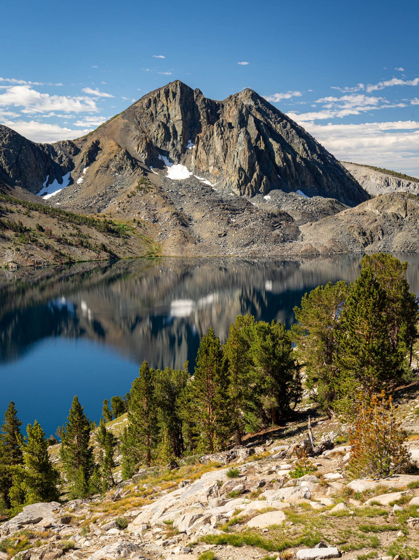
For a more detailed description of hiking the Duck Pass Trail, check out our trail guide here.
Where to Stay
Camping
There are more than a dozen campgrounds in the Mammoth Lakes area, with sites for tents and RVs (no hookups). The following campgrounds are the best options.
- Lake Mary Campground: This fantastic campground is located on the north end of Lake Mary, the largest and most developed on the 11 lakes in the region. There are 48 sites, which can be reserved in advance. The best sites have views of Lake Mary, which offers two marinas, boat rentals, and excellent fishing. Swimming is not allowed. Amenities include picnic tables, fire grills, bear boxes, potable water, and flush toilets. Open from early June to mid September.
- Twin Lakes Campground: Located between the eastern and western shores of Twin Lakes, this large and popular campground offers 92 sites that can be reserved in advance. Amenities include picnic tables, fire grills, bear boxes, potable water, flush toilets, hot showers, boat ramp, and fishing pier. A general store is within walking distance. Open from mid May to late October.
- Minaret Falls Campground: This scenic and popular campground is located along the Upper San Joaquin River, near Minaret Creek and Minaret Falls. Devils Postpile National Monument is less than 1 mile away. There are 27 FCFS sites. Amenities include picnic tables, fire grills, bear boxes, potable water, and vault toilets. There are limited supplies at the Reds Meadow Resort store nearby. Open from mid June to mid September.
Lodging
There are also plenty of lodging options if you don’t want to camp, ranging from cheap motels to high-end resorts. Here are two great options.
- The Mammoth Creek Inn: This family friendly inn is located just minutes from Mammoth Mountain. 25 rooms come in a variety of sizes, with some that include kitchens, fireplaces, and a deck with great views. The inn is pet friendly and includes an indoor spa and fitness center.
- Empeiria High Sierra Hotel: Located on a quiet stretch of Main Street, this modern and updated hotel offers spacious rooms, including a family room with bunk beds. Pets are allowed in some rooms. There’s also an indoor pool, hot tub, fitness center, and free WiFi.
June Lake
Drive Time from Mammoth Lakes: 20 miles / 25 minutes
The June Lake area is a popular destination for hiking, biking, fishing, water sports, and in the winter, skiing and snowboarding at June Mountain. The fall colors here can be spectacular, and easily seen along the scenic June Lake Loop drive.
What to Do
The June Lake Loop is a beautiful drive, particularly in the fall when the colors change. The 16-mile loop on Highway 158 takes you past four pretty alpine lakes, and features fantastic mountain views along the way.
Start at the southern end (14 miles north of Mammoth Lakes), and be sure to stop just past the gas station at the start of the loop to take in the view (and a photo!) of the road leading into the mountains.
You’ll pass by June Lake first, which has a nice beach popular in the summer. The town of June Lake is next. It’s a good spot for coffee (at The Lift) or a beer at June Lake Brewing Company.
Next up is small Gull Lake (which has an easy nature trail around it), then Silver Lake (which offers great views of Carson Peak). Lastly, you’ll pass by Grant Lake. It’s not as pretty as the other lakes, but it’s large and a good spot for fishing.
There are some great hikes along the June Lake Loop. Here are three of the best.
- Parker Lake: This easy 3.8-mile out and back hike takes you to pretty Parker Lake at the base of Parker Peak. From the trailhead, you’ll start heading upwards. At the crest, turn around to enjoy views of Mono Lake in the distance. In the summer, wildflowers are abundant along the creek, while aspens dazzle in the fall. Fishing is also great here. The trail is largely exposed, and you’ll gain around 500 feet in elevation.
- Fern Lake: This moderate 3.2 mile out-and-back hike has a steady uphill climb up around 1,500 feet. Find the trailhead past Gull Lake. Around 1 mile in is a split in trail—take the left for Yost Lake and Fern Creek and right to continue to Fern Lake. There’s a beach at Fern Lake and you can jump in, but be aware that the water will be really cold. You can also fish for trout in Fern Lake.
- Gem Lake: This moderately difficult 6.5-mile out and back hike gains around 2,000 in elevation. Find the trailhead near Silver Lake. You’ll get great views of Silver Lake and Horsetail Falls, the tallest waterfall in the area. After crossing some railway tracks, you’ll come to Lake Agnew. Continue climbing, with numerous switchbacks, to reach Gem Lake, which has a beach on the western end. Be careful with creek crossings in the late spring and summer.
Where to Stay
Camping
There are five forest service campgrounds along the June Lake Loop. They are all open seasonally, typically from late April to early November, depending on the weather. All campgrounds offer sites for tents and RVs (no hookups).
- June Lake Campground: Located at the northeast shore of June Lake, this campground offers 28 sites. Amenities include picnic tables, fire grills, bear boxes drinking water, flush toilets, and a boat ramp. The town of June Lake is walking distance.
- Oh! Ridge Campground: Located a quarter mile from the north shore of June Lake, this is the largest campground at June Lake, and offers 143 sites. Amenities include picnic tables, fire grills, bear boxes, drinking water, flush toilets, and a swimming beach.
- Gull Lake Campground: Located at Gull Lake, the smallest (and arguably prettiest) of the June Lake Loop lakes, this campground offers 11 FCFS sites. Amenities include picnic tables, fire grills, bear boxes drinking water, and flush toilets.
Lodging
There are more than a dozen lodges in the area. Here are two good options if you don’t want to camp.
- Double Eagle Resort: Choose from resort rooms with whirlpool tubs and balconies, cozy cabins with fireplaces and full kitchens, or a large guest house, all with great views. Open year round, there’s a restaurant and bar onsite, plus spa and fitness center with indoor pool.
- Gull Lake Lodge: Located in June Lake Village between June Lake and Gull Lake, this immaculate lodge offers an affordable and comfortable stay at a great location. Choose from 1-bedroom suites with full kitchen and deck or balcony, or a 2-bedroom cabin.
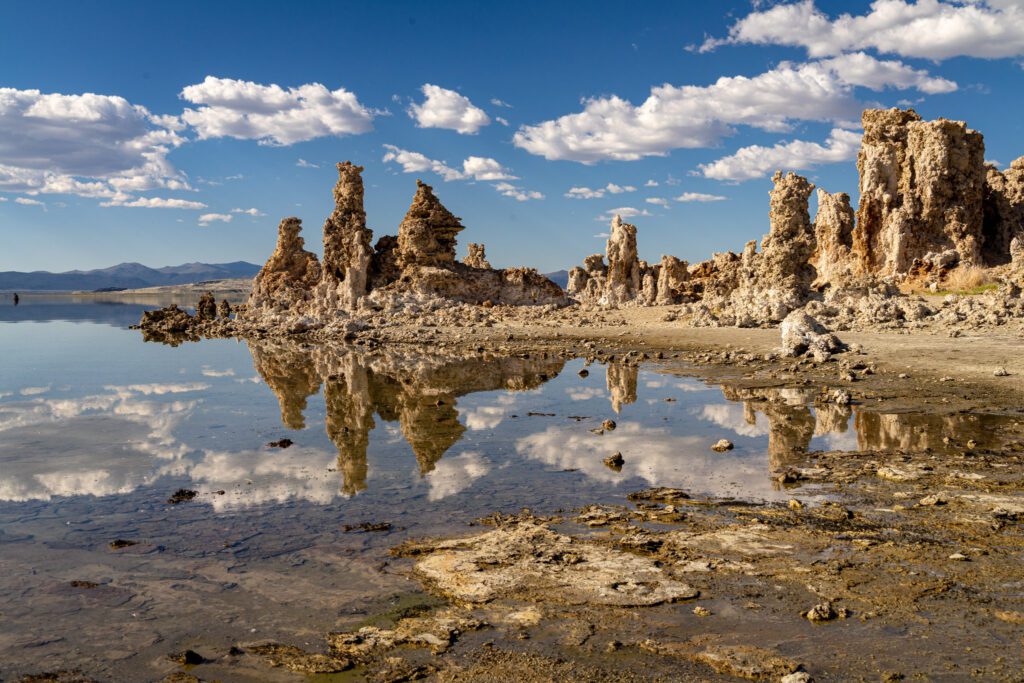
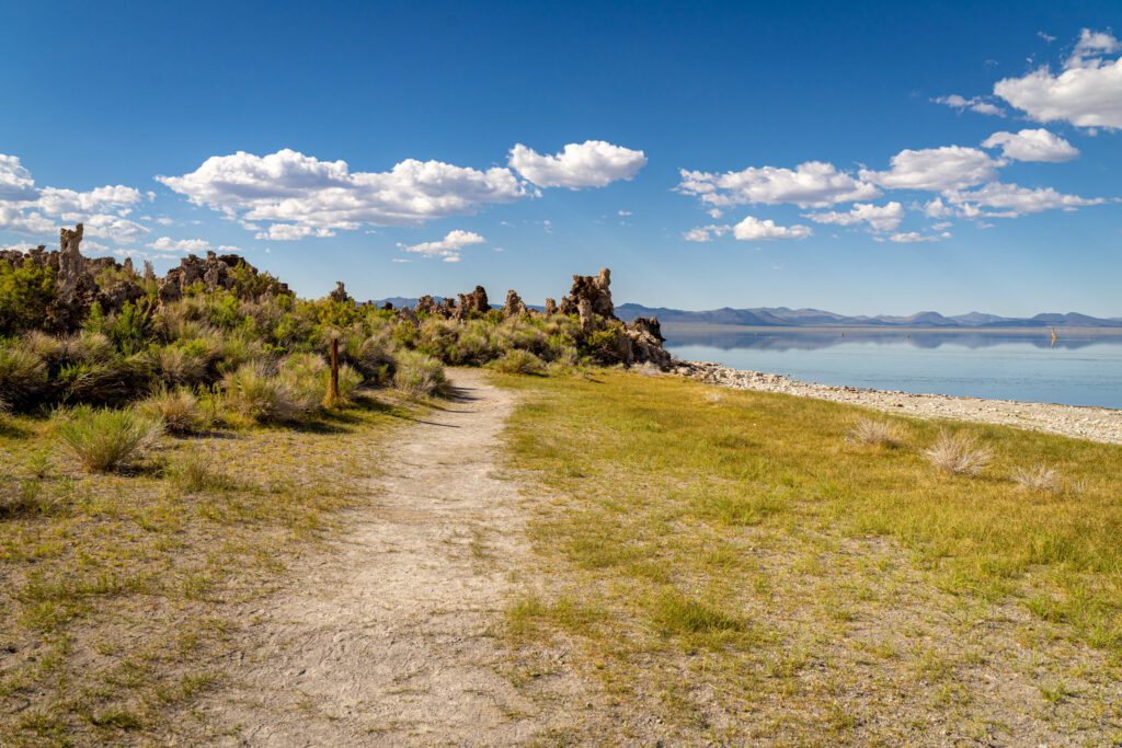
Mono Lake
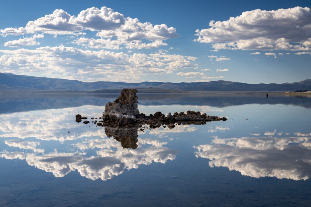
Drive Time from June Lake: 15 miles / 25 minutes
The second oldest lake in North America, Mono Lake is an ancient saline lake that is more than twice as salty as the ocean and incredibly alkaline.
Known for its tufa towers (of calcium carbonate) and reflections of the Sierra Nevada mountains in its still waters, it’s a surreal and unique landscape and environment. It’s a haven for alkali flies, brine shrimp, and numerous migratory birds, including ospreys that nest on the tufa towers.
The area is particularly scenic at sunrise and sunset, and a big draw for photographers and bird watchers.
The South Tufa area offers the largest concentration of tufa towers, and there’s an easy 1-mile self guided nature trail. Visit the Mono Basin Scenic Area Ranger Station and Visitor Center (just north of Lee Vining) to learn more about the lake, and for guided tours of the area over the summer.
Nearby Navy Beach is the best spot for swimming and for putting in canoes and kayaks. The parking lot for the south tufas are located 5 miles east of Highway 395, off Highway 120.
Nearby Panum Crater is the youngest of a string of craters that lead towards Mammoth Mountain. A short (30 minute) trail leads you around the rim of the crater, while a short and steep trail leads you to the crater’s core.
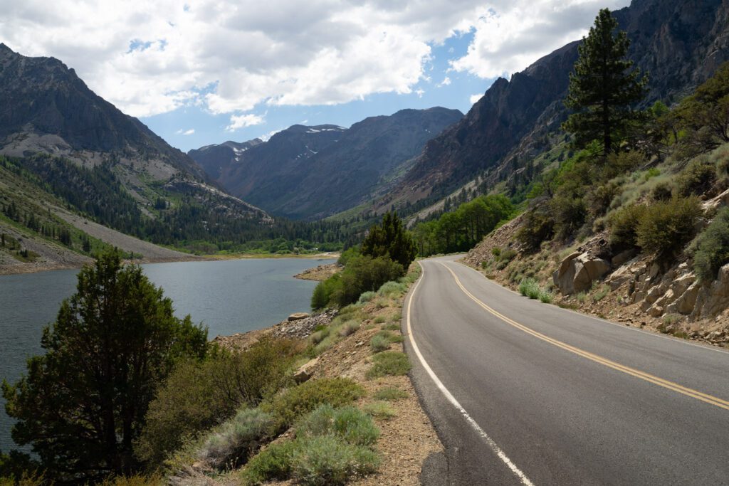
Lee Vining & Eastern Side of Yosemite National Park
Drive Time from Mono Lake South Tufa: 7 miles / 15 minutes
The small town of Lee Vining is a gateway to the eastern side of Yosemite National Park. Stop for a bite at the Whoa Nellie Deli, then continue on Tioga Road.
- Whoa Nellie Deli: A stop here on a Highway 395 road trip or Yosemite trip is almost required. It’s the best food you will ever find at a gas station. Their fish tacos are amazing, and portion sizes are large. Grab a bite (you can order online in advance too), and sit outside on their picnic tables. There’s also a nice overlook towards Mono Lake.
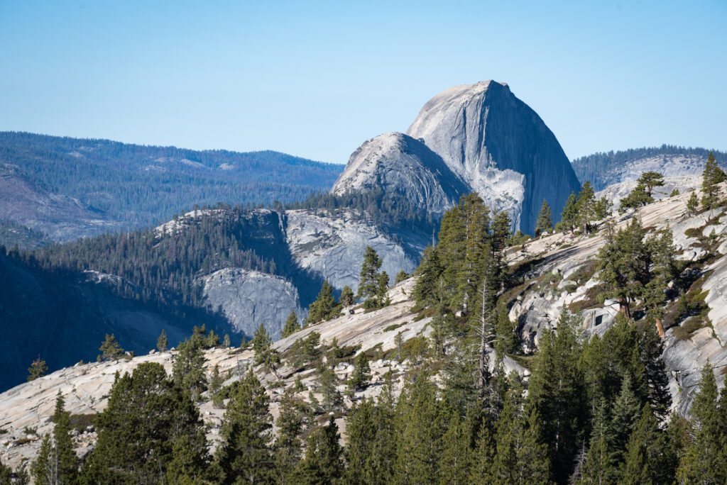
- Tioga Road: Tioga Road (Highway 120) is the eastern entrance to Yosemite National Park, and offers a stunning drive through the Yosemite high country. Highlights include Ellery Lake, Tioga Lake, Pothole Dome, Tuolumne Meadows, Lembert Dome, Tenaya Lake, and Olmstead Point. From Lee Vining, the Tioga Pass entrance to Yosemite National Park is about 12 miles along Tioga Road. From the entrance, it’s around 60 miles to Yosemite Valley. If you want to just see the highlights along Tioga Road, expect to drive 30 miles to Olmsted Point (or 20 miles to Tuolumne Meadows) from Lee Vining. Tioga Road is only open from around May to October, depending on the weather. Check the latest road conditions by calling (209) 372-0200.
If you have more time, check out our guide on 2 Days in Yosemite.
Lundy Lake + Lundy Canyon
Drive Time from Lee Vining: 10 miles / 15 minutes
It’s an easy drive to Lundy Lake, just 5 miles along Lundy Lake Road north of Lee Vining. The 100-acre lake is a great spot for fishing without the crowds, offering shore and boat access. There’s also a county campground and resort offering lodging and a general store nearby.
The Lundy Canyon Trail is a fantastic hike, best in July (when wildflowers are in bloom and waterfalls are full) or October (when the quaking aspens turn colors).
The easy to moderate 4-mile out-and-back hike climbs gently along Mill Creek and into the Hoover Wilderness, and takes you past beaver ponds, the ruins of an old cabin, and several beautiful, cascading waterfalls, including the impressive Lundy Falls. Also look for waterfalls along the canyon walls.
It’s possible to extend the hike up to Lake Helen and the Twenty Lakes Basin, but the route up can be treacherous, with loose shale, and is not recommended when you only have limited time (and even then, only if you are an experienced hiker). It’s also easier to access those lakes via Tioga Road and Saddlebag Lake.
Alternatively, you could take the Lundy to Oneida Lake Trail, which starts off on the southwestern side of Lundy Lake and follows an old mining road. Enjoy splendid views of a series of small lakes at Lake Canyon, and the ruins of the May Lundy Mine.
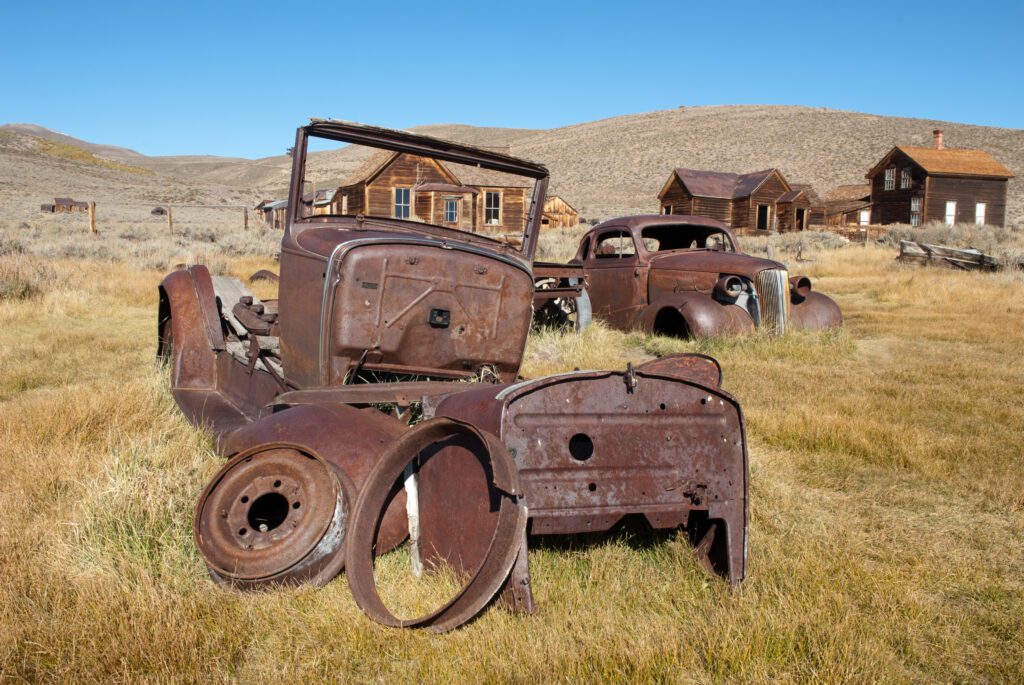
Bodie State Historic Park
Drive Time from Lundy Lake: 30 miles / 45 minutes
Once a booming mining town with 10,000 residents in the 1880s, today Bodie is the largest unrestored ghost town in the west, with more than 100 deserted buildings preserved in a state of “arrested decay.” Everything remains as it was when the last residents left in the 1940s.
You can walk around the town and peer inside of buildings, where you’ll see store shelves still stocked with goods, homes with mattresses on beds, clothing, hanging and even plates on tables, and lessons still on the chalkboard in the school house.
There’s a museum and bookstore (open May to October) where you can pick up a self-guided tour book. Guided tours are offered over the summer, including the Standard Mill. There are also rusted out cars and machinery lying all around.
Take Bodie Road (Highway 270) from Highway 395 around 7 miles south of Bridgeport. Head east 10 miles on a paved road, then 3 miles on a dirt road. Bodie is open year-round, but high elevation (8,375 feet) and snowfall could limit access to those with snowmobiles, skis, or snowshoes. Call the park at (760) 616-5040 for the latest information on road and other conditions.
Travertine Hot Springs

Drive Time from Bodie: 20 miles / 35 minutes
Located just south of Bridgeport, Travertine Hot Springs is a series of all natural hot springs with fantastic views of the Eastern Sierra mountains.
Named for the deposits that form into terraces from the minerals in the hot springs, you can choose from different pools with different temperatures, starting from right near the parking area. The only facility is a pit toilet by the parking area. The pools are also clothing optional.
Camping is not allowed right by the pools, though you can find limited spaces along the road leading to the hot springs. Just south of Bridgeport, turn right at Jack Sawyer Road and follow the dirt road for 1 mile.
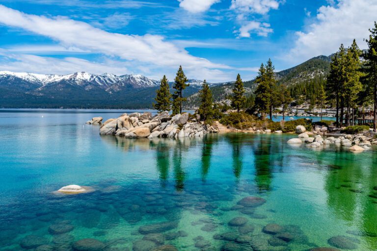
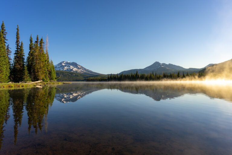
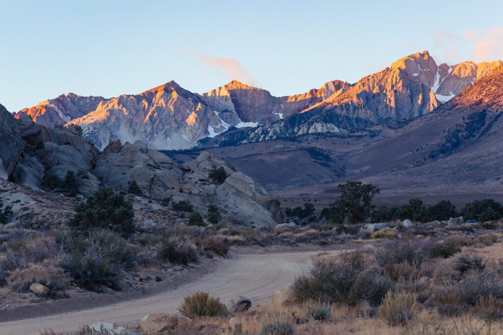
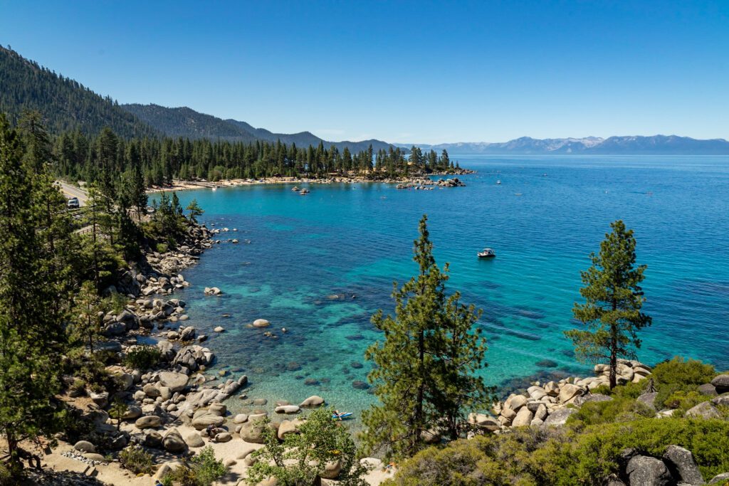
Lake Tahoe
Drive Time from Travertine to South Lake Tahoe: 90 miles / 2 hours
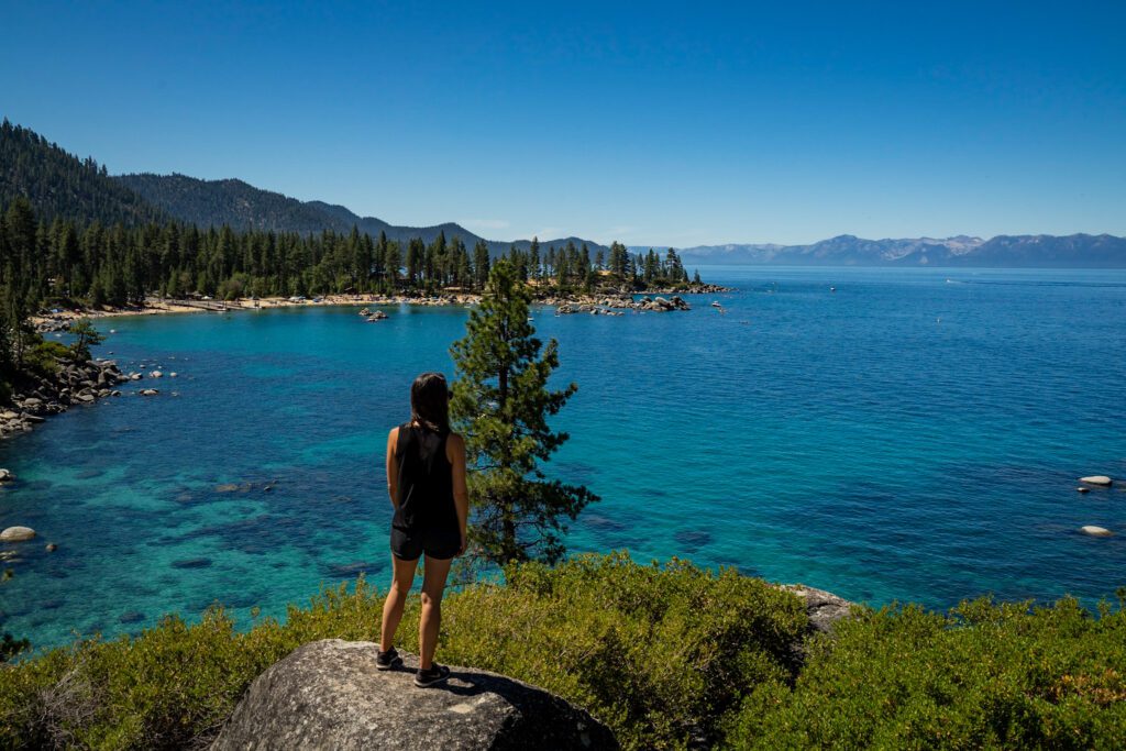
Your last stop on this road trip will be Lake Tahoe. The gem of the Sierra, Lake Tahoe is the largest, and second deepest alpine lake in North America.
With 72 miles of shoreline and clear blue waters surrounded by pine forests and framed by snow-capped mountains, it’s known for its breathtaking scenery and a wide range of activities and attractions.
What to Do
- Drive around the Lake: A great way to appreciate the beauty of Lake Tahoe is to drive around it. There’s so many vista points and scenic points of interest that you’ll want to plan on at least a few hours.
- Emerald Bay: Emerald Bay is one of the prettiest spots around Lake Tahoe and a must see. It’s the only inlet on the lake, and also home to the lake’s only island, Fannette Island. Sunrise and sunset are spectacular here. Also nearby are Eagle Falls and Vikingsholm, a Scandinavian castle.
- Take a Hike: There are hundreds of miles of trails around Tahoe. Even with limited time you can do a great hike or two. Top options to consider include Eagle Lake and Eagle Falls, the Rubicon Trail, Castle Rock, Echo Lakes, and Five Lakes. For more information, check out our guide on the 15 Best Hikes in Lake Tahoe.
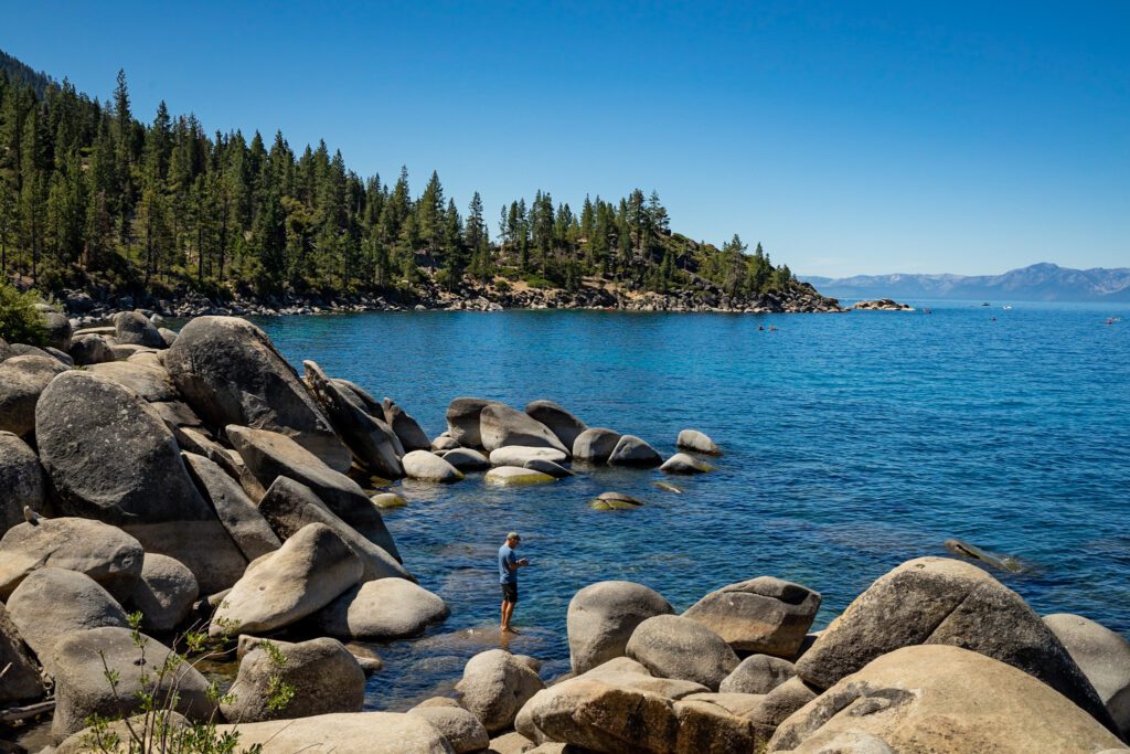
- Spend Time On the Beach: With more than 40 beaches and 72 miles of shoreline, you have plenty of options. Sand Harbor is one of the prettiest and most popular beaches in Tahoe, with giant boulders and long stretches of sand. Nevada Beach is a local favorite and has a long and wide stretch of sand. Zephyr Cove offers rentals and a great beach bar. Or hike to Secret Cove or Chimney Beach to escape the crowds.
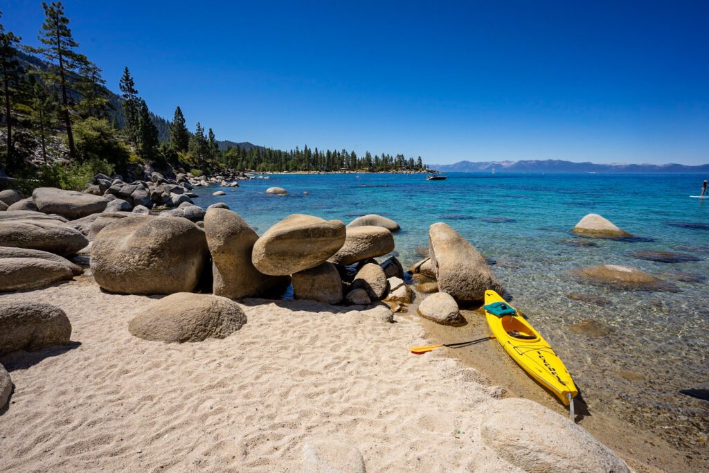
- Get Out On the Water: You need to get out on Lake Tahoe to really appreciate her beauty. Standup paddleboarding and kayaking are both popular and you can find rentals at many beaches. You can also go for a dip, though be warned that the water will be cold! Or opt for a boat cruise like the M.S. Dixie Cruise.
If you have more time, check out our guide on how to spend 3 Days in Lake Tahoe.
Where to Stay
Camping
There are more than a dozen campgrounds around the lake. Here are our top picks.
- Eagle Point: Located on a promontory at the entrance to Emerald Bay, Eagle Point offers more than 100 tent and RV (no hookup) sites, many of which offer stunning views of the lake. Amenities include picnic tables, fire grills, bear lockers, flush toilets, coin showers, and drinking water. Open mid May to early September.
- Nevada Beach: Located in Stateline next to Nevada Beach, there are 54 sites for tents and RVs (no hookups). Amenities include picnic tables, fire grills, bear lockers, flush toilets, and drinking water. Open mid May to mid October.
- William Kent: Located on the northwest shore near Tahoe City, there are more than 80 sites for tents and RVs (no hookups) and three yurts, with the lake across the street. Amenities include picnic tables, fire grills, bear lockers, flush toilets, and drinking water. Open late May to mid October.
Lodging
South Lake Tahoe offers a lot of hotel options, including casinos. The North Shore is quieter, but there are hotel options as well. Vacation rentals are also popular around the lake.
- Basecamp Tahoe South: Located in South Lake Tahoe, just minutes from Heavenly Village, this eco-friendly boutique hotel offers a variety of room options, a rooftop hot tub, and outdoor beer garden with fire pits and live music.
- Basecamp Tahoe City: Located in the heart of Tahoe City on the northwest shore, the lake is just minutes away. There’s also a sun terrace and a cozy lobby bar.
You Might Also Like
- MAMMOTH LAKES: What to Do in Mammoth Lakes in the Summer
- MAMMOTH LAKES: 9 Staggeringly Beautiful Mammoth Lakes Hikes for Your Bucket List
- MAMMOTH LAKES: Hiking the Outrageously Beautiful Duck Pass Trail
- LAKE TAHOE: The Best Things to Do in Lake Tahoe in the Summer
- LAKE TAHOE: 15 Stunning Hikes Near Lake Tahoe
- LAKE TAHOE: How to Spend 3 Amazing Days in Lake Tahoe
- DEATH VALLEY: How to Plan an Amazing Death Valley Itinerary
- YOSEMITE: A Picture-Perfect 2 Day Yosemite Itinerary
Plan an Unforgettable California Adventure
Heading to California? We’ve got all sorts of super detailed, in-depth California travel guides written by locals to help you plan an amazing trip.
- San Francisco: We’ve got a guide to spending 3 days in SF, one day in San Francisco for planning a shorter trip, and a complete guide to finding the perfect place to stay in San Francisco. We also have guides to 14 perfect weekend getaways from San Francisco and the best day trips in the Bay Area. Oh, we almost forgot, here are the 15 best hikes near San Francisco, written by two Bay Area locals.
- Los Angeles: Read our perfect 2 Day L.A. itinerary, our guide to spending one amazing day in L.A. (with two versions!), and a guide to helping you figure out where to stay.
- San Diego: Learn how to spend a day in San Diego, a weekend in San Diego, and where you should stay.
- Lake Tahoe: Plan the perfect summertime adventure with our 3 day Tahoe itinerary, guide to the best hikes, and our guide to the best things to do in Tahoe.
- Santa Barbara: We have a guide to planning a weekend in Santa Barbara, and a guide to a day trip to Santa Barbara from Los Angeles if you’re pressed for time.
- Mammoth Lakes: To plan a perfect getaway in the Eastern Sierra, read our guide to the best things to do in Mammoth Lakes in the summer. Plus, our guide to the best hikes in Mammoth, featuring the epic climb to the top of Duck Pass.
- Big Sur: Plan the perfect weekend away with our complete Big Sur itinerary.
- Yosemite National Park: Plan an amazing trip with our guide to planning an amazing Yosemite itinerary, and our guide to choosing where to stay at Yosemite.
- Joshua Tree National Park: Plan the perfect trip with our perfect weekend itinerary (or a day trip, if you have less time), a guide to the best hikes, and some cool places to stay in Joshua Tree.
- Death Valley National Park: We have a SUPER detailed guide to planning the perfect Death Valley itinerary, and a guide to the best hikes in Death Valley National Park.
- California Road Trips: See the best of the Pacific Coast Highway on our San Francisco to San Diego road trip, or make the trip up Highway from on a Los Angeles to SanFrancisco road trip. If you’re more into mountains than beaches, a Highway 395 road trip from Los Angeles to Lake Tahoe might be more your speed.