The 17 Best Hikes on the Oregon Coast: A Complete Guide
You haven’t truly experienced the magic of Oregon until you tap into the best hikes on the Oregon Coast. Despite visiting the Oregon Coast at least once a year as a kid, I didn’t realize how special Oregon’s coastline was until I visited a few beaches on the East Coast.
Sure, the warm water and white sand was lovely, as was the rocky coastline in the Northeast. But somehow hiking on the Oregon Coast feels so much more wild and isolated. I’d take waves slamming into high cliffs, arches that reveal themselves at low-tide and mossy, old growth forests over lazy white sand beaches any day.
The Oregon Coast stretches for about 350 miles along the Pacific Ocean. Much of this stretch is where the mountains meet the ocean. Trust me when I say this collision makes for an epic place to hike.
There are so many different kinds of hikes on the coast. You can seek out dunes and cliffside ocean views. You can explore out on rocky capes and lookouts. Or you can immerse yourself in dense coastal forests. It’s a diverse ecological wonderland and one of my all-time favorite places to go hiking.
Planning a trip to the Oregon Coast? Don’t miss our guide to the best stops on an Oregon Coast road trip.
Disclaimer: Some of the links below are affiliate links, which means that if you click on one and purchase something, we make a small portion of the sale at no additional cost to you. It goes without saying that we would never recommend something we wouldn’t use or do ourselves.
When to Visit the Oregon Coast
The Oregon Coast experiences all four seasons, though wet and cool is the common thread through much of the year. I always recommend bringing a rain jacket or extra layer hiking. Likewise, some trails can be muddy year-round due to moisture in the air, so be mindful of your footwear when hiking.
The Northern Oregon Coast and Southern Oregon Coast experience somewhat different weather. The Southern end is warmer and sunnier in both the winter and the summer, though it gets the most rain in the winter. The Northern Oregon Coast can be more wet and rainy and is much cooler in the winter, even getting a small amount of snow occasionally.
May to August is the most popular time for hiking on the coast. Wildflowers are blooming, waterfalls in Oregon are flowing at full force, the rain is beginning to ease up, and the days are incredible when the sun is out. Weekends, especially holiday weekends, can be really crowded on the Oregon Coast. It’s best to start out early or stick to weekdays if you want to avoid crowds.
September and October are a bit cooler, but are lovely months to go visit the Oregon Coast since the crowds tend to die down and the seasonal color changes can be absolutely gorgeous. Don’t forget your rain jacket, as storms blow through often in the fall. Migrating whales pass by the Oregon Coast this time of year.
November to April on the Oregon Coast is pretty magical if you don’t mind bundling up. There is rarely snow, but you can likely count on quite a bit of rain. This means hardly any crowds and variable trail conditions, but if you have the gear and the gusto, you’ll have peaceful Oregon Coast hikes. Trails can be really muddy in the winter. Make sure you have appropriate footwear for the hike you have planned. January is the best month for whale watching.
Wondering what to wear on a hike? Check out our guide to what to wear hiking for our exact hiking wardrobe, and recommendations on what to wear in each season.
Tips for Hiking on the Oregon Coast
Be prepared for weather. On the coast storms can roll in quickly. Bring extra layers in case you get caught in a downpour. Likewise, it can be deceivingly hot on some days in the summer, especially if you are on sand dunes. Don’t forget to pack water no matter the weather.
Always check the tide if you are hiking a trail that will put you near the ocean or on a beach. Sometimes sections of trail can be impassable during high tide. Likewise always be mindful of sneaker waves.
Trails can be muddy and slick. This is especially true after rainfall and in the winter months. Wear appropriate footwear and clothing. Consider bringing trekking poles. Steep trails or trails that don’t receive much sun can be really muddy and slippery. Watch your step and take your time.
Keep an eye out for wildlife. I always have an eye and an ear open while hiking on the coast. There are so many opportunities to see birds, wildlife, and little forest rodents, as well as sea creatures like whales, seals, sea lions, and dolphins. In some places you can see sea turtles. It’s a good trip to remember your binoculars and a camera, just make sure you have some sort of waterproof carrying case for your camera.
Treat yourself post-hike. One of my favorite things about hiking is the post-hike meal. There are so many great restaurants on the coast. A meal of fresh-caught seafood and good cold beer is the perfect way to end a day of hiking.
Want to discover more great hikes in Oregon? We’ve got a bunch of Oregon hiking guides for you.
The 17 Best Hikes on the Oregon Coast
Below, you’ll find 17 great hikes to add to your Oregon hiking bucket list, organized from north to south along the coastal route from Astoria to Brookings.
Northern Oregon Coast Hikes
Fort to Sea Trail
- Length: 6.1 miles one-way or 13-miles out & back
- Elevation Gain: 530 ft.
- Trail Type: One-Way or Out & Back
- Difficulty: Easy
- Trailhead Location
Just as the trail’s name suggests, this hike begins at Fort Clatsop and takes you right to the Pacific Ocean. The coolest part about this hike is the different biomes it passes through. Beginning at Fort Clatsop, the trail travels through a temperate rainforest before dipping down and traversing through cattle pastures and farmland. The path then zig-zags through Sunset Beach State Recreation Site and down to the beach.
You can park a car at either end and make this a shuttle or do the full hike as an out and back. You can also start at Sunset Beach and hike this trail backwards from sea to Fort Clatsop. Either way is a pleasant hike. Dogs are allowed on this trail but must be kept on leash.
Saddle Mountain
- Length: 5 miles
- Elevation Gain: 1,900 ft.
- Trail Type: Out & Back
- Difficulty: Hard
- Trailhead Location
Saddle Mountain is a hard hike that will make you work for the views. If you can conquer the uphill hike, you will be rewarded with sweeping views of the Pacific Ocean, Mt. Hood, and even a few peaks in Washington.
The trail begins from Saddle Mountain State Natural Area. There is plenty of free parking here. It’s a steep hike and can be difficult in some areas. You gain about 1,600 feet in elevation in 2.5 miles. Be cautious of muddy and wet trail conditions. The weather can change quickly here, especially on top of the mountain. Bring an extra layer and pay attention to the weather.
Clatsop Loop
- Length: 3 miles
- Elevation Gain: 785 ft.
- Trail Type: Loop
- Difficulty: Easy
- Trailhead Location
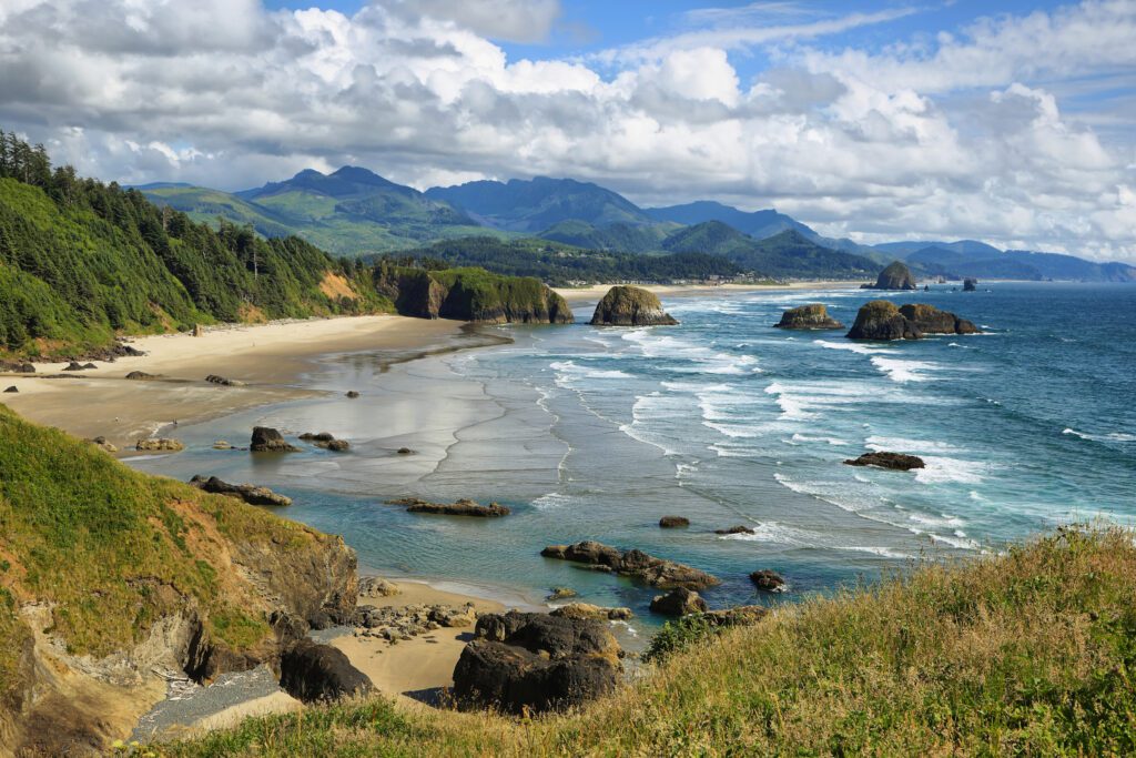
This is a short and easy hike near Cannon Beach that is great for kids. The trail begins from the Indian Beach Day Use parking lot, in Ecola State Park. The hike passes under a beautiful forest and right by a former WWII radar station. After that you reach a viewpoint for the Tillamook Rock Light, known to locals as Terrible Tilly. The loop connects with the Tillamook Head trail (below).
Tillamook Head
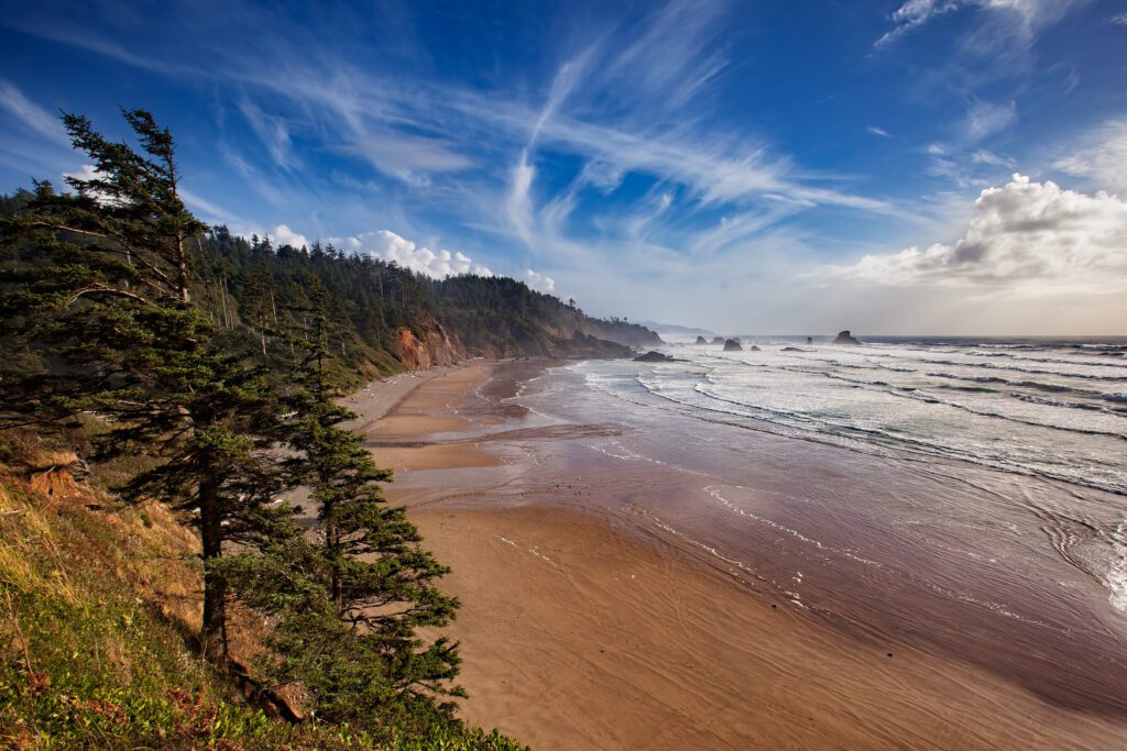
- Length: 6.3 miles or 12.6 miles
- Elevation Gain: 1,350 ft.
- Trail Type: Loop or Out & Back
- Difficulty: Moderate
- Indian Beach Trailhead Location
- Tillamook Head National Recreational Trailhead Location
Tillamook Head was the farthest point west reached by Lewis and Clark. You can do this trail two ways. You can begin from the Indian Beach Trailhead and shuttle cars, which essentially makes a longer version of the Clatsop Loop. Or you can begin from the Tillamook Head Trailhead near Seaside, which extends the hike to 12.6 miles.
Both routes are beautiful hikes, it just depends on how much of a hike you want to do.
Cape Falcon
- Length: 4.6 miles
- Elevation Gain: 623 ft.
- Trail Type: Out & Back
- Difficulty: Moderate
- Trailhead Location
This is a short and often muddy hike, but the views at the end make it worth the trek. Begin at the Cape Falcon Trailhead on the Cape Falcon Trail, within Oswald West State Park.
As you hike away from Highway 101, you’ll come to a sign. You can take a few different side trips you can make here. Turn right to follow the trail toward Cape Falcon. Once you come to a large landslide area, the trail drops down lower. You can take a side trail here to the small but scenic Blumenthal Falls. Continue on toward the end of the trail, which offers several viewpoints of Cape Falcon, Neahkahnie Mountain and the town of Manzanita.
This is a popular trail for bird watching and wildlife viewing. Dogs are allowed but must be kept on leash. Note that it can be a muddy hike all times of the year.
Neahkahnie Mountain
- Length: 5 miles or 2.7 miles
- Elevation Gain: 2,300 ft.
- Trail Type: Out & Back
- Difficulty: Moderate
- North Trailhead Location
- South Trailhead Location
Neahkahnie Mountain is located within Oswald West State Park. You can reach its summit from either the north or south side. Both routes are relatively short but do offer a different experience and views. It’s not recommended to make this a loop because you would have to walk along the shoulder of Highway 101 for quite a ways.
The North Neahkahnie Mountain Trail begins from a pull out on the side of Highway 101. The trail is a 5-mile round trip and has awesome wildflowers in the late spring and summer. It’s basically switchbacks all the way up, until you drop into a saddle then one last climb to reach Neahkahnie Mountain Viewpoint. The rare open area has a steep path up to a peak where you can see to the south all the way to Nehalem Bay Mouth. Return the way you came.
To access the South Neahkahnie Mountain Trailhead, take Neahkahnie Mountain Road off Highway 101. The trailhead begins at the end of the road. This is a short and steep 2.7-mile round trip. Expect lots of switchbacks through a beautiful forest before reaching Neahkahnie Mountain Viewpoint. Take in the views then return the way you came.
Cape Lookout
- Length: 5 miles
- Elevation Gain: 900 ft.
- Trail Type: Out & Back
- Difficulty: Moderate
- Trailhead Location
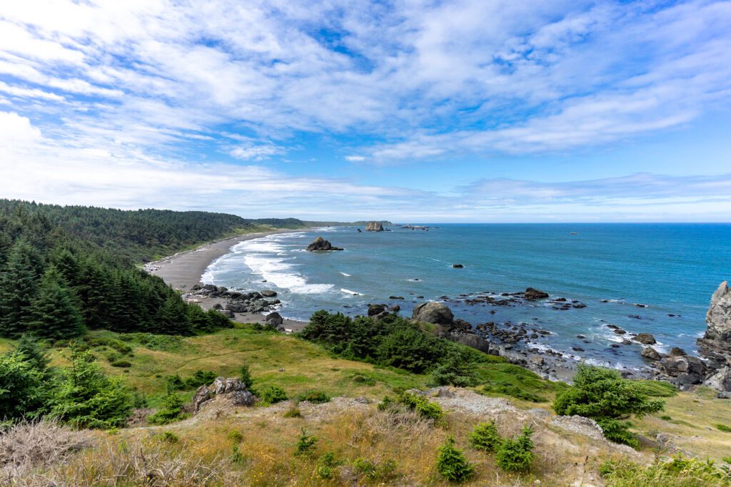
This 5-mile round-trip takes you out the tip of Cape Lookout. You can see landmarks up to 50 miles away on a clear day. Another reason it’s a favorite hike is the wildlife viewing. Cape Lookout is the best place on the Oregon Coast for whale watching from the shore. In the fall and spring, you can see migrating gray whales make a detour around the peninsula. Sea lions, seals, sea birds, and occasionally dolphins are seen from Cape Lookout.
It’s a mostly flat trail, which can get muddy in the winter and spring. You can connect two sections of the Oregon Coast Trail to make your hike longer. Parking is available at the Trailhead or the nearby Cape Lookout State Park Campground. If you stay at the campground, you can access the Cape Trail via the OCT North Trail.
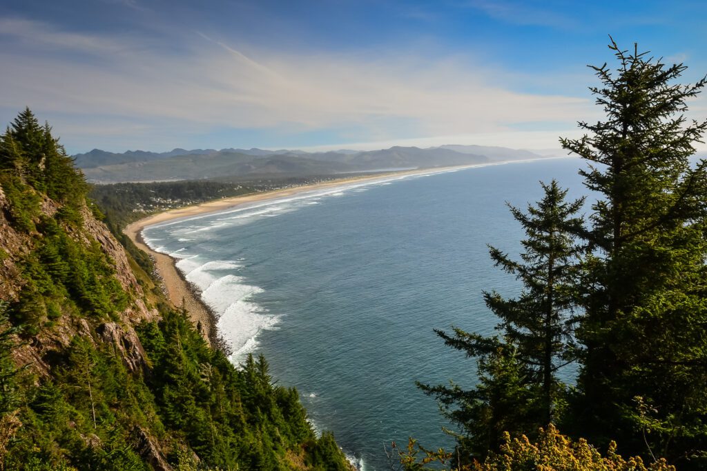
Cascade Head
- Length: 6.3 miles
- Elevation Gain: 1,380 ft.
- Trail Type: Out & Back
- Difficulty: Moderate
- Trailhead Location
Cascade Head is one of the best hikes with a view on the Oregon Coast. It’s no surprise that it’s a popular hike, too. Consider starting out early if you want to avoid crowds.
There are several creek crossings as you climb through the dense forest. A mile or so in you break free of the forest and enter a headland meadow. The views here are incredible. You will see the Salmon River Estuary below and Lincoln City off in the distance. The trail continues on a ridge then offers a view off a high cliff of the coastline to the north. There is an upper viewpoint at the end.
This trail can be really muddy after rainfall. It’s an awesome hike on a clear day.
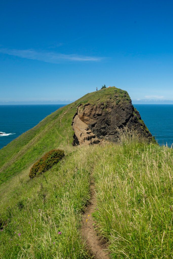
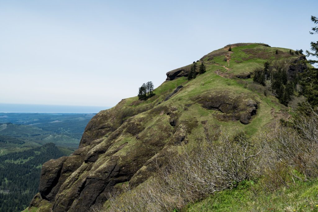
God’s Thumb
- Length: 4.6 miles
- Elevation Gain: 1,025 ft.
- Trail Type: Out & Back
- Difficulty: Moderate
- Trailhead Location
God’s Thumb is one of the most popular hikes near Lincoln City. The thumb-like cliff is covered with beautiful grasses, the ocean waves crash into the cliffside below, and there is an awesome view of Lincoln City in the distance.
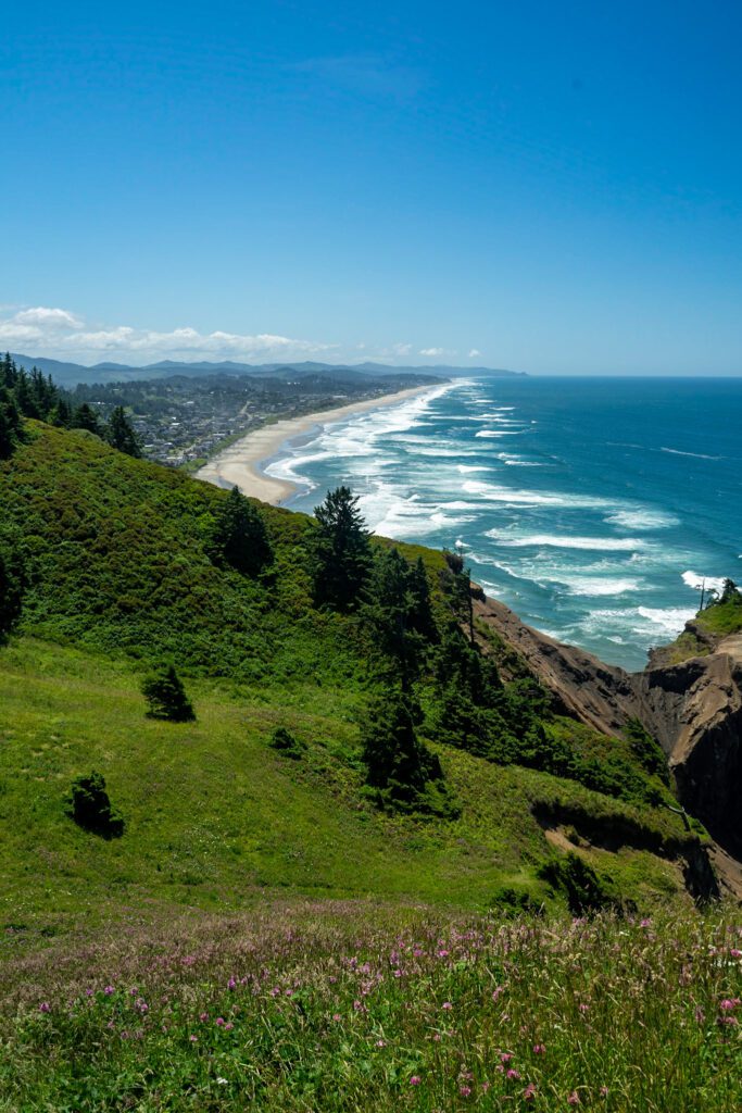
Parking for this trail is important because the trail is surrounded by private property. You will park at Road’s End State Park parking lot, then take Road’s End Trailhead at the end of Port Drive to access God’s Thumb Trail.
The trail traverses up a grassy ridge toward the thumb. Elk often rest here so keep your eye out. This trail can be extremely muddy in the winter and spring. There are some long uphill stretches and steep cliffs. It is a dog-friendly trail but they must be on leash.
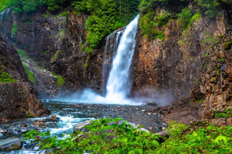
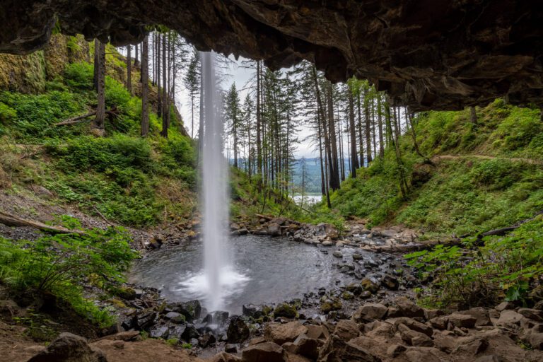
Drift Creek Falls
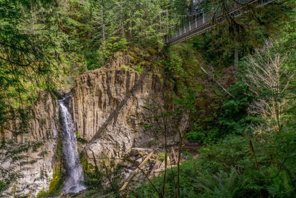
- Length: 3 miles
- Elevation Gain: 490 ft.
- Trail Type: Out & Back
- Difficulty: Easy
- Trailhead Location
A pleasant year-round hike through a beautiful coastal forest. You will pass over a huge suspension bridge before reaching the 75-foot Drift Creek Falls.
Start from the trailhead and traverse into the old forest. You will reach a fork with the North Loop, which will add an additional mile to your hike. Continue on the North Loop or the main trail and reach the suspension bridge crossing over Drift Creek. The bridge is 100-feet high and 240-feet long. Shortly after you will arrive at the beautiful Drift Creek Falls.
This trail is wide and well-graded. It’s uphill on the way back but the climb is fairly easy.
Want to discover more great hikes in Oregon? We’ve got a bunch of Oregon hiking guides for you.
- The 16 Best Hikes in Oregon: A Complete Guide to Hiking in Oregon
- Hiking at Mount Hood: Complete Guide to the Best Hikes at Mount Hood
- Hiking on the Oregon Coast: The 17 Best Hikes on the Oregon Coast
- Hiking in the Columbia River Gorge: 12 Amazing Hikes in the Gorge
- Hiking in Portland, Oregon: A Local’s Guide to the Best Hikes in Portland
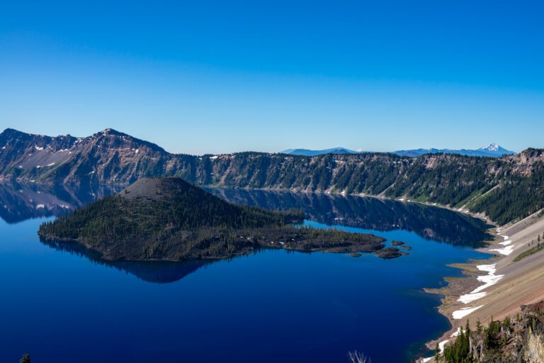
- The 7 Best Hikes in Crater Lake National Park
- The Best Hikes near Hood River: A Complete Guide
Southern Oregon Coast Hikes
Hobbit Trail
- Length: 3 miles
- Elevation Gain: 960 ft.
- Trail Type: Lollipop
- Difficulty: Easy
- Trailhead Location
This is a great trail for many reasons. It’s not too long and is beautiful year-round and in all kinds of weather. It’s a good one for variable weather conditions and hiking with kids. You can also combine this with China Creek Loop for a longer hike.
The trailhead begins from a small pull out on Highway 101. You can park here or across the highway at China Creek Trailhead. As soon as you begin it feels like you’ve been transported into a fairy tale forest. The forest is dense and full of huge moss-covered trees. It feels like a gnome could hop out at any moment.
You will quickly reach a sign for Hobbit Beach and Heceta Head. Both hikes are short and can be combined for an additional three miles. Start out early and go to Hobbit Beach first. You’ll likely have this peaceful secluded beach to yourself. Then backtrack to the sign and go out towards Heceta Head. This part of the trail is uphill and can be slippery after rain. You will eventually reach Heceta Head, which has an adorable lighthouse and great views.
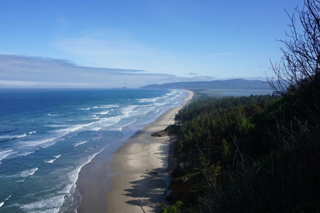
Tahkenitch Dunes
- Length: 6 miles
- Elevation Gain: 702 ft.
- Trail Type: Loop
- Difficulty: Moderate
- Trailhead Location
This hike goes through a little bit of every environment found on the Oregon Coast. It’s also an area of the Oregon Dunes where ATVs aren’t allowed, which makes for a great day-trip or weekend backpacking route.
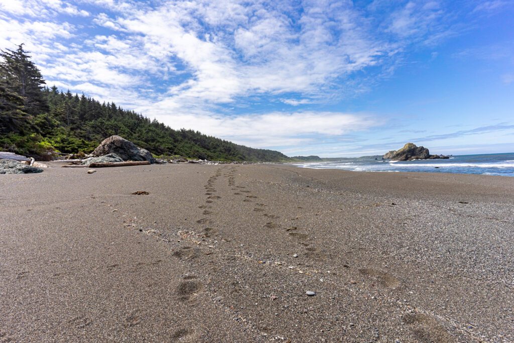
Begin at Tahkenitch Campground Trailhead. The first mile or so goes through conifer and spruce forest. At the fork, go right toward the dunes. Walk across the dunes, which is more of a workout than you might think, then re-enter a smaller stand of shore pine before reaching the beach. There is not much room on the beach at hide tide, so be sure to check tide before starting out. Continue down the beach and re-enter the trees to complete the loop. Stop by Threemile Lake, a freshwater lake where you can wash the sand and saltwater off your feet.
Dogs not allowed on this trail March through September. Start out early if you are doing this hike in the summer. The dunes can be very hot. Parking at the campground is $5 per day or a valid Recreation Pass.
John Dellenback Dunes Trail
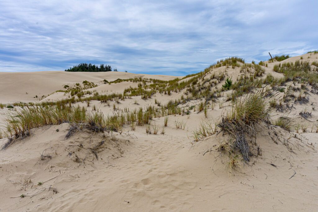
- Length: 5.5 miles
- Elevation Gain: 300 ft.
- Trail Type: Loop
- Difficulty: Moderate
- Trailhead Location
This is another hike with several scenery changes. It starts out passing through with a lush conifer forest, then opens up to the widest stretch of sand dunes on the Oregon Coast.
Through the dunes the trail is marked with wooden poles with a blue stripe around the top, but they can be easy to lose. Keep heading toward the beach and if you lose your bearings, climb the tallest dune. Before reaching the coastline, you will pass through another section of dense coastal forest and then out right onto the ocean.
You can park at John Dellenback Dunes Trailhead in Eel Creek Campground for $5 per day. It’s a great family-friendly Oregon Coast hike. The trail is named after John Dellenback, a former Oregon Representative who pushed for legislation authorizing the Oregon Dunes National Recreation Area in 1972.
Sunset Bay to Cape Arago
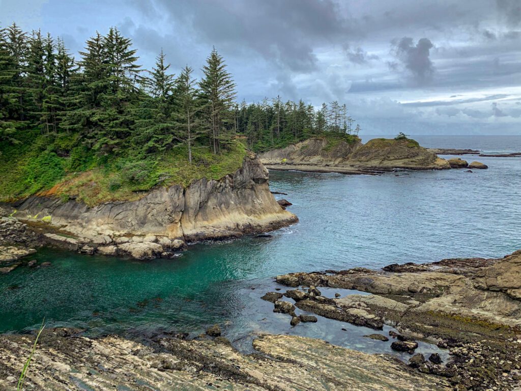
- Length: 8.5 miles
- Elevation Gain: 702 ft.
- Trail Type: Out & Back or Loop
- Difficulty: Easy
- Trailhead Location
This is another easy hike with a big reward. You can do this one at a one-way or a longer round-tip. I recommend doing the full loop. There are so many cool parts to this hike, it’s worth taking your time.
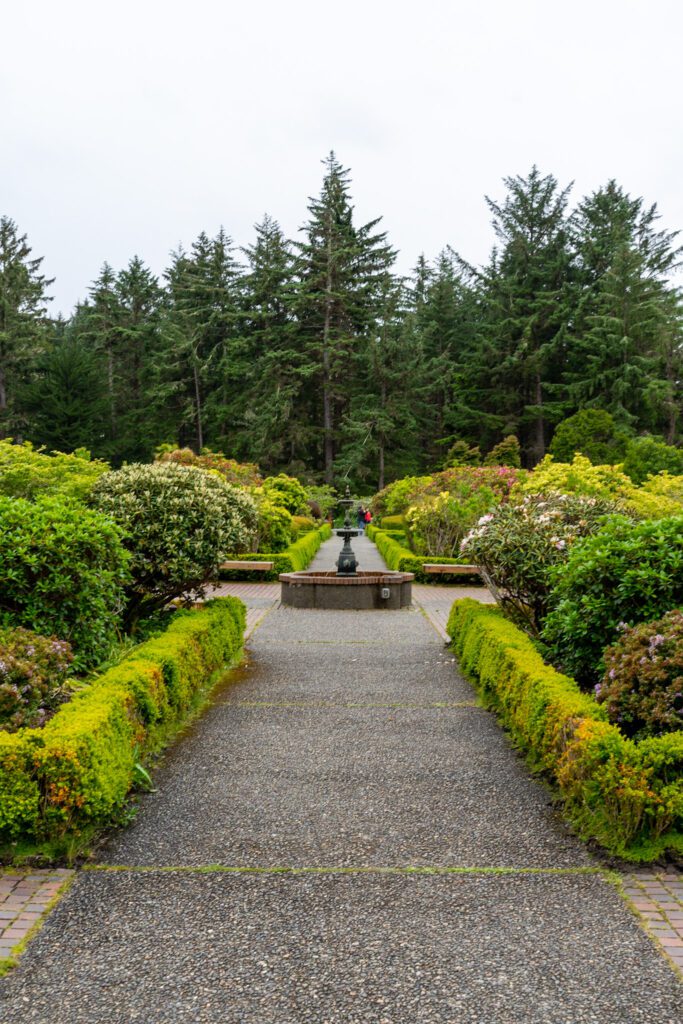
Begin from the trailhead in Sunset Bay State Park. You can park in the trailhead parking area for free. The first highlight is the Cape Arago Lighthouse viewpoint, which was erected in 1866. Continue on the trail and you will eventually pass through the beautiful gardens in Shores Acre State Park, then arrive at Cape Arago viewpoint.
Here you can see Cape Blanco and Humbug Mountain to the south. Looking north, you can see Simpson’s Reef, where hundreds of seals and sea lions hang out during low tide. The return route takes you a slightly different way along the coast where you can see interesting rock formations and ocean views.
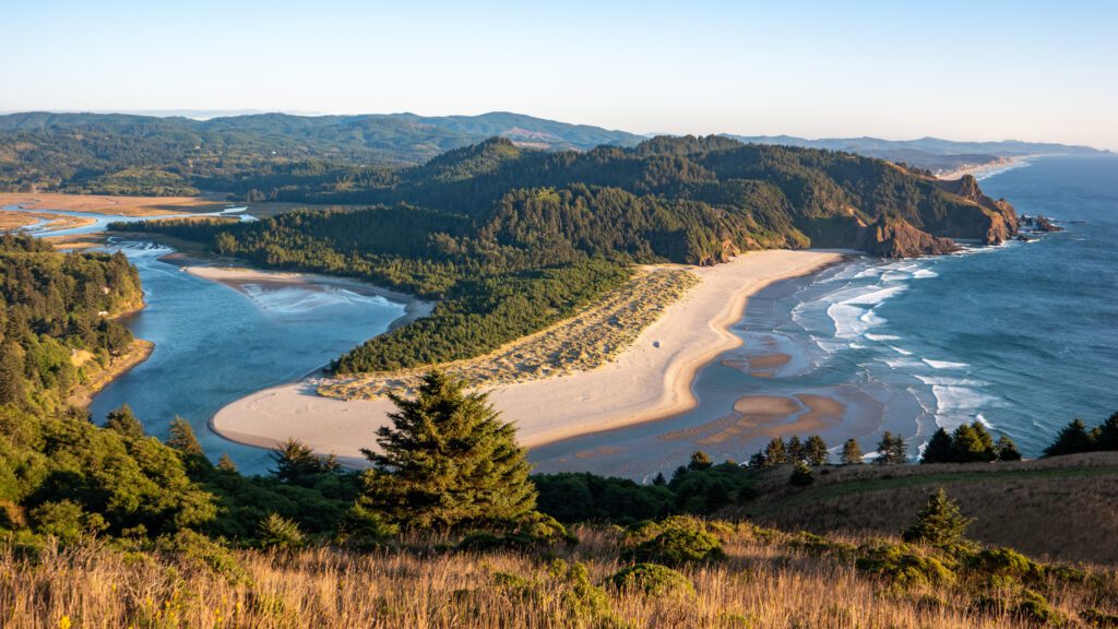
Floras Lake to Blacklock Point
- Length: 8.5 miles
- Elevation Gain: 200 ft.
- Trail Type: Loop
- Difficulty: Easy
- Trailhead Location
This is a great hike in one of Oregon’s lesser-known state parks that takes you through thick coastal woodland and out to the rocky cliffside of Blacklock Point. Note that this trail can be pretty wet in the winter and early spring. By the summer, rhododendrons are in full bloom along the trail.
Park at the Cape Blanco Airport for free. The trailhead for Blacklock Point, Floras Lake, and the Oregon Coast Trail begins here. The trail is mostly flat and goes through a Douglas Fir forest and out toward the beach at times. The views from Blacklock Point are amazing. There are several small rock islands and beautiful coastal cliffs to admire. Make sure to take the quick detour down to a deserted beach that you’re guaranteed to have to yourself.
There is a longer trail that can be done starting from the Boice Cope Park and Campground.
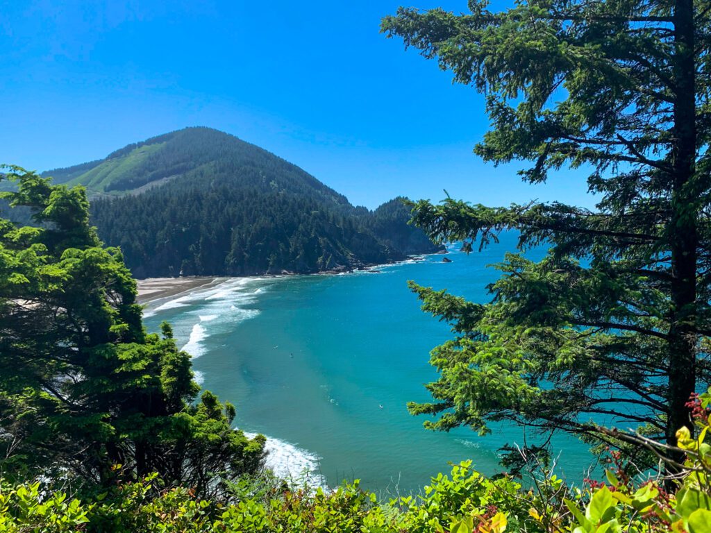
Humbug Mountain
- Length: 5.5 miles
- Elevation Gain: 1,750 ft.
- Trail Type: Lollipop
- Difficulty: Moderate
- Trailhead Location
Hike to the summit of one of the tallest mountains on the Oregon Coast! The stunning ocean views from the summit are worth the hike. On a clear day, you can see down the coastline for miles. Trail runners will love it for a short uphill workout.
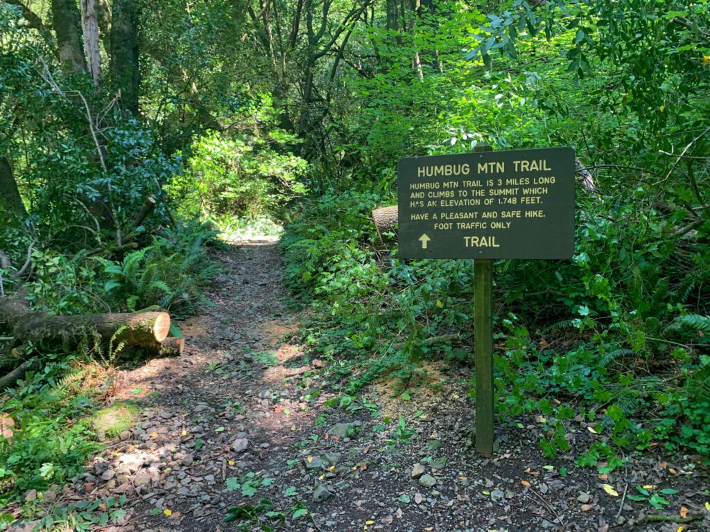
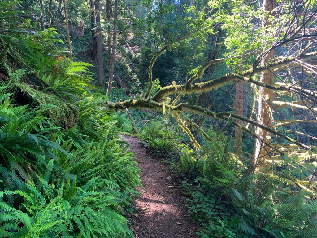
The trailhead is accessed from a turnout off Highway 101, across the road from Humbug Mountain State Park Campground. Campers will access the trail via a tunnel that passes below the highway. About a mile in, you’ll come to a fork in the trail. Take a right to follow the west route up to the summit.
The view from the top is simply stunning. A few log benches have been constructed to take a rest on. Continue on down the east side to complete the loop and join back up with the main trail back to the trailhead.
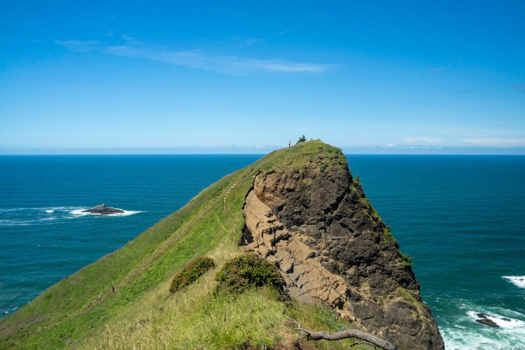
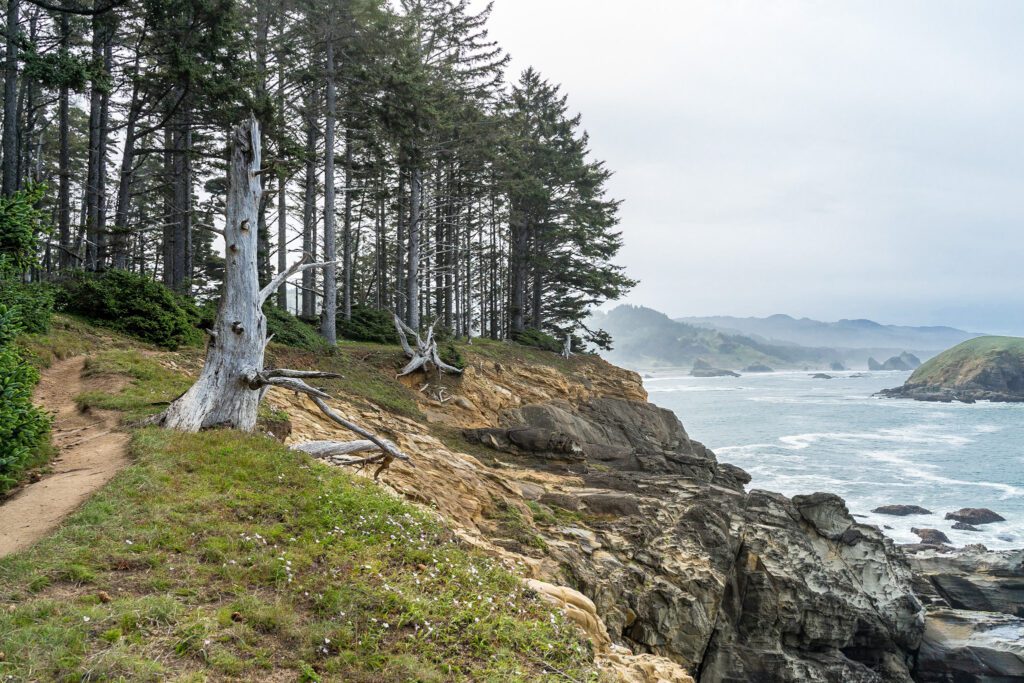
Cape Sebastian Trail
- Length: 2.7 miles
- Elevation Gain: 718 ft.
- Trail Type: Out & Back
- Difficulty: Moderate
- Trailhead Location
If you want a short hike with a big reward, this is the best Oregon Coast hike for you. The trail begins at Cape Sebastian Viewpoint just off Highway 101, then switchbacks gradually through a shady, old growth forest right down to the ocean.
The trail brings you out onto a rocky bench at the base of Cape Sebastian, where the ocean waves crash spectacularly right beside you. Keep going all the way down to the beach using the rope handrail — it’s totally worth it. The rock formations are super interesting and the ocean views are amazing. You may even get lucky enough to see a whale in the distance. It’s a lovely place to pack a picnic and enjoy the afternoon.
Be sure to check the tide before you set out on this trail. The beach may be inaccessible at high tide. Also remember that you are ascending on the way back, so give yourself plenty of daylight for the trek back to your car.
Discover the Best Hikes in Oregon
- The 16 Best Hikes in the State of Oregon: An Oregonian’s Guide
- The 13 Best Hikes Near Portland (Local’s Guide)
- The 12 Best Hikes in the Columbia River Gorge
- Hiking Near Mt. Hood: Gorgeous Hikes Around Hood
More to Explore in Oregon
Enjoying this guide? We’ve got more Oregon travel guides to help you explore the best of Oregon and fall head-over-heels in love with it like we have.
- 25 Incredible Places to Visit in Oregon, the Best State in the Union
- How to Plan An Unforgettable Oregon Road Trip
- A Complete Oregon Coast Road Trip Itinerary
- 16 Incredible Hikes in Oregon
- One Day in Portland: The Best of Portland in a Day
- A Weekend in Portland: A Portland Itinerary for First Timers (Local’s Guide)
- Where to Stay in Portland: A Local’s Guide to 8 Areas to Stay
- The Best Hikes Near Portland (Local’s Guide)
- The Best Day Trips from Portland
- Amazing Weekend Getaways from Portland, Oregon
- The Best Things to Do in Hood River, Oregon
- What to Do in Cannon Beach: A Complete Getaway Guide
- How to Plan an Amazing Crater Lake Itinerary (1 or 2 Days)
- 24 Amazing Cabins in Oregon (Coast, Mountains, and More)
- Glamping in Oregon: 23 Cool Glamping Spots to Book for your Next Getaway