The 15 Best Hikes near Vancouver, B.C.: A Complete Guide
Vancouver is a wild world unto itself, but zoom out and you’ll see that it is surrounded by vast expanses of mountain wilderness. It is arguably one of the best staging cities for outdoor adventure, with some of the most epic hikes less than a 90-minute drive away. If you dream of sub-alpine fields and towering snowy peaks, meandering rivers cutting through canyons, or that sparkling turquoise lake to greet your aching feet: then enjoy this snapshot of the best hikes near Vancouver.
I’ve been exploring British Columbia for many years now and hiking is my soul-soothing activity. I can’t wait to share with you my favorite trails, and hope it inspires some serious hike-holiday planning!
Disclaimer: Some of the links in this post, like hotel and vacation rental links, are affiliate links, meaning at no additional cost to you we make a little bit of money if you click through and book. That being said, we would absolutely never recommend something to you that we don’t stand behind 100%.
Tips for Hiking in Vancouver
Here are some quick tips and things to know before you head out on your first hike near Vancouver.
Day Passes to Hike in Vancouver
Currently, Day Passes are needed to hike in certain locations from June to October. These passes are free and issued per vehicle, but you can only apply for them from 7:00 am one day in advance of your planned hike. The locations requiring passes are:
- Garibaldi Park (Diamond Head, Cheakamus, and Rubble Creek trailheads)
- Stawamus Chief Park (Chief Peaks Trail)
- Golden Ears Park (all trailheads and day use areas)
- Joffre Lakes (all trailheads)
- Mount Robson Trail (Berg Lake Trail)
Full information and reservations can be found on the BC Parks website.
Camping Passes
Passes are needed for both Frontcountry and Backcountry Camping in British Columbia. I would advise booking these as soon as you have your travel dates as some of the popular sites can really fill up.
While each park will have their own booking system, you can navigate to all of them using the BC Parks website itself.
Get to the Trailhead Early!
As you’d expect, parking lots for popular hikes can fill up fast. The early bird catches the worm! During peak summer season I’d advise getting to the more popular trailheads as early as you can to avoid cramped parking and an overcrowded trail.
What If I Don’t Have a Car?
Vancouver’s regular public transit system is quite extensive. A combination of metros, buses, and ferries can usually take you where you need to go.
TransLink serves the whole of metropolitan Vancouver and the website has all the information on schedules, routes, and fares; including very detailed service maps and a dedicated ‘Trip Planner’ feature (although Google does a good job, too!).
If you don’t have a vehicle, parkbus.ca is a great way to get to Garibaldi, Golden Ears and a few other sites. Return tickets are reasonably priced, just make sure that you’re back at the parking lot at the allocated pick-up time so you don’t get stuck.
Want to explore Vancouver? We’ve got plenty of detailed Vancouver travel guides to help you explore!
The Best Hikes in Vancouver: A Complete Guide to Hiking near Vancouver B.C.
If you look at Vancouver on a map, you’ll see it’s nicely segmented by various geographical features. I’ve split my favorite Vancouver hikes into three key areas and focused on trails within an hour of downtown Vancouver (with a few that are a bit further away, but worth it!).
- North Vancouver: The area immediately north of Burrard Inlet. Features include Lynn Headwaters Regional Park and Mount Seymour Provincial Park.
- Sea-to-Sky Highway: The area bordering Highway 99 which links downtown Vancouver with the likes of Squamish, Whistler, and Garibaldi Provincial Park.
- East Vancouver: Trails east of Burrard Inlet near Coquitlam and Golden Ears Provincial Park.
Don’t have time to read the entire guide below? Here are my top picks for the best hikes around Vancouver to help you find your next great hike.
- Hollyburn Peak: Easily one of the most rewarding hikes in terms of Vancouver views and very doable in half a day; only 4 miles long and a 30-minute drive from downtown.
- Garibaldi Lake: This full day hike can be a challenge but offers the classic British Columbia landscape: lush forest canopy, alpine meadows, shimmering blue lake, and powerful high peaks all around.
- Gold Creek Falls: There’s nothing quite like the sound of a rushing river, and this trail does not disappoint. Relatively short, easy to navigate, and just difficult enough for you to feel like you’ve earned that post-hike feast!
Hikes in North Vancouver
Despite its sprawling, urban focus; hiking in Vancouver could not be easier.
The city is split in two by Burrard Inlet, and the north shore is the gateway to some fantastic trails. This area is especially great for winter, with many easy-to-access ski areas providing ideal snowshoeing routes.
Mount Seymour
- Length: 5.1 miles
- Elevation Gain: 1,900 ft.
- Trail Type: Out and Back
- Difficulty: Moderate / Hard
- Drive Time from Vancouver: 35 mins
- Trailhead: Dog Mountain Trailhead
- Pass Required: Day Passes are only required for winter usage, but BC Parks may introduce passes for summer.
Mount Seymour lies on Vancouver’s north shore and offers a Choose Your Own Adventure type of hike. There are three peaks (referred to in the community as ‘pumps’) with the last being the most difficult to get to but worth the views.
I would only recommend doing the full trail to the Third Pump (the true summit) in the summer or early fall when there is no snow, rain, or fog as it is quite the sheer-sided scramble. Some people do summit in the winter but you’ll need ice axes, crampons, and experience!
The trail is a steady ascent so a good level of fitness is required, with some sections near the summit over 40% incline. Good shoes and steady footing are essential as there can be loose rocks and tree roots to scramble over. You can always choose to stop at the Second Pump which is only about 100 feet below the summit, and still offers exceptional views over the inlets, cityscape, and high peaks beyond.
Park at the Mt Seymour Resort Parking Lot and try to get there early. When the trail branches left to Dog Mountain, stay straight. I’d also recommend a trails app as there are a few branching trails and not as many signs.
Lynn Lake Trail
- Length: 13.1 miles
- Elevation Gain: 2,660 ft.
- Trail Type: Out and Back
- Difficulty: Hard
- Drive Time from Vancouver: 25 mins
- Trailhead Location: Lynn Headwaters Entrance Parking Lot
- Pass Required: None
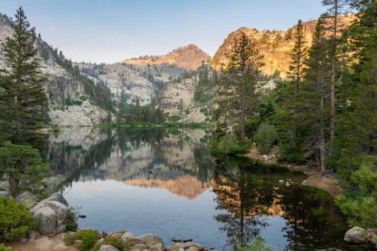
Located in Lynn Headwaters Regional Park, this hike is not for the faint of heart. There are loads of shorter and easier hikes to choose from, but this is one of my favorites and is so worth the effort! This is quite the wilderness trail which crisscrosses over the river and involves a fair amount of creek walking.
For this reason, this trail is ideally suited to the hotter summer months with less rainfall.
The incline isn’t too steep, and a few sections open out into some spectacular views of the Coast Ranges, over sprawling Vancouver, and down to the Salish Sea. Lynn Lake is your reward and is the perfect place to take a dip after a hot hike.
Due to its conditions, you won’t find many other people on this trail. In fact, we had the lake to ourselves on a day in early September; we couldn’t hear a thing except the chirping of birds and the rustle of the wind through the evergreens.
The park is subject to closures, especially in the winter, but you can stay updated on the Metro Vancouver website.
Dog Mountain Loop
- Length: 4.6 miles
- Elevation Gain: 1,160 ft.
- Trail Type: Loop
- Difficulty: Moderate / Hard
- Drive Time from Vancouver: 35 mins
- Trailhead: Dog Mountain Trailhead
- Pass Required: None
This loop is an excellent choice for those who are seeking breathtaking views without too much difficulty. Park at the Mt Seymour Resort Parking Lot and head north to the trailhead, taking the first left path about 1/4 mile in.
This will lead you up nicely to Dog Mountain then up and along the ridge of Suicide Bluffs, where you can look out over the majestic alpine peaks of Garibaldi Provincial Park. After you descend from the bluff, cut back to the parking lot or add on Mystery Lake: a charming little lagoon nestled in the evergreens.
This trail is beautiful in the winter, just be prepared for deeper snow. In the summer, exposed roots can be quite hazardous to the untrained so pay extra attention to your footing. As always, be alert for black bear activity, especially in the spring and fall.
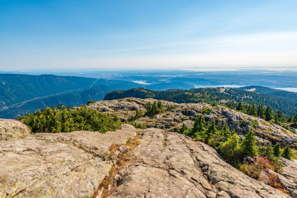
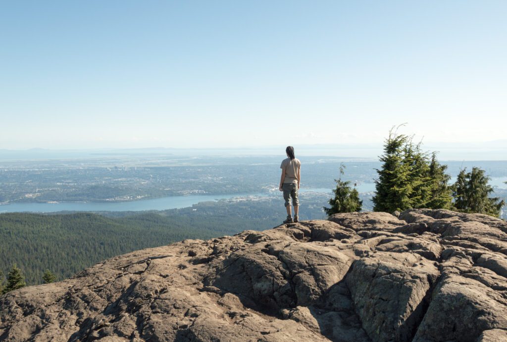
Hollyburn Peak
- Length: 4 miles
- Elevation Gain: 1,391 feet
- Trail Type: Out and Back
- Difficulty: Moderate
- Drive Time from Vancouver: 30 mins
- Trailhead: Cypress Mountain Nordic Area
- Pass Required: None
Located in North Vancouver’s Cypress Provincial Park, this classic hike is a must for those who want views, views, and nothin’ but views! I love this trail in both summer and winter, and it is a great starter hike for anyone just getting into snowshoeing.
Start at the Nordic Ski area of the park and make your way to the trailhead. The parking lot is quite small so I would advise getting there early. The trail begins with a steady ascent, and make sure you keep looking back to appreciate the sights over Vancouver and the Georgia Strait beyond.
You’ll pass a small but charming lake and, if hiking between spring and fall, you’ll traverse meadows of berry bushes (keep ears and eyes peeled for black bears), before beginning the final rocky ascent. If you’re here in the winter, do watch out for downhill skiers as this is a popular run.
The trail is well signposted throughout and there aren’t any technical sections. It’s the perfect half-day hike with an almost 360-degree vista from the peak!
Hikes Along the Sea-to-Sky Highway
This stretch of highway between North Vancouver and Whistler offers some of the most jaw-dropping hikes you can find. With granite walls, lush vegetation, and myriad waterfalls surrounding Squamish to the dramatic, snowy peaks and alpine meadows of Garibaldi Provincial Park – there is something to cater to every pair o’ boots.
In my opinion, this region offers the absolute best hiking trails around Vancouver. Be aware that day passes are now required at almost every trailhead.
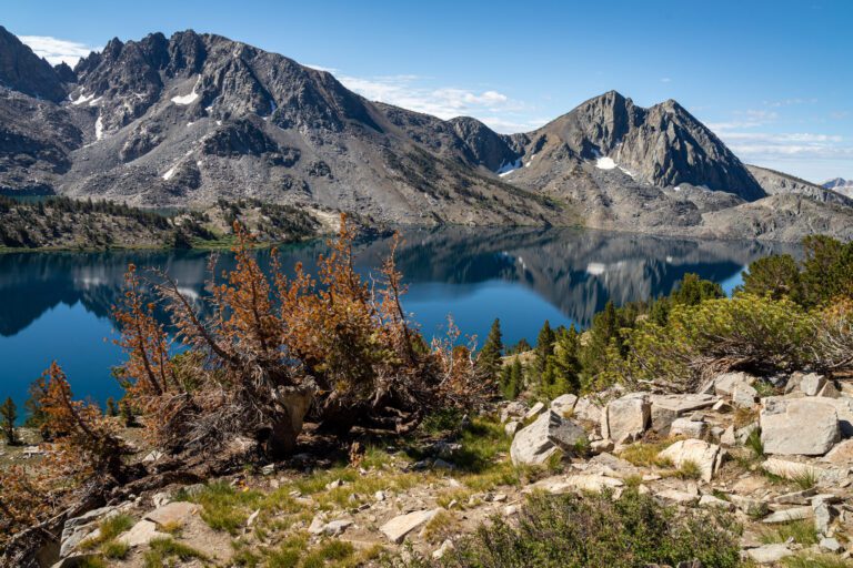
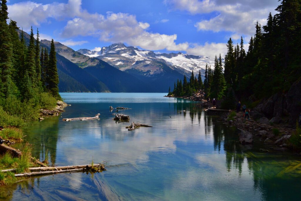
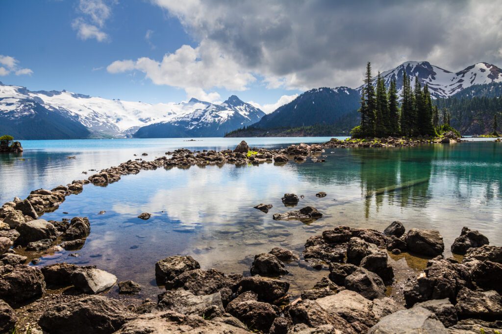
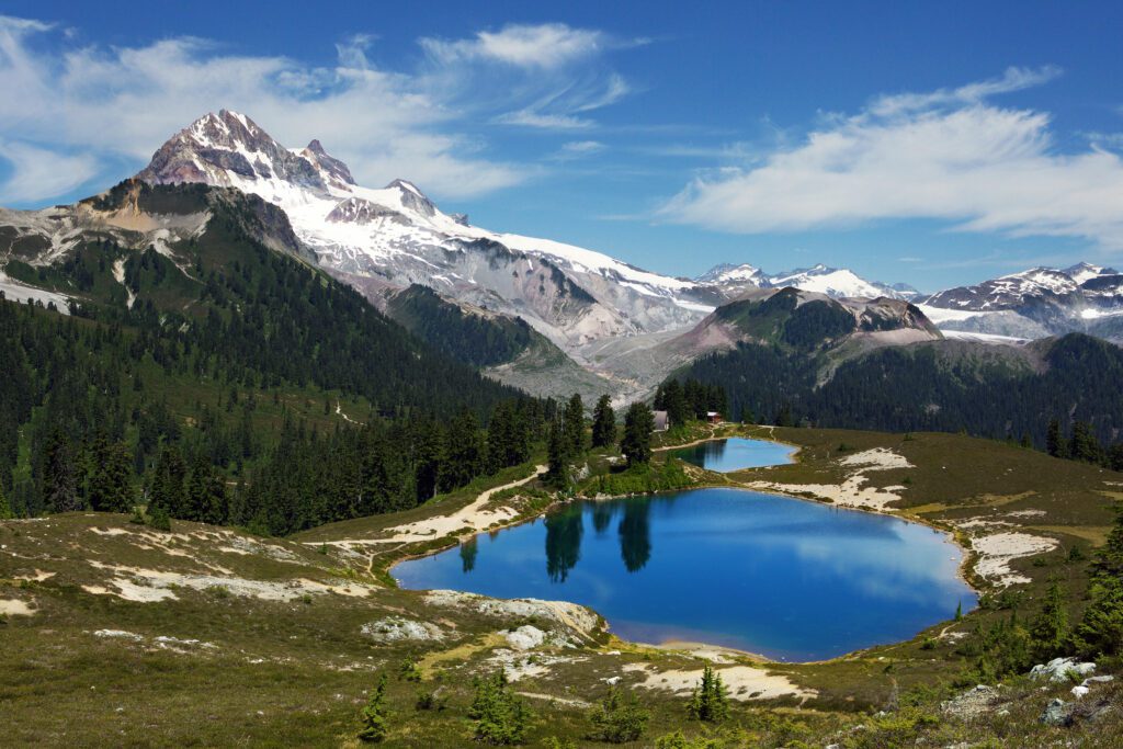
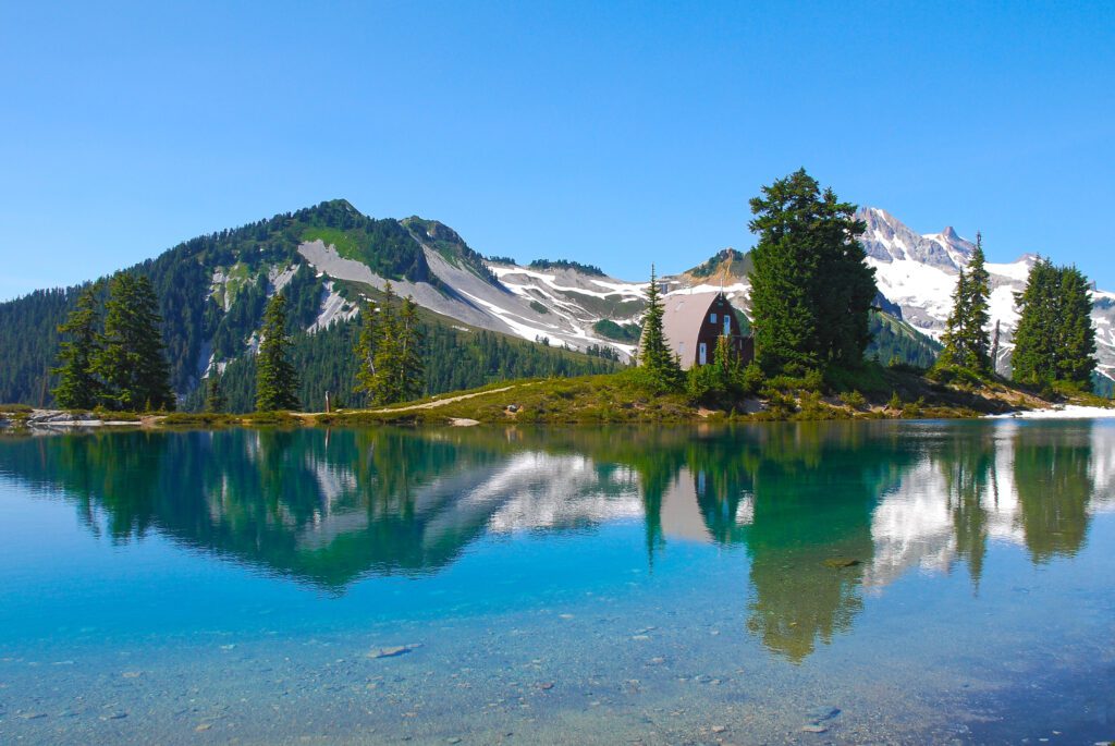
The Garibaldi Lake Trail via Taylor Meadows
- Length: 12.6 miles
- Elevation Gain: 3,694 ft.
- Trail Type: Lollipop
- Difficulty: Hard / Very Hard
- Drive Time from Vancouver: 75 mins
- Trailhead: Rubble Creek Trailhead
- Pass Required: Garibaldi Park Day-Use (June to October)
This hike can be challenging if you’re a little out of practice, but it is seriously worth the effort! This is a popular trail due to it being one of the most easily accessed day hikes in Garibaldi Provincial Park, but I’ve added the Taylor Meadows loop for a little extra finesse. Starting at the Rubble Creek parking lot, the first few miles (switchback city) are steep and can be tough as you ascend through a beautiful covered forest.
Eventually, you’ll reach the turn-off to Garibaldi Lake (right), but keep left as you want to go through Taylor Meadows and do the loop in a clockwise direction. The next leg takes you through some incredible alpine forest, the scenery of course is dependent on the season in which you hike!
Dramatic peaks such as the Black Tusk and Mt Garibaldi begin to come into view, and open fields of wildflowers stretch out before you.
Bear right to Garibaldi Lake when you have the option and reward your day’s efforts with a dip in the chilly lake, or just take a rest by the crystal-blue water’s edge. The way back can be hard on the knees so definitely bring hiking poles if you need them.
Go a little further…
For those wanting an extra challenge: start early and head through Taylor Meadows but bear left to Panorama Ridge and back. This adds on an additional 5 miles and 1,500 feet of elevation gain, but the views from the ridge are unparalleled: a myriad of azure lakes and snowy peaks at your feet.
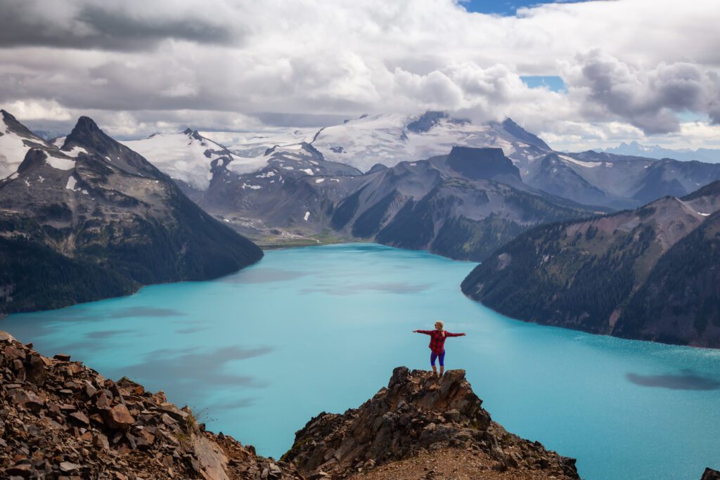
You can also split it into a multi-day; just remember to have the appropriate camping permit. I arrived at the ridge in November on a bluebird day and it was one of the best hikes I’ve ever done, hands down!
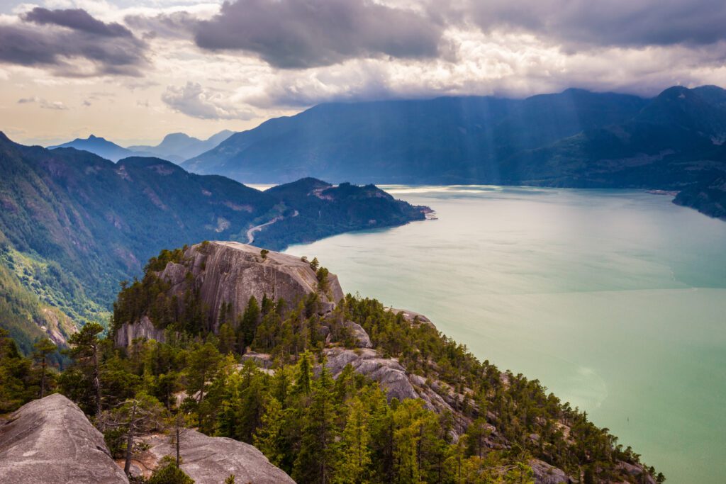
The Stawamus Chief Trail
- Length: 3.7 miles
- Elevation Gain: 2,150 ft.
- Trail Type: Lollipop (double-ended)
- Difficulty: Moderate / Hard
- Drive Time from Vancouver: 50 mins
- Trailhead Location: Stawamus Chief Trailhead
- Pass Required: Stawamus Chief Park Day-Use (June to October)
This short but challenging hike will have you huffing and puffing up not one, not two but three iconic granite peaks that overlook Squamish and Howe Sound.
Despite it being one of the area’s most popular trails, it remains one of my favorites due to its accessibility from the city. Once at the top, the presence of other hikers doesn’t bother me at all.
Start at the parking lot and you’ll see the towering monolith slabs before you. It’s a short trail but it is almost 100% ascent. You do have the option of just completing one or two of the peaks – and there’s a nice loop connecting the first and second peak – but I’d recommend persevering all the way to the third for the best views and fewer people.
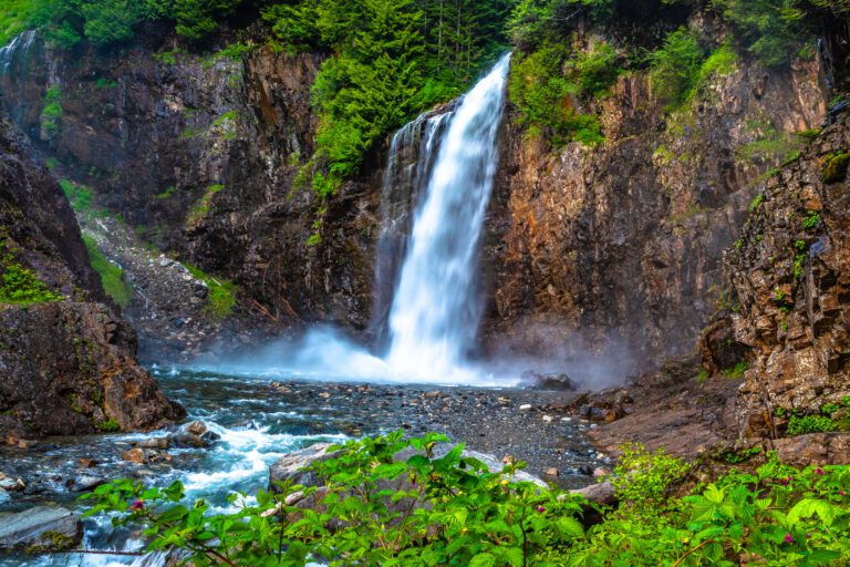
As an alternative start and endpoint, park at the Shannon Falls trailhead and take the connector trail to the Chief. It is an extra four miles but it’s not a difficult trail, and takes you past the beautiful, cascading Shannon Falls and surrounding ancient forest.
The Elfin Lakes Trail
- Length: 15.5 miles
- Elevation Gain: 2,700 ft.
- Trail Type: Out and Back
- Difficulty: Hard
- Drive Time from Vancouver: 80 mins
- Trailhead: Diamond Head
- Pass Required: Garibaldi Park Day-Use (June to October)
Another of Garibaldi Park’s crème-de-la-crème day hikes, this out and back trail is a great workout and doable in a day, or you can split it and camp overnight at the Elfin Lake Campground.
Starting at the Diamond Head parking lot, head past the trail marker towards the lake. The scenery is typical of most of the longer hikes in this area, with an initial ascent through towering forest until you break out into a beautiful sub-alpine climate.
After four miles of steady ascent, you’ll start to descend gently to the lake as the meadows stretch out in every direction towards those iconic high, snow-capped peaks. I didn’t stay at the campsite here but almost wished I had – certainly one of the best views you could wake up to!
Be wary of mountain bikers on the initial part of the trail as Diamond Head is a popular area for biking.
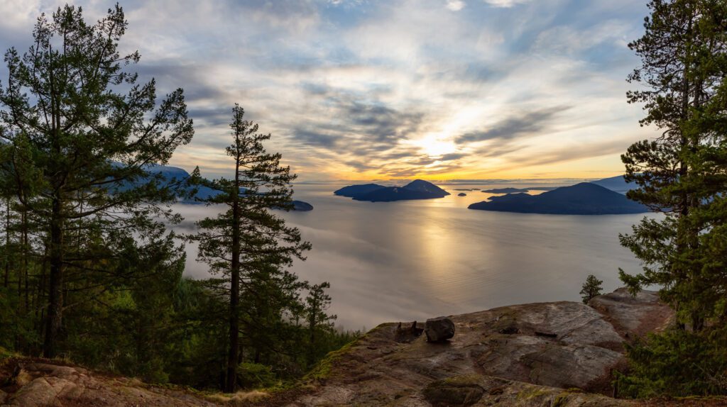
The Tunnel Bluffs Trail
- Length: 6.7 miles
- Elevation Gain: 1,700 ft.
- Trail Type: Out and Back
- Difficulty: Moderate / Hard
- Drive Time from Vancouver: 30 mins
- Trailhead: Sunset Trailhead & Parking
- Pass Required: None
This trail is only 30 minutes from downtown and only a short hop from the Sea-to-Sky Highway. I hiked this in the fall on a fairly cold day: snowy peaks towered over the trail and fog banks created the most dramatic mood around Howe Sound.
Starting at the Lion’s Bay parking lot, head up the switchbacks for about 1.5 miles. Most of the ascent is in this first section, and the rest is a very pleasant hike through the forest.
The view eventually breaks out at Tunnel Bluffs, overlooking the sound and Gambier Island. The trail is generally well-signposted, but there are a few forking trails and unmarked logging roads so come prepared with some form of map or GPS device.
You might be tempted to park at Tunnel Point and hike up (we were!), but the parking lot now has a ‘30 minute maximum’ imposed which has seen many hikers having to reclaim their towed cars.
Lion’s Bay has ample paid parking at the trailhead, or park for free at the elementary school and walk the extra mile.
Hikes in East Vancouver
The area east of Burrard Inlet is the gateway to spectacular backcountry. There are many trails within an hour’s drive of Vancouver, all situated within a maze of Provincial Parks, wildlife parks, and conservation areas.
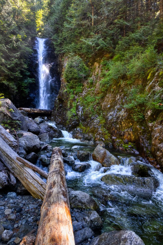
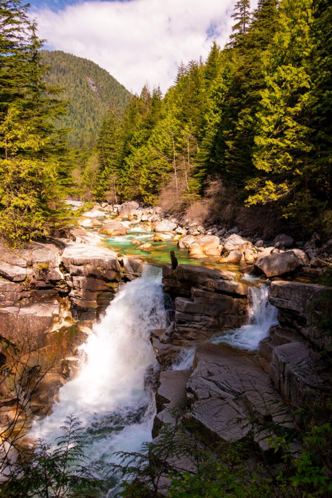
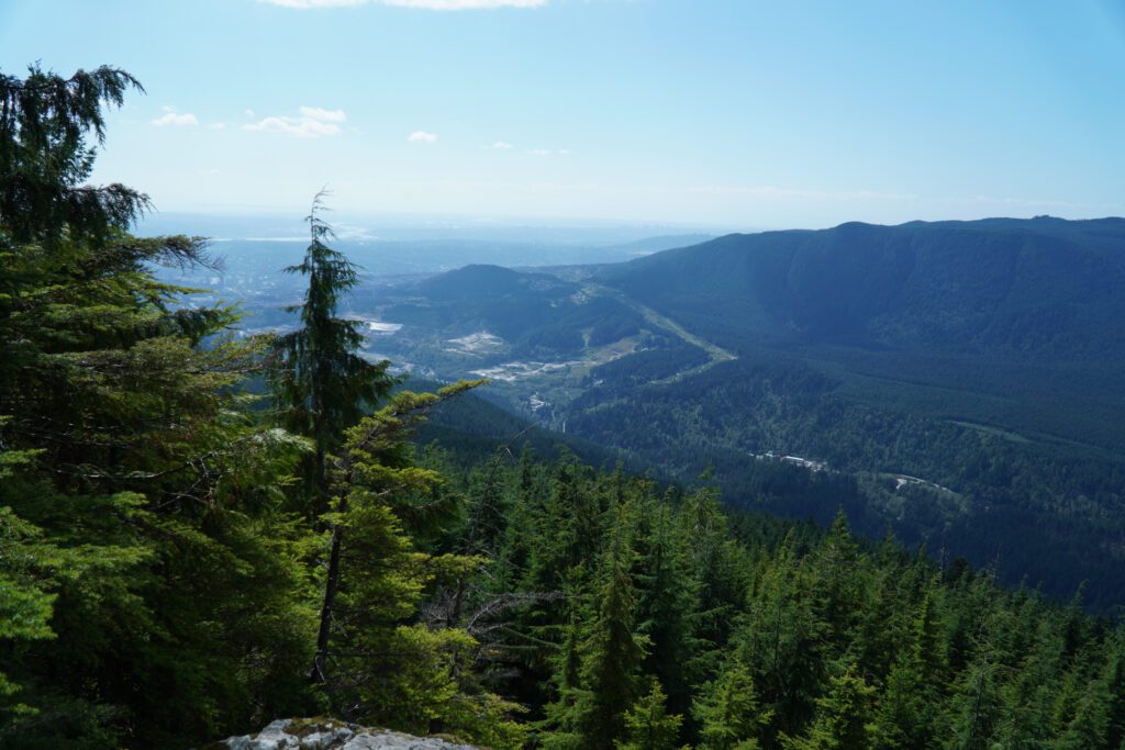
Upper Gold Creek Falls

- Length: 6.4 miles
- Elevation Gain: 1,280 ft.
- Trail Type: Loop
- Difficulty: Moderate
- Drive Time from Vancouver: 60 mins
- Trailhead Location: Gold Creek Parking Lot
- Pass Required: Golden Ears Park (June to October)
Located in the beautiful Golden Ears Provincial Park only an hour from downtown Vancouver, this trail takes you into the heart of iconic BC backcountry. You’ll follow Gold Creek through the forest until the rocky falls, with plenty of river viewpoints and places to stop for a snack along the way.
The Upper Falls is connected by the East and West Canyon Trails. I did this hike anti-clockwise, starting from the parking lot, however, the West Canyon Trail features a steeper scramble that I had to do downhill; you may want to go clockwise to tackle that section on the uphill.
Golden Ears is a popular place in the summertime so I would advise keeping this hike for the shoulder seasons, or setting off early to beat the crowds! Bring good footwear as there are a few sections that have exposed roots, small streams to cross, and a fair bit of mud.
The Coquitlam Lake View Trail
- Length: 6.7 miles
- Elevation Gain: 2,000 ft.
- Trail Type: Out and Back
- Difficulty: Moderate / Hard
- Drive Time from Vancouver: 40 mins
- Trailhead: Coquitlam Lake View Trailhead
- Pass Required: None
This trail is super easy to access, only 40 minutes from downtown Vancouver. Situated in Pinecone Burke Provincial Park, it winds up through lush forest canopy, before breaking into spectacular views of Coquitlam Lake, Deep Cove, and the city.
I love this trail on a hot day because it is so well-covered and the myriad streams keep you cool. The trail is wide but some sections contain particularly loose rocks and are covered in roots, so do take caution.
This hike is doable in the colder months with proper gear, just be aware that the last mile to the viewpoint is around a 25% grade and it can get very icy. Use the pink flagging tape as your guide and have a GPS to hand. Once at the top, the ridge behind the lake contains peaks with some cracking names – ‘Dilly Dally Summit’ being my personal favorite!
On weekends or during peak summer, try to get to the trailhead early, as the Harper Road parking lot is quite small and parking on the road itself can be tricky.
Diez Vistas (from White Pine Beach)
- Length: 5.2 miles
- Elevation Gain: 1860 ft.
- Trail Type: Out and Back
- Difficulty: Moderate / Hard
- Drive Time from Vancouver: 40 mins
- Trailhead: Buntzen Ridge Trailhead
- Pass Required: None
Depending on your affinity for switchbacks, you’ll either find this trail a pleasant workout or a bit of a leg burner! Start at the White Pine Beach parking lot and follow the Buntzen Trail until Vista #1, before returning down the same trail. As with most hikes around Vancouver, prepare for all weather types, mud and some scrambling!
Do plan to spend some time at White Pine Beach on your return – it is incredibly pleasant and a great spot for a swim.
The Diez Vistas hike is often paired with Buntzen Ridge which you can do as a longer, more challenging loop. This shorter hike, however, is perfect to do in a few hours with rewarding views over Burrard Inlet as you climb.
Easy Hikes near Vancouver
Vancouver is famous for its beautiful city walks, and there are so many places to have a rewarding hike if mountains and valley scrambles aren’t your cup o’ tea.
All of these are within an hour’s drive from the city and feature little elevation. Most of these trails will usually be snow-free, but even downtown is blanketed in snow in the heart of winter!
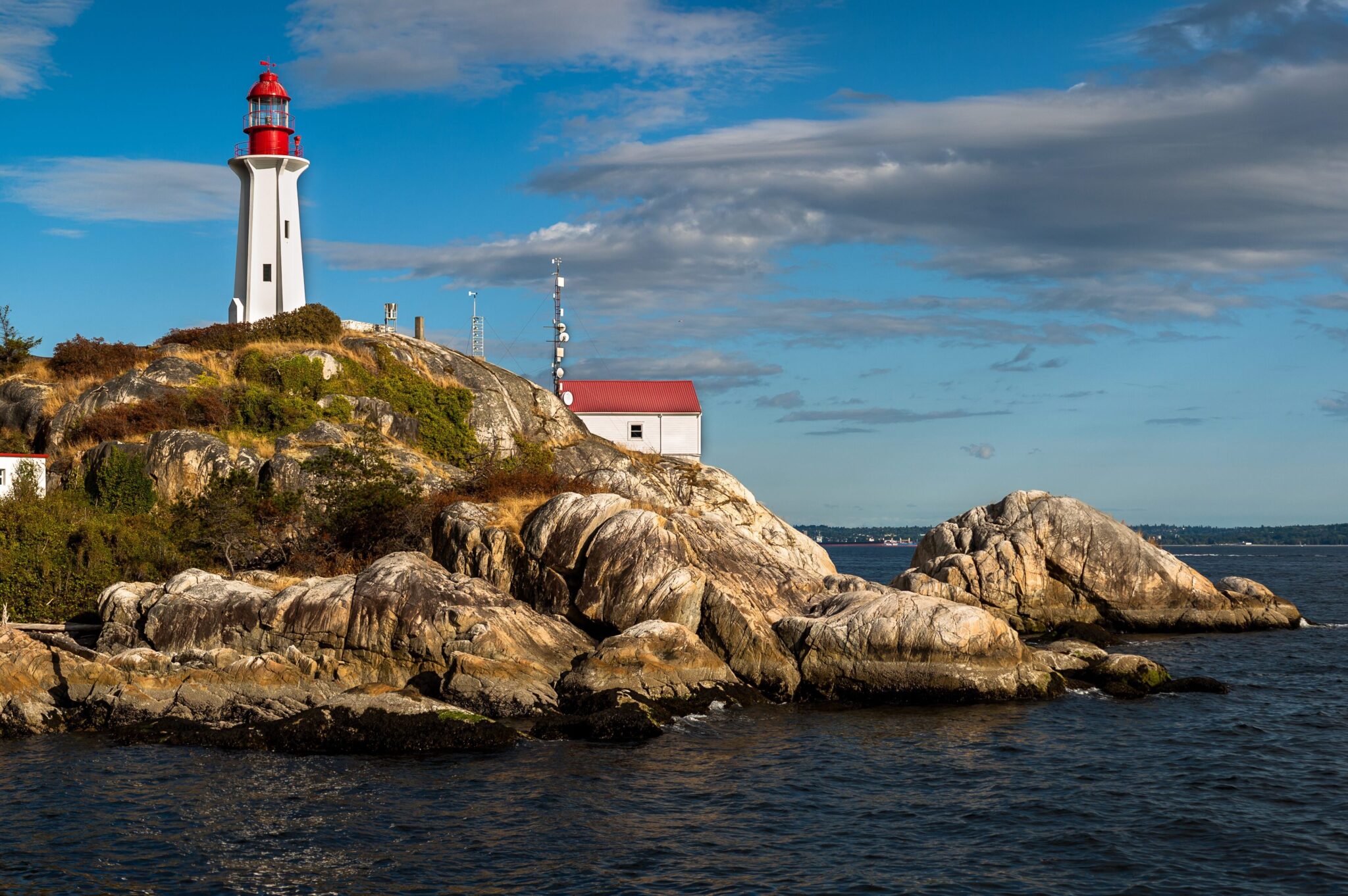
Lighthouse Park
- Length: 2.5 miles
- Elevation Gain: 550 ft.
- Trail Type: Loop
- Difficulty: Easy
- Drive Time from Vancouver: 30 mins
- Trailhead: Lighthouse Park Parking Lot
- Pass Required: None
Charming Lighthouse Park is the perfect place for a stroll along a picturesque slice of the coast. Situated in West Vancouver just south of the Horseshoe Bay ferry terminal, it is easily accessible from downtown year-round.
There are many little trails cutting through the park, or you can loop round the coastline and enjoy the panorama over the inlets and Strait of Georgia, to the distant shores of Vancouver Island.
On the southernmost tip of the park, the Point Atkinson Lighthouse stands proud – named by Captain Vancouver himself in the late 1700s.
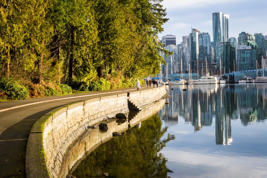
Stanley Park Trails
- Length: Up to 5.5 miles
- Elevation Gain: < 100 ft.
- Trail Type: Loop
- Difficulty: Easy
- Drive Time from Vancouver: 4 mins
- Trailhead: Denman Street Parking
- Pass Required: None
No trip to Vancouver is complete without a stroll in world-famous Stanley Park.
Situated at the edge of the West End, this huge expanse of green space is very well-connected to downtown and other central Vancouver areas. If you’re looking for the best hikes in Vancouver – actually inside the city limits – this is your best bet.
There are lots of different hiking trails to suit all needs and abilities, and you’d be hard-pushed to find any elevation!
Circumnavigating the entire Sea Wall is a favorite of mine, but you can carve your own route through one of the many paths. There are plenty of attractions and amenities along the way: Lost Lagoon, the Teahouse, multiple beaches, Brockton Point Lighthouse, art installations, concession stands, and ample restrooms – to name but a few.
I usually park in the Denman Street parking lot and walk along the Sea Wall to the park, but you can also find parking closer to the beaches and golf course.
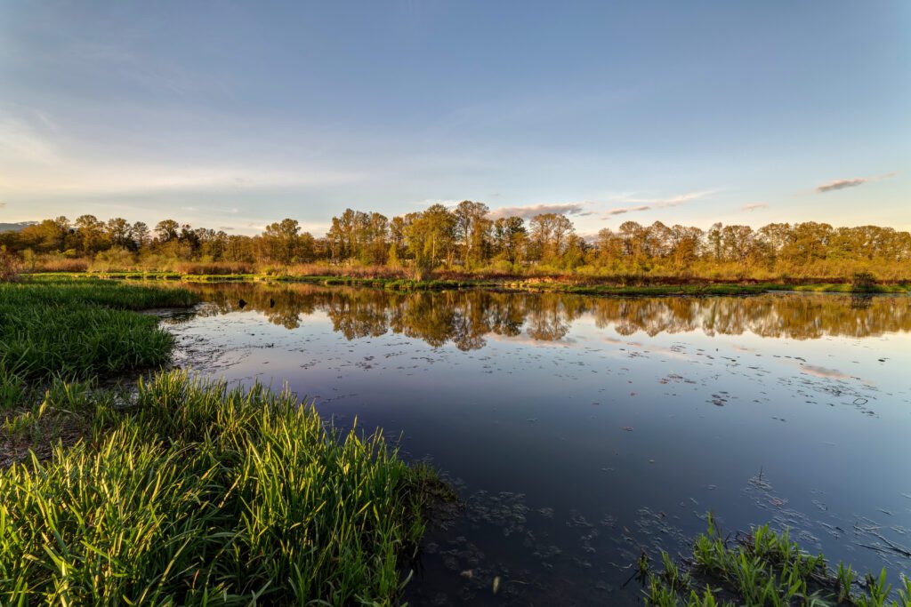
The Burnaby Lake Park Trail
- Length: 6.2 miles
- Elevation Gain: 75 ft.
- Trail Type: Loop
- Difficulty: Easy
- Drive Time from Vancouver: 20 mins
- Trailhead: Burnaby Lake Parking Lot
- Pass Required: None
Burnaby Lake Regional Nature Park is an inner-city wilderness haven. The park has virtually no slopes and is built to be totally accessible, so it is the perfect place for anyone unable (or unwilling!) to commit to uphill or downhill stints.
This trail circumnavigates the lake, which provides critical habitat for over 400 species of plants and animals. You can also cut through the park and do a shorter trail if you don’t have time to circle the whole lake.
This fantastic spot is a birder’s paradise (keep an eye out for the iconic Great Blue Herons and Bald Eagles) and is certainly the best place to learn more about British Columbia’s essential wetlands and conservation efforts.
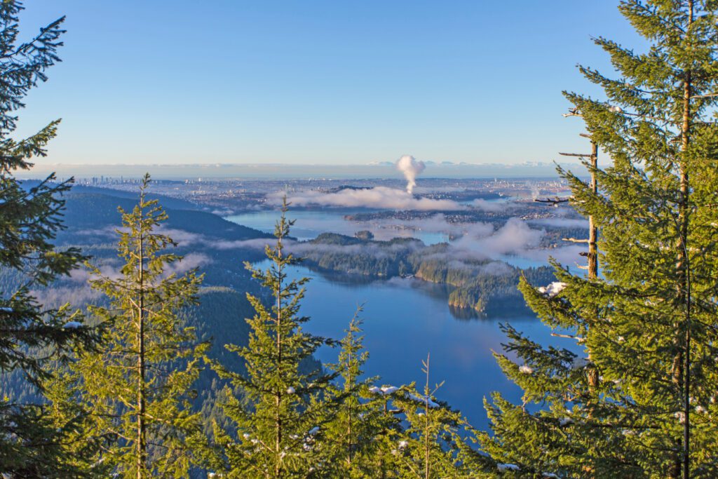
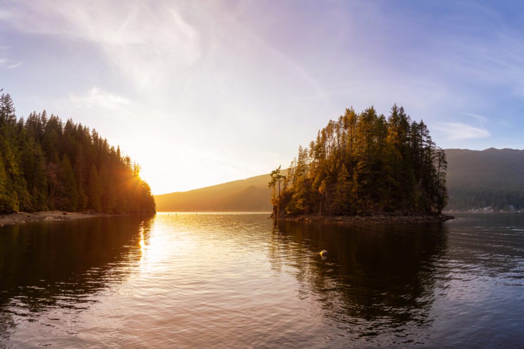
The Jug Island Beach Trail
- Length: 3.2 miles
- Elevation Gain: 725 ft.
- Trail Type: Out and Back
- Difficulty: Easy / Moderate
- Drive Time from Vancouver: 40 mins
- Trailhead: Jug Island Beach Trailhead
- Pass Required: None
This idyllic little trail leads to a secluded beach, only accessible by foot. It is located in Belcarra Regional Park and looks northwards up Burrard Inlet. On a warm day, swimming in the (very chilly!) waters out to Jug Island is popular – just make sure you are a good cold water swimmer as there can be strong currents in and out of the inlet.
The trail does feature a fair descent and ascent for its length, so it is the perfect moderate hike to slot into a morning or lazy afternoon. Parking is easy and plentiful, located in the Belcarra Picnic Area.
As with many places around Vancouver, it may be busy on a hot summer weekend, so plan to arrive early!
The Best Time to Go Hiking in Vancouver, B.C.
Typically, late summer into fall is the best time for hiking around Vancouver, as the climate is temperate and there is minimal snow on the trails. July and August are the most popular months for hiking as the weather is best, but smoke from wildfires can often obscure views and even close down parks.
My favorite month is September with fewer people, a lower risk of wildfires, and beautiful fall colors beginning to emerge.
Can You Hike in the Spring and Fall?
The shoulder seasons (October/ November and April/ May) still offer great hiking and, naturally, the weather varies by altitude and region.
Come prepared for wind, rain, mud, and snow with a positive attitude and you’ll be fine anywhere!
Make sure you have microspikes handy in case you come across any unexpected snow or ice; they make a world of difference.
I use Mountain Forecast to check detailed weather and snow conditions – it is my go-to and offers very accurate weather conditions for over 11,000 peaks worldwide.
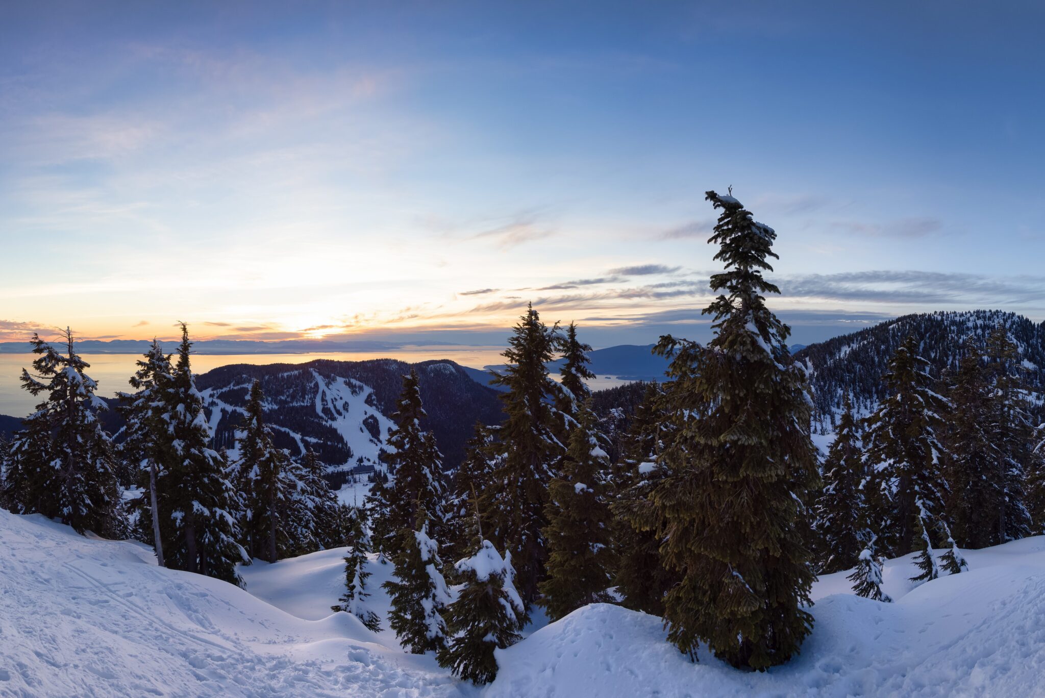
What About Hiking in Vancouver in the Winter?
Winter in the parks around Vancouver is as you’d imagine: cold and covered in snow!
If you’re an avid snow-shoer then you’ll certainly not be disappointed with the number of great snowy hikes just out of the city. If you’re new to winter hiking then I’d always recommend going first with an experienced friend or a tour guide.
Some of the more isolated roads to Provincial Parks might be closed during heavy snowfall, and some close their gates at night to prevent camping in parking lots. Make sure to refer to the specific park information provided by BC Parks before you go.
It is also a good idea to check highway conditions on one of British Columbia’s many live highway cams – a neat aid to planning and preparation.
There are also a number of hikes in Vancouver (and around) which are low altitude and generally snow-free all year round that I’ll detail in the last section.
The possibilities for hiking around Vancouver attract thousands of people each year. There really is something to cater to every ability and taste, and you don’t have to go far for some seriously awe-inspiring views.
Just make sure you hike with good gear, be bear-savvy, and always check weather conditions before you set off – it’s worth the preparation to be rewarded with some of the best trails that the west coast has to offer!
More to Explore in British Columbia
Want to explore the best that British Columbia has to offer? We’ve got plenty of detailed travel guides to help you explore!
Vancouver BC Travel Guides:
- How to Spend a Perfect Weekend in Vancouver, B.C.
- Where to Stay in Vancouver, B.C.: A Complete Neighborhood Guide
- 14 Incredible Day Trips from Vancouver, B.C.
- 12 Great Weekend Getaways from Vancouver B.C. to Plan Now
- 15 Unbelievable Hikes near Vancouver, B.C. (Hiking Guide)
Vancouver Island Travel Guides