A Complete Guide to the Best Mount Hood Hikes (+ Map)
Looking for a guide to the best hikes near Mount Hood? You’re in luck! Mount Hood is our favorite hiking destination near our home in Portland, and one of the reasons we love living in Portland is the fact that you can go from our front door to a trailhead in the mountains within 90 minutes.
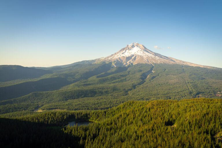
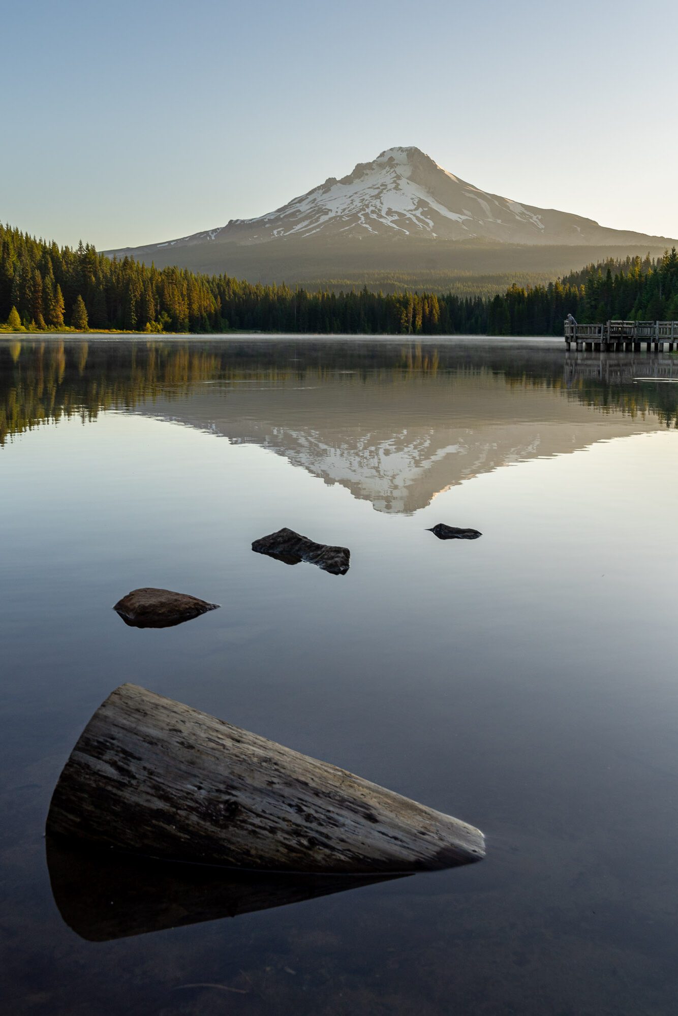
When you’re in Portland, a “nice day” is at least partially defined by whether or not you can see Mount Hood’s snowy peak on the horizon to the east, towering behind the city at just over 11,000 feet.
Growing up in Seattle, we had a similar barometer – in Seattle’s case, it’s Mount Rainier – but there’s one major difference between the two (there’s probably a lot of differences, really, but we’re focused on one for the purposes of this guide).
That difference is the distance from downtown to the mountain. On a good day, it’s going to take you almost three hours to get from downtown Seattle to Rainier, whichever way you slice it. That’s a little far for a day trip.
Mount Hood, on the other hand, is a relatively quick and painless 90 minute drive from downtown to some of the main trailheads.
We were sitting around the campfire with friends on our last trip trying to figure out if there’s another major metro area with a closer mountain, and were stumped. Definitely not on the west coast!
Despite its proximity to Portland, it feels like a whole different world when you step out of the car on first arrival up at Mount Hood. The weather is 10-15 degrees cooler, the air is more “crisp,” and you’re just about close enough to Mount Hood to reach out and touch it.
Add the plethora of wildflowers in the early summer and the rushing waterfalls as the snow starts to melt, and you’ve got yourself a veritable alpine wonderland 90 minutes from your front door (if you live in Portland, that is).
In this guide to the best hikes at Mount Hood, we’re going to share 10 of our favorite hikes around Mount Hood.
We’ll give you the trail details you need – mileage, elevation gain, trail type (e.g. lollipop or loop), trailhead location, etc. – and a brief description of what to expect on the trail.
We’ve done almost all of the hikes on this list over the course of our many trips up to Hood, sometimes multiple times. The two at the end are on our list, but the weather and timing hasn’t quite worked out just yet.
Disclaimer: Some of the links in this post, like hotel and vacation rental links, are affiliate links, meaning at no additional cost to you we make a little bit of money if you click through and book. That being said, we would absolutely never recommend something to you that we don’t stand behind 100%.
A Complete Guide to 10 Fantastic Hikes near Mount Hood
After a couple of brief notes and things to know before you go hiking at Mount Hood, we’ll get straight into the hikes that we’ve done and love.
The first thing to know is that all of these hikes are in Mount Hood National Forest, which means you’ll want to have either a Northwest Forest Pass (which covers parking at all National Forests in Washington and Oregon) or an America the Beautiful Pass (which covers all National Recreation lands – including National Forests) to park at trailheads.
In terms of the best time to do these Mount Hood hikes, we’d say mid-July through September.
Of course, this totally depends on the year, the weather in the spring, and the snowfall in the winter. Some of the lower elevation trails will be snow-free by early July (for example, we did Tom, Dick, and Harry on July 3rd and Tamanawas Falls on the 4th with no issues).
However, on the higher elevation trails like McNeill Point and the trails around Timberline Lodge, you’ll find snow into July.
Keep in mind that we’ve done almost all of these hikes ourselves, sometimes multiple times. While we have personal experiences to draw from, trail conditions are extremely variable, and can change. The best way to know what to expect is to read recent trail reports.
We use AllTrails to do that, and we make sure to check recent trail reports for road conditions, trail conditions, weather, and more.
We’ve also written more in-depth trail guides for some of the hikes below to give you a more in-depth look at the trail and all the details you should know before you head up (like where to park, where not to park, and what to expect on the hike).
Here they are for easy access:
- The Tamanawas Falls Trail: A Complete Trail Guide
- Tom, Dick, and Harry Mountain: A Complete Trail Guide
- Hiking to Mcneil Point: The Best Views in the State of Oregon?
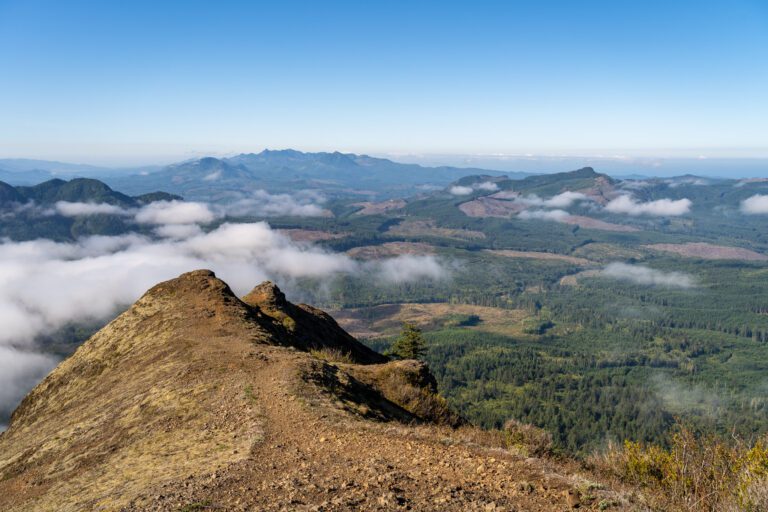
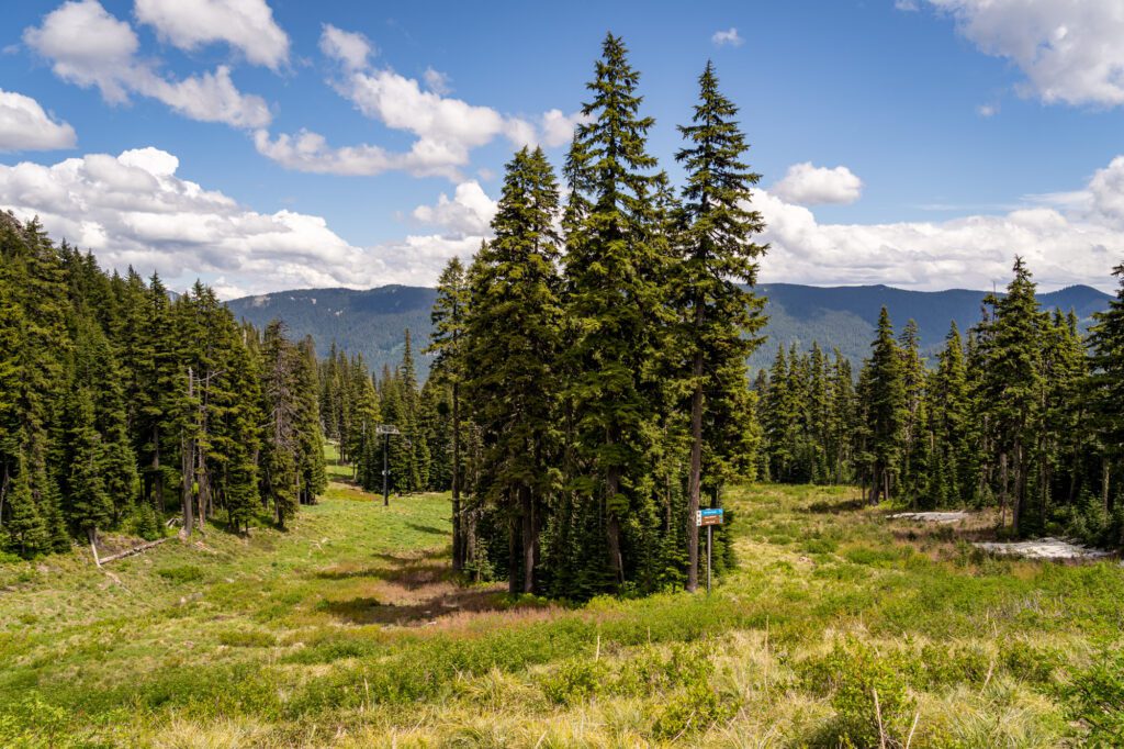
McNeil Point
- Length: 10 miles
- Elevation Gain: 2,700 ft.
- Trail Type: Lollipop
- Difficulty: (Very) Hard
- Dog-Friendly? Yes, on a leash.
- Parking Pass: Northwest Forest Pass
- Trailhead Location
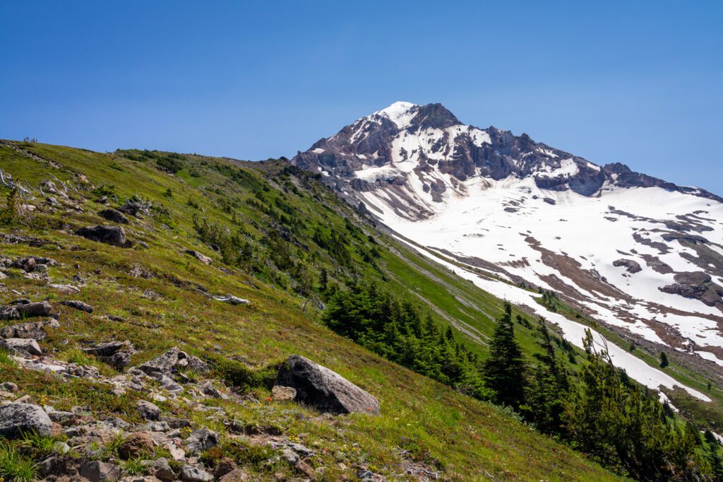
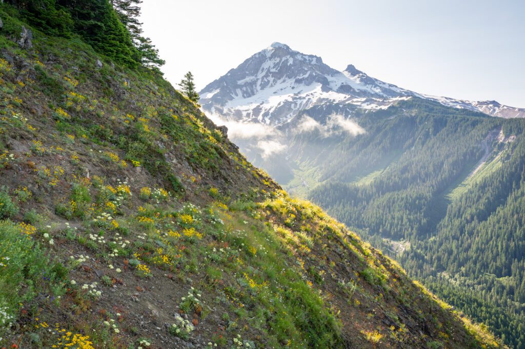
We did this hike once, and it’s by far our favorite hike around Mount Hood. Between the incredible views throughout, the popping wildflowers in the summertime, and the cool rocky structure at the summit, it’s near the top of the list of our favorite hikes in Oregon.
However, this hike is hard AF. When we did it, we were living in our van (Homer the Honda Odyssey) on our six week Oregon road trip, hiking 8-10 miles most days. This hike still kicked our butts.
When asked if she would do it again in the next five years, Alysha gave a firm “nah.”
However, it’s definitely worth doing once. Be prepared with plenty of water, food, and sun protection. In the early summer, the top of this trail might still be covered in snow, so make sure you read recent trail reports and are prepared with microspikes.
The hike leaves from the Top Spur Trailhead, which is a tiny parking lot with spots available along the forest road that leads to it. The road, at least when we did it, was totally passable in a passenger vehicle (read: a heavy minivan).
It’s a lollipop trail, and you should do the lollipop portion counter clockwise. The right side of the loop is an all-out scramble, and while it cuts off a nice chunk of mileage if you go up that way, we wouldn’t go down that way.
In fact, we opted to hike back around the loop, adding a mile or a mile and a half, rather than trying to go down that way when we found ourselves at the top of that section looking down.
If you’re anxious about a scramble, you can totally do this hike as an out-and-back, but it’s slightly longer (add 1.5 miles or so).
The first mile or so of the trail climbs to meet the trail out to Bald Mountain from Lolo Pass (more on that in a second), and the unobstructed view of Mount Hood from Bald Mountain is one of our favorite views in Oregon. It’s plastered all over this website.
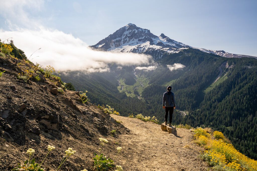
If you thought that was as good as it gets, you’re in for a real treat. The views only get better and more panoramic as you climb.
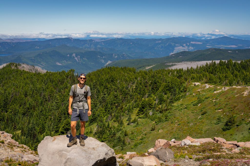
Once you’re up on the loop part of the trail, you’ll also have a great view to the north, which includes Mount St. Helens, Mount Adams, and, if you’re lucky, Mount Rainier on a clear day.


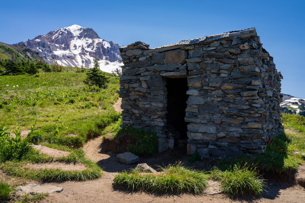
Near the top of the trail, there’s a cool little stone shelter that hikers have been using for decades. Mainly as a shelter from the wind, based on our experience. It’s windy up there!
Read More: How to Hike the McNeil Point Trail at Mount Hood
Lolo Pass to Bald Mountain
- Length: 6.7 miles
- Elevation Gain: 1,500 ft.
- Trail Type: Lollipop
- Difficulty: Moderate
- Dog-Friendly? Yes, on a leash.
- Parking Pass: Northwest Forest Pass
- Trailhead Location
This was our first ever hike at Mount Hood, and it was a little bit of a letdown. However, that’s not the trail’s fault at all – we’d still highly, highly recommend this hike.
We drove up from Lost Lake Campground and got stuck on a REALLY bumpy forest road in our minivan. Then, we arrived at the trailhead to find it misty and foggy (it was completely clear at camp).
The trailhead is small, with parking for just a few cars. If you’re coming from Government Camp, it’s a relatively straightforward journey that will take you 40 minutes, give or take.
The hike itself is beautiful, and when we were there in mid-July it was absolutely covered in blooming rhododendrons.The forest was basically half trees, half pink blooms. It was pretty crazy, and it was something that we’d never really seen before (welcome to Oregon!).
From the trailhead, you start out on a section of the Pacific Crest Trail. Along this stretch, we met a thru-hiker with her dog who had lost her GPS, and we texted her mom that she was okay (and not floating down a river with her GPS) when we got back into town.
Follow the Pacific Crest Trail, which climbs steadily for just about three miles, out to one of our favorite lookouts in Oregon.
Remember how I said that this hike was a little bit of a letdown? We got to this viewpoint on our first hike and it was completely socked in.
You could not see Mount Hood. Not even a little bit. We were looking directly out from the viewpoint, and all you could see was fog. It was so thick that you could barely see your hiking companion a few yards in front of you.
We learned on our second hike here that we were definitely looking in the completely wrong direction. But the view on that second hike more than made up for the effort we put into the first hike without a payoff.
Tom Dick and Harry Mountain
- Length: 9 miles
- Elevation Gain: 1,700 ft.
- Trail Type: Out and Back
- Difficulty: Moderate / Hard
- Dog-Friendly? Yes, on a leash.
- Parking Pass: Northwest Forest Pass
- Trailhead Location
This is probably the most accessible hike if you’re coming from Portland, which means it’s also one of the busiest Mount Hood hikes. It shares a trailhead (and a trail) with the short and sweet Mirror Lake trail, which only adds to the crowds.
If you’re looking for solitude, this probably isn’t the right hike for you. If you’re willing to brave the crowds and families to get to some of the best views of Hood around, we think it’s worth it.
The trail starts from the Mirror Lake Trailhead right off of Highway 26. There are parking spots for about 30-40 cars, plus a bunch of extra spots in the parking lot to the east (though you should know that you cannot park in the Mt. Hood Skibowl parking lot). There are bathrooms at the trailhead.
This lot fills up early on weekends in the peak summer months (July and August), so you’ll want to get an early start if you want to snag a spot and have the trail somewhat to yourself.
You’ll start on a paved trail, then begin a gradual climb up to Mirror Lake with a series of wooden bridges and switchbacks.
Every time we’ve done this hike, we’ve gotten stuck behind a slow-moving family with beach chairs and kids in tow – don’t be afraid to speak up and ask to pass (and if you’re the family, remember to keep an eye out behind you to let faster hikers pass you).
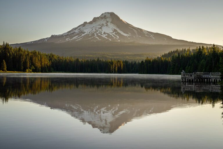
It’s worth doing the loop around Mirror Lake, which adds a half mile or so to the distance. The best view of Mount Hood is from here, but it’s worth exploring the south shore of the lake to see if you can find one that you like better.
From the lake, the real fun begins. It’s a tough climb. You’ll start with a gradual climb up the northern side of Tom, Dick, and Harry, before making a sharp turn and heading east, which turns into a steep, rocky climb until you reach the first viewpoint, which is a rocky outcropping where most people stop.
To get here and back, it’s somewhere between 7.5 and 8 miles.

On a clear day, you’ll have views of Hood, Adams, St. Helens, Rainier, and Mount Jefferson. We were lucky enough to see all five on our last hike up here. The amount of natural beauty in Oregon and Washington is truly stunning.
If you want to escape the crowds and go further, the trail continues along the ridge for another half mile.
We’ve gone another quarter mile or so to leave the crowds behind and enjoy the view by ourselves. The trail definitely gets harder to follow, and becomes a scramble at points.


You can continue along the ridge to the peak at 5,000 feet, but you’ll want to make sure you have a map (we use the AllTrails maps) to find your way.
Learn More: Tom, Dick, and Harry Mountain – A Helpful Trail Guide
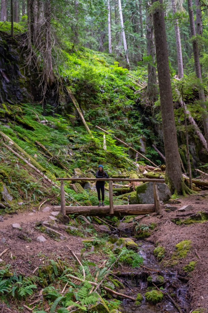
The Mirror Lake Trail
- Length: 4.2 miles
- Elevation Gain: 675 feet
- Trail Type: Lollipop
- Difficulty: Easy / Moderate
- Dog Friendly: Yes, on a leash.
- Parking Pass: Northwest Forest Pass
- Trailhead Location
The Mirror Lake Trail is the first half of the trail you’ll follow to get to the top of Tom, Dick, and Harry Mountain. We’d guess that 80% of the people who hike from the Mirror Lake Trailhead are going to the lake (rather than continuing on to the summit).
The trail up to the lake starts with a paved section that descends from the parking lot before leveling out and climbing gradually through the forest, crossing several bridges along the way.
Right before you get to the lake, you’ll start up some switchbacks. We saw many families struggling here – it’s definitely the hardest part of this hike. Luckily it’s shaded.
The loop around Mirror Lake is nice, and has some nice opportunities for a reflection of Mount Hood in the lake from the south side of the lake.
One thing to know – during the early summer (June and early July), the loop trail that goes around the lake can be washed out, which means you’ll have to do the “loop” as an out and back.
The first time we did it in late July, it was fine. The second time we did it around the 4th of July, it was flooded. No big deal, but something to be aware of.
There are some campsites around the lake if you’re looking for an easy overnight trip. The bugs, though, are ridiculous in June and July, which might mean that this is a better late season destination.
Umbrella and Sahale Falls
- Length: 5 miles
- Elevation Gain: 950 feet
- Trail Type: Loop
- Difficulty: Moderate
- Dog Friendly: Yes, on a leash.
- Parking Pass: Northwest Forest Pass
- Trailhead Location
This is the last hike we did on our latest trip up to Mount Hood, and we did it with some friends who were spending the weekend with us camping at Trillium Lake.
Of the three hikes we did that weekend, this was the clear favorite for both of our hiking companions. The other two trails we did were Tamanawas Falls and Tom, Dick, and Harry, so it’s not like the competition was lacking.
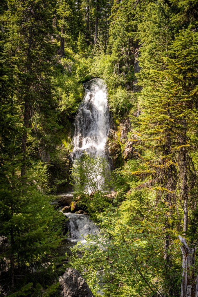
The first thing we want to make super duper clear here is that you actually can’t get a good view of Sahale Falls from this trail. And it’s a little bit of a scramble to get down to the viewpoint that is reachable.
We’d completely skip the offshoot that leads to Sahale Falls and, instead, drive to this bridge on the forest road after your hike, which has an excellent view of the falls.

The second thing we’d say is that you should absolutely do this hike as a loop (really, a lollipop) because the best part of this hike is the northern end of the loop, which you’d completely skip if you did it as an out-and-back.
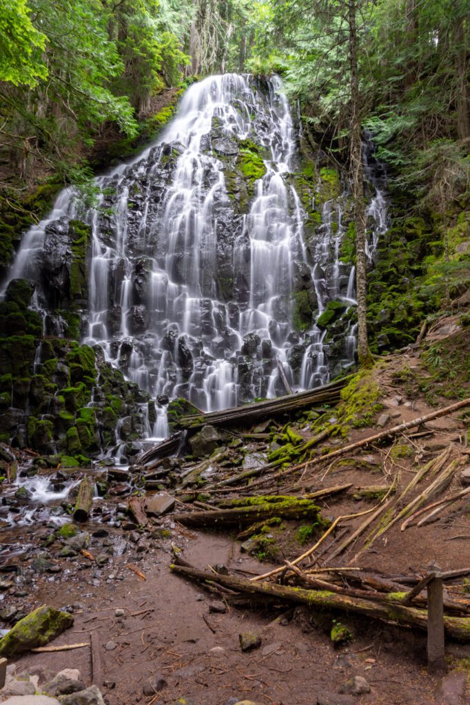
The reason this hike was so popular with our little band of hikers is the varied terrain you’ll cover. The hike starts from the Mount Hood Meadows parking area (you can also do it from the Elk Meadows Trailhead, which you’ll pass as you hike the loop), and immediately descends to the base of Umbrella Falls, which is an impressive waterfall.
From there, you’ll head out into the forest. We liked doing the lollipop portion of this hike counter clockwise for the gradual descent and steeper ascent, which is better for our creaky knees, which seem to be getting more and more creaky by the minute.
If you head counter clockwise, the trail meanders slightly downhill, and then turns left (north) and hits the Elk Meadows parking area. There’s a pit toilet here if you need it.
Then, you’ll follow the Elk Meadows trail for a hot second before turning left onto Umbrella Falls Trail 667, which is the best part of the hike.
It’s steep at points, but you’ll ascend through the ski resort, which is full of wildflowers and gorgeous views out to the south and east. Like I said, this was our favorite part of the hike.
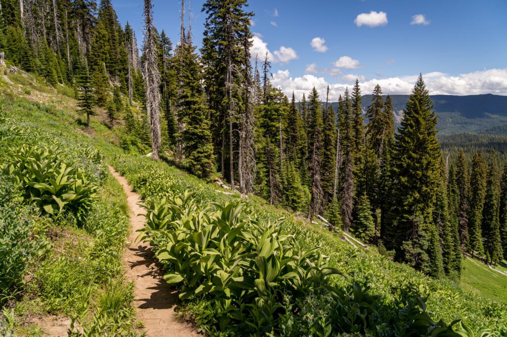
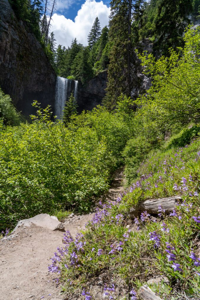
In terms of wildflowers, target mid to late July and beyond for the best showing. We were a few weeks early, though things were just starting to pop.
This hike is at a higher elevation than some of the other hikes on this list, so snow might linger a little later than the trails at lower elevation. By July 4th, there was still some snow on the trail when we did it, but it was totally doable in trail runners / hiking boots.
Ramona Falls

- Length: 7.1 miles
- Elevation Gain: 1,000 ft.
- Trail Type: Lollipop
- Difficulty: Easy / Moderate
- Dog-Friendly? Yes, on a leash.
- Parking Pass: Northwest Forest Pass
- Trailhead Location
If you’re looking for a relatively easy hike to one of the best waterfalls in Oregon, we’d definitely point you in this direction. The hike itself isn’t particularly special, if we’re being completely honest.
This is a lollipop hike, and the first section of the hike is a slight uphill grade along the Sandy River Trail that takes you out to – you guessed it – the Sandy River.
This is the tricky part of the hike. Through 2021, the Forest Service installed a seasonal bridge across the river. They no longer install that bridge, partially because it gets washed out too often. When we did it in 2020, there was no bridge, and the crossing was a little bit treacherous.
Our best advice for crossing is to read recent trail reports on AllTrails, which usually have some comments about the water levels and best routes for crossing.
If the water is too high and you don’t feel comfortable, we wouldn’t risk it. It can be dangerous when the water levels are high, which is usually in spring and early summer.
If you do manage to cross the river, follow the Pacific Crest Trail to the right and tackle the trail counterclockwise. Follow that until you hit another fork, where you’ll hop on the Timberline Trail for a hot second before you reach the base of Ramona Falls, which is lovely.
It’s 120 feet tall, but rather than being a huge flow of water, it’s broken up into hundreds of tiny tendrils snaking their way into the creek below.
Follow the Ramona Falls Trail through a dense forest with some cool rock formations back to the river, cross back to the other side, and head back to the parking lot.
The road to this trailhead closes seasonally (usually 12/1 through 4/1), and you can check the status here. Look for road 1825 (or just use ctrl+F to search for “Ramona”). It’s a little bumpy in places, but we’ve done it in our minivan, Homer the Honda Odyssey, and he lived to tell the tale.
There are bathrooms at the trailhead, and lots of places for dispersed camping along the road to get there.
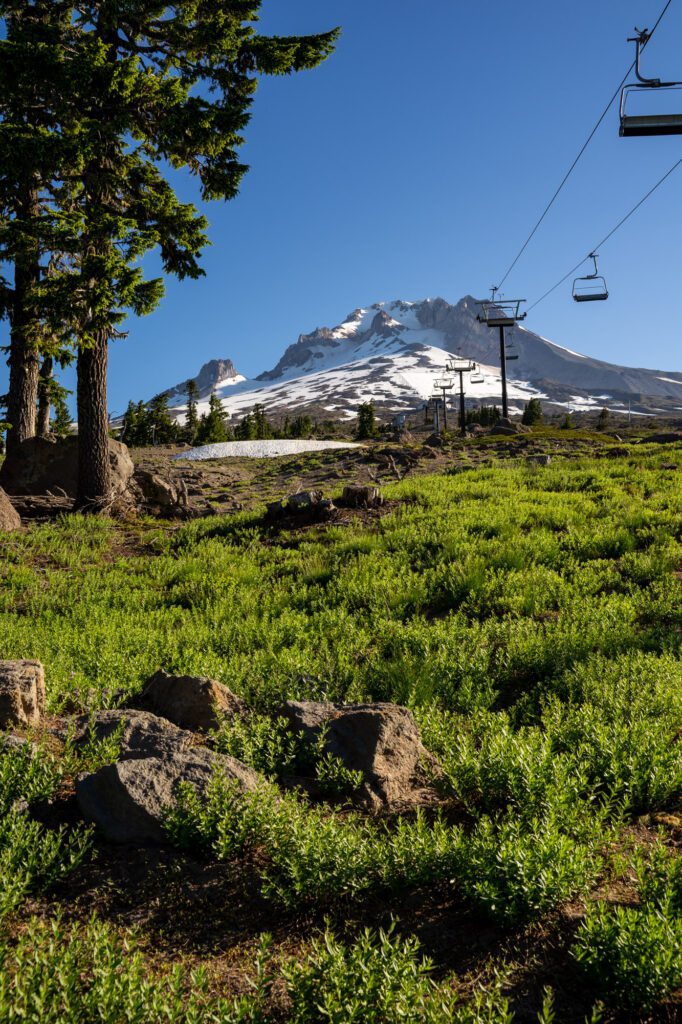
Timberline Lodge to Zigzag Canyon

- Length: 4.7 miles
- Elevation Gain: 880 ft.
- Trail Type: Out and Back
- Difficulty: Moderate
- Dog-Friendly? Yes, on a leash.
- Parking Pass: Northwest Forest Pass
- Trailhead Location
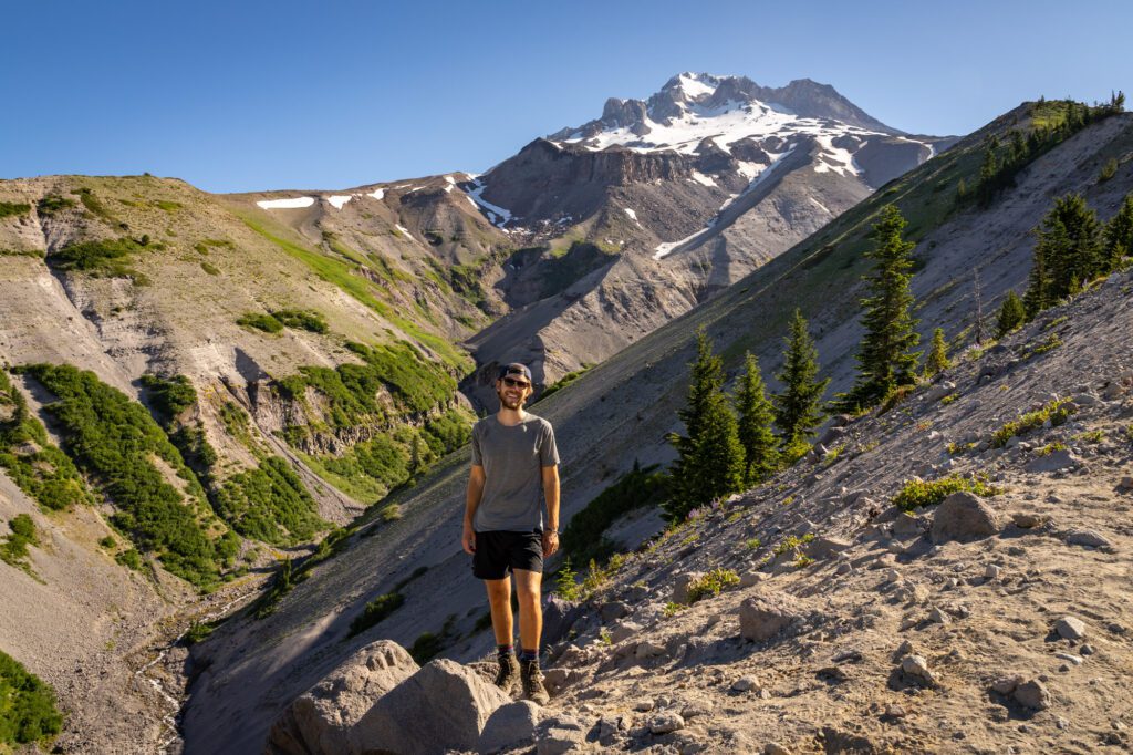
This hike starts at Timberline Lodge – which is well worth a stop if you have some time before or after your hike – and heads west along the Pacific Crest Trail to reach Zigzag Canyon.
We like this hike for a few reasons.
First, you’ll spend the first section of the trail hiking under the ski lifts of Timberline Ski Area, which is cool.

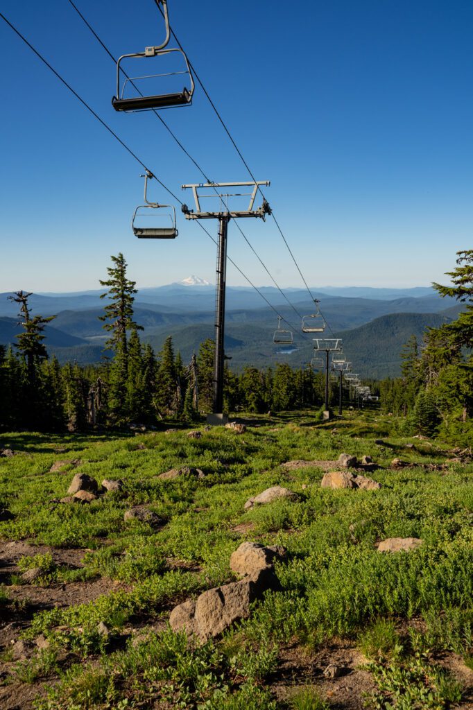
Second, because you’ll be following a section of the PCT, and you’re likely to encounter a few thru-hikers who are always fun to chat with and ask about their journey.
Third, because the view of Zigzag Canyon and Mount Hood at the end is nothing short of incredible. You’ll be looking directly up the craggy canyon towards Mount Hood, with blooming wildflowers in the foreground (if you’re lucky in July).
It’s a fairly straightforward journey, though the network of trails at the beginning near the lodge need a serious signage update.
The parking lot at Timberline Lodge is big, the trail is well-marked after the first quarter mile or so, and it’s a moderate grade without any sections that jump out to us as particularly difficult.
The Tamanawas Falls Trail
- Length: 3.4 miles
- Elevation Gain: 600 feet
- Trail Type: Out and Back
- Difficulty: Easy / Moderate
- Dog Friendly: Yes, on a leash.
- Parking Pass: Northwest Forest Pass
- Trailhead Location
The Tamanawas Falls trail blew our expectations out of the water. We did it with two friends over a holiday weekend, and it really wasn’t as busy as we expected.
It’s on the eastern side of Mount Hood, which means it’s a little far to do as part of a day trip from Portland (you’re looking at around 90 minutes driving to get to the trailhead).
But if you find yourself in either Hood River or Government Camp and are looking for a relatively easy hike, this is the one!
It leaves from the Tamanawas Falls Trailhead, which is right along Highway 30 roughly 30 minutes from both Hood River and Government Camp. It’s a fairly small parking lot, but the turnover is pretty quick since it’s a short hike.
Do not park outside of the parking lot on the side of the road – there are no parking signs up and down the road, and we saw a USFS ranger handing out tickets left and right.
Turns out “they can’t give us all tickets, right” – which is what we were saying to each other before deciding to wait five minutes for a parking spot in the lot – isn’t strictly true. They can, and they might.
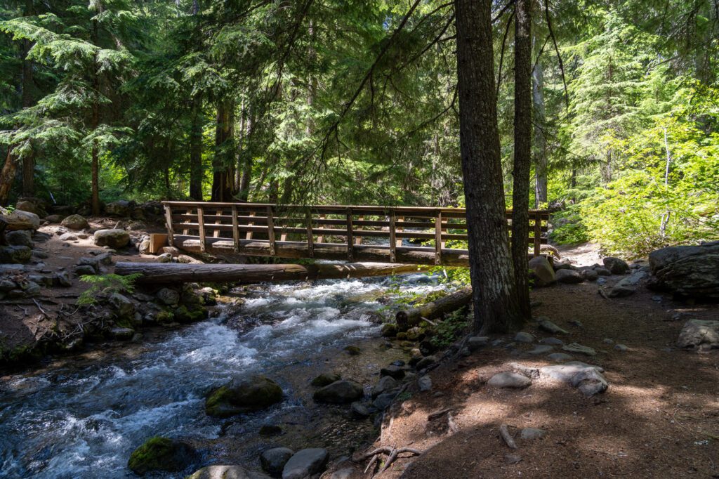
The hike itself starts by crossing over the river and winding through the forest. You’ll reach a fork in the trail – veer left (heading right is the route to make this trail a loop) and continue down a hill to creek level, where you’ll cross another log bridge and start climbing.
This middle section of the hike is along the river, and the sound of rushing water will accompany you all the way to the falls.
Learn More: Hiking the Tamanawas Falls Trail – A Helpful Trail Guide
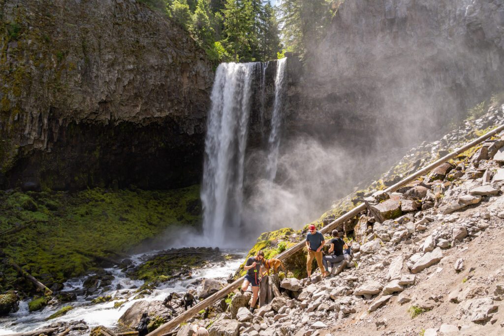
The hardest part of the hike comes just before reaching the falls, where you’ll do a short but steep climb through a boulder field. This area is full of slick rocks, so watch your footing.
Alysha, who is a very experienced hiker, actually slipped here on the way down and ended up with a big bruise.
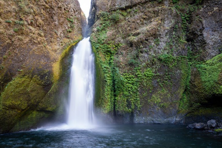
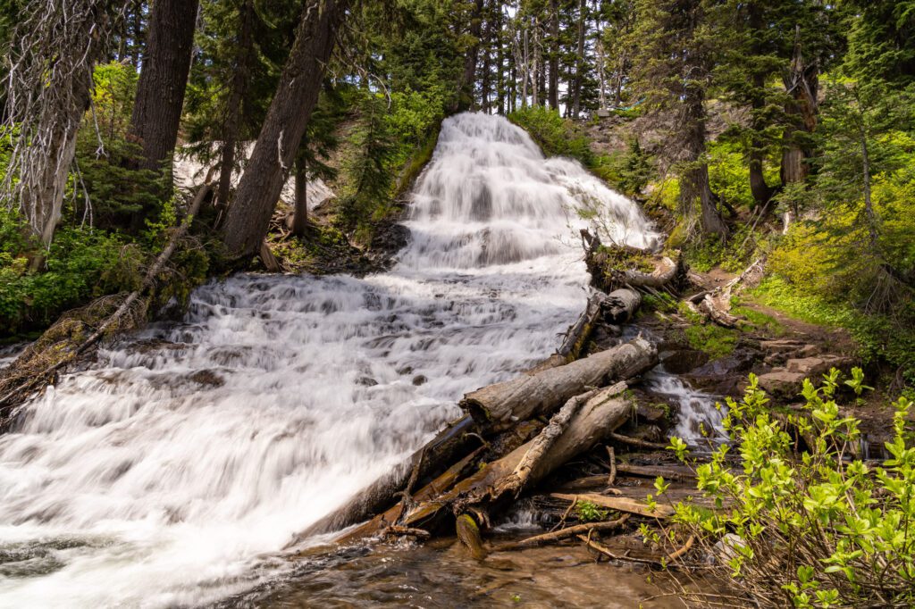
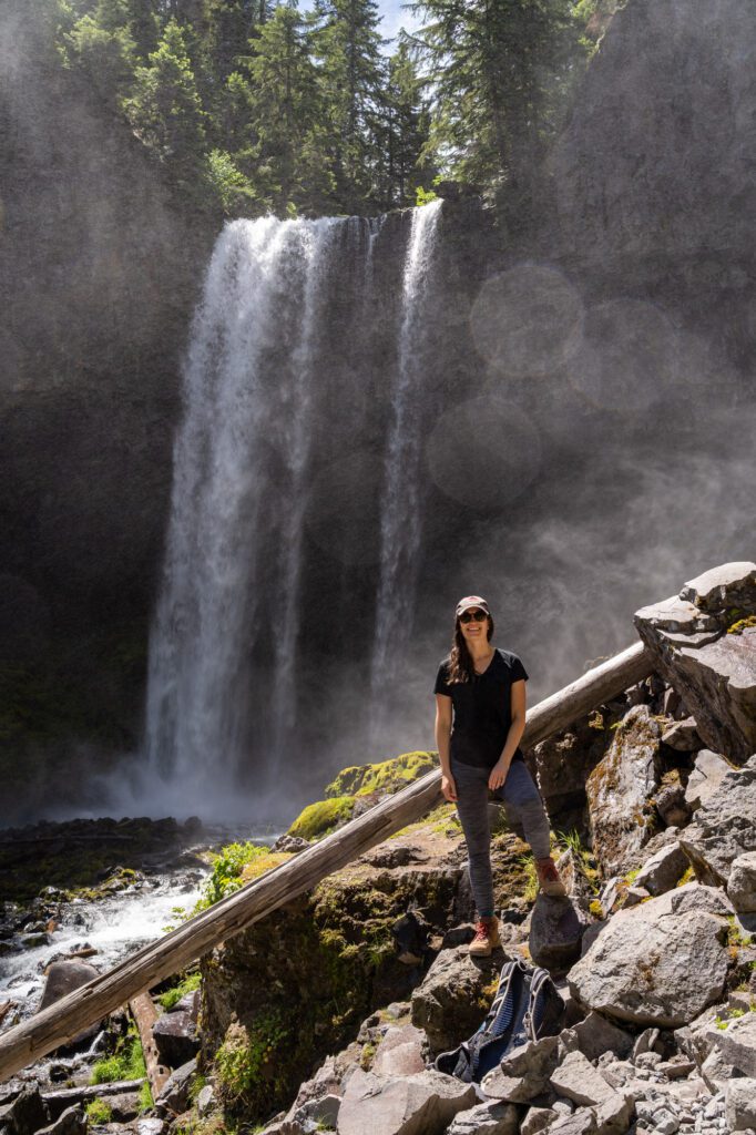
The falls itself is majestic. Tumbling off a rock ledge 110 feet into the creek below, it’s one of the best waterfalls in Oregon, especially when you consider the relatively easy journey to get there.
There are nice views of the falls from the viewpoint where the trail dumps you out, but the best views are up the rocky hill to the right.
With the exception of the short boulder field section, this is one of the best easy hikes near Mt. Hood, and it should be at the top of your list if you’re looking for something that’s accessible for the whole family.
Elk Meadows
- Length: 5.7 miles
- Elevation Gain: 1,050 feet
- Trail Type: Lollipop
- Difficulty: Moderate
- Dog Friendly: Yes, on a leash.
- Parking Pass: Northwest Forest Pass
- Trailhead Location
We haven’t gotten a chance to do this trail just yet, but it’s high on our list. We were going to tackle this on our last trip, but there was a river crossing that was said to be treacherous.
We were with friends and a dog, and didn’t feel super confident in our ability to ford the river without our proverbial wagon sinking or catching dysentery (remember Oregon Trail? What a gem).
The draw here is the lush meadows with great views of Mount Hood. There’s a whole network of trails that you can explore once you’re up into the meadows, which makes this an excellent choice for a multi-day backpacking trip.
Lookout Mountain
- Length: 2.6 miles
- Elevation Gain: 550 feet
- Trail Type: Out and Back
- Difficulty: Easy
- Dog Friendly: Yes, on a leash.
- Parking Pass: Northwest Forest Pass
- Trailhead Location
Another one that’s high on our list – it was still covered in snow in early July, so we chose a different trail. This hike is short and kind of steep, but the views of Mount Hood (and several other peaks in Oregon and Washington) from the top are spectacular.
It’s a great option for people who want the spectacular views, but don’t want to put in 8-10 miles to get them.
The trail to get out here is a bumpy forest road – best to take it slow and bring a high clearance vehicle, if you can. There is, however, a bathroom at the trailhead, which is a little surprising to me.
Our Favorite Mount Hood Hikes, Mapped
Here are the trailheads for all of the hikes mentioned in this guide on a map so you can visualize and understand the geography around Mount Hood.