The Magical Twin Falls Trail in Washington: (Complete Guide)
If you’re looking for a relatively easy hike in Washington that takes you to one of the best waterfalls in Washington, the Twin Falls Trail in North Bend (inside Olallie State Park) is for you. As a bonus, the hike to Twin Falls is also accessible year-round thanks to its low elevation, which makes it an excellent winter hiking option.
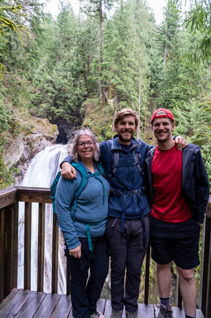
It’s Matt’s family’s go-to hike around the holidays, which is the last time we tackled this hike.
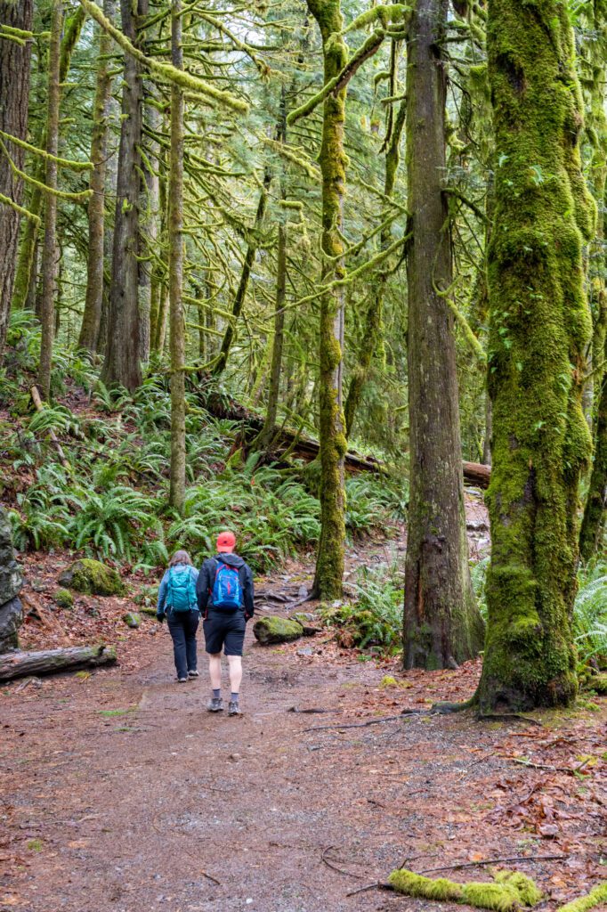
The trail has it all – a beautiful, lush forest with moss-covered old growth trees (at least in the winter and spring), a rushing river (the South Fork of the Snoqualmie River) and not one but two waterfalls waiting for you at the end of the trail.
It’s a great option for families and people who are looking to get a little bit of fresh air, but aren’t up for an eight mile grueling climb like Mount Si.
Plus, the trailhead is just 40 minutes outside of Seattle, which makes it one of the best hikes near Seattle if you’re looking for a nice waterfall.
Disclaimer: Some of the links in this post, like hotel links, are affiliate links, meaning at no additional cost to you, we make a little bit of money if you click through and book. That being said, we would never recommend something to you that we don’t stand behind 100%.
Twin Falls Trail Details
- Length: 2.5 miles
- Elevation Gain: 600 ft.
- Season: Year Round
- Trail Type: Out and Back
- Difficulty: Easy / Moderate
- Dog Friendly: Yes, on a leash
- Pass Required: Discover Pass or a $10 day pass available at the machine in the parking lot
- Trailhead Location
The Alternate Route from the Homestead Valley Trailhead
There’s an alternate route to get to Twin Falls that is actually a nice option on busy days, because you’ll be approaching the falls from a much less traveled trail.
This route starts at the Homestead Valley Trailhead (here on Google Maps) at Exit 38.
It’s also in Olallie State Park, so you’ll still need your Discover Pass to park at the trailhead. This version of the Twin Falls hike follows a portion of the Palouse to Cascades Trail west towards Twin Falls.
The trail is both a bit less enjoyable – mostly because it’s downhill on the way to the falls, and uphill on the way back to the car – and a bit harder than the version we’re covering in-depth below.
It’s a 3.7 mile hike (roundtrip) that climbs 1,000 feet, mostly on the way back to the trailhead. Plus, it doesn’t follow the river, and you’re closer to the highway and traffic noise can be deafening.
On the positive side, as we mentioned above, this side of the trail is going to have significantly fewer people on it, and parking at the trailhead might be a bit easier (though, still not great).
The Best Time to Hike the Twin Falls Trail
The hike to Twin Falls is basically accessible year round, which is fairly unique when we’re talking about hiking in Washington.
It’s our go-to hike in the winter, when most trails in the mountains are completely inaccessible without winter hiking gear.
The entirety of this hike is below 1,000 feet above sea level, which means that it doesn’t suffer from being covered in snow from December to May (ish).
The waterfall is roaring in the winter and early spring thanks to the abundance of rainfall in western Washington, and slows a bit as you get into the late summer and early fall.
Getting to the Twin Falls Trailhead
The Twin Falls trailhead is in North Bend, about 40 minutes / 35 miles east of Seattle.
You’ll hop on I-90 East towards Snoqualmie Pass and follow it to Exit 34 (468th Avenue SE).
From there, take a right on 468th Avenue SE and drive for just under a half mile, taking a left at SE 159th Street and following it to the trailhead.
Parking at the Twin Falls Trailhead
Because of its accessibility and natural beauty, this is a very, very popular hike. Especially in the summer.
We’ve seen the small trailhead, which has bathrooms and room for approximately 20 cars, completely full by 8:30am, overflowing out onto the road leading to the trailhead.
Going midweek or in the offseason is going to make this hike, in particular parking for this hike, much more enjoyable.
If that’s not a possibility, plan on arriving at the trailhead by 9:00am at the very latest for a chance at parking in the lot.
Otherwise, there’s parking along SE 159th Street, the road you turn left on to reach the trailhead. Pay attention to parking signs, there’s no parking on one side of the road, and as you get closer to the trailhead there’s no parking allowed on either side of the road.
Trail Report: Hiking the Twin Falls Trail in Washington
Normally, in other trail reports (like Colchuck Lake or Burroughs Mountain), we break up the trail into parts to describe exactly what you’re going to encounter throughout the hike.
However, those hikes are significantly longer and feature more diverse scenery, so it doesn’t really make much sense to do that here. Instead, we’ll cover the entire hike, from the trailhead to the upper falls (with a stop at the lower falls along the way).
This hike does a little bit of up and down throughout the hike, so you should keep in mind that you’ll be hiking uphill in both directions at points.
However, most of the climbing is going to be on the way out to the falls, with a few shorter climbs on the way back to the trailhead.
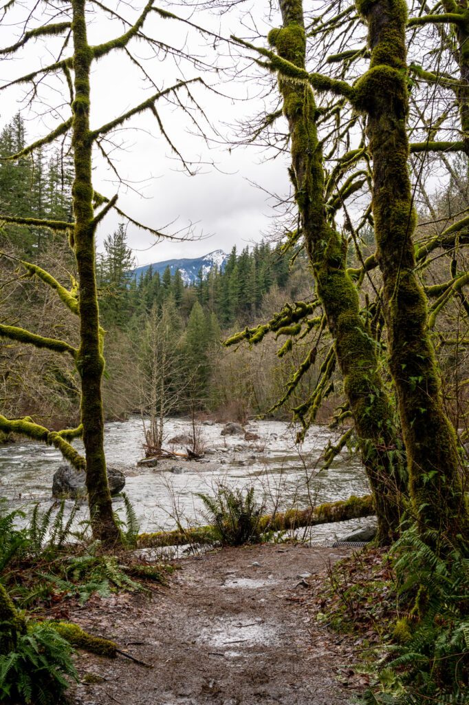
From the trailhead, the trail begins by following the South Fork of the Snoqualmie River. For the first half mile or so of the trail, it’s a nice, easy stroll along the river, with plenty of access points along the way where you can get right down to river level.
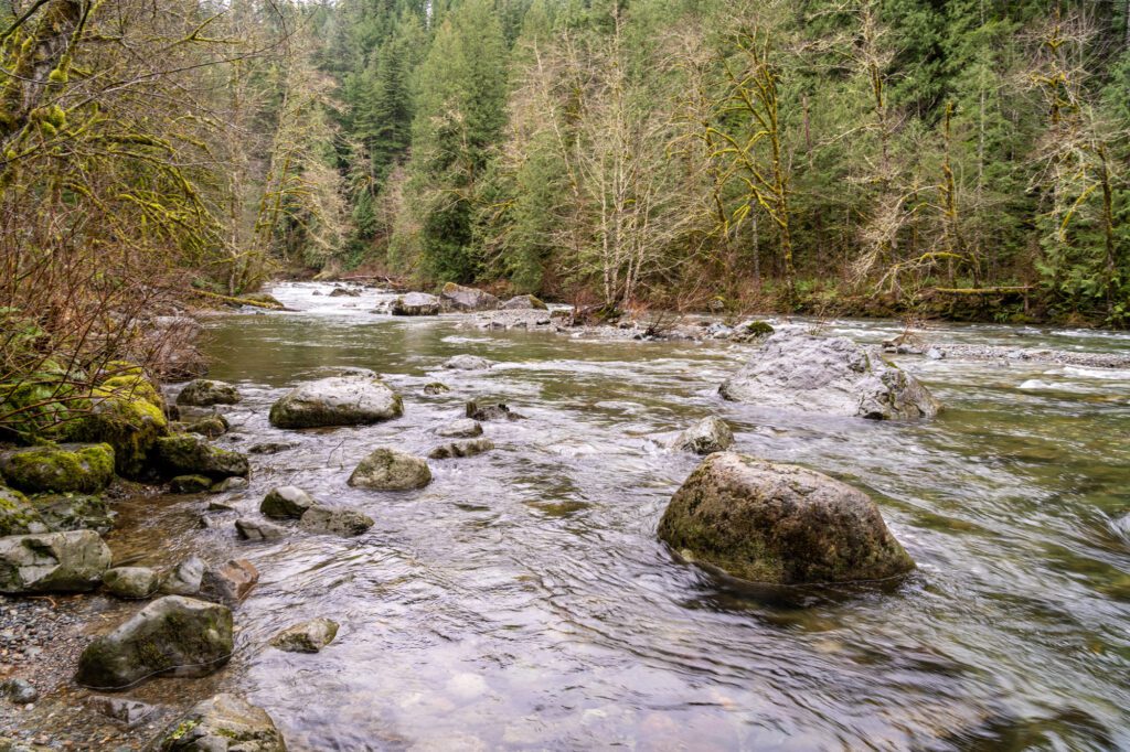
Be careful in the winter, where this river can be rip-roaring. Although, I don’t know why you’d want to get in the frigid water in the dead of winter anyway, so I suppose that’s a little bit of a moot point.
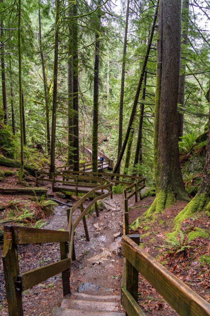
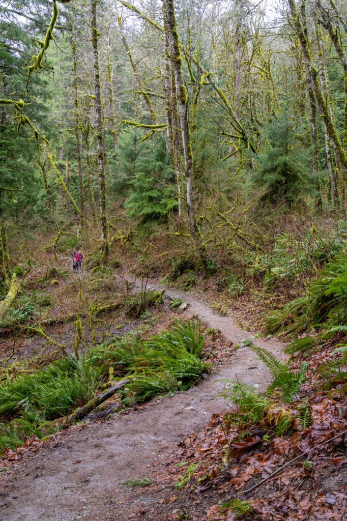
At the half mile mark, the trail starts the first of your two big climbs en route to the falls.
This first ascent is the smaller of the two, and climbs about 150 feet over 0.2 miles to reach an overlook, where there’s a nice bench to catch your breath.
From here, you’ll have your first view of the lower falls, though it’s still pretty far away and it’s really only a partial view, at best.
From the crest of that first, smaller hill, you’ll then head downhill (which seems counterintuitive) into a valley, and as soon as you hit the bottom the trail starts to climb again. There’s a path out to the river at the bottom of the valley, which is worth a slight detour.
This climb is the “big one,” climbing almost 300 feet over the course of a short stretch of trail with a steep set of forested switchbacks. You’ll come pretty close to the highway at this point in the trail, and the noise from the passing cars is definitely noticeable.
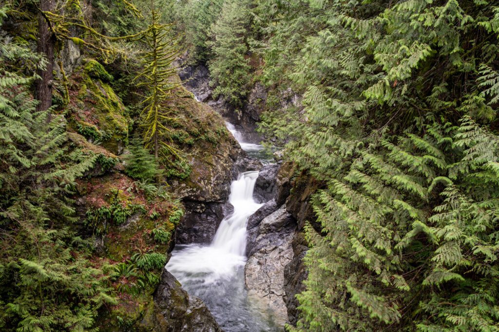
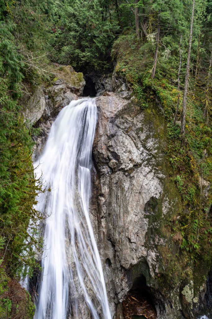
At the top of the hill, you’re ready for the final approach to the Twin Falls. As the name suggests (and as we’ve already covered), there are two distinct falls on this trail. Technically, there are three, but the third isn’t really visible from the trail.
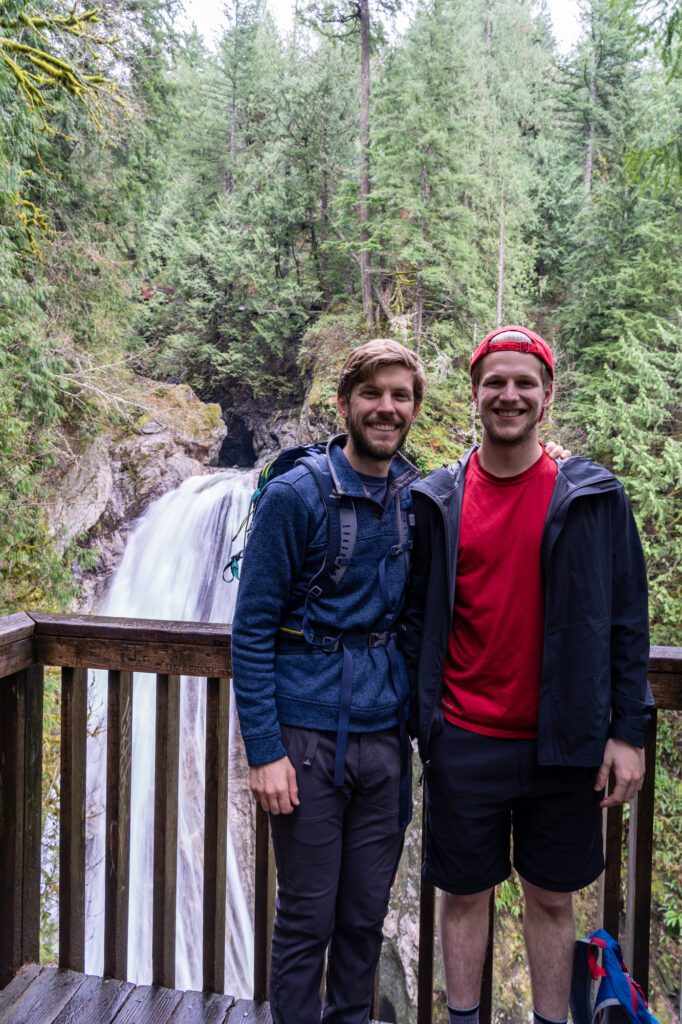
We’d recommend heading to the upper falls viewpoints first, then circling back and doing the lower falls on the way back to the trailhead.
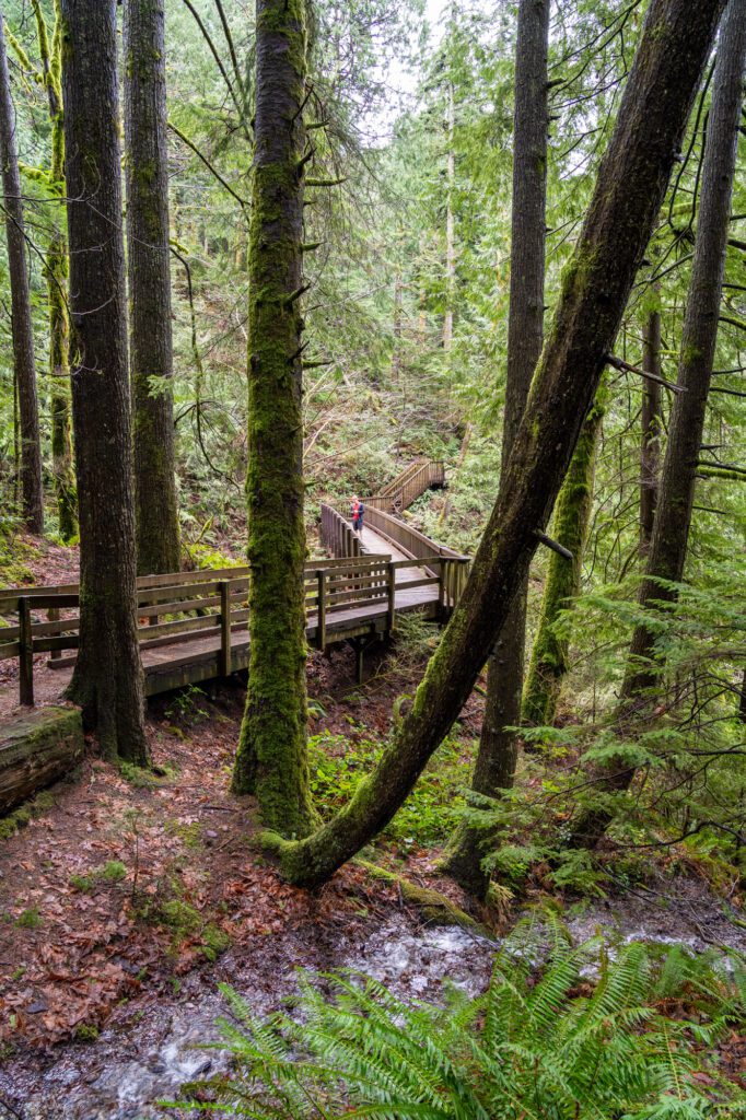
Pass the steep steps that take you down to the lower falls viewpoint and continue along the trail for another 0.1 miles, where you’ll emerge onto a wooden bridge with a nice view of the upper falls.
This view might be good enough for you, but there’s another view of the falls up the trail across the bridge that involves a little bit of climbing and another 0.1 miles of hiking.
If you continue past this point in the trail, you’ll eventually reach the Homestead Valley Trailhead, which is an alternate route for getting to the falls (as we covered above, it’s both less crowded and less enjoyable).
From the upper falls viewpoints, head back the way you came and take a left to descend the steep set of stairs that take you down to the wooden platform with a view of the lower falls.
Be careful when it’s wet – these steps can be very, very slippery. There are handrails for a reason.
After you’ve taken in the view from the lower falls, head back up the steps to the main trail, and back the way you came. Like we mentioned, there are a few short climbs on the way back to the trailhead, but nothing too crazy.