Hiking the Amazing Naches Peak Loop Trail at Mt. Rainier
While there are many, many amazing hikes in Mount Rainier National Park, few of them offer as good a payoff-to-effort ratio as the Naches Peak Loop trail. Located at Chinook Pass just east of Mount Rainier, this hike gives you a trio of amazing characteristics: blankets of multicolored wildflowers in the summer, spectacular views of Mount Rainier, and two picture-perfect alpine tarns.
The best part? You only have to hike 3.4 miles to take them all in! This is one of the best easy hikes in Washington State, and is one of the better family-friendly hike options near Rainier.
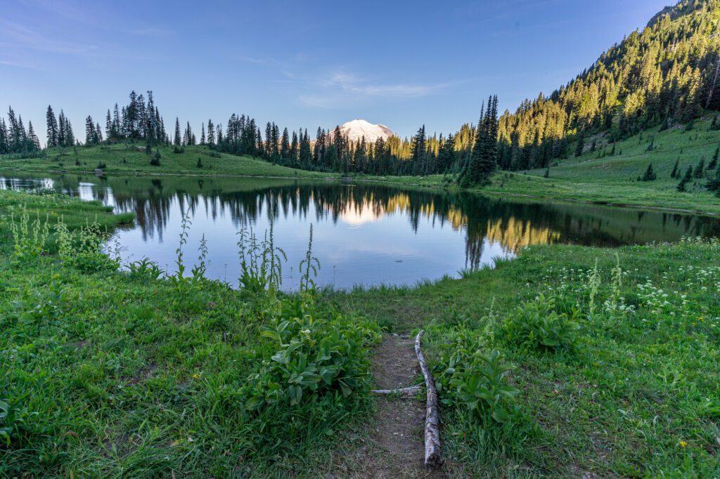
If that wasn’t enough, Tipsoo Lake is one of the best sunrise locations in the state, with the rising sun coming over the ridge behind you (if you’re facing Rainier) illuminating the peak in a pink glow before it is awash in that soft golden light you only get within an hour or so of sunrise or sunset.
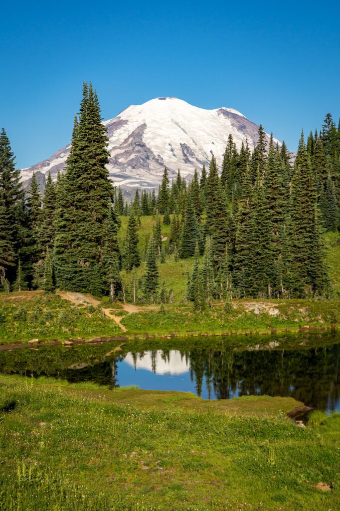
From the northeastern shore of Tipsoo Lake, you can get a nice reflection of Rainier in the water on a still morning. Even better, in our opinion, is the view from just above that shoreline along Highway 410, where you’ll have a view out over the lake with Rainier towering over it in the background.
A sunrise at Tipsoo Lake followed by a jaunt on the Naches Peak trail is an amazing way to kick off a day at Mount Rainier.
Disclaimer: Some of the links in this post, like hotel links, are affiliate links, meaning at no additional cost to you, we make a little bit of money if you click through and book. That being said, we would never recommend something to you that we don’t stand behind 100%.
Hiking the Naches Peak Loop: Trail Details
- Distance: 3.4 miles
- Elevation Gain: 600 feet
- Trail Type: Loop
- Trailhead Location: Tipsoo Lake
- Highlights: A staggering combination of good views of Mount Rainier for a surprisingly small effort. Plus, fields of wildflowers in the early summer, and huckleberries in the late summer.
- Starting Altitude: 5,300 feet
- Highest Altitude Reached: 5,900 feet
The Route for Hiking the Naches Peak Loop
We have a strong perspective on the best route for this hike. You should do it in a clockwise direction, which means heading off to the left from the trailhead at Tipsoo Lake. The reason to do it clockwise is twofold.
First, you’ll have a steadier climb up to the highest point on the hike (the second half of the hike is a steep downhill set of switchbacks).
Second, and more importantly, if you do the hike clockwise, the best views of Mount Rainier will be right in front of you throughout the second half of the hike.
There are about three spots along the descent that give you world-class views of Rainier, and if you go counterclockwise, you’ll have to look over your shoulder to notice them.

The Best Time to Hike the Naches Peak Loop Trail
Like other trails in this neck of the woods, the hiking season is limited by the status of Highway 410, which runs down the eastern side of Mount Rainier National Park.
The road is only open from mid-summer through fall (roughly mid-June to early November, most years, but it depends on snowfall and spring weather).
You can check the status of Highway 410 over at WSDOT here.
That means that this trail is really only accessible in the summer and early fall, which are both good times to hike in the Cascades. In the early summer, you’ll get blankets of wildflowers dotting the many meadows along the trail.
As summer progresses, those wildflowers start to disappear, and the huckleberries come out!
Getting to the Trailhead for Naches Peak
There are multiple trailheads that will give you the same basic experience for this hike since it’s a loop. Just remember, no matter where you park, do it clockwise!
The main trailhead – the one with bathrooms and the biggest parking lot – is at the southwest corner of Tipsoo Lake.
You can also park at the small parking lot just up the road, or along Highway 410 above Tipsoo Lake. From there, you would walk down to the main Tipsoo Lake parking lot, which is where you will start the hike.
The main trailhead is a 6.5 mile drive (about 12 minutes) up Chinook Pass from the turnoff to the White River entrance and Sunrise Visitor Center, which gains elevation with long winding switchbacks. From Seattle, it’s 88 miles and just a hair under two hours.
An alternative place to park is where the trail meets the Pacific Crest Trail, which is about a quarter mile into the hike. To get there, just continue driving past Tipsoo Lake, where you’ll pass under the footbridge that signifies the park boundary.
There are a couple of parking lots there on either side of the road. The trail passes right over that footbridge, so you can do the full loop as planned from here.
Are Dogs Allowed on this Trail?
It’s worth noting that dogs are not allowed on hiking trails in national parks.
However, to the east of that footbridge that crosses over the road just past Tipsoo Lake, you’re actually outside the national park and following the PCT, which is on National Forest Land.
Technically, dogs are allowed on about half of this trail – from that junction out to the junction where the Pacific Crest Trail veers left and takes you down to Dewey Lake (it’s roughly a mile and a half, one way).
However, I would say that you’re missing the best parts of the trail if you do it that way – none of the Rainier views are along that stretch of trail (though there are some nice wildflowers and a picturesque tarn).
If you have a dog with you, that’s really your only option though.
Hiking the Naches Peak Trail: A Complete Trail Guide
This is the part of the guide where we give you a complete rundown of what to expect along the hike.
Usually, we split this section up into different segments based on distinct parts of the trail, but this hike is short enough and similar enough all the way through that there’s no real need to do that.
At a high level, this trail is a nice, steady incline for the first two miles or so, then a slightly steeper descent to get back to Tipsoo Lake. The trail is in fantastic shape.
The trail starts from the main Tipsoo Lake parking lot, which is at the southwest corner of the lake.
From there, you’ll head left, up the hill. When we were there in early August, this part of the trail was just completely blanketed with purple wildflowers. It was quite the spectacle.
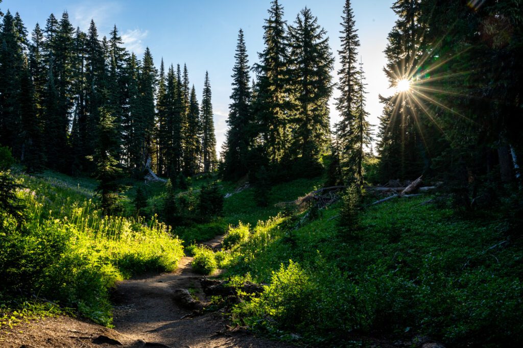


The trail climbs 150 feet over the first quarter mile, then you’ll emerge from the forest onto a footbridge that crosses over the highway.
This marks the entrance to Mount Rainier National Park for people coming from east to west over Chinook and Cayuse Passes. You, on the other hand, are heading east, which means you’re leaving the park here.
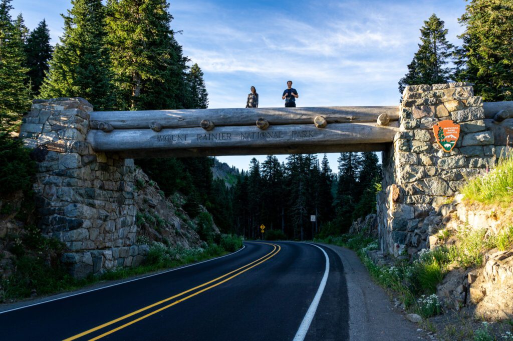
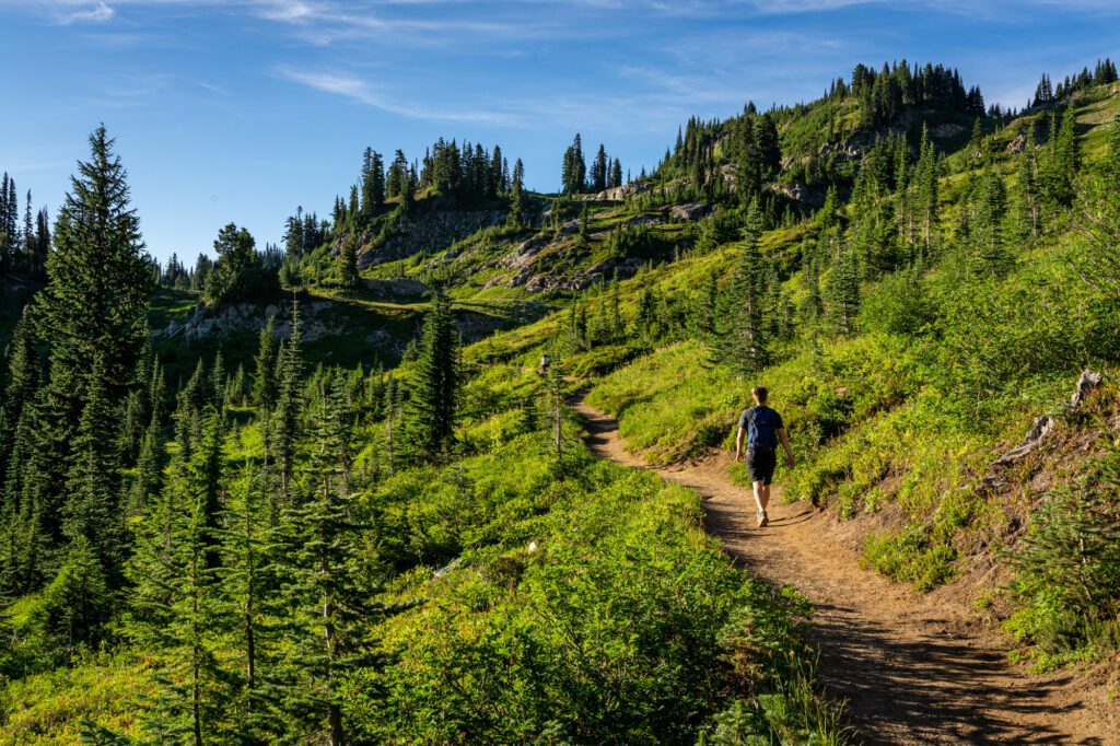
This is where the trail meets the Pacific Crest Trail, which you’ll follow for the next mile and a half or so. You’ll emerge onto a ridge with great views of the Cascades out to the east (your left).
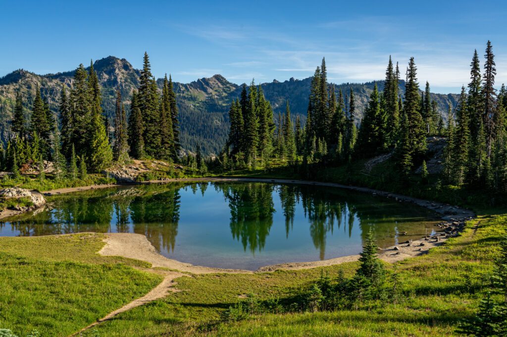
You climb through a nice bowl, passing a picturesque tarn about a mile into the hike, and continuing the climb.
You’ll know the lion’s share of the climbing is over when you hit a couple of switchbacks that take you to the top of a ridge where you can see out to Dewey Lake and beyond.
And this, my friend, is where the best part of the hike begins. It’s largely downhill, and there are several spectacular views of Mount Rainier to be had along the way.
At 1.7 miles in, you reach the trail junction where the PCT veers left down to Dewey Lake (this is a nice three mile addition to your hike, if you’re looking for more mileage).
To get back to Tipsoo Lake, veer right, where you’ll enter the national park again (pup owners – either turn around here, or send your dog back to the car with the keys to get the A/C going while you finish the hike).
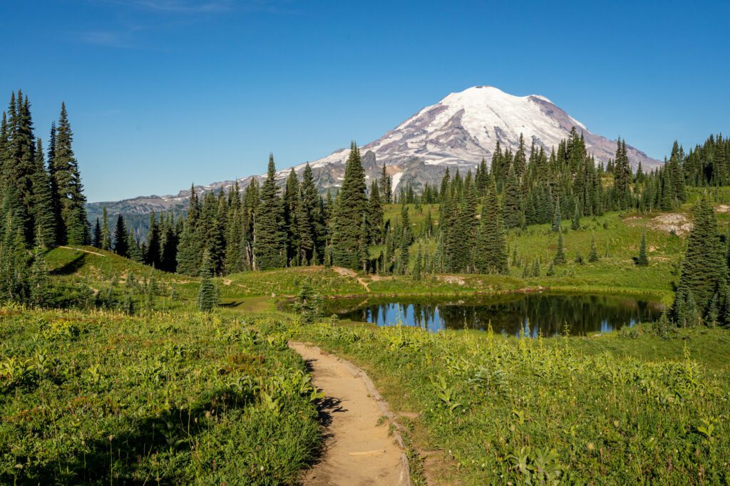
Immediately after that junction, you’ll hit the most stunning views of Mount Rainier on the entire hike in quick succession.
The first is a view of a meadow and tarn in the foreground, with Rainier rising 8,000+ feet above it in the distance (it’s at about 2 miles in, on the dot).
The second is a ridge – where we saw a wedding party taking photos and wondered how she hiked up in her dress! – where you have a pretty nice view of Mount Rainier (it’s about 0.2 miles past the tarn).

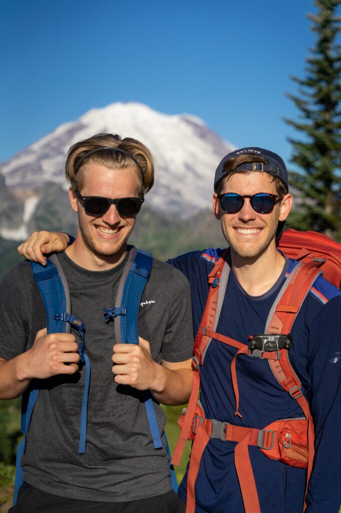
Great for some quick portraits before you start the descent in earnest!
The next mile or so of trail is fairly boring, descending along the mountainside with an occasional view of Mount Rainier popping out between the trees. You’ll need to cross Highway 410, then head back to your car (wherever it happens to be parked).
That’s 3.4 miles in the books, and some of the best views of Mount Rainier around!