Hiking the Incredible Colchuck Lake Trail: A Complete Guide
Tucked away in the eastern foothills of the Cascade range near the town of Leavenworth, you’ll find a slice of paradise. At least if you’re mountain people like we are. We’ll take an alpine lake backed by a rocky peak over a wide sandy beach any day of the week.
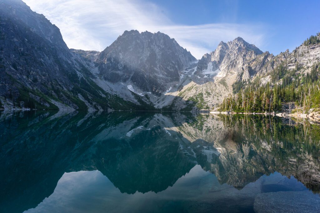
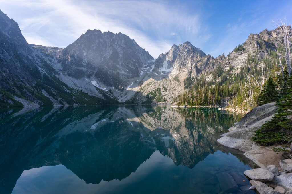
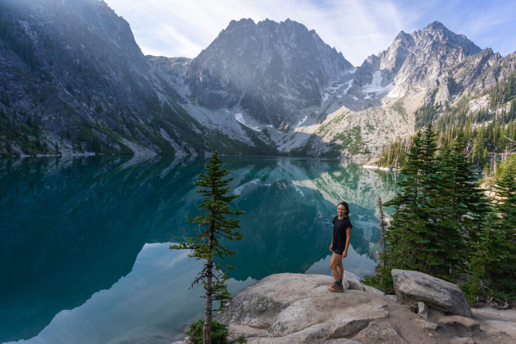
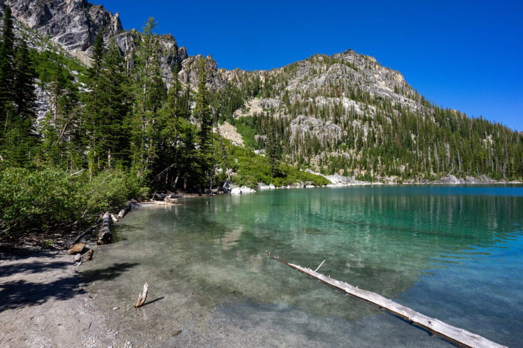
The Colchuck Lake trail takes you up to one of the best lakes in the Alpine Lakes Wilderness, a crystal clear, green blue piece of magic backed by the rocky silhouette of Dragontail Peak and the epic climb to Aasgard Pass.
The heart of this wilderness area – the Enchantments – is accessed via a strenuous 19+ mile hike that is best done as a 2-3 night extravaganza (though people do it in a day, which is nuts to us). However, that’s probably out of reach of 90% of visitors.
This hike is probably the most accessible way to get a taste for the alpine lakes and rocky peaks you’ll find in the (aptly named, we think) Alpine Lakes Wilderness.
Is it an easy hike? Definitely not. Despite the difficult climb and perpetual business of this popular trail, we think the proverbial juice is worth the squeeze here. Which is why we’ve done this hike multiple times, both as a standalone day hike, and as a piece of our three night trip up into the Enchantments.
In this guide, we’re going to go through everything we think you need to know to safely and smoothly hike to Colchuck Lake. We’ll start with the logistics – where to park, and other things you need to know for a smooth trip – and then go into a trail report based on our own experiences hiking the trail.
Sound good to you? Let’s get into it.
Disclaimer: Some of the links below are affiliate links, which means that if you click on one and purchase something, I make a small portion of the sale at no additional cost to you. It goes without saying that I would never recommend something I wouldn’t use or do myself.
Colchuck Lake: Hike Details
- Length: 8.5 miles
- Elevation Gain: 2,650 ft.
- Season: Mid July – October
- Trail Type: Out and Back
- Difficulty: Hard
- Trailhead Location: Stuart / Colchuck Lake Trailhead
- Dog Friendly: No
- Pass Required: Northwest Forest Pass or America the Beautiful Pass
The Route for Hiking to Colchuck Lake
There is exactly one route to get to Colchuck Lake, and it involves parking at the popular Stuart Lake Trailhead and following the Stuart Lake Trail to the junction with the Colchuck Lake Trail, which leads you up to the lake.
Technically, I suppose you could call the hike from the Snow Lakes Trailhead through the Enchantments and down Aasgard Pass another version, but it’s hardly in the same category since that involves 20 miles or so and a LONG climb.
How Difficult is the Hike to Colchuck Lake?
Overall, I would put this hike somewhere between moderate and difficult. The elevation gain is decent – you’re climbing about 600 feet per mile over the 4.25 miles from the trailhead to the lake – but nothing that should make you think twice about hitting the trail.
We’ve done this hike multiple times, including once with my 60+ year old mom (who did the hike again the following summer with her sister), and she handled it well.
Take it slow, bring plenty of water and snacks, and be prepared to take a break at the lake for some rest (and to enjoy the view you earned).
Getting to the Trailhead for Stuart / Colchuck Lake
The trailhead for Colchuck Lake is 13 miles outside of Leavenworth, but the last portion of that drive is a potholed Forest Service road that is not particularly well maintained, so it’s going to take you longer than you think.
Budget 30 minutes or so if you’re coming from Leavenworth.
If you’re coming from Seattle, you’re going to want to get a REALLY early start because the drive is going to take you somewhere around three hours, plus or minus 15 minutes.
Coming from Seattle, you’ll go over Snoqualmie Pass on I-90, then take 970 to Highway 97 over Blewett Pass to get to Leavenworth. Turn left on Icicle Road, and follow it until Eightmile Campground, which is where you’ll start up the forest road to the trailhead.
For that reason, we’d strongly recommend trying to stay up around Leavenworth the night before OR the night after your hike so that you’re not tackling six hours of driving there and back after a long, hot day of hiking.
We have suggestions on where to stay near the trailhead in a separate section below.
Parking at the Trailhead
This is a really important section, so pay attention! This hike is EXTREMELY popular.
It’s easy to understand why – it offers you a slice of the Enchantments at a moderate effort, and doesn’t require you to go up or down Aasgard Pass (which is a brutal climb) to get it.
However, that popularity does have some practical implications that you need to consider as you’re planning your hike.
The main implication is that parking for this hike is insanely competitive, especially on summer weekends.
If you can swing it, you will have a much better time if you do this hike midweek.
However, if that’s not a possibility and you’re doing it on a weekend, you’re going to want to make sure you arrive at the trailhead by 7am AT THE VERY LATEST.
6am would be better. Seriously. The parking lot will be full by 7am or so, and you’ll have to park along the narrow road leading to the trailhead if you arrive later.
The other thing you need to know is that a portion of the lot is reserved for overnight hikers. It’s not particularly well signed, so just do a double check that you’re not parked in the part of the lot that is off-limits for day hikers.
There are pit toilets at the trailhead, and there are privies (backcountry toilets with no walls and, occasionally, a nice view) up near the lake, too.
Passes and Permits Needed for This Hike
This hike – more importantly, the trailhead – is on National Forest land. You’ll need a Northwest Forest Pass to display in your car to park at the trailhead, which you can get in advance (we usually get ours at REI).
You might be able to purchase a day pass at the trailhead for $5 cash, but we’ve also seen plenty of times where the envelopes are all gone, especially on summer weekends. We’d plan on securing a pass in advance given the popularity of this hike.
An America the Beautiful Pass also works, because it covers all federal recreation land (including national forests). If you’re planning on visiting three or more national parks in the next 12 months, the America the Beautiful Pass is the way to go (it pays out at 3+ parks).
You can also get an America the Beautiful Pass in advance at REI, or at the entrance station to any national park.
Don’t try to park without a pass – you will almost certainly get a ticket, since this is one of the most patrolled trailheads in the state thanks to its popularity.
The Best Time to Hike to Colchuck Lake
This hike is best done in the summer and fall, roughly July to mid-October, when the trail and roads to the trailhead are clear of snow. It is doable in the winter as a snowshoeing adventure, but we much prefer the summer version.
Are Dogs Allowed?
No, dogs are not allowed on this hike. Period. The end.
Can You Camp at Colchuck Lake?
Yes, you can camp at Colchuck Lake provided you have a backcountry permit which, just like the parking lot, are extremely competitive.
Most of the permits for the season are issued via a lottery that happens in the spring, with a few permits held for walk ups on the day of.
For reference, in 2021 39,000 people applied for a backcountry permit to spend a night in the Enchantments. Out of those applications, just 2,444 were issued permits.
For you math geeks out there, that means that 6.2% of applicants got a permit. Not great from an equity and access standpoint, but it’s necessary to preserve the natural beauty up in the Alpine Lakes Wilderness.
More information on the permit situation and how to get one can be found here.
Hiking the Colchuck Lake Trail: A Complete Trail Guide
We’ve done the hike to Colchuck Lake a few times now, including once as part of a multi-day backpacking trip through the Enchantments, and the euphoria that you get as you reach the high point of the hike and get your first glimpse of the lake is equal to the first time we hiked it.
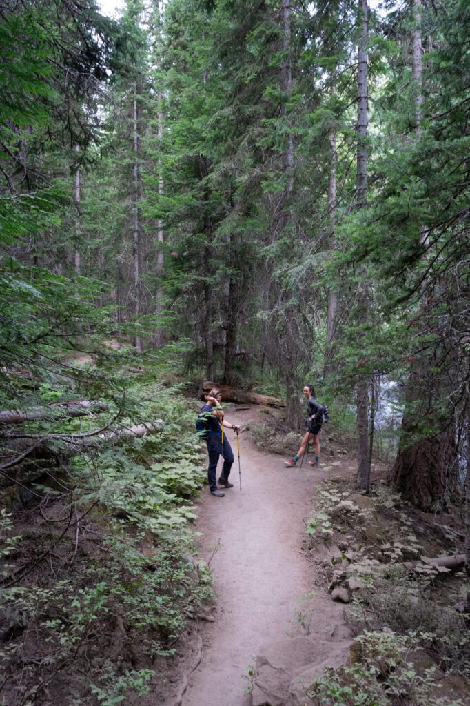
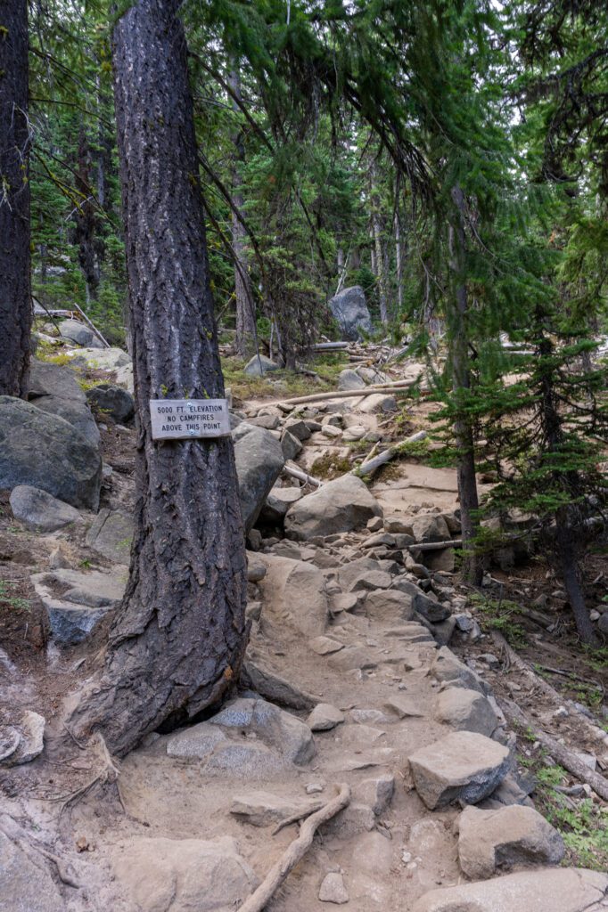
In many ways, this is a trail of three parts. Each section of trail gets progressively more difficult than the last, starting with a slight uphill meander through the forest, moving onto a section of trail that will have you shedding layers, and ending with a fairly strenuous, rocky climb up to the lake.
Parking Lot to the Wooden Bridge Crossing
Length: 1.5 miles // Elevation Gained: 600 feet
From the parking lot, stop by the posted map for any trail updates and to fill out a self-serve permit that just lets rangers know how many people are out on the trail (you’ll carry it with you on your hike).
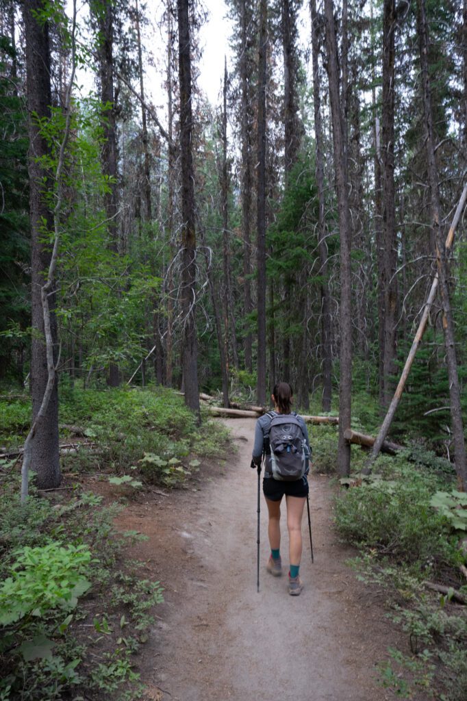
The first half of this hike is along the Stuart Lake Trail, which is a relatively easy stretch of trail that gradually climbs through a dense forest.
The landscape here is drier than the ones in the western foothills of the Cascades, though the forest is equally dense, providing much needed shade on the hot summer days in Leavenworth.
When you compare the landscape on this first stretch of trail to the one you’ll find up at Colchuck Lake, it’s pretty wild that they’re only separated by a few trail miles and 2,000 feet of elevation (it gets even wilder once you get up into the rocky Enchantments, where the trees are few and the alpine lakes are plentiful).
You’ll spend a solid chunk of this first part of the trail following Mountaineer Creek, which provides some nice white noise as you climb.
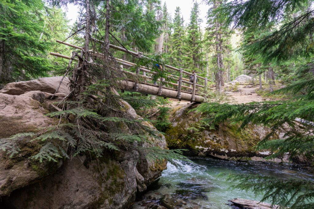
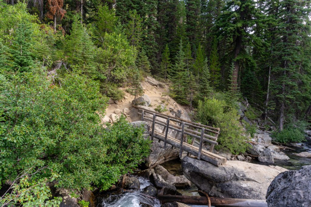
Eventually, you’ll reach a sturdy wooden bridge that crosses the creek, which is where this stretch of trail ends (and the real climbing begins).
From the Wooden Bridge to the Trail Junction for Colchuck Lake
Length: 0.6 miles // Elevation Gained: 450 feet
This short section of trail starts to climb more aggressively almost immediately after you cross the bridge.
In the dry summer months, this section of trail can get dusty, and if you’re hiking in a group the people in the back are likely to be covered in a fine layer of dust by the time you reach the lake.
There’s nothing particularly special about this part of the trail. It ends after just over a half mile when you reach the junction with the Colchuck Lake Trail, which you’ll follow off to the left, following signs for Colchuck Lake.
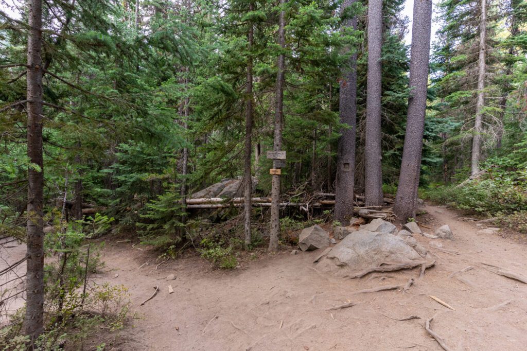
If you head right, you’ll reach Stuart Lake in 2.4 miles, which is probably something for only the most ambitious hikers.
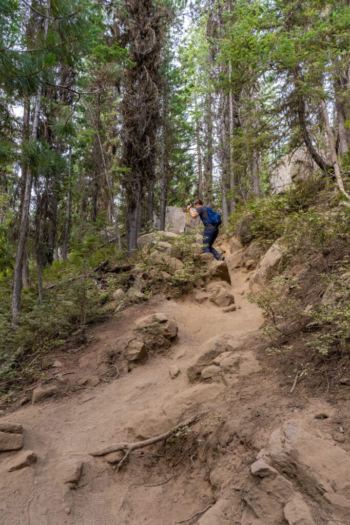
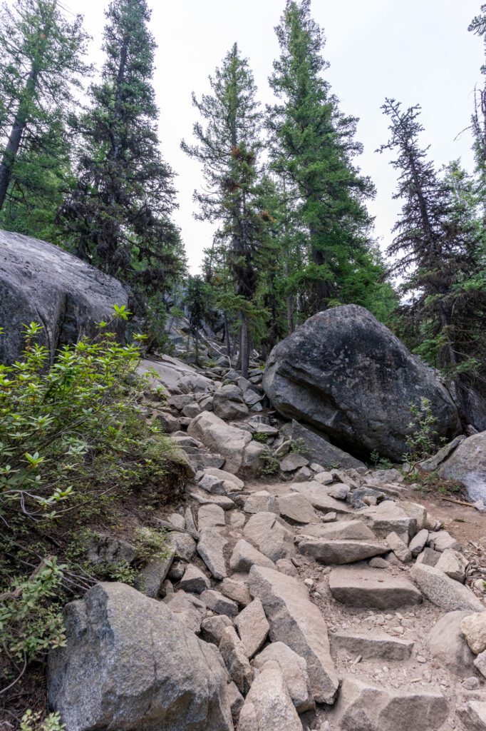
The Final Ascent to the Far End of Colchuck Lake
Length: 2.1 miles // Elevation Gained: 1,100 feet
This section of trail covers the point where you veer left, leaving the Stuart Lake Trail to embark on the final ascent along the Colchuck Lake Trail, all the way to the far side of Colchuck Lake where you’ll be standing at the base of Aasgard Pass, the gateway to the Enchantments.
You may (or may not) be wondering why we call this section of the trail the hardest when it is almost identical in terms of trail stats to the first two sections of trail combined.
It’s because the final 0.6 miles or so are relatively flat as you make your way along the lakeshore. Which means you’re climbing 1,100 feet in approximately 1.5 miles, which is no joke.
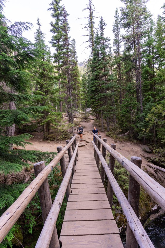
Immediately, the trail crosses a smaller wooden footbridge over Mountaineer Creek – the same one you crossed earlier – and becomes noticeably more rocky.
There’s some light scrambling to be done as you briefly follow the creek, and then the trail turns left and the true final ascent begins.
The climb here is a mix of steep rocky steps and tight switchbacks. There’s a granite slab with a nice view of the valley that makes a good rest spot at the 2.7 mile mark (ish).
As you reach the lake, the trail splits again and you want to head right, which takes you along the western shore of the lake where the trail continues all the way to the opposite end.
You don’t really need to go all the way around the lake – going all the way to the other side adds about a mile to the total distance, though it adds limited elevation gain because it’s mostly flat.
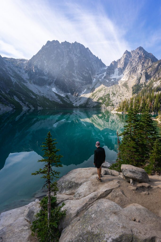
Plus, we think the best view is from the closer end of the lake anyway, where you’ll have the lake in the foreground backed by the iconic silhouette of Dragontail Peak that looms over Aasgard Pass.
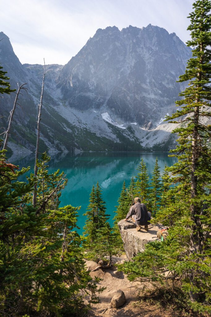
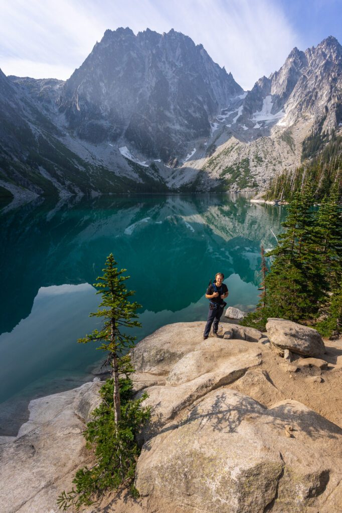
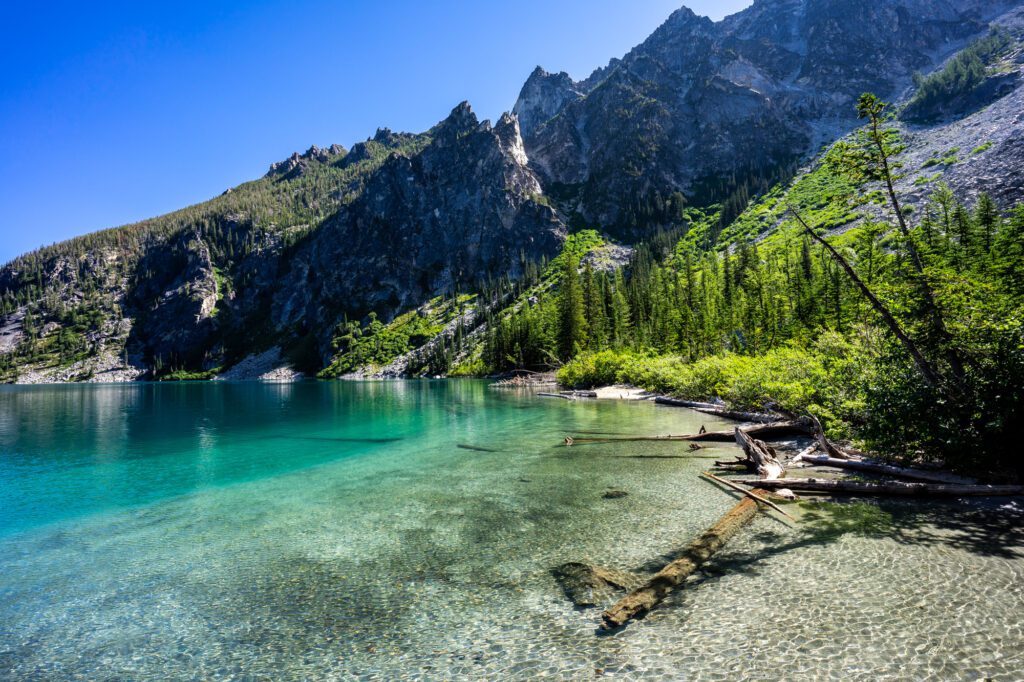
Here is what the view from the other side of the lake looks like.
Along the shore, there are a series of campsites that are a great place to spend the night, but you need to have an elusive Enchantments backcountry permit to stay there (and yes, this is one of the most highly patrolled areas by rangers, so you likely will get caught if you try to stay without one).
It’s also worth noting that there are two privies (backcountry toilets) up at the lake – one right before you emerge onto the lake, and one about halfway around the lake. If you need to go, use the privies (and BYO toilet paper).
Where to Stay near the Trailhead
Because you need to get to the trailhead so early and it’s a solid two and a half hours from Seattle, we’d strongly recommend staying overnight either the night before your hike or the night after to avoid driving long distances tired.
Obviously, not everyone can make this happen, but if you can swing it, we’d absolutely do it. Plus, Leavenworth is a lovely place to spend an afternoon and evening after hiking.
If you’re looking for a place to stay near the trailhead, we can recommend Eightmile Campground, which is a short drive from the turnoff that takes you to the trailhead.
We stayed there the night before our last Colchuck Lake hike, and it’s a nice campground that couldn’t be in a better location for hiking Colchuck. Make your reservation in advance, especially for weekends.
Bridge Creek Campground, which is nearby, is another option, and it’s literally on the road up to the trailhead (though you’ll still have to drive up to the parking lot).
If you’re not up for camping (or the campgrounds are full), the charming Bavarian-themed town of Leavenworth is your best bet.
We like LOGE – they have a lodge right in town with hotel-style rooms, and some cabins on the river on the outskirts of town (still walkable) that have more space.
For what it’s worth, we’ve stayed at the cabins (and friends have stayed at the lodge) and would recommend either one!